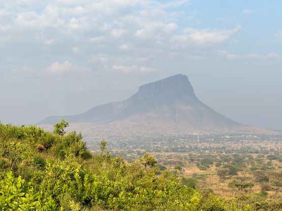
Mount Napak
January 8, 2024
2538m
Uganda
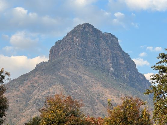
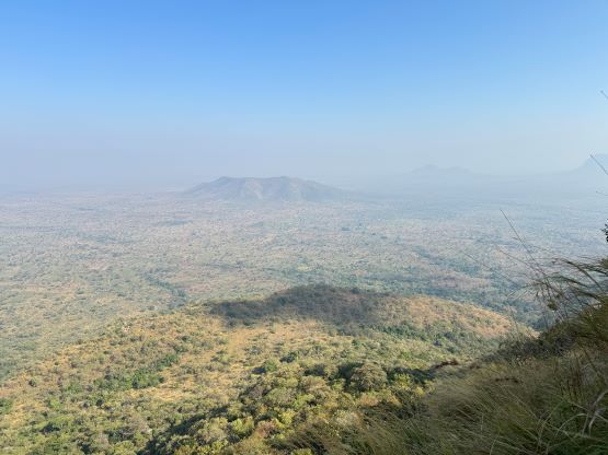
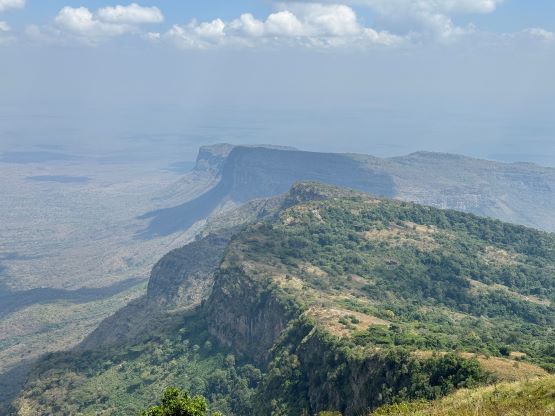
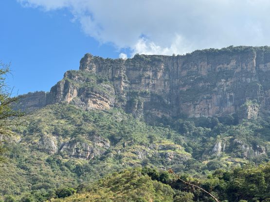
Mt. Napak in eastern Uganda boasts over 1300 m prominence but does not have much “beta” on the internet. This is in fact a rather popular objective in the area and many local people actually live on various parts of the mountain. Rob, Alastair and I hired Julian Wright from African Ascents to guide this ascent and Julian himself hadn’t even done this peak. Julian did manage to connect us with the local guides. This was the final objective in Uganda and the day was also supposed to be a “buffer day”, but then everything panned out smoothly. We decided to do this peak but there were a lot of unknowns. The south slopes would be the gentlest way up according to the maps, but there’s no road on that side of the mountain. The standard route actually goes up through the north side cliffs and involves at least three sections of “roped scrambling”, according to the local guides. In order to be safe we decided to bring harnesses, helmets and a 30 m rope, and of course those weren’t needed. The “roped climbing” was entirely in the realm of 3rd class (4th class if wet). The locals had no problem ascending/descending in sandals or barefoot so how hard could it be.
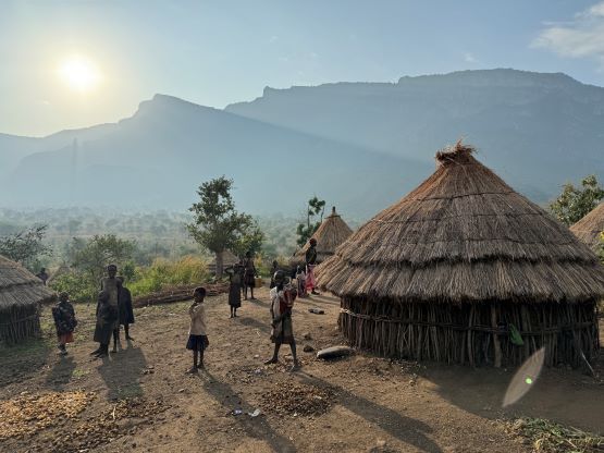
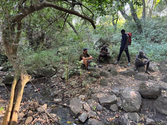
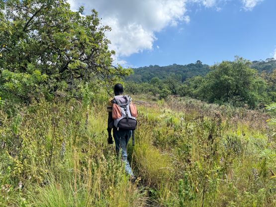
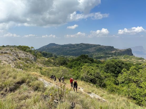
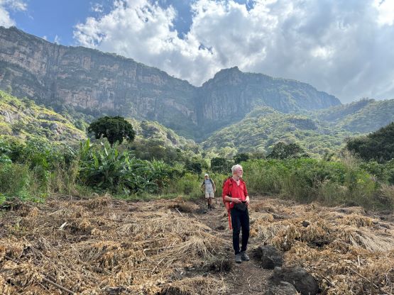
Our basecamp for these few days was in Karamoja Safari Camp in the village of Moroto, and the drive to Mt. Napak would take roughly 2 hours. The hike would by no doubt be a toasty one since we’d be starting from the desert plain, so we had to leave early again. The breakfast was ordered to be served at 5 am and was more or less on time. The three of us, together with Julian, Elijah and David (the local guide for Moroto area) eventually made to the base of Mt. Napak at around 7:30 am. We then met our local supporting team with two more guides. None of them spoke much English, but David ensured us that they knew the route well. I eventually ended up following this older local guide for most of the day, and he surely was an incredibly strong guy and knew the mountain really well. A total of 8 of us were going up and that was a wee bit “too much” for a technical route. Of course the route turned out to be non-technical but I was not particularly stoked about the size of this group. Nevertheless I’m aware that in this part of the world it’s safer to have a larger team for some obvious reasons.

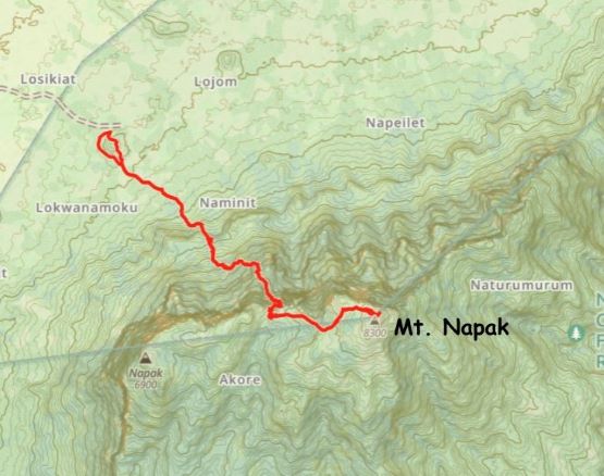
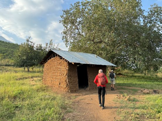
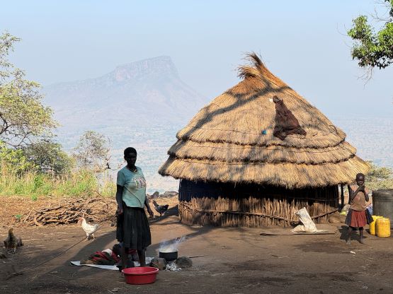
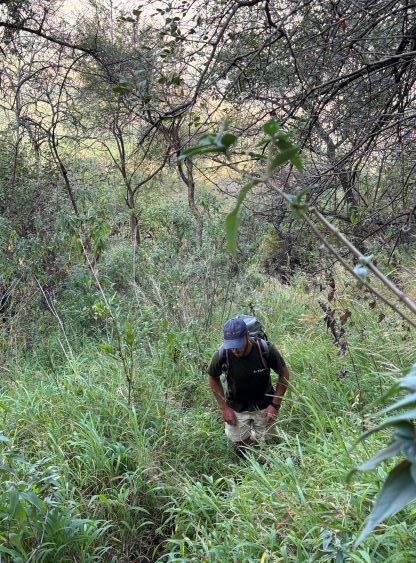
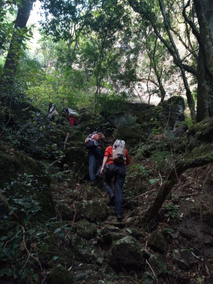
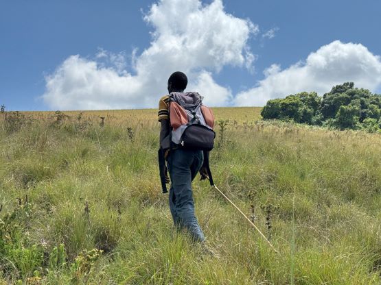
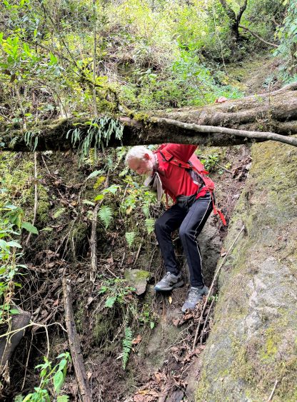
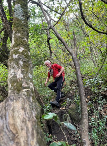
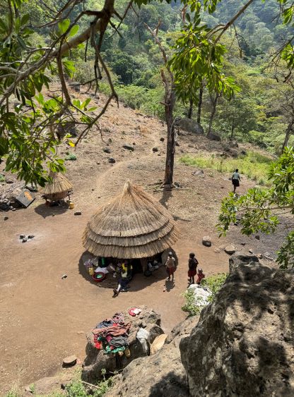
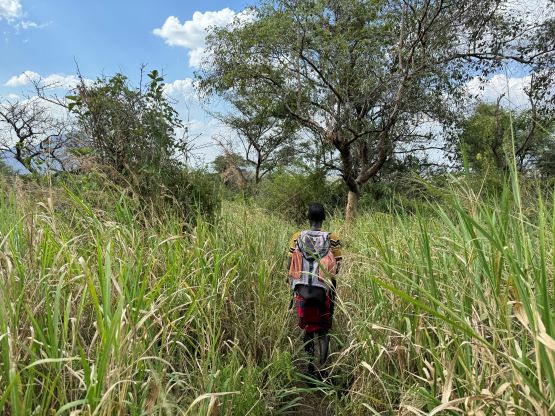
We eventually started hiking by 8 am and the local guides took us directly through their home village. On the way out we bypassed the village on the side. We encountered a few more homes further up the hill and we had to stop and chat with each of those families for at least 10 minutes. That was a bit frustrating because I was still expecting a technical climb in a group of 8 via an unknown route, so we had a shit ton load of work to do on this day and we’d better be efficient. Eventually we did start to finally gain some elevation and got the rhythm going. Upon reaching the base of the first “technical” section we stopped for yet another break, and I made the call to don harness and helmet for the sake reason of why-not. Rob, Julian and I were waiting for the rest of the group to catch up so we might as well do something. The rest of the group ended up not donning any of those gears and those surely were not needed. The first “crux” ended up being a long section of 3rd class scrambling with one stiffer move. There was then a long stretch of hiking and traversing on some overgrown trails to reach the second crux, a short but vertical step with good holds.

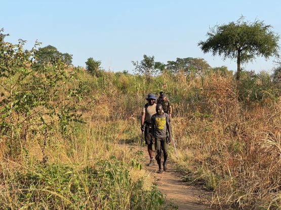
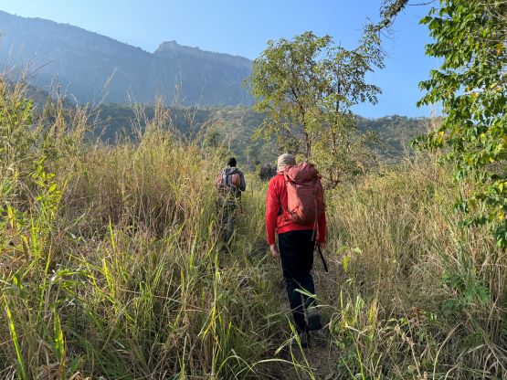


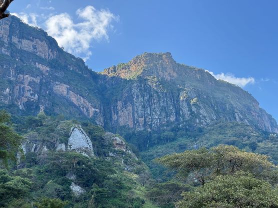

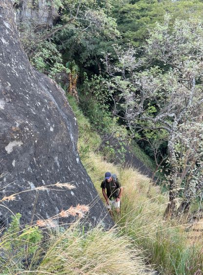


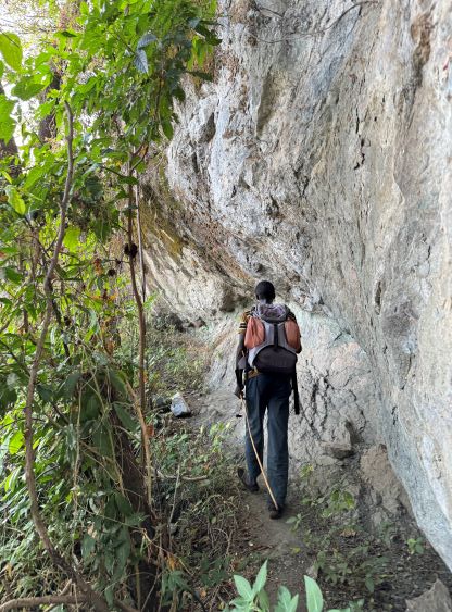
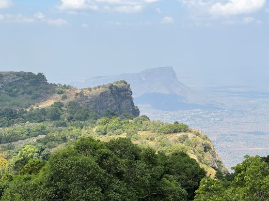
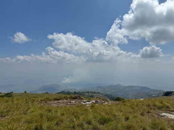
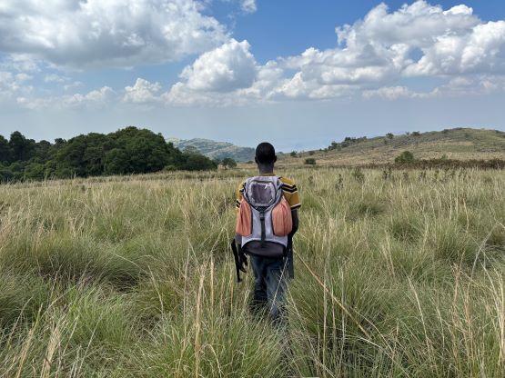
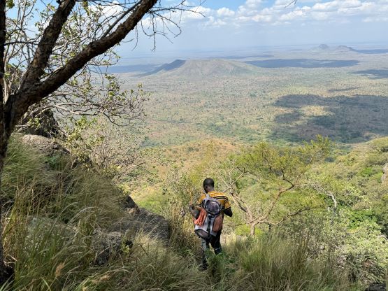
The route then ascends through the forest into a large gully system, and the final crux was actually the hardest in my opinion. The terrain was down-sloping and slippery and there weren’t a lot of holds. It was a bit awkward in trail runners. Not far beyond this final scrambling step we made to the upper plateau and the guides claimed that the difficulties were “finished”. Julian had turned around to wait for us at the lower crux, whereas Elijah pushed on to summit with us. We took a few more breaks on this upper plateau and slowly plodded to the high point. I was surprised that the trail actually goes most of the way up. I thought the local people generally do not bother with attaining the “true summit” but that’s not the case here. The guides did lead us to the highest point. The final 100 m ascent was on some annoying tall grass with lots of holes, and we all found some surprises. There were at least two summit contenders and I visited both to be sure. Rob used his hand level to determine the north summit being the highest one, so the Gaia topo was wrong, again. We then took another lengthy break in between the two high points since the view was the nicest from there.


Eventually Elijah made the call to start descending since it’s better to be back “home” early, if possible. We all managed to down-climb the few cruxes rather smoothly, but the group did spread out eventually. I was beating myself really hard to keep up with the leading guide and I felt like I had maxed out my descending pace. Back in home hardly anyone could keep up with me descending class 3 kind of terrain but this guy could easily leave me in the dust by just wearing sandals. The lengthy stops and chats in those villages and homes were annoying and frustrating, but there’s nothing I could do. I ended up scrambling up and down a nearby boulder to kill time. I did learn that one of the guys living there had 4 wives and at least 15 kids and they all live together, and that’s rather interesting. We eventually finished the round trip in exactly 8 hours and subsequently drove back to Karamoja Safari Camp, for the 3rd night in a roll. The camp’s quite luxurious by Ugandan standard, with wifi and shower, but the dinner was served late again (not surprised at all). There were some problems with the oven and the dinner was not served until an hour later. Thankfully I had my laptop handy and worked on the trip reports while waiting.


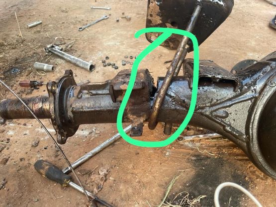
On the next day we woke up at 5:30 am again in order to start driving no later than 7 am. The plan was to drive all the way to Entebee to position ourselves for the morning flight to Rwanda. This day turned out to be quite eventful as well. The plan was for Julian and Elijah to drop us off in the town of Jinja and we did manage to get most of the way there. The Landcruiser, after 2 weeks of heavy abusing, finally broke down a few kilometers from the town with no way of fixing. Elijah eventually managed to get hold with our pick-up guy so there wasn’t a huge delay for us, but Elijah and Julian were still with their broken vehicle by the time we got to our hotel in Entebee in the evening. I was just glad that this did not happen in the various remote parts of this trip.