Culmination Point Mountain
January 28, 2024
1875m
Highway 97C / Okanagan Connector, BC
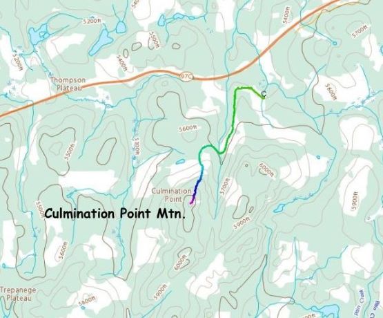
The name of this peak is Culmination Point Mtn., and it sits about 15 km to the west of Pennask Mtn., which is the highest peak on the plateau that hosts Highway 97C between Merritt and Kelowna. Contrary to the higher neighbour, there is no trail to facilitate the ascent, and the summit is forested and viewless. It does boast over 100 m prominence and the name is official, but the ascent definitely falls into that category of “trash bagging”. Kate and I tagged it simply because we were in the area doing Pennask Mtn., and had extra time to do a secondary objective. Even so I was not very excited about it, but given the access road (Sunset Main) being plowed we had no excuse. The other way of doing this peak would be in the summer but then why would I bother with Culmination Point Mtn. in the summer.
The Sunset Main was indeed plowed on the other (west) side of the highway’s turn-off, but to a lesser extent than the east side that led to Pennask Mountain. The road was still mostly in skating conditions but the Subaru handled the job reasonably well with only minor spinning here and there. I was slightly concerned about the few uphills that we had to face on the return, but I made me to worry about that a few hours later. For now we had driven to the start of the secondary spur road and had to concentrate on the task ahead. The spur road was not plowed but had been used by snowmobiles. I was hoping to drive further but this spot was already within the walkable range, so I turned the vehicle around and parked. We had to do this peak.
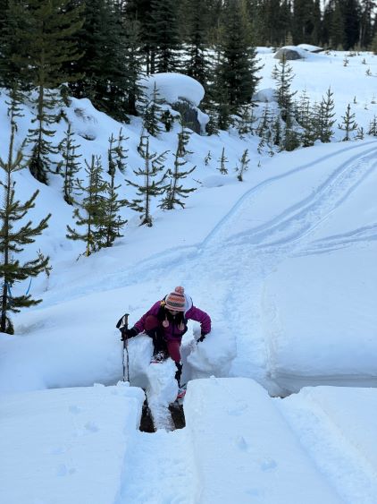
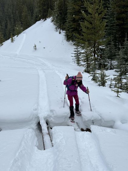
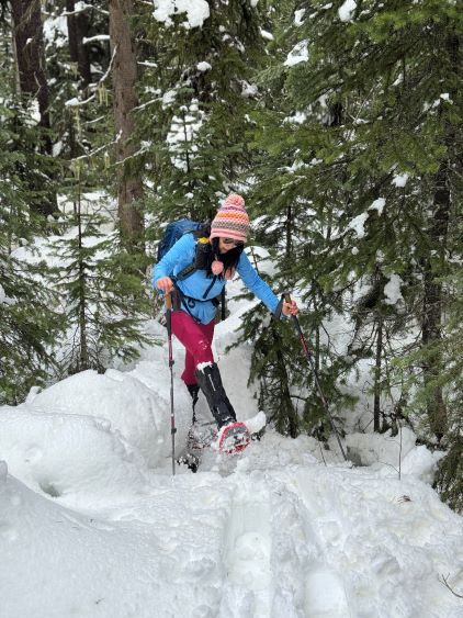
There was about 3 km of sled tracks and I was anticipating nothing but cruise sailing, but I was wrong. The snowpack was so thin and saturated that we were constantly post-holing on top of the snowmobile tracks, even with the 30′ snowshoes. This made me worry about the trail-breaking after leaving the sled tracks, but again I made myself to stop thinking about it until being in that moment doing the thing. There’s a creek crossing about 2 km in, and the bridge was pulled. The sleds had driven across on a foot bridge that was no more than 15 cm wide, and it took us a while to balance our way across. There’s at least 1 m of air underneath, and I wondered about the size of those sledders’ balls. We plodded/post-holed for another 500 m horizontal distance with more up-and-downs and then bailed the road. The idea was to more or less follow the north ridge to the summit but first of all we had to ascend a cut-block. I was mentally prepared for a progress of no more than 1 km per hour, but to my great surprise the condition wasn’t actually that horrible. The snowpack, though saturated, was actually not that thin and was not entirely isothermal.


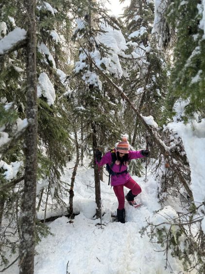
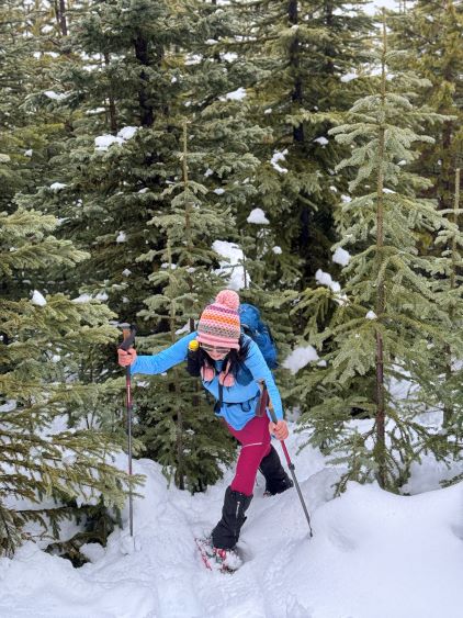
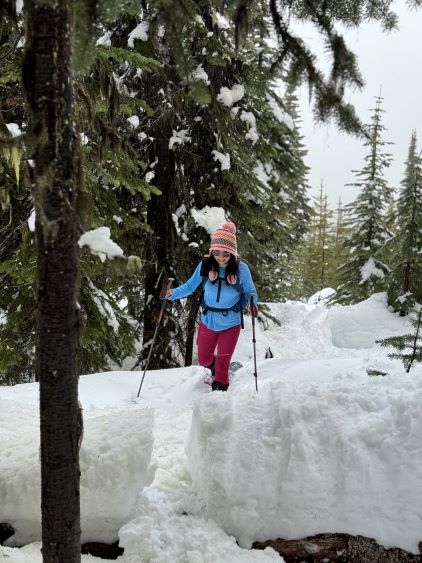
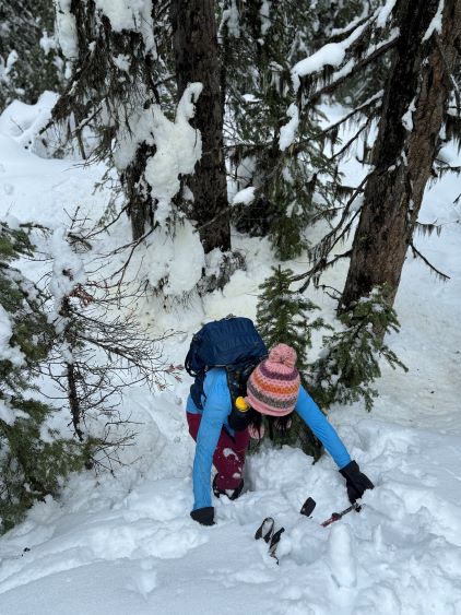
It was the bushwhacking that slowed us down. The snowpack was not thick enough to cover the bushes, especially in the forest above the cut-block. The timbers were tight and the dead-falls were abundant. Again, that was to be expected based on my past experience. The weather was also not cooperating with a persistent drizzle, even though we could see glimpses of sunshine and blue skies above this cloud layer. This combined with the ridiculously warm temperature (which was melting the residual snow on the trees) got us thoroughly soaked. The snowpack was also less supportive near the dead-falls or the tight timbers so we did discover lots of deep holes. Kate, on her women’s 22′ snowshoes, kept falling in on top of my tracks. I had the men’s 30′ snowshoes and did better. Not far below the summit we also encountered a few bluffs that necessitated some trenching techniques as the wallowing was waist deep. This started to shape up to become a hard won summit, but the reward was nothing. There’s absolutely no view from the summit. Even if the weather was bluebird I’m sure we wouldn’t be able to see much as the tree coverage was quite thick.


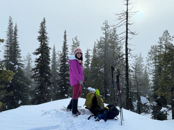
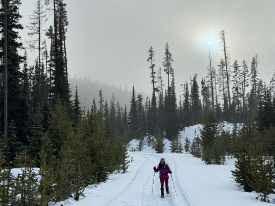
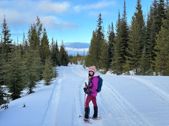
Not doing much lingering we quickly followed our own tracks down. Kate was entirely soaked and my boots were already waterlogged, so we couldn’t afford stopping too much in this kind of conditions. We basically made a single dash back to the vehicle. The weather finally improved as we plodded back on the snowmobile tracks, so we then stopped frequently for photos. Still, there was not much to see beside the marvelous cut-blocks. Our round trip time was over 3 hours. The drive-out turned out to be fairly trivial as the continuous melting had made the road less of a skating rink. The day had also become longer by the end of January such that we still had some daylight by 5:30 pm. By then we had already descended the Coquihalla corridor to Hope. By the time we entered the Fraser Valley it was not to our surprise, raining heavily so it rained the whole day while we were away.