Cardenas Butte
March 10, 2017
1914m
Grand Canyon National Park, AZ
Cardenas Butte is one of those rugged buttes below the south rim of Grand Canyon in the far eastern side of the national park. Those buttes have been gazed by hundreds of thousands of people every year from the observation tower at Desert View, and yet, only the selected peak-baggers would bother to research their names. Cardenas Butte is probably one of the easiest summits in Grand Canyon with the easiest route rated at a mere Class 2 scramble, along with a well-maintained trail (Tanner Trail) for access. For the more adventurous folks it also makes a fun scramble traverse when combining with the nearby Escalante Butte, and that’s exactly what I did.
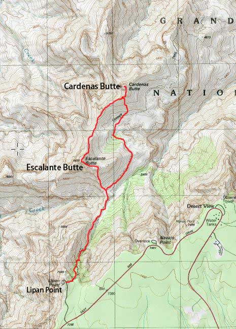
Scramble routes for Escalante and Cardenas Buttes. GPX DL
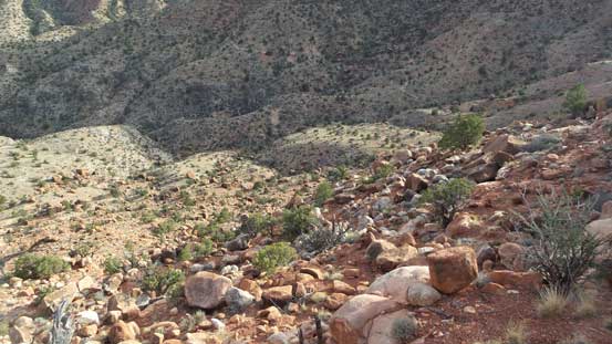
After dropping down the north ridge of Escalante Butte to Escalante/Cardenas saddle I quickly started the opposite side. The ridge traverse was very scenic and I had to stop constantly for photos. There’s a minor highpoints along the way which I easily bypassed on the right (south-east) side using wide ledges. Going up the broad SW Ridge I stayed more-or-less on the crest until cresting the upper portion of the south ridge.
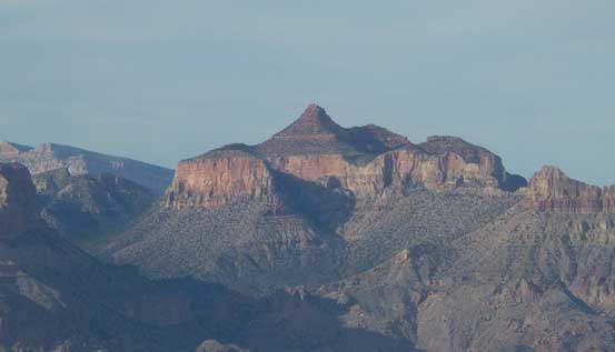
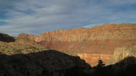
Cardenas Butte from partway down the N. Ridge of Escalante Butte

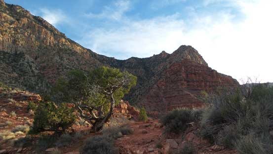
Cardenas Butte from Escalante/Cardenas saddle
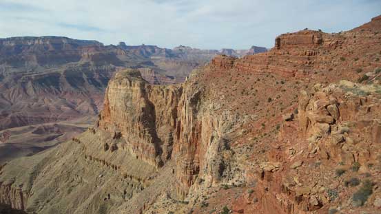
Going up the SW Ridge now, looking sideways across some interesting rock formation

Looking back towards Escalante Butte
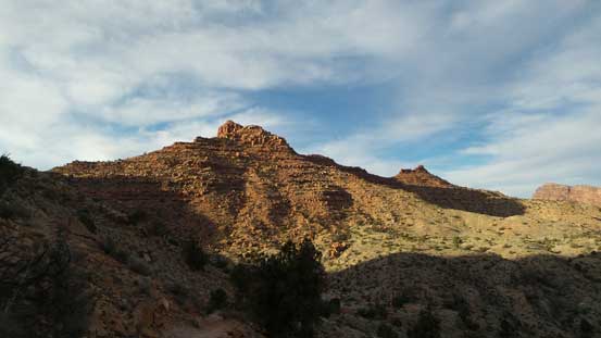
The summit was getting closer and closer
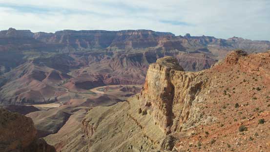
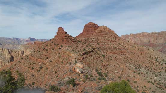
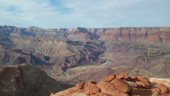
Another view looking down at that shear rock face. The Colorado River far down below
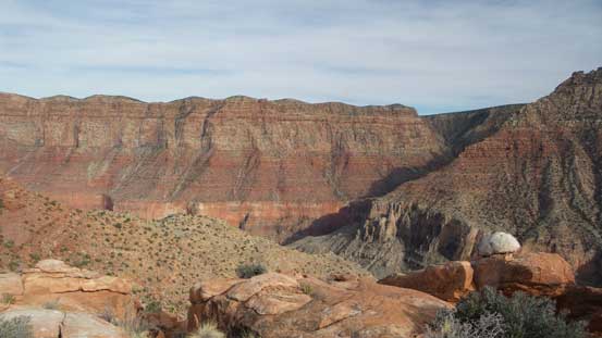
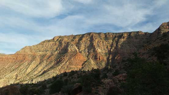
Looking at the cliffs by Desert View. Not sure how many tourists were looking down at me now.
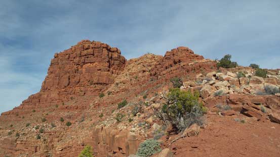
Onwards from here staying on the edge would be more technical but there are always easier lines if you traverse to the climber’s right. I went up a couple short, but fun 3rd class variations as I was tired searching around. I was really beat by now thank to the lack of sleep combined with the hot weather and I just wanted to get to the summit, and soon enough I was there enjoying the views. I did a much-needed very long break up there until I felt I had regained enough strength to make back, meanwhile the position of the Sun had made some good lighting.
The last bit of the grunt.
Looking sideways across the east side towards Palisades of the Desert
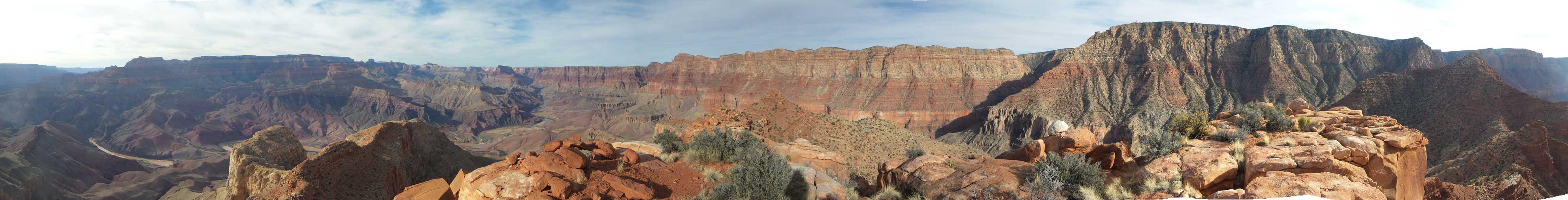
Summit Panorama from Cardenas Butte. Click to view large size.

Looking downstream into Colorado River and the Grand Canyon. The light wasn’t good on this side.
Another shot of Palisades of the Desert
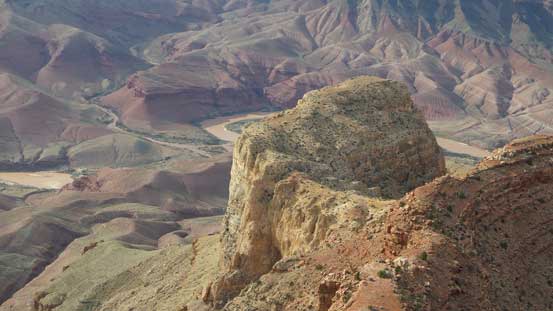
This is looking down at an unnamed butte with Colorado River behind
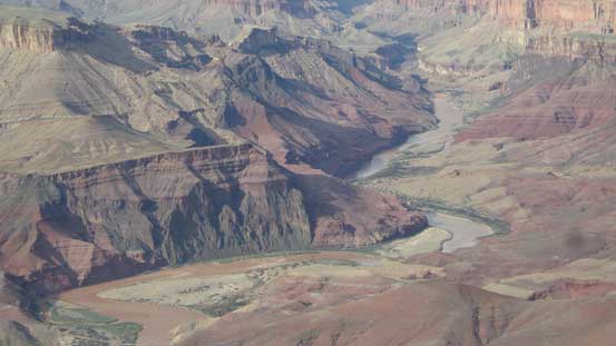
A zoomed-in view of Colorado River

The impressive Chuar Butte looms behind

A wider shot looking northwards down into the Grand Canyon
Another shot of the upstream side of Grand Canyon

Comanche Point and Palisades of the Desert
That impressive Gunther Castle

Me on the summit of Cardenas Butte
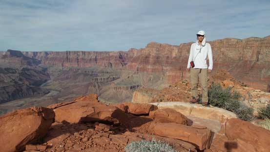
Another picture of me on the summit of Cardenas Butte
On the descent I did not bother to search around neither so basically went down whatever that looked feasible back to the intersection of the S. and SW Ridges. And then I bailed down the broad south slopes, taking a direct line down towards Tanner Trail far below. There were minor rock bands but nothing troublesome. Once back to the trail I changed my footwear back to the sneakers and leisurely plodded back to the Tanner Saddle. At this point I still had about an hour till sunset but given my physical state there’s no way I could make back to Lipan Point before that so to take the most advantage of the views I opted to wait for sunset at the saddle. Unfortunately it was a little bit too cloudy so the views weren’t as good as I was hoping for.

Time to head down, looking back at the summit

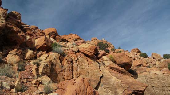
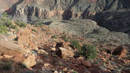
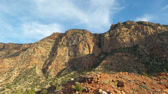
The typical terrain on this scramble
Now, time to bail down the south slopes

Can’t get rid of this view.
Another picture looking down. Tanner Trail was somewhere down there.
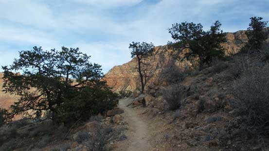
Back to the Tanner Trail now.
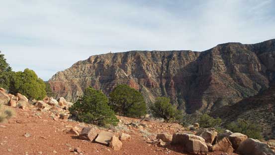
Looking way up towards Desert View
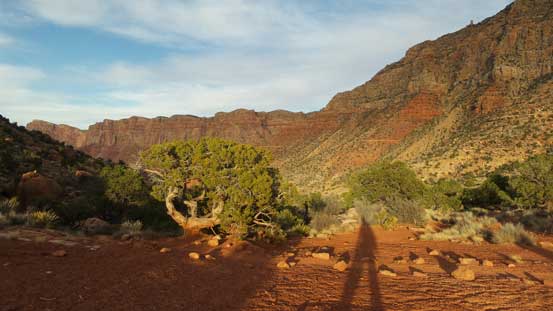
A review shot of Cardenas Butte
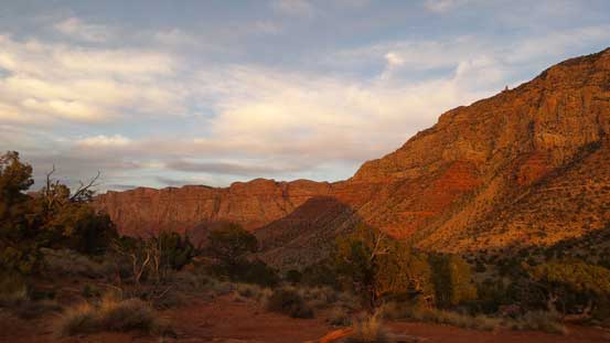
Lighting was getting better and better.
Back to the saddle now, looking ahead towards Lipan Point.
I decided to wait for sunset here.
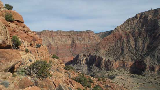
Cliffs below Navajo Point
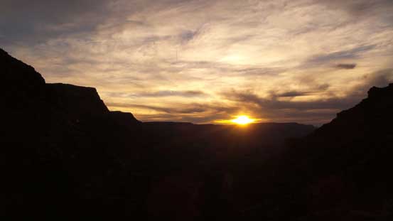
It’s sunset time!!
One last picture before grunting back up to Lipan Point
The Sun had gone down below the horizon, the temperature had dropped and I also had regained plenty of strength so it’s time to move on. The final 400 m elevation grunt up the upper Tanner Trail to Lipan Point was not inspiring but at least I could move much faster now. In less than an hour I was back at my vehicle.

Full moon rising behind the observation tower on Desert View
All in all the traverse of Escalante Butte to Cardenas Butte is a great route with a lot of fun scrambling and expansive vistas, but took a lot longer than anticipated mainly due to my physical conditions far below “normal”. I would still recommend the two for experienced scramblers looking to get away from the crowds.
Now it’s completely dark and I had to find a place to “refuel”. Driving westwards along SR 64 through the national park I found lots of places to eat in the small town of Tusayan about 10 km beyond the park’s gate. I randomly picked a Mexican restaurant. The price was very reasonable especially given the proximity to a world-class tourism central. After the dinner I was too tired to do anything literally so just picked a random place and slept in my car.
