Mount Breakenridge
April 11-12, 2021
2395m
Harrison Lake East, BC
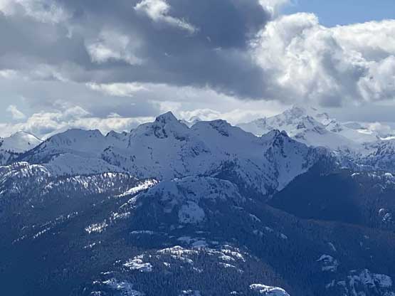
Mt. Breakenridge is a large and broad glaciated massif that rises over 2300 vertical meters above the east side of Harrison Lake and dominates the backdrop of many viewpoints in the vicinity of Harrison Lake, whether from ground level or from alpine ridges and peaks. This peak is not a secret in either the backcountry skiing or the hiking/peak-bagging community of SW BC, but doesn’t seem to get a lot of ascents each year. A dozen years ago the English Creek FSR was drivable a fair ways up but nowadays it’s deactivated at 370 m elevation and though still walkable, the road has been reported as significantly overgrown and bushy in summer months.
The better plan is to do Mt. Breakenridge in spring with a thick snowpack eliminating most, if not all of the bushwhacking on the logging roads. This objective had been on my list for a few years and I had rejected quite a few day-trip invites either in spring or summer. The main reason was that I wanted to combine Mt. Breakenridge with the taller but unofficially-named “Traverse Peak” in a single trip likely over 2 days. “Traverse Peak” is much less iconic but is the highest peak in the range making it a “Ribu” or P1000m status. To get both peaks done in a single trip in spring certainly ups the game to the point that requires proper mission-styled planning, timing and group fitness capable of 40 km distance and 3000 m cumulative elevation gain with a heavy pack and trail-breaking. This window did not come until a few years later when my schedule lined up with Vlad’s for 2 days and meanwhile, Matt’s “Midnight Club” was able to follow up on the second day. The weather was bomber but the conditions turned out to be rather marginal with over 30 cm of fresh snow and some brutally cold winds (for April standard in the South Coast ranges).
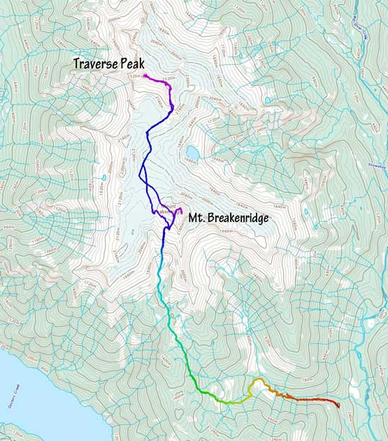
As for the route we would simply do the “standard route” roughly following GPX track recorded in Al and Mel’s trip in June 2019. We did do some modifications and managed to shave off some unnecessary elevation loss and regains but more than on that later. In the morning I had to make a detour to pick up Vlad in Richmond at 4:30 am and three hours later we were cruising up the East Harrison FSR. The road’s condition was better than expected with not many pot-holes. Over 40 km later we turned onto the much-rougher English Main. This spur road definitely required a proper 4WD and high clearance vehicle. It did not impose much of a problem to my Tacoma so that we did drive to the road’s end at 370 m elevation. For the gears I lent Vlad my cheap MEC -18 sleeping bag and XTherm and I carried my WM -32 Puma GWS. It might sound like an overkill but I was damn glad we didn’t go light on sleeping gears in this trip. Anticipating some tough trail-breaking work I made the spontaneous decision to carry the 30 inches Lighting Ascents snowshoes. I brought both pairs of snowshoes in the truck and made the call based on how much fresh snow I saw on the mountains.
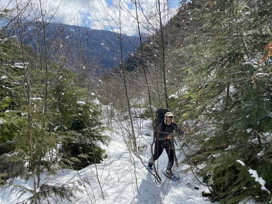
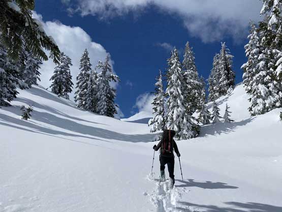
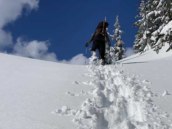
The first kilometer or so on the deactivated English Creek FSR was much easier than expected with barely any bushwhacking, and in fact, a short-based 4WD vehicle could probably push further on this road. After about 100 m elevation gain we started to encounter continuous snow and surprisingly, a set of skin tracks. We followed this set of skin tracks for another kilometer until realizing that we just made the same mistake that Al and Mel made a few years ago. We went back and found the correct spur road and sure enough, the ski tracks had stopped and turned around. Just when I thought the day’s too “easy” we were left alone on the mountains breaking trail and finding our own path. The snowpack was not deep enough at this elevation (roughly 500m) to cover the alders so we did have to bushwhack for a while, but the intensity was tame for SW BC status. What I found more annoying was the 20+ small creek crossings. By 700 m elevation the snowpack had become deep enough to completely eliminate any form of bushwhacking, but the post-holing soon took over. At this point we both knew we were in for an adventure and I sure was damn glad I took those 30′ snowshoes as otherwise we probably would have to turn around right here.


The snowpack increased to at least 4 meters deep by 800 m elevation and it’s there that we encountered a few troublesome ditches on the road. We left the road at 900 m elevation immediately after crossing a deep creek to short-cut a long and seemingly unnecessary switchback as we had come to a conclusion that minimizing horizontal distance (so to minimize post-holing distance) was the top priority at this point. This short-cut turned out to be a great call as the post-holing in the forest was actually easier than on the boring road. We resumed this straight-up orientation across a few more higher logging spurs all the way to around 1050 m elevation, then started the long and diagonal traverse aiming at the first lake at 1400 m. I was worrying about this section fearing some steep forest and impossible creek crossings but it turned out that at this elevation the snowpack had fully flattened the terrain making all worrisome unnecessary. Al and Mel’s track had at least 100 m of elevation loss along this stretch but we managed to cut that down to 20 meters at maximum (albeit with constant GPS checking).


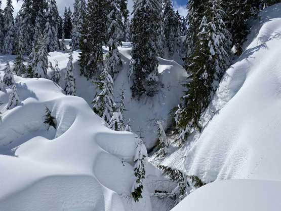

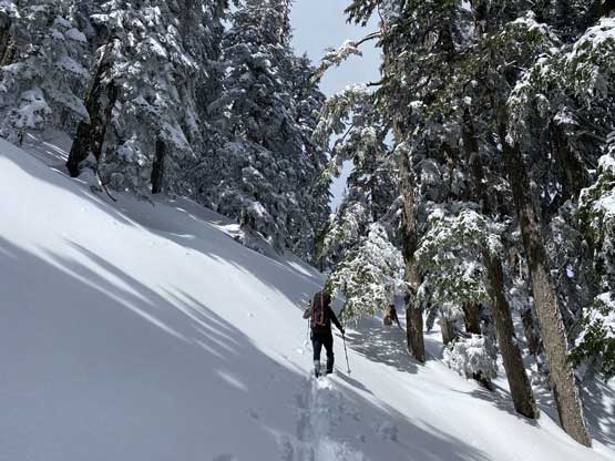


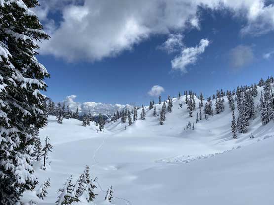
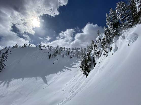
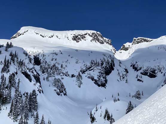
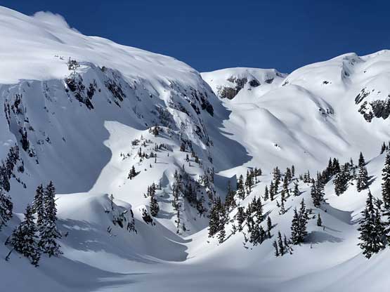
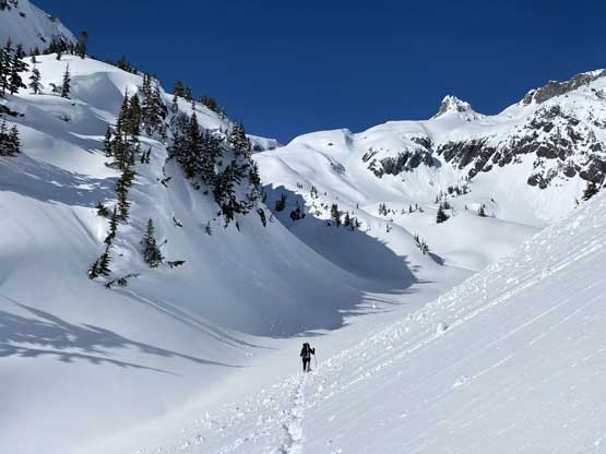
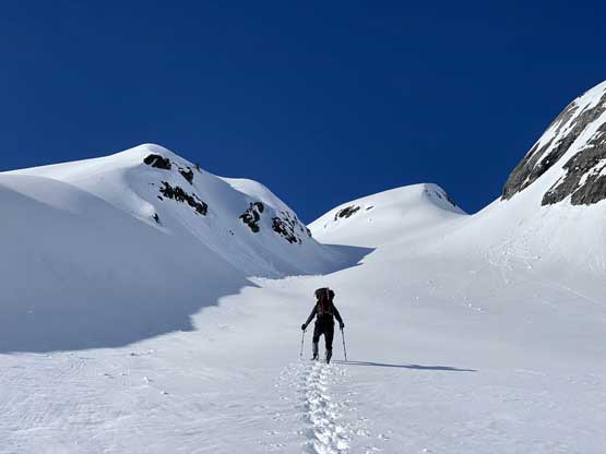
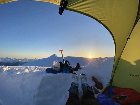
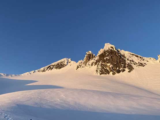
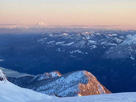
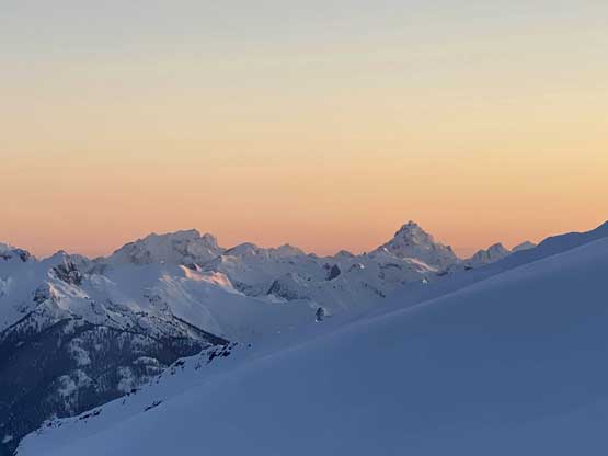
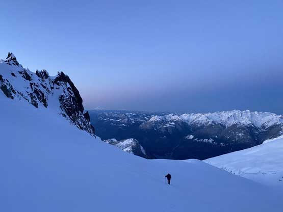
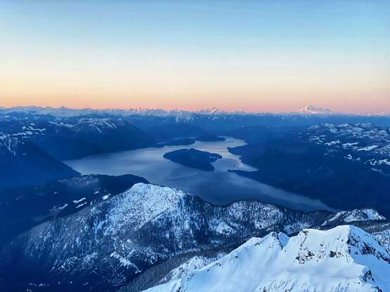
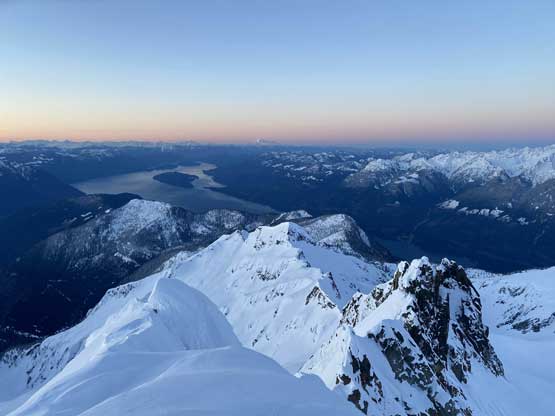
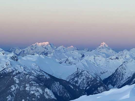
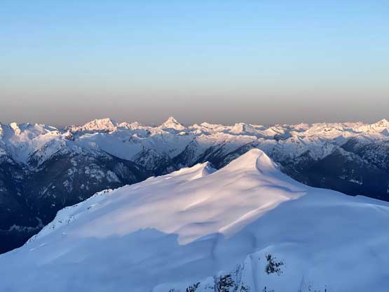
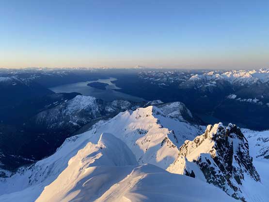
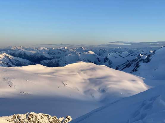
The next stage involved linking up several lakes with some unavoidable undulating terrain. We took a different line than Al and Mel’s trip by staying far on the climber’s left (west) side of the zone. We crossed those frozen lakes and used several gullies and gulches to link them up. The post-holing had reached its worst on this day mostly because the fresh snow had balling under our snowshoes making our feet at least two times heavier than normal, if not more. The temperature was still below freezing but the April sun was strong. After passing the 1600 m lake we pressed onward into the massive bowl under Mt. Breakenridge’s south slopes. We weren’t sure where exactly to set up camp but we wanted views and wanted to make use of the last few hours’ of sunlight, so decided to push hard to around 7 pm. About 600 m of elevation was dispatched in a gigantic gully system with the steepest around 35 degrees in the middle, all the way up the south slope of Mt. Breakenridge to a unbelievable spot at 2150 m elevation with views down to Harrison Lake. We quickly set up camp, watched sunset and dived into those “winter camping routine”. Unfortunately the fuel canisters were working very slowly in the cold that it literally took me a couple hours to get the melting job done. I had to put them inside my sleeping bag along with the water bottles and thankfully they did function properly in the AM. Vlad felt cold in the -18 bag. I was glad to have the -32 bag for some extra comfort.


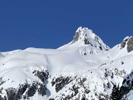


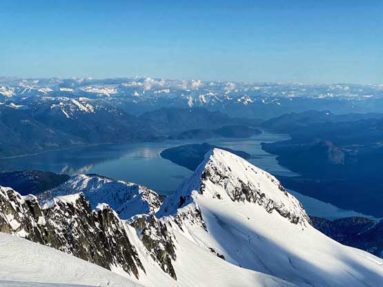


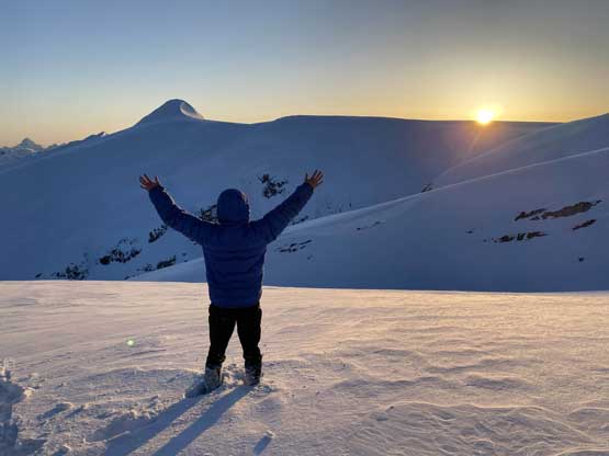


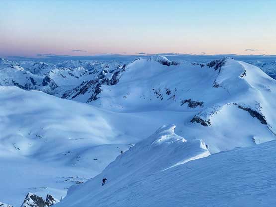
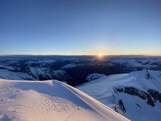
The plan for the following morning was to tag Mt. Breakenridge at sunrise then wait at camp for the other guys to show up. We did some math and decided to wake up at 5:20 am which turned out to be an excellent call. None of us bothered to eat anything in the cold as we all wanted to get going as quickly as possible, although kicking into the frozen boots was never an easy task for any winter camping trip. The peak looked to be close but involved 250 m elevation gain, so once started I led a reasonably fast pace charging up onto the NW Ridge. The view was very foreshortened. There was about 50 m of steep terrain to gain the ridge and the whole summit ridge itself was suspect to be on a gigantic cornice, so I had to gingerly traverse some steep and exposed slope (with snowshoes on) to reach the highest point. From there looking back I could see that the ridge was actually not on a cornice so Vlad had some easier time traversing to the true summit. We made there with about 10 minutes of spare till sunrise so the timing was excellent, although the wind was brutal enough that we didn’t want to linger any longer than necessary.


After the summit sunrise show we quickly retreated following our own tracks down to camp. We estimated that the other group would show up in about an hour so we went into the sleeping bags and melted more snow for the day. Just when I thought I should cook a proper Ramen breakfast I heard something and sure enough, Ben showed up. Matt, Mel and Iliya showed up in the next 10 minutes. It had taken them only 4.5 hours to reach this spot so Vlad and I had to hurry up to get ready. And the trip continued with a solid teamwork ascent of Traverse Peak.

