Mount Alexandra
September 26-28, 2014
3388m
Bush River / Kinbasket Lake Area, AB/BC
The plan of making an ascent of Mount Alexandra – a beautiful but remote 11,000er, halfway between Lyell Icefield and Columbia Icefield on the Continental Divide has been made for more than a year already and things finally lined up nicely in this past weekend. This September has been superb with sunshine in the forecast for all weekends, but given the gloomy weather on Thursday and Friday we’d expect fresh snow as well as a soggy and miserable approach, doing perhaps the harshest bushwhack in our climbing career in rain. Vern, Ben and I are hardcore peak-baggers and we wouldn’t easily give up this opportunity, so that’s it…
Like many of the 11,000ers, the challenge of Mt. Alexandra is more about getting closer to the mountain rather than ascending it. (I’m not saying the climb is easy though as it’s still a grade II alpine route). It boasts perhaps the most complicated driving of all 11,000ers as well as one of the most arduous approaches. There’re two commonly accepted approach routes, one via Lyell Creek and the other via South Rice Brook. Over the past years a few of our friends had explored these two options. Lyell Creek approach is a 10-hour-plus thrash up horrendously dense alders, 8-foot tall devil’s clubs and thousands of dead-falls. The South Rice Brook approach involves much less bushwhacking, but has probably the worst and yet longest side-hill bashing as well as more than 1000 m of elevation loss/regain. On top of that this route lacks detailed description. The conclusion we got was to take the South Rice Brook highline traverse route. To get there we have to drive to Golden first, then northwards to Donald, onto Bush River FSR on the west side of Kinbasket Lake. We’d drive 94 km up this logging road before taking a much narrower, rougher, ridiculously steeper and yet, decommissioned branch switch-backing exposedly high above Rice Brook. And just before it drops to Rice Brook (which is where you park for Mt. Bryce), we’d continue driving up the switchbacks on the south side of this valley to as far as we could. Well, that’s the adventure we like…
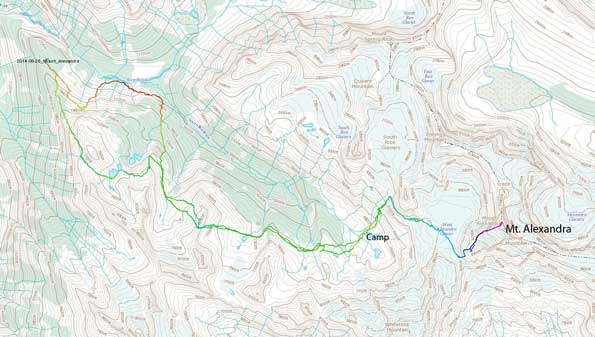
Mt. Alexandra approach and ascent route via South Rice Brook. GPX DL
As usual I couldn’t leave Edmonton until 10 pm on Thursday evening so that meant Ben and I would have very little sleep at that night. We made to Calgary by about 1:30 am on Friday morning and met Vern 2 hours later. Vern did an excellent job driving all the way up. It wasn’t without intense moments though. Immediately after starting the Bush River FSR we noticed a big yellow sign saying the road’s closed at 89 km… We decided to go in anyway and thankfully didn’t encounter any barrier nor washout/bridge-out. The only difference we noticed after 89 km was the loss of kilometer marks. I think the more proper term would be “decommissioned”. And, just before parking Vern’s truck got overheated. Thankfully that didn’t cause any major damage otherwise we’d be in a huge trouble.
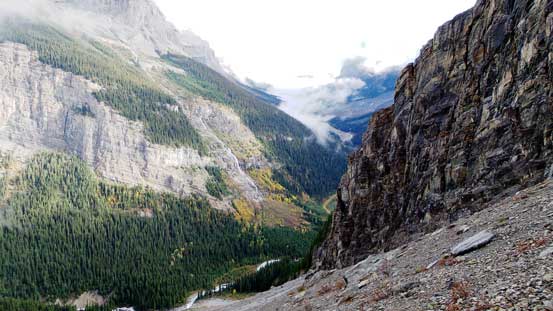
Due to the thick fog (low visibility), confusion between our route beta and the lack of research (as a result of a busy school week combined with the last minute decision) we made some serious navigation errors. We did park at the correct spot, but instead of gaining steeply to the treeline we picked a contouring line. This line brought us to the base of a impenetrable cliff band. At this point we should have gone up underneath this cliff band but we somehow managed to convince ourselves to drop down to the valley floor… This was frustrating to say the least, so after wasting 2.5 hours we were back to South Rice Brook, hundreds of meters below our starting point… We then hiked up the abandoned logging road and soon enough it ended at Rice Brook. From here on our route became experimental and we’d spend hours and hours bashing through dense alders, Devil’s Clubs and krumholtz (the young grown on avalanche paths). It wasn’t as bad as how the Lyell Creek sounds but still deadly miserable, especially with all the vegetation soaking wet… There really wasn’t much to write for this long section, and our route choice was completely wrong anyway. Long story short it was probably the most miserable 5-6 hours I’ve ever spent in the mountains. I still don’t know how we managed to keep up the motivation since we were literally moving at a pace of 0.5 km per hour.. My mood had dropped to the lowest and I thought we’d need a miracle to make the bivy on Friday.
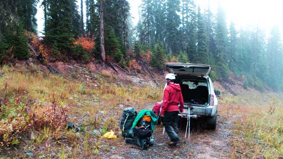
Starting high on the logging road
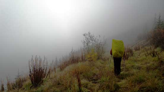
Into the fog. We couldn’t see where to go and in fact we even guessed our ascending valley wrong. We mistakenly thought Rice Brook Valley as South Rice Brook Valley. It was such a rough start… Totally confused.
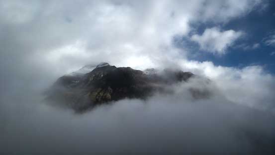
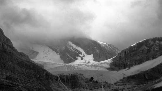
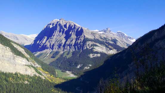
Through occasional breaks we could see Mt. Bryce the majesty
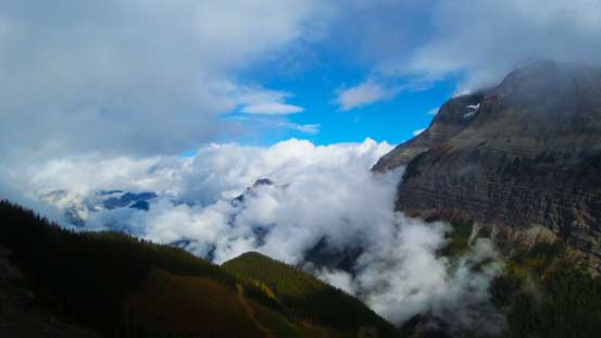
Probably the best view we got on Friday
Now what. We decided to descend all the way down to the Rice Brook, back to where we started, only a few hundred meters lower…
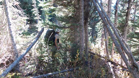
Then the bushwhacking game began… I did not take many pictures on the approach since I thought our chance of success was low.
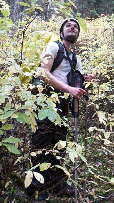
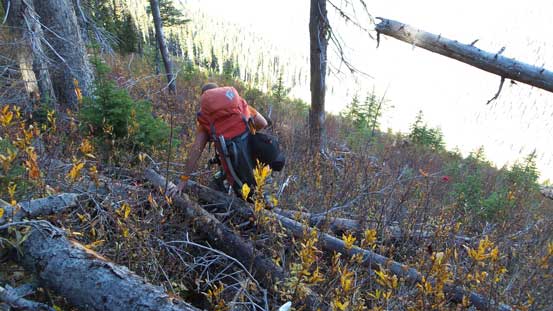
Thankfully the devil’s clubs were dead. Still spicky though, just not as dense as supposed to be. Photo by Ben
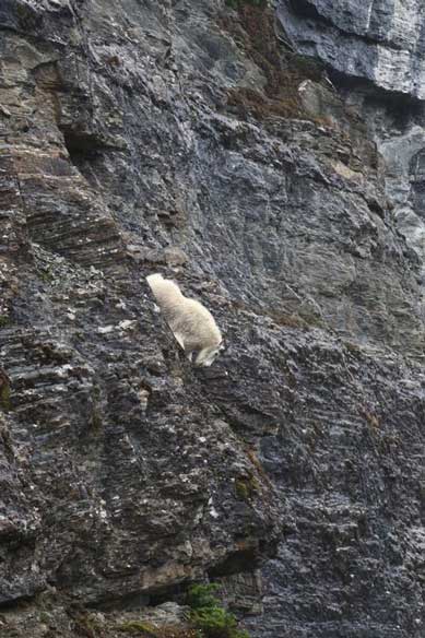
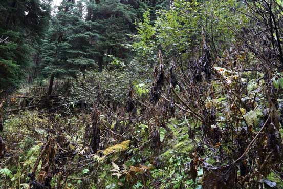
Here was an interesting moment. We noticed a possible short-cut through a minor cliff in the thick bush, and a goat was coming down that way too. He managed to avoid us but our “short-cut” turned out to be a dead-end… That was frustrating to hell. We basically took some risks for nothing, and wasted 15 minutes or so….
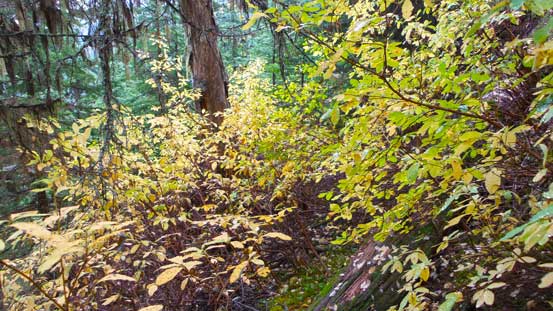
And the alders… They would never give up. Hours and hours of this. To be honest it was much better than I imagined though.
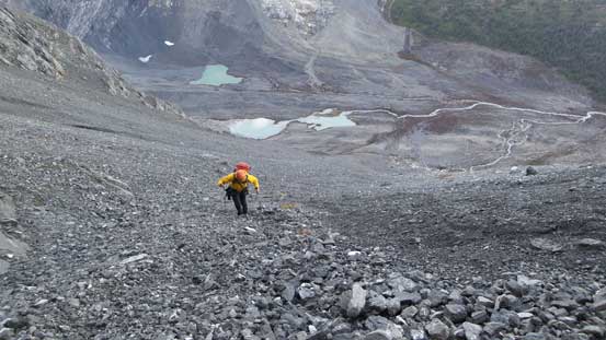
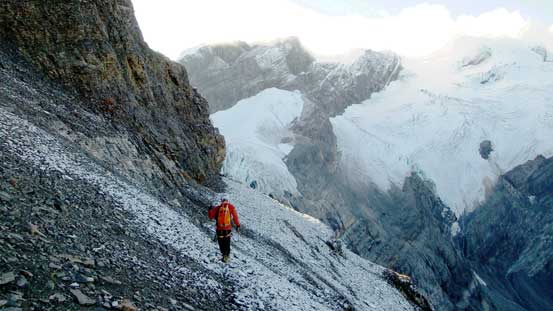
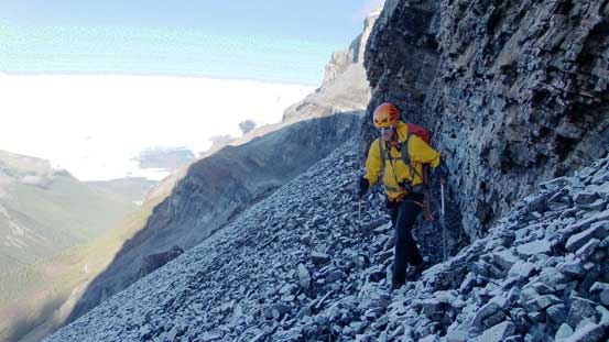
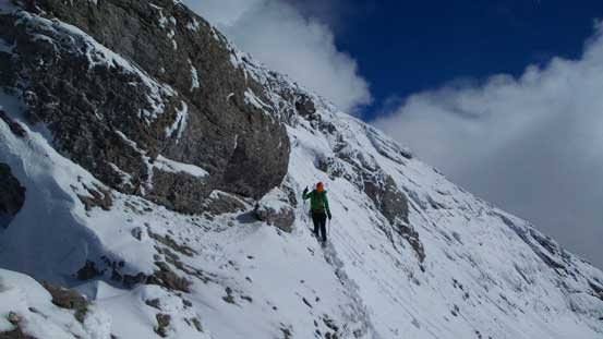
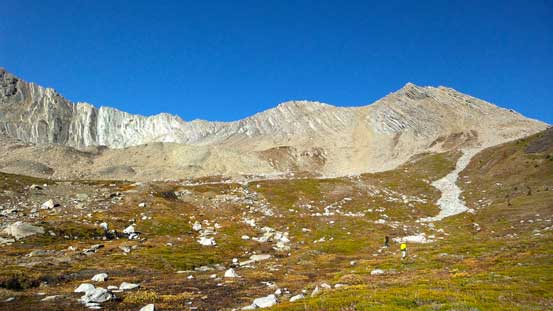
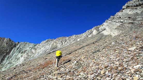
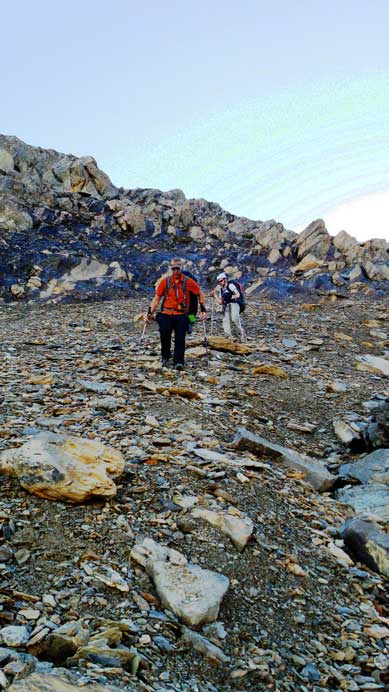
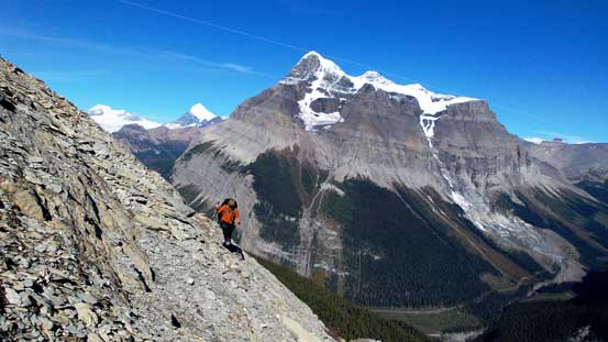
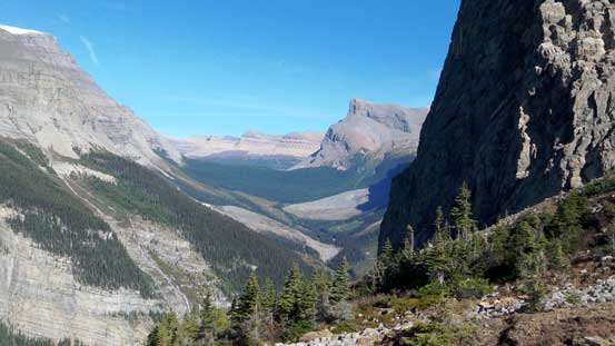
Once we got out of the bush we had only about 2.5 hours daylight time left. Looking ahead this just seemed hopeless, and a blowing-in wet snow storm didn’t help neither. Ahead it appeared we couldn’t traverse around treeline anymore (cliff bands or more krumholtz which was just a pain in the ass) so we had to aim for a high col way on climber’s right. We also made some mistakes route-finding and ended up dealing with loose, wet and exposed difficult scrambling terrain. Well, I should say we did make the bivy on Friday, without the aid of headlamps even, so there was some sort of miracle. Once cresting over the col our pace boosted up significantly. We still had to traverse around or go up and over two more subsidiary bumps but there’s minimal bushwhacking left. What appeared to be “open slopes” did turn out to be open slopes this time. There was no alders nor Christmas trees and we were simply hiking on grass. I led the way contouring as fast as we could around the second-to-last bump, down and across a waterfall on its upstream side, ascend a break through cliff bands to the final bump followed by losing elevation to our final destination. Excluding the initial hours that we wasted it took us 8 hours to the bivy, so I should say it wasn’t that bad. On the downside both Ben and Vern were soaked through from bottom to top. I kept my rain pants, rain jacket and gaiters on for the entire bushwhacking. They together with my mountaineering boots did an absolutely fantastic job keeping my core dry.
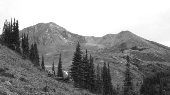
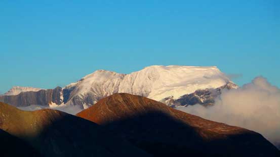
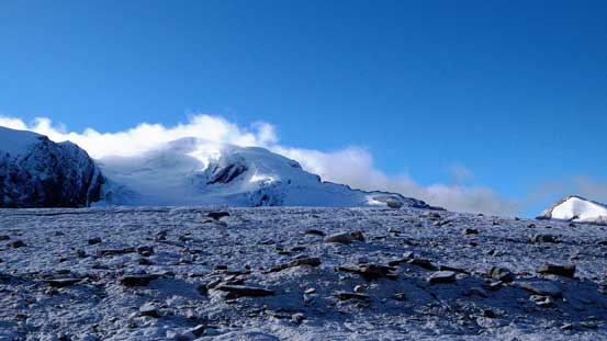
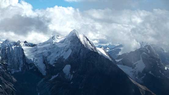
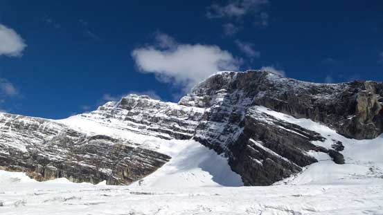
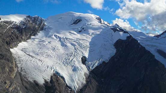
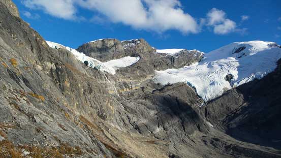
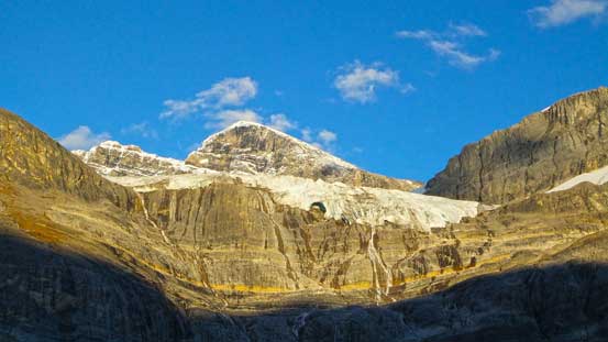
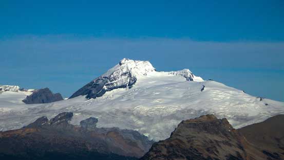
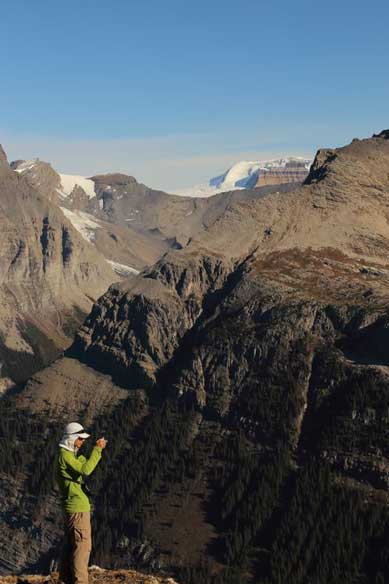
Probably the best view of our objective on the approach.
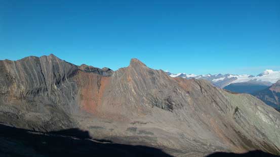
Looking back at the high col we just descended. It’s way up high at center of this picture.
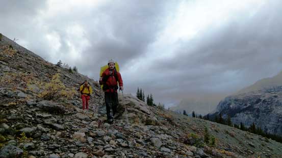
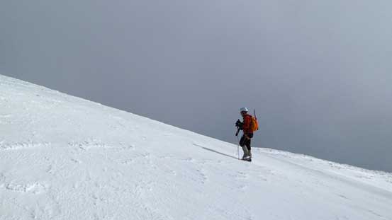
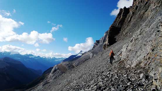
I led the way side-hilling these easy terrain as quickly as possible hoping to make the bivy site before dark.
We got lucky with the weather temporarily and it had stopped raining for a while already. We managed to set up camp and cook dinner without the disturbance of rain. But just before finishing my dinner another rain storm came, and lasted for a long time. It rained on us overnight too but at this point we had nothing to do except for catching as much sleep as possible and hoping for the best. At 5 am I woke up with millions of stars looming above. Awesome so I went back to sleep. One hour later I woke up in thick fog….
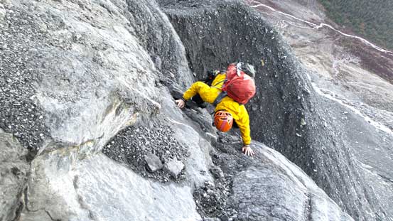
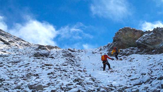
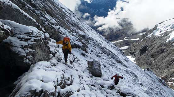
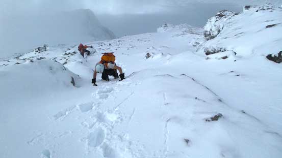
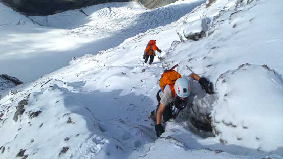
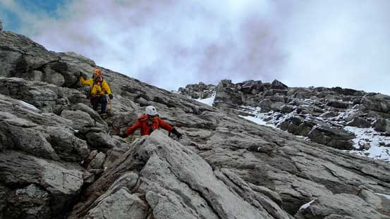
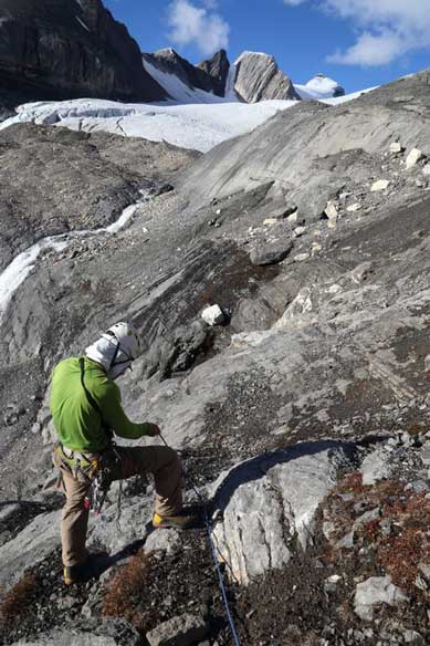
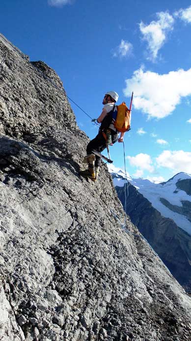
Without visibility we couldn’t even tell where should we go. There’s a section of 4th class scrambling followed by a 5.2 crux up the head-wall. In order to do them safely we had to wait until the fog staring to lift. It was about 7:30 am when we left camp. What appeared to be ridiculously steep turned out to be much flatter once we got closer. Following our basic mountain senses we got through the lower 4th class section relatively trouble-free. After that we’d slog up a long pile of scree to the base of the 5.2 section. There was a beaten path on the scree thank to the ACC section camp as well as the various guiding parties. We got extremely lucky with condition on the 5.2 step. It was short and not as difficult as expected, but exposed, down-sloping and involved very small holds. We all free-solo’d it. And yes, just above it we started to encounter fresh snow and ice as we transitioning to the traverse under Mt. Coral’s face…
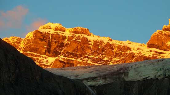
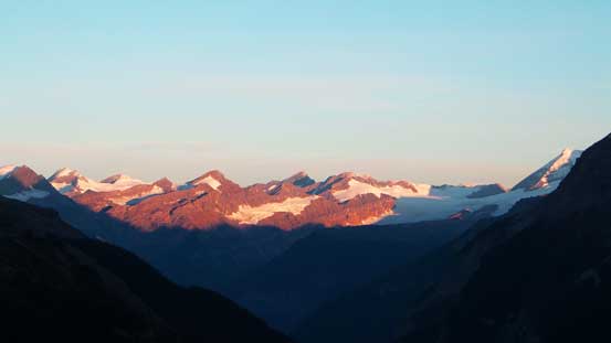
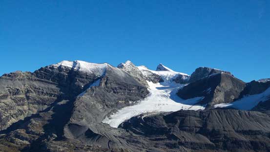
Alpenglow on an impressive peak in the “Chess Group” – a group of glaciated peak without official names.
More gorgeous morning colours over the horizon.
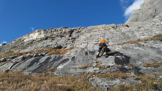
Zig-zagging and finding the easiest possible route was the key in the lower 4th class section
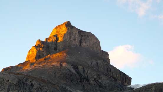
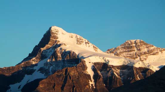
This peak in the Chess Group is Pawl Peak
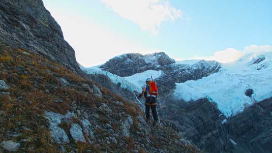
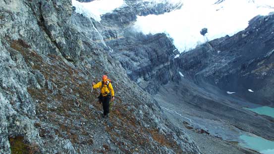
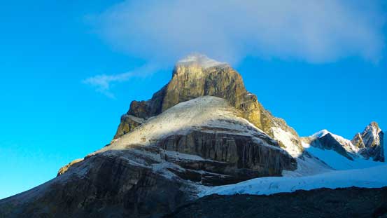
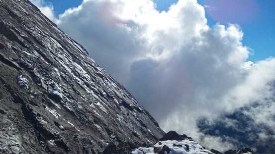
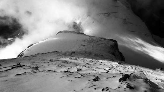
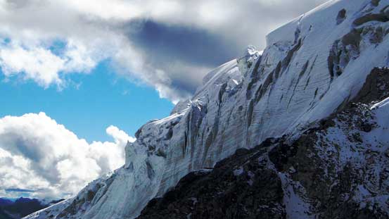
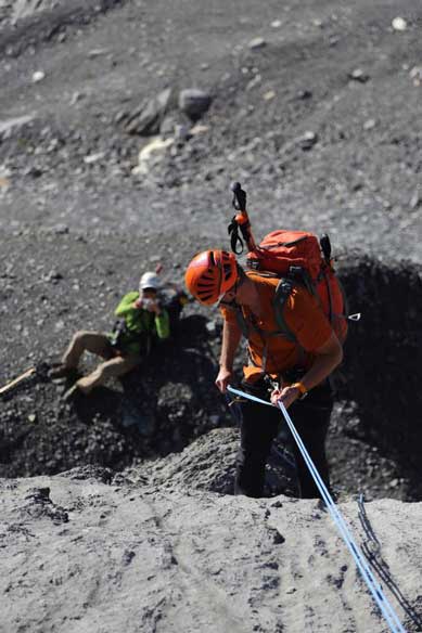
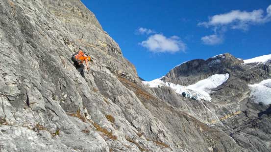
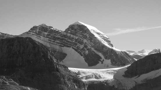
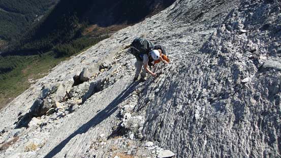
Ben ascending the head-wall with the fractured West Alexandra Glacier above his head. It’s a long way to get there though despite the appearance.
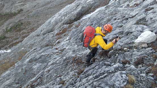
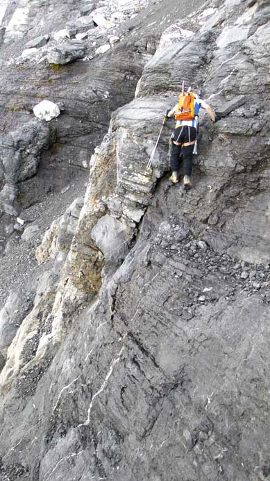
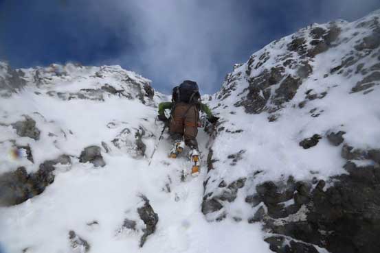
Vern negotiating the typical terrain. Slabby difficult scrambling.
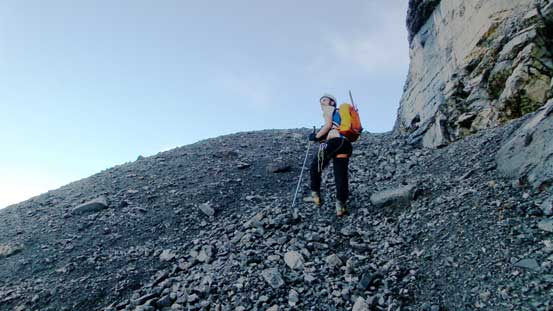
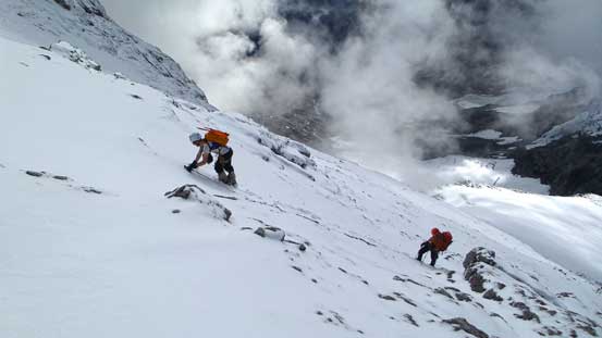
Between the lower head-wall and the 5.2 crux we had a long pile of scree to slog up.
Vern on the scree
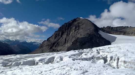
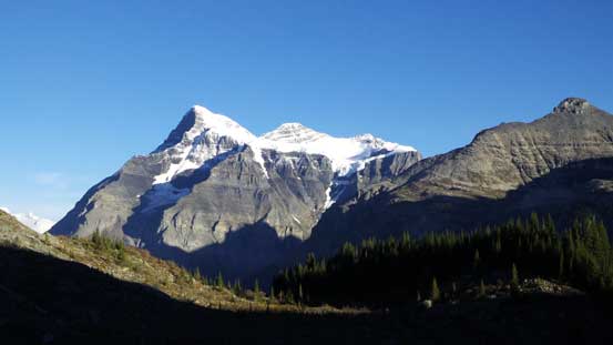
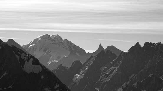
Surprisingly this impressive peak does not have a name. My friend Dan Kim did its first ascent with Rick Collier a couple years ago. It looks quite technical.
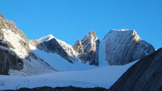
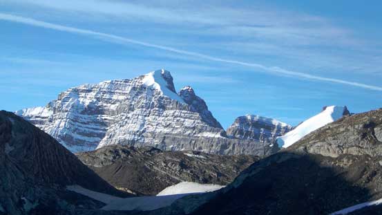
This couloir looks super fun on Queant Mountain.
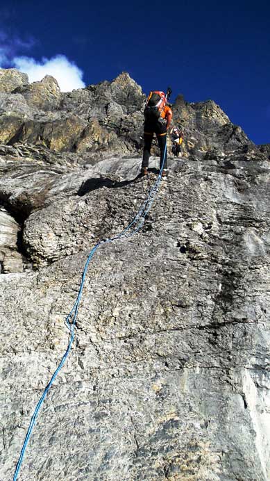
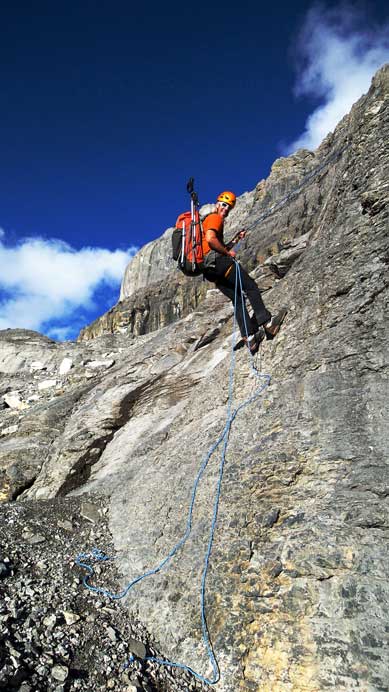
Ben leading the way up the 5.2 rock step.
Vern free-soloing the 5.2 step. As you can see it’s quite exposed and slabby.
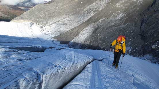
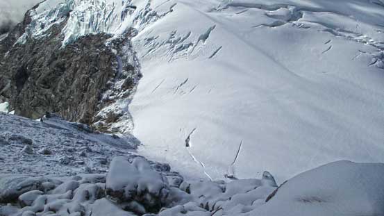
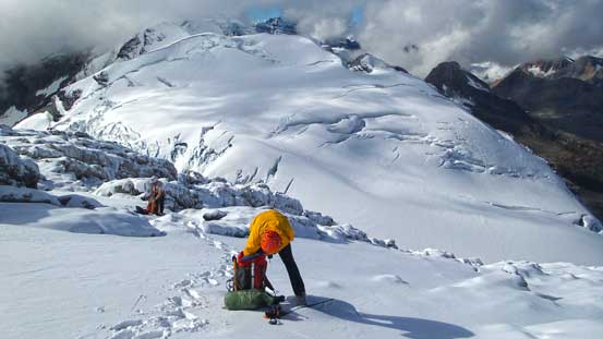
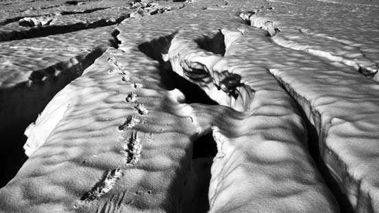
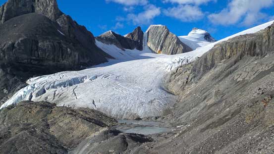
The ledge across Coral’s face was wide enough to just simply walk on, but slippery and exposed. There was again, a beaten path we could follow so in short time we arrived at the other end. And again, there was a bit of elevation loss to access West Alexandra Glacier where we strapped crampons on. The glacier appeared to be relatively straightforward initially but soon we entered a maze of crevasses, just like on Mt. Woolley, except this time we had to zig-zag for probably an hour to find a way through. There were sections we had to balance on an ice arete with width less than 1 feet, with deadly crevasses on both sides… It was crazy. To make a long story short we eventually made through this crap, and rope’d up once hitting continuous (old) snow. The glacier leading towards Alexandra/Whiterose col appeared to be tame but actually not. Near the col we had to cross a monster sized crevasse (that extends right into the rock debris and spans mostly across the col) with questionable snow bridge…
Ben crossing the broad but exposed ledge on Coral’s face. It was icy and slippery.
Vern on the slippery ledge
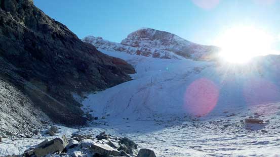
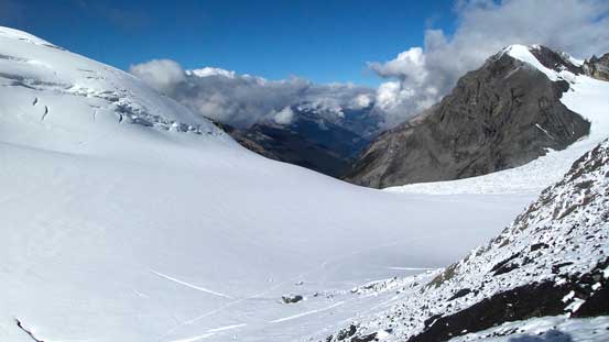
Arriving at West Alexandra Glacier. The sun was just about to shine on us.
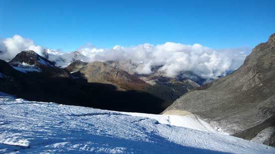
Whiterose Mountain in the distance. It kept catching clouds during the entire day, but it did do a good job blocking clouds from hitting Alexandra (for most of the time anyway).
Vern starting the glacier. Immediately we had to deal with crevasses..
We could observe clouds forming up, and we were hoping for the best.
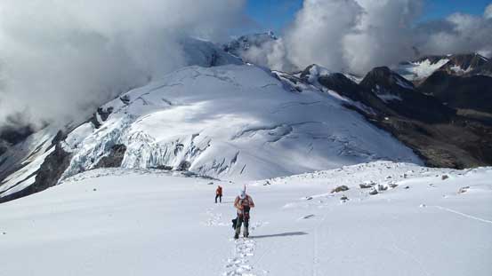
Ben leading the way into the maze.
We soon switched lead. Zig-zagging was the key here.
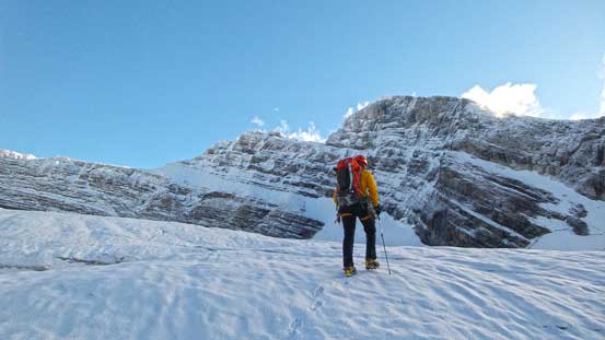
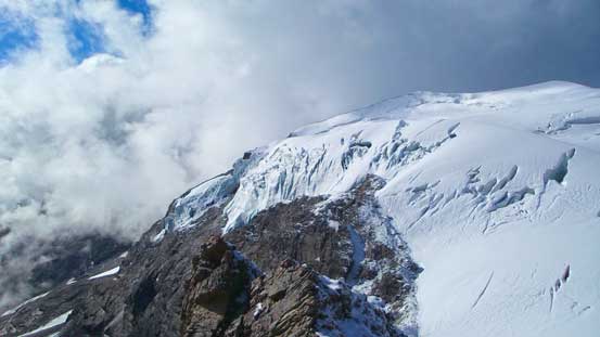
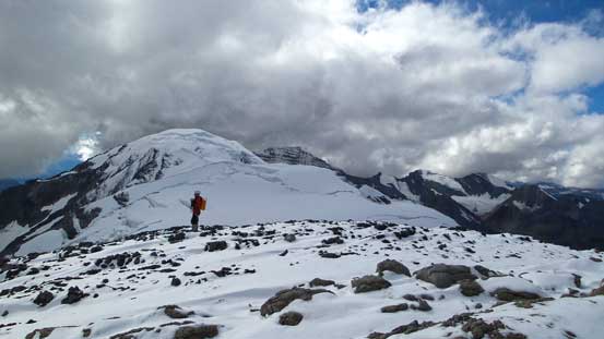
Vern with our objective in the background. As you can see it’s free of clouds.
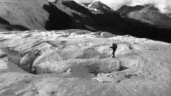
Oh the crevasses. Looks very familiar to 3 weekends ago…
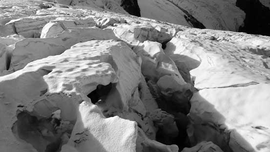
Monster-sized holes everywhere. Intense fun…
Finally onto the snow.
This sub-peak of Whiterose is quite beautiful actually
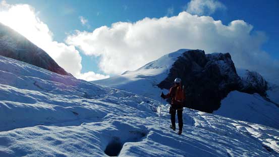
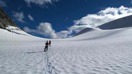
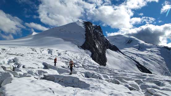
Ascending towards the col. The glacier isn’t as tame as it looks here.
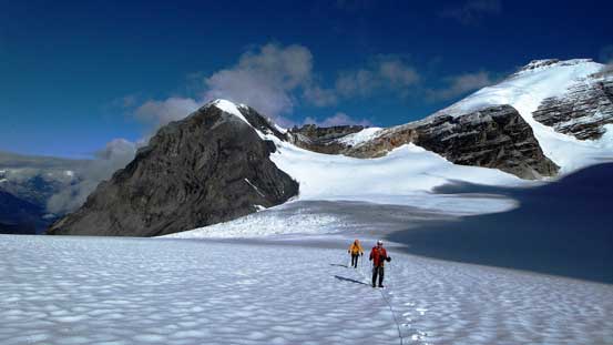
Ben and Vern with Mt. Coral and Fresnoy Mountain behind.
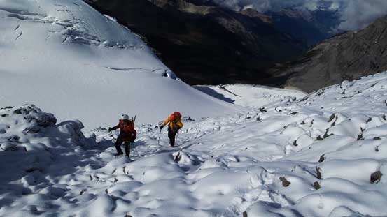
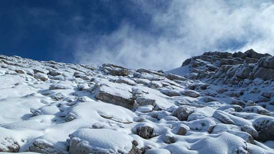
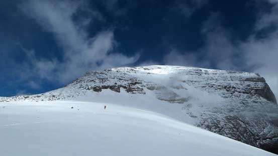
And, the face wasn’t easy neither given the current condition. Immediately we had to deal with snow covered slick and down-sloping rocks. Almost everyone mentioned following a snow gully up but we didn’t have that option thank to the crazy melt-out earlier in this summer. For the entire ascent we had to keep the crampons on and in my opinion the lower 200 meters or so was the trickiest in terms of avoiding the slabs. With the thin snow coating we had to avoid any major piece of slab, and thankfully we managed to do so. Upon arriving at the “bench” terrain started to level out. After a quick energy break we started up this gentle, but very foreshortened glacier. Towards the upper end we had two choices – one was attacking the snow/ice face directly (steeper than 40 degrees) and the other ascending loose and slabby rocks on climber’s left. We picked the rock route. It wasn’t actually that bad with careful route-finding as well as the aid of crampons, but certainly a bit more involved than we thought.
Starting the face. It didn’t look as we were expecting. There was no “snow gully”
We went a bit too far climber’s right. Further right would be this stuffs…
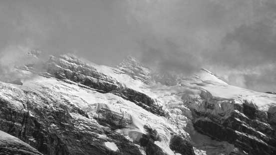
Looking back we did see some impressive serac scenery
And also our tracks
We carefully worked our way back climber’s left. Crampons on slipper rocks.
The lower face was quite steep.
Terrain started to level out near the “bench”.
Ascending easy terrain onto the bench.
The bench is actually a gentle glacier. Not sure if there’re crevasses. At least we didn’t discover one.
Taking a short break with incredible scenery behind.
Ascending the small glacier towards the upper mountain. Whiterose Mountain in rear.
We stuck on snow for as much as we could. Beneath the snow was slabs so crampons were essential.
Typical terrain we had to ascend.
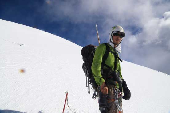
Looking back from an easier section.
And this is me climbing up a steeper step. Photo by Ben.
Ben and Vern ascending.
Fresnoy Mountain
Queens Peak. Its official height is only 4 m shy from the magic 11,000 feet mark…
Vern coming up with big clouds behind.
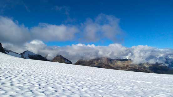
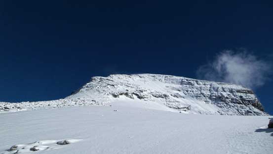
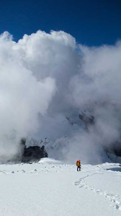
With a good perseverance we eventually arrived at the upper snow field/glacier that would eventually lead us to the summit. Weather was coming in and out at this point. We lost views towards the distant peaks but on the positive side we got excellent clouds scenery. It was an extraordinary moment to realize we did make the summit. A day ago at the same time I would not think about that…
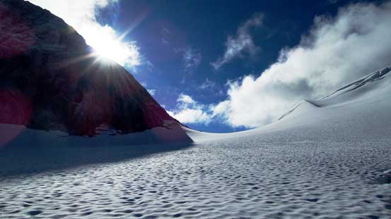
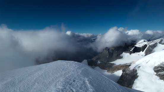
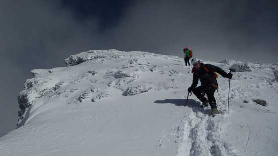
Me arriving at the upper slope/glacier. Photo by Ben
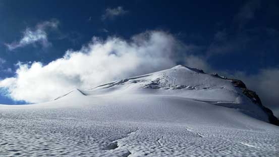
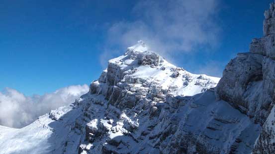
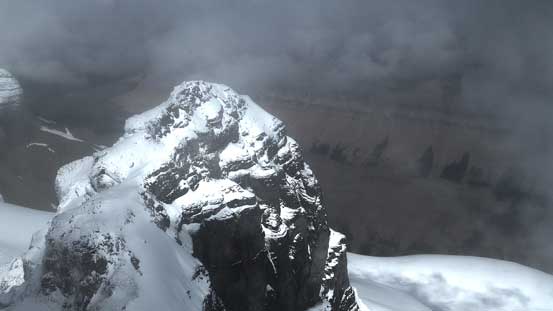
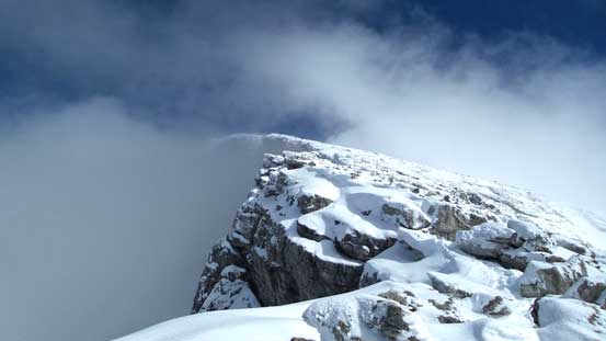
Ben ascending the final snow cap to the summit
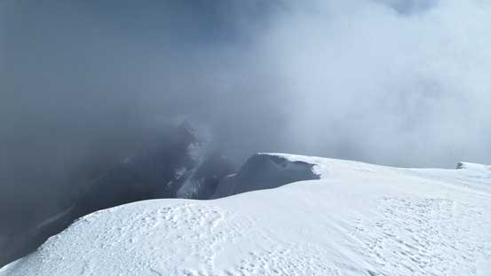
Arriving at the summit, weather started to clear up!
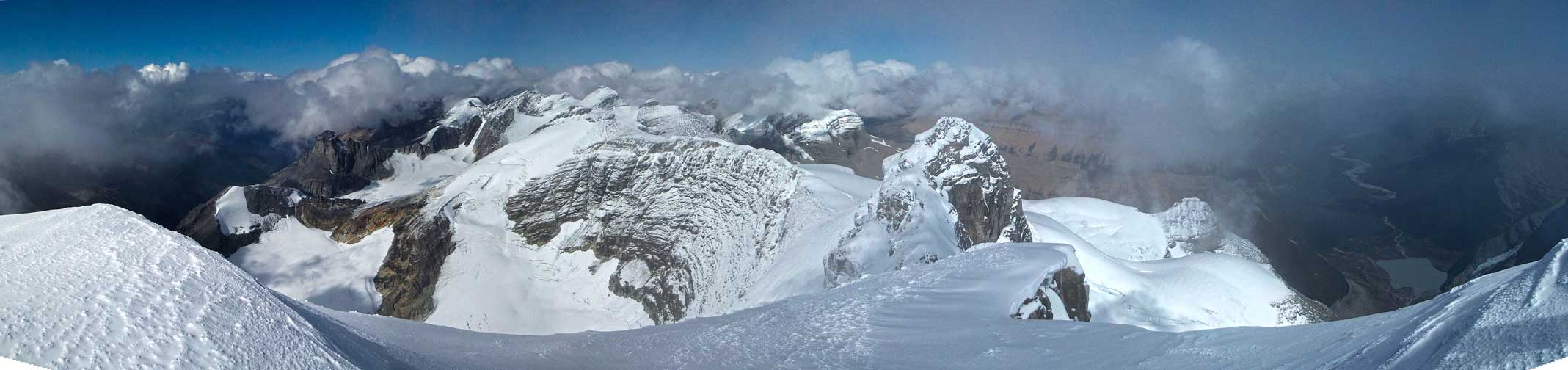
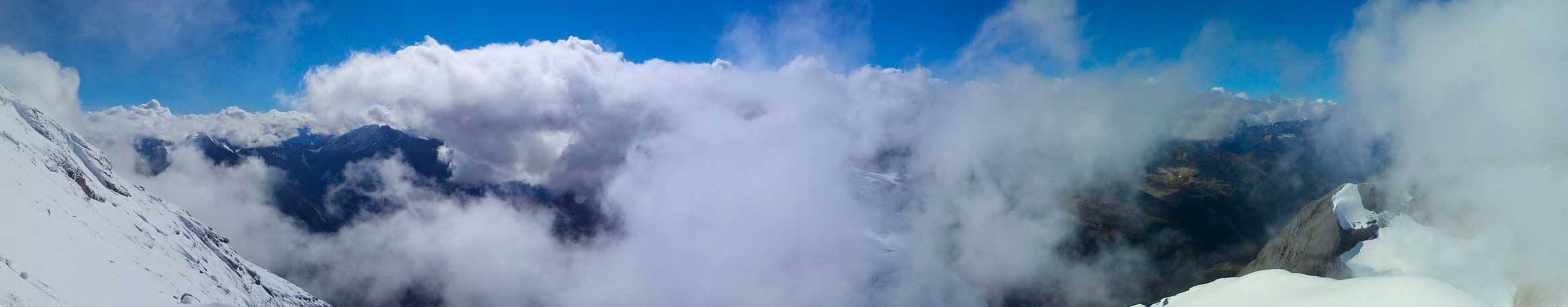
Panorama from Mt. Alexandra. Click to view large size.
Panorama from Mt. Alexandra. Click to view large size.
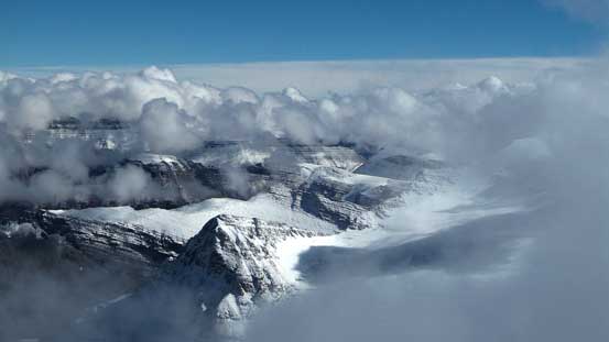
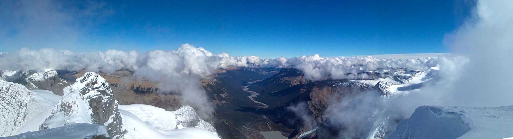
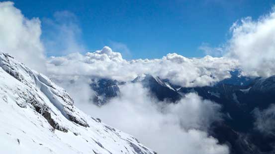
Incredible clouds scenery looking east.
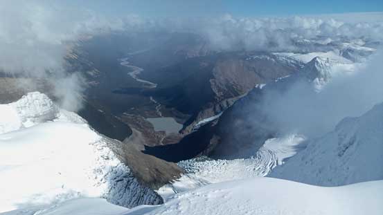
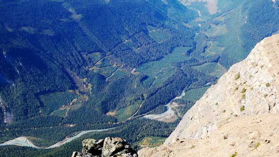
Even the Alexandra River Valley showed up.
Clouds and blue sky.

Clouds partially rolling in creating dramatic effects
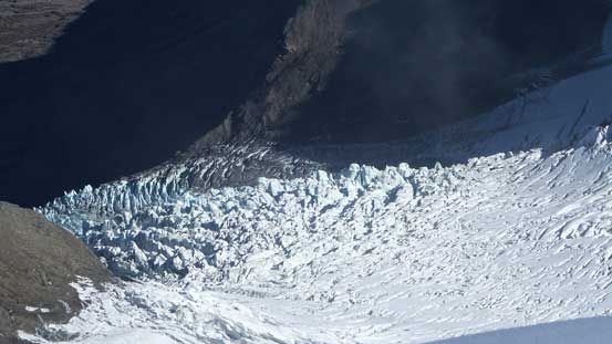
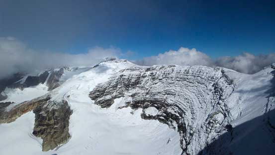
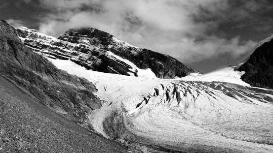
The fractured Alexandra Glacier. The South Rockies ski traverse goes up this glacier I believe
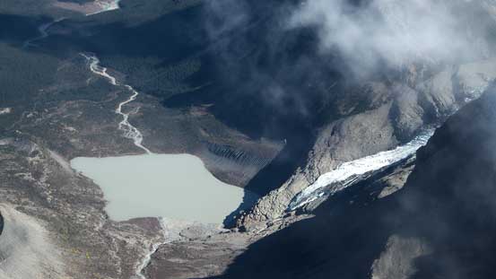
A neat glacial tarn on the Alberta side.
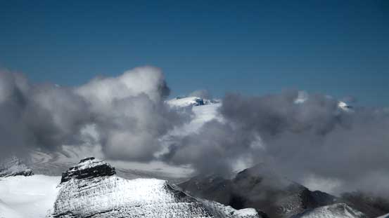
Damn the clouds otherwise we’d have an unobstructed view of the Columbia Icefield…
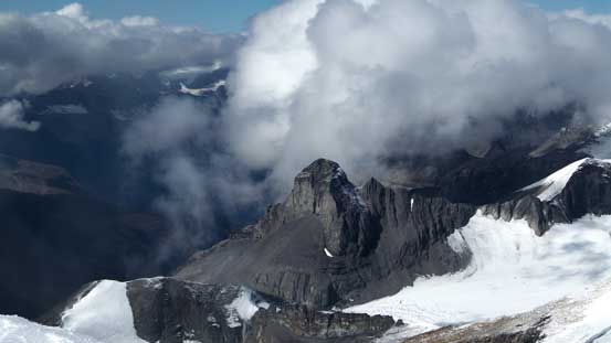
The peak that Dan Kim and Rick Collier did a first ascent.
Queens Peak
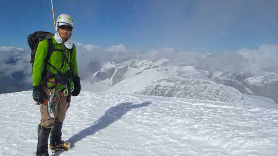
Me on the summit of Mt. Alexandra, my 18th 11,000er.
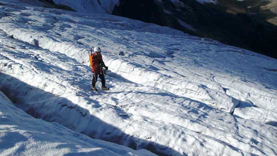
Descending the slabby and snow covered terrain on the SW Face was relatively straightforward but did require extra caution. Negotiating back through the maze of crevasses was tricky thank to the afternoon heat. We did put a foot or two into a crevasse on terrain that was safe earlier in the morning. We decided to keep rope on and tight throughout the descent. This slowed us down infinitely when it came to the zig-zagging section but at this time of the day nobody was in a rush. It was also apparently nobody was in the mood to ascend Mt. Coral, nor did we have enough time neither. Lower down we decided to rappel off a bolted station down the 5.2 step (our 30-meter rope was just enough), and after that we down-scrambled the lower 4th class headwall. It was surprisingly late in the day when we finally made back to camp. We had probably only an hour or two’s daylight time left to kill, but that’s sufficient for picturing evening glow on the giants. There’re so many sexy peaks nearby that we all agreed we’d come back! The night was peaceful but oh man there was so much condensation going on.. Almost everything got iced up in the morning..
Starting the descent. Careful with crampons on.
A panorama of the rolling-in-and-out clouds. Click to view large size.
Lots of clouds view.
Vern bypassing a vertical step on the ridge
Looking up Alexandra’s face.
Whiterose Mountain
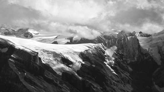
The Lyell Icefield started to show up!
I think it’s La Clytte Mountain on the Lyell Icefield
Ben taking in the views with Whiterose behind
Looking back Alexandra’s face
The Lyells briefly showing up.
Descending the lower rock section, still with crampons on.
Seracs on Whiterose.
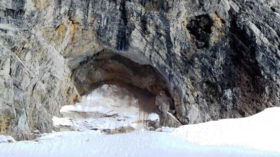
A beautiful rock cave on Alexandra.
Descending West Alexandra Glacier
Into the maze.
Queens Peak and Mt. Alexandra from the glacier.
Thankfully our tracks were still visible and not hard to follow.
Mt. Coral ahead.
Off the glacier, looking back.
Onto the side-hill traverse. No ice anymore.
Whiterose is such a beautiful mountain that I might go back for.
The South Rice Glacier that eventually leads up to Mt. Spring-Rice – another sexy peak I might go back for.
Me preparing for the rap. Photo by Ben
Vern rappelling down and me taking pictures from below. Photo by Ben
Vern on the rappel
Vern near the end of the rappel
Ben rappelling
Vern down-scrambling the 4th class headwall
Ben on the headwall
The headwall and the glaciers. What a beautiful environment
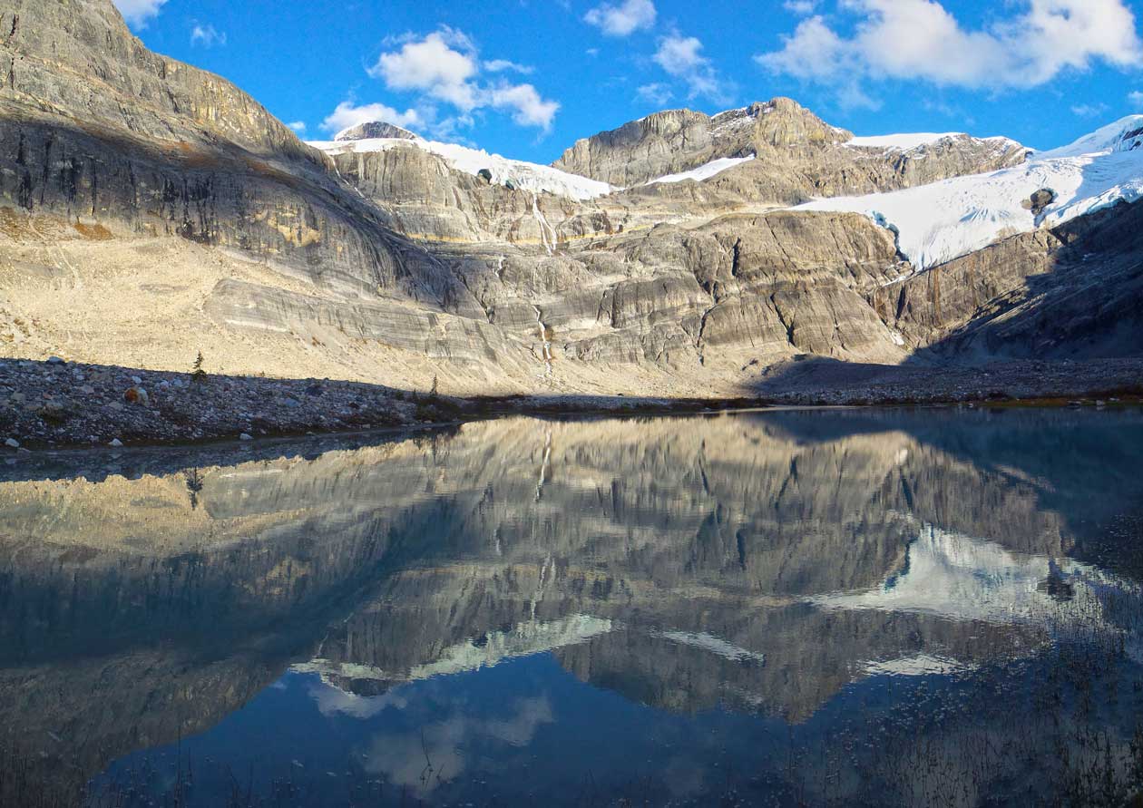
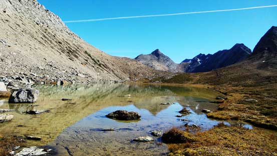
Back to the valley floor, there were three lakes like this
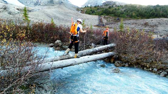
Even a log bridge crossing this raging stream.
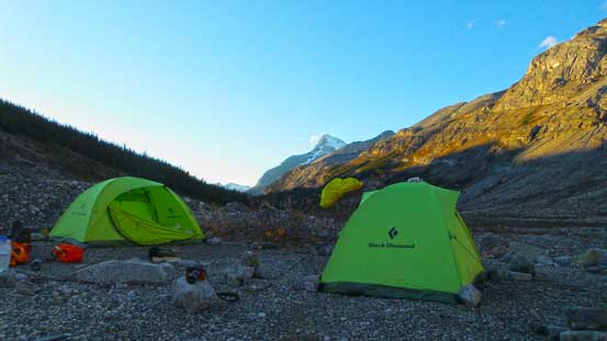
Our bivy site! Home sweet home…
Gorgeous view. Now it’s time to enjoy the trip. Pressure off.
West Alexandra Glacier and our objective
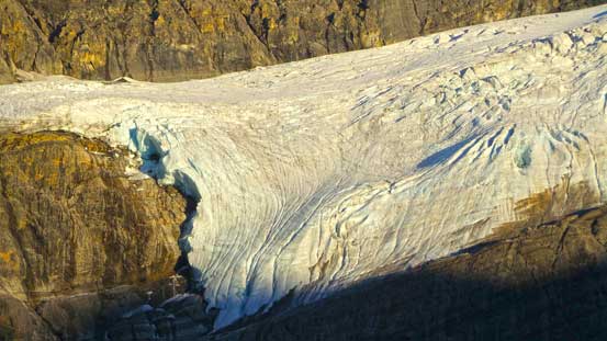
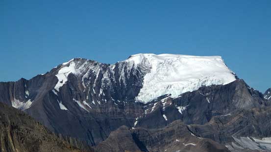
A closer look at the glacier on Whiterose
Queens Peak on evening glow
The unnamed peak on evening glow
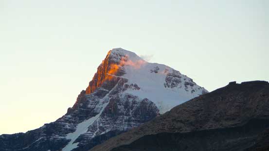
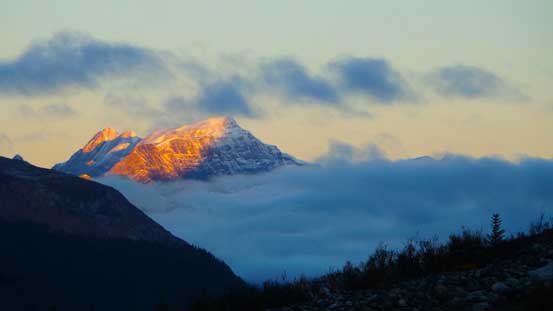
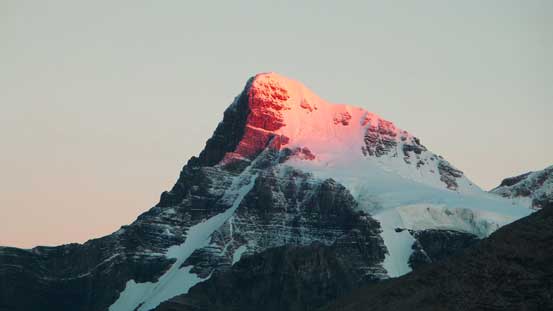
And finally, Mt. Bryce on fire!
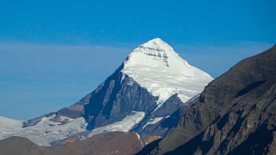
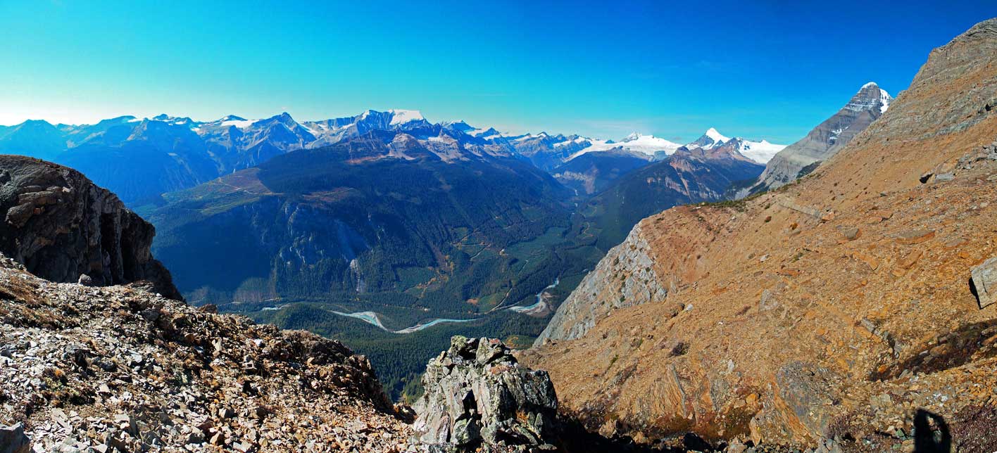
On Sunday morning we woke up under crystal clear sky. After packing up our iced-up gears our depproach day started with alpenglow on Mt. Bryce. We were all psyched about getting the views that we missed on Friday. And if the terrain made sense we’d explore the highline traverse as well as the “4 lakes”. Overall we knew this day would be extremely taxing (physically and mentally), but there were still a lot of things to look forward to. So off we went. Retracing our steps up-and-down or sidehill around the initial two bumps went uneventfully and in short time we were on our way to the high col on the 3rd bump. This was a tediously tedious slog… Over the high col we immediately faced our first major problem on this day – the concrete hard, frozen and slippery scree… Ben slipped immediately and got a cut on his arm. We figured that’s not gonna work so made the decision to keep going upwards, up and over the peak on our right side. The ground looked sunnier on the eastern aspect and we also got some excellent views. Oh man Mt. Bryce is huge! It reminded me looking towards Mt. Robson from Cinnamon Peak…
The 3rd day started with alpenglow on Mt. Bryce
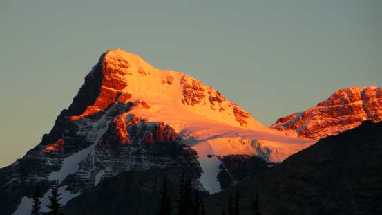
Alpenglow on Mt. Bryce
Mt. Alexandra, our objective in the morning. The sun was directly behind it.
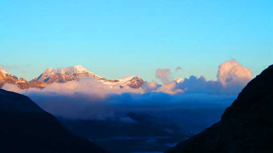
Peaks on Chaba Icefield on alpenglow.
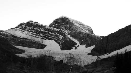
Another picture of Mt. Bryce
Just as picturing Mt. Robson, it’s very difficult to show how big Mt. Bryce is…
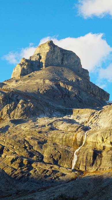
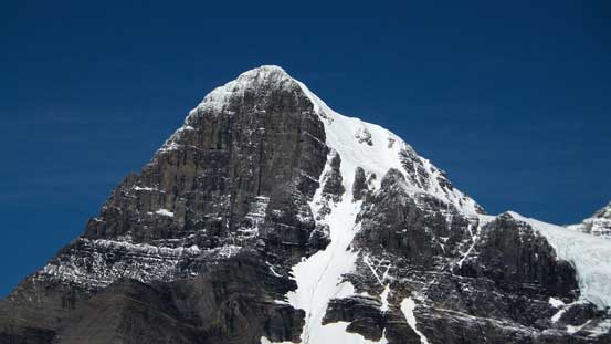
This impressive peak is Cockscomb Mountain. There’s no beta about its route…
Beautiful alpine environment.
But we had to slog all the way back up that col…
Looking towards our next possible col (left of center), or down and around treeline
Mt. King Edward high on our list – next year hopefully.
Obvious this one has been on my list for a while already. Hope we can get the weather next spring…
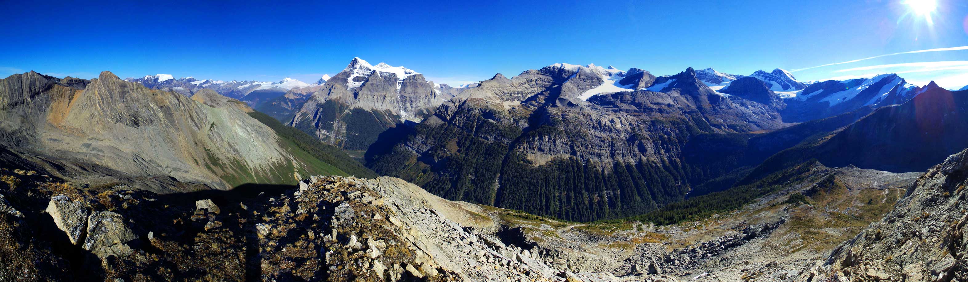
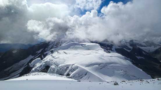
We went up the nearby summit and got some really awesome views. Click to view large size.
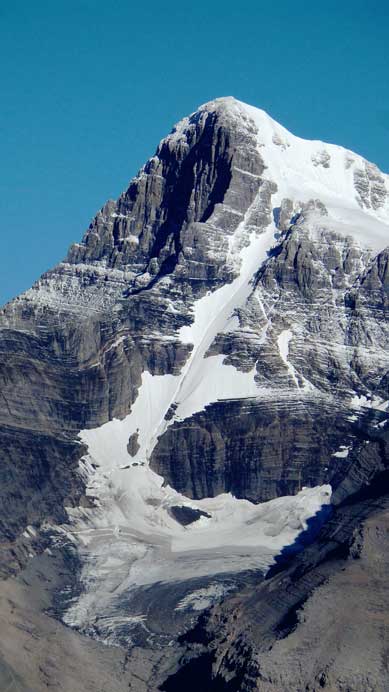
This picture shows the entire south glacier ascent route on Mt. Bryce. It looks just like Lefroy, a bit longer though.
Pawl Peak in the Chess Group.
Too many sexy peaks in this area. This one is Bush Mountain. Not the greatest name though, but I get the idea what to expect on its approach…
Mt. Spring-Rice across South Rice Brook valley
Mt. Alexandra
Me soaking in the views with Mt. Andromeda behind. That was my 10th 11,000er, bagged earlier in this year.
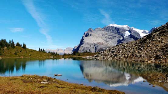
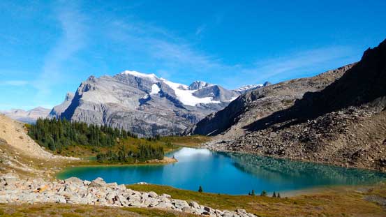
For the next bump we had a few choices. We could ascend a reddish high col way on the left (west) side or we could contour around treeline dealing with tedious side-hilling and occasional but very dense bushwhacking. We voted for the treeline option since we weren’t 100% sure about the other side of that red col. The treeline contouring was actually more pleasant than we thought, but once around the other edge we had to make another decision. It’s apparent we couldn’t descend straight into the next valley (valley with 4 lakes). We could descend for more than 100 m followed by reascending to the lowest lake, or we could go up the ridge followed by descending to the lakes. Either way we had to deal with a ton of elevation loss and regain. We decided to explore the high route. The higher we went the less confidence we had but thankfully after zig-zagging through some steep slabs we managed to find a difficult scrambling route up our ridge line, and thankfully again, we did find a easy route down into the next valley. These lakes are among some of the most beautiful I’ve ever seen (including Lake O’Hara area).
Descending frozen scree down from the summit/col we just crested over
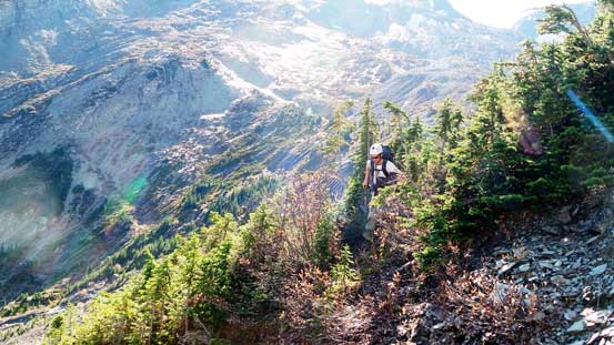
A bit of bush and lots of side-hilling around treeline
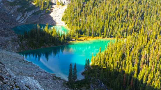
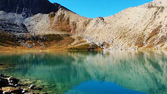
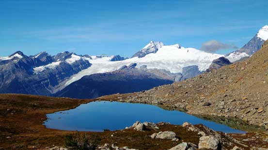
And eventually we hit the other ridge, and got to look at these
Then we decided to go back up. Tricky scrambling and route-finding.
Vern with the massive Mt. Bryce behind.
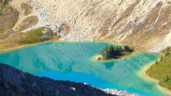
Another lake came into view. Even prettier
Oh the views
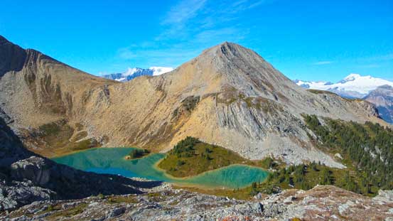
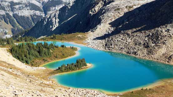
The 2 lower lakes
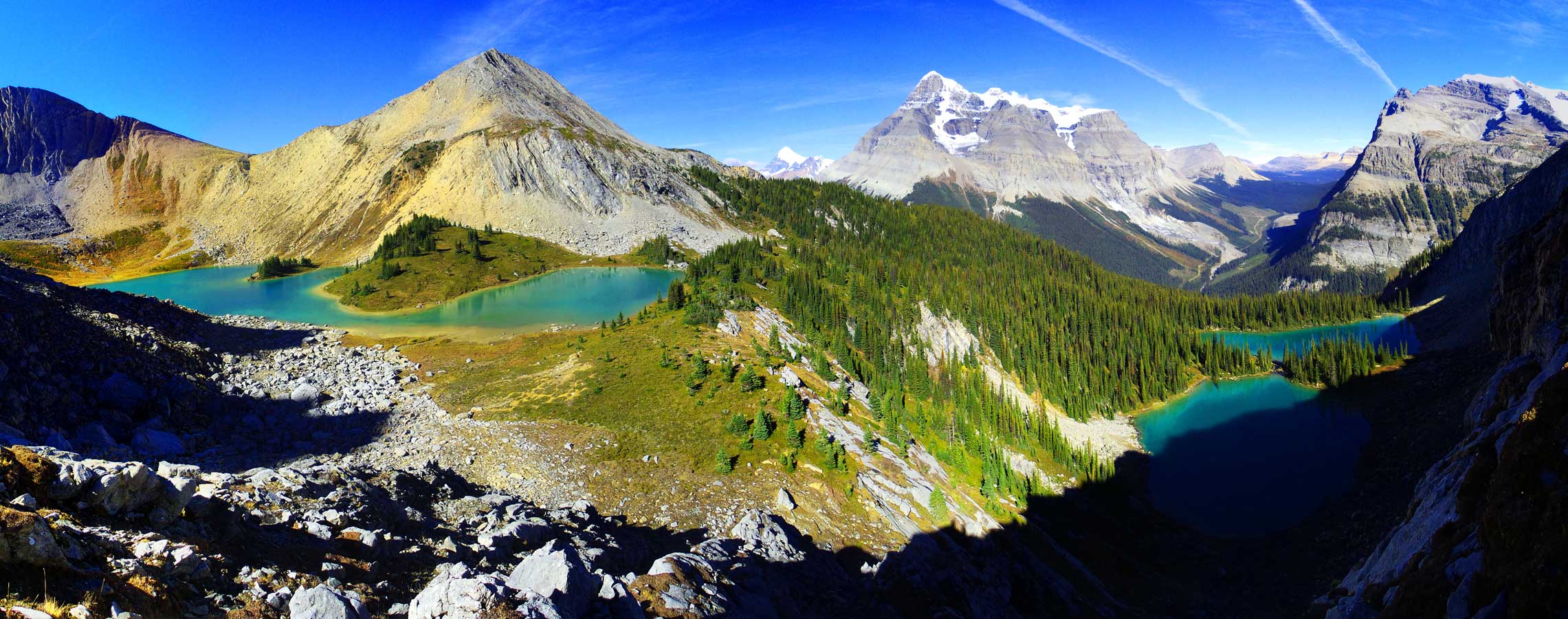
Panorama of this gem area. Click to view large size.
Can’t stop taking picture of Mt. Bryce.
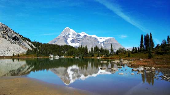
Down to the lake now. Mt. Bryce with its reflections in it.
Our next col ahead.
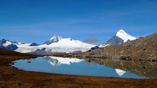
Mt. Spring-Rice with its reflection in the lake.
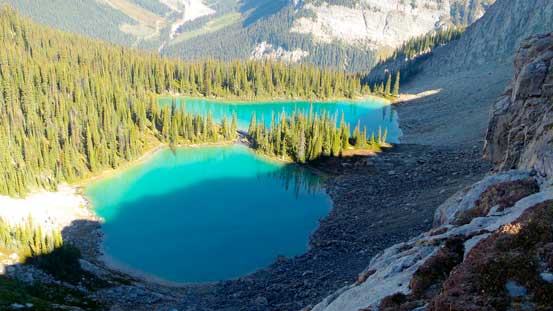
Keeping exploring the highline traverse we’d soon enter the most experimental part. According to Vern’s GPS the highest lake was on the left (west) side of the last bump. This was a bit against the concept of “contouring around treeline” but since we were here anyway we had to give it a shot. There was again, a bit WOW moment upon cresting the last high col. So far the scenery had been exceeding our imagination and no doubt this highline traverse is the most scenic approach I’ve done to date. I led the way side-hilling across a steeper scree ramp around the last corner, and then a trouble-free line appeared in front of us.. Yes, we did find a way through. We scree-ski’d down to treeline and then entered the bush. Now we were only a kilometer away from Vern’s truck. To get there we still had to deal with dense bush but it only lasted for half an hour or so.
Spring-Rice and the previous lake
Looking down at that lake again, from near the last col
Cresting the last col, what a view again!
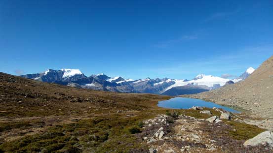
King Edward and the last, also the highest lake
Mt. King Edward, Mt. Columbia and their reflections
The same lake, but looking at the opposite direction. I can’t imagine bivying here with alpenglow/evening glow views!
Panorama from our last highpoint. On the right side of this photo will be our last bit of side-hilling traverse.
Active logging and you can also see Bush River FSR running way down below
Through the gap we can see Watchman Peak
Of course we still had to deal with bush, just not nearly as intense.
The last bit of bush
Looking back towards Spring-Rice and our South Rice Brook Valley.
Back to the truck, there was no surprise except for a black bear wondering around. There was no flat tire nor dead battery and soon we were on our long journey back home. Thankfully again there was no big boulder coming down blocking the narrow and exposed logging road. Vern again, did a fantastic job driving out of the wilderness. It was a long way back to Edmonton for Ben and I though, and we made back by 1 am on Monday morning, which wasn’t too bad.
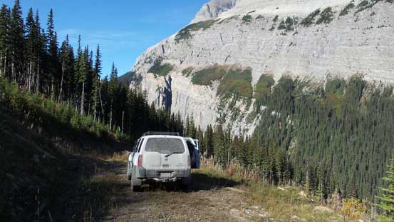
As you can see we drove way up high.
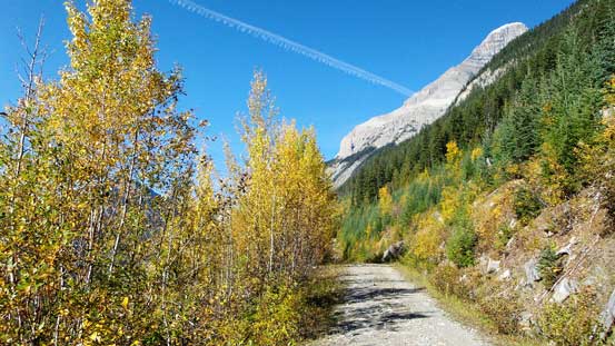
Beautiful fall colours.
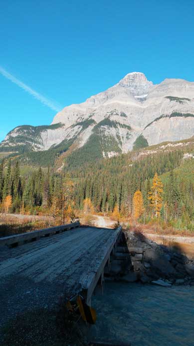
Mt. Bryce rises 2500 m above Bush River.. This bridge in the foreground seems decommissioned. Don’t know how to access this area if the bridge is gone.
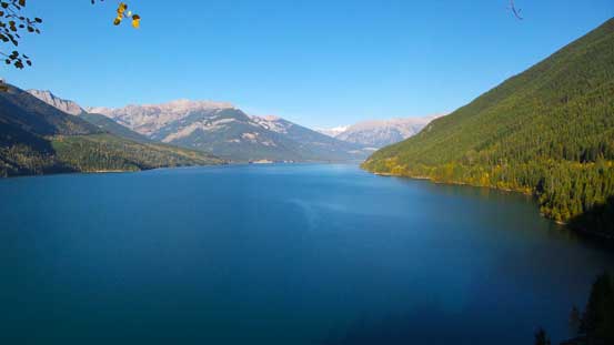
Kinbasket Lake is huge. This is just the Bush Arm of it…
Overall this trip was a blast and I still can’t believe we already had Mt. Alexandra bagged. It was a dramatic adventure just like Recondite Peak we did last year that I’ll never forget. Speaking this objective, I think the highline traverse is definitely the way to go. Yes it involves about 1100 m elevation loss (thus regain), but you essentially trade off bushwhacking for awesome views. Comparing to eight-foot devil’s clubs and alders higher than my head I’d rather prefer elevation loss/regain anyway. And once again, we did an excellent job picking Mt. Alexandra as our objective in this past weekend, and this September has been a blast! Four big 3-day mountaineering trips in different areas with incredible views from each and it can’t get better than that!

Wow, this description hints at some very long and intense days. The remoteness is stunning. And I thought that the Mummery Group was remote (went there this past summer). I am putting this on mental “to do just once in a lifetime” list.