Mount Aberdeen
March 8, 2015
3157m
Lake Louise, AB
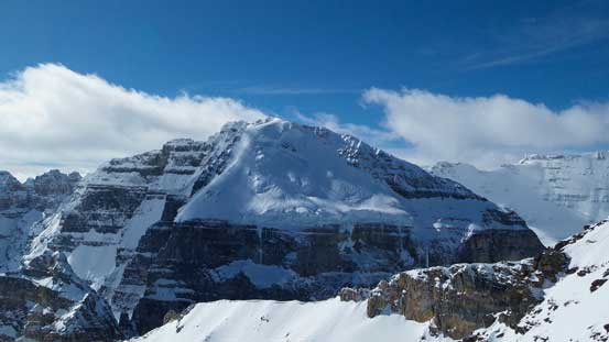
Mt. Aberdeen (and its lower neighbour, Haddo Peak) are two of the sought-after peaks in Lake Louise area. Though not that grand compared to the nearby 11,000ers like Temple or Lefroy, these two peaks do host one of the classic mountaineering routes in this area, the 55-degree ice climb via the N. Glacier. The climber’s descent route is described as 2000 vertical feet of scree running or glissading. About a few years ago I was quite interested in ascending the climber’s descent route as a scramble but ever since I really started mountaineering I became less and less motivated for doing that. In my climbing philosophy skipping a classic climbing route (especially the ones that’s not super hard) by slogging up the ugly descent route cannot be considered as “elegant”, unless I artificially create more challenge to it. For example, by doing it in winter… Oh well, I guess that’s what Vern and Ben were thinking about too.
With Vern’s suggestion as well as avalanche condition rated at low/low/low for almost 2 weeks in a roll already, we made an agreement on a semi-exploratory attempt of Aberdeen’s descent route on skis/snowshoes. I say “semi-exploratory” because we hadn’t heard anybody ascending this route in winter, but we did know it’s an “easy scramble” as per the summer mountaineers. I checked my pictures taken from Mt. Temple (summer) and Little Temple (winter), and Man that gully is gigantic. It runs about 1000 vertical meters from Aberdeen’s summit, funnels through a narrow canyon and drops all the way down to Paradise Creek. That IS a slide path!… In retrospect this was probably a wee bit more aggressive given the sunny and warm forecast but hey we were all back home successful and safe..
Another thing I tried in this trip was switching between skiing and snowshoeing. Due to the horrible ski conditions recently I wisely chose to ascend the steep terrain on snowshoes, but also because of the icy conditions I decided to do the approach/depproach on skis to speed things up. The way of doing that was simply fitting my AT bindings to my mountaineering boots and carrying my 25′ Lightning Ascents on the approach.
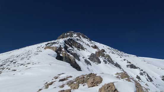
Ascent route for Mt. Aberdeen and Haddo via S. Face/S. Ridge. GPX DL
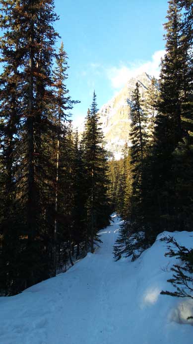
Alright, due to the DST we got to sleep in an extra hour in the morning. We woke up at 5 am in Vern’s house and made to the trail-head by Moraine Lake Road in good time. It was just about bright enough to not use head-lamps. Skinning up the road was fast and efficient and in short time we took one of the cross-country ski trails branching to the climber’s right. The trail led us joining the main Paradise Valley trail. There was some confusion here and the correct way should be sticking relatively to the creek bed on a well-defined skin track. We took the summer trail which involved more height gain/loss but eventually brought us to the same place near Lake Annette turn-off. Here’s where skiers should leave the trail for Little Temple or Aemmer Couloir but for us, we’d continue up the creek for additional 2 km or so before reaching the base of Mt. Aberdeen. By now it was about 10 km into the trip.
Skiing up the summer approach trail

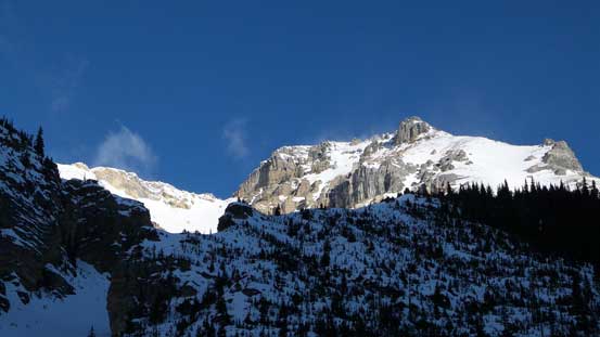
Sheol Mountain looks fairly impressive from valley floor
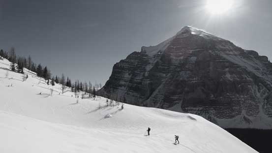
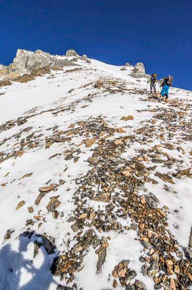
Due to some blistering problem I ditched my skis a bit earlier than necessary, switched to snowshoes and caught up with Vern and Ben at the base of that giant slide path. At home we thought about ascending through the trees on climber’s right but that looked ugly so we went right into the terrain trap thank to the bomber snowpack. It didn’t feel that big while ascending but trust me, it’s one of the biggest terrain traps I’ve ever ascended, threatened by a large “fan” of Aberdeen and the nearby unnamed peak’s south slopes with huge cornices hanging 1000 meters above. If you think Mt. Wilson’s short-cut gully is huge then try this one… This gully led us into a large bowl at treeline height (still more than 700 vertical meters to go) and we had to make a choice. Obviously we had the choice of continuing ascending the very foreshortened and steep slope straight up (as per planned) but we all had a second thought due to the extremely strong solar radiation and the lack of wind. It was a hard call but we decided to bail to climber’s right onto a “ridge” feature in hope for more wind-blown terrain.

Some clouds hanging around Hungabee Mountain
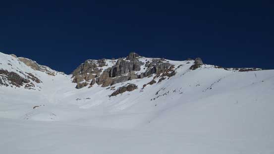
Zooming-in towards our objective. We should have taken a mental note from here
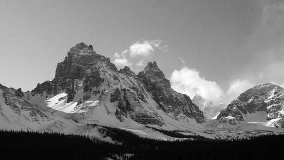
Pinnacle Mountain and Eiffel Peak both look impressive
The summit of Hungabee pokes through making it look like a Himalayan giant
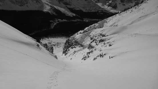
Looking up the ascending gully

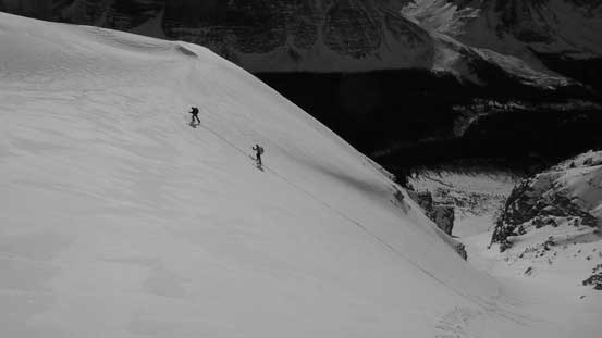
Vern and Ben skinning up
Vern and Ben exiting the gully. As you can see the terrain is very big and foreshortened
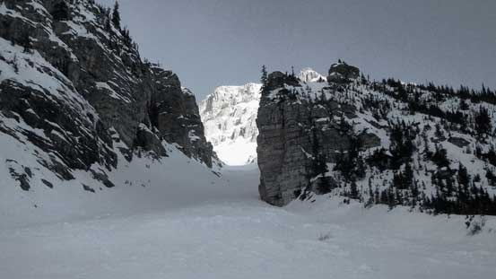
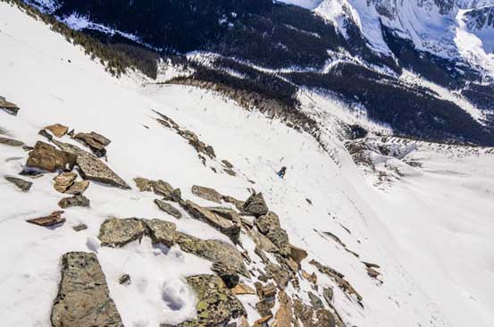
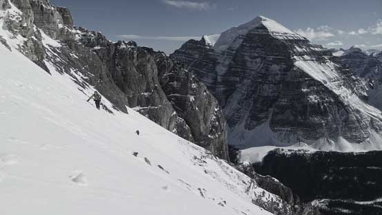
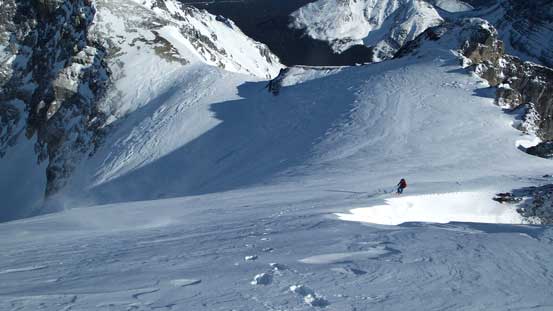
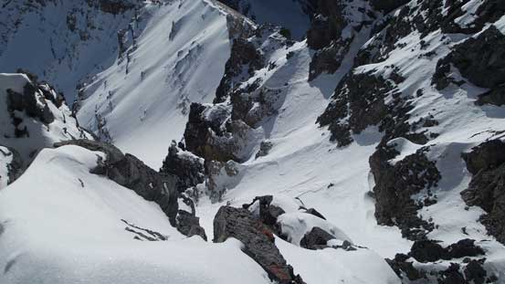
Most of the snow coming down the south side of Aberdeen funnels through this gully
Ben and Vern with the mighty Mt. Temple behind
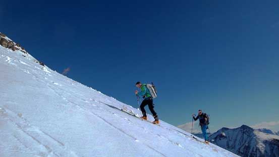
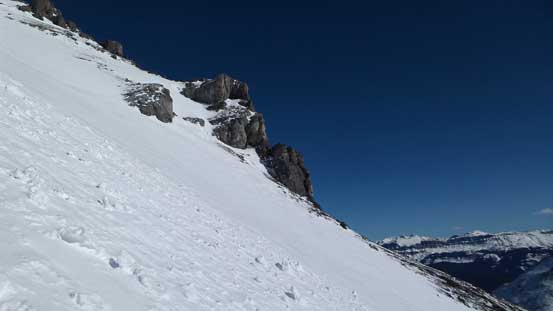
Here we could have ascended straight up on left, but we opted for climber’s right
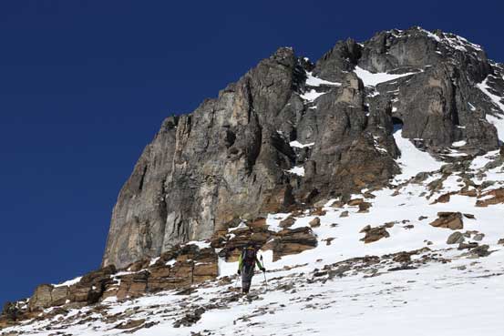
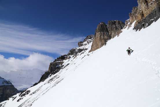
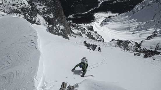
The next few hundred meters up this broad ridge was the least fun part for us. The reason was simple. It’s no longer ski terrain… Vern and Ben had to ditch their skis pretty soon but the snow was not supportive enough for them. As a result they were punished with some tedious and arduous waist-deep wallowing. They pretty much had to post-hole to the bottom of the snowpack for every step forward and this was NOT an easy task on the 35-40 degree terrain. I didn’t time ourselves but we probably ended up spending a good few hours swimming and wallowing the snow. At one point I got tired of the post-holing and picked a long rising traverse line (on snowshoes) across another giant slide path towards climber’s right. This line would not work for Ben and Vern due to the extreme wallowing so they continued bashing/swimming straight up their ridge. “Gigantic” was the only word I could describe the path I crossed. I seldom feel super exposed but this time I almost froze at a couple occasions when I tried to look down… But oh well, by taking a couple deep breaths I eventually made to the other side with no incidence. The next section was some wind-blown terrain mixed with snow drifts and we re-grouped near the base of the the complex upper mountain.
Vern and Ben managed to skin up to as far as they could
Now time to ditch skis for them. Lots of wallowing so I carried my ‘shoes for later use. Photo by Vern
A brief refreshing on wind-blown ridge. Photo by Vern
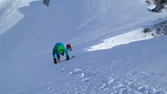
Soon we were back to wallowing
Vern ascending a steep step. Photo by Ben
Very steep terrain
Getting higher we could see the upper mountain
Upon inspection we had to traverse towards left. Photo by Ben
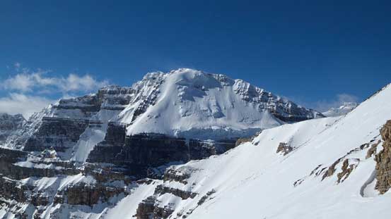
The mighty Mt. Lefroy brings back some ballsy memories from my ascent last year
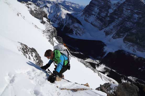
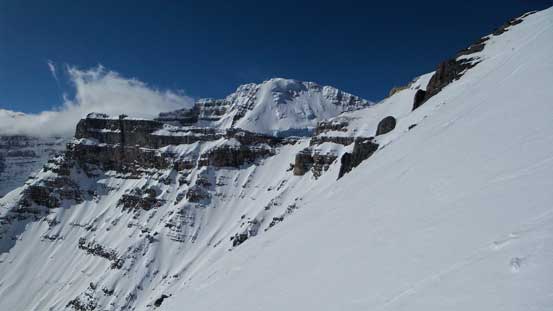
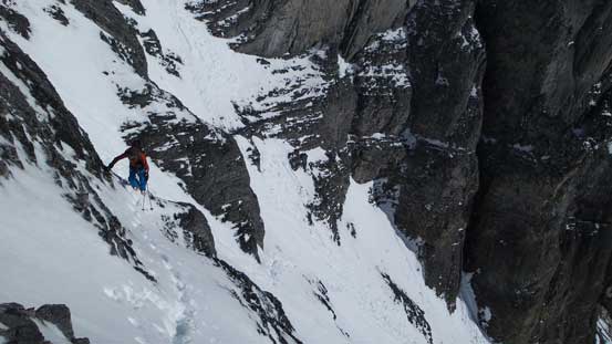
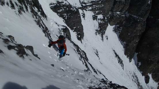
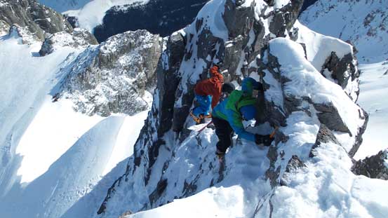
We were originally hoping to pick a line straight to Haddo/Aberdeen col but upon inspection it’s apparently this route couldn’t go, so we had no choice but traverse sharply climber’s left underneath the imposing cliff bands ahead. I went up a difficult scrambling step but Vern and Ben stayed lower on scree. Both lines worked, around the next corner we saw more complex terrain ahead. The terrain here reminded all of us Woolley/Diadem and needless to say the route choice was not obvious. We had no beta about the terrain around here neither so it was basically picking a line and go. I led up a steep couloir first but soon Vern and Ben reminded me to cut sharply climber’s left as soon as possible due to the number of threatening cornices hanging above. I managed to cut left using some narrow and down-sloping ledges, but around the next corner I only got to see more traversing ahead. After pausing for a while I took out my ice axe and nervously led across the next dicey traverse (with very bad run-out zone and still threatened by some cornices above) for about 100 meters and here came to the final corner. I should have strapped my crampons here but when I realized I was already way up high on the final snow climb towards the col. It would be super awkward to change gear on such a steep slope so I just simply sucked it up, cutting some steps using my axe and kicking 5-7 times as hard as I could and eventually crested Mt. Aberdeen’s SE Ridge. Alright, more terrain to come…

Around a corner, looking back towards Temple
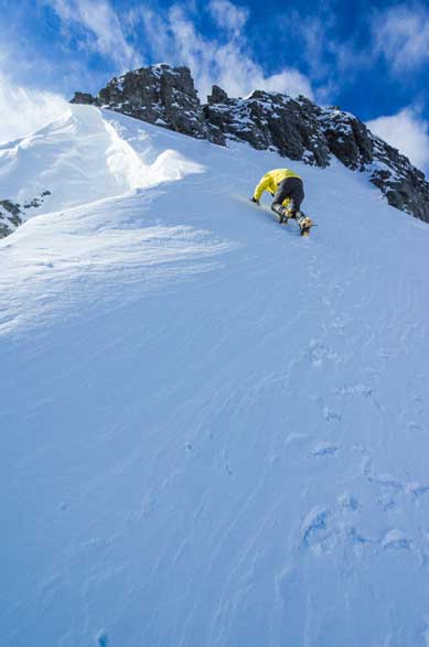
Here instead of keep traversing we ascended straight up
Mt. Lefroy again
Ben traversing some narrow and thin ledges
We went through this section quickly as it’s threatened by gigantic cornices from above
Me and Vern traversing another sun-baked slope. Photo by Ben
Vern and Ben traversing another dicey slope. I felt this one sketchier than the traverse of Ayesha
Vern following my steps up the final snow climb towards the col. Note the big cornice on left, and the terrain trap (now looks small) way far down in the distance. That’s a hack of a slide path!

Cresting the ridge, only to find more stuffs coming.
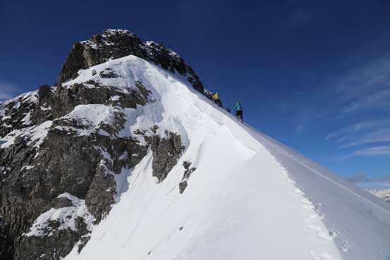
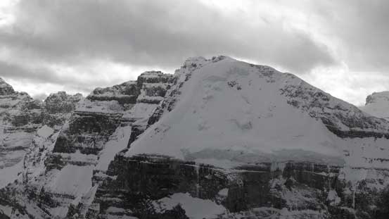
Thank to the lack of trip report none of us was mentally prepared for the difficult summit block. In dry condition it’s probably a 4th class scramble but in winter, oh well, it was an interesting mixed climbing. Getting to the base of that rock step wasn’t easy neither. Crampons on and ice tool out I got to lead the final snow climb, initially on the snow arete but soon switched to the N. Face side due to the cornice that I couldn’t tell the boundary, and finally straight up. Vern took over the lead at the rock section and went straight up the step. Ben took a different line but seemed more awkward so I followed Vern’s route up. The challenge was not over yet as we still had to overcome a short but very exposed ridge section (mixed terrain) followed by balancing over a narrow snow arete to eventually stand on Mt. Aberdeen’s summit. It was very wind and cold up there so nobody was in the mood of lingering.
Me and Vern ascending the snow arete
Ben starting the snow section
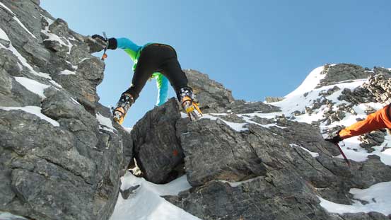
Vern leading up the mixed pitch
Me following up. Photo by Vern

Ben finishing the mixed pitch. Still a section of exposed ridge
Vern and I tackling the last bit of challenge – a narrow and loose snow arete
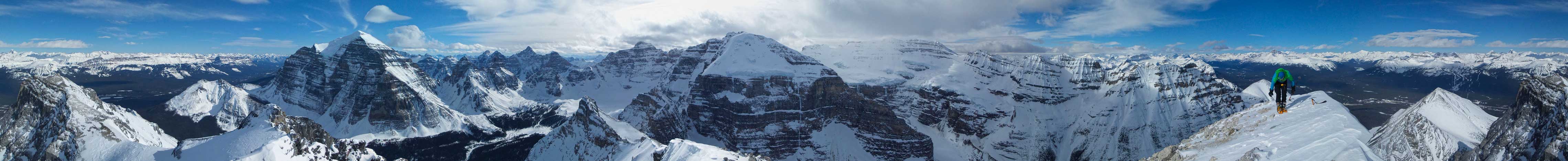
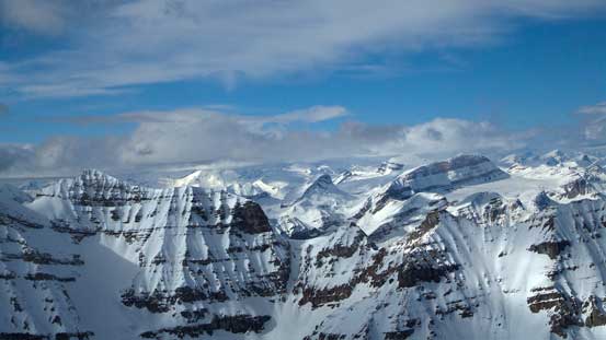
Summit Panorama. Click to view large size.
Ben arriving at the summit
The familiar peaks on Wapta Icefield in the distance (now I’ve done most of them)

Cataract Peak a rarely ascended peak that’s almost 11,000 feet.
The mighty Mt. Hector is my 2nd 11,000er climbed
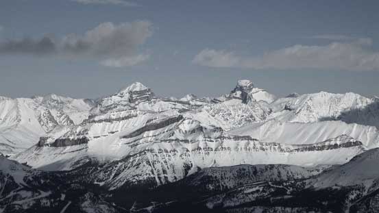
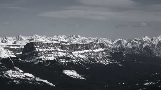
Giants behind the Skoki – Mt. Douglas and Mt. St. Bride
Bonnet Peak way in the distance. It’s on my to-do list
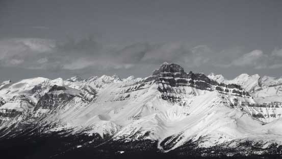
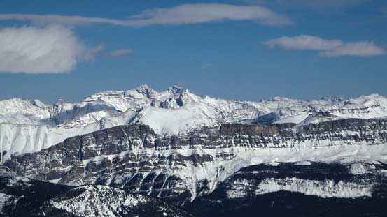
The impressive Castle Mountain. Surprisingly I haven’t done it yet.
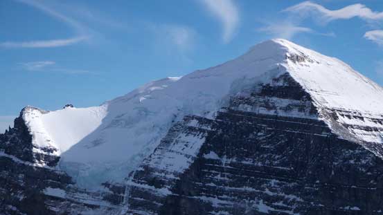
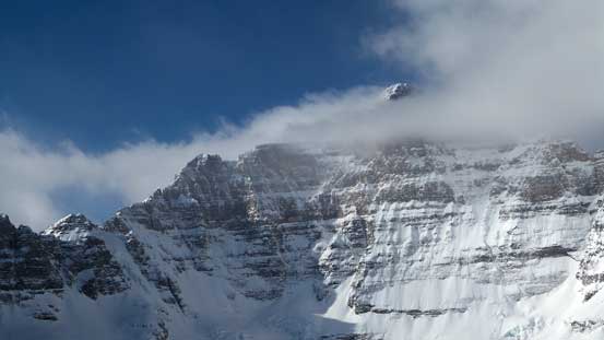
A zoomed-in view of Mt. Temple’s north glacier
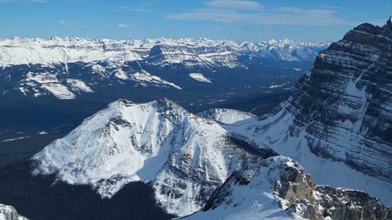
Little Temple and Bow Valley
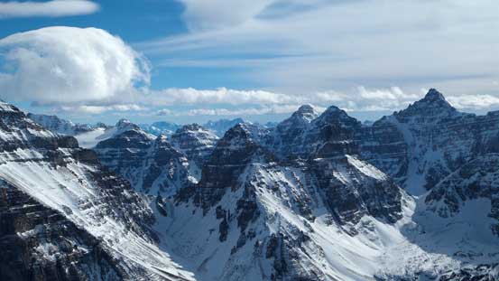
The “Ten peaks” including Deltaform Mountain
Can’t get rid of Mt. Lefroy

North Victoria which I ascended last year. It looks doable in winter too.
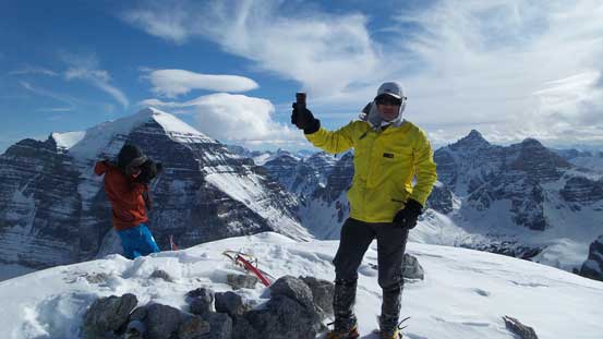
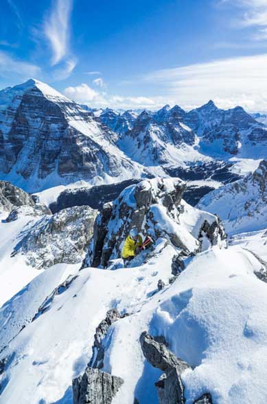
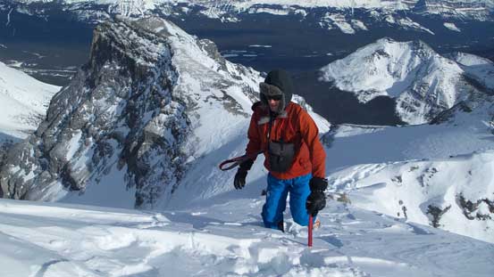
Me on the summit of Mt. Aberdeen
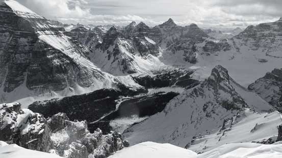
A view of Paradise Valley again
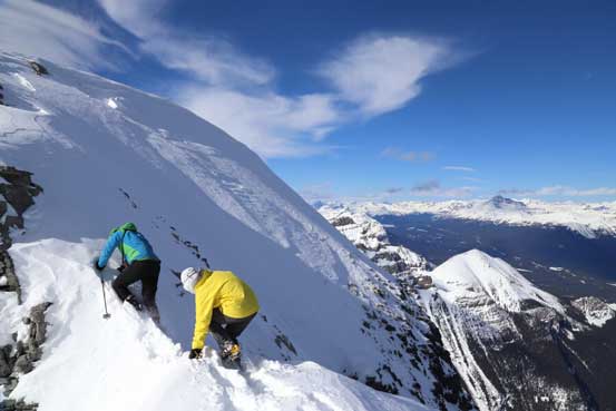
I was surprised that not many people have commanded on the demanding terrain on the summit block and I’m sure not many people will appreciate down-climbing this without a rope. We managed to down-climb without incidence and it was actually quite fun (as compared to the climb we did on Peyto 2 weeks ago this was pretty straightforward), and soon we were back on our front points down the snow arete.
It’s darn exposed along the final traverse.

Vern and Ben down-climbing the crux
Careful foot placements are essential. It’s a fun down-climb though despite how it looks from here

Me down-climbing. Photo by Vern
Ben and Vern front-pointing down the snow arete.
Me down-climbing snow. Photo by Vern
We were already much later than planned. Neither of us wanted to get back home by 3 am on Monday morning but neither of us wanted to slog back to Haddo/Aberdeen col for the second time too.. Uh the stubborn peak-baggers. After a short break we were on our way to bag the easy Haddo Peak, 1 km to the NE.
