Mount San Antonio (Mount Baldy)
March 24, 2017
3068m
Los Angeles, CA
Mt. San Antonio or more commonly known as “Mt. Baldy” is the highest peak in Los Angeles vicinity and thank to the huge population of that metropolis it’s no wonder why this is the most frequently appeared peak in many southern California’s postcards. As much as a “ultra-prominent” peak goes getting to the summit of Mt. San Antonio is an easy fair for a seasoned hiker. There are quite a few routes to choose from but the easiest is via Baldy Bowl trail and can be done in pretty much any time of a year. For me myself the timing was towards the tailing end of this past spring break vacation so much of the upper mountain was still snow bound.
The previous night I parked and slept somewhere near the city of Upland and then woke up later than anticipated. After a quick breakfast in a McDonald I drove up towards the town of “Mt. Baldy”. This is actually a good-sized ski resort in winter but now the season was over and everything felt much quieter. The road is steep and winding (thankfully paved) and a ton of switchbacks later I made to the parking lot by Manker Flat. Despite the popularity of this objective you still want to do some detailed research such as where to park as otherwise it’s not that obvious.
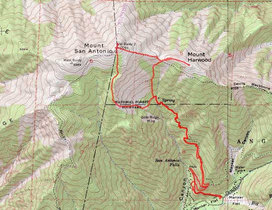
Ascent of Mt. San Antonio and Mt. Harwood via Baldy Bowl. GPX DL
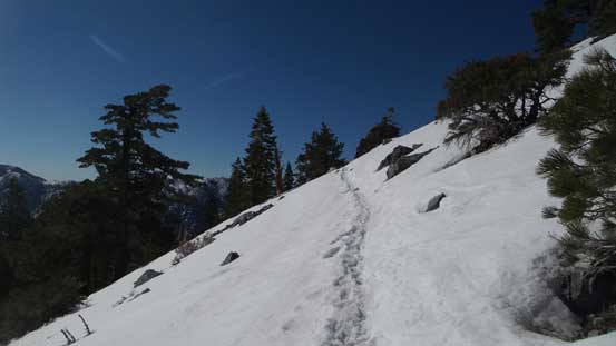
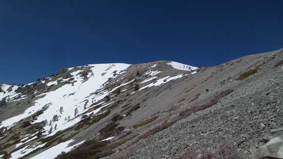
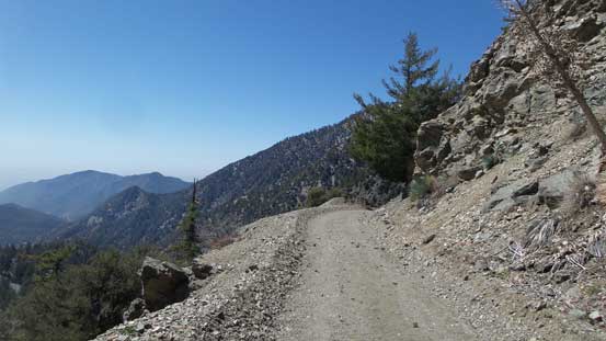
One major decision I struggled to make was the snowshoes. I knew the alpine would still be extensively snow covered but I had no experience with the snow conditions in southern California. The previous day I carried, and used snowshoes on San Jacinto Peak so to make it safer I hauled snowshoes again. Two switchbacks later I got a glimpse of the upper mountain and right away I ditched the ‘shoes. I had no trust on other people in this part of the country so went into the bush and buried the snowshoes so that nobody could see. The first stretch of this trip was following a logging road. The actual trail-head was not very well marked but that’s speaking the California standard. For someone coming from the west coast of British Columbia it would be dumb to miss that junction. Elevation was dispatched steadily on this trail and there’s little worth noting other than the trail was a in a good shape.

The first glimpse of the upper mountain

Looking back towards the city of Los Angeles
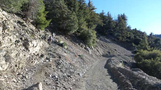
The initial mile or two was following this boring road up
More about the logging road walk

Looking down into San Antonio Canyon

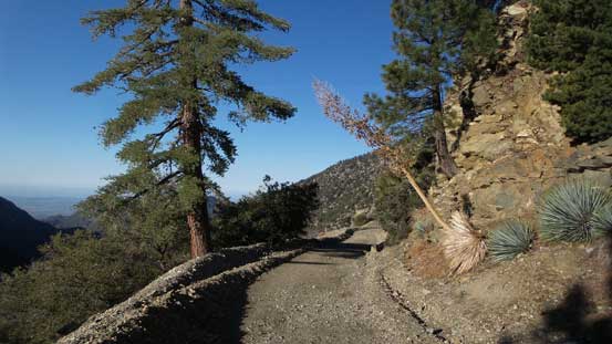
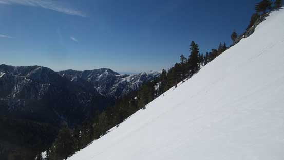
Partway up the trail. This is the typical view looking back
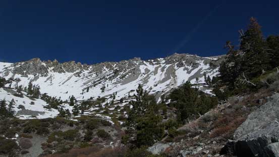
The Baldy Bowl finally ahead
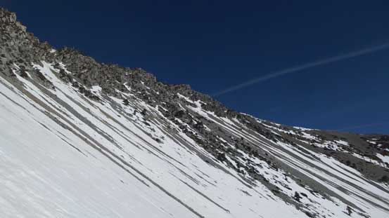
The next natural stop was an old “ski hut” although I did not do any unnecessary lingering. The trail crosses the creek and then traverses into “Baldy Bowl” and from there onwards I encountered continuous snow and soon lost the trail. There’s no point in following a trail anyway and looking around I already had an idea. Partway of me was not happy about hauling ice axe and crampons up so to justify that decision I had to use them. Straight up the bowl on climber’s left had a steep snow passage to gain the broad south ridge of Mt. San Antonio so that’s where I’d go next. The slope was much longer and steeper than appeared so the snow equipment was indeed required. Upon topping out I took another long break transitioning and meanwhile, soaking in the views.
Upwards into the winter wonderland

I decided to ascend that obvious snow corridor
It’s quite steep overall
Looking sideways across Baldy Bowl

Topping out on the broad south ridge now
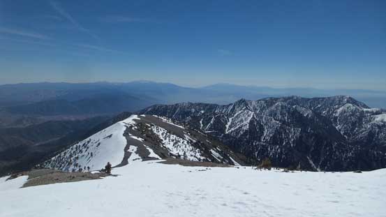
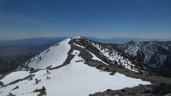
It’s an easy, albeit a bit monotonous plod upwards along the south ridge, sometimes on dirt and sometimes on snow. Upon reaching the final rise towards the broad summit the snow became continuous again but then I just had to follow the highway of boot tracks. The summit was so broad that I had to wonder around to take in the views.

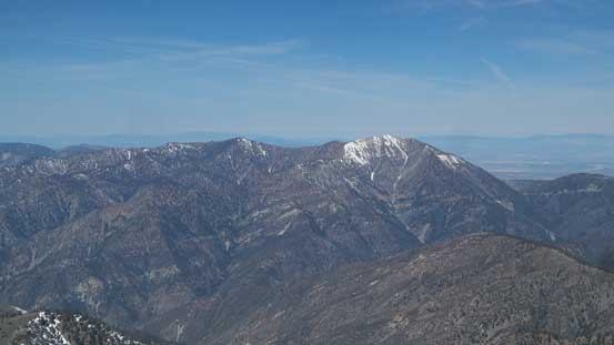
This is looking back at Ontario Peak

The south ridge has some unobstructed views towards the surrounding areas

Picking up the trail again
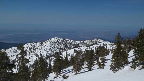
The bumps are all getting lower now

Summit Panorama from Mt. San Antonio (Mt. Baldy). Click to view large size.
Mt. Baden-Powell among others looking NW
Pine Mountain

Desert landscape looking NE
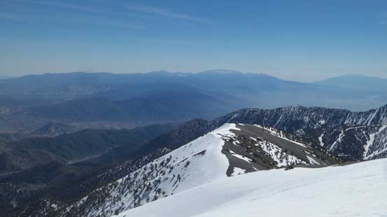
The massive San Gorgonio Mountain on the skyline.
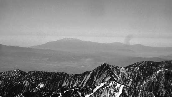
This is zooming-in towards Mt. San Jacinto massif

West Baldy
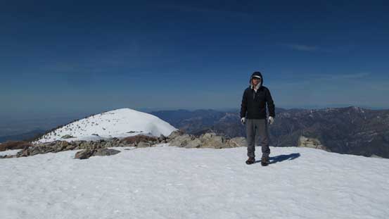
Me on the summit of Mt. San Antonio
There’s a breeze of cold wind forcing me to start descending as soon as I could. My camera even went died for a while and I had to warm it up in my jacket. The easiest descent option was simply retracing my ascent route but I also knew there’s the more adventurous way by looking back via “Devil’s Backbone”. I went down towards the backbone mainly because that way I could tag the nearby Mt. Harwood as a bonus, so why not. Descending the east ridge was fast and fun with lots of plunging and boot-skiing. I used snow for as much as possible and even the dry sections were soft dirt. From Baldy/Harwood pass the ascent of Mt. Harwood was as easy as one could expect.
Time to descend the east ridge

A southern view from the east ridge towards Ontario Peak

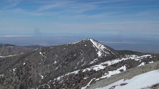
Pine Mountain and Dawson Peak.
Mt. Harwood is that bump ahead

Looking back towards the summit of Mt. San Antonio.
I abandoned the idea of looping back via Devil’s Backbone. It looked like I could just short-cut back into Baldy Bowl by descending straight down from Baldy/Harwood saddle and I was right. Although a bit experimental this short-cut indeed turned out to be a short-cut with much of the elevation lost on either snow or scree. In no time I was back at the “ski hut” rejoining the trail. Hiking down the trail was uneventful and then I made another short-cut hiking down the logging road switchbacks. I had no problem relocating my snowshoes and then made back to vehicle before noon.
Bailing straight down from San Antonio/Harwood saddle

Scree and snow. Easy peasy…

Crossing the creek and rejoining the trail
Back to the road walk.
The day was still young so I had to make more use of it. My original plan was to bag a small peak inside the actual city of Los Angeles but the traffic gong show scared me away. Browsing the maps I found another interesting objective not too far away deep in Santa Monica Mountains. I still had to drive through Los Angeles (I-10 and then US-101) but the traffic was overall not as bad as I thought. And then there goes my last objective in this trip – Sandstone Peak.
