Sulphur Mountain (Traverse)
June 13, 2013
2461m
Banff, AB
With a rainy forecast (with possible thunderstorms) I didn’t expect too much from this day. I’ve done the tourist’s “Sulphur Mountain” which is the mere north end, officially named Sanson’s Peak. This time I would go for the true summit which is 5 km south of the Gondola station. That also involves going over 3 bumps with one big dip and that makes it a fairly long day with lots of elevation and some scrambling. According to So Nakagawa’s trip report, the summit is the south peak of the two highest. I’ll refer the true summit as 4th summit, and the one being nearly as high as the 3rd. This is different from So’s reference.
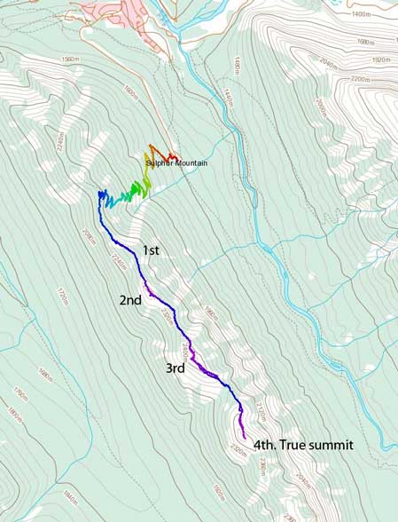
Sulphur Mountain hiking/scrambling route
I leisurely started the day at 9 am. My plan was, if it really started to pour then I would stay at the Sanson’s Peak tourist’s restaurant. It started with sunshine but soon turned into a quite heavy hail storm. I was kinda low on motivation to continue and I almost decided to turn around. Glad I didn’t and the storm passed by quickly. Didn’t get soaked at all after this. There’s nothing to describe about the 5.5 km hike up the trail except for it being much flatter than needed. I made to the top of gondola station after 1.5 hours of hiking. Surprisingly, it was sunny towards the other side, and the clouds were creating some quite unique scenery!

Typical hiking on Sulphur Mountain trail
I soon left all the people and started my lonely trudge towards the other direction. Going up the first summit was probably the technical crux of this trip. I went climber’s right looking for a ledge but didn’t find one and ended up scrambling up a difficult slabby route. On the way down I went straight down the nose which also involves a few difficult moves. In winter I’m sure this would give at least some mountaineering feels.
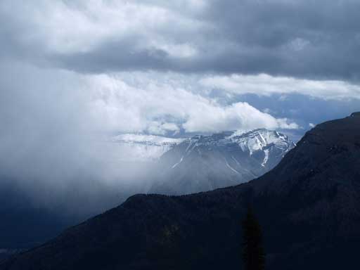
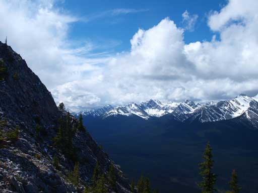
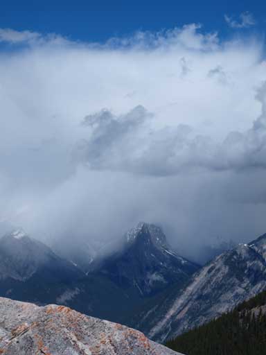
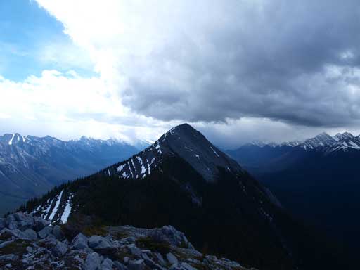
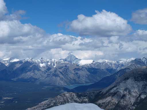
A storm passed by
Great view once topping on the ridge
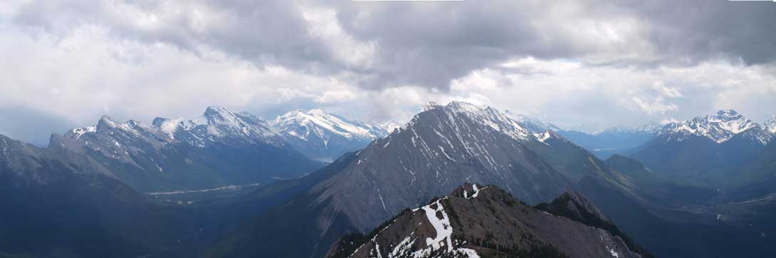
One of the prominent peaks on Sundance Range
More about Sundance Range

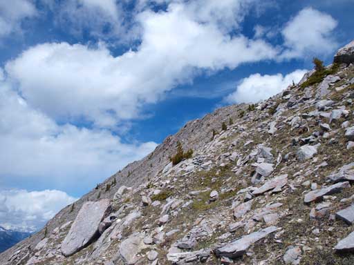
I scrambled up this slabby bit

Gorgeous view of Bow Valley from 1st summit

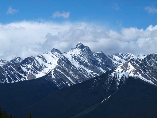
Mount Louis, the impressive one in Sawback Range

In the distance is Mt. Brewster and Vermilion Range
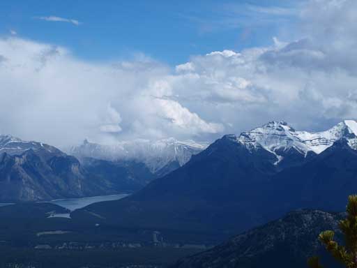
Lake Minnewanka and Mount Inglismaldie
There’s a bit of elevation loss back into the trees before the longer slog up the 2nd summit. And then, a bigger dip into the trees again before slogging up the 3rd. I got tired of the gain and loss and side-sloped on climber’s right to bypass the 3rd summit. I wouldn’t recommend doing this since the terrain was not very friendly on the side. The 4th summit was the true summit according to So, but really, one cannot tell which is the highest, 3rd or 4th. The dip between the two was very significant and very frustrating. Thankfully the weather held as I slowly moving towards the true summit. From its top it appeared that the 3rd being slightly lower. I also got a great view of the big massive Rundle from the entire trip. I don’t believe there exists a scramble route up the true summit of Rundle from the west side. It appears to be very slabby. I could also see the thin Dragon’s Back on scrambler’s Rundle.
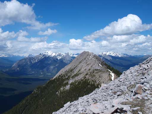
The 2nd summit
It’s gonna be another gorgeous day!
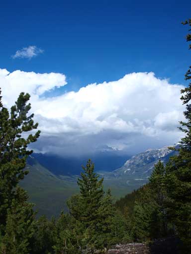
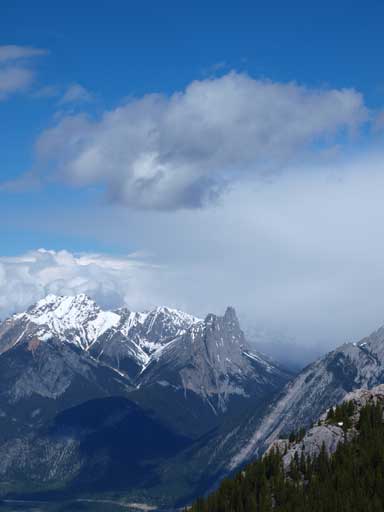
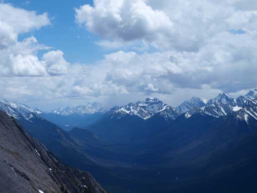
The rain clouds and Sawback Range
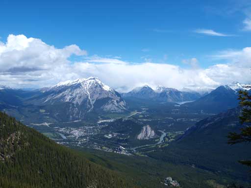
This is the classic view from Sulphur Mountain

Zooming-in towards Tunnel Mountain and Banff
Mount Louis again
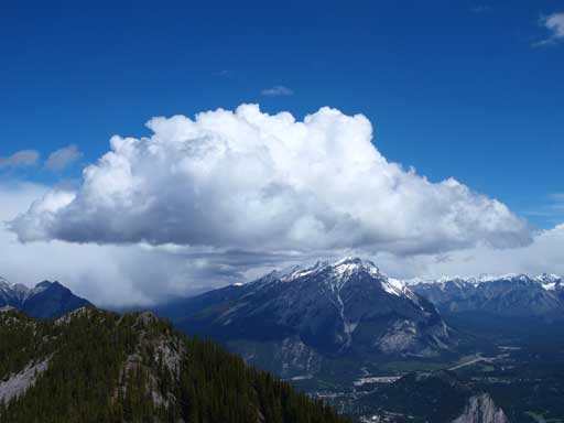
Cascade Mountain with a big piece of cloud
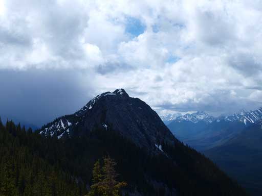
3rd summit from 2nd summit. Note the approaching clouds

The clouds passed by and I was on my way to the 4th summit (true summit)
I bypassed the 3rd summit on its west side

Looking back towards the 3rd summit

Near the summit, the east side becomes increasingly steep
Cascade Mountain, a classic Banff scramble
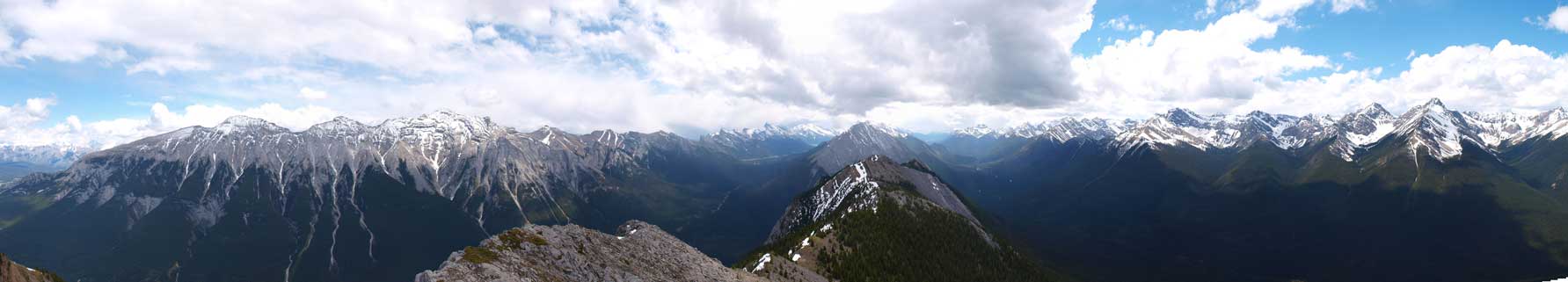
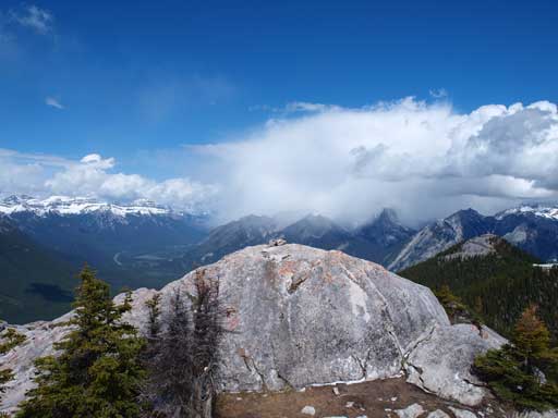
Summit Panorama. Click to view large size.

Pretty much all peaks on Sundance Range are unnamed…
Looking south into Kananaskis Country
On the way back I decided to slog up the 3rd summit to make sure I have done this mountain. From its top it appeared that the 4th being slightly lower, so really, one cannot tell. To be consistent with other sources, I’ll call the 4th being the summit, to give peak-baggers more work to do! Towards the end of this long ridge, I really started to appreciate the elevation gain, loss, and regain. What a theme of this trip! I got pretty tired once slogging back to the top of Gondola station and took a lengthy break before the boring hike down the “highway”.
Going back

What a gorgeous day out. It was forecasted to be rainy with amount 5-15mm
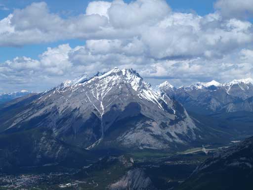
The long Mount Rundle

True summit of Rundle

Summit Panorama from 3rd summit. Click to view large size.
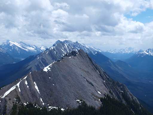
Does the 4th look to be lower than the 3rd??
Mount Aylmer finally showed up!
Looking south deeply. The peaks are still part of Sundance Range

Scrambly parts near 1st summit
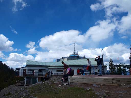
Back to the gondola station
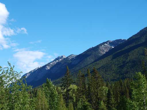
Sulphur Mountain seen from town of Banff
Overall it was a pretty good day in the mountains with gorgeous views. My round trip time was 7.25 hours so it wasn’t actually that long, but it’s definitely not a short day neither. Not sure how much I’d recommend Sulphur Mountain traverse though as it’s mostly just a long plod, although I do can tell that the true summit isn’t often ascended.

I’ve hiked up Sulphur several times and gone along the ridge to the 3rd summit. I must have taken the wrong route so I never made it to the fourth summit. It’s hard to see which is higher from up there. The views were as spectacular as you say.
[…] fourth peak clearly looked lower and after seeing his photos I agreed. (I have no idea why So and Steven insist on calling the 4th peak higher despite all the maps I could find referencing the 3rd peak as […]
Is that too dangerous to hike? I saw some videos where people go to very exposed zones. I was told that if you stay at the ridge all the hike, it is pretty safe. Is that the case?
Thanks