Mount Wrightson
March 19, 2017
2882m
Tucson / I-19 Corridor, AZ
At about 30 miles south of Tucson, Arizona the distinct summit of Mt. Wrightson is well-known as the highest peak in its vicinity. The access is from Green Valley in the I-19 corridor and a paved road brings hikers to a higher base area called Madera Canyon. Two popular trails lead to the summit and hikers do not break through the forest until the last quarter of the trip making a comfortable ascent even in summer months. The summit offers an unobstructed, 360-degree view of the southern Arizona landscape and on a clear day one can see right into Mexico. Putting all of these together it’s no wonder why Mt. Wrightson is one of the finest local classics.
For that matter I knew I had to make this ascent while I stayed in Tucson during my spring break vacation. Earlier in the trip I had come down through Grand Canyon, Sedona, Phoenix, Tucson and then did a side-trip into the state of Texas and now I was back in Tucson and it’s already the 10th day. For the sake of ascending Mt. Wrightson I figured I did not have to wake up early and after some lazy morning routines I didn’t make to the parking lot until 9 am. Hordes of hikers were already in front but there’s still plenty of space to park.
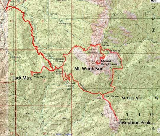
Ascents of Mt. Wrightson, Josephine Peak and Jack Mountain. GPX DL
I started the hike fairly slowly but soon I warmed up and picked up the speed. In short time I passed hordes and hordes of hikers but the drag to Josephine Saddle seemed quite never-ending. And then I took the left branch heading for Baldy Saddle. There’s literally not much to document as I just had to follow the trail and the crew had done great job building the switchbacks and cutting the bush. The northern views started to open up as I gradually gained elevation but at this point I was still on the mission to pass the hikers in front.
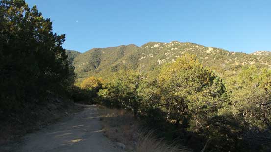
The start of the hike.
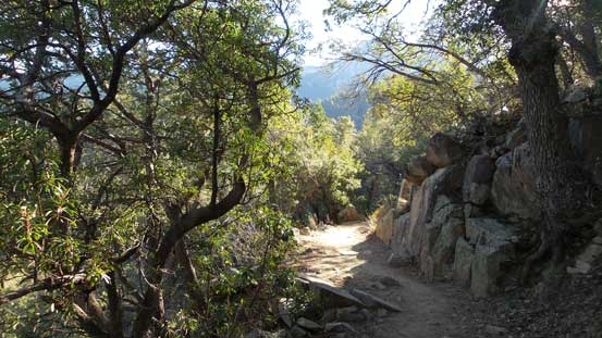
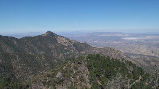
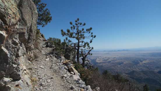
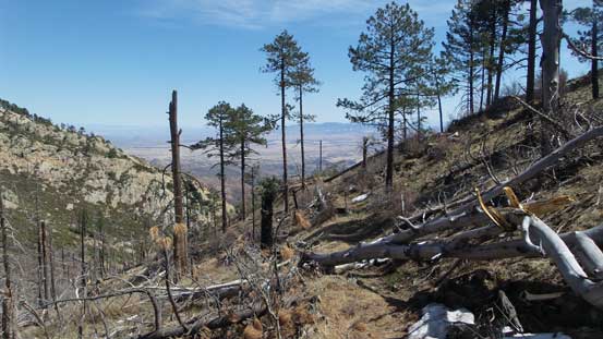
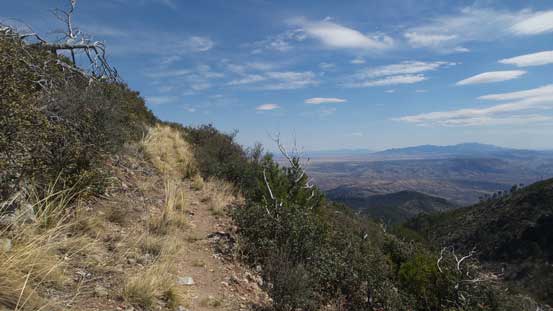
The typical view from Old Baldy trail below Josephine Saddle
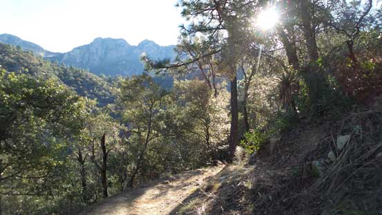
Another view from Old Baldy trail

Above Josephine Saddle now, the trees are thinning
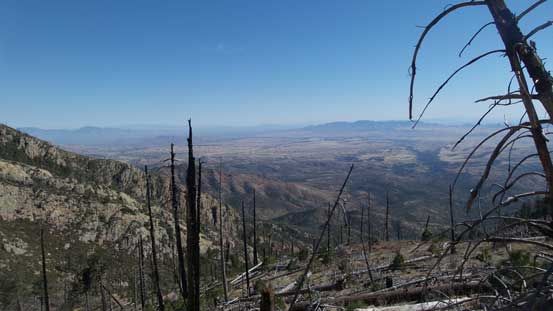
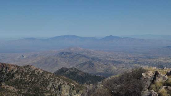
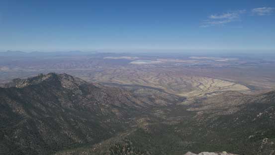
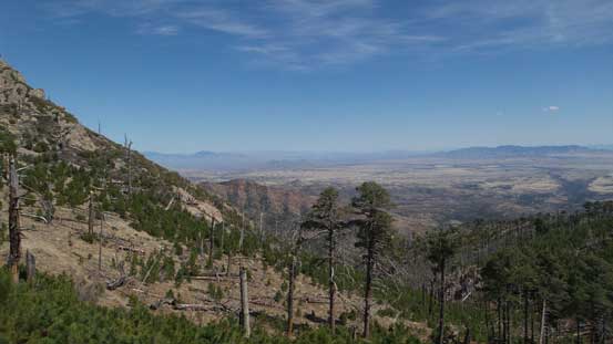
An unobstructed view looking down at an outlier of Mt. Hopkins and the desert plain

More about the desert plain looking north

Mt. Hopkins nearby
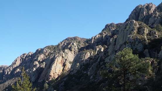
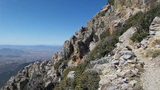
The slopes on Mt. Wrightson are steep and cliffy
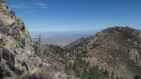
From Baldy Saddle, could see the far side.
From Baldy Saddle onwards I could no longer see hikers in front which meant I’d at least have some sort of solitude, so slowed down again enjoying the views. There were patchy snow to negotiate but nothing really worth noting thank to the previous parties’ foot path. The trail skirted around the summit block for about 180 degrees from the north side to the far southern aspect, and the last 100 m or so was done on some very steep switchbacks. There were two other hikers on the summit so I didn’t have it to myself, but the summit area was large enough so that I could still have my own solitude, but once the other hordes started to show up it’s time to move on again.

Patchy snow on the upper portion of this trail

Looking back at the northern extension of Baldy Saddle

A sideways view from the trail. Note the grade of the terrain.
Another view looking back towards the northern ridge branch.

Upwards and onwards.

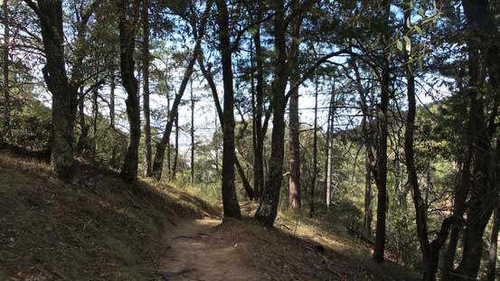
At sections it traverses in the forest
Hiking into the sky!
The very upper reach.
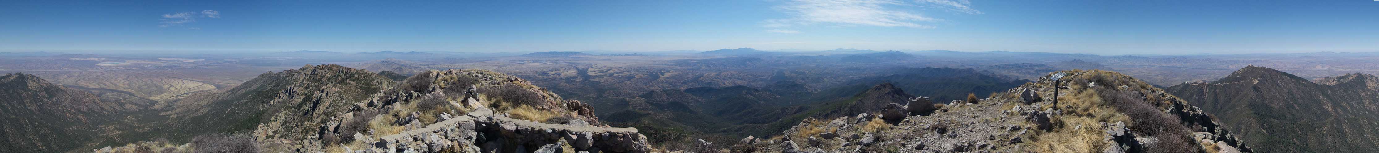
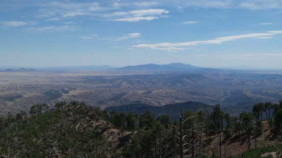
Summit Panorama from Mt. Wrightson. Click to view large size.
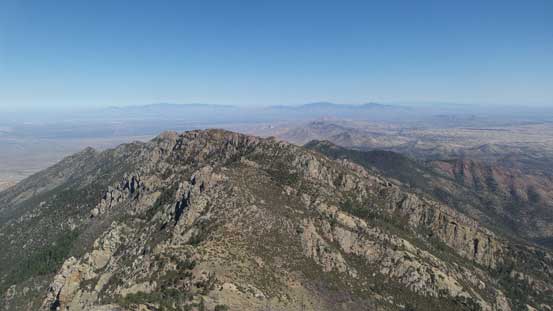
Mc Cleary Peak, Florida Saddle and other features on the northern branch
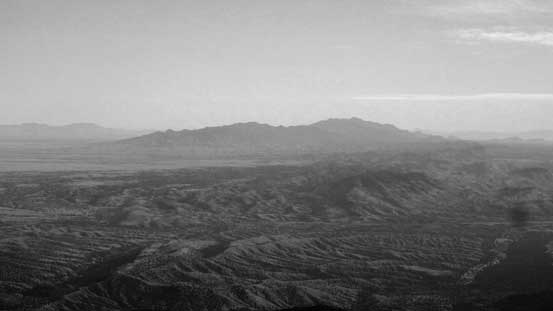
Mica Mountain and Rincon Peak on the skyline
The desert floor
Miller Peak just north of the Mexican border
More peaks looking east. Too lazy to figure out their names.
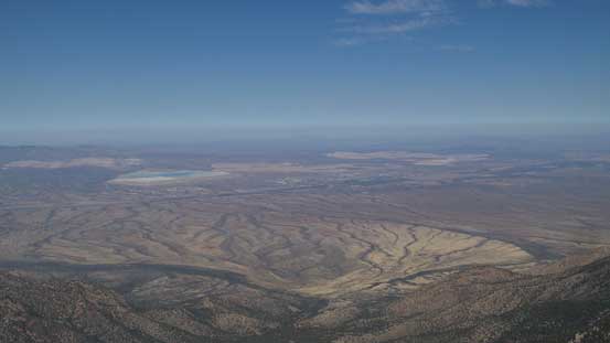
A wider view of the desert plain by Tucson
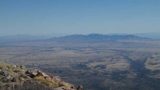
Another wider view looking north.

Me on the summit of Mt. Wrightson
Reversing my route down to Baldy Saddle went uneventfully and then I decided to take the longer trail (aka. Loop Trail) back via Riley Saddle. Part of the reason was to make an ascent of Josephine Peak and the other part was to avoid the hordes on Old Baldy Trail. This loop trail was much less maintained and overgrown for about 1 km length, and to make it worse those vegetation was the bramble types. Thankfully I do not hike in shorts which at least saved me from bleeding too much, for now anyway. The ascent of Josephine Peak from Riley Saddle was a entirely different game though and it surely got me introduced to the desert bushwhacking…

Another hiker approaching the summit.

One last look at the salt plains and the desert floor to the north
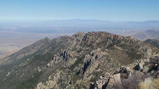
Mt. Hopkins is now way below
Almost back to Baldy Saddle.
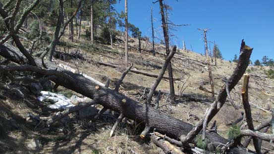
Picking up the Loop Trail which had numerous dead-falls
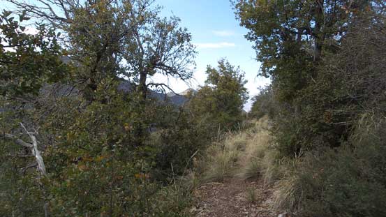
The typical view along Loop Trail

Looping around…
Another look towards the distant Miller Peak
More about the views from the south-east corner

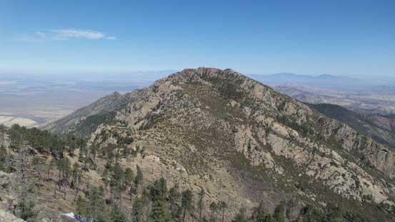
Josephine Peak ahead

The next stage traversing across this slope was bushy
The trail and the views…
Once back to Riley Saddle I resumed the traverse along Loop Trail and thankfully the next section wasn’t as overgrown and the vegetation was much more hiker-friendly now. It didn’t take me long to get back to Josephine Saddle with the aid of the downhill grade. Then after a short break, Jack Mountain is right there so I had to push on.
The section between Riley Saddle and Josephine Saddle.
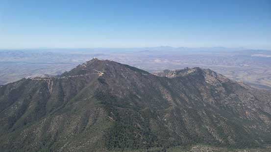
The ascent of Jack Mountain was forested but wasn’t totally garbage as I did get a good view looking back at Mt. Wrightson. The rest of the descent down Old Baldy Trail was a bit mind-numbing but at least it’s all downhill so didn’t seem to take long. And then I wasted no time in the parking lot but soon drove back to Tucson.

Mt. Wrightson from Jack Mountain
As much as the descent along Old Baldy trail goes.
Overall I’d agree with Mt. Wrightson being a fine classic that for those into hiking this is a must-do in the southern Arizona, but if I ever do it again (which I won’t) the route will be in-and-out via the Old Baldy Trail. It’s not really worth to do the loop traverse and the ascents of Josephine Peak and Jack Mountain are the classic “Type II/III” fun and only for the peak-baggers. And even so, it’s probably not worth bothering..
