Journeyman Peak
January 11, 2017
2134m
Whistler / Callaghan Valley, BC
The unofficially named Journeyman Peak refers to the peak immediately south of Journeyman Lodge in the upper Callaghan Valley. In the right conditions the north slopes of this peak offer some of the finest skiing from the summit all the way down to the lodge, for about 1000 vertical meters of relief. For that reason this place is more well-known in the heli-skiing community. The same route is also briefly documented in John Baldwin’s Exploring the Coast Mountains on Skis. The only trip reports I’ve read involve going from Callaghan Lake via a mix of bush, snow and boulder fields in summer conditions, while through browsing all kinds of maps I came up with the plan to attack the broad forested east ridge on snowshoes. This likely gives the most direct approach in winter conditions.
In winter time the service roads in Callaghan Valley are only maintained to Alexander Falls parking lot and from there it’s about 6 km of walking to the base of Journeyman Peak’s E. Ridge and another 6 km or so to the Journeyman Lodge. I didn’t see a point to waste the valuable daylight hours in this stage so set my alarm at 3 am in the morning. Two hours later I found myself driving up the increasingly icy Callaghan Valley road. The Alexander Falls parking lot was closed for this-or-that reasons but there’s just enough space to park beside the gate, so that’s it. The beginning of this year was extremely cold and there’s no exception on this day as I quickly geared up in the pitch dark.
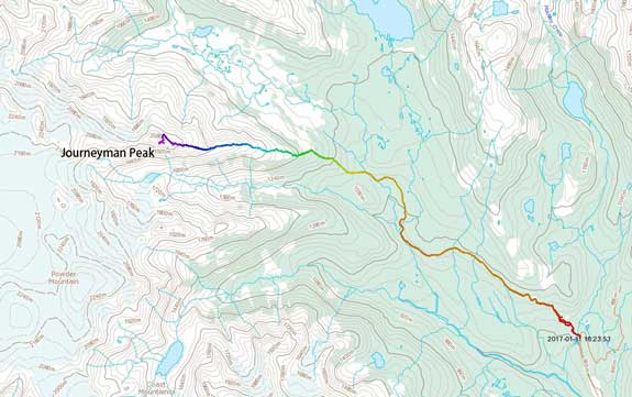
Journeyman Peak ascent route via E. Ridge. GPX DL
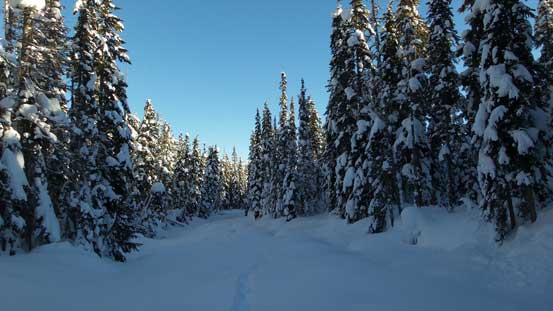
From the gate it’s about 100 m of walking to the proper parking lot. The Callaghan Lake road was very well groomed so that I didn’t even need to strap the snowshoes on, but this only lasted for a short period of time until I took the narrower branch upon reaching a critical junction. Confirming with my GPS I turned left up Callaghan Lodge Services Road and although also groomed, I started to post-hole so the ‘shoes were strapped on soon. Crunch, crunch and crunch… The next 1.5 hours or so was a mind-numbing plod up the road and there’s literally nothing to talk about except I actually put the balaclava on thank to a cold head wind blowing in from the north.
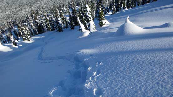
The place where to leave the road and start Journeyman Peak’s E. Ridge is arbitrary and I picked a place just before a small rise. It looked to me this could avoid some elevation loss/regain but I’m not so sure in the end. The first business after leaving the road was to find a way down and cross the main creek in this valley but once there I found it’s actually easier to travel directly in the creek. It was very well filled thank to the enormous snowfall we’d received in this season. The post-holing was however, a different story as every step I sank to almost knee level and this was just the flat part. Eventually I left the creek and entered the forest. No bushwhacking involved but the terrain was confusing and disorienting thank to some micro-terrain ridges and rises. The GPS kept me in the correct bearing and after a few short steeps it seemed like quite a while before the grade steepened. Meanwhile I finally got some much-needed sunlight and at an appropriate place I took the first break of the day.
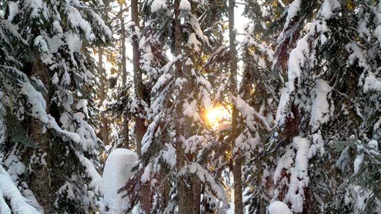
The first beams of sunlight of the day

It’s going to be another gorgeous day ahead.
Upwards and onwards this game quickly became a mind-numbing plod again. A few steep stretches provided some variety and I opted to attack them head-on just for more fun. The trail-breaking had become increasingly difficult and my progress was certainly not very fast. After what seemed like eternity the views finally started to open up and my motivation finally got boosted again. Taking another short break I then quickly made my way onwards into the alpine. Numerous rolls were overcome in a sequence and the summit just didn’t seem to get any closer.
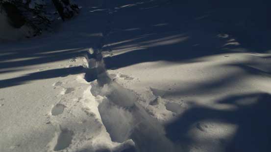
The post-holing was horrible though.
The views were about to open up.

The morning sun behind.
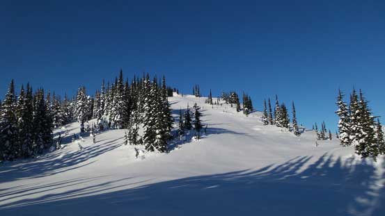
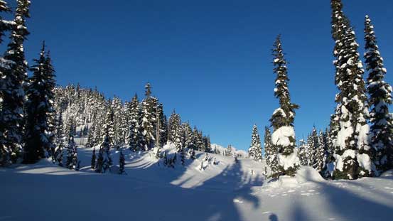
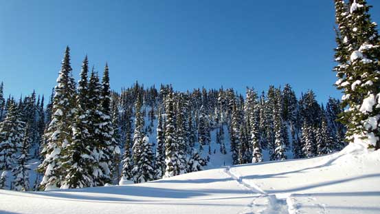
Near treeline now, still going up.

Hidden Peak looks fairly impressive from this angle

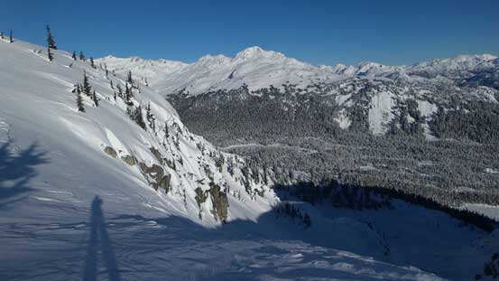
Looking back at Rainbow Mountain as well as my tracks.
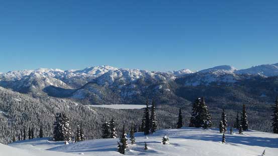
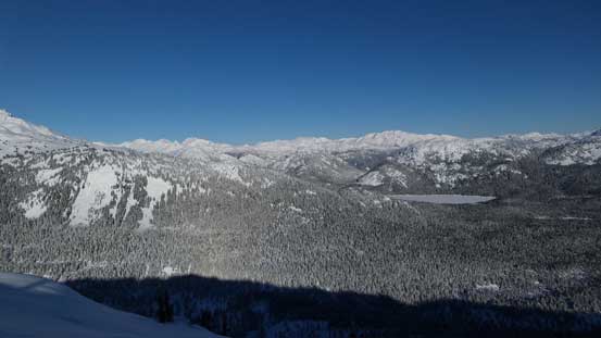
Could see the frozen Callaghan Lake
Into the alpine now.

It seemed like I still had lots of work to do.

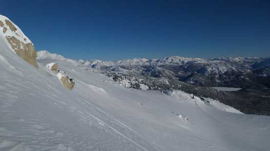
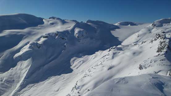
Nonetheless it’s a scenic ridge walk.
The summit doesn’t even seem to get any closer.
There seemed to have lots of heli-skiing activity recently and I saw at least two choppers in a roll landing somewhere near the summit. Upon close inspection it was actually the false summit that the skiers got dropped off. As a result the last steep slope before the false summit got tracked out and that significantly reduced the trail-breaking effort for me (for only 100 vertical meters though, out of perhaps 1000 meters)… The 3rd chopper landed just as I topped out on the false summit and the group of skiers seemed very surprised to see someone had come all the way up from the valley this early in the day, but I wasn’t quite in the mood of chatting as the view ahead was quite surprising.

Looking back from one of the many bumps along the way
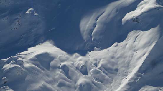
Looking sideways across one of the ribs on the north slopes
Going up a steeper rise now.
First view of the nearby Powder Mountain.
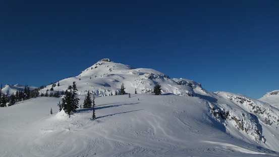
Almost on the false summit.
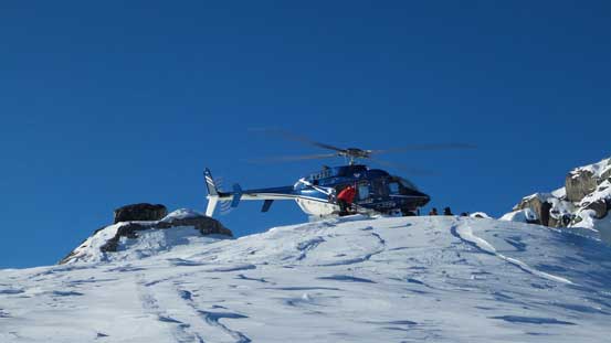
A chopper landing. This is an area popular for heli-skiing companies
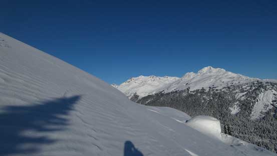
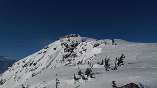
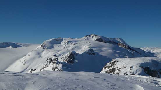
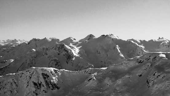
The true summit appeared technical from this side and that’s certainly not something I was mentally prepared for. Given the fact I’m not a mixed climber and certainly wasn’t equipped with mixed climbing gears on this day I had to find another way, and the only possibility was by dropping down skier’s right cutting underneath a big slope, in hope there’s easier terrain on the north side behind the summit buttress.

The true summit from false summit.

The group of heli-skiers were surprised to me showing up out of nowhere.
The slope gradually steepened to about 40 degrees as I dropped quite a ways down and to the right, and once around a corner I did spot a line that looked feasible. Judging by the GPS I figured this gully ahead should lead to the summit but without reading any similar trip report the only way to find out was to test it out myself. About 12-15 short and tight switchbacks were made as I slowly grunted my way up the increasingly steep gully/couloir. The gully terminated at a plateau feature and I correctly estimated the right bump being the higher in elevation. Upon arriving at the summit I was relieved to see the next highpoint to the east being lower in height, so that’s it.

Looking up the gully I’d ascend soon. It’s steeper than appeared.

About 12 switchbacks solved the problem.

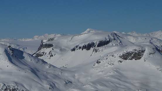
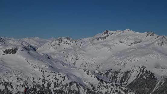
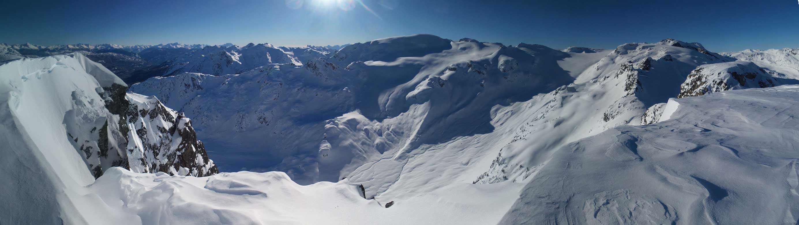
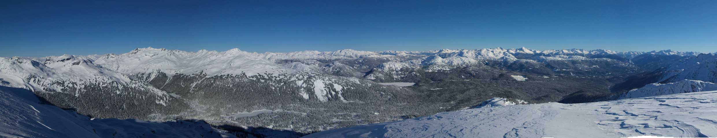
Summit Panorama from Journeyman Peak. Click to view large size.
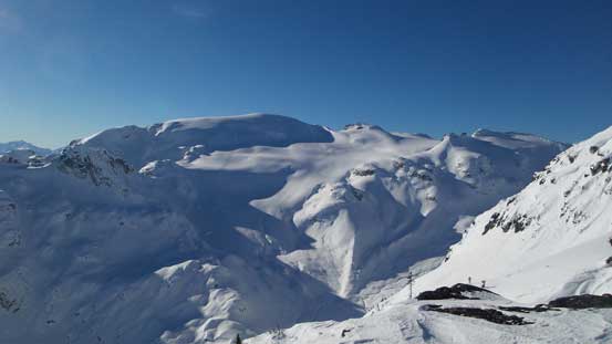
This rugged ridge eventually connects to Les Gendarmes on the Powdercap Icefield
Ring Mountain looks unique from this side
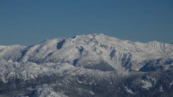
This big peak on right is Mt. Callaghan
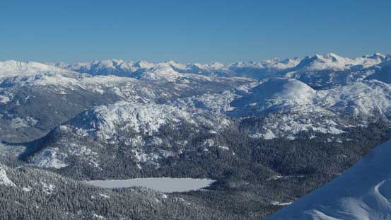
Callaghan Lake with the Price Glacier Group and Mt. Currie behind on the skyline

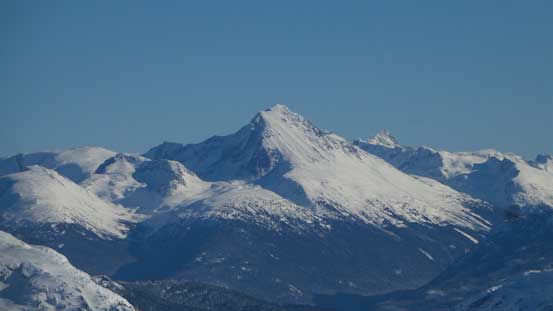
Mt. Currie
Ipsoot Mountain

Exodus Peak on the western edge of Pemberton Icefield

The very evil-looking twin towers of Mt. Fee. That N. Face of N. Tower looks damn steep…
The Spearhead Range behind Blackcomb Peak
Wedge Mountain – the 4th highest in SW BC and highest in Garibaldi P. Park

Mt. Weart rises behind the broad Rainbow Mountain

Another view of the ridge leading towards Les Gendarmes

This picture shows the south side of Journeyman Peak being some steep cliffs..
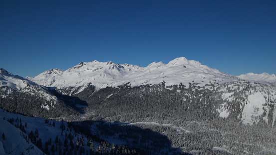
The valley between Powder Mountain and Journeyman Peak. Looks like a good approach route.
The toe of Powder Mountain’s NE Glacier
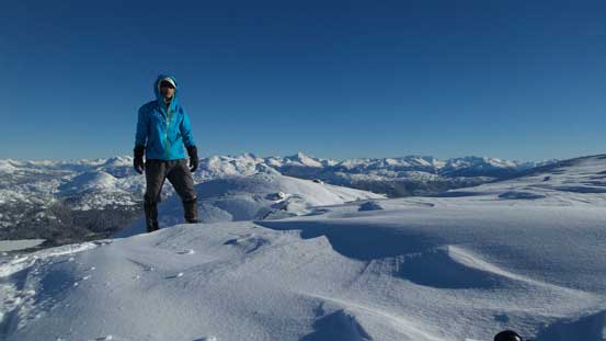
Me on the summit of Journeyman Peak
Panorama showing the south side including Powder Mountain. Click to view large size.
Panorama showing Callaghan Creek Valley. Click to view large size.
And of course I took a long break soaking in the views, but with that cold temperature I couldn’t linger too long up there. The top part of that gully was too steep to plunge so I gingerly reversed using my up-tracks and then the lower couloir provided a fast and fun plunge. Cutting back across that aforementioned steep slope I then grunted up the false summit again, with fair amount of elevation regain. This time not bothering with any lingering I soon plunged down the east side. At somewhere above the treeline I took the last long break of the day, figured might as well soak in more views as I still had plenty of time ahead.

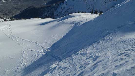
Traversing back across the steep slope

Looking back at the traverse I just did.
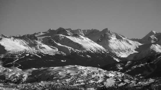
The many summits on Brandywine Mountain

Plunging down one of the few steep slopes on the E. Ridge
Neat terrain.
Mt. Callaghan and Hidden Peak

Rainbow Mountain
One last look at Callaghan Valley as well as Callaghan Lake
Going down the forested slopes was fast and fun comparing to the post-holing fest a couple hours ago. The few steep sections provided some extra fun as I could just jump/glide between trees on lots of soft powders. Once down to that lower slopes it did feel like quite a drag before finally merging into the creek, and about half an hour later I re-joined the road. The final 6 km walk wasn’t that inspiring but at least with musics it didn’t feel too long. Thank to the closure of this area as well as Alexander Falls parking lot I had the entire road-walk, which is essentially a cross-country ski track to myself. The parking lot was quiet and I did not see a single soul.

What a trail that I broke in the morning…
The typical treeline country.
Into the forest
Down to the creek now.
Hopping over the gate my Jeep was still parked there. It didn’t get towed nor did I get a ticket so that’s good. The drive back home was uneventful although tiring to say the least. I made back just in time for dinner, and after briefly updating some Facebook status I had to go out again, for some evening work commitments…
