Table Mountain
December 7, 2016
1750m
Mount Baker Highway, WA
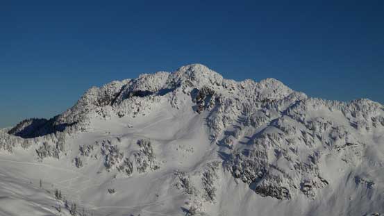
Not to be confused with The Table in British Columbia’s Garibaldi Provincial Park, this equally-aptly-named Table Mountain sits right in the backcountry of Mt. Baker ski resort in Washington state. Thank for the well-engineered and well-maintained Mt. Baker Highway the access has become effortless, and given the incredible scenery there’s no wonder why thousands of people rush to this area every year. Fortunately not that many people choose to ascend Table Mountain especially in winter as the peak, although flat in nature, does have steep cliffs on nearly all sides making the summit bid a serious undertaking. The easier alternative is a circumvention of this peak and even that would involve some prolonged exposure to avalanche terrain. By far the easiest winter route goes up the East Ridge via the obvious buttress and I have to say that steep section appears fairly formidable from all directions.
Earlier in the year I had made a solo trip to the nearby Artist Point and tagged two very minor summits on skis, and having Table Mountain in sight for pretty much that entire trip I knew I just had to make this one a winter ascent too. All I needed was a bluebird day lining up with some good snowpack stability, and this cold snap in the early December was perfect for that. The downside was again, my deadline to get back home before 3 pm for work but there’s no way to have that being my deterring factor. Driving out at 11 pm after work I managed to make to as far as about a couple miles past the small town called Glacier on Mt. Baker Highway before pulling out for a nap due to tiredness. A couple hours later my alarm went off and I resumed the rest of the drive up that steep, narrow, winding and slippery road to its end. It was still dark and the temperature had dipped down to -15 degrees. Fighting tiredness and laziness was difficult but I knew the rewards a couple hours later would be all worth the effort.
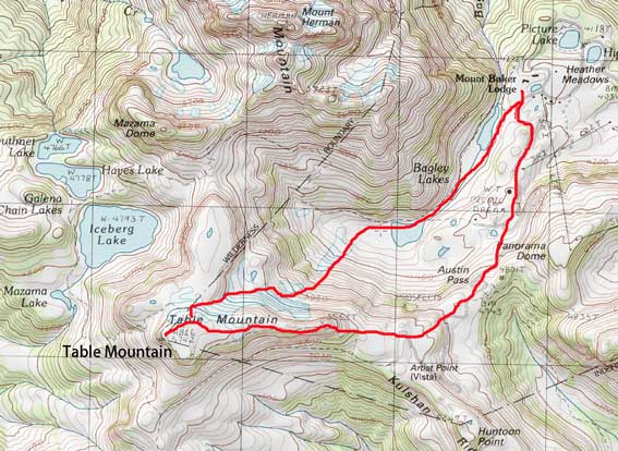
Table Mountain up East Ridge and down NE Slopes
About half an hour into the plod the horizon had become bright enough and it’s there that I did my first stop to swap head-lamp for my camera. Up until Austin Pass I stayed inside the ski resort boundary to take advantage of the well groomed runs and once crossing the resort boundary I managed to pick up a set of snowshoe tracks and that led me gradually to the ridge in front, also known as Artist Point. I did not do any lingering but immediately turned right towards Table Mountain’s east buttress. The snow was very soft and I sank to almost knee deep even with 30′ Lightning Ascents. Also in this stage I got treated by another amazing 360 degree panorama of alpenglow views.
The northern horizon at dawn

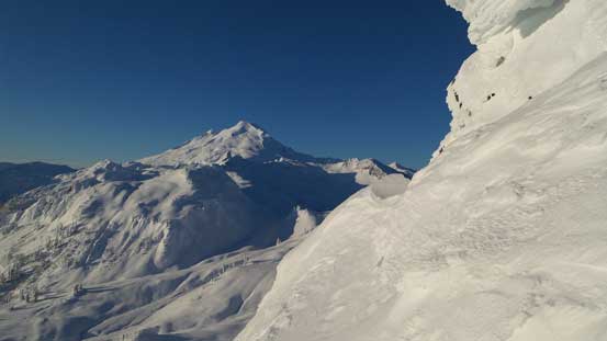
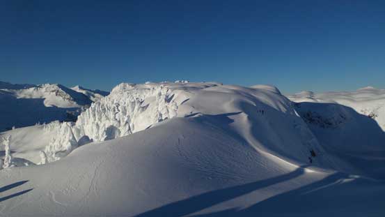
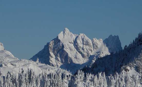
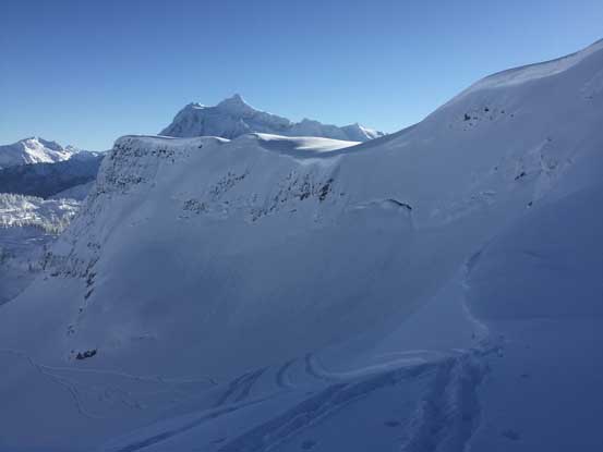
A look at Table Mountain and its NE slopes that I’d descend later
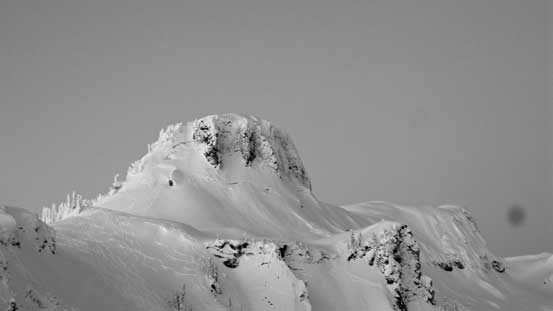
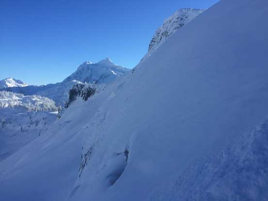
This is the steep east buttress. My ascent route is up the left skyline
Mazama Dome and Mt. Herman before sunrise.
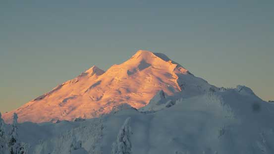
Alpenglow on Mt. Baker
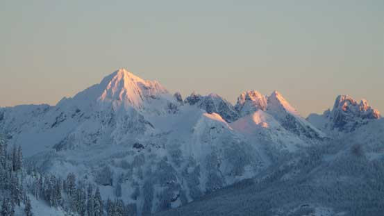
Alpenglow on Mt. Larabee, The Pleiades and Slesse Mountain

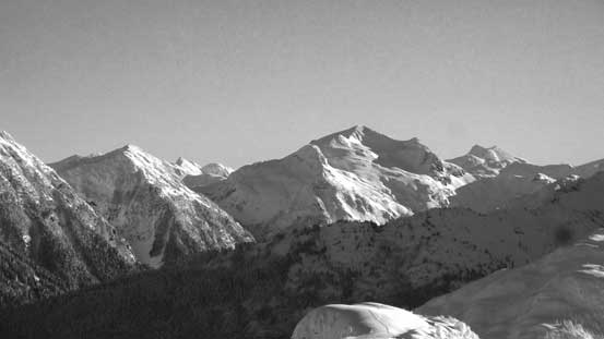
Mt. Shuksan in black-and-white

Alpenglow on the two summits of Goat Mountain
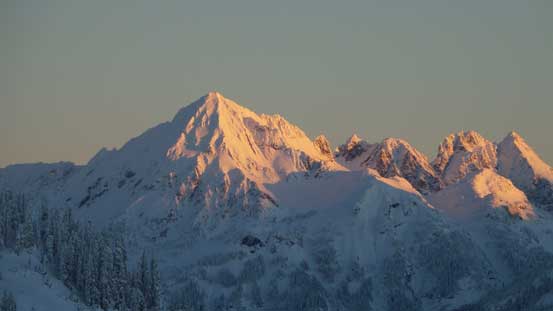
Another picture of Mt. Larabee
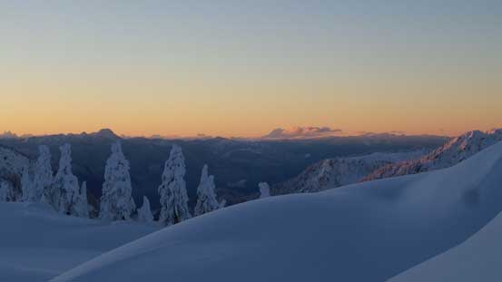
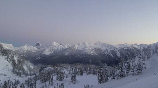
The southern horizon
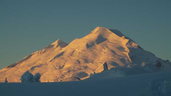
Another look at Mt. Baker
The east buttress appeared ridiculously steep from the approach and the angle did not ease by much even at its base. After hesitating for a while I took the snowshoes off and up the slope I went from climber’s right side – easy going initially but soon enough I started to kick into rock slabs and moving left a bit I immediately sank past waist deep. I tried swimming up on all fours but it’s nearly impossible to fight through those loose snow without slipping backwards. It’s time to think about another solution. I don’t think I’ve ever tried snowshoeing up a 45-degree slope but here why not to give it a try. Of course directly ascending wouldn’t go but by cutting a few large switchbacks it actually worked, although the process was arduous and my progress was slow like a tortoise. Near the top I still had to take the ‘shoes off for a short while but after that the buttress was over and I was on easy terrain now.

At the base of the east buttress. It’s still looking steep…
Time to give it a shot.
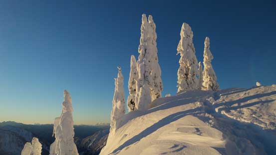
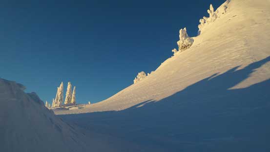
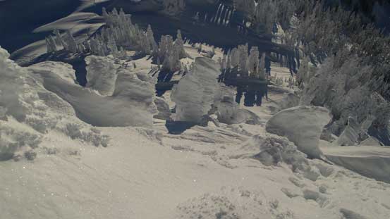
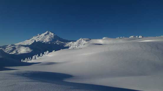
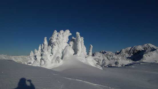
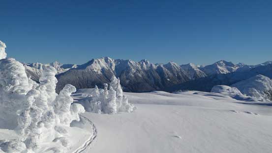
Beautiful tree sculptures around!
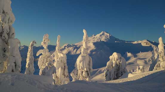
Looking through the tree sculptures towards Mt. Baker

One more photo the of the trees

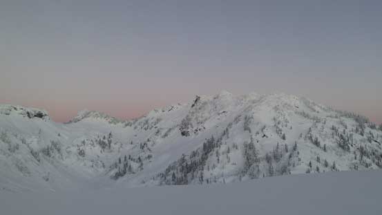
Looking back, Mt. Sefrit at center background
Wallowing up the steep slopes
Partway up, looking down

Almost there!
On top of the east buttress now, looking ahead
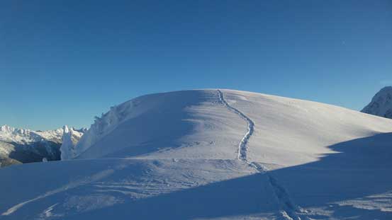
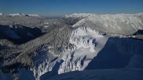
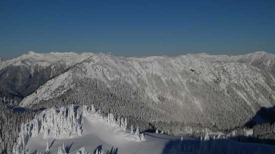
Traversing the rest of the E. Ridge to the broad summit appeared easy and tame but still required lots of effort. There was no previous parties’ tracks and I had to break trail for the whole way (and it’s just as deep as I’d expect). The difference now was that I got accompanied by some incredible views but time flee by fast. Near the summit there’s a bit of micro-terrain to negotiate but overall it’s still pretty easy to stay oriented.
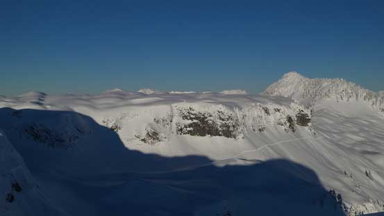
Looking across Table Mountain’s northern arm. Mazama Dome at rear right
More about the east ridge traverse
My tracks descending from the east buttress
A closer look at the summit of Mt. Herman.

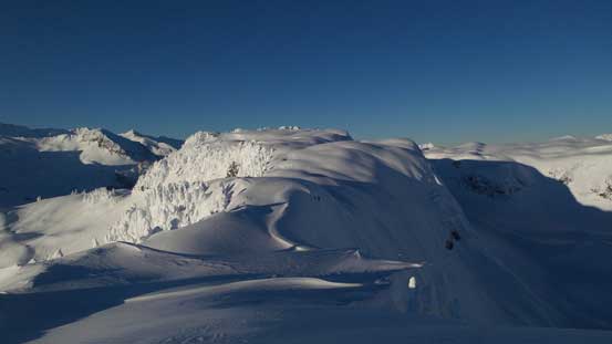
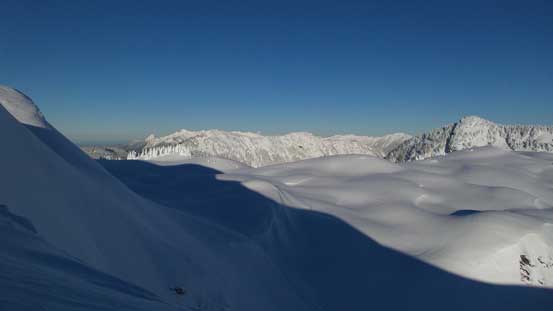
The flat portion of the ridge. It’s indeed like a table..
Mt. Baker and the table feature.
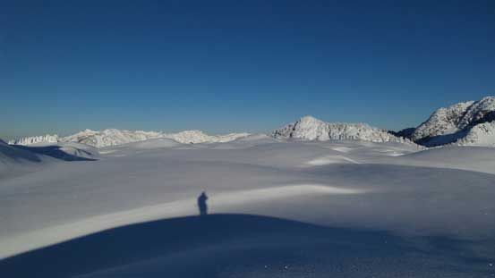
Me catching a shadow under the morning sun
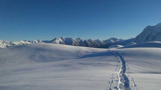
Again, looking back at my tracks

Another look at Mt. Herman
Looking across the northern arm again. I had to find a way down to that plateau

Looking down at the lower reach of Mt. Herman. There’s a ton of ski tracks up that way
Mt. Herman rises behind the northern arm of Table Mountain
Still have trees up here near the summit
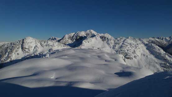
From the summit, looking westwards

Mazama Dome
Barometer Mountain in the foreground
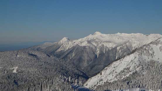
Looking way to the NW towards Church Mountain
A zoomed-in view of Canadian Border Peak – apparently not an easy peak
That ridge leading towards Coleman Pinnacle
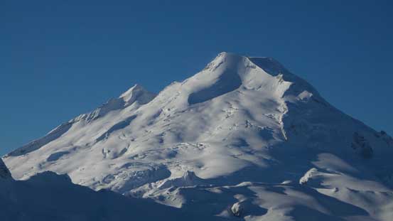
Mt. Baker
Looking towards Nooksack Ridge (Mt. Sefrit to Ruth Mountain)

Mt. Shuksan
Ruth Mountain
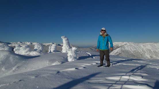
Me on the summit of Table Mountain
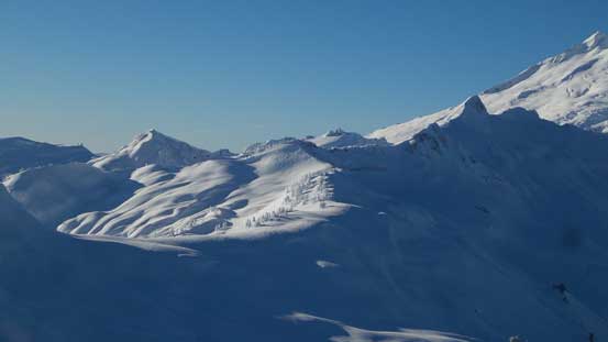
Earlier in the trip I already made a call to descend via the steep NE Face to avoid that buttress section. I had spotted lots of skier’s tracks down that way and I’m pretty sure it’d go, but the problem was how to get down the initial cliff that guarded the summit plateau. I searched around and found the least steep spot on the north side. It’s about again, 40-45 degrees and thank to the soft and deep powder I didn’t have to take the snowshoes off, although it’s a wee bit too steep to just plunge down so I had to do some side-stepping and traversing. After this section I picked up some ski tracks and followed them into the NE bowl, then traversed further east to merge onto a gigantic slide path. I really wished to have my skis on at this point but plunging down 35-degree slope was fast and fun on snowshoes too anyway, so I wouldn’t complain.

This is the first very steep section
Now merging into the NE Bowl.
Very big terrain

Looking back from partway down
Once down to the valley below (Bagley Creek drainage) I crossed the creek and picked up the main set of skin tracks, and the rest of the return to the parking lot was easy and scenic. Unfortunately my camera froze up on the summit and stayed frozen during the entire descent even though I tried my best to warm it up inside the jacket, so the pictures from the descent were taken using my iPhone. And not to my surprise, my iPhone also froze up after a while, so there’s no picture from the last portion of this trip.

A review shot of the NE slopes with the lower route shown in red line
Back to the parking lot my timing was a bit late than planned. I also took a nap somewhere along the Mt. Baker Highway as I was literally too tired to continue driving safely. And then the border crossing at Sumas also had quite some volume, but still, I did manage to get back just in time. The rest of the afternoon and evening was exhausting but I did find some ways to stay awake. Eventually after finishing everything I got back home by around 11 pm and with some weather coming in it’s finally the time to catch up some well-deserved sleep.
