Mount Daniel
October 27-28, 2017
2426m
Alpine Lakes Wilderness, WA
The iconic glaciated massif of Mt. Daniel in the heart of Alpine Lakes area dwarfs pretty much every other peak in its immediate vicinity. This peak is however, not on a famed Bulgers list but that doesn’t diminish its structural beauty. The access requires a somewhat long drive on dirt roads around I-90 corridor but the standard route is nothing fancier than a “long plod” in good conditions. Although it’s not a peak that draws attention on everyday’s Instagram users it does receive a fair amount of traffics in the prime season. If you have seen it before particularly from the north side then you would want to climb it at some point, and this is exactly the case for me.
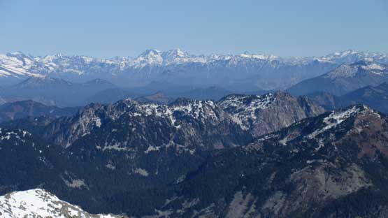
The simplest way to check off Mt. Daniel is by a fairly sizeable day-trip in summer but then I do realize there’s simply too many (better) objectives to do in summer months. That kind of tactic is too lame for my kind of taste as I want challenges that’s a wee more than just a “day-trip, scramble” ascent. In the right conditions I do see Mt. Daniel getting occasional “winter ascents” on snow and that often means an overnight stay. Perfect. The last weekend of this October seemed like a right time. There was a big dump of snow but then a return of summer-like temperature had put many bigger peaks back in shape. With two days in the cards I wasn’t really expecting much of a challenge although I do know things tend to get harder than expected at this time of a year. To make full use of my timing window I decided to hike up Granite Mountain in the morning for simple reason of why-not. That turned out to be an excellent call with some incredible views. The lunch break was taken in the small town of Cle Elum and then another hour or so later I parked my truck at the trail-head. Finding the trail-head could be tricky but not with a downloaded GPS track.
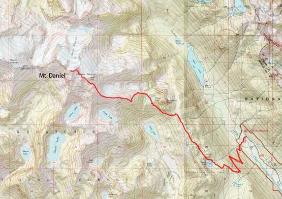
Mt. Daniel standard ascent route. GPX DL
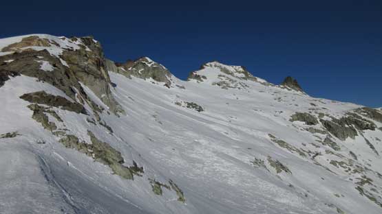
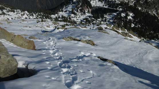
The first hour or so was a gradual plod up a well-maintained trail towards Squaw Lake. This trail is signed but has quite a few junctions and the direction is to aim towards “Cathedral Pass”. I hated this trail. Too much horse shit actually made some tricky footwork at times. After a few long switchbacks the grade eased and then I started encountering snow. The snow depth increased dramatically after the first significant rise above Squaw Lake. There’s no horse shit anymore but then I had to deal with the slippery conditions and then soon enough, post-holing. A solo climber turned around near the supposed “meadows” area which on this particular day, looked more like a snow field. The snowshoes were soon strapped on and even so I sank to knee deep on a regular basis (isothermal snow), but I powered it through nonetheless. To my great relief that traverse underneath Cathedral Rock was relatively free of snow.
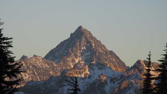
Evening view of Mt. Stuart. Just glimpses through trees
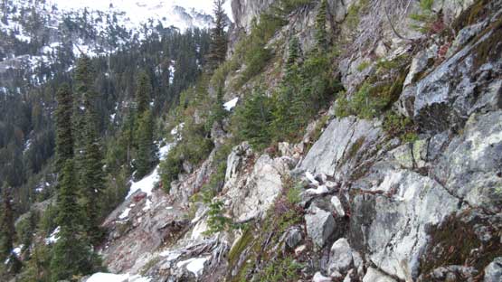
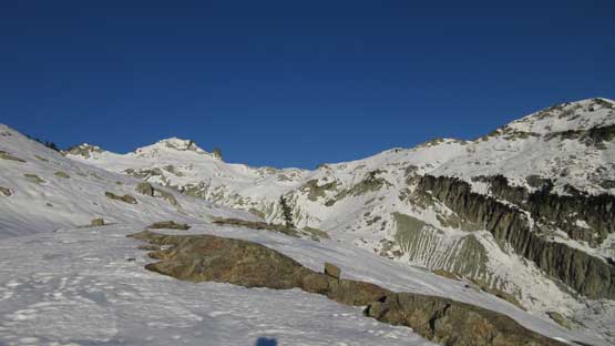
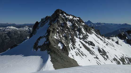
Ahead is the long steep traverse underneath Cathedral Rock
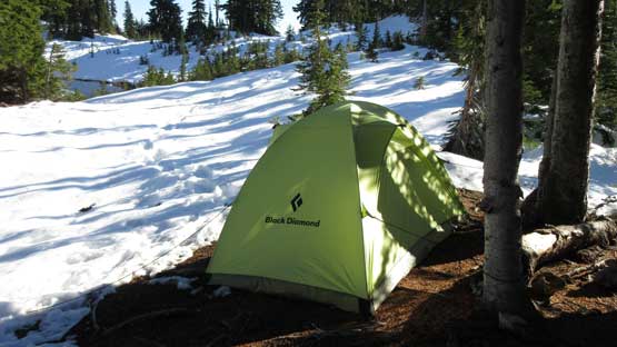
This steep traverse required some degree of caution even when dry as a slip would not be very pleasant at a couple spots. The trail was covered by only a thin layer of snow with some deep drifts so didn’t impose too much of a problem, although time was slowly getting on. Towards the rear end of this traverse the sun had already set. My intentional camp site was right beside Peggys Pond. There’s a bit of guess work and bushwhacking as I lost the trail in the snow but at that point I was already close to the pond. After rushing a bit I did make to the pond without using head-lamp but then setting up the camp was done in complete darkness. It’s always a fun procedure when it gets to this “winter camping” thing. I forgot my shovel on this day but thankfully there’s one dry spot underneath some tree coverage.

Dusk horizon just after I finished that steep traverse section
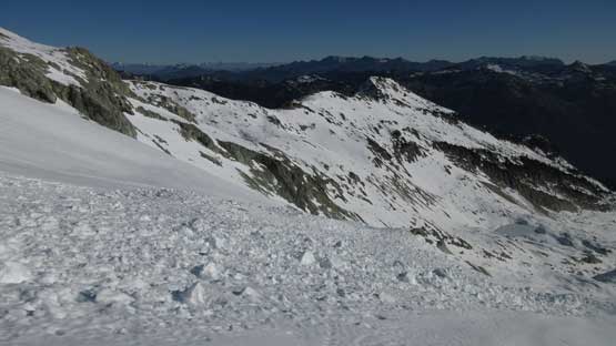
I was a bit tired of this wallowing thing so decided to sleep in and wake up at sunrise. The general route-finding was to gain the broad SE Ridge but at least the lower reach did not look fun to me at all. Much of the terrain was steep and the snow was absolutely garbage even with snowshoes. The only place without significant post-holing was the big, open areas but those weren’t abundant. There’s a lot of hidden boulders and holes from underneath that I had to be extra cautious with which made slow progress. There’s one steep roll that appeared “interesting” from afar that I had to traverse a long ways due south (left) to bypass.
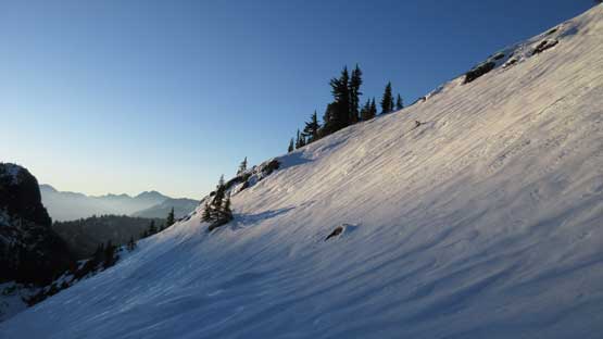
The first beams of sunshine since the start of this trip…
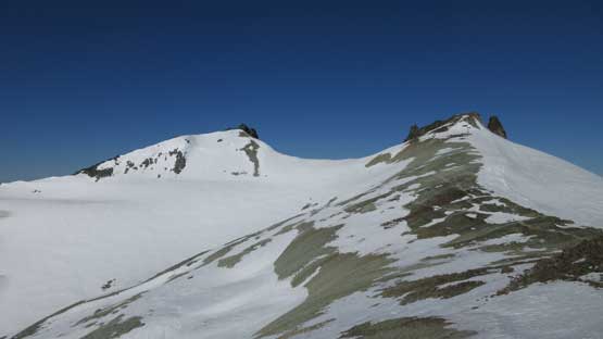
Gaining the lower SE Ridge now. Way in the distance is just the “east peak”

The typical travel through partially covered boulders

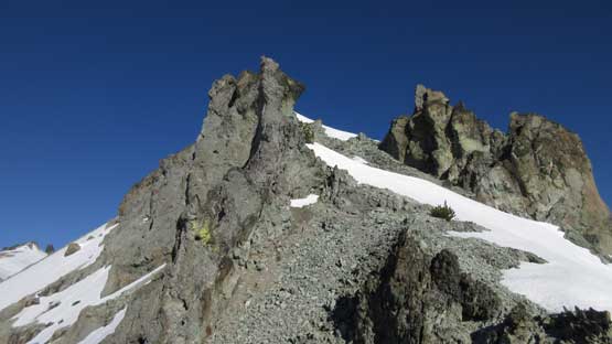
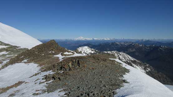
I don’t think this peak has a name but looks cool..
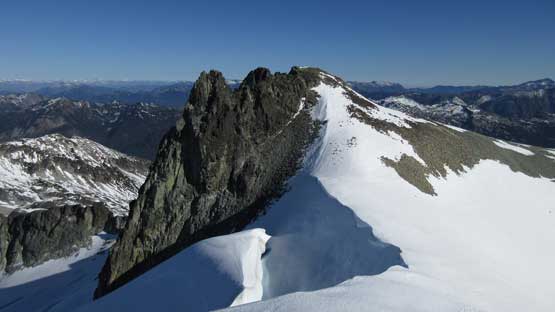
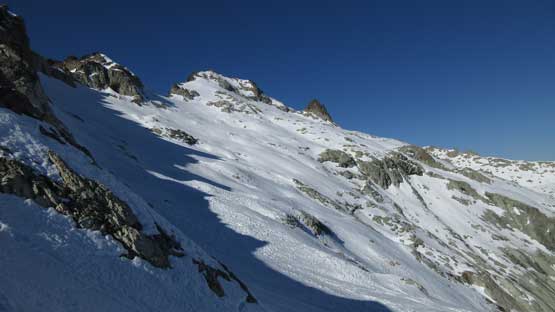
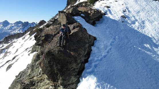
The ridge gradually narrows down after that steep roll and at one spot I actually had to step off the crest and traverse some crusty steep snow on the north side. Not far after that I reached the point that I had to bail north and start the first long snow traverse. This traverse looked terrible from low down that I even considered calling a day, but wasn’t too bad once I committed myself onto it. The grade was pretty mellow throughout that I could even keep the snowshoes on although crossing a couple recent slide paths (triggered by cornice fails) was freaky to say the least. I knew the snow wasn’t in the greatest conditions (far too soft) but pushed on nonetheless.

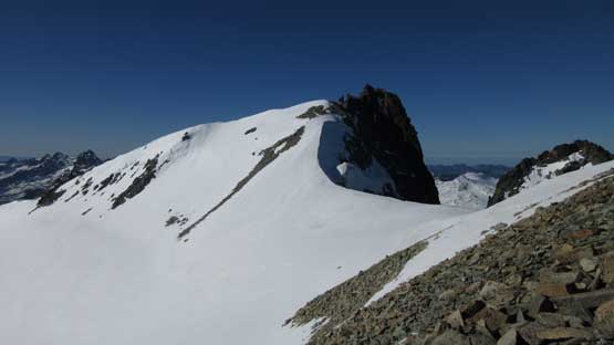
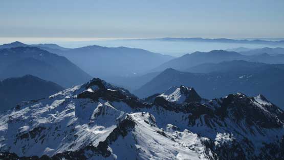
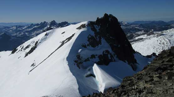
First full view of the upper mountain. That first traverse looks pretty bad …
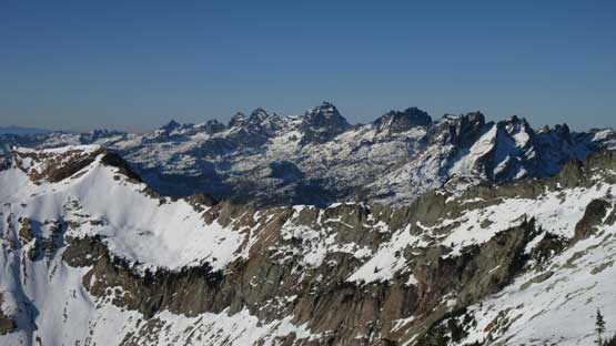
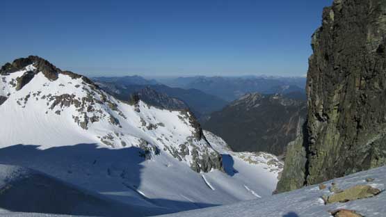
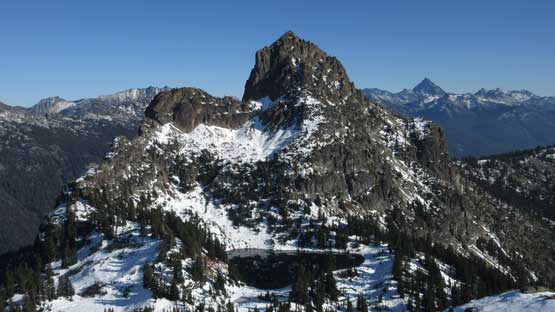
At least the view into Chimney Rock area was superb
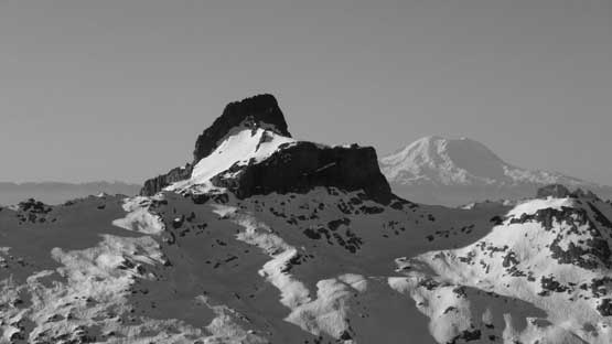
This is unofficially-named “The Citadel”, with Mt. Rainier behind

Chimney Rock is a pretty damn hard peak
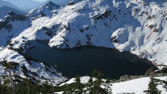
Cirque Lake. I like the wintery view but without the frozen lake.
Ready to tackle the first (long) traverse

A wider view with Cirque Lake and The Citadel in one shot
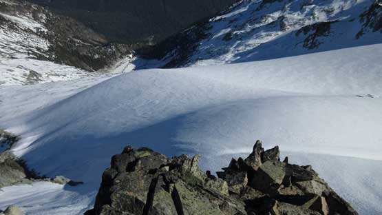
Avalanche debris!!
The end of this first traverse dumped me right at the base of “east peak”. I had little interest in wasting time on this peaklet so moved on. The second traverse across the south-west face of “east peak” looked terribly steep so that I even took the ice axe out. Crampons weren’t required although I would honestly prefer conditions that actually require crampons… Thankfully this wasn’t a long traverse and pretty soon it’s over, but then I was facing at a third (unexpected) steep snow ascent. This was getting out of “east/middle” col and required some knee-deep post-holing. It’s too steep to use snowshoes so I must wallow. At the top of this section I then ditched snowshoes.
The “east peak” from the first saddle. I didn’t bother with this sub-summit

Looking ahead to the second steep traverse

Partway along the second traverse, looking south. Venus Lake below

The second half of the “second traverse” into “east/middle” saddle

Looking back at my tracks across the second traverse

Grunting (actually, post-holing) up the “middle peak”
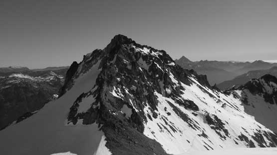
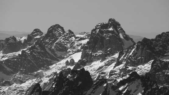
A black-and-white shot looking back at the East Peak
It’s dry now..
The summit on left. Ditching snowshoes now.
I followed the faint trail traverse around the south side of “middle summit” but on purposely went higher to avoid unnecessary wallowing, and then easily plunged into “middle/true” col. The ascent of true summit follows an aesthetic snow arete that appeared worse than it actually was. The final summit block was free of snow and the easiness of it surprised me a bit. I was expecting some real “class 3” but not really…
Ahead is the true summit. Almost there…
Already great view into the north side.

This is the western sub-summit of Mt. Daniel. Rarely ascended.
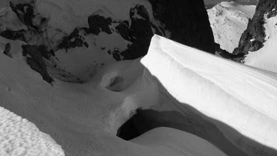
This bergschrund can easily eat an apartment house

The summit block. Easy peasy…
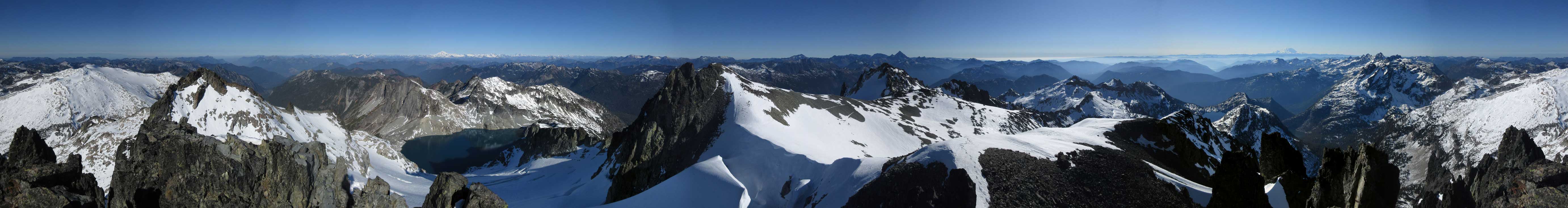
Summit Panorama from Mt. Daniel. Click to view large size.

Pea Soup Lake with Dip Top Peak and Lynch Peak behind.

Mt. Stuart and the Enchantments rising behind the “east peak”
This is looking north into US-2 Corridor. Baring Mountain is visible.
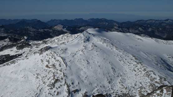
Mt. Hinman is this broad snow plateau but is much more remote

This is looking over Lynch Peak towards Glacier Peak Wilderness
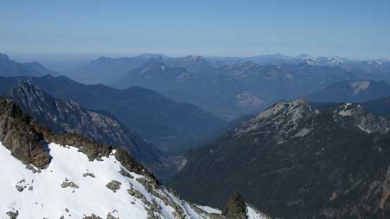
The south side is just forested hills. This is looking towards Cle Elum

Big Snow Mountain
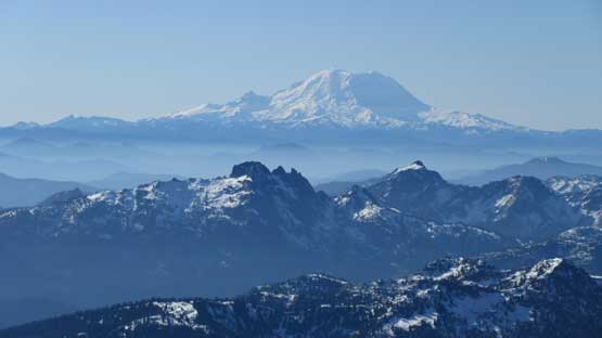
Mt. Rainier rises behind Kelly Butte and Hibox Mountain
Chimney Rock
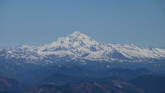
Glacier Peak
Mt. Fernow and Mt. Maude by the Entiant Cirque on the skyline

Another shot of Pea Soup Lake below Lynch Glacier

Me on the summit of Mt. Daniel

Another panorama from the summit of Mt. Daniel. Click to view large size.
I took a well-deserved summit break mainly because there’s actually some decent cell phone coverage which I wasn’t expecting at all. But then time was getting on as don’t forget I had to push all the way back to Vancouver on this day… So down I went, but before that I went up the “middle summit” for more views and I have to say it actually worth a visit. Reversing the two traverses was pretty easy peasy following my own tracks and then plunging down the lower SE Ridge wasn’t so fun. The post-holing was terrible even with snowshoes and I was surprised there were still people going up with just boots. The highlight was seeing Cathedral Rock right on the face.
This is the middle summit.

This bergschrund really impressed me…

Lynch Glacier and further into Highway 2 areas
This shot of the true summit shows my tracks now

The east peak still looks tiny.
More about the north side glaciers. Skiers?
East Peak looks much bigger now.

Traversing…

Another shot during this traverse. I didn’t take too many photos here…
Finished this sketchy traverse now.
Perry the other hiker on her way back down. We camped pretty close to each other

Nice ridge though.

One last look at the traverses you must do on this peak.

What a day!
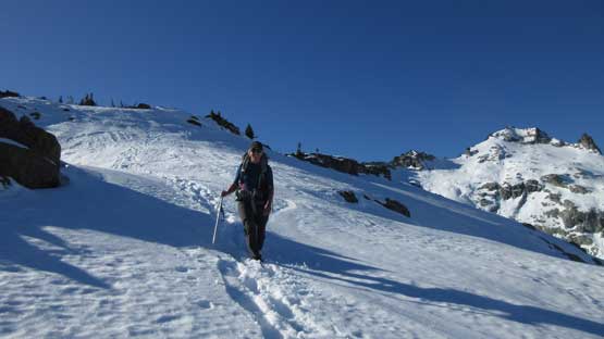
Perry’s having lots of fun now. Lower down probably not so much.

Cathedral Rock is starting to look big
Oh post-holing..
Cathedral Rock

Down to Peggys Pond now
Back to camp, but have to push on.
I spent a bit of time relaxing at camp but I had to resist the temptation of getting lazy. The best way is to release all the air in Thermarest first so you won’t fall asleep again. After dragging myself out and breaking camp I slowly followed my steps down into the short bushy stretch and then onto that steep traverse underneath Cathedral Rock. I didn’t bother with snowshoes anymore as there were already quite a few hikers helping to pack down the lower trail although the post-holing was still pretty bad. The rest of the decent was uneventful. I tried to race against the head-lamp time and I did succeed, although in terms of how many horse shit I actually stepped on I had no idea. The boots and gaitors went right onto the truck bed anyway so whatever.

Leaving this beautiful area behind.

Traversing underneath Cathedral Rock. It’s even drier now.
The bumpy ride out of this forestry road seemed to drag on for a long while but then the dinner in Cle Elum was well-deserved. It was about 9 pm and I was still doing good on energy. For one single push I made all the way back to Exit 260 north of Bellingham for some gases, and then the next stop was at home after midnight.
