Laluwissen Mountain
May 1, 2020
1607m
Lytton / Fraser Canyon, BC
“Laluwissen Mountain” is the unofficial name of a forested summit about 30 km north of Lytton right next to Highway 12. The name was likely given because of the proximity to Laluwissen Creek (aka. Laluwissin Creek) to the north, but the access of this peak is from Izman Creek FSR to the south. There is a spur road that runs all the way up its broad south ridge to within 1 horizontal kilometer to the summit but the status of this road was unknown on the internet. The summit appeared completely forested on the satellite images and the peak itself boasts generally zero interest from any perspective except for probably 4×4 driving and hunting… Among the stubborn peak-baggers I had heard nobody that drove all the way past Lytton to bag this little summit. When Alex threw out this idea I was not very stoked but agreed nonetheless as the weather appeared drier towards that way.
We had the usual limitation that I needed to be back home no later than 3 pm for work, so considering the long drive (3.5 hours each way) and the unknown status of the logging roads we opted to leave Vancouver at 10 pm after work. About 3 hours later we made to the start of the first (major) logging road, which climbed steeply beside Izman Creek and was rougher than expected. The second (spur) road was however, not in a bad shape. We did not expect to drive far up this spur road but other than some minor waterbars we encountered no obstacle. We passed a large group (at least 10 people) gathering and camping once topping out on the south ridge of Laluwissen Mtn. and opted to drive two more switchbacks further. The ditches were getting too big for Alex’s Subaru and the road was becoming increasingly bushy so we opted to park, at around 1150 m elevation. We estimated it would take at most 1.5 hours to reach the summit so we set the alarms at 4 am and tried to sleep. I had a lot of experience sleeping on the front seats so managed to sleep for about 2 hours but Alex got almost zero.
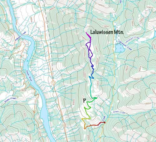
Laluwissen Mountain via South Ridge. GPX DL
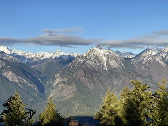
I ate two sandwiches and we were soon trudging up the boring road. It appeared that we could kept driving for at least another 2 km or so but whatever. The sky was getting brighter by 5 am and we made to the road’s end about half an hour before the official sunrise time. We continued bushwhacking in a large cutblock to an opening area and opted to wait for sunrise. It appeared that the true summit would be entirely forested so the best views were from this cutblock. It was a chilly morning but I came prepared with some winter clothing. The sunrise was nice, but not as spectacular as expected because the alpenglow wasn’t very sharp.
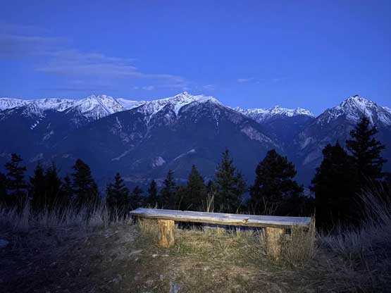
There’s even a desk on the road. It’s more popular than we thought.
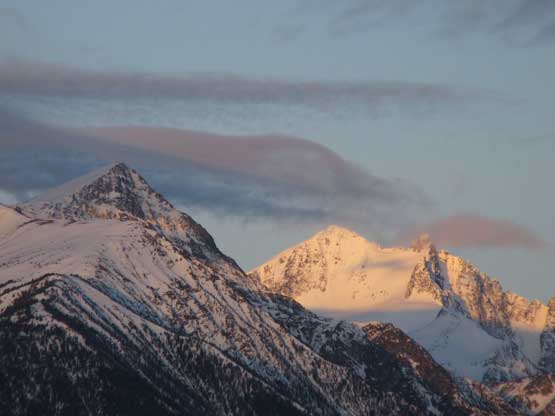
Alpenglow on Siwhe Mountain, one of the tallest in SW BC…
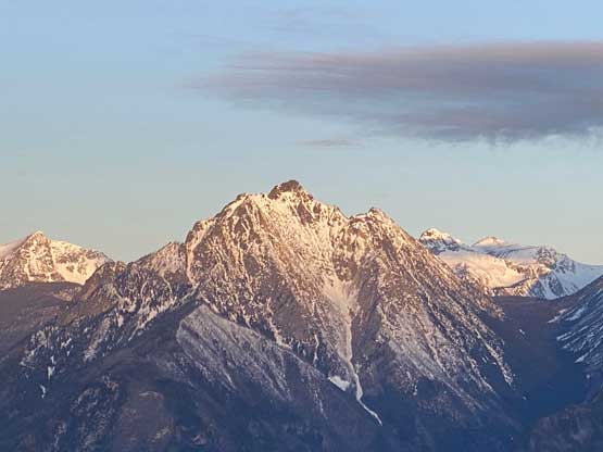
The unofficially named “Xavier Peak”

Klowa Mountain and Nikaia Mountain to the south
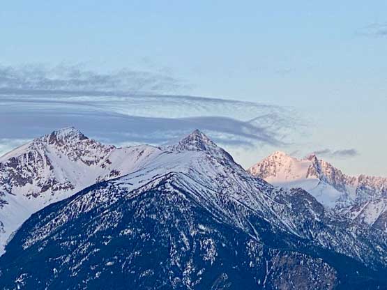
Another view of Siwhe Mountain and the sub-peaks of it

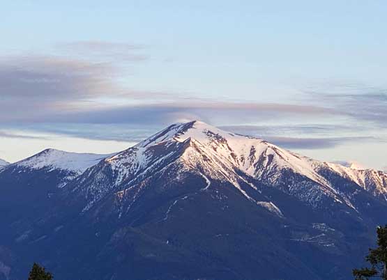
The massif of Stein Mountain
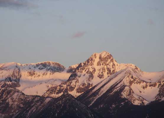
“Rahu Peak”

“Intlpam Peak”
Askom Mountain.
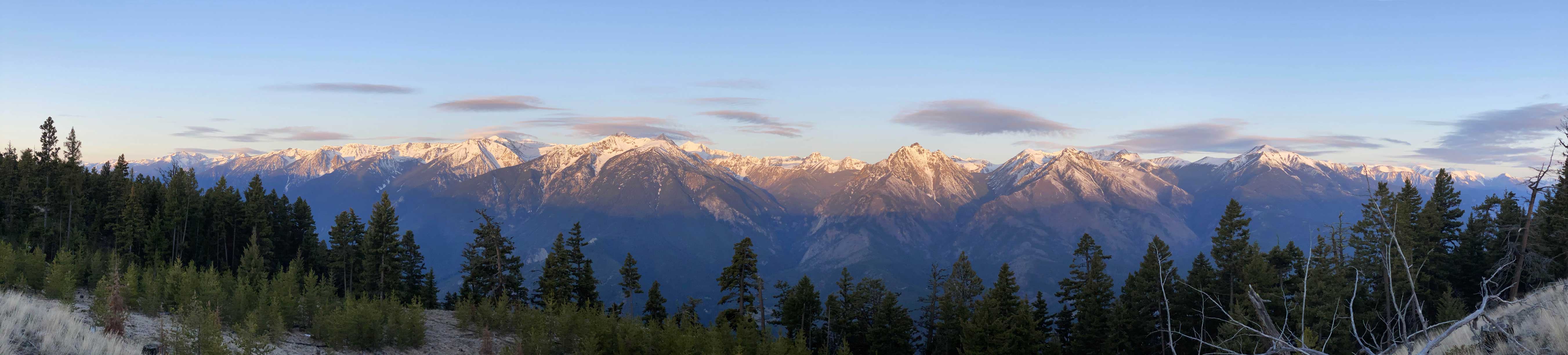
Panorama from the viewpoint in this clear cut. Click to view large size.

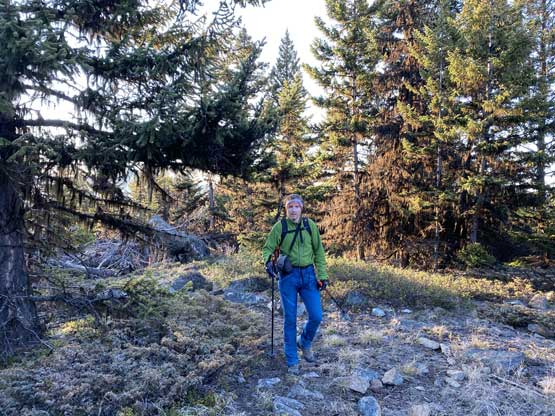
Me taking in the views. Photo by Alex R.
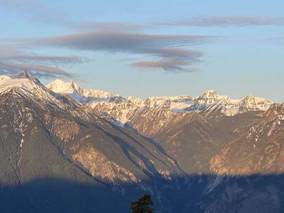
A wider view into Siwhe Creek with Siwhe and “Xavier” on the horizon
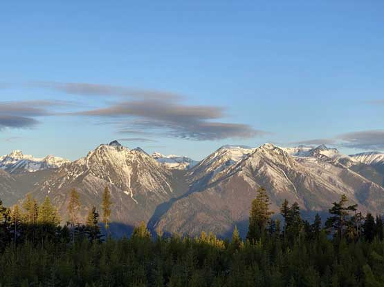
“Rahu Peak” and “Intlpam Peak”
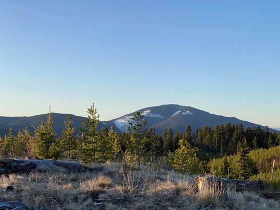
Looking south towards Botanie Mountain
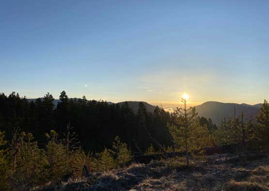
It’s sunrise time. The east side view wasn’t spectacular though.
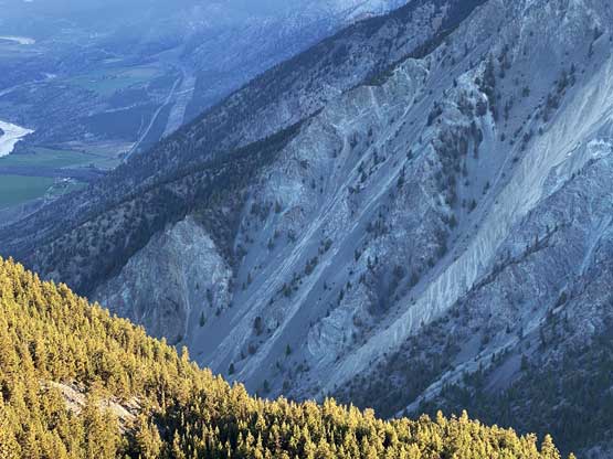
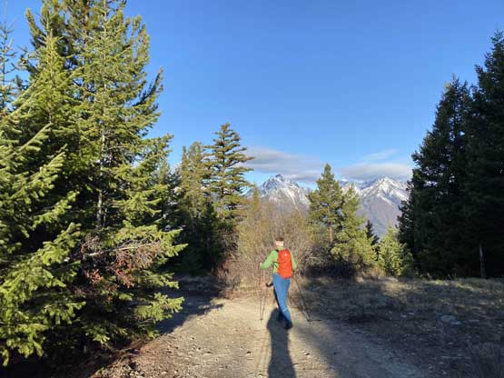
Once the peaks turned golden we resumed the bushwhack through some tight timbers into the mature forest. We were surprised to discover some dirt biking trails (with fresh tire tracks) but the trails didn’t go all the way to the summit. The last section had some unavoidable bushwhacking over dead-falls and the true summit was as expected, 100% forested with zero view. I did however, notice that on the Gaia map the northern flanks of Laluwissen Mtn. appeared pretty damn steep so opted to bushwhack north for another 5 minutes to the edge. That was quite a surprise as I honestly wasn’t expecting much. There came an incredible viewpoint with unobstructed views looking north up the Fraser Canyon towards Lillooet.

Me resuming the ascent. True summit ahead. Photo by Alex R.
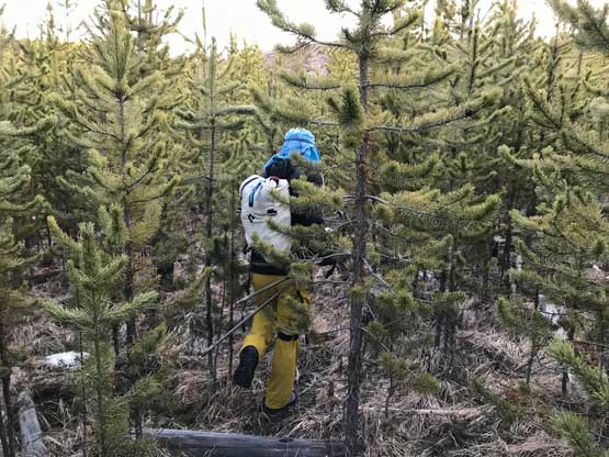
Annoying bushwhack through tight timbers. Photo by Alex R.
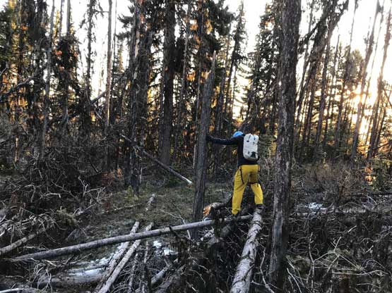
Me balancing over a dead fall field. Photo by Alex R.
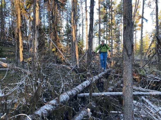
Alex balancing on the sticks.
Alex on the true summit of Laluwissen Mountain
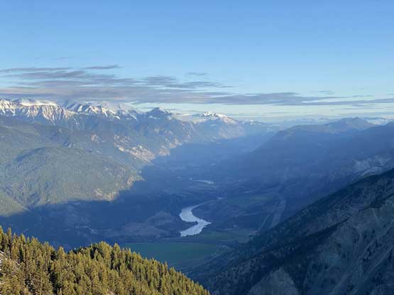
Looking north into Fraser Canyon.
The few minutes of bushwhacking surely paid off nicely.
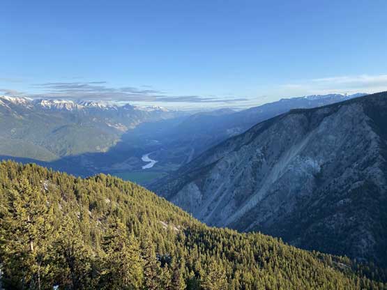
A wider view from this viewpoint north of the summit
Once having enough photos we leisurely reversed our tracks back to the cut block and then followed the dirt biking trails that skirted around the cut block to the road. The road walk was pretty boring and we made good time back to the vehicle. The higher peaks around us already started to have their cloud caps so we made pretty good use of this brief weather window in the morning.
Another photo of “Rahu Peak” across the Fraser Canyon
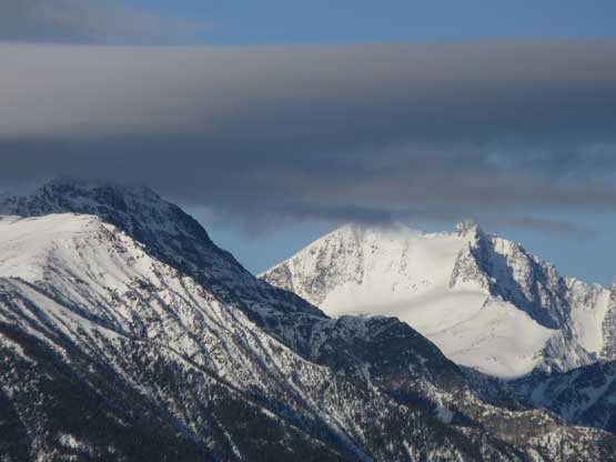
Another closer view of Siwhe Mountain
Alex plodding down the never-ending road…
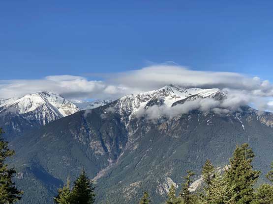
As you can see, the clouds were building up over taller summits
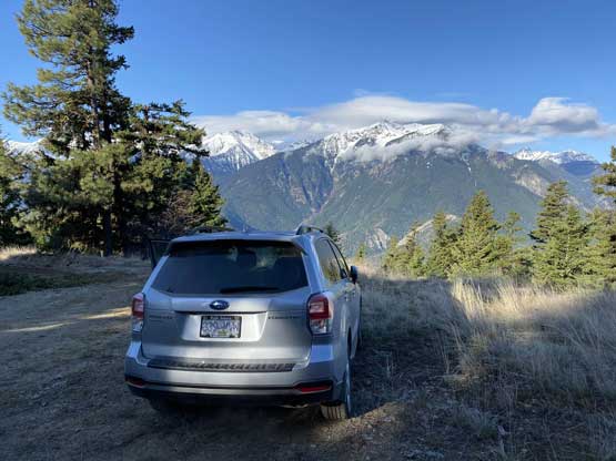
The Subaru made to 1150 m elevation and could even go higher
It was only 8 am when we finished the hike which meant I could get back home with more than 3 hours of spare before work. This seemed too luxurious for such a long drive so we talked about the second objective. There was nothing short around Lytton but we could attempt to drive up Mt. Oppenheimer just to the south of Yale.
