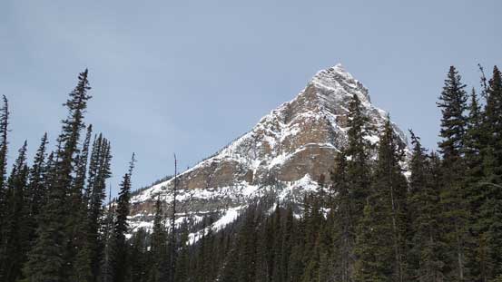
Little Temple
April 21, 2014
2660m
Lake Louise, AB
This past Easter long weekend was tricky. By the last minute I decided to catch up some sleep on Saturday and (hopefully) bag something on Monday, and at the mean time I’d keep my eyes closely on what other groups would do. Any newest trip report would be the first-hand condition update. Apparently it was too warm and condition was pretty rough for skiing. Eventually on Sunday afternoon, Vern and I finalized our objective on the “lowly” Little Temple. And it was funny. Apparently Raff, Andrea and Golden Scramblers were thinking the same thing… They ski’d it on the previous day in a white out and eliminated route-finding and trail-breaking for us.

Little Temple ski ascent route. GPX DL
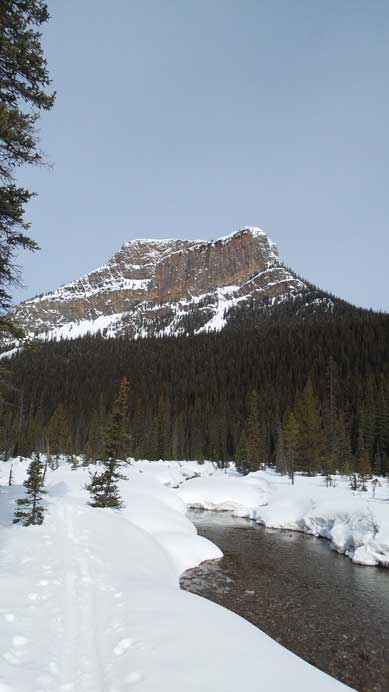
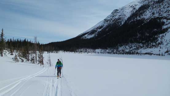
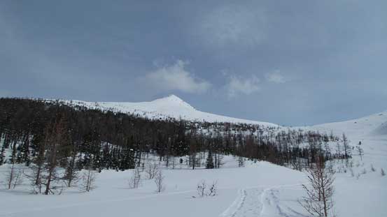
Speaking this objective, it’s not as “lowly” as expected. Yes it’s called a “Little” something but it’s daddy, Mt. Temple, is one of the biggest mountains in the Canadian Rockies. For the ski route via Lake Annette, the round trip distance would be 22 km and elevation gain was 1,100 m. It’s a solid day-trip objective. We didn’t start early since we didn’t realize it’s that long. The first section of the approach was skiing the (flat) Moraine Lake road till Paradise Valley turn-off. There’s an option to leave the road earlier on a cross country ski trail but we weren’t sure about that route so used the summer trail. The snowpack was very solid but apparently it’s gonna be a hot day ahead of us.
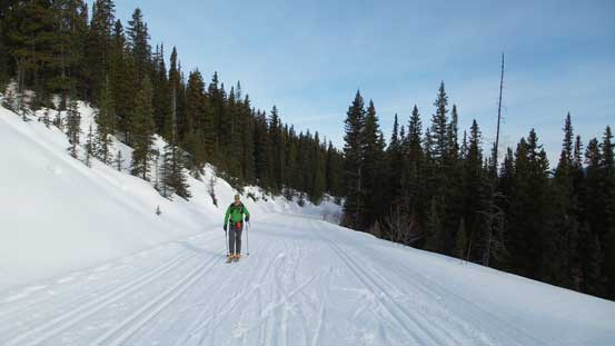
Vern skinning up Moraine Lake road
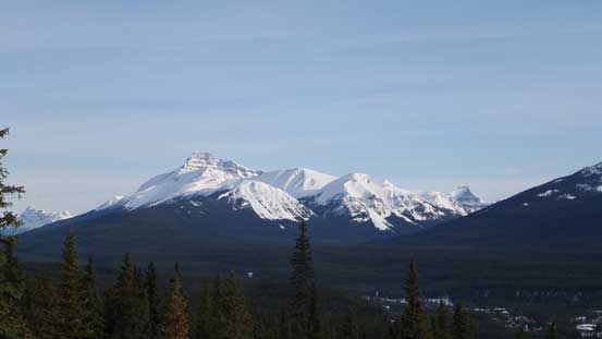
Mt. Hector was free of clouds at this point

Molar Mountain looks pretty striking
Whitehorn across Bow Valley
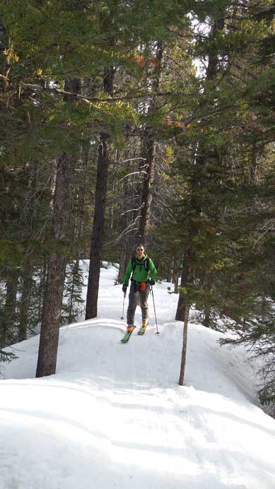
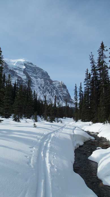
Skinning up the Paradise Valley trail
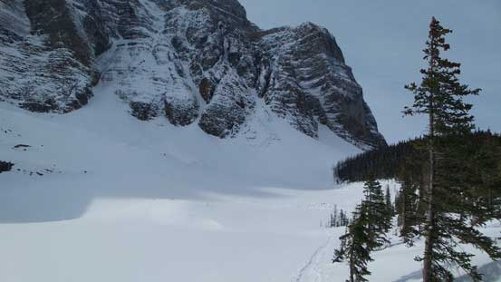
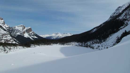
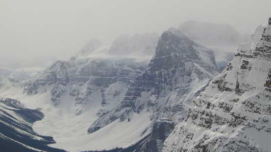
This (flat) valley would go on forever. I could imagine how sloggy this part would be if weather was bad. Thankfully for us, weather was much better than forecasted and we were treated with impressive vistas all around. Sheol Mountain looked pretty striking and Mt. Temple looked big. Well, it is pretty big… Further in the valley we managed to pick up Golden Scrambler’s ski tracks. The tracks crossed Paradise Creek for quite a few times on (solid) snow bridges and eventually led us to the outflow stream of Lake Annette. Swinging leftwards, the trail got steeper and steeper and the trickiest part came at just before topping out on Lake Annette, where it became pretty icy. The Lake offered some fresh scenery. It’s a beautiful area.

Sheol Mountain and its reflection on Paradise Creek
Saddle Mountain also looks pretty impressive from this side
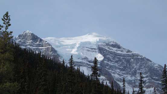
The glaciated Mt. Temple
Sheol Mountain
Impressive vistas all around. It’s indeed a “Paradise” valley.
Arriving at Lake Annette now
Skinning around Lake Annette
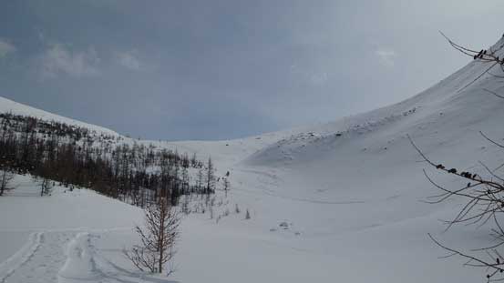
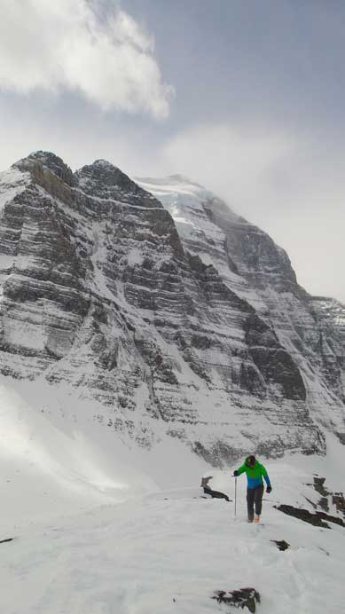
The next part would be grinding up a foreshortened gully. It’s not as steep as it looked but a lot longer than expected. And once exiting this gully we noticed another (steeper) gully ahead. This area was definitely steep enough to slide and also subjected to cornice/serac fail high on Mt. Temple’s north face. We moved through quickly and then ascended the steepest slope following the uptracks. The uptracks were a bit too far climber’s left and traversed some of the steepest slopes possible, oh well… Upon reaching the upper basin we could finally see the (distant) summit.
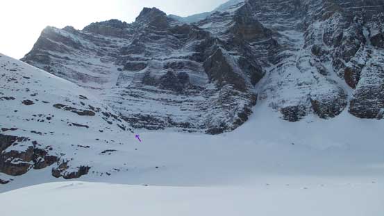
The purple arrow shows where we were aiming at
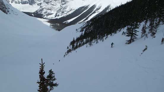
Looking back down at Lake Annette
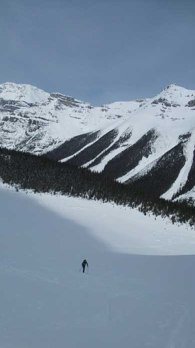
Skinning up this foreshortened gully

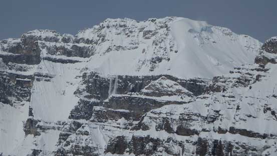
Seracs high on Mount Temple
Avalanche coming off the south slopes on Mt. Lefroy

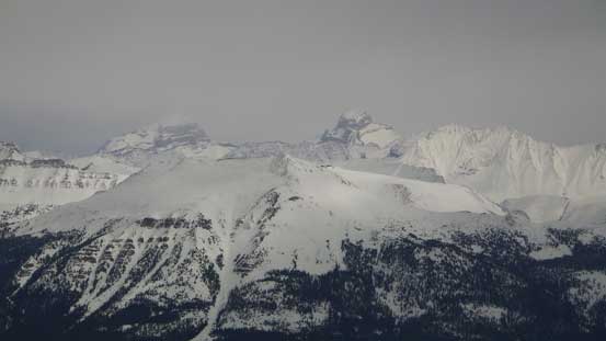
Exiting the first gully. Aberdeen and Haddo behind
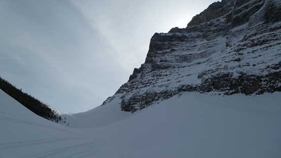
Looking ahead towards the second gully (steepest)
Grinding up the big terrain on this gully

It’s steep…
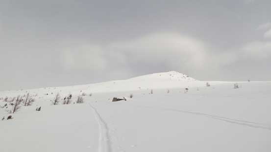
Upon reaching the upper draw, looking ahead towards the summit
We’d aiming towards this col first
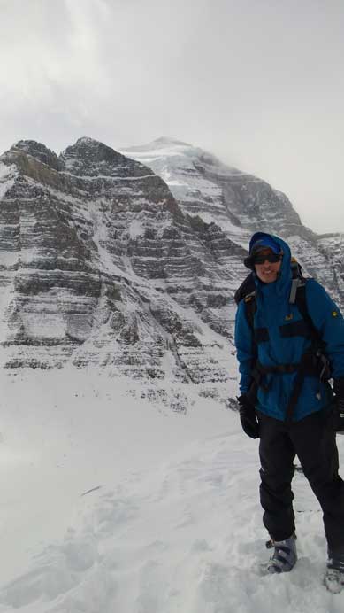
Once nearing the entrance of Aemmer Couloir we veered left following the uptracks diagonally traversing the upper slope towards the left hand side skyline ridge. We kept skis on for as far as we could and eventually ditched them once the ridge got rockier. There was still a fair amount of boot packing to do after that. By this time the weather had eventually moved in and we lost most of the blue sky. Wind also picked up so we didn’t stay long on the summit but immediately started the descent.
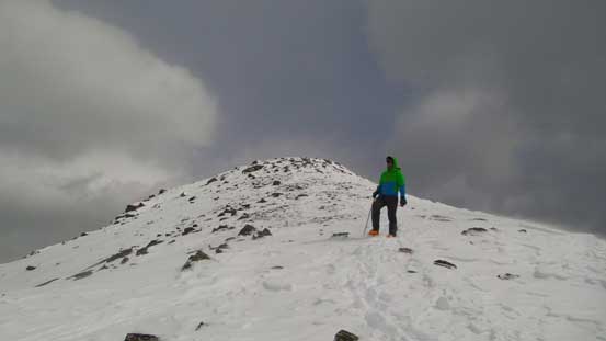
The summit ahead
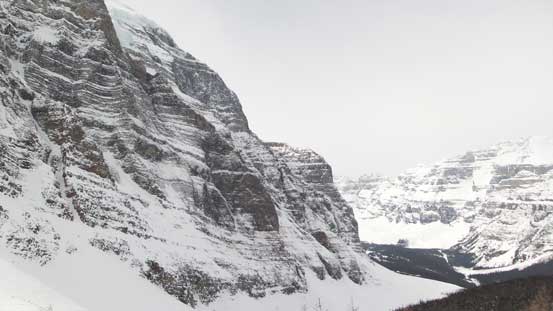
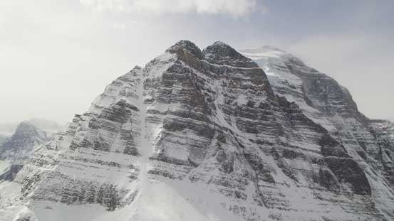
Impressive North Face of Temple
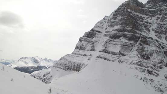
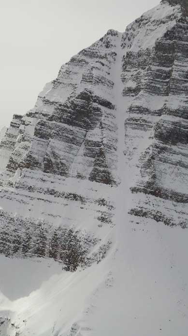
Aemmer Couloir started to show up. What a line that is…

Panorama Ridge is a scenic scramble
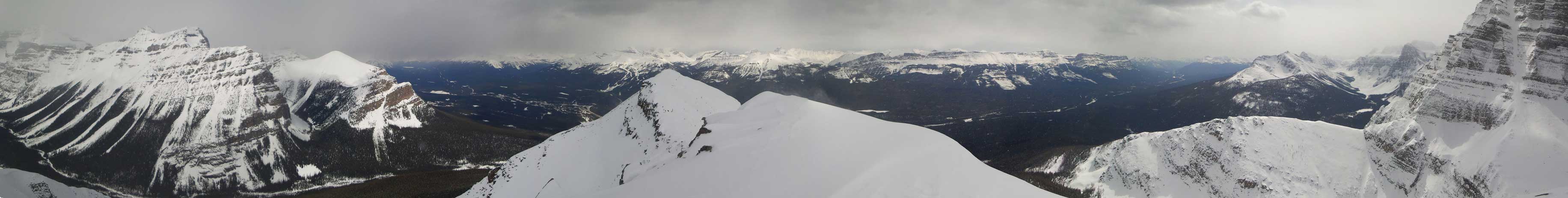
Summit Panorama. Click to view large size.
Mt. Temple

Hungabee Mountain in the distance
I’d be very happy if I can just climb this couloir… Skiing it? Oh man…
Mt. Babel is surely a good looking objective.

Castle Mountain
Giants behind Skoki – Douglas and St. Bride
Fairview Mountain got some sunshine. Note the clouds in the background.
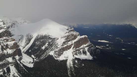
The next summit is lower and getting their requires difficult down-climb.
Vern approaching the summit
Me on the summit
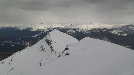
Descending the summit ridge.
Probably because of the increasing cloudiness, the snow quality was better than expected on the descent. Vern was a much better skier so he cruised down far ahead. I ski’d down slowly and awkwardly but managed not to take even one fall. The steepest slope was challenging due to the flat light condition but manageable by doing some kick-turns. By the time we finally reached Lake Annette my legs were pretty burned out. After a short break we continued skiing down the icy and steep trail. Once down to the valley bottom the downhill was over and the rest was a pure slog back. I think my cross-country skill is slowly improving since I managed not to fall far behind. But on the other hand, because I was busy keeping up with Vern, I didn’t take any photo on the way back.
Overall the trip turned out to be better, but also more involved than expected. Our round trip time was 6 hours 20 minutes. And I’d recommend this objective as a ski ascent when avalanche condition is favourable.
