Modal Peak
October 18, 2015
2608m
Downton Creek / Duffey Lake Road, BC
Modal Peak is a small, but interesting objective by Downton Creek drainage near Lillooet on the Duffey Lake Road. It’s rather one of the far eastern extensions of the much-bigger Mt. Seton and for obvious reasons my primary objective in this trip was Mt. Seton itself. I had time to explore around so went traversing eastwards along the ridge. After ascending up and over Saddlebag Peak it’s time to investigate the scramble route of Modal Peak. Before this trip I did some quick Google search but couldn’t find much information about it. From Google Earth and the topo maps it appeared to be a straightforward ridge-walk but what I didn’t know was that there’s a sting in the tail…
Mt. Seton, Saddlebag Peak, Modal Peak traverse. GPX DL
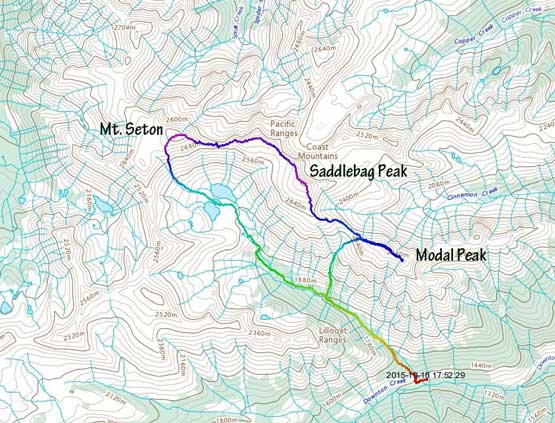
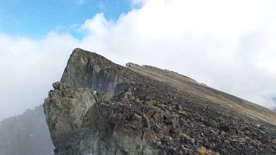
From Saddlebag/Modal col I quickly made my way up the broad ridge. The weather was finally clearing up to be “a mix of sun and clouds” as forecasted and I got to see some cool clouds scenery. Looking back Saddlebag Peak appeared fairly impressive. I think that peak deserves an official name at some point as it’s also the second highest peak in Cayoosh Range… Upwards along the ridge I soon made to the “summit” of Modal Peak but soon realized there’s a higher and distinct pinnacle at another hundred meters or so further down the ridge. That’s gotta be the true summit then so I didn’t really have a choice but to investigate the route to get there. I have to say it did not look very inviting at the start… The terrain between myself and the true summit was those broken towers and the rocks were horribly loose.
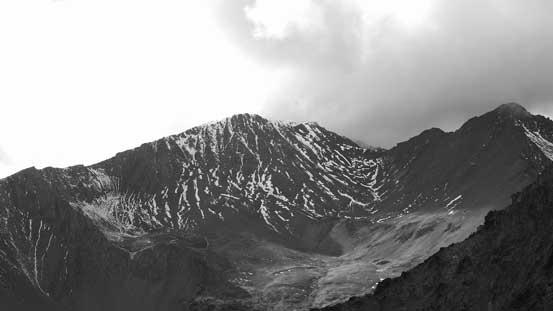
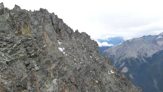
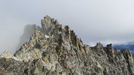
This is Modal Peak seen from partway down Seton E2
Cool clouds scenery
Looking back along the ridge

Clouds lifted up a bit and I got to see Seton E2
Skimka Peak (center) and Trilateral Peak (R)
Seton E2 and the connecting ridge that I traversed
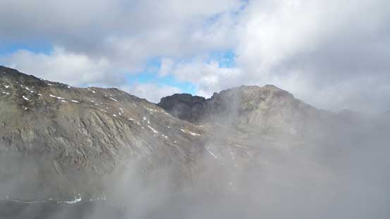
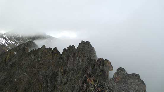
Peaks through the mist
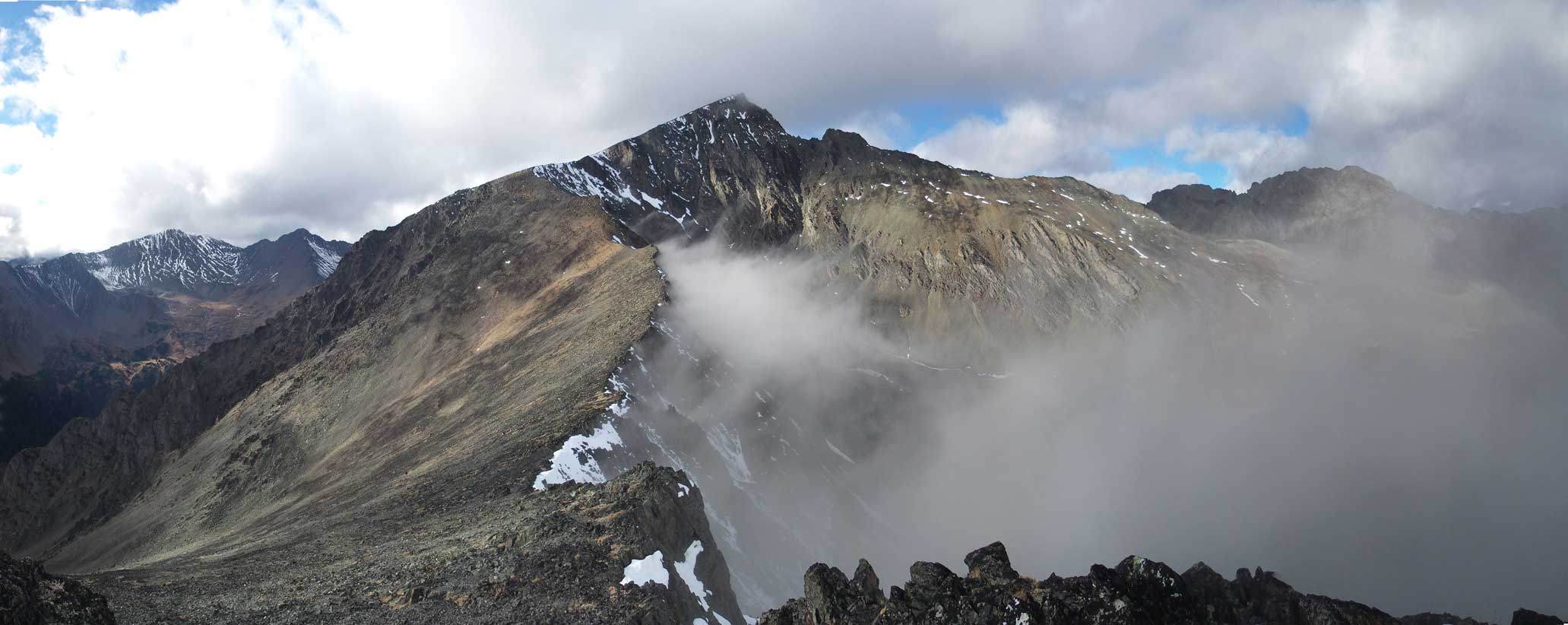
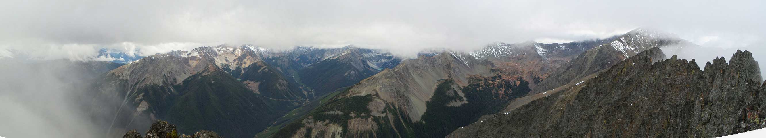
My favourate panorama from this trip. Click to view large size.
Upwards along the ridge

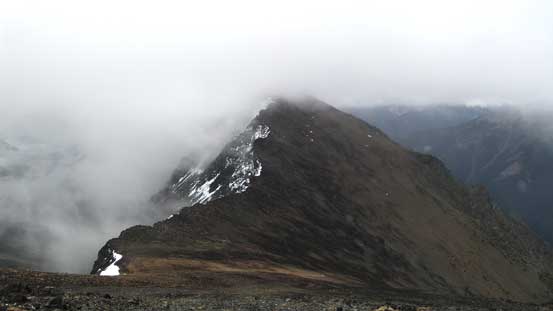
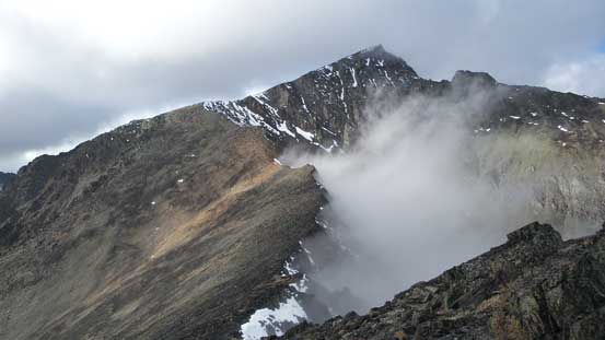
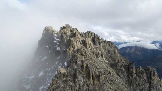
Almost there? Or not…

Oops… It’s obvious there’s a true summit ahead….
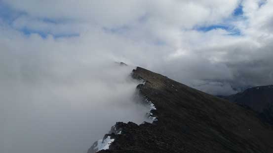
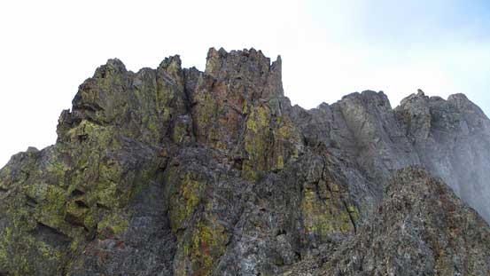
Immediately after the false summit was a shear drop-off with moderate exposure. Upon close inspection I decided to down-climb right at the nose as there appeared to be a few ledges if I trended slightly to the down-climber’s left. It worked out reasonably well for me but there were a few tricky moves involved on questionable holds. The texture of the rocks reminded me the chossy Rockies but the good thing for me was that I’ve been much more used to face-climbing on those loose crap (versus the slab/crack climbing on granite)… After this bit of excitement I went down-climber’s right (south) traversing on some ledges between loose gullies to bypass a few towers and eventually made to the base of the final summit block. Like I mentioned earlier I did not have any information about this ascent so I basically picked my own way by spontaneous decisions. I picked a line further on climber’s right and after traversing around another corner I got to see a steep chimney ahead. I ditched my poles and committed to the ascent. I probably will say it’s 4th class and the rocks were super loose that even some bigger blocks could easily wobble… There was no summit cairn on the top. I didn’t bother to build one neither as I had to immediately focus on getting down this thing. Looking around there might be an easier route had I stayed closer to the connecting ridge, but the chimney was fine for me and I’d rather descend the route I’d already known.
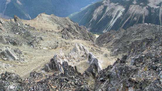
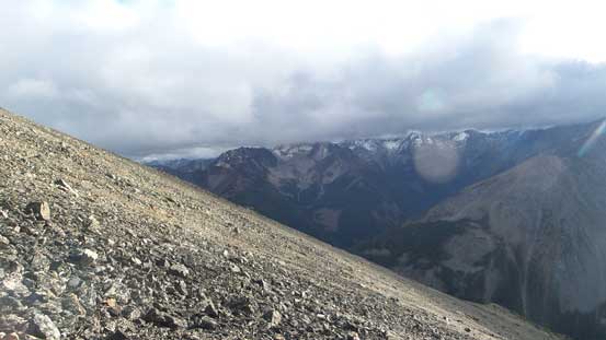
Looking down the scree bowl to the south. That’s not where I’d descend…
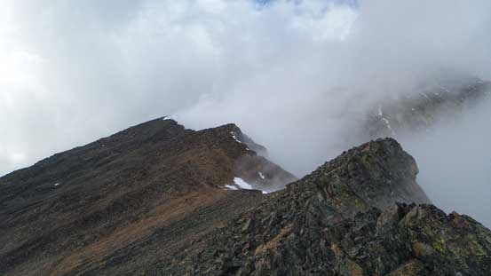
Another look at the true summit towers

Here’s that down-climb right at the start
Looking back at this down-climb

Oh the loose gullies that I had to traverse across or ascend/descend
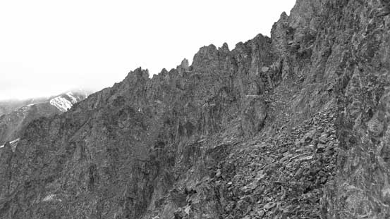
Lots of route-finding

Looking down at the crux chimney that I just climbed up
On the summit, looking back along the connecting ridge.

Me on the true summit of Modal Peak
Summit Panorama. Click to view large size.
Down-climbing the summit block I had to pay some extra caution. I did dislodge a few blocks and move around at least one microwave by stepping on some wrong places. But it all went relatively smoothly, and then I traversed back across those gullies and ledges, then it’s the up-climb back to the false summit. It looked fairly imposing from below, but oh well… I didn’t have problem down-climbing it so how bad the up-climb could be…

A review shot of the chimney that I climbed
Traversing across on loose ledges
One last look at the true summit before climbing back up to the false one
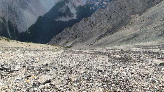
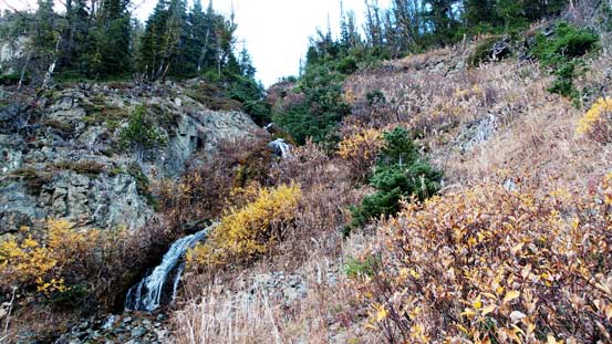
Back to the false summit I made the call to short-cut my descent by a steep gully that I observed earlier in the day. It was quite a gamble since I did not have any information about that, nor did I have a full view of it during the day. But I figured it could potentially shave 2 hours off my day (the other choice would be reascending back to Seton E2 and descend to the lakes from Seton/Seton E2 col). Down I went there was some good scree skiing for a while and then it’s the talus field. More scree lower down and I could see the slope angle started to get steeper and steeper and the broad bowl I just descended through started to funnel into a tight gully. I was quite nervous at this point but looking over the edge what I saw was nothing but easy ground. I stayed skier’s left of the fall line and even the bushwhacking was very minimal. The descent pace was even faster than I was expecting and it felt pretty short to get back into the valley, crossed the creek and onto the trail. For those wishing to ascend Modal Peak itself this gully is definitely the way to go. The final 2 km walk back to the logging road was uneventful and my round trip time was 10 hours.
One last look at Seton E2

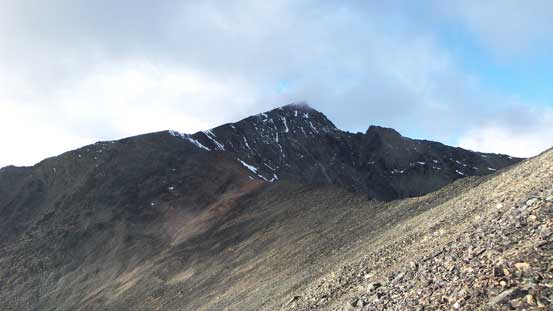
The slope on Modal Peak
Not just the rock quality, the scenery here also felt like the Rockies
Down into the bowl

Looking back up this bowl

It’s a very foreshortened bowl
Into the gully, nothing tricky
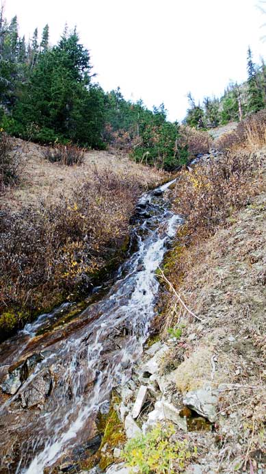
Neat waterfalls
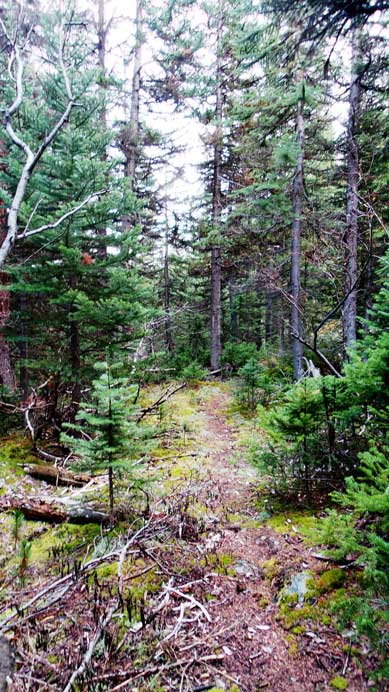
Back onto the trail

Gorgeous evening colours
Overall this was a great trip to bag 3 not-so-often-ascended peaks. The weather, however, was very disappointing but as soon as I decided to ascend into the alpine with the forecast of “a mix of sun and clouds, 30-40% of precipitation” I should not be surprised by weather like this… And then it’s the exhausting drive back home. I think it took me 4.5 hours from where I parked with only 1 stop along the way (at Pemberton)…
