Pico de Orizaba
December 28-29, 2018
5636m
Puebla/Veracruz States, Mexico
At over 18,000 feet the stratovolcano of Pico de Orizaba (Citlaltepetl) is the highest in Mexico, the 3rd highest in North America after Denali and Mt. Logan, and the 7th most prominent in the world making it one of the grandest summits on the continent. However, from climbing perspective this is considered as an introductory level high-altitude climb that boasts very little technical or logistical challenge. The weather is often stable in the dry season – December to March. The standard route up Jampa Glacier is a mere plod on a 35-degree glacier, and although icy at times, minimal mountaineering experience is required. For those without high altitude climbing experience this peak should still be treated seriously. I’ve heard the success rate at around 50% and most turned around running out of gas due to the lack of proper acclimation. I had wanted to climb Pico de Orizaba for at least a few years but the trigger wasn’t pulled until the end of 2018. About two months before the trip Lily Q. made the suggestion and I agreed without much of hesitation. I was too busy with work to think about the mountains and I figured since I was no longer a poor student anymore it made perfect sense to pay my cash and climb something international.
Kilimanjaro and Pico de Orizaba were the two easy 5000+ meter summits that I immediately considered but between the two I opted for the cheaper, and yet more challenging Pico de Orizaba. In terms of the logistics we would not use any of the guiding company’s services and instead, we would figure everything out on our own starting from Mexico City airport, except for taking the 4×4 truck services offered by OMG (Orizaba Mountain Guides) hostel. The cheapest airline tickets were between Dec. 25 and Jan. 4th giving us 9 full days in Mexico. To make the most use of this trip several other volcanoes were also planned. Earlier in this trip we had hiked up Cerro del Cuatlapanga on Day 1 and then Volcan La Malinche on Day 2 for the purpose of acclimation. On the evening of Day 2 we drove to OMG and crushed in the hostel. Because this was a Friday we were the only climbers staying that night (very surprising).
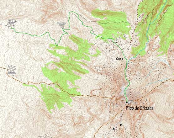
Pico de Orizaba via Jampa Glacier. GPX DL
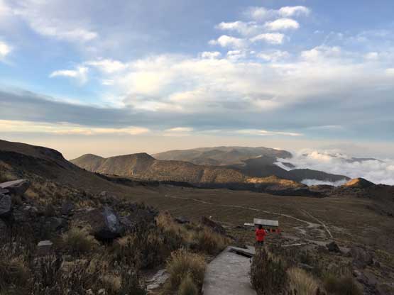
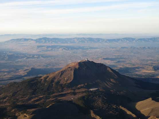
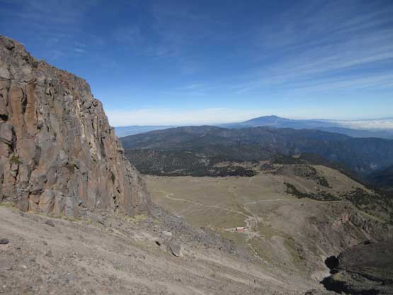
On the morning of Day 3 we woke up at around 8 am and had some nice breakfast given by the hostel. This was my first time in the trip eating real Mexican food and I really liked it. By around 10 am the truck showed up and we took the first ferry ride. From OMG at Zoapan to the basecamp at Orizaba’s north (standard) route the truck would gain around 1200 m elevation over ~10 km. This stretch of road is arguably the worst I’ve ever ridden. One needs a lifted 4×4, experience with off-roading, excellent local knowledge and the willingness to destroy your vehicle in order to tackle the drive. Therefore I suggest taking the 4×4 services no matter what type of rental vehicle one has. We opted to stay in the basecamp of OMG instead of Piedra Grande Hut. This was not as expected and an additional 80 m elevation gain had to be made on our summit day, but the basecamp area is much quieter than the hut overall.
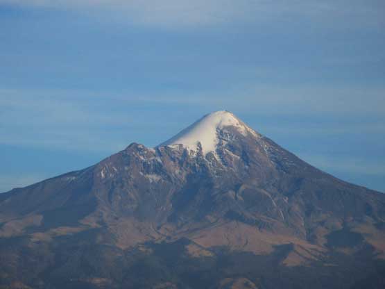
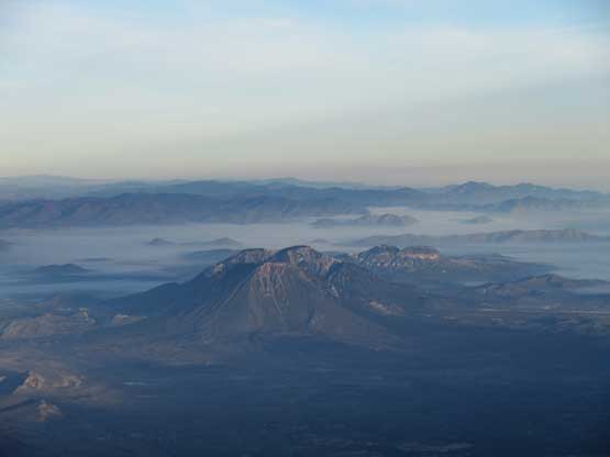
Pico de Orizaba from our drive towards Tlachichuca
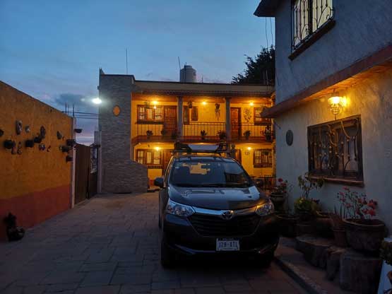
Arriving at OMG at dusk. It was very empty to our surprise. Photo by Lily Q.
Me and the truck. Photo by Lily Q.

A zoomed-in shot of Jampa Glacier from the 4×4 ride.
We arrived at the basecamp at just past noon and despite the previous two days’ acclimation I could definitely feel the thin air at 4120 m elevation. I felt very sleepy probably because of the combined effect of altitude and the lack of rest in the past several days. I lied on the sleeping pad for at least two hours but resisted the temptation to fall asleep. By around 4 pm we got out of the tent and decided to hike 300 m up the route to check things out, to kill time and to further acclimate. We went to as far as 4500 m elevation and enjoyed a neat sunset on our way back to camp. My appetite was normal despite what’s warned by others, but unfortunately sleep did not come easily at night. The alarm was set at 11:30 pm and I got zero minute of sleep. At around 10:30 pm I was so frustrated that decided to kill the remaining 1 hour by listening to music. Lily did manage to get at least two hours of sleep.
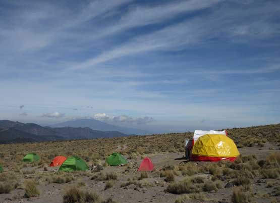
This is the OMG’s basecamp that we would stay for one night
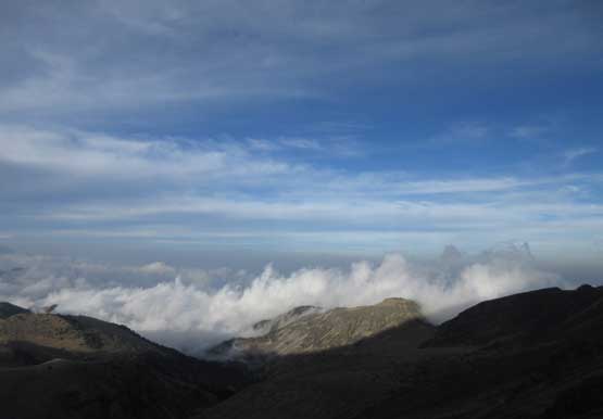
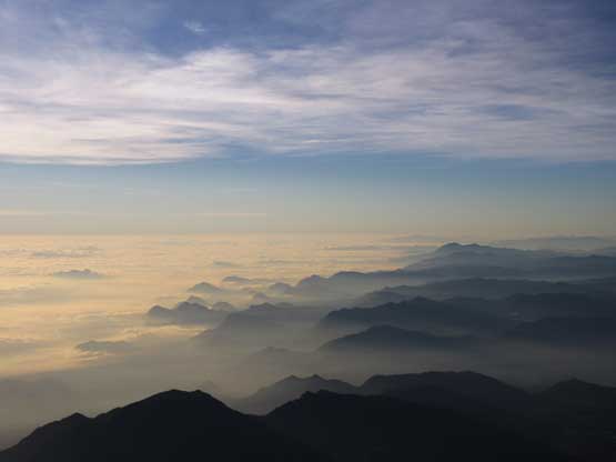
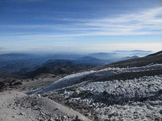
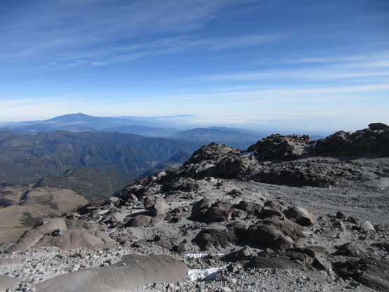
A sea of low clouds in the state of Veracruz to the east
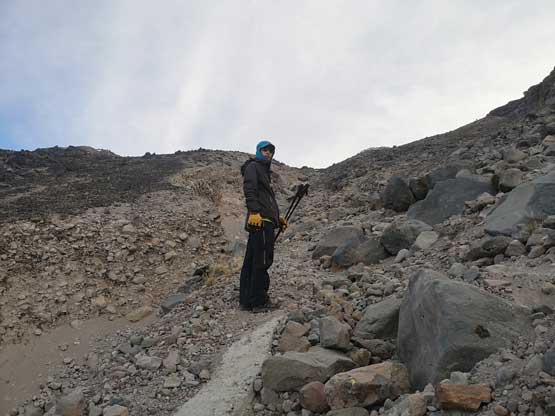
Me scouting out the lower route. Photo by Lily Q.
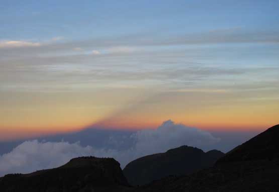
The shadow of Pico de Orizaba during sunset.
Hiking back to camp after scouting the lower 300 m of the route.
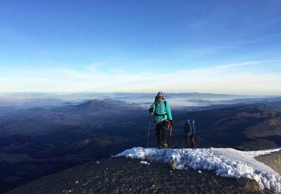
The morning routine took a whole lot longer than my expectation we did manage to get going before 1 am, and this was as expected. There were several guided groups leaving shortly behind us but overall it seemed like everyone’s on the same page at the start – a line of headlamps marching up the access trail at 1 am, as typical as a volcano climb goes. Despite the sleepless night I felt surprisingly strong and with a previously-agreed slow ass pace I was doing great with the altitude. Lily wasn’t so lucky and started to develop symptoms of altitude sickness including puking and her pace was extremely slow, to the point that everybody passed us within an hour after leaving. At this point, far below “the labyrinth” we became the last persons in the Conga line, slowly marching up falling behind the crowds. The route travels up a valley feature paralleling some cliffs to our right. The grade had been relentlessly steep for a long while, but eased off at elevation of ~4500-4600 m. At the entrance of “labyrinth” we caught up with the slower guided group donning crampons. There was no snow to be seen but we opted to trust the guides, donning crampons as well. Because of our slow pace I made the call to pass them and start our own route-finding into the unknown following the downloaded GPS track traversing far out climber’s left aiming for the lowest angled terrain. It was soon clear that the guides weren’t following the route we took and instead, they stayed on climber’s right ascending some icy chutes. I trusted my own research so we ignored what they were doing. For a while Lily’s performance had improved.
The route we took still involved a lot of travelling on ice but nothing’s steep nor sustained enough to warrant the use of ice axe. We kept zig-zagging among short cliff-bands and the GPS track I discovered online (from peakbagger.com) was bang on. However, Lily’s performance downgraded drastically as we entered the elevation zone of 4800 m, to the point that she had to rest for half a minute for every 5 steps forward… This was clearly not right but she showed no further symptom of altitude sickness such as headache or more puking. I was moving literally below half the pace of what I would do if climbing solo. I had no idea whether this was due to the altitude, or the lack of fitness. I did some rough calculation and based on our current pace I figured our chance of summitting would be 50%, if not less. I gave her three choices – turning around, waiting at above the labyrinth, or climbing on her own pace, and she picked the 3rd option.. I do not remember I was ever so angry and frustrated while climbing a mountain, but at this point I was at least relieved to be able to climb at a pace I was comfortable with, even though I knew this wasn’t the safest decision.. I started to pick my pace up albeit still far below my “normal pace” at sea level, and got the rhythm going. In about 20 minutes I caught up, and passed the slower guided group, and another half an hour later I reached the base of Jampa Glacier. A line of headlamps were making their zig-zags ahead, but I had to stop and take a much-needed food break at this convenient spot. Meanwhile I finally took my ice axe out and ditched a trekking pole.
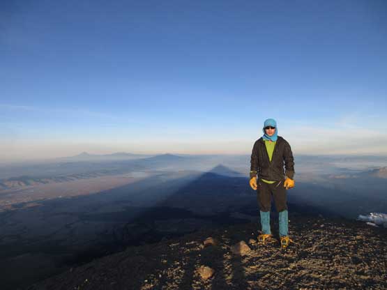
About 15 minutes of resting later saw me starting up the glacier. It’s much tamer than appeared at a distance, and my guesstimate was 20 degrees maximum at the lower reach. I regretted not taking the other trekking pole with me because the angle was too flat to use an ice axe for balance.. I somehow missed the boot path that the guides had set, but at this point who needs a path?! For some reason I was still not affected by the altitude and I started to hike faster and faster. The sky was getting brighter and the line of climbers was getting closer and closer. The grade of the slope finally steepened up at elevation of 5300m ish. I think the steepest stretch would be 35-40 degrees and the snow surface was quite icy, but with the boot paths the “climbing” was still very easy. I caught up with the first (big) party’s members and passed them one by one. All of them were short-roping. By the time I reached 5500 m elevation there were only two rope teams ahead of us, and meanwhile the sun rose from the other side of Pico de Orizaba creating its iconic shadow on the north-western horizon. It’s a spectacular moment that I would never forget.
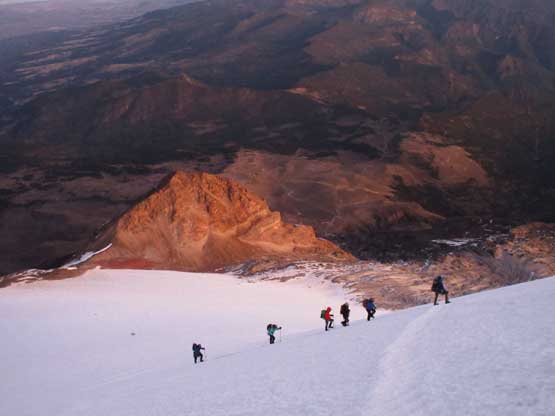
After a long haul I had past most of the climbers ahead by daybreak.
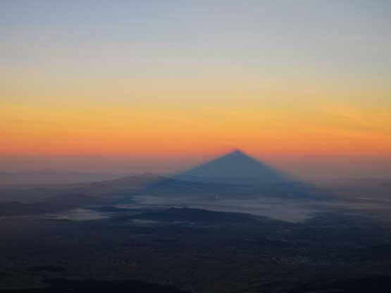
This is the iconic morning shadow of Pico de Orizaba.
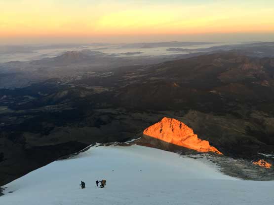
Looking down at the climbers struggling in the thin air.
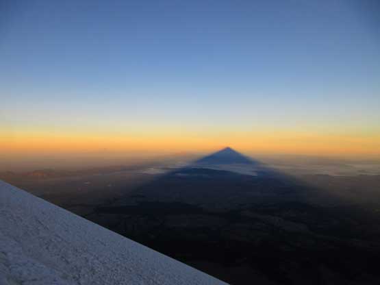
Another photo of Pico de Orizaba’s shadow. This was very spectacular.
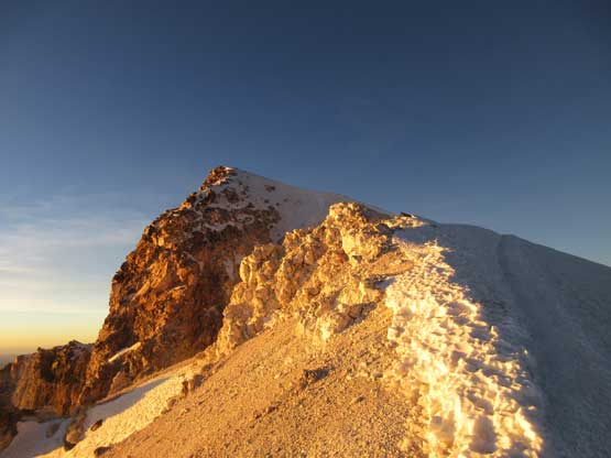
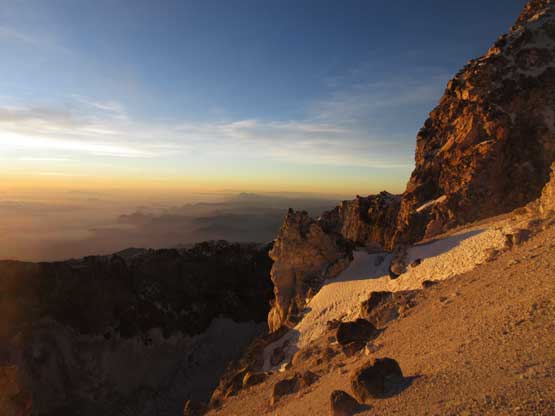
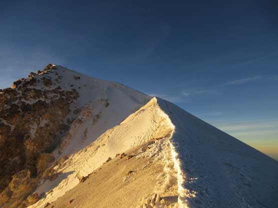
Upwards and onward I still felt uber strong despite the thinning air. I crested the crater rim shortly past 7 am and another 15 minutes of scenic ridge traversing brought me to the summit of the 3rd highest peak in North America. I was joined by the two rope teams celebrating their successes, and within 15 minutes the other members of the first group all showed up. The view was much better than I thought with the most spectacular scene looking into the bottomless crater. To the east was the state of Veracruz and a sea of clouds covering the Atlantic Ocean, more than 5500 vertical meters below. I stayed for about half an hour on the summit before the coldness forced me to retreat.
Cresting the rim of the crater was another spectacular moment
Looking south across the crater at 7 am was amazing.
About 10 meters up the crater rim I got to ascend a narrow arete
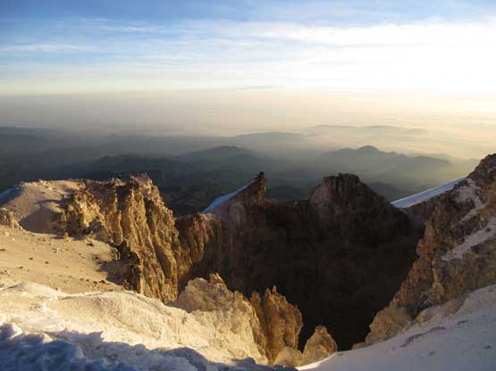
Looking into the crater from partway up the arete.

Looking back along the rim that I just traversed. There’s still a bit of ways to go..
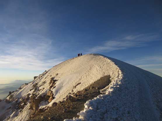
After a while of horizontal traverse the true summit was finally in sight.
Me on the summit of Pico de Orizaba – 3rd highest in North America!!
Another photo of me wondering on the summit of Pico de Orizaba

Partial Summit Panorama from Pico de Orizaba. Click to view large size.
Sierra Negra is rather a satellite peak of Orizaba
The terrain to the south was far below and covered in low clouds
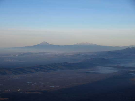
Popocatepetl and Iztaccihuatl dominating the western skyline
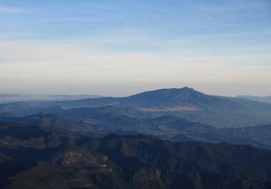
Cofre de Perote is another tall peak in central Mexico
These are some smaller peaks looking north. Too lazy to figure out their names.
Another photo of Sierra Negra

The Sun rose higher and I took another photo looking into the crater
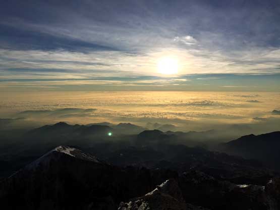
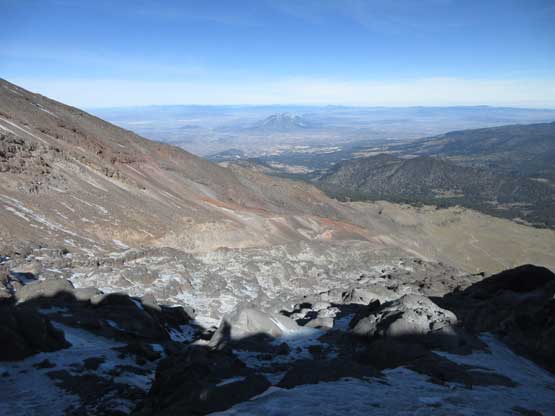
Another photo of the sea of low clouds in the state of Veracruz
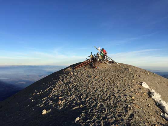
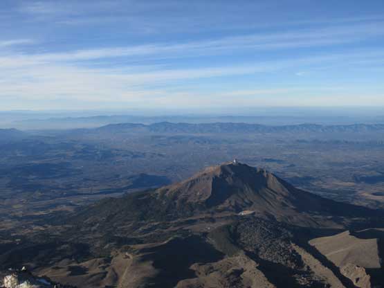
The summit of Pico de Orizaba
The two Californians approaching the summit enjoying their success
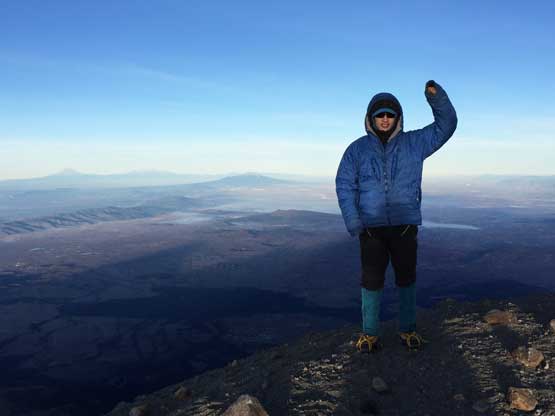
One last photo of me on the summit. Note I had already donned the parka.
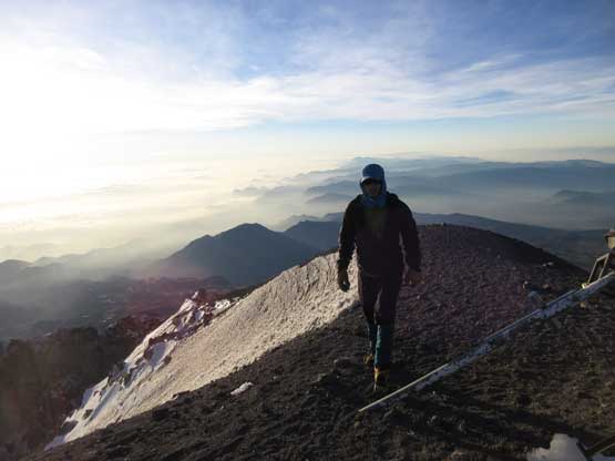
Despite the slow pace on the first half of the climb my camp-to-summit time was just over 7 hours. Pretty sure I could have done it easily in under 6 hours if soloing the whole thing but nonetheless I was satisfied about my physical performance at this altitude, especially this was only the 4th day after leaving sea level. I carefully reversed the scenic crater rim traverse back to the point to drop back onto Jampa Glacier. I was surprised to see Lily still going up, as the last person in the gang far below the rim. Apparently she was doing OK with the altitude otherwise she wouldn’t have made this far, but by guesstimate she probably still needed another 2-3 hours. There’s no point in waiting at the crater rim so I went down. I easily descended the steepest section using the guides’ foot paths and rejoined Lily at below 5400 m altitude. I tried to convince her to turn around but opted to give her own right to make a decision because I could sense how badly she wanted this summit had she pushed this far with her poor physical conditions. After a bit of discussion she resumed on, and we agreed to meet back at the camp so that I would minimize my exposure to the higher altitude. I continued descending the lower half of Jampa Glacier back to where I ditched the trekking pole. I looked back to see Lily still going up, slowly but steadily, so turned downhill and resumed my own descent.

Back down to where the route joins the crater rim

This is a zoomed-in view of the route. If you look closely you can see the access road

Other climbers were still on their way up.

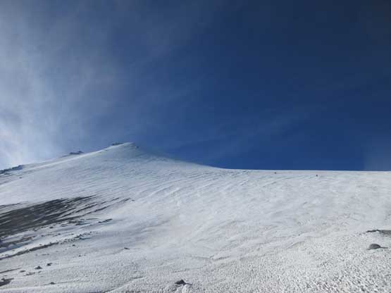
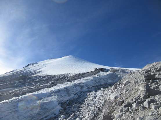
The boot path and the steepening Jampa Glacier – 35-40 degrees at the max.

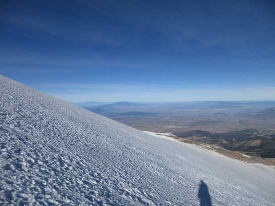
My shadow on the glacier. I on purposely took my time descending
Another photo of Jampa Glacier in the sunshine
Off the glacier now, looking back. The route is super foreshortening.
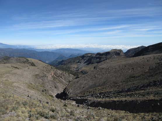
Too lazy to remove my crampons I simply hiked down the sandy path below Jampa Glacier towards the top of labyrinth. For some reasons I felt this section more confusing in daylight than at night and I even made a few minor route-finding errors and ended up having to back-track. Once entering the labyrinth I retraced the route I took earlier in the morning following the GPS track. At the exit point I removed the crampons and took another long food break. I started to feel a little bit affected by the altitude so didn’t linger any longer than necessary. The rest of the descent back to camp was uneventful but went on and on and on. I got back to camp before noon and immediately went into my sleeping bag. I think I slept for at least 1-2 hours but once awake I was hit by a light headache. I tried to breathe for as hard as I could but the headache was still there, but I was fine. At around 2:30 pm Lily showed up, much faster than I thought. It turned out that she had descended together with the slower group of guided climbers. All good now. Our truck showed up shortly after and we had to scramble to get things all packed. We did manage to squeeze all the gears (and ourselves) into the truck, and another 1.5 hours of bumpy ride later we arrived back in OMG hostel.
The broken lower terminus of Jampa Glacier
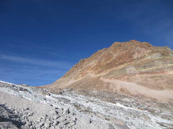
This is a rather impressive sub-summit to the north of Jampa Glacier
Looking back at the glacier cap
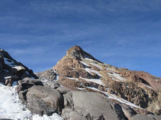
Another look at the sub-summit that doesn’t have a name
After a while I reached the flats above “the labyrinth”
Starting down “the labyrinth” following closely my GPS track
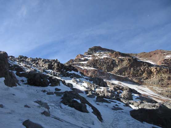
This is the typical terrain in “the labyrinth” – minor cliffs and icy conditions
Off the labyrinth now and entering the “valley” at 4600 m level
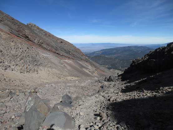
This is the last 300 vertical meters of descent
A view of the typical volcanic scenery around Orizaba’s basecamp.
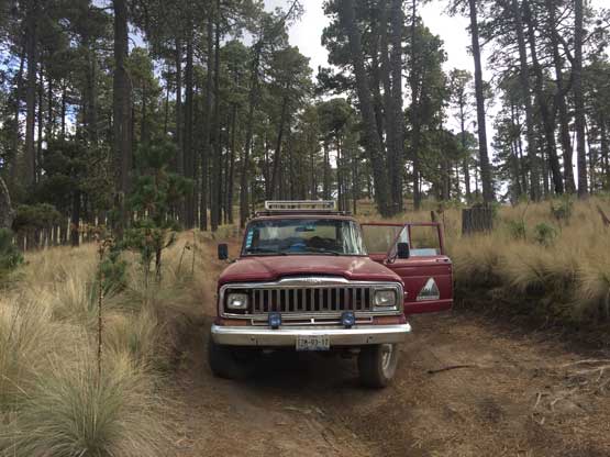
The truck that got us back down to OMG in Zoapan. This road is terrible..
Both of us were exhausted so we again went to sleeping mode immediately. The time was lost, but at around dinner time we did manage to drag ourselves out to have some Mexican food. That night I had concerns about my headache but with descending back to 3000 m altitude my symptoms were all gone by the evening. I was surprised that Lily didn’t even develop a slight headache and she actually did pretty well once above 5000 m. I had no idea what actually happened to her in the morning, but I think it must be the combination of the heavy pack, the fact we had very little sleep, the altitude and the general lack of fitness (compared with me) that took the toll on her performance. This was both her and my first high altitude climb so I really cannot comment much, but to me the result is the most important. We both got the summit and descended safely and sometimes that’s more than enough.
For those interested in this climb I would suggest not making the summit push on Day 4 if coming from sea level. From my past experience on Rainier, Shasta, Whitney and Fairweather I could tell that the way I performed at altitude is definitely not representative of the average. I can assure you that Lily is definitely not “weak” (otherwise I wouldn’t have climbed with her at the first place) and the way she struggled suggested that one probably wants a few more days’ acclimation before tackling this beast. The way she performed was “below average” if comparing with the crowds on this particular day, but being able to finish the round-trip in under 14 hours was statistically very acceptable. It’s just that the whole gang on this day was doing exceptionally well and in the end I was really glad she toughed it out and got the job done. On the morning of Day 5 we slept in till whenever we wanted. My headache was completely gone and Lily was feeling OK to resume the journey. The plan for Day 5 was getting food/water supplies, driving to Paso de Cortes to get Iztaccihuatl’s permit and then driving to Alzomoni Hut (4000 m) before making a one-day push on Volcan Iztaccihuatl on Day 6. As aggressive as it seems this is my normal ordeal of peak-bagging..
