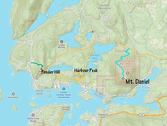
Mount Daniel, Pender Hill and Harbour Peak
February 8, 2023
450m
Pender Harbour / Sunshine Coast, BC
Mt. Daniel, Pender Hill and Harbour Peak are three officially-named bumps in the lowlands near Pender Harbour and despite the low elevation all three bumps boast at least 100 m prominence making them “legitimate” peaks. Mt. Daniel is the highest of the three and offers the best hiking/sightseeing potential. There are maintained trails on Mt. Daniel and Pender Hill so those are no-brainer kind of objectives but the third one, Harbour Peak would be an exploratory bushwhack with no trail nor hardly any “beta” on the internet. I had been looking at those peaks for a number of years but it’s always difficult to justify the long drive combined with the ferry logistics for some “dumpster-diving” objectives. The situation of this Wednesday was different. Various forecast models converged to agree that Sunshine Coast was actually the place with the highest chance of seeing sunshine, and Wednesday was the only day of this entire week with some decent weather. I had to be back home no later than 3:30 pm for work so I had very limited choices of objectives. I pulled the spontaneous trigger on Tuesday afternoon to book the 10:55 pm ferry ride. To make this plan work the only way was to car-camp at the trail-head.
I finished work at 9 pm, hastily packed and rushed to Horseshoe Bay. I arrived with about 20 minutes of spare and the ferry had no delay. I arrived at Langdale at midnight and still had to drive over an hour to the far side of Sechelt Peninsula. Those with 4×4 could drive a short ways onto the forestry roads on Mt. Daniel to the actual trail-head but I only had the Corolla this time. Instead, I just parked on the side of the highway and slept in the vehicle. I was hoping to wake up early to watch sunrise but I decided against that. I was too exhausted and unmotivated to execute that plan, so turned off the alarm and slept in till 7:30 am.


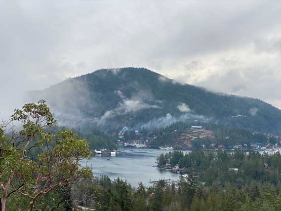
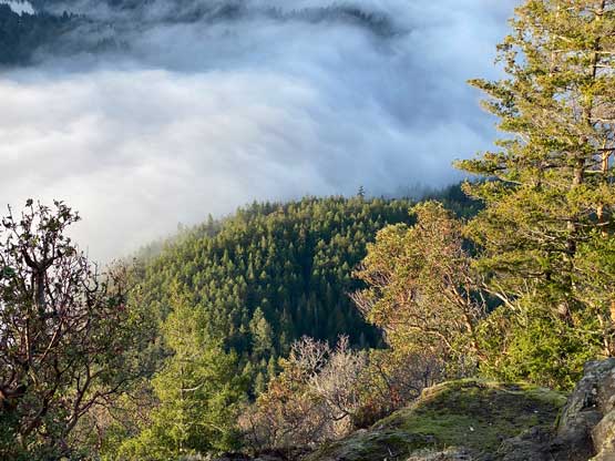
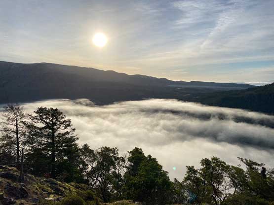
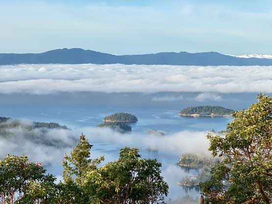
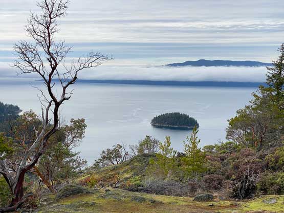
I opted to carry nothing except for some spare clothing and water. The temperature was actually quite frigid in the morning so I moved rather quickly to warm up. The trail grade was quite steep at places but the hike was otherwise, no-brainer. The trail wouldn’t bring hikers to the true summit but rather only the viewpoints on the south side bluffs. I left the trail and went for a short ramble to the true summit (viewless) before making a descent to the viewpoints. There were at least three spots to see something and the best was the southernmost one, offering unobstructed views into the harbour and towards Cecil Hill.


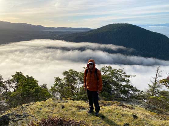

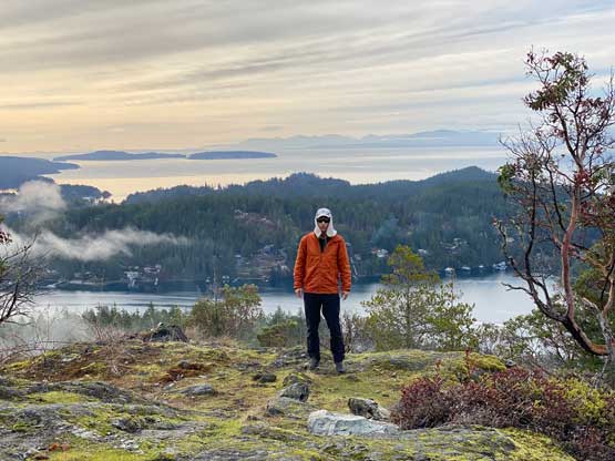
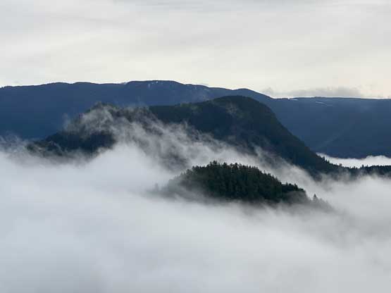
I spent at least 15 minutes taking photos but eventually reluctantly descended to the car. There’s nothing worth documenting about the hike-out as I just needed to put one foot in front of another while following the trail. I then drove 10 minutes to Pender Hill. There’re two sets of trails on my Gaia map and I was thinking to ascend the south ridge but there’s no designated parking area and the trail seemed very unofficial. Instead of parking at someone’s home I opted to check out the west side trail-head and sure enough, that’s the better one. There’s even an official sign to direct hikers. The trail was considerably steeper and rougher but this was still a no-brainer ascent. I only needed to gain about 150 m elevation so I arrived at the summit in no time. The better views were actually from a short ways down the south slope from the summit so I spent another 15 minutes to wonder around for photos before descending.


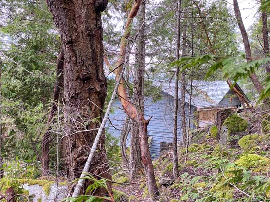
It was tempting to get lazy by skipping Harbour Peak but I checked the ferry schedule. There’s no way could I make the 10:50 am ride so I must aim for the 1:05 pm one, so I wouldn’t get home any earlier whether I went for Harbour Peak or not. There’s no “beta” about this objective but the shortest route should be from the south side so I drove there. To my disappointment I found nothing but residential houses. I don’t think this peak sees enough visitors to bother the locals to put up those “no trespassing” signs but it’s obvious that by one way or another I needed to trespass. The first attempt was to walk on a private driveway but an aggressive dog came out immediately after I started walking. There’s no messing with that so I turned around and drove away. I immediately noticed some fresh logging activities so I parked on the side of the street and dived into the bushes from there. This was about 100 m further east.

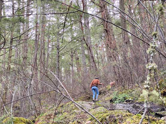
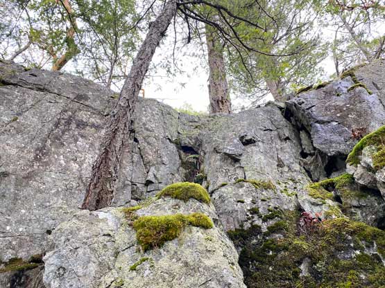
The bushwhacking wasn’t too bad but I immediately found myself thrashing towards more residential houses on the hill from their backyards. I sneaked by quietly as I didn’t want them to notice my presence as a threat of theft and I hoped those houses didn’t have dogs. I could hear dogs barking but only from distance and I assumed that’s the same dog I encountered 10 minutes earlier on the other entrance point. I also encountered numerous cliffs that required class 3 scrambling to overcome. At one point I opted to ascend a 4th class chimney that was also greasy and wet. Later on the descent I tried to down-climb that but got scared and had to find another way. The exit of this chimney brought me onto a “bench” with some open views and I traversed eastwards to link up with the upper route. The lower and the upper routes were separated by a short stretch of dense bushwhacking and the upper route was attacked from the SE. I found similar, but easier terrain and quickly gained the forested summit. There’s no view to speak of whatsoever so I took a mandatory photo and started the descent.
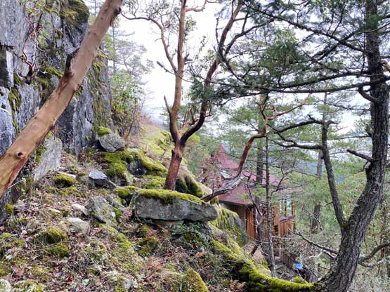


The simplest way down would to be reverse what exactly I did as that’s how I remembered the terrain, with the only exception of that 4th class chimney. To find a different way I had to descend a ways to the west and that brought me much closer to another (blue) house and I could even hear people talking. Judging by their conversation I didn’t think they had noticed my presence so I quietly made my way back into the dense forest and descended a line roughly halfway between the blue and red houses. Nobody ended up noticing me and I quickly drove away after finishing the thrash. The ascent had taken me longer than expected so now I had to rush back to Langdale to catch the 1:05 pm ferry. I sped at least 20 km/h faster than the speed limit for most of the way. I did one stop in Tim Horton’s to grab food for lunch and showed up at the terminal with 15 minutes of spare. The line-up was insane due to some cancellations in the morning thank to some technical issues, but I was still able to board the boat. The reason to buy Tim Horton’s was to eat quickly and sleep a bit on the ferry. The rest of the homewards journey went uneventfully and I got back to White Rock at exactly 3:30 pm. I went straight to work without making a stop at home.