Eldorado Peak
June 6, 2017
2705m
Cascade River / North Cascades Highway, WA
The legendary Fred Beckey called Eldorado Peak “the Queen of the Cascade River” and he sure wasn’t exaggerating. This beautiful glaciated massif is the highest peak standing out from the largest non-volcanic icefields of the “lower 48” in the heart of the North Cascades. The position, elevation and the aesthetic looking of it makes Eldorado Peak one of the finest classics that’s gained a lot of popularity these days. The climb is however, largely non-technical in the “right conditions” but does involve a knife-edge traverse near the summit as well as a large icefield crossing.
On hindsight soloing Eldorado Peak would have been “not-too-bad” given my experience but this is an objective that I’d like to share with friends, if possible. Vlad and Al (Spectrum) were both quite keen on the mission so when another high pressure ridge kicked in towards the start of this work week we made an agreement to pull it off on Tuesday. The timing for this peak isn’t tricky especially when it comes to late spring as the mere requirement is a guaranteed weather window. The temperature would be toasty though and a 3500-m freezing level suggested we’d have no overnight freeze whatsoever, but on this particular peak softer snow only serves to reduce the pain on my knees and that’s especially true for the coastal snowpack where the base is well-consolidated no matter what.
The usual method of car-camping and “light-and-fast” was applied and for the sake of this style we’d carry no technical gear other than an aluminum axe and aluminum crampons. Not much water was required neither as we were pretty confident that from all the spring snow melt there’d be streams to fill up. Once everything was set I drove Al and Vlad out in my Toyota Tacoma and in about 3 hours we arrived at the milepost-20 on Cascade River Road. The parking lot was more than luxurious and the trail-head party was on together with two other groups. The other groups started at around 2 am in the morning while we wouldn’t even bother to wake up until 5:30 am. Given the fact we’re fast and efficient I really don’t see the point of skipping the valuable couple extra hours of sleep.

Eldorado Peak standard ascent route. GPX DL
Everything got sorted out including packing the tent, pads and bivy sack and by 6:03 am we had started the plod. The whole “morning thing” took a mere half-an-hour which was very good. Not knowing where exactly to go we followed a foot path down to the North Fork of Cascade River only to find out that the log crossing wasn’t there. We backtracked and found the correct crossing about 30 m downstream. This is a big fat log spanning fully across the streams that’ll probably stay there for at least 10 years but even if it’s washed away the wade looked tame and easy anyway. Once on the other side of Cascade River we picked up the Eldorado Creek trail and then the next hour or so was a mundane uphill plod. We knocked off 500 vertical meters in one hour and then there came the famous boulder field.
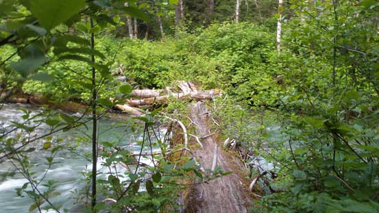
This fat log crossing is very impressive

Believe or not we were still on the log now.

Fast forward. On the boulder field now.
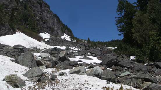
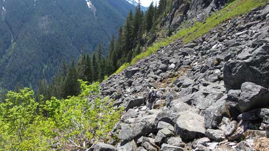
The boulder field was painful to say the least but at least there’s abundant cairns marking the way. Vlad took over the lead here while I played a bit more cautious and then we re-grouped at the snowline about three quarters of the way up this field. It’s freaky to look down and see the depth of the holes that people made knowing how badly injured we could get had we fallen in one, but the main set of footpath was strong and supportive. Higher up I found a stream to fill up my water bottle and then we continued upwards into the treeline, and then the alpine.

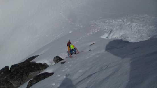
Snow and boulders don’t mix well. A bit freaky at places but worked.
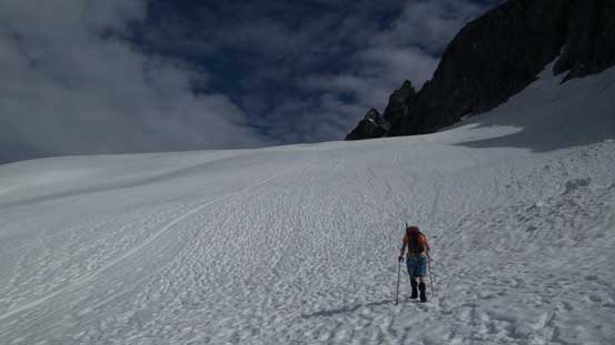
Finally onto continuous snow now.

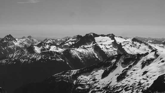
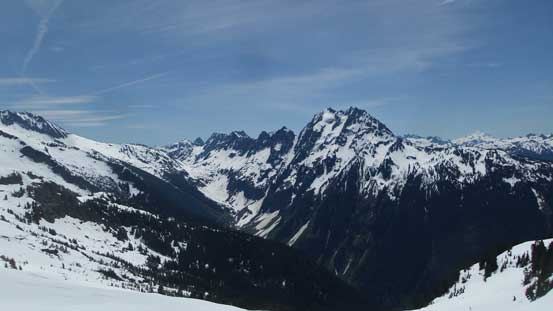
Johannesburg Mountain to the south
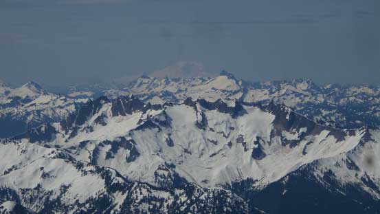
The elusive Glacier Peak way far in the distance.
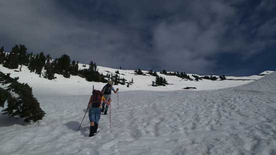
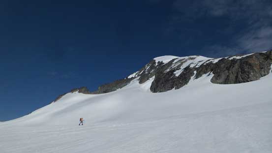
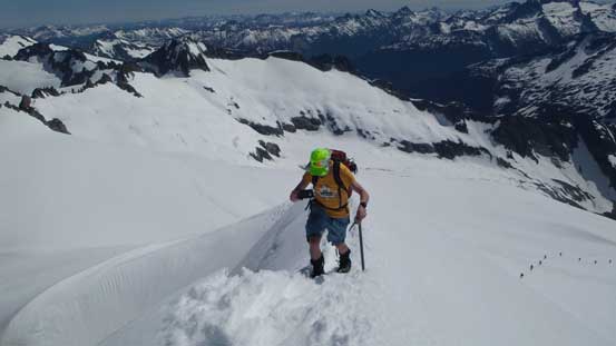
At this point we were paralleling the ridge to our left but soon enough the “highway” of path started to trend left aiming for a small break/shoulder on the ridge crest. A short, but fairly steep roll was soon ascended and then we arrived at the 1900-m shoulder where the view into Roush Creek and Eldorado Glacier finally opened up. A short food break followed as it’s a scenic viewpoint but we had to get back into the game. Al led the way descending a short chute with a sketchy moat crossing on down-climber’s left. This is a trip that I didn’t do much route research as I easily downloaded a GPS track from peakbagger.com so figured there’s not much point in studying the details. This short descent surprised me a little bit but soon enough we were going uphill again. The plod up the upper Roush Creek valley and onto the lower reach of Eldorado Glacier was very foreshortening but we crushed it in a pretty reasonable time.

Me descending the short chute just above the moat crossing. Photo by Alan Blair

Vlad plodding upwards in the upper Roush Creek valley
It’s a long haul to the Eldorado Glacier icecap
Al leading the way. Note the highway of boot tracks…
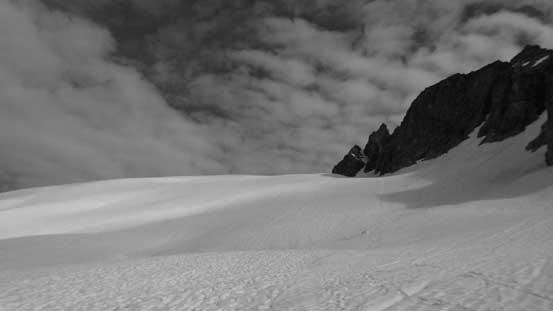
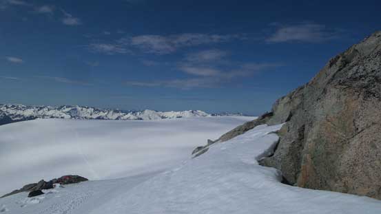
Upon cresting the upper icefield (aka. the Inspiration Glacier) we could see the upper route ahead. The glacier plod ahead didn’t look as flat as shown on the map and involved some elevation loss to get to the base of the E. Ridge. Vlad and I just followed the main “highway” of footpaths while Al took a more curving line resisting losing too much of the hard won elevation. The two routes joined at the base of the E. Ridge where we passed three very luxurious tents. We all figured why the climbers were still on the mountain if they camped this high up, but let’s focus on our own business here. Two skiers and a soloist came down past us but as soon as I saw the massive, roped party of 7+ I told Al that we had to pass them before the knife-edge section.

Ahead is the plod across Inspiration Glacier with a bit of elevation drop.
Al plodding across with Eldorado Peak behind

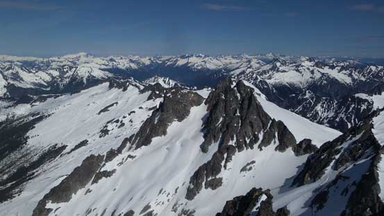
Looking back shows Vlad on Inspiration Glacier and the pinnacle that we went up later
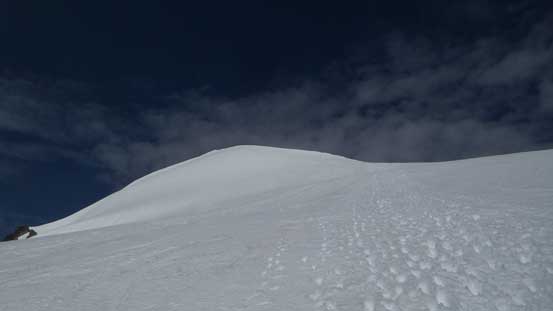
Onto the east ridge now. About 400 m of height gain on this final stretch

There’s a big roped party in front that we were set to pass them.
Up our pace and then upwards we went. I went ahead of our group here as I really didn’t want to get stuck behind a roped party and it seemed like we still had about 200 m elevation gain to catch up. It turned out that in no time I caught up and passed them and some were dressing like an Himalayan expedition with double-plastic boots, pickets and some full-on stuffs. Talking to their leader I soon understood why as this was their 6th day of the Ptarmigan Traverse. This was awesome as I wasn’t really expecting to see some hardcore people on this day. Vlad and Al did fantastic on their pace too and soon enough we re-grouped at the base of the knife-edge.

Looking down at Al marching up the never-ending east ridge
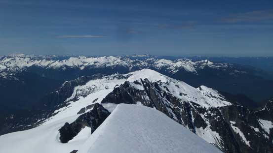
The north side of Forbidden Peak makes some very impressive alpine scenery

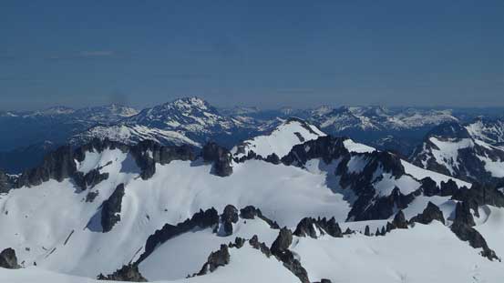
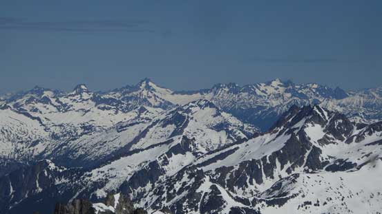
Looking sideways across onto the Klawatti-Inspiration-McAllister Icecap
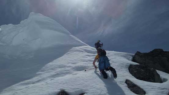
Almost there…
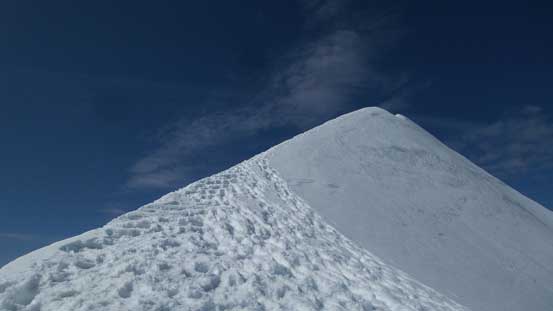
The final knife-edge ahead. Note the highway of tracks again…

Took a long break here transitioning gears.
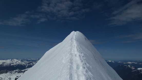
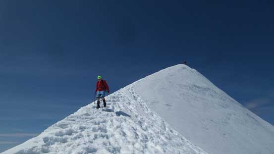
From the base this infamous knife-edge traverse looked like a joke with footsteps across the entire stretch, but the exposure towards each side still deserved respect. I had brought my ice axe and crampons up so might as well justify the purpose of doing that, so two minutes gear transition later saw me charging up the arete. Technically this was indeed a joke but a fall is likely fatal towards either side. The angle of the arete itself was very flat and mellow which meant two poles probably would work better than an axe but I have to say that holding an axe here looks better in a video. The “exhilaration” was over in short time and then it’s time for the routine summit celebration.

Me charging up the arete. Photo by Alan Blair
It’s indeed knife-edge, but easy going for us…
Al showing his awesome style holding his phone recording a video..

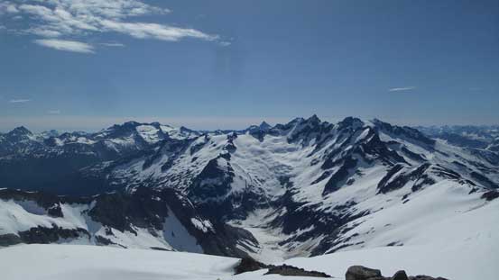
Summit Panorama from Eldorado Peak. Click to view large size.

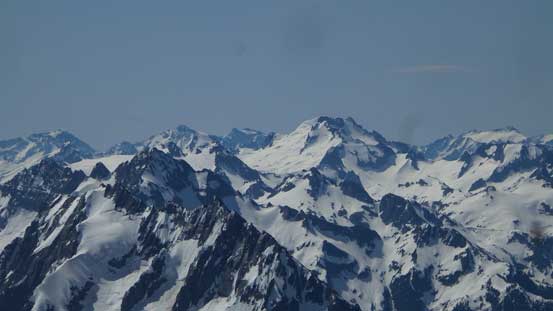
Looking over the top of J-burg Mountain towards distant giants like Bonanza

Goode, Buckner, Boston, Sahale behind Forbidden Peak in the heart of N. Cascades
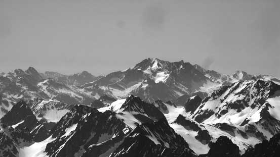
The massive bulk of Mt. Logan is a remote giant. The name makes it more impressive.

Kimtah, Katsuk, Mesahchie Peak on Ragged Ridge and other eastern N. Cascades
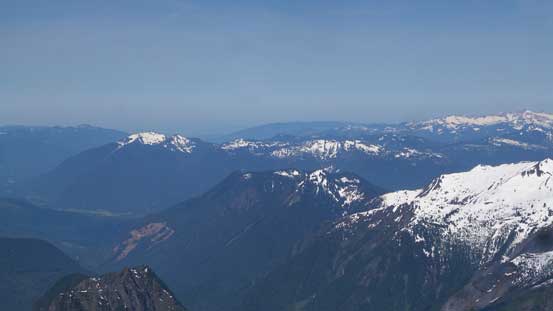
Sauk Mountain is that isolated snowy cap on far left.
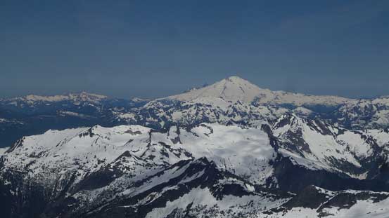
Mt. Baker looms on the horizon

Mt. Shuksan is trying her best to compete..
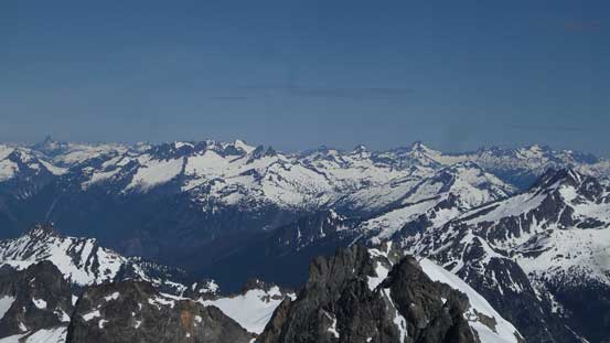
A sea of peaks in the Picket Range at the most remote part of Washington state

Snowfield Peak in the foreground and giants by Chilliwack valley behind
Looking over the top of Primus Peak towards the bulk mass of Jack Mountain

A zoomed-in view of Goode Mountain – highest peak in N. Cascades Natl. Park
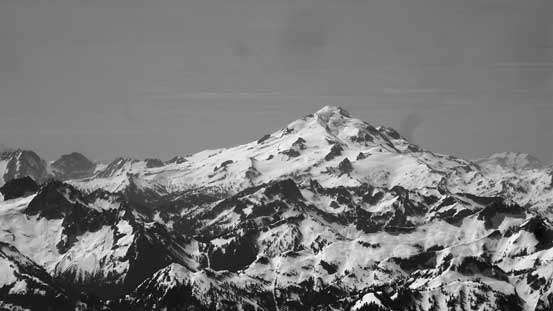
Bonanza Peak is the highest non-volcanic peak in the entire Washington state
“Dome Peak” isn’t a sexy name, but is surely a sexy mountain
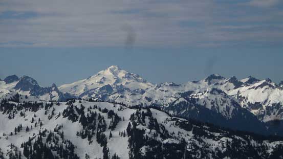
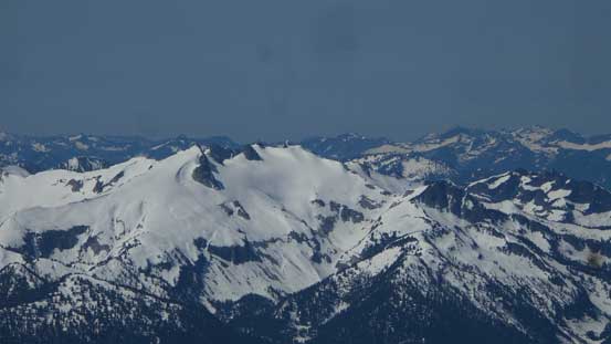
Glacier Peak is the most remote volcano in the Cascades
Way far back we could see the outline of Mt. Rainier, behind Sloan Peak
Snowking Mountain which Vlad and I ascended two months ago
Redoubt, Spickard just south of the border
The double-summit of Hozomeen Mountain
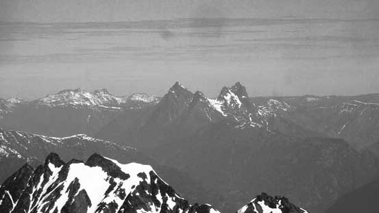
Dorado Needle in the foreground – apparently a 5.6 climb…
This is a full western view from the top.
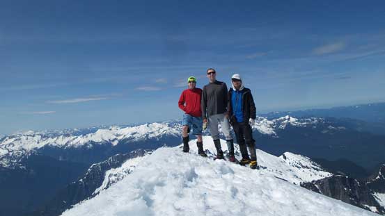
Our group shot on the summit of Eldorado Peak
Time to head down and we had no problem bypassing the roped party on the most exposed section of this arete as the leader did a great job stepping beside the track to let us pass. Thank to them very much as otherwise we would have to wait for a long time. To save an extra gear transition we grabbed the ditch poles and without doing any stopping we kept plunging down with crampons on. Eventually at about 2/3 of the way down the stretch of east ridge we found a flat, dry spot to take a long break soaking in the views. But soon enough the break was over and we had to keep descending. Considering how far ahead of schedule we were I briefly threw out the idea of making an ascent of Klawatti Peak but didn’t generate enough interest plus I wasn’t sure about the route neither. The “shark’s fin pinnacle” aka. Pk. 7733 right beside our ascent route looked like a fun one to kill some time so why not.

The other party on their way up the final arete
Al leisurely walked off the arete.
The snow no longer looked that steep anymore from the base of Pk. 7733 and we could see a nice ramp traversing across the middle of the face. The downside of this route was the brief exposure under a gigantic cornice but we were fine with that. The route turned out to be easy and very enjoyable with minimal suffering and lots of variety thrown in here and there, so highly recommended if you have extra time to kill.
Al following me up one of the short stretch of steep snow on “Pk. 7733”

Great view towards Forbidden Peak and Forbidden Glacier

A unique perspective of The Triad too
Guys down-climbing from “Pk. 7733”. Note the cornice that we must traverse underneath
Descending the upper reach of Roush Creek valley was very fast and fun, either by plunging large steps or by glissading. I usually don’t do glissading for one reason that my snow pants are expensive and for another reason I have shoulder concerns over the years and I don’t like this type of unpredictable random motions. The condition was terrific on this day though so after watching Al and Vlad having fun I soon joined the team. The short ascent up to the ridge crest was easy peasy and at the crest we passed the soloist who was packing up his camp. And then down into Eldorado Creek valley we soon ran out of snow. The transition from snow to boulder field was mentally sketchy but none of us punched through any surprise which was good. We also managed to pick a more efficient line through the boulder field but even that, the steepness of the terrain meant it’s a painful process no matter what.
One last look at J-burg Mountain. Cascade Pass on the left

Vlad leading the way down this snow-boulder mixed terrain
It’s not very pretty…

At least it’s all dry now.
Still not over yet…
Once the boulders finally gave way to the trail we took the last break of this day resting our knees and then we caught up with the two skiers who passed us earlier in the day. The rest of the trailed descent was uneventful although it did seem much longer and steeper than what I remembered from a couple hours earlier. Every time what seems like an easy stroll in the morning would turn out to be a heck of a grunt on the way back down and this wasn’t an exception. Hearing the river rushing and seeing the log crossing was very refreshing.

A mandatory shot of the final log crossing of Cascade River
Our round trip time was exactly 8 hours which was a tad faster than what’s typically advertised on other sources. Travelling “light and fast” surely helped and having perfect weather, perfect conditions and a “highway” of packed tracks didn’t slow us down neither. Vlad and myself were discussing possibly making another ascent (Mt. Pilchunk) but nobody brought it up on the drive back home. I certainly had enough energy but my knees definitely wouldn’t like that idea and these days I just don’t do that kind of double-ascent days anymore. The border crossing back into Canada was fairly fluent and we all got back by dinner time and that concludes another awesome trip in the North Cascades.
