Tsar Mountain
August 4-11, 2018
3424m
Sullivan River / Clemenceau Icefield Area, BC
Located on the southern edge of Clemenceau Icefield the iconic pyramid of snow, ice and rock named Tsar Mountain is THE MOST REMOTE among the 54-58 11,000ers of the Canadian Rockies. This is said after putting 3 years into the research with countless hours spent on all kinds of maps looking for the easiest access into the area. I could not find one, neither could my friends. For those into the purist, 2-week self-propelled type of adventure and capable to carry backpacks over 80 lb, here’s the short summery of my research. Unfortunately I could not physically handle the pack weight so the approach I used is by taking an Alpine Helicopter…
Perhaps the one-way week-long march from Icefield Parkway over Woolley Shoulder and Snowy Pass requires the least amount of creativity, but involves the longest distance, the greatest elevation gain and the most complicated combo of “unpleasant terrain”.. Such march might can be short-cut by accessing via Mt. King Edward from the upper Bush River Road but doing so a major river crossing is added right off the bat. The climb of Tsar Mountain via any route is not remotely closed to be considered as a “ski mountaineering” ascent but at least one soloist had put down such feat by knocking all three Clemenceau Icefield 11,000ers in a 2-week expedition from Icefield Parkway via Fortress Lake and Chisel Pass. The abundance of snow coverage in June does smooth out the approach by a large margin, but the added weight and the significant and prolonged exposure to unsupported avalanche terrain on Tsar Mountain would put the climb itself into a different level of alpinism. The second approach to Tsar Mountain is via a long ass plod across the entire Clemenceau Icefield in a N to S direction while the north end (Tusk/Clemenceau) is approached by a 3-4 day march from Wood Arm of Kinbasket Lake, which itself is accessed by canoeing ~30 km from the small community of Mica Dam… The third option is via the very-much untraveled Kinbasket River Valley and has absolutely no information anywhere to be found online or in person. The kilometer-tall headwall at the head of this valley is guarded by numerous cliff bands, vertical bush and for the most important, what seemed like vertical moraine at the bottom. If you can find a way to climb that headwall (unlikely) then the approach can be shortened to a mere 2-3 days but still, a canoe is needed to cross Sullivan Arm from the helicopter staging area near the end of Sullivan FSR, which itself requires ~130 km (one-way) driving on logging roads… The 4th option is a very contrived high-level travel in a S to N direction over the countless ridges and peaks south of Mt. Odell, and the starting point also requires a canoe for crossing a braided Sullivan River. Mind you, much of the pieces in this option has probably never seen a human being to this date, and a potentially dangerous glacier is still needed to be crossed, hence it’s far from “guaranteed”… Good luck…
[Update from Oct. 2018 – Ben Nearingburg and Liam Harrap made an ascent of Tsar Mountain by traversing up and over Woolley Shoulder and carrying their packrafts, and exiting to Kinbasket Lake valley. That was Nearingburg’s 11,000ers finisher. I cannot find their detailed trip reports anymore but that trip was surely one of the grandest achievement in Rockies’ exploring and mountaineering history.]
[Update from 2024/25 – Foresty Forest etc. had put in more time exploring Ben/Liam’s exit route and had since published an approach from Kinbasket Valley. No packraft needed as the logging crew had extended the road into the mouth of that valley, and Foresty had built a fairly good trail through the lower section. Getting up the moraine at the headwall is apparently not that big of deal, and determined parties can do Tsar Mountain nowadays in 3-5 days sans air support, putting Clemenceau and Tusk back on the “most remote 11,000ers” list. Devan Peterson’s GPX track]
Taking a helicopter is far from an easy fair due to the complicated logistics of coordination, a large block of time off (1 week or more) and a lot of money. The Clemenceau Icefield area sits halfway between Golden and Valemount and not surprisingly it also requires the longest flight to get to among anywhere in central Canadian Rockies. A round trip to this area via helicopter will easily cost over 4000 dollars.. Fortunately I got the opportunity of jumping into Robb Schnell’s group. After completing Mt. Alberta in the fall of 2017 Robb’s 11,000ers project was down to just one – Tsar Mountain, so needless to say he was very much gong-ho for this adventure. Robb took care of the logistics and managed to gather a group of 7 in the end – myself, Robb, Raff, Jeff N., Lyle R., Gen K. and her boyfriend, Pedro. To further reduce the cost our group teamed up with the Tusk Peak’s group coordinated by Dean Lister (who’s also at 57/58) to share the Sullivan staging area. This way the cost was down to under 600$ for each person and I should say this is as cheap as it can get. Normally you want to budget over 1200$ (per person) for a trip into the Clemenceau area.
As the date came closer the weather forecast had gradually improved to the point that it was almost too sunny/warm to stay comfortably at camp. Our grand plan was to ascend Tsar, Ellis, Somervell and Shackleton but the last one is experimental without much of information. In the end we only got the first three as the glaciers and icefields in this area are beyond the Rockies’ scope. Making a lengthy travel on any of these glaciers in August is a very difficult fair. I started the driving from Vancouver at around noon of August 3rd and made to Golden just before midnight. The next morning I picked up Raff and went for the Bush River Road and then Sullivan FSR. These logging roads were in excellent shape that I felt comfortable cruising at 60-80 km/h but as mentioned above, a total of 130 km is needed to reach the staging area. The staging area wasn’t that obvious. We ended up over-shooting the drive and had to turn around after negotiating some sketchy ditches and overgrown sections that simply didn’t make sense. Raff and I were the last persons and then it’s party time. This was my first time meeting most of the 12 people sitting there.

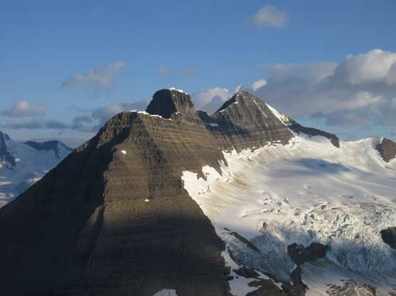
Tsar Mountain standard route.
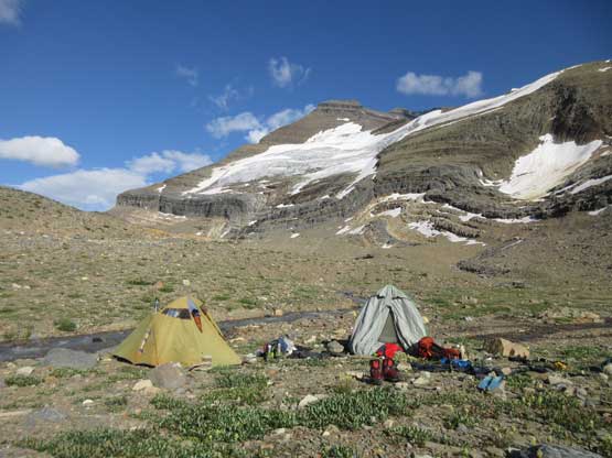
Around 3 pm the helicopter showed up. The 7 of us were ferried to a 5-star campsite near Tsar/Somervell col in two trips. The weather was partly cloudy and the rest of this day was spent setting up camp and cooking. We brought a lot of redundancies up there including canned food and extras that you normally do not see in the backcountry. The plan for the following day was Mt. Ellis. This is the easiest peak in this region that offers an excellent reconnaissance. From the summit we could see the immense icefields nearby and for the most important we could decide whether a 3-day side-trip to Mt. Shackleton is feasible or not. This day turned out to be pretty much as expected. We got a rarely ascended but not-so-tiring summit with excellent views and we did make a decision that Mt. Shackleton was unlikely to happen. The glaciers were too broken to even worth exploring towards that direction.

This is our helicopter at the Sullivan staging area
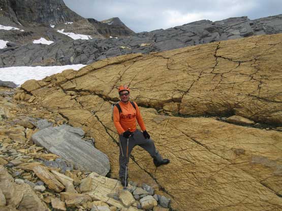
The evening of Day 1 I hiked up to a nearby moraine for some views
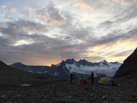
Back to camp, time to watch some evening colours.
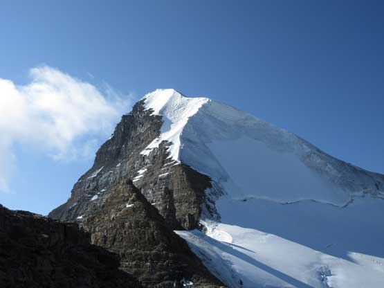
The morning of Day 2 we went for Mt. Ellis. This is looking back at Tsar Mountain
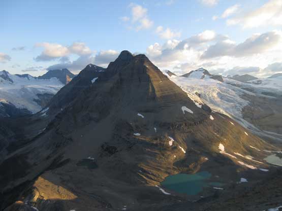
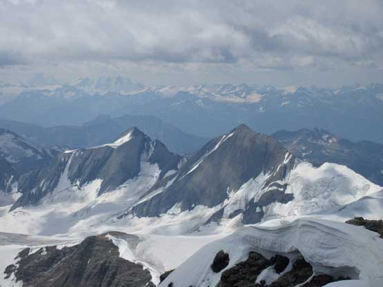
Mt. Somervell from the summit of Mt. Ellis
Back to camp in the afternoon of Day 2
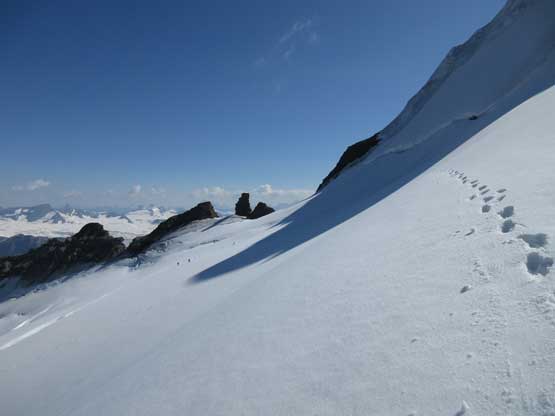
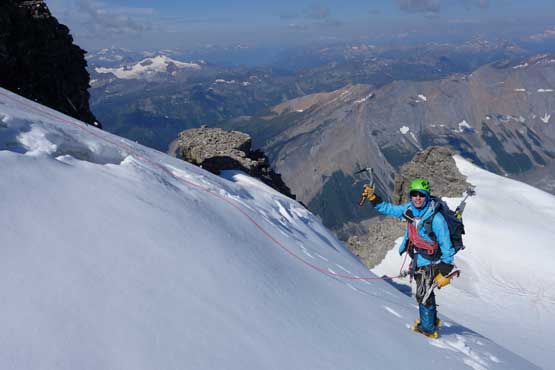
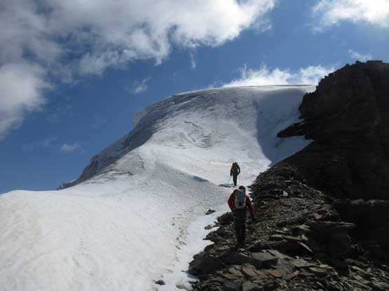
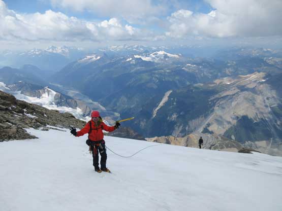
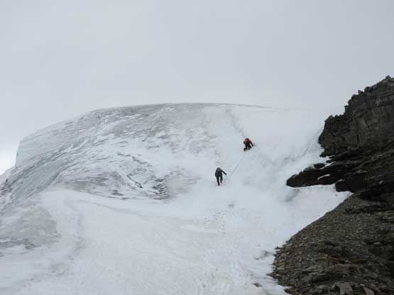
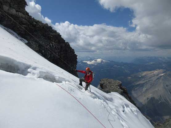
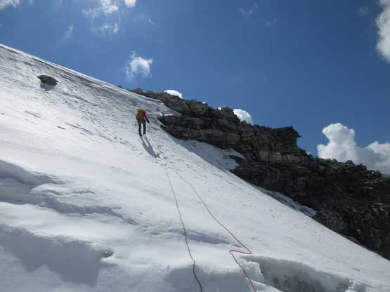
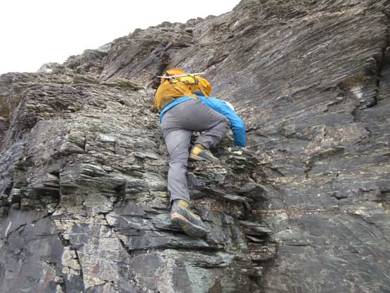
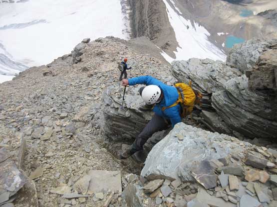
The next day (Aug. 6) was time for Tsar Mountain. We had spent two days making detailed plans about how were we going to attack it. First was the division of group. It made no sense to travel together in a group-of-7 due to rock falls so the division was Jeff, Lyle and I going ahead followed by Robb and Raff and then Gen and Pedro. For gears we had to haul glacier and ice climbing equipment because the summit block appeared very icy. The lower mountain required a bit of mapping and everyone eventually agreed to use a zig-zagging line far on climber’s right (west) side to gain the broad bench on N. Ridge’s West Spur. Everybody woke up at around 4:30 – 5 am and started the day in about an hour. The headlamps were only briefly required and we all made good progress on the lower slopes. There’s some route-finding but nothing major and eventually we all merged into a snow bowl. Ascending snow was far easier but did require taking the ice axe or crampons out, and the transition back onto rock was a little unpleasant.
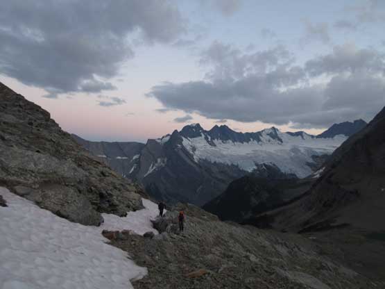
We only used head-lamps for maybe 20 minutes and now it’s time for alpenglow
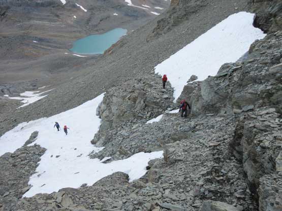
We all picked our own lines in this bowl. Your choice between scree and snow

Robb ascending the increasingly steep snow
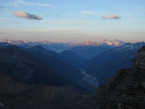
Cresting the west spur of north ridge now. This is the western horizon
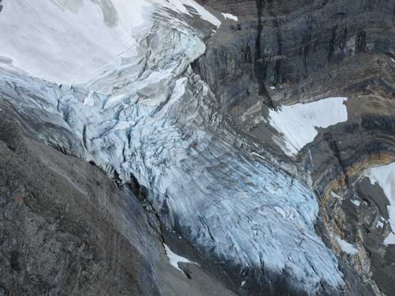
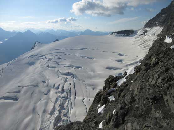
The tongue of the north glacier of Tsar Mountain
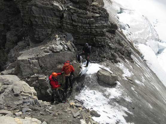
The next section was a pleasant surprise as we walked across the top of the north ridge’s west spur. The ridge crest was very broad and pretty much flat and we got to see the impressive north glacier up-close. There is one steep step requiring 3rd class climbing on loose rock but elsewhere was nice and easy. Towards the “headwall” feature I opted to put crampons on and ascend on snow while Jeff and Lyle decided to stay on rock. In terms of efficiency I think we were the same. To gain the North Ridge proper we had to find a way up the headwall. We all had some concerns about this section but it turned out to be nothing harder than 3rd-4th class. The hardest step was a wet, down-sloping corner (4th class) near the bottom and the exposure was quite mild the whole way.
Ascending the west spur. It’s mostly just “class 2”
Looking back at Mt. Somervell and the Tsar/Somervell col
The glaciers with Mt. Ellis behind
Mt. Somervell. Later in this trip Jeff and Lyle made a F.A. of the peak on left
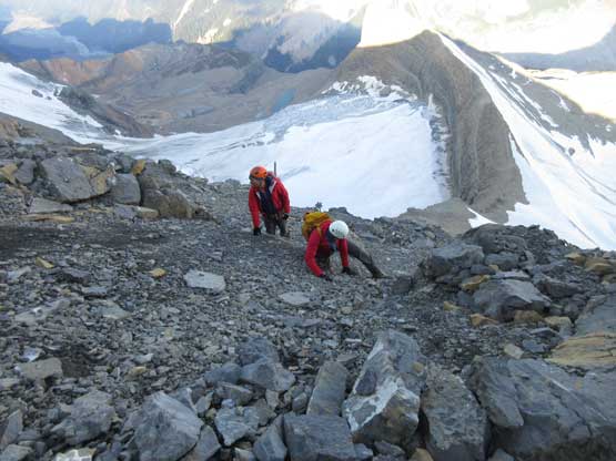
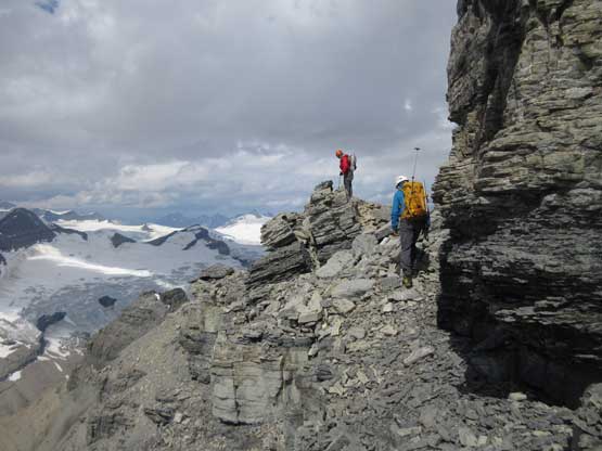
Jeff and Lyle scrambling up the “headwall”. Route-finding is the key
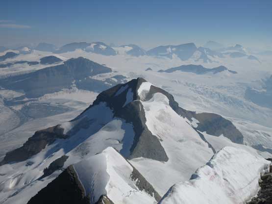
Tsar Mountain still looks very big…
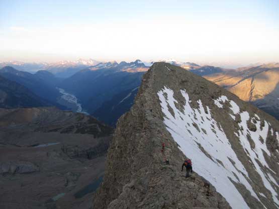
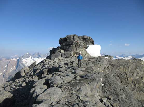
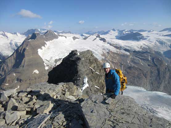
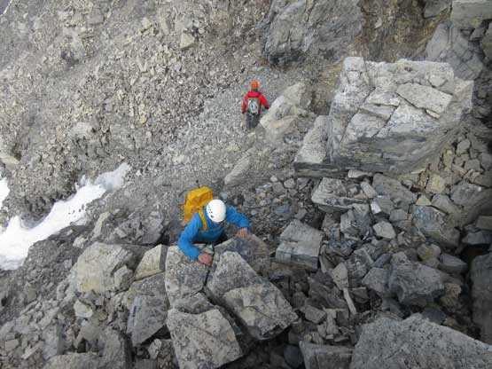
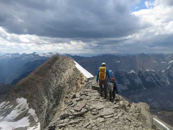
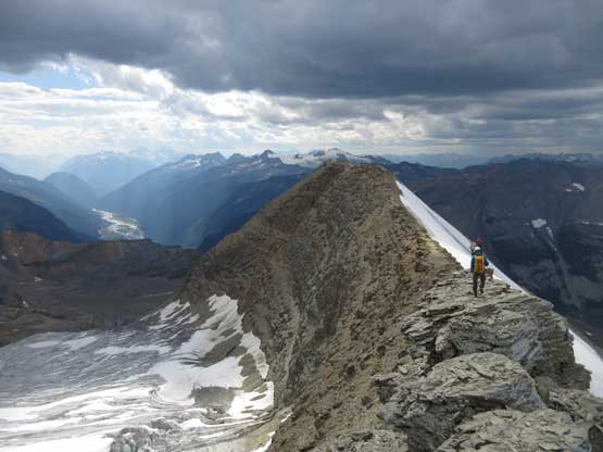
Gaining the north ridge proper was one of the highlights on this ascent – superb and aesthetic position with an exciting ridge ahead of us. Much of the next stage reminded me the upper mountain on Mt. Murchison but at least 2 times longer than Murchison. The rocks are mostly horizontal dinner-plate shale and the scrambling can be broken down into endless series of 3rd-4th class steps. Most of the impassible towers are bypassed on climber’s right (west) side and micro-terrain route-finding played an important role to move efficiently. We did encounter a few climbing steps but I believe all of those could be bypassed, if we looked for that. Wherever “climbing” is required I found the rocks were relatively solid. After what seemed like a long while we reached a shallow notch with a big boulder. It appeared we could have rappelled off that boulder to reach the upper glacier but the decision was to continue scrambling over another tower to the highest point on this north ridge. This was a poor decision because we got ourselves into the least enjoyable terrain of the whole ridge. We made across nonetheless but swore to use the lower notch on the return…
Cresting the north ridge proper now. Time to take a well-deserved break
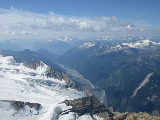
The east side glacier is even bigger…
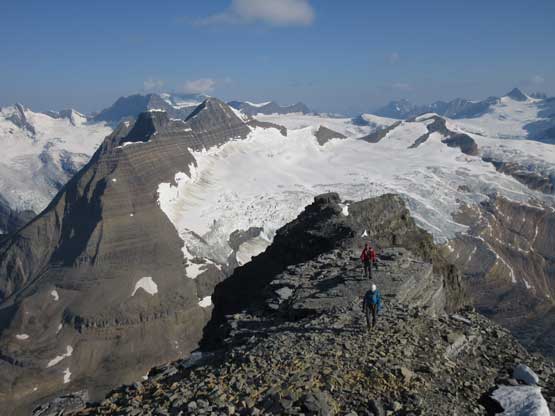
As you can see, sections of the north ridge was a flat board walk
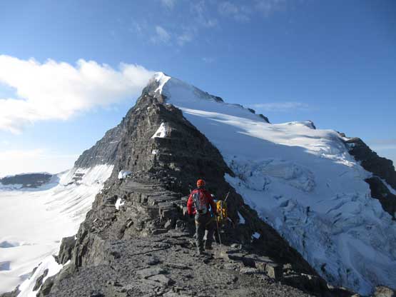
Lyle dashing across the board walk stretches
It’s getting steeper now.
Jeff N. posing for a photo
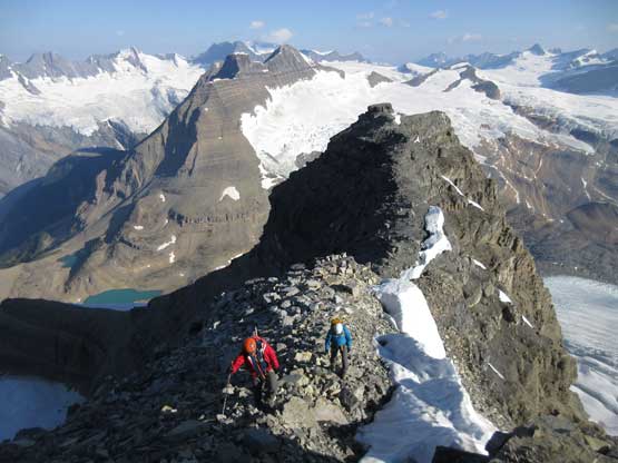
Upwards and onward with Mt. Somervell behind getting smaller and smaller
Having lots of fun on this ridge despite the loose rocks
Jeff climbing up a vertical step
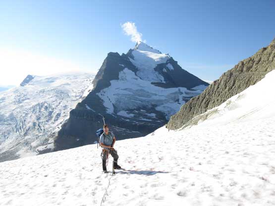
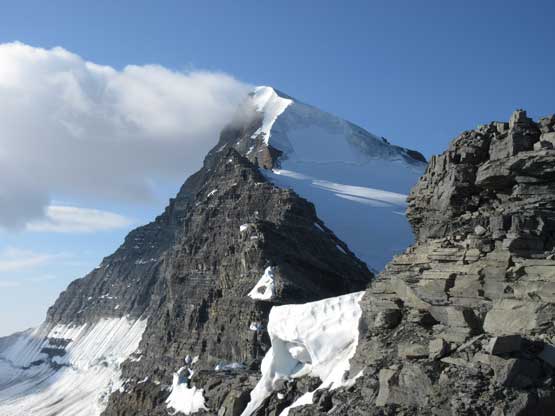
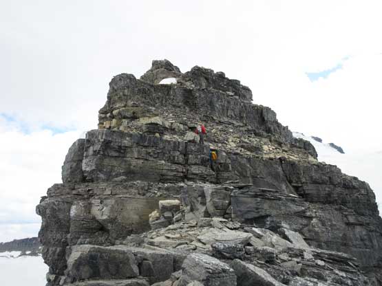
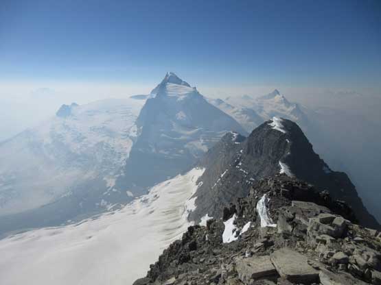
It’s getting closer and closer. The summit block is huge
Getting closer to the glacier now. We were looking for a spot to drop onto it.
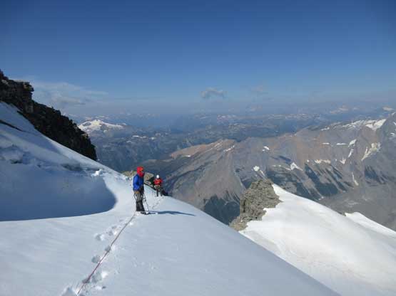
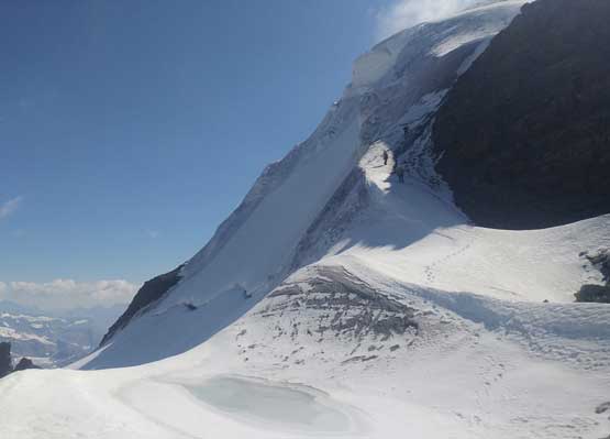
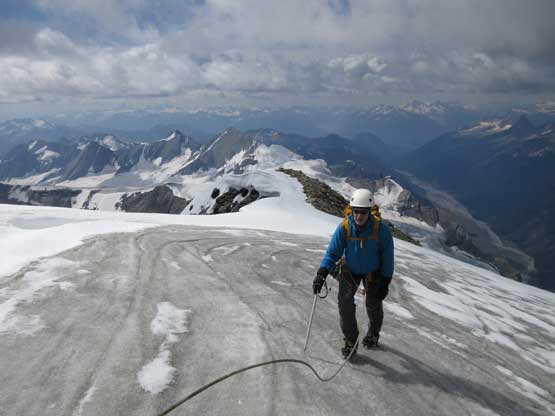
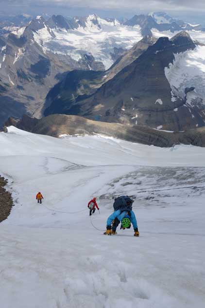
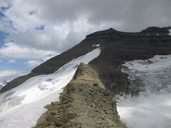
What seemed like a tame glacier from below turned out having quite a few crevasses especially on the near side so we played cautiously and roped up. Meanwhile this highest notch on the north ridge provided a natural platform to take a lengthy break. I believe we stopped there for at least half an hour and this allowed Robb and Raff to catch up. They had rapped off that big boulder onto the lower glacier and meanwhile we just started the horizontal traverse over towards the uppermost west ridge. The crevasses on the near side were indeed troublesome and the snow bridges were too soft to trust. Eventually after trying around Jeff picked a questionable bridge and went for it. It held for Jeff and Lyle but I put one leg into the hole on the 3rd crossing. Crossing the bergschrund on the far side (near west ridge) also had some questionable snow bridges that required a lot of probing to trust. To gain the west ridge we had to climb a pitch of steep ice right off the bat. Jeff made it look easy and belayed the two of us up. Meanwhile Robb and Raff had caught up to the same position and we climbed in more-or-less a group-of-5 for the rest of this ascent.

Rope management is the key on alpine climbs like this
Lyle R. stepping onto the ice

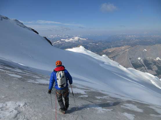
Crossing the upper glacier to the far west side
We debated where exactly to cross the bergschrund
Looking back at our tracks across the glacier
Me just before crossing the schrund. Photo by Rafal K.
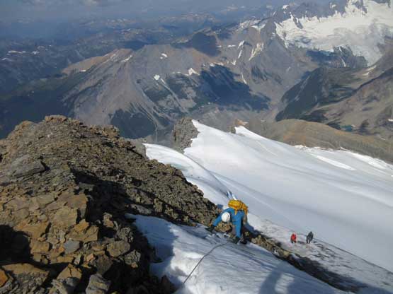
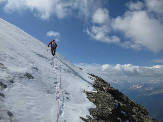
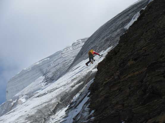
The upper west ridge was much more complicated than I thought. This is largely due to the conditions. On a dry year like this one much of the ridge had turned into ice climbing and there are several pitches of those. The three of us did some running belays and swinging leads and I got the oppourtunity to lead the second (longest) pitch on some dirty black ice while Jeff handled the other two short pitches. I was very glad to be wearing the Nepal Evos with steel crampons, and have hauled two ice tools otherwise I wouldn’t have felt comfortable on this type of terrain. Much of the ridge required great caution even on the uppermost slopes. The slope was no more than 35 degrees but we were walking on “snice” hence slipping was not optional. The highest point is on a snowy hump and we took a long break on an adjacent rocky ridge immediately to the south – congratulations to Robb for finishing the 58 11,000ers!
Me leading my group up the black ice pitch. Photo by Robb S.
Jeff topping out the black ice pitch.
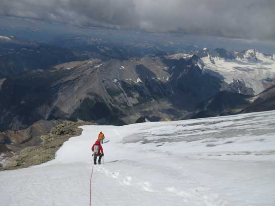
Continuing upwards there were more rolls of ice
Pretty sure I snapped this shot of the Kinbasket River valley while walking..
Lyle climbing over another roll. This time, with post-holing on soft snow
After a long while this is Jeff approaching the summit of Tsar Mountain
Raff approaching the summit of Tsar Mountain
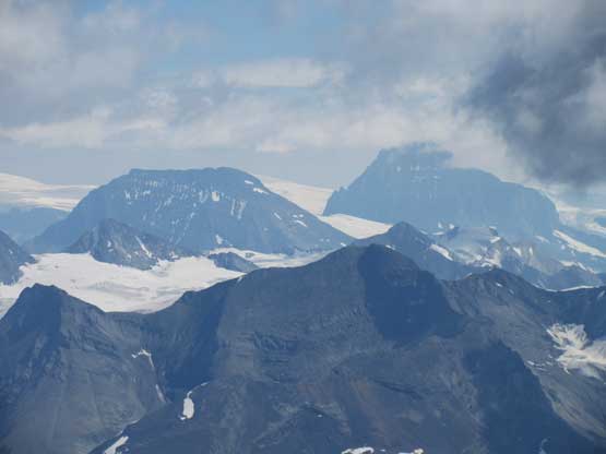
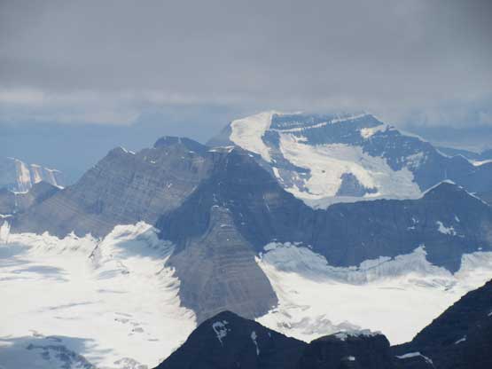
The west faces of Mt. King Edward and Mt. Columbia
In the foreground is Mt. Odell and behind is the Adaments
This is looking at the remote Snowy Pass
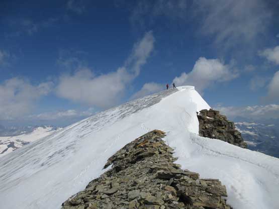
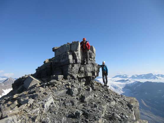
Robb and Raff on the true apex of Tsar Mountain
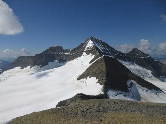
Mt. Clemenceau rises behind Mt. Shackleton

Our group shot on the summit. Photo by Rafal K.
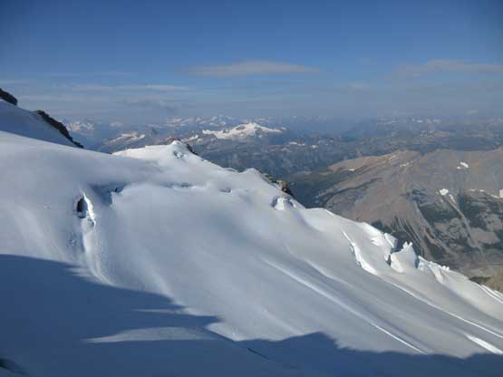
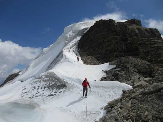
On the descent we decided to down-climb for as much as possible because several of the pitches didn’t have obvious anchors to rappel off. For the black ice pitch I down-led using a single ice tool and placed an ice screw about half way down. Lyle and Jeff are much better ice climbers and no issue getting down. At the top of the last pitch we tied the two 30m ropes together and this rappel also got us across the troublesome bergschrund with that added safety factor. The rest of the glacial descent went without incidence and then it’s time to reverse that long 3rd-4th class north ridge scramble. To be honest I felt it was quite enjoyable probably due to the downwards direction. Descending that headwall sucked as expected but at least short-lived, but then walking back across the west spur was again, nice and scenic. To get off the lower mountain we took a different line avoiding that steep snow section and this worked out perfectly.
Time to head down.
Me down-climbing the first roll. Photo by Rafal K.
Raff and Robb down-climbing the first roll
This is Jeff down-climbing the black ice pitch
Finishing the black ice pitch
This is after another (shorter) pitch of ice
Lyle rappelling over the bergschrund
Jeff on rappel
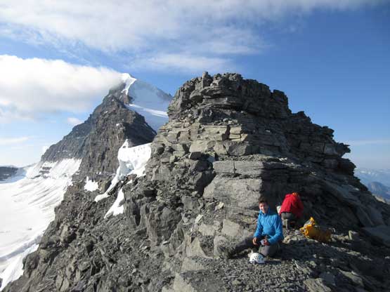
Fast forward. Now we were grouping at that rappelling boulder
Lots of down-climbing on the north ridge
And lots of route-finding
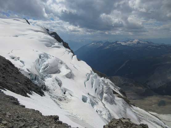
The north glacier is really cool though
Typical, typical…
The very remote Aqueduct Peak
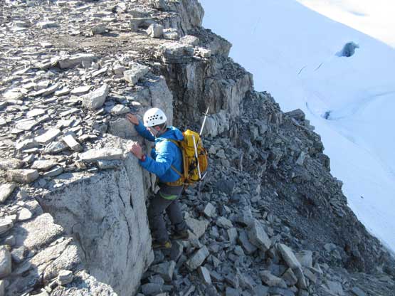
Jeff down-climbing that wet, down-sloping corner
The typical terrain on that “headwall”. Not that bad.
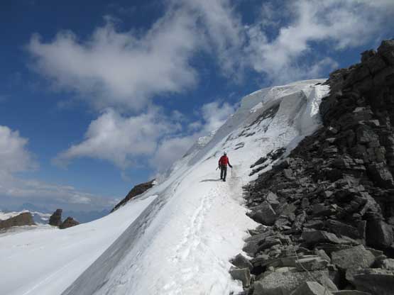
Back onto the west spur now
Halfway down the west spur, looking back at the headwall area
Another photo of walking across the broad ridge crest
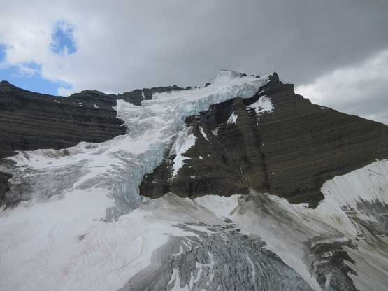
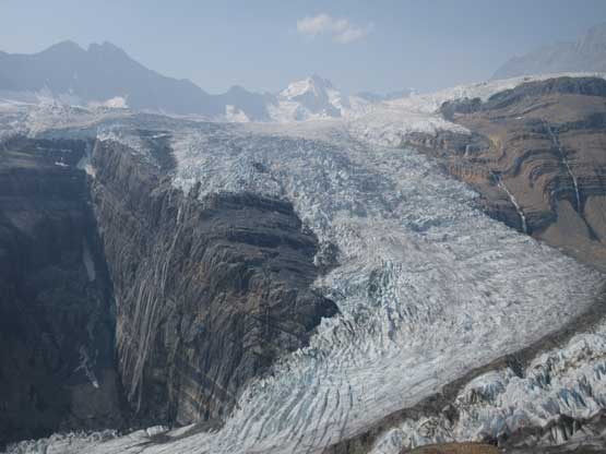
Tsar Mountain and its impressive north glacier. Photo doesn’t do the justice
Almost back to camp now.
Once back to camp we had learnt that Gen and Pedro turned around pretty early into the ascent and were planning to be back on this mountain in a couple days. Robb and Raff showed up in about an hour later and then the rest of this evening was spent celebrating the success of Robb’s last 11,000er. For the first time in history I accepted to drink some beer and whiskey although the price I paid was a full day of headache on the following day. The following day was my rest day anyway so I pretty much spent the whole day in my tent doing nothing.
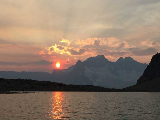
Sunset over Mt. Rhodes and Mt. Livingstone
On Aug. 8th the three of us (Jeff, Lyle and I) went for Mt. Somervell while Gen and Pedro went for Tsar Mountain. This was a very successful day that everybody achieved their goals. Mt. Somervell is a very rarely ascended summit and far from “easy” to tag. We made the 4th ascent in history after the F.A. party, Rick Collier’s group and then David Jones’ group. The entries in this register is a real time log of who-is-who…
The immense Chaba Icefield from the summit of Mt. Somervell
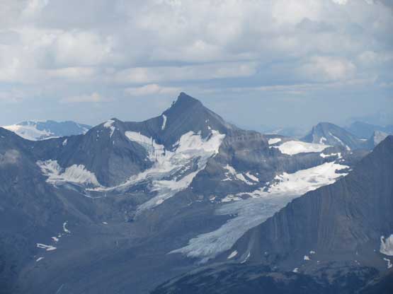
Tsar Mountain from the summit of Mt. Somervell
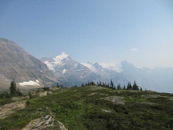
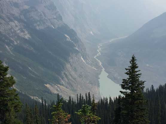
The next day I was supposed to rest but at around 2 pm I made a spontaneous decision to explore the bench on the west side of Mt. Somervell. The main reason was to kill time but I also wanted to search for a reasonable route getting down into Kinbasket River valley. I spent at least 5 hours exploring and the conclusion is that I could not come up with a conclusion. The steep moraine at the bottom could be a show stopper but there’s only one way to tell the truth.. The bonus was that I got a head-on view of the icefalls and glaciers on the south side of Mt. Shackleton. Eventually after getting enough of the views I slowly but steadily hiked back to camp (which involved ~200 m elevation regain) and then had a leisure dinner. Everyone else was taking a rest day so the evening was again, very relaxed. But to be honest by this point I was already sick of the area and was eager to get out. The forecasts showed bad news for our pick-up day but thank to the collaboration with Tusk Peak’s group we were all stuck here. I’m sure the other group wanted to get out earlier too but there’s no way to communicate with each other… Lesson learnt.
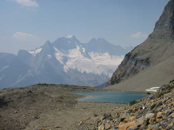
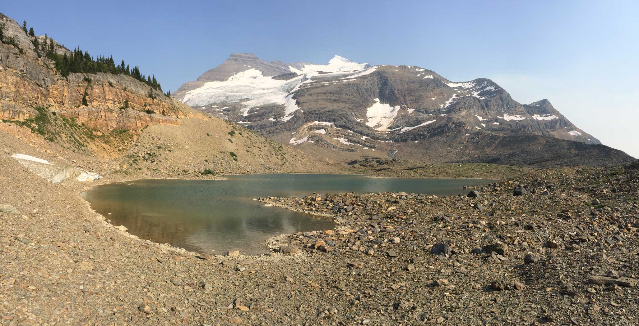
This is one of the several lakes near Tsar-Somervell col
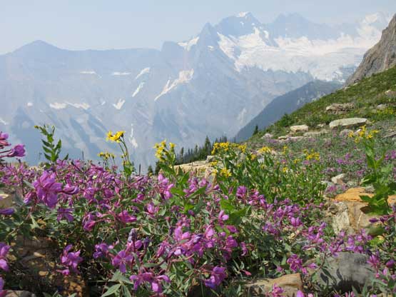
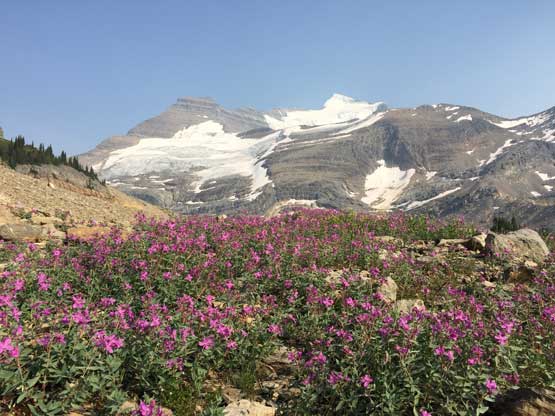
There are a lot of wild flowers

I walked to the edge of the cliffs
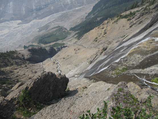
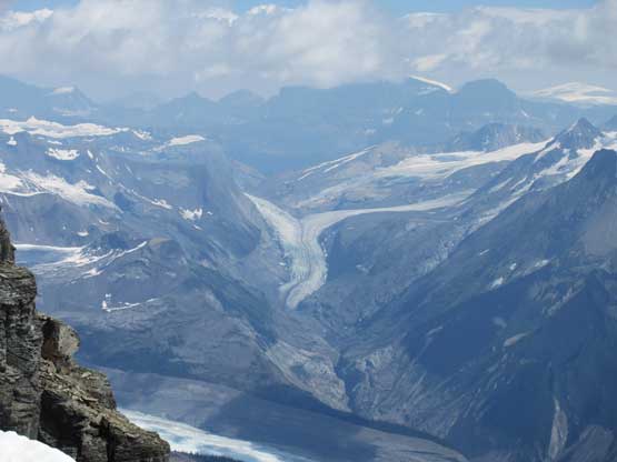
It’s over 1000 vertical meters down into Kinbasket River valley

Just another shot looking down…
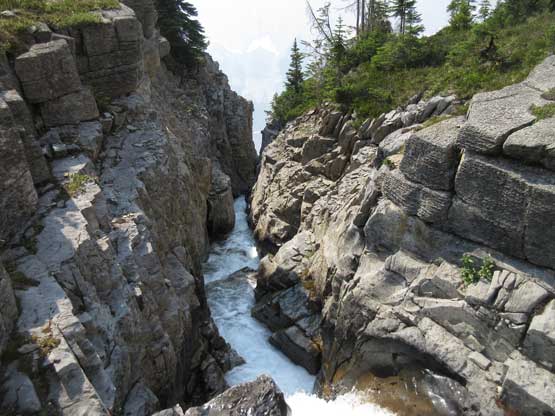
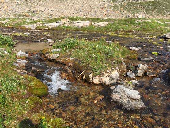
Coming across this mini canyon was a pleasant surprise
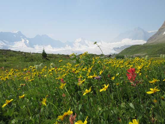
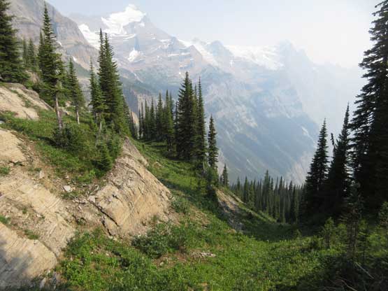
I really loved this alpine meadows. Endless oppourtunity to explore
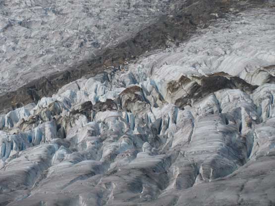
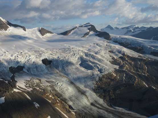
Fast forward. After a long slog I reached the edge of the glacier
This icefall is as impressive as Canadian Rockies can offer
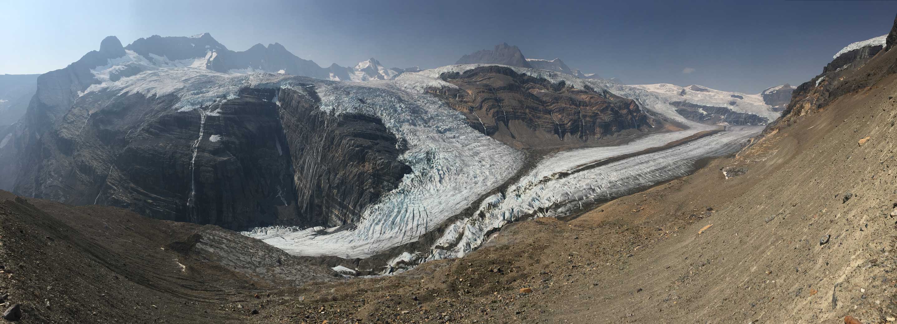
A panorama view of the glaciers and icefalls. Click to view large size.
I hiked up a nearby grassy hill and got this shot looking back at Tsar Mtn.
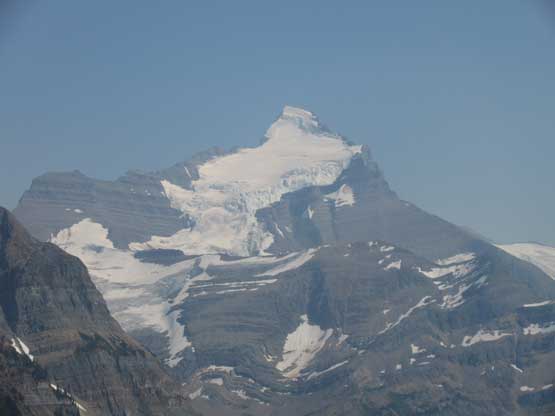
A closer view of Tsar Mountain
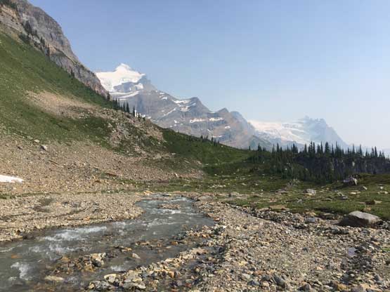
The lake at the headwaters of Kinbasket River
There might be a way down this direction into the valley but I cannot tell
Years ago the ACC used this site as basecamp.
Lovely…
Almost back to our basecamp now.
I went around to explore that lake again
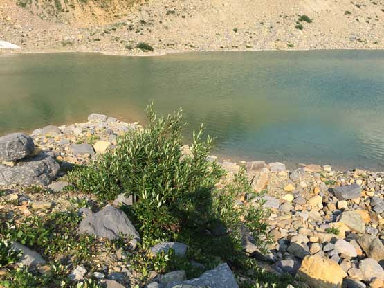
The lake
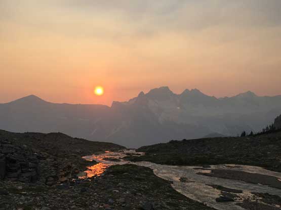
After dinner I went out again for shooting sunset.
For me the day of Aug. 10th was nothing but sleeping in my tent killing time. Robb and Raff went for Mt. Somervell but turned around while Jeff and Lyle made a first ascent on a nearby unnamed peak. I’m not keen on unnamed peak especially the ones without significant prominence so there’s literally nothing to do. On the last day weather rolled in as expected and we were hammered by thunderstorms after thunderstorms. Thankfully the rain eased off a little bit in the afternoon and we actually got a short window to pack up the camp. The worst thing was waiting for the helicopter to show up. It was 2 hours late and the waiting in rain was miserable to say the least… However, the fly off and down the Kinbasket River valley was scenic. At last I got to see this untraveled valley but the mystery of this access would be left for another party to explore. After getting Tsar, Ellis and Somervell I’m done with this place.
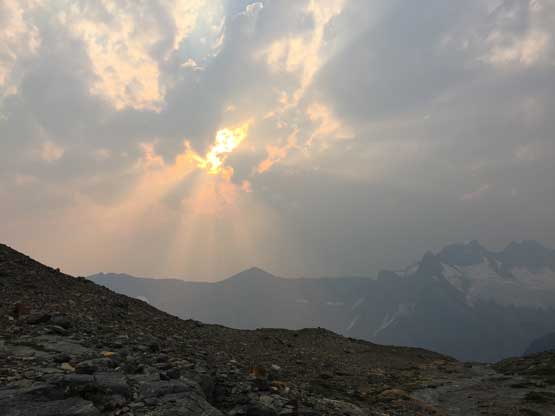
The last sunset of this trip. Note the clouds rolling in already…
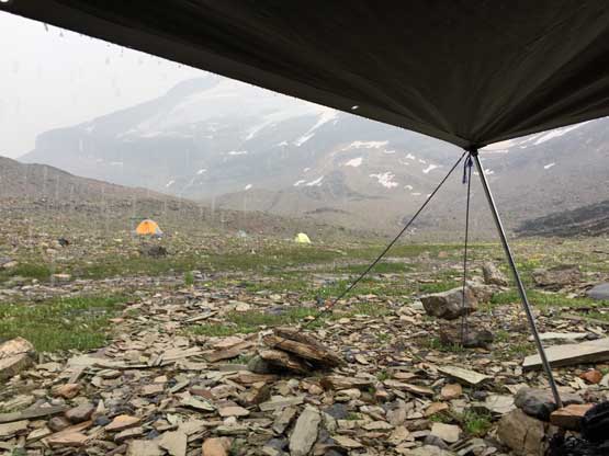
The pick-up day was miserable to say the least…
The last piece of this adventure was driving out of the Sullivan FSR. The drive was uneventful although I would wish to be able to see more of the area. The clouds and smoke had obscured the views. The first thing after getting back into civilization was checking the weather forecast. After two days of thunderstorms another high pressure was supposed to kick in so that meant I would stay in Golden and get ready for The Goodsirs.
