Shovelnose Mountain
March 21, 2021
1694m
Merritt / Coquihalla Highway, BC
This peak is rather just a forested hill that does not offer much interest other than the 600+ meters of prominence. Shovelnose Mtn. locates in a drier area about halfway between Merritt and Coquihalla Pass and because of that, this peak does offer some oppourtunities to escape the dreary weather when the South Coast ranges are soaked in. The most obvious route to ascend this peak is via a communication tower road from the south, but the road itself if 10 km long and to reach the bottom of that road requires an additional 10 km of driving off Coquihalla Highway on some unpaved roads. I had no idea about the maintenance status of these roads but as a winter ascent I think the work’s too much, unless one owns a snowmobile. The route I planned is from NW on some logging road system. The advantage is the much-shorter distance (roughly 8 km each way) but the downside is the lack of information as well as the uppermost 300 m elevation likely requiring some bushwhacking.
The only reason I would bag peaks in this area is when the rain pushed me to drive farther. This happened to be the case on this past Sunday. The weather was not sunny even for Merritt area but at least there’s no precipitation in the forecast, whereas the South Coast would receives more than 20 cm of snow or rain. I thought about to just solo it on snowshoes but I checked in with Lily at the last minute. Lily would not be interested in such a dumpster objective but what about to ski it. The route was flat enough that the skiing was well within our level, so the trigger was pulled. We left Vancouver at 6 am in the morning and drove through some downpours. The road over Coquihalla Pass then involved some careful winter driving but as forecasted, the precipitation stopped as we drove down the other side of the pass towards our objective. I had no idea about the status of the logging roads we were going to use. I was hoping for some snowmobile tracks to ease our trail-breaking effort and I sure was not disappointed. There’s one truck parked at the Highway exit and there were sled tracks going in the direction we wanted. Another good news was that despite the lack of snow in this elevation, the road was skinnable from the truck at under 850 m elevation.
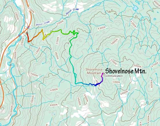
Shovelnose Mountain via NW logging roads. GPX DL
The roads that I was going to use weren’t shown on Gaia GPS map but I had also downloaded the satellite images, so our navigation was mostly used by those images. The first 2 km was fairly icy but the conditions improved higher up. The first major intersection came at around 1200 m elevation where we took the right branch heading southward. The sled tracks had gone both ways so we still didn’t have to break trail. It seemed like the weather was going to stay cold for the whole day so we might not need to break trail after all. This long stretch of skinning due south had a few minor up-and-downs that would come a bit annoyingly on the return but that’s something to worry about later. Upon skinning towards the next major intersection we were surprised to see the roads ahead were doing some slight descending AND being plowed likely due to active logging. I didn’t want to take skis off so led us into the forest hoping to short-cut that stretch. This turned out to be a mistake as the bushwhacking was much worse than I thought. I kept forgetting how bad the bushwhacking was in these drier areas. The forest was dense, the tree branches were stiff and there were a shit ton of dead-falls to negotiate. To correct the mistake we descended onto that road but we found a narrow and skinnable shoulder so that we didn’t have to actually descend onto the road.
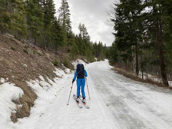
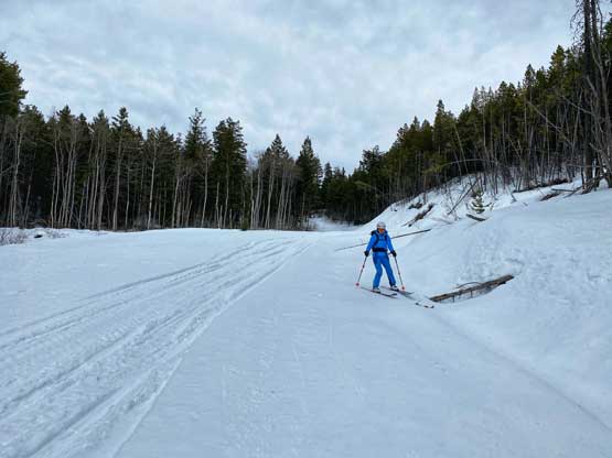
The very beginning of the ascent. As you can see, it was icy
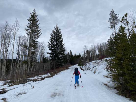
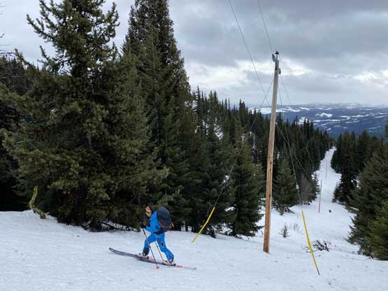
About 1 km into the plod, the conditions gradually improved

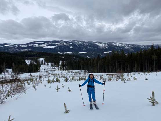
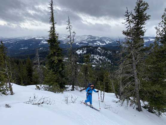
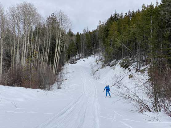
This is at least an hour into the trip

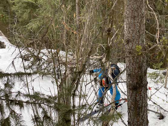
The unsuccessful bushwhack bypass. We bailed down soon after this
Once reaching the base of a large clear-cut area we started ascending again, roughly staying on the left (north) side of this plowed road. At this point we both knew that skiing down in this cut-block would be fantastic on the descent. This stretch of ascent was longer than I thought and towards the top we indeed saw some logging trucks working on cutting the trees. Above this cut-block we had about 50 vertical meters of unavoidable travel in the forest but the bushwhacking was not too bad. Higher up we came across some old roads. My original plan was to detour around on that road to another clear-cut further to the south, but the forest ahead didn’t look too bad so we just ascended straight up. The next 100-200 m elevation involved skinning through some young trees. We kept ascending straight up until hitting what seemed like a powerline clear-cut, and followed that steeply to the summit. The upper part of this mountain turned out more interesting than I thought and the views from the top was also fairly expansive.
Lily skinning up the clear-cut with “Fig Peak” behind
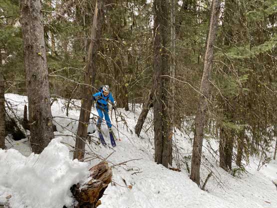
After the cut-block we had a very short stretch of bushwhacking

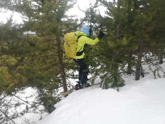
Me skinning up the uppermost powerline clear-cut
Lily skinning on this same stretch of powerline clear-cut
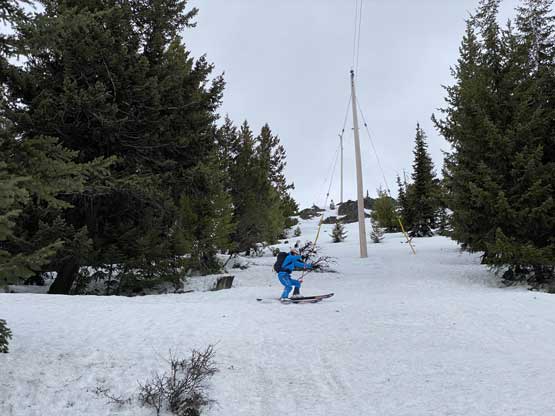
Near the top we veered climber’s left to bypass a rock band

We joined another road near the very top.

This is looking down into Merritt and Nicola Valley
Mt. Thynne to the south soaked in clouds

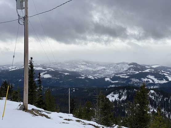
Looking down onto Coquihalla Highway
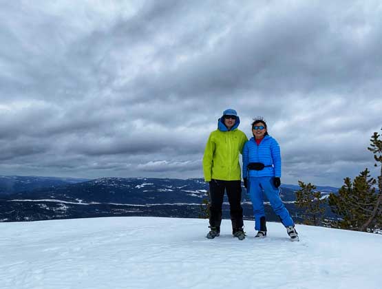
Lily and I on the summit of Shovelnose Mountain
The summit was unfortunately cold and windy so we didn’t linger too long. The last time I had put skis on my feet was February 2019 so I was curious whether or not I still remembered how to ski. It turned out that the muscle memories were not easily forgettable. I had no problem descending the powerline clear-cut that would be equivalent to a “blue run” in a resort. That section of the young trees was challenging that I had to descend by lots of side-slipping and a few kick-turns. Once descending into the lower clear-cut we had an amazing few hundred meters’ of skiing down to the road. Lily opted to carry her skis and boot-pack on that plowed road while I decided to put skins back on (my skis were too heavy to carry on my arms). The skiing back down the roads were super fast and fun that this eventually turned out to be an enjoyable trip on skis. In my past experience I would end up questioning my sanity for 4 ski trips out of 5, so this trip was surprisingly sweet.
Lily making turns on that powerline cut-block

Another picture of Lily skiing down the powerline cut
The young trees section required some unpleasant tight moves

As bad as this stretch went
This was from the lower part of that bushwhack

Boot-packing up that plowed road
The rest of the descent was such a cruise sail
Easy and fast.

We continuously skied right to the truck.
Too bad I had completely dialled into this GPS navigation in the past few years. I followed Google’s direction without even taking a look at the bigger picture and sure enough, the next thing I got onto the highway in the wrong direction. I believe this was definitely an error in Google as the exit where I parked (Coldwater Road) is such a major one that no way I couldn’t go south from there… This meant we had to drive 40 extra km than necessary as the next U-turn exit was at Comstock Road, 20 km away from us. Some heavy precipitation started as we approaching Coquihalla Pass but thankfully the traffic back into and through Fraser Valley was fairly fluent.
