The Fortress
September 15, 2012
3000m
Kananaskis – Smith Dorrien Valley, AB
The Fortress is one of the most popular scrambles in Kananaskis Country due to its easiness to access, lack of technical difficulty, lovely approach valley (Chester Lake area) and gorgeous summit view. This was done as the 3rd objective of a long multi-peak day. Neil and I just finished Mount Galatea and Gusty Peak.

Mt. Galatea, Gusty Peak and The Fortress scramble link-up
After descending from Gusty Peak we took no break and soon started the trudge up The Fortress. The scree was easy to ascend, and there was a snow slope that offered better footing as well (thank Neil for kicking the steps). It didn’t took us long to make to the Fortress/Chester col.
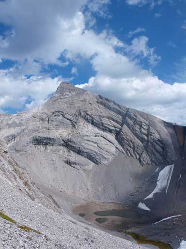
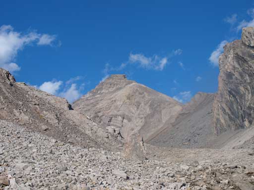
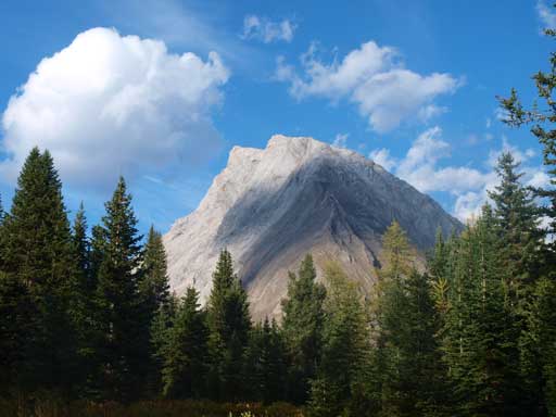
The Fortress seen from Gusty Peak’s slope

We need to slog up to this col
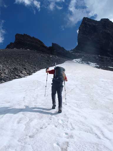
Some step-kicking on snow
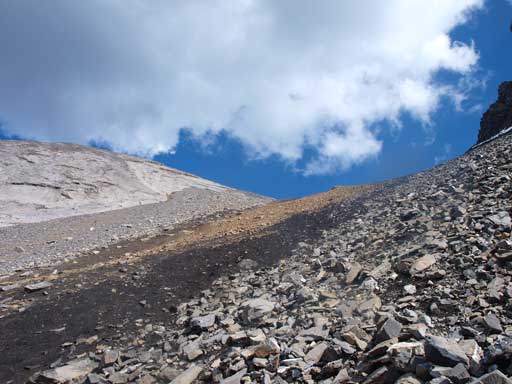
Back to scree slog
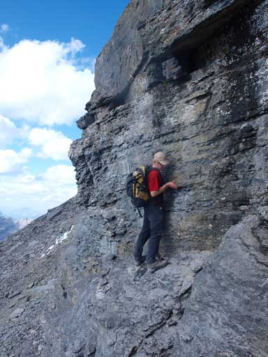
From the col, we simply followed the paths up the slope. Once at the base of summit block, we chose to directly ascend the block, which proved to be extremely difficult and exceeding our comfortable level. We were forced to awkwardly backtrack after being blocked by an overhanging and wet step… After circumventing the block on climber’s left side, we each found another difficult chimney to gain the summit. The summit view was excellent. It was better than from Gusty and Galatea in my opinion.
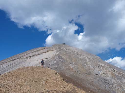
The upper slope seen from the col
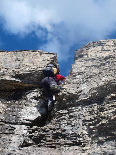
Neil challenging a very difficult step
That line didn’t work and he had to back-track
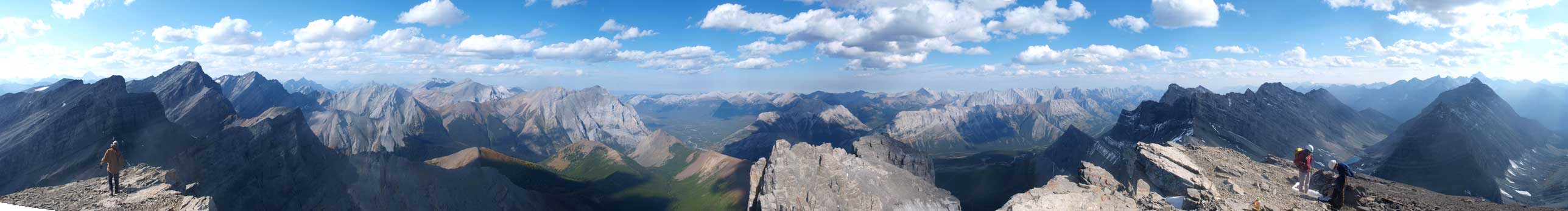
Summit Panorama. click to view large size
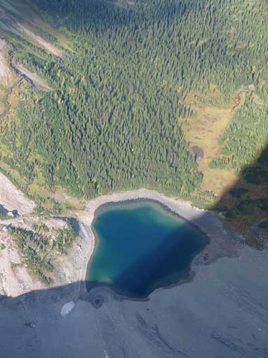
Looking way down the East side to a lake
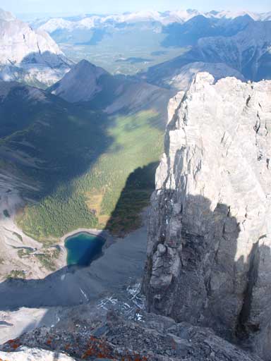
Looking down the shear East face

The McDougall Range traverse is on left and center
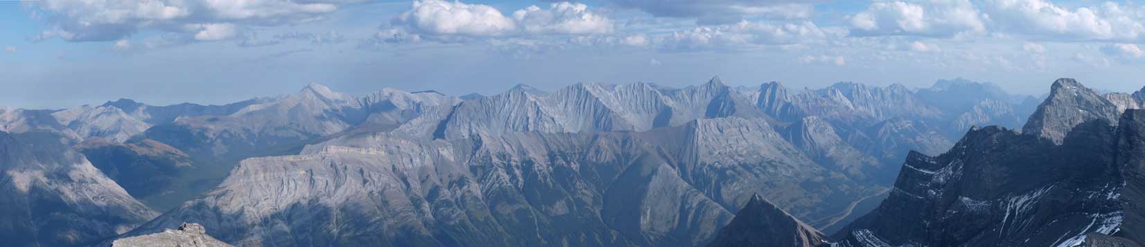
Fisher Peak and Opal Range
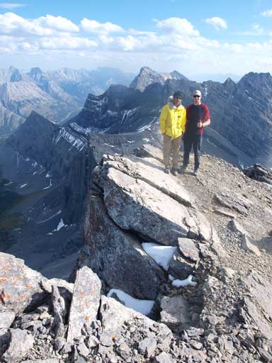
Neil and I on the summit
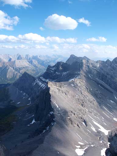
Looking towards South side. James Walker in the distance
We decided to use Chester Lake valley to exist because we all had other plans the next day. Doing Headwall Lakes valley is for sure more scenic but it adds more distance. Scree running down the black scree band was fun and fast and we quickly made back to the valley floor, and then leisurely walked down to Chester Lake. The trail wasn’t easy to follow, but basically we just followed the valley floor out. I took several panoramas at Chester Lake and the meadows. Neil managed to somehow lose his camera, and thankfully I was able to spot it on the trail… The hike-out felt pretty boring and a bit tiring after a long day.
Looking back at The Fortress
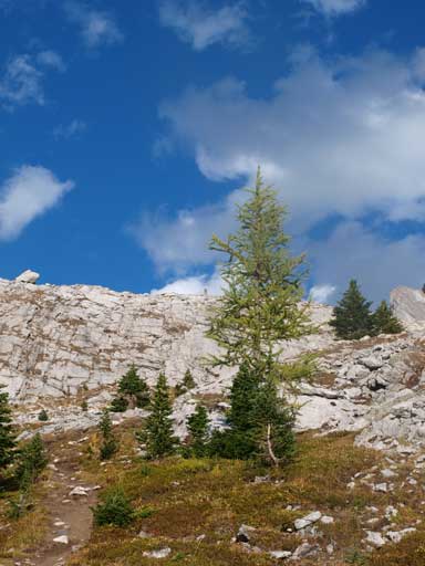
Beautiful alpine environment!

Can’t wait for next weekend!!

A panorama of Chester Lake
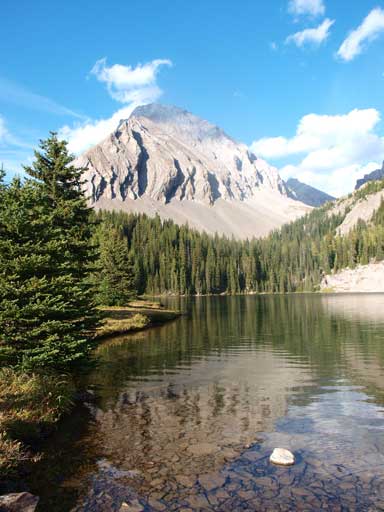
Chester Lake and an outlier of Gusty Peak
Another photo of this area. Mount Chester on right

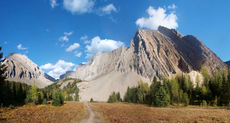
Panorama of a large meadow area. Mount Chester at center
Gusty Peak

Mount Chester
Overall, this a very enjoyable and satisfactory 3-peak-day, and a big thank to Neil for accompanying. We covered 2400 m elevation, and round trip time: 11.5 hours.

[…] Steven Song – The Fortress […]