Rhododendron Mountain
June 7, 2022
2523m
Pemberton, BC
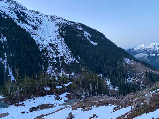
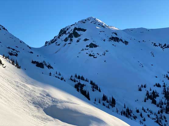
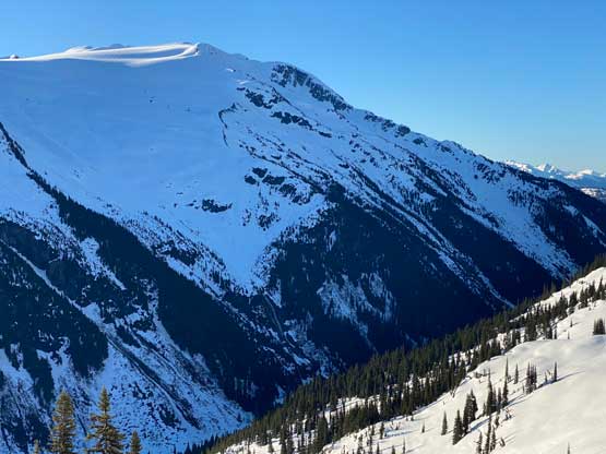
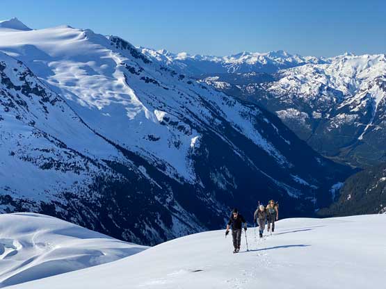
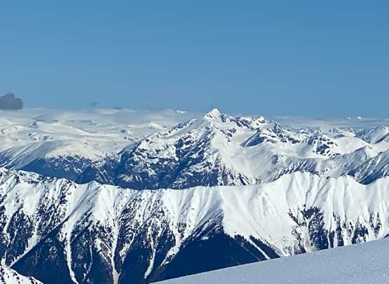
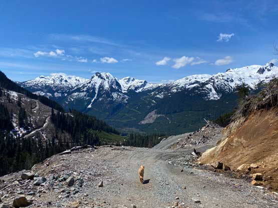
Rhododendron Mtn. is one of the three major peaks (all over 600 m prominence) on the immediate west side of Pemberton sandwiched between Pemberton Valley and Rutherford Creek. This one is considerably more obscured than Sugarloaf Mtn. and Ipsoot Mtn. as the access isn’t as obvious. Rhododendron Mtn. has been traditionally approached from Miller Creek to the east, but recent logging on the south side in the upper Rutherford Creek valley had opened up another possibly that Matt and I were keen to check out. We would essentially start from the highest logging clear-cut a few hundred meters above where we parked for Ipsoot Mountain’s SW approach a year ago, and contour/traverse a few kilometers at treeline between 1600 m and 1800 m and above this valley’s insanely steep bluffs. We also thought about to plod up the valley bottom but such option would require a deeper snowpack to cover the bushes and the creeks. It’s already June, so we opted for the “west canyon highline” option.
The only solid weather window recently happened to be on a Tuesday. This was unfortunate as Monday and Tuesday had become my busiest work days but with some thorough planning I determined it’s possible to bag this peak and still get back in time for work which meant 4 pm in White Rock. This was a very ambitious plan that required a solid all-nighter, type-2 fun push. It’s not my preferred way as by doing so we wouldn’t be enjoying the outing as much, but whenever needed I’m always ready for the challenge. I managed to find three more to join – Vlad, Phil and Nico. The five of us agreed to meet at the end of the FSR at 4 am. Phil and Nico opted to depart earlier to catch more sleep at the road’s end. I wouldn’t finish work until 10:30 pm on Monday night and subsequently couldn’t leave White Rock until 11 pm. I grabbed Vlad from Richmond and then crashed in Matt’s home for about an hour and half. Neither Vlad nor myself got any sleep. Matt then woke us up at 1:40 am and cruised us up the Sea to Sky corridor and Rutherford FSR in record-breaking time. We eventually showed up at Nico and Phil’s vehicle, and then in two vehicles we drove another kilometer further only to be stopped by a downed tree. We could have cut this tree and drive to the road’s end, but it wouldn’t save much time as we were only 1 km from the end anyway. This was 4:20 am so we didn’t start as early as I was hoping for.
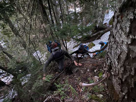
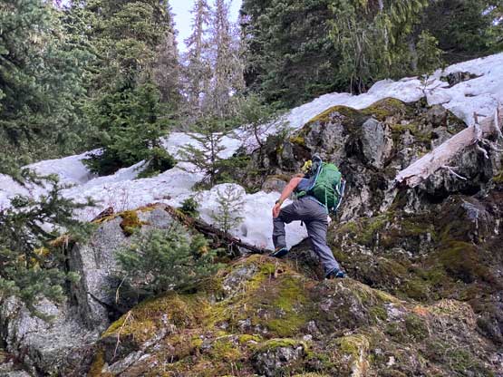
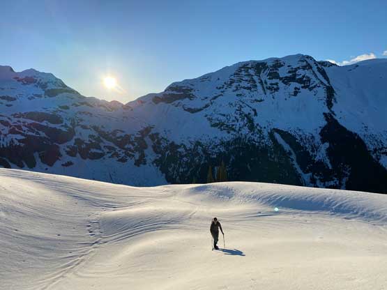
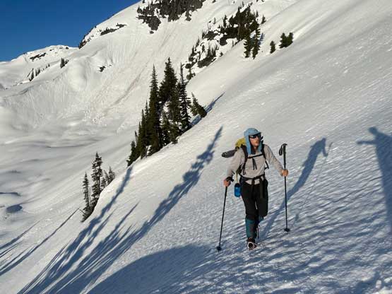
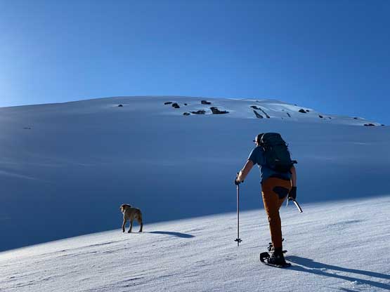
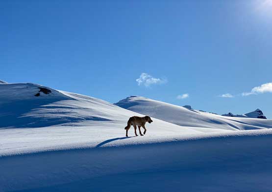
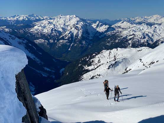
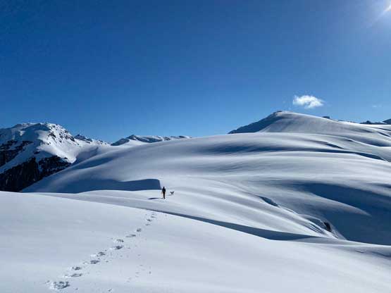
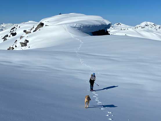
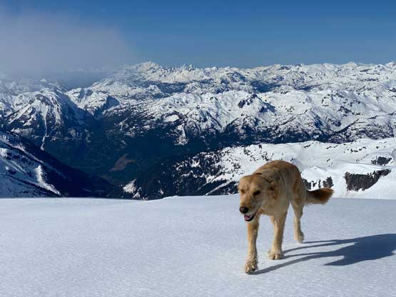
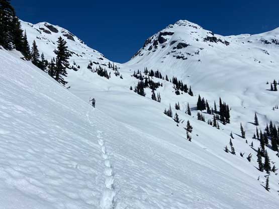
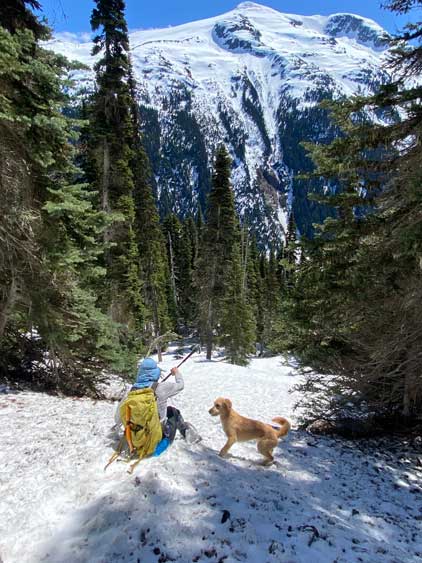
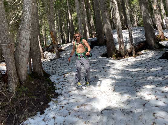
It was already bright enough such that we no longer needed to use head-lamps thank to the openness on the logging roads. The road’s grade was insanely steep. Vlad and I took two short-cuts to make it even steeper but we needed those short-cuts to catch up as we started a little bit later than the rest of the group. At the road’s end we ascended intermittent snow patches into the cut-block and then Twig, for some reasons, wanted to eat a porcupine. Matt and Nico then spent at least half an hour to pull out the quills from his mouth and paws but a few were stuck deeper that we couldn’t do anything about. Matt considered to call it a day here, which wouldn’t be the problem for the group as we had two vehicles. Nico, Phil, Vlad and I carried on but 10 minutes later Twig showed up. I guess Twig had refused the turn-around decision despite still having at least 4 or 5 quills in his body. Nico led the way scrambling through a series of 3rd class bluffs trending more climber’s right than the absolute easiest path. On the descent we stuck further south of our line and found no bluff to content with. The forest’s steepness gave way to to continuous snow in no time and a few more hundred meters of gain later we took a short break strapping the snowshoes on. At around 1700 m we found a neat strip of flat-ish land to traverse northwards and that marked the start of the kilometer-long side-hill bashing.


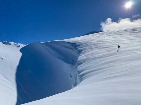
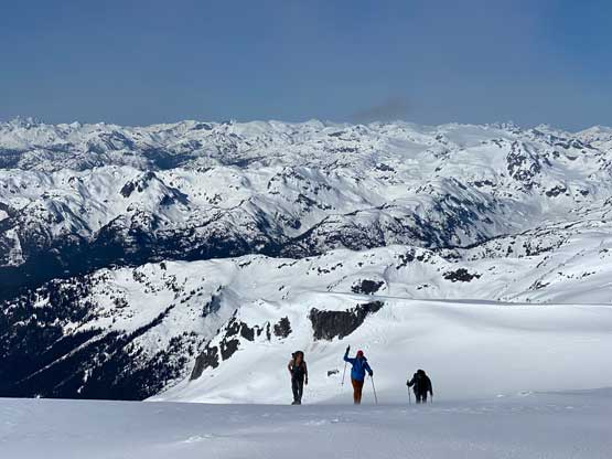
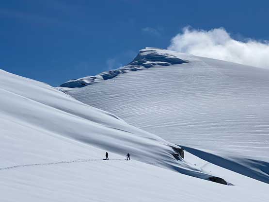
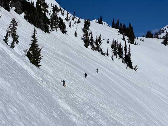
Matt then led across the sustained 35 degree traverse with huge run-outs on snowshoes trying to maintain the elevation. I had noticed this zone to be the most problematic on the satellite images. It turned out not as bad as I thought, but the icy condition in the morning had made things treacherous. The rest of us were all struggling to keep up the pace as nobody was as comfortable side-hilling on snowshoes. Vlad and I even got frustrated enough to ascend an extra 30 m elevation to pop into a shallow gulch feature to avoid more side-hilling. Meanwhile Nico and Phil took a much-need energy break and the four of us also needed an additional transition to don crampons upon seeing the next stretch of traversing that seemed to be even steeper. As a result Matt had to wait almost half an hour for all of us to catch up. Matt and I then led ahead ascending into a broad gully for a few more hundred meters’ elevation gain to a col on the edge of the icefield. I swapped crampons back to snowshoes as I’m significantly faster plodding straight up a slope on snowshoes than on foot. This stretch was extremely foreshortened and seemed to drag on for a long while.

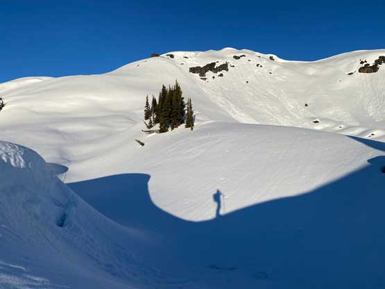


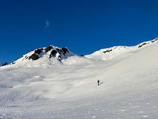
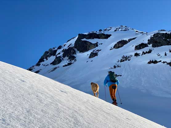

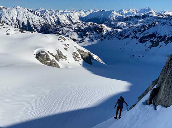
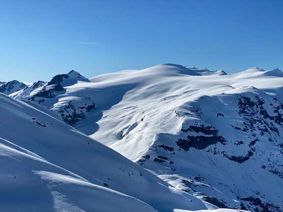
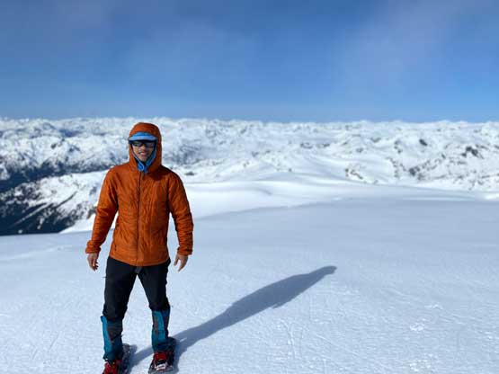
The next stage turned out unexpectedly to be the crux of the route as we must ascend a zone of 40-degree snow to hop onto the contrived SW Ridge system. There would be a way to work around this stretch but additional elevation loss and side-hilling was required, that none of us was keen on. Matt went ahead and did this whole climb on snowshoes but with an ice axe. I opted for crampons for more secure foot placements, but didn’t feel the need to take out the ice axe. I mostly just side-stepped my way up. Above this steep hill we had to traverse over another subsidiary bump before traversing/dropping onto the main glacier SW of the summit. I swapped for snowshoes again. The plod across the glaciated plateau was definitely a drag and so was the final push onto the summit. I constantly checked the GPS to make sure I didn’t get allured by the foreshortened view. The summit was spacious but the north side was on a suspiciously large cornice so there’s no 360-degree views, unfortunately.


On the descent we all glissaded the icier upper slopes back onto the glacier plateau. Matt then led us traversing a “high line” to avoid the 25-m drop but this traverse added considerable amount of side-hilling. With Matt’s tracks to follow it wasn’t too bad. The four of us did not catch up to Matt until finishing that sketchy down-climbing zone. We all went for our own tactics down that section while Matt was giving his lady a phone call. We all ended up catching some cell reception so all of us were on the phone for at least 5 minutes before resuming the descent.


Descending that shallow gully was uneventful but then the snow conditions had turned mushy as we started the long traverse back across the 1700 m zone. The snow was very bad but this had been the theme for this entire season, so again nobody complained. The snow would turn shit by 10 am and we all expected that. Matt and I took turn breaking trail back through the knee deep slush and at times, triggering small wet slides. Back into the forest we constantly tripped and fell and might as well just going for some controlled glissades. Matt had a great sense of direction and led us back through the forest taking a different line, avoiding all sketchy bluffs. We all eventually finished the trip at 12:30 pm and the new goal was set to push back to North Vancouver by 2:30 pm.


This new goal would normally mean nothing to Matt given his driving skills but the traffic was incredibly heavy throughout the entire sea to sky corridor. I ended up catching about half an hour’s sleep on the passenger seat, and we eventually got back to Matt’s place at exactly 2:30 pm. This gave me enough time to definitely make back to White Rock before 4 pm. I ended up earning about 15 minutes of extra time so firstly grabbed some food from Tim Horton’s and then went home for a quick shower before showing up for the work. I ended up working till 9:30 pm and that was an insanely exhausting finish. I basically planed to squeeze two days’ of work into one and the mission was a success in the end. Post trip update: Twig ended up in the hospital for 6 hours immediately after the trip and they took out 6 additional quills. I could not believe what he had pushed through on the hike, limping most of the way up and still beating all of us.
