Mount Sedgwick
June 28, 2020
2082m
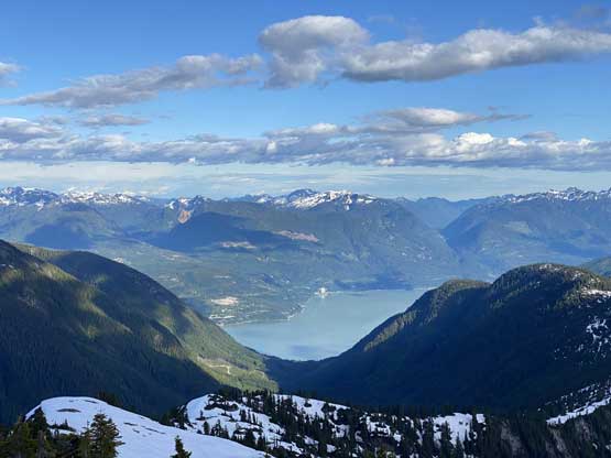
Squamish, BC
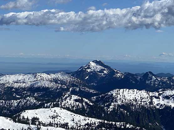
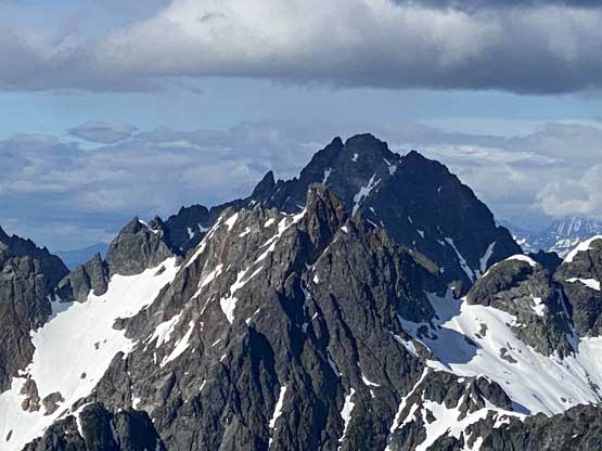
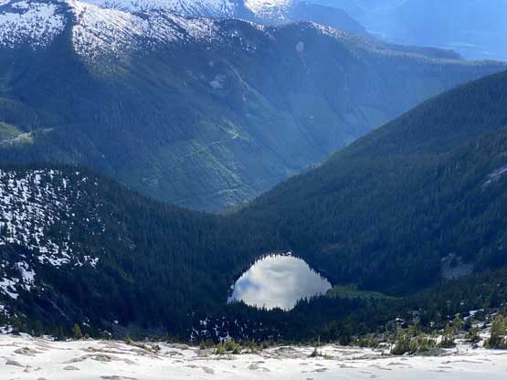
Mt. Sedgwick is not a particularly tall summit by SW BC standard but is yet another peak that everyone talks about in the small climbing/peak-bagging community. The triangular-shaped SE Face of this peak provides a stunning backdrop for drivers going up the Sea to Sky Highway. The peak is a non-technical ascent by pretty much any route, but the access is challenging. In the old days when Woodfibre Mill ferry was still available, this peak was done a bit more often via the south ridge from Henriette Lake. Even back in the days this was still a sea-level-up ascent that normally took two or three days to complete. The access had significantly worsened in the past decade due to the decommission of the ferry and the logging roads on the far side of Howe Sound had become extremely overgrown. This peak had been done last year via the same entry point but the trip sounded like two days of extreme level of sufferfest.
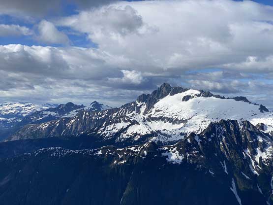
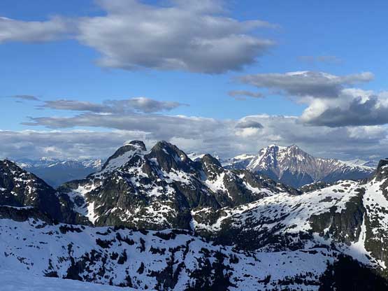
There are a few alternative approach options and one is from Lake Lovely Water by traversing around Mt. Conybeare. This traverse had been done in either direction but again, the access to Lake Lovely Water had its own challenges such as a Tyrolean traverse across Squamish River on a cable car. The third option that I discovered in the past few years is by a ridge rambling from Mt. Lapworth over the summit of Mt. Conybeare. I wasn’t entirely sure if this would be a viable option but by just looking at the topo maps and satellite images I also didn’t see any reason that this route wouldn’t go. The approach to Mt. Lapworth would still require a crossing of Squamish River as well as a sea-level-up ascent. As I stated before, I’m not someone that particularly likes the access challenge even though I love doing researches, so this trip was never high on my list, until this spring when Alex suggested to fly into the area to bag Mt. Conybeare, Mt. Murchison and Mt. Lapworth. I figured if I flew into this area I’d like to tag Mt. Sedgwick as well and the plan eventually jacked up to a 5-peak traverse from Mt. Lapworth all the way to Mt. Roderick. To accomplish this plan in a single day we flew to the summit of Mt. Lapworth, then ascended the north ridge of Mt. Murchison, and then the south face couloir of Mt. Conybeare. Marius had called it a day before Mt. Conybeare but Alex, Vlad and I insisted to carry on.
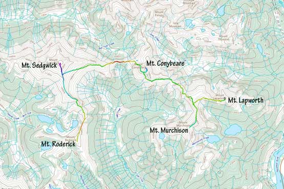
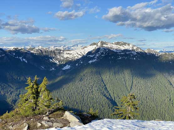
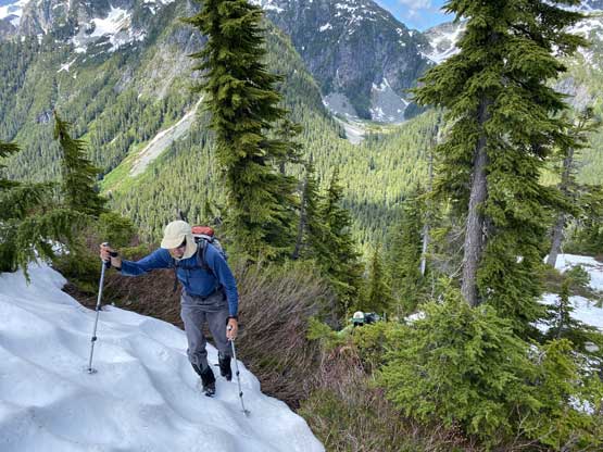
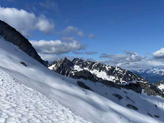
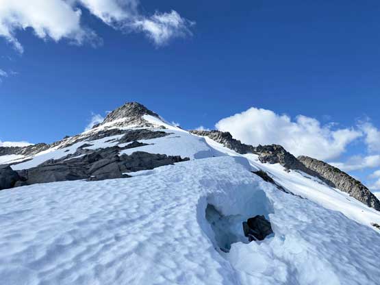
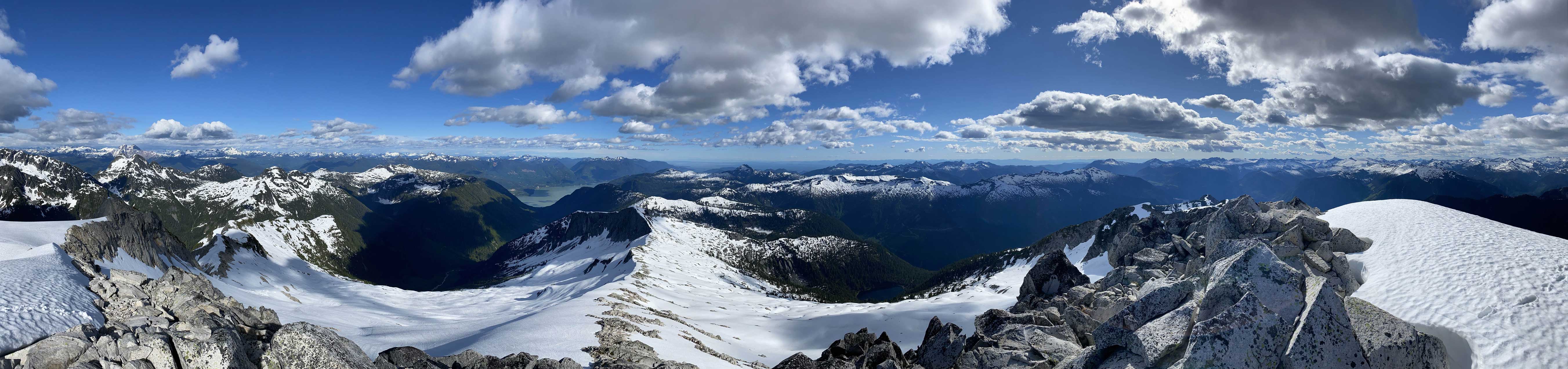
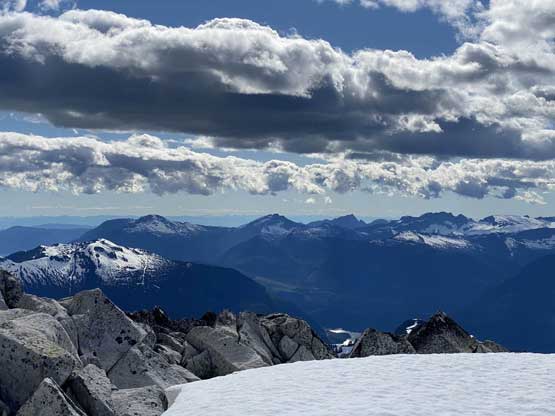
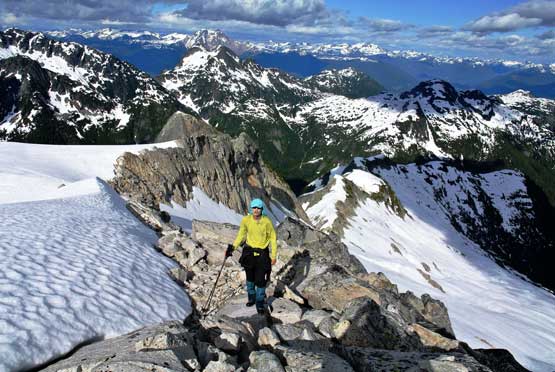
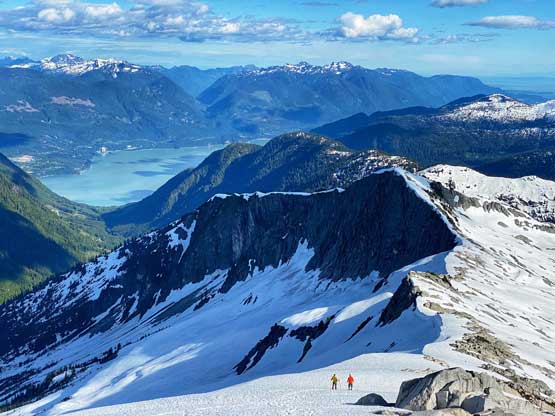
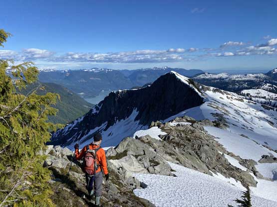
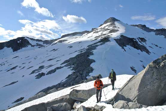
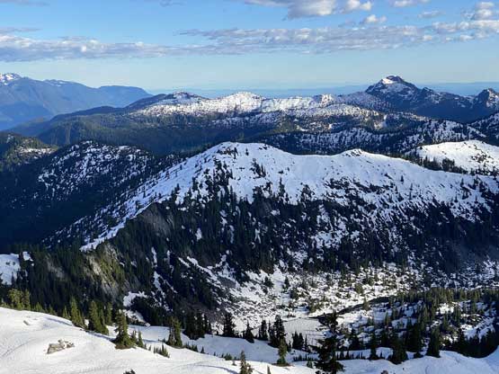
The lowest point of this trip was Conybeare/Sedgwick col and from the col onward we had to deal with a bit of bushwhacking but the ascent soon became a smooth-going on snow. I thought about following the ridge but one bushy step and buttress forced us to traverse onto the snow slopes to our right. We then easily ascended onto the east ridge at 1550 m where we took a lengthy break. There were several options. My original plan was to ascend the SE Face straight up to the summit but changed my mind upon seeing an obvious line diagonally up traversing the face onto the upper south ridge. This would be longer in distance, but allowed us to ditch our packs once intersecting the south ridge. The ascent/traverse turned out to be a foreshortened slog that took us at least an hour if not longer. To reduce slipping and to make side-hilling easier we opted to wear crampons.
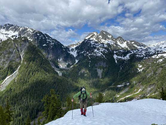
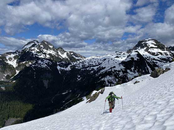
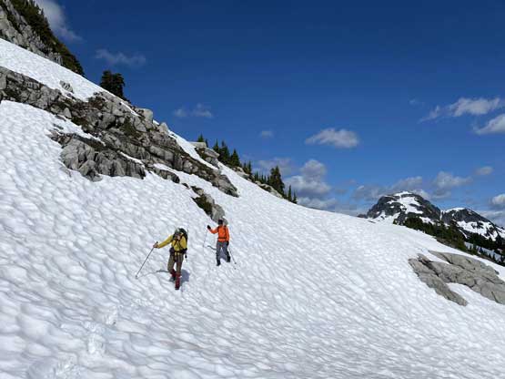
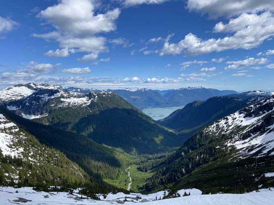
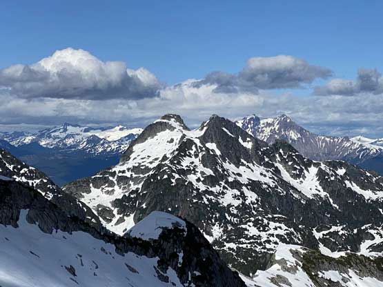

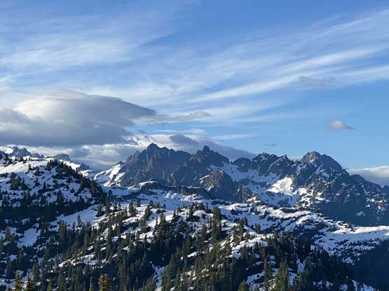
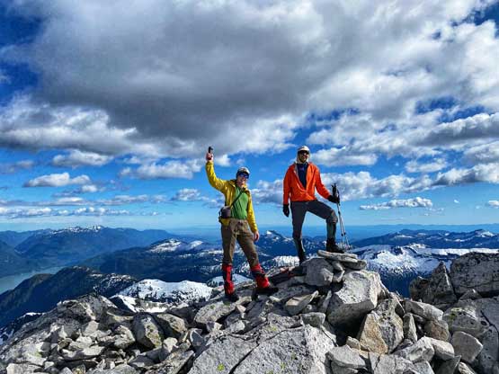
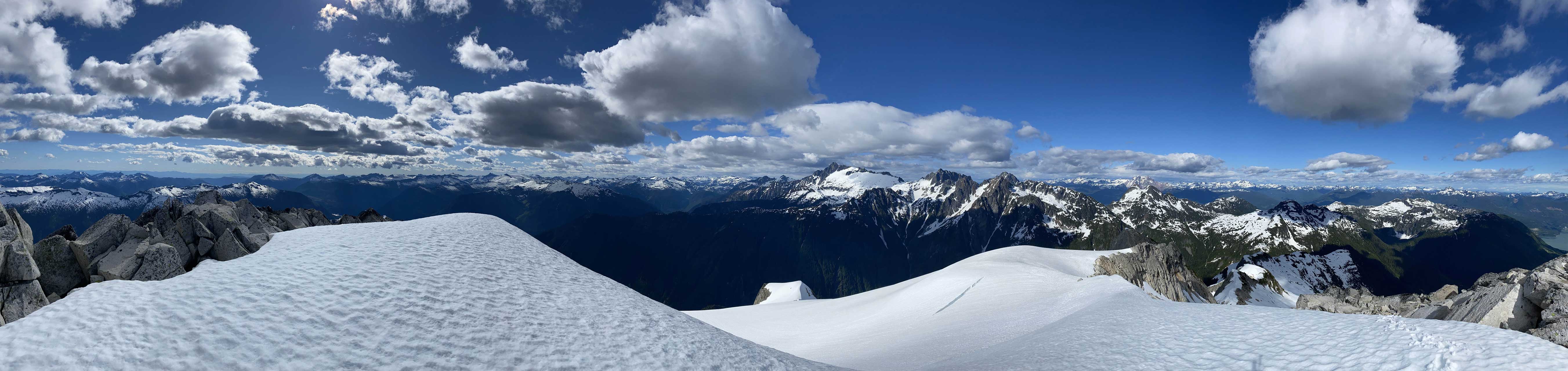
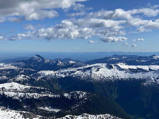
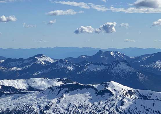
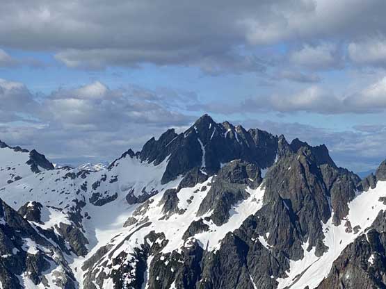
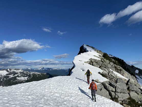
We took another long break on the upper south ridge ditching everything including our packs. The ascent to the summit still required more than 200 m elevation gain so in retrospect I should have eaten something. We then carried on, plodding up the never-ending snow ridge with fabulous views towards all directions. The summit pyramid had some fun class 2-3 scrambling. At this point I was exhausted for not eating enough but still managed to drag tired self onto the summit. The last register enjoy was indeed Maria Masiar’s in summer 2019 in which they took a boat and started from Woodfibre Mill at sea level.
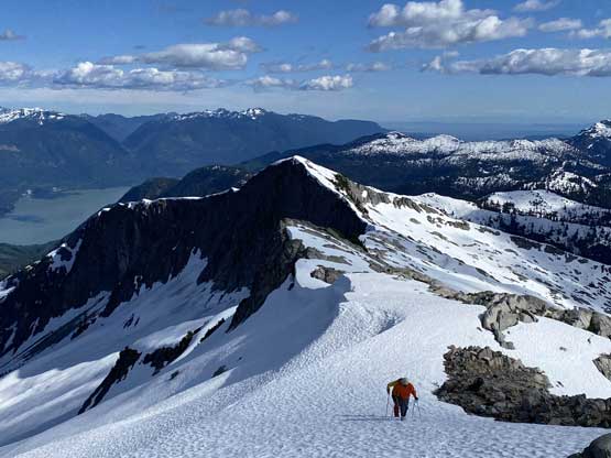
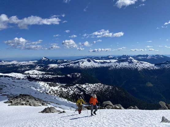


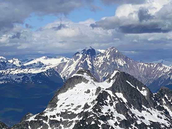
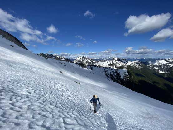
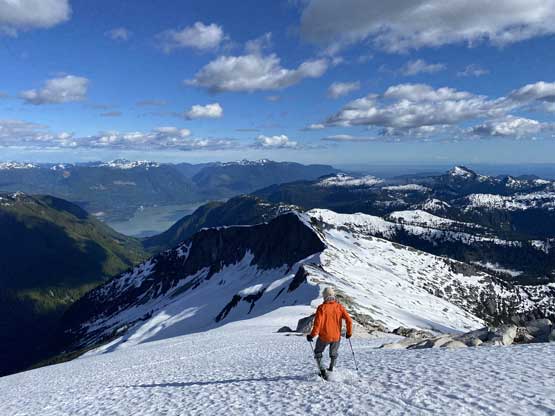
Because we weren’t doing particularly good on time we had to keep going. Alex and Vlad down-scrambled the rock while I easily bypassed the rocks by taking the snow route. The plod down the upper south ridge was then super fun and fast. I stuffed a big dinner in after getting back to our backpacks and now with 1.5 hours till the helicopter pick-up time we had to race towards Mt. Roderick to finish our project. The bump immediately to the south of Mt. Sedgwick proved to require some route-finding due to cornices and the descent down its south side had some scrambling as well. Lower down we actually stayed more on the south-west slopes rather than south ridge trying to avoid elevation regain for as much as possible. It turned out that avoiding up-and-downs was impossible and we also had to deal with some bushwhacking and considerable amount of route-finding. Thankfully we had full snow coverage to ease things.
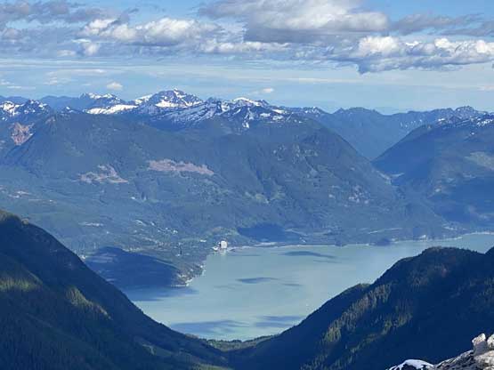
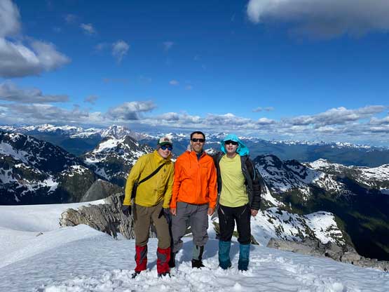
By the time we eventually got down to Sedgwick/Roderick col we had only 20 minutes till the pick-up time, and there’s still over 100 m elevation gain to the summit. Were we tired? Of course yes, but at this point we just had to suck it up and maintain the racing pace… Mt. Roderick is a minor bump on the long and undulating south ridge of Mt. Sedgwick and in the old days when Woodfibre Mill ferry was still running, this peak is often traversed up and over en route to Mt. Sedgwick, or bypassed for those that weren’t peak-baggers. In the modern days one rarely hears stories about these peaks anymore because the access had significantly worsened over the years. The plod to the summit of Mt. Roderick seemed to drag on for a long time especially now with a time constraint, but we did make there with 5 minutes of spare. There was spotty cell reception and Alex got a text message saying the helicopter would be in the air in less than a minute so we still had some time to take the obligatory victory shots. The summit was flat and open enough for the helicopter to land but we did dissemble the cairn just in case. Once the helicopter showed up we quickly piled in and directed the pilot towards one of the few bumps on the east ridge of Mt. Conybeare where Marius was patiently waiting for us. We then picked him up and had a fast ride back to Squamish, and eventually home at 11 pm.