Cartmell Peak
May 27, 2020
1436m
Hemlock Valley / Harrison West, BC
“Cartmell Peak” is the unofficial name of the highest of the four summits in the immediate vicinity of Hemlock Valley ski resort just to the west of Harrison Lake. The name was assigned by bivouac.com due to the proximity to Cartmell Creek. Among the four peaks in Hemlock Valley I think “Cartmell Peak” offers the best view because the north side of the summit faces a shear drop into the upper Cartmell Creek hence free of vegetation. The access is super easy as the road to Hemlock Valley is as smooth as a “highway” despite the gravel status, and brings hikers to an elevation of 950 m. With only a couple kilometers distance and 500 m elevation gain to the summit this hike can be done in a mere few hours round trip. However, Hemlock Valley isn’t known for its hiking nor peak-bagging and there is no trail on the south ridge beyond the ski resort. To minimize bushwhacking one wants to have snow, so April or May (after the ski season ends) should be the best time to do Cartmell Peak, or any of the other three summits in this area.
Three years ago I had come to this area with ascents of Mt. Davies and Mt. Keenan on snowshoes. I was not particularly impressed by the views from those two peaks so a return didn’t happen until three years later. The weather forecast was calling for “golden” on literally anywhere in BC but I had to be back home on time for work in the afternoon. I asked around on a couple Facebook groups whether the Hemlock Valley road was closed for this stupid COVID thing and the answer was negative. I figured I might as well take advantage of the access and pulled the last-minute trigger. I woke up at 4:15 am, spent half an hour preparing for food and made to the resort at around 6:30 am. The drive was longer than expected but was smooth going.
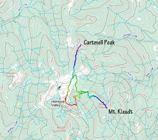
Cartmell Peak and Mt. Klaudt ascents from Hemlock Valley. GPX DL
It’s apparent that I no longer needed snowshoes so I packed all shits into a small, 20 L backpack. I was also the only one parked at the resort. The resort had some signs of “no entry” but it wasn’t clear if the main parking lot was included, so I parked there anyway. I started the hike by walking up the now-closed ski resort sticking to the right side edge. I picked a wrong turn at some point, came to a dead-end and had to correct the mistake by cutting sharply left through minor brushes. Then I had no problem following the main road to near its end and then bailed into the forest. The snow at 1200 m had become continuous so there was no bushwhacking up on the south ridge. I followed the ridge overcoming a few intermittent bumps. The true summit had a steep rise to gain and once there I was treated by unobstructed views from the Chehalis group to Harrison Lake.

My truck on the empty lot with Mt. Keenan behind
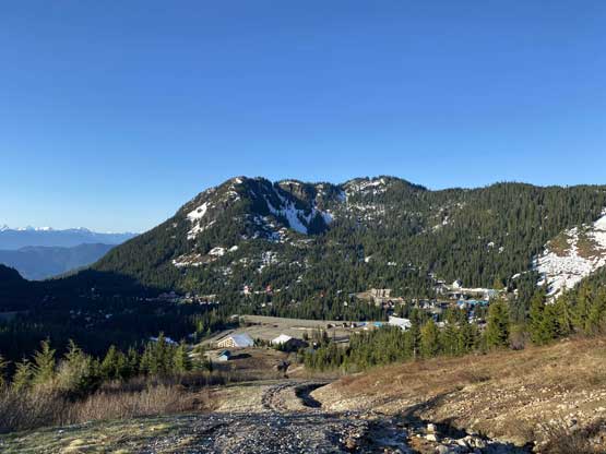
Walking up the resort runs. Looking back at Mt. Keenan

Soon the snow became continuous.

I bailed into the forest near this cut block

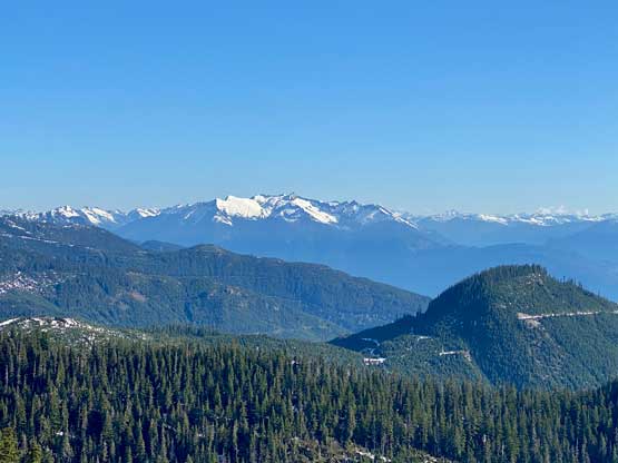
Mt. Baker on the southern horizon

The Golden Ears Group
Looking down at the south end of Harrison Lake and Echo Island
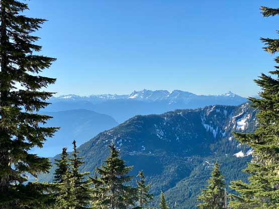
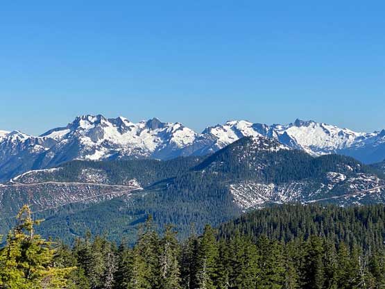
The Cheam Range peaks dominate the southern skyline

Slesse Mtn. and the Border Peaks poke behind Mt. Klaudt

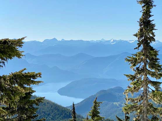
Harrison Lake wide range view from the summit of Cartmell Peak
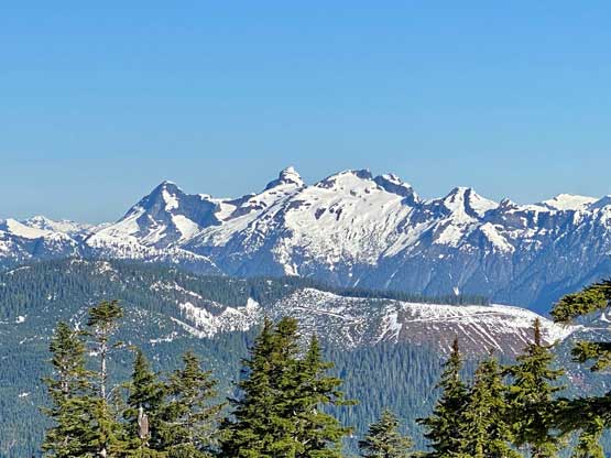
Mt. Breakenridge on the northern skyline
Mt. Clarke, Nursery Peak and Grainger Peak behind Mt. Downing
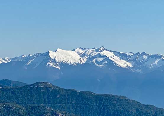
A zoomed-in view of Mt. Breakenridge massif
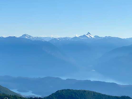
The striking Mt. Urquhart on the other side of Harrison Lake

Grainger Peak’s south face

Mt. Clarke, Recourse Peak and Viennese Peak
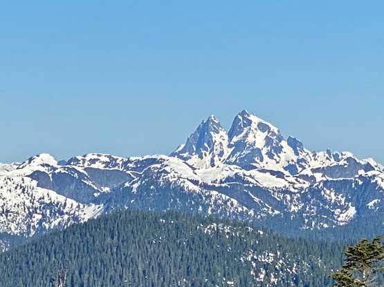
The iconic Mt. Judge Howay
Mt. Ratney is the highest with Stonerabbit Peak and Mt. Bardeen
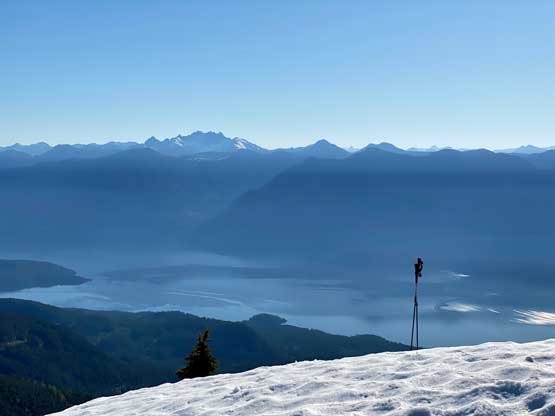
The Old Settler and more of Harrison Lake

Me on the summit of Cartmell Peak
After at least half an hour’s lingering I decided to hike back. I debated about going for Mt. Klaudt since it’s right there, and opted for yes. It appeared that I could link up several logging roads to Cartmell/Klaudt saddle and then bushwhack up the broad NW flanks of Mt. Klaudt.

Leisurely walking down the broad south slopes of Cartmell Peak
Speaking the one that I just did (Cartmell Peak), I had no idea about its obscurity on the internet. I’m sure it’s been hiked a lot more often (anonymously), but I could only find two or three trip reports by simply searching on Google and none was detailed. I also don’t hear much about this area on Facebook and Instagram. Now with my trip report and GPX tracks out I hope more of you will come. If you plan accordingly you can come up here for the sunset as an after-work exercise in May or June when the sun don’t set until past 9 pm. Type 1 fun. Why not…
