Mount Andromeda
April 13, 2014
3450m
Columbia Icefield, AB
Mount Andromeda is a beautiful 11,000er on the infamous Columbia Icefield that offers classic alpine routes for mountaineers at all levels. Andromeda Strain is probably the hardest mixed climb in the Canadian Rockies. For intermittent climbers the aesthetic Skyladder is one of the must-do’s. For those lacking technical ice climbing skills like myself, the south ridge offers a non-technical way to reach this lofty summit. This route is normally done on skis in spring time when the crevasses on Athabasca Glacier are well bridged. The details of this route are well documented in Bill Corbett’s 11,000ers book.
Mt. Andromeda ski ascent route via South Ridge. GPX DL
After ascending its higher neighbour, Mount Athabasca in July last year, I was keen to tag Mount Andromeda sooner than later. However, to successfully reach its top one has to wait patiently for perfect weather and snow condition, and at the mean time there must be enough snow to cover Athabasca Glacier’s crevasses. This is quite a luxury requirement especially in this year. The dryness and heat in the past summer combining with the low amount of snowfall in early winter made glaciers dangerous places, and after the drought period’s surface got buried in early February, avalanche danger was kept red and orange for the following month. There was no guide report of Columbia Icefield whatsoever. The weekend before this trip, Ben and part of his “Great Divide traverse” group ski’d up Athabasca Glacier and placed their 3rd food drop near the Trench. That was a miserable trip due to terrible weather but they did provide the crucial condition update. One week after that a high pressure system moved in. It’s not gonna be a long stretch of good weather but all forecasts agreed with “golden sky” on Sunday with good overnight freeze. It’s the time to push things harder and there’s no way I would do foothill ascents again…
This wasn’t our original plan though. Knowing well ahead a big group would attempt Cathedral Mountain it was tempting to just follow their tracks. However, Ben and I decided against it as we wanted something “winter only”. Cathedral has a very long climbing season and is a good day-trip in all months except for late fall/early winter. We waited till the last day to eventually make the call to ascend Snow Dome and Kitchener. Ben was keen to finish them off since he was supposed to get them in the previous weekend, and I had no problem with that so that was it. We left Edmonton earlier on Saturday and arrived at Jasper at dinner time. Weather looked to be better than expected (Saturday was supposed to be cloudy) as we drove southwards on Icefield Parkway. All looking good we car camped at the trail-head. There was already a truck parking at there and we were hoping to see a set of skin tracks. With a million starts and a bright full moon we woke up at the ridiculously early 1:20 am. It took us longer than expected to sort everything out and we eventually started at 3 am. It’s gonna be my first trip up the infamous Athabasca Glacier.

Night scene from parking lot. Photo by Ben N
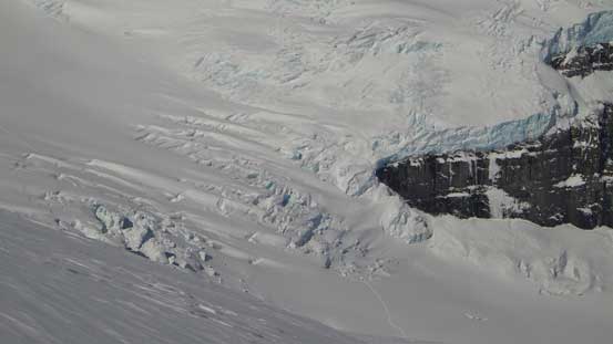
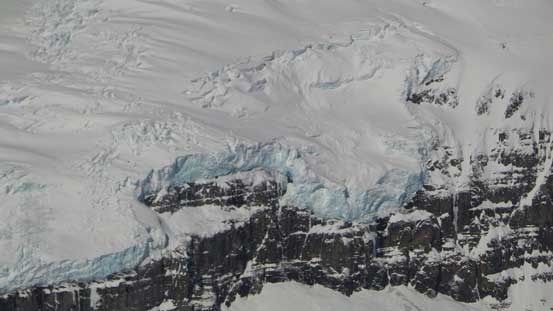
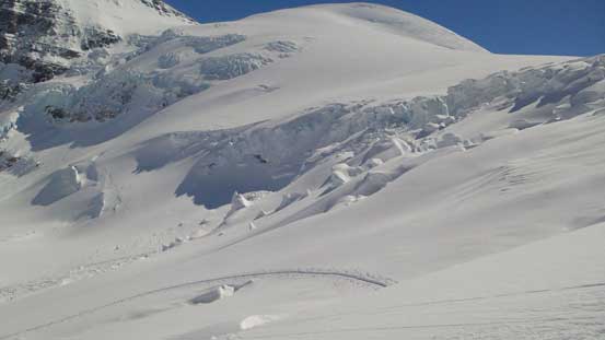
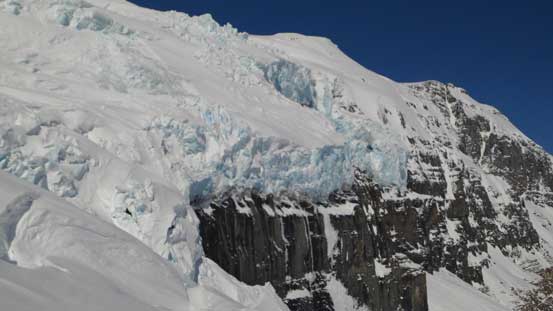
Following Ben’s GPS track from the previous weekend we ski’d down towards right hand side of the glacial toe and then up the glacier while following the moraine. Ben set up a blistering pace and we were cruising up pretty fast. Looking back we could see the AA col falling behind us quickly. Towards the first icefall my super power bright head-lamp spotted a nice set of skin tracks and we felt a huge sense of relief. Oh well, no need to GPS the maze of crevasses now… The skin tracks led us leftwards once up the first icefall. They took the bypass route. We were wishing to ascend the serac route since it shaves off about 20 minutes and has less crevasse problem, but at this point the skin tracks would be our best friend. The second icefall was a lot more broken than expected and we ended up maneuvering around some big ass holes. Sometimes we were right beside some impressive ice chucks that’s within touching distance. At the mean time the snowpack was much thinner at a couple places and we could pole down to the glacial ice easily… I think they didn’t go far left enough and ended up ascending straight up the icefall, but because it was my first time up there (and was dark so couldn’t see far ahead) I don’t want to make a solid commend here. What I can tell is, I’d never seen terrain as big as that before and it was just amazing.
Back rightwards towards the final ramp, also known as the third icefall. Again, following the tracks eliminated route-finding to us and it was easy going just simply putting one foot in front of another. However, the terrain was as expected, big… It was quite steep and there were quite a few open crevasses to maneuver around. Ben had the fresh memory from the previous weekend when his group did a boot-axe belay over the crux traverse above a gigantic open crevasse, but on this day apparently the party who made the tracks did a better job route-finding. Once exiting the glacier we continued following their tracks for a while. It took us 3 hours from car to here.
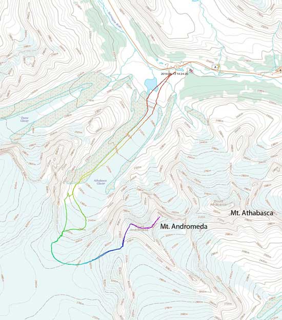
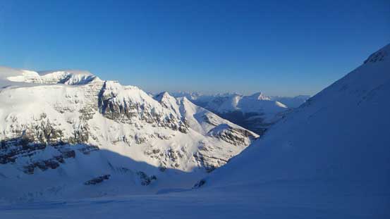
At this point the sky was still dark but we could see bright colour starting to appear over the eastern horizon. Our ambition kicked in and we figured we might have enough time to grab Andromeda, Snow Dome and Kitchener… Andromeda would be the most difficult and required ascending earlier in the day so we left the skin tracks. To access its south ridge we had to traverse a long way under a 3330-meter unnamed peak. Just about to gain elevation significantly on that big diagonal traverse, we watched the horizon turning purple then pick and finally red. It’s alpenglow time!! It reminded us greatly the epic 15 minutes we got on Athabasca last year. It was just beyond spectacular. Two of the Rockie’s giants stole the show – Mt. Bryce and Mt. Columbia.
Morning colour over the Eastern horizon
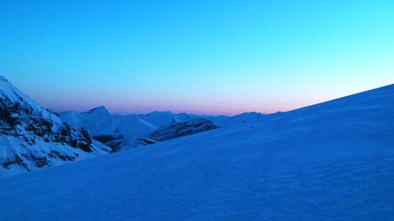
Mt. Columbia just about to glow
Now, Mt. Columbia full on alpenglow
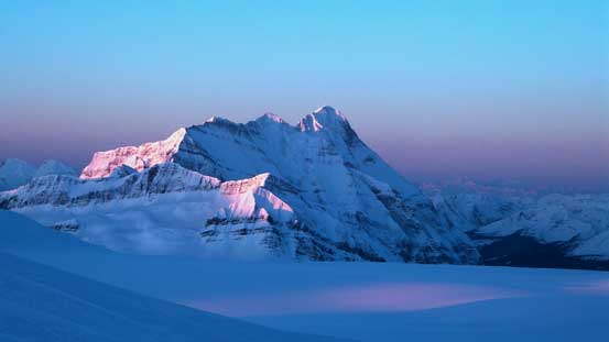
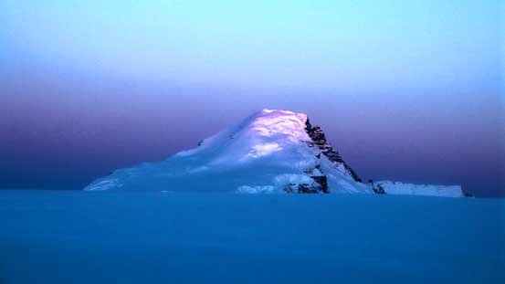
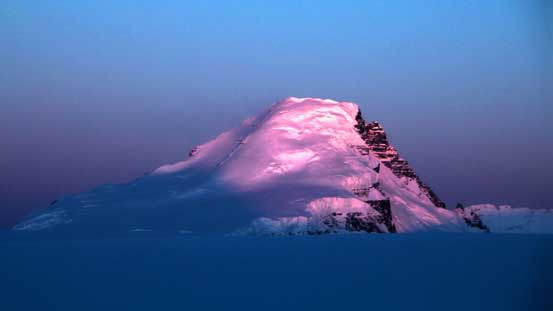
Mt. Bryce at alpenglow
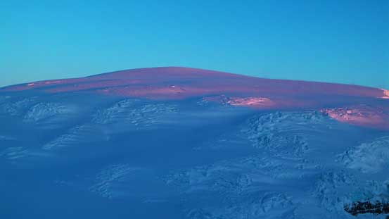
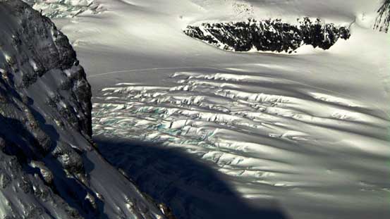
Snow Dome and the crevasses…

This outlier is sometimes referred as “Little Snowdome”
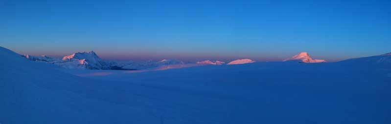
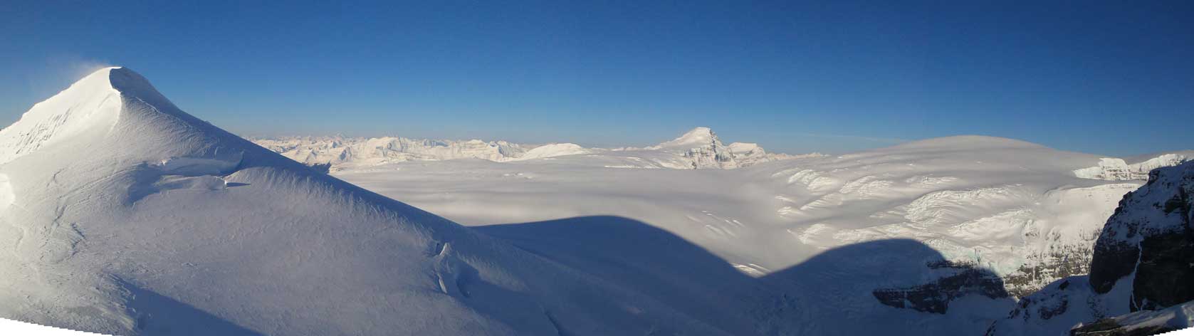
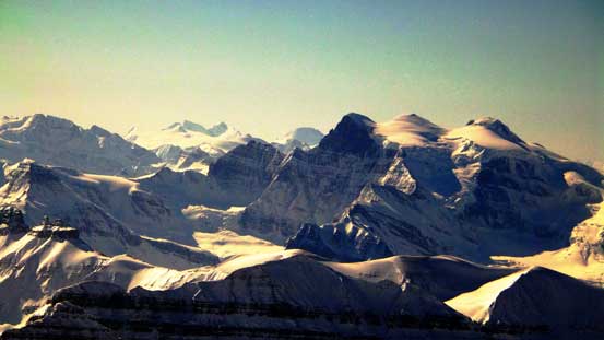
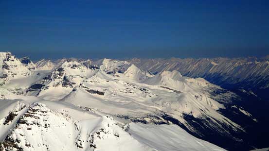
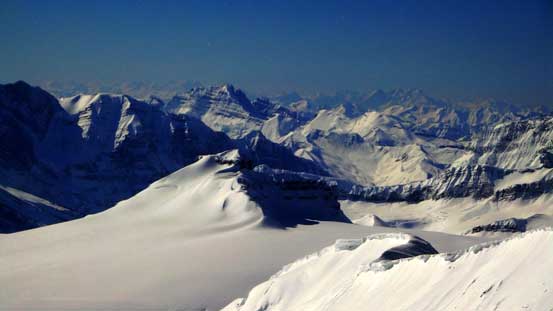
Panorama of the Columbia Icefield at alpenglow

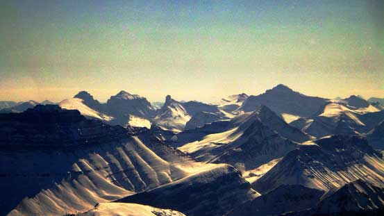
Panorama of Snow Dome at alpenglow
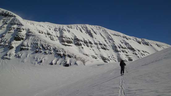
This diagonal traverse was very foreshortened. About halfway through Ben got tired so we switched position trail-breaking. It was also at this point the wind finally picked up. It was ridiculous as there was pretty much no wind on the glacier and icefield below but the wind suddenly picked up to crazy. It was also extremely cold. (Kinda the theme of this year. Every once in a while high pressure system came it also came together with extreme coldness)… The traverse got steeper towards the col (definitely avalanche terrain here), and we could start seeing big open crevasses above and below us. There’s a steeper roll in front of us which turned out to be another big hole… There’s a minor elevation loss down to the col and even right on the col there’s an open crevasse… This is the part that one cannot afford an avalanche and in order to avoid the crevasses visibility must also be decent.

Ben breaking trail diagonally up the big slope
Looking back at Ben. We already switched lead here

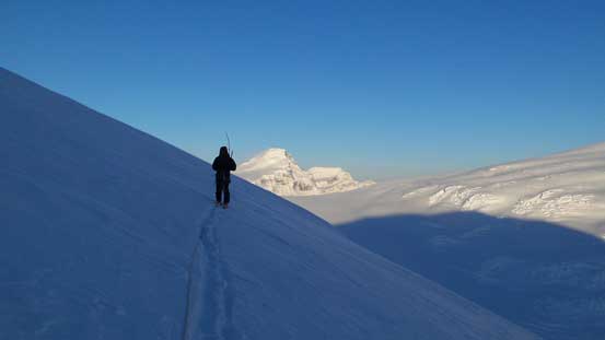
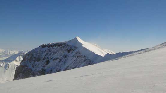
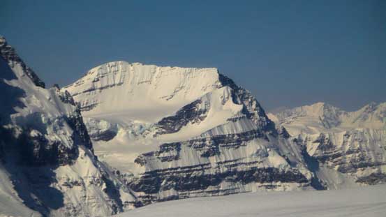
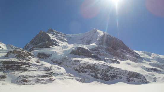
Looking ahead towards Andromeda’s dry south ridge
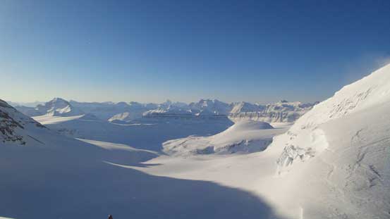
Nice views from the col
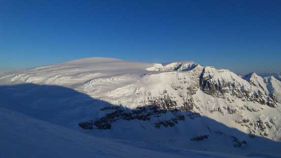
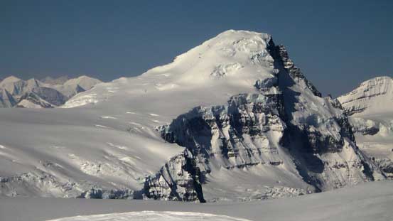
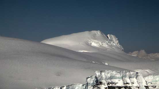
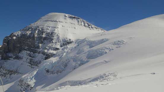
Snow Dome
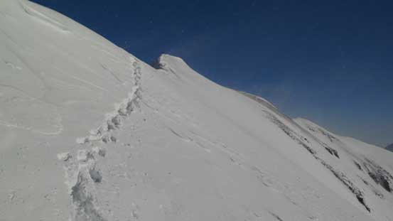
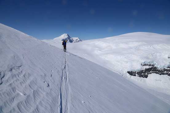
The Andromeda/unnamed col also marks the base of Andromeda’s south ridge. There’re 3 ridge sections to ascend/traverse and this one is the steepest. We ditched skis and ropes at the col. The ridge appeared to be straightforward simply because there wasn’t much of snow on it… On the other hand the scree made some awkward travel for us. Higher up we had to strap crampons up as the snow patches were icy. It took us a long time to ascend this ridge before it eventually levelled out, but at the mean time, wind had even gone crazier. Together with the blowing snow it was miserable to say the least. I had to put all layers on including my parka. And I still felt cold. The coldness at this point was approaching Balfour and Ghita’s level. Ben’s thermometer recorded air temperature of -21 degrees and with the strong wind I wouldn’t be surprised if the ‘felt like’ temperature was below -40… There are two false summits to go over and the first one is where Skyladder route tops out. This is the part with the strongest wind. Once we started the second ridge section traverse (which turns right by 90 degrees), wind almost completely died down and it started to become very hot….
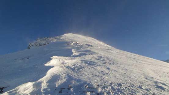
Looking up the south ridge. Sun finally shone on us..
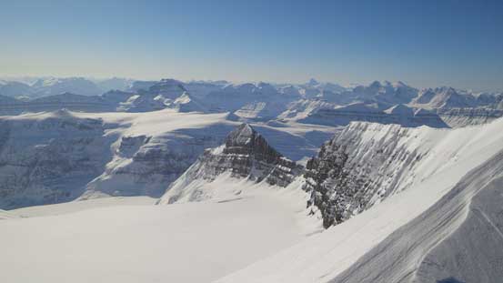
Looking back towards the unnamed 3330-meter peak. Raf refers it as Androlumbia
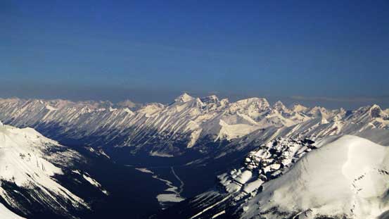
Looking southwards. This glacier will eventually leads down to Saskatchewan Glacier
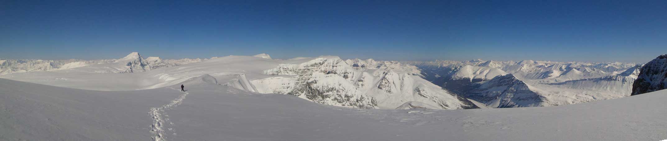
Panorama from the south ridge. Click to view large size.

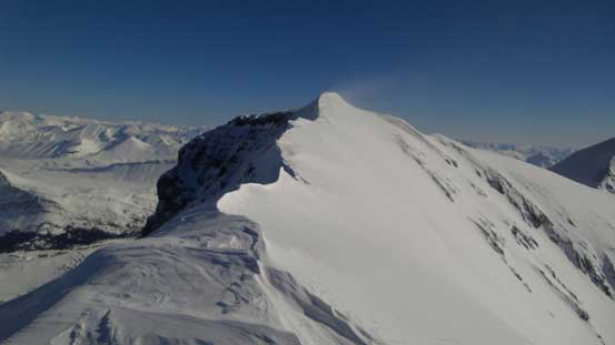
Ben approaching the 1st false summit.
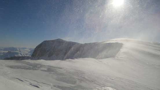
It was windy as you can see from this photo.
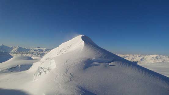
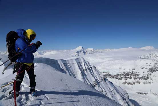
The second ridge section traverse was the easiest. It was a simple walk to the second false summit. We bypassed it on climber’s left side to save some unnecessary elevation gain/loss/regain. The final summit ridge appeared to be more difficult than expected. All description said it’s “corniced”, but apparently, it was heavily corniced. We initially tried to stay on the ridge crest but we soon had to bail down the climber’s right side (south side) as it was very difficult to tell the cornices’ boundary. The traverse on the south facing slopes was quite steep and already sun baked. It’s overall not as difficult/dangerous as Vermilion or Wilson’s summit ridge but certainly not an easy walk… The celebration on the actual summit was short lived due to the coldness and the crazy wind. It took us longer than expected to get here and our one-way ascent time was 7.5 hours.

Splendid view from the second part of ridge traverse

Ben traversing towards the second false summit
Panorama from near the second false summit. Click to view large size.
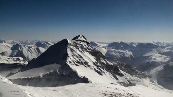
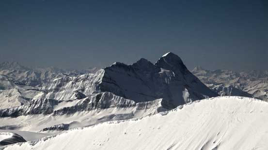
The true summit ahead
It’s definitely not an easy walk….
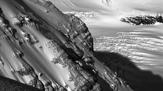
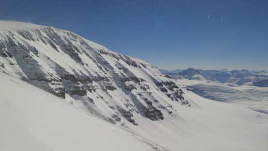
Neat cliffs on the south side of Andromeda

Looking back from the true summit
Mt. Athabasca
Lyell I, II and III
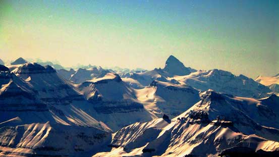
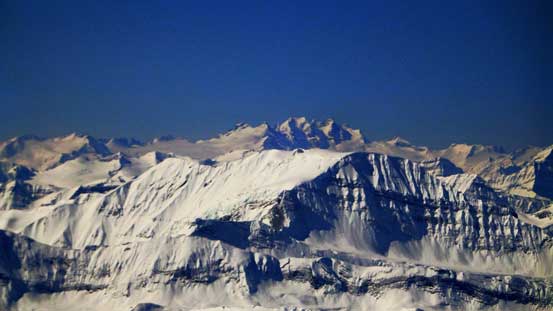
Mt. Columbia the giant
Whitegoat Peaks and Mt. Cline in David Thompson Country
Looking north, Mt. Unwin and Mt. Charlton dominate the skyline
The Skyladder Route – an exposed way up
The mighty Mt. Forbes is the highest peak entirely in Banff N. Park

Mt. Alexandra is another easy 11,000er. Mmm, I mean technically easy, not physically…
North Twin and Twins Tower

Mt. Woolley and Diadem Peak, two of the 11,000ers on Sir Winston Churchill Range
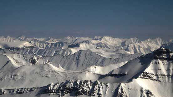
A sea of front-range peaks by Southern Jasper Park
Part of Sir Winston Churchill Range
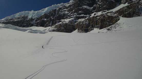
Crevasses on Athabasca Glacier. You can also see our tracks.
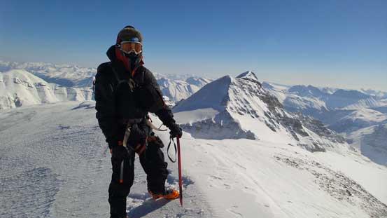
Ben on the summit
Me on the summit of my 10th 11,000er, soaking in the views. Photo by Ben N
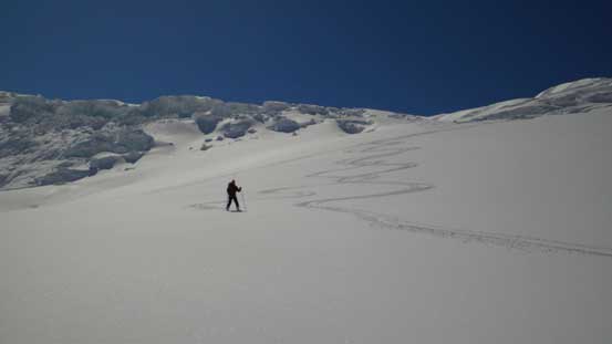
Coming back we took a lunch break at a windless area spending some time soaking in the views. We also briefly considered bagging the nearly unnamed peak. It’s a sexy looking objective viewing from Andromeda’s south ridge but after examining carefully there were quite a few spots that we suspected being (hidden) crevasses with no obvious bypass like (and it would be hard to tell once we were on there). We figured we’d taken enough risks on this day and this unnamed one wasn’t a peak we wanted to risk our lives on so we decided to leisurely ski back. We kept the rope and skins on over the crevasses area and down the diagonal traverse until our uptracks became visible.

Going back along the summit ridge
This photo shows the slope angle you have to traverse.
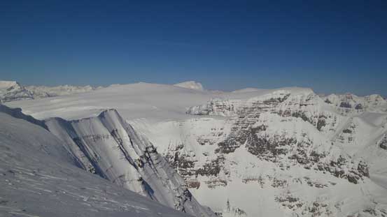
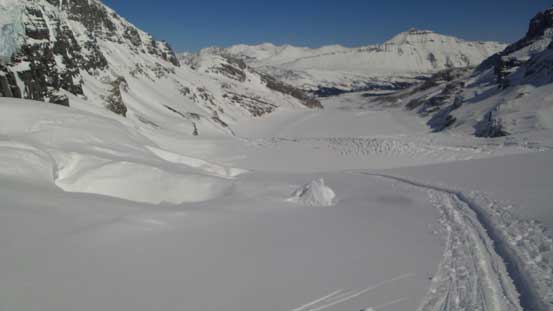
Columbia Icefield
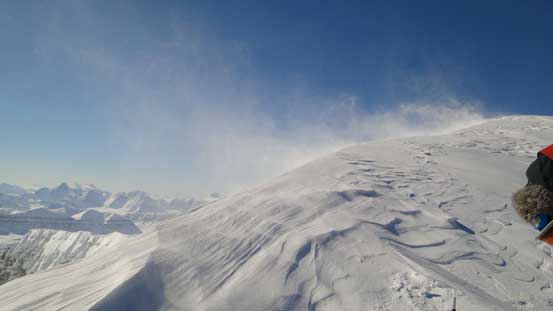
It was very windy….

Mt. Sir Sandford way in the distance – highest peak in Selkirks
Adament Mountain is another giant in the Selkirks
Mt. King Edward
Castleguard Mountain looks tiny from here. Behind is the sexy Cockscomb Mountain
The mighty Mt. Bryce…

Descending the south ridge. Androlumbia in the background

These are the crevasses to avoid during the diagonal traverse..
Looking back towards Andromeda’s south face
The ramp (3rd icefall) on Athabasca Glacier. Lots of route-finding.
Seracs on Snow Dome
Skis on again.
Me with Columbia and Snow Dome behind. Photo by Ben N
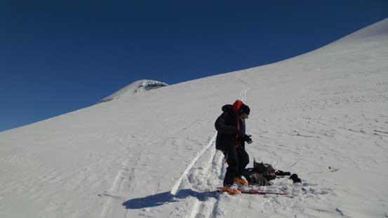
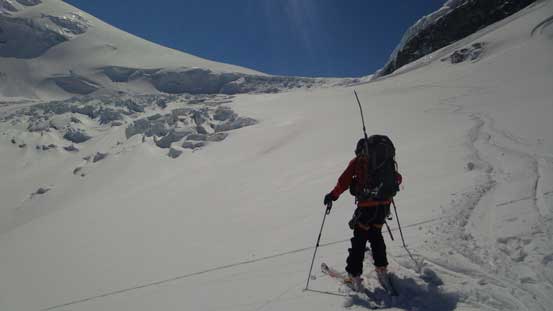
Time to take the rope and skins off.
Andromeda took us much longer than expected and we were already very tired and short on motivation. We would have enough time to bag Snow Dome but we just didn’t feel like pushing any harder. After de-skinning we enjoyed an enjoyable run back down the icefield. We met a group of two splitboarders on their way bagging Mt. Columbia. We chatted for a while and after wishing them good-luck we started the nerving ski down the icefalls. The first one was the ramp (3rd icefall) which was the trickiest to descend. We managed to keep as close to the uptracks as possible on the upper section, and towards the end we ski’d relatively straight down and skier’s left aiming for the fast route – the serac route. The serac route wasn’t as scary as expected but also not as fast as we thought. I hate skiing without skins when it comes flat terrain. There weren’t uptracks on this side so we kept skier’s left for as long as possible until directly above the second icefall. This was the steepest slope of the entire trip and was certainly steep enough to slide especially in a hot afternoon… After awkwardly skiing down this bit the rest was easy and fun. There was a flat section on the main glacier but for the most part we could maintain a good pace.
Looking back towards Andromeda

These two guys from Invermere were going to do Columbia
Ready to ski down the Ramp
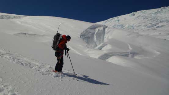
Ben maneuvering around big open crevasses
Typical terrain on Athabasca Glacier
Car to house sized chucks are ready to fall off at any time..

Directly below this slope on bottom right is a gigantic open crevasse
Skiing down the rest of the ramp
Ready for the 2nd icefall. Through the Snow Dome serac already
Quite a steep slope to descend.
We were up there a couple hours ago!!

Me cruising down Athabasca Glacier. Photo by Ben N
The last part of this trip was miserable. There’s a significant elevation regain from the glacial toe back to the parking lot. We were too lazy to put skins back on and must had spent half an hour here. Eventually I couldn’t manage to ski up anymore so took off the skis and dragged them behind and struggled back to the car… Our round trip time was 11 hours 20 minutes. The wind surely slowed us down and we were not fast skiers when it came downhill so I think we did okay… Overall, it was a very satisfactory trip to successfully bag my 10th 11,000er. But on the mean time, I have to admit it’s a somehow bold and risky ascent. I wouldn’t suggest going up a lengthy glacier in a 2-man team unless both members are expert on rescue, and certainly not on Athabasca Glacier.
