Canoe Peak (Vancouver Island)
February 15, 2022
1440m
Vancouver Island, BC
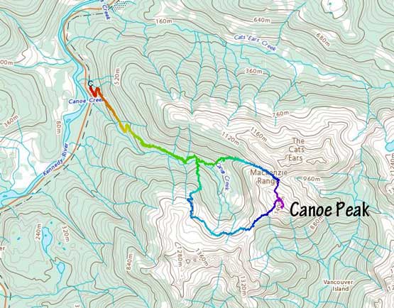
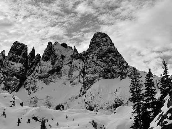
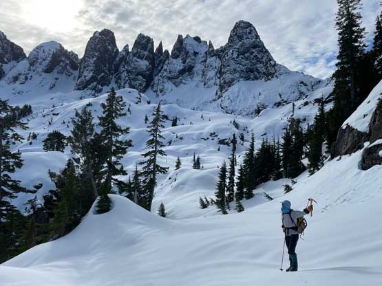
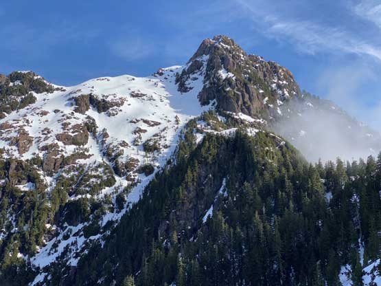
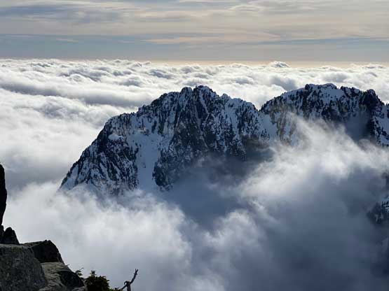
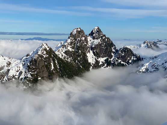
“Canoe Peak” is the unofficial name of an obscured summit accessed from Highway 4, about halfway between Port Alberni and Tofino. The immediate vicinity includes the rugged massif of McKenzie Range, Triple Peak and The Cat’s Ears that draw more attention from the local climbers. “Canoe Peak” is somewhat overshadowed by these peaks but on a clear day, offers some of the finest views of the nearby towers. The access had never been straightforward but with a new hydro project built in Canoe Creek valley the more logical way has shifted to the west side, starting from this (gated) road to the hydro project. Bushwhacking is still required no matter what and winter seems to be the easiest time when a thick snowpack covers at least some of the bushes. This is a challenging steep snow climb in winter so the timing needs to be on one of those firm, stable and bluebird days, which are rare but not non-existing in January and February.
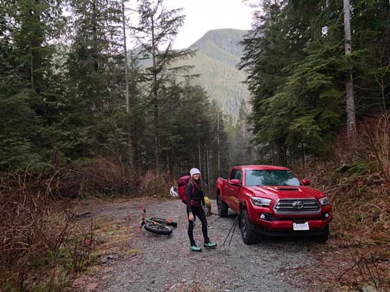
I never had noticed this small peak until seeing a recent post in the “Vancouver Island Climbing & Mountaineering” group by Barry and Rich. I made a mental note that I should hop onto the island as soon as the conditions lined up and that happened to be on this Tuesday, merely two days after their trip. There had been some precipitation events on Monday, but one or two cm of dusting wouldn’t change the overall picture of the recent stable conditions. Holly happened to have seen this post and it was actually her who sent me this link. It took Holly about half a day to take Tuesday off work along with the night before, and our spontaneous decision was triggered. I had only about 2 hours to research, book the ferry, get everything sorted out and packed, so that was quite a hassle. We eventually grouped in Tsawwassen at 10 pm on Monday, the Valentine’s Day and hopped onto the 10:45 ride towards Duke Point. I managed to catch tiny bits of sleep on the ferry which wasn’t ideal, but enough to keep me awake for the next few hours. The drive to the gate on this new access road took about 2 hours from the ferry terminal with some treacherous foggy conditions on the second half. I drove a tiny ways up the dirt road and parked near the gate. It was about 3 am when we eventually turned in and the alarm was set at 6 am. We both managed about 2 hours of sleep in the truck.
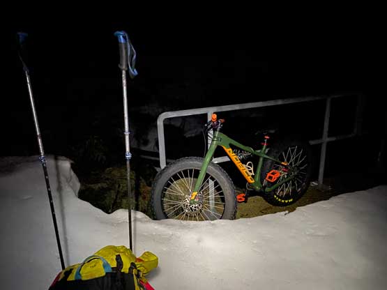
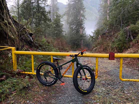
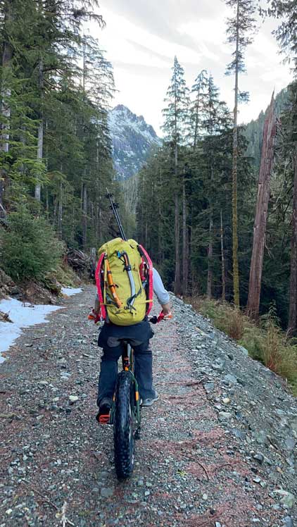
I had brought my fat bike for the ride to the hydro project. I did not expect to be able to ride the way up, but coming down would be a blast. Holly does not own a bike so she had to walk both ways. The road turned out to be ridiculously steep for most of the way (>30% grade) with lots of loose rocks and some unexpected obstacles, but it wasn’t worse than the access road on Alexandra Peak so I had the confidence to ride it down at the end of the day. Holly simply could not believe that I was planning to ride this road. Nearing the end of the road I finally managed to ride some flat and slightly uphill stretches. We encountered snow on the last half of a kilometer but the snow was firm enough to ride on. I rode all the way to the hydro dam and locked my bike to the steel bar. While taking a long break Holly was tempting to go for a winter swim but we wouldn’t have extra time for that.


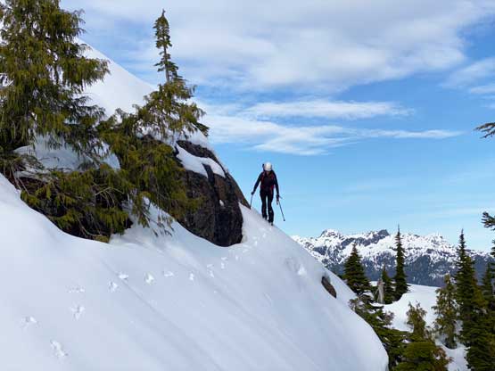
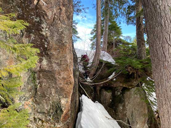
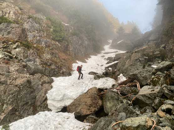
I only had a rough idea of where Barry and Rich went. The plan was to take their descent route towards Canoe/McKenzie saddle but the trip did not unfold as fluently as expected, partly because of the lack of research and partly because I underestimated the island’s micro-terrain. Right at the beginning we followed a set of foot prints onto a flagged path that looked more like an unofficial trail. I did not come here knowing there’s actually a “trail” in the forest, so we definitely would take this pleasant surprise. The going wasn’t that smooth as the trail had fair amount of up-and-downs while travelling up the north side of Canoe Creek. After about 20 minutes we followed the trail dropping into and across Canoe Creek to the south side and from this point onward we were already off-route. There were fresh foot-prints, a clearly defined path and abundant flagging tapes so even though we headed off the direction I still believed that the trail was just doing some weird things to bypass some bluffs or slide paths in the valley. After about 200 m gain in increasingly steep and bluffy terrain the trail was still ascending and I finally convinced myself that we were officially off-route, heading unexpectedly up the broad N/NE Ridge of McKenzie Range. One option was to backtrack but I hated the idea of wasting two hours here. The other option was to ascend to treeline and (hopefully) traverse across the entire north slopes of McKenzie Range towards Canoe/McKenzie saddle. I had absolutely zero beta whether this route would go, but I believed in my estimate based purely off satellite images and Gaia’s topo map and Holly believed in me, so the new decision was to just take this “trail” and set of foot prints to treeline and decide from there.


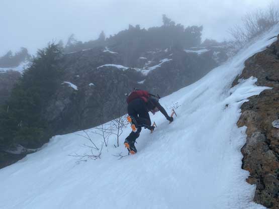
This was overall just another steep “climber’s trail” with lots of wet bluffs and bushy stretches to power through so the progress was rather slow. At about 800 m the flagging gave way to snow and the foot prints were still going up along with dog tracks. I wondered what the heck those guys had climbed a day or two earlier. These were definitely not Barry and Rich’s tracks (which we also discovered a few hours later near Canoe/McKenzie saddle). Later at home we learnt that a new climber’s trail had been partially flagged and built to access McKenzie Range from the hydro project in Canoe Creek valley as this route has the potential to be much better/faster than the traditional route. Of course we did not come here with this knowledge so everything was confusing and not making sense at the moment. At 900 m we had to make a stop to don crampons and another hundred meters later we took the ice tools out. We started the long and complicated traverse at around 1000 m, veering off the foot prints that were still ascending straight up. The traverse could be broken down into three stages with the first stage being the hardest. The route-finding was complicated and the terrain was steep and exposed. We started by climbing an optional 45-degree icy slope. I then managed to keep our elevation within 1000 and 1050 m for a good while, traversing across several deep gullies and 40+ degree slopes. We might or might not have picked the best line. We then descended to under 950 m and traversed into a “basin” that was the low point of this traverse. Based on the satellite images I determined there were two lines to traverse across the McKenzie Range’s north slopes and we opted for the lower option. During this stage a chopper came by and flew around us for at least five rounds. They might be looking for some overdued climbers but we did not know.


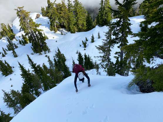


The second stage of this traverse involved crossing one broad rib/ridge feature on the north slopes of McKenzie Range and this started with front-pointing up a diagonal ramp out of this bowl. The slope angle was at most 40 degrees but the exposure was over a cliff band. After the ramp we turned climber’s right and easily ascended to the top of this ridge, then dropped down to the other side. The third stage was basically to gain the saddle between Canoe Peak and McKenzie Range to join the “standard route” which was the one we initially planned on. I’m sure all options would go. We opted to descend another 30 m to stay low under some nasty-looking steep shits and then utilized some gullies to ascend the steep forest. Wherever possible we would traverse climber’s left and topped out exactly onto the saddle.


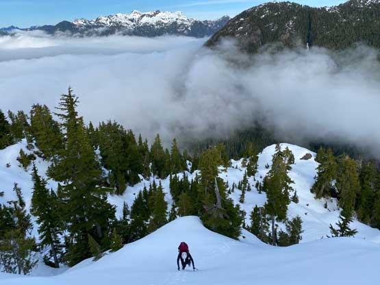
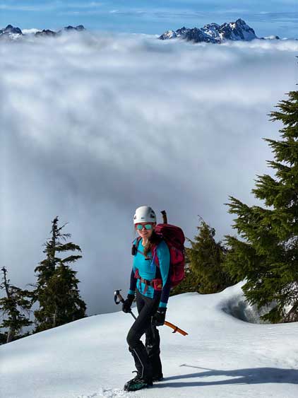
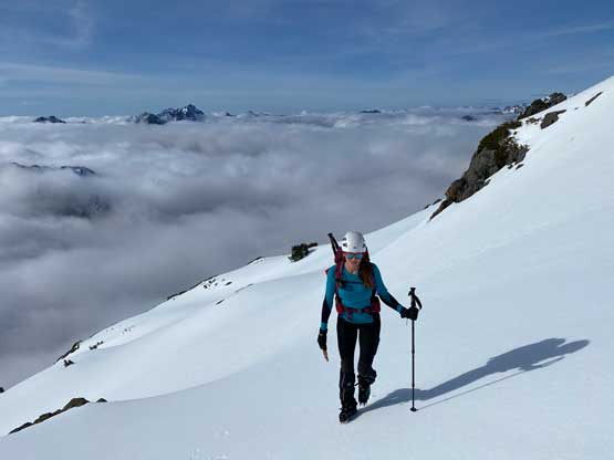
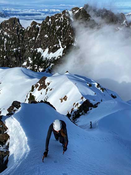
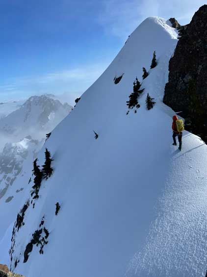
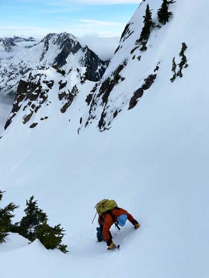
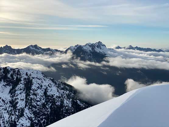
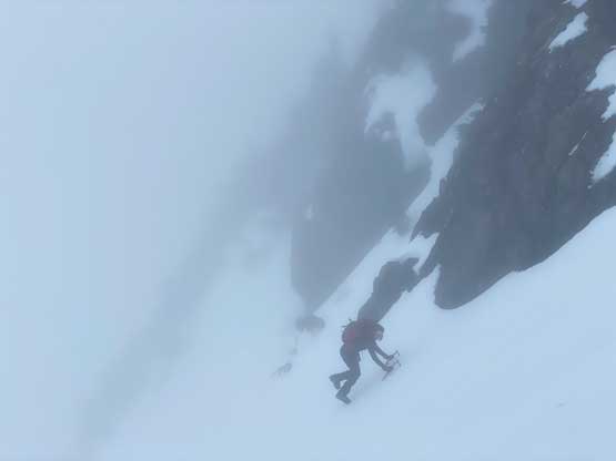
Plodding ahead we soon joined Barry and Rich’s descending foot-prints and they led us the base of an insanely steep buttress. Though short, this section ahead was difficult even with the foot prints to guide the way. The general bearing was mostly to aim straight up the face with a few sections trending climber’s left. The slope angle was 45 degrees or steeper and we had to do some vege belay to haul up some steps. The snow was also much softer. Once above this step we took another long break and decided to descend Barry and Rich’s ascent route down into Canoe/Cat’s Ears col a few hours later, mostly to avoid descending this treacherous section. Little did we know that the other side had more shitty sections much worse than what we just did. The next short stage was plodding across a flat-ish ridge with some up-and-downs and was done in some intermittent white-outs thank to the lifting fog layer, but as soon as we started ascending the SW Face of Canoe Peak we broke through the clouds. The SW Face was overall easier than appeared with slope angle at most 35 degrees but very icy. We kept a leftwards diagonal bearing and eventually intersected the upper NW Ridge which we easily followed to the base of the summit block.
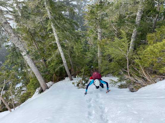


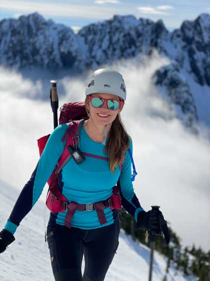

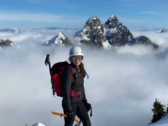
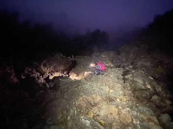
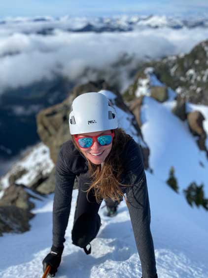
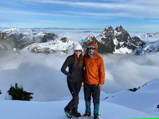
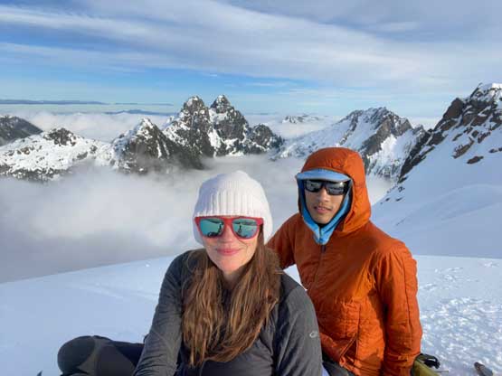
Holly and I took another long break to gather some strength for this technical finish. The attack of the summit block was from the north side and the condition was even icier and felt more like snice than snow. The slope angle was at most 45-50 degrees but in the conditions we had the climbing involves mostly front-pointing and the exposure was over the entire north face slopes. I gave my second ice tool to Holly so she had two Petzl Gullies for the climb, while I climbed with a single Petzl Quark. I was wearing Trango Towers boots and Petzl Lynx “real” crampons and still felt undertooled. Too bad we only had three ice axes/tools together as otherwise I would definitely use two ice tools for the climb. This steep face brought us back onto the uppermost NW Ridge which we traversed to the summit. The final summit ridge was narrow but not very steep and we could see Barry and Rich’s tracks again. The summit itself was very windy and did not offer enough room for the two of us to linger around.


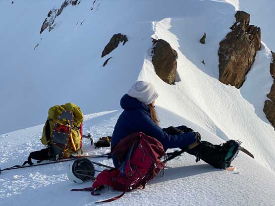
After taking enough photos we soon down-climbed the summit block. The down-climb wasn’t as hard as one would anticipate mostly because we already knew what exactly to expect. The spot under the summit block was sheltered from wind so we spent at least another hour soaking in the experience. Eventually at 3 pm we figured it’s the time to start the descent as we still faced a great deal of unknowns while descending a route that we did not come up from. I directed our bearing more-or-less straight towards Canoe/Cat’s Ears col and although icy, the terrain wasn’t too bad until the very end. I knew something tricky would show up near the col based off topo and satellite maps, but the other guys had climbed up from this side so there had to be a way. I did not know where exactly they went, but by sticking my nose into the terrain I eventually found a diagonal ramp. It was not straightforward with slope angle 50 degrees and some considerable exposure, but given our position this was the only option so we had to commit. Again, I down-climbed in one ice tool as I gave the second one to Holly, who followed me down without a problem. The bottom of this ramp was only 20 m to the east of the col so we easily traversed there afterwards.


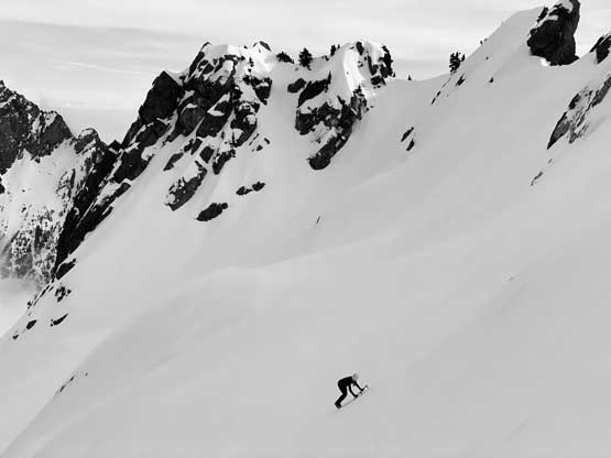


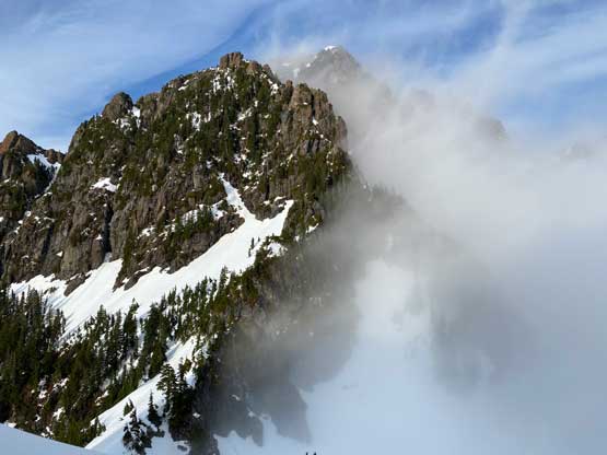

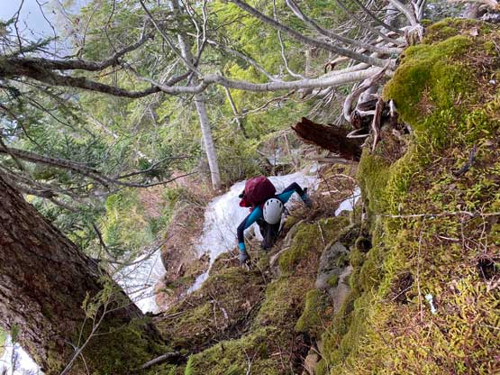
The top of the gully heading west down between Canoe Peak and The Cat’s Ears was still steep, but nothing worse than what we had just done. The slope angle soon mellowed out such that I could store the ice axes for poles. Walking down the gully on firm snow was a cruise-sail for a long while until the snow became thin at 1000 m elevation. The first challenge was a melted-out section that involved some class 3 scrambling on loose rocks. Lower down we encountered lots of questionable snow bridges and holes that required some great caution, but generally speaking the going was “reasonable” until the very end where we completely ran out of snow above a waterfall. With only half an hour’s daylight time we took a gamble to descend the down-climber’s left side of the waterfall and that was a mistake. After lowering ourselves down a few 4th class steps holding on nothing but alders we eventually got completely cliffed out. We put the head-lamps on and patiently hauled ourselves back up to above the waterfall while wasting at least 1 hour in the process, hopped across the stream and eventually found a class 3 route to descend on the west side. My head-lamp could not penetrate through the fog by more than 5-10 meters so the route-finding was interesting to say the least.


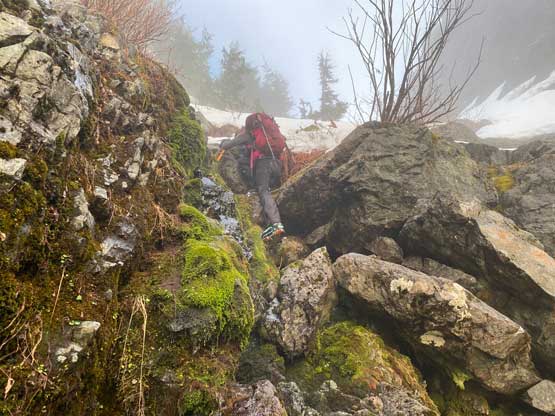


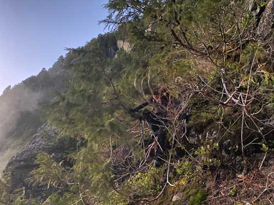


But this time our gamble was correct and we successfully descended this steep and rocky zone back onto easier terrain. There would have no more scrambling nor exposure, but some nasty bushwhacking was yet to come. I knew from the satellite images that we should aim to walk around a band of alders but that was easier said than done. We eventually got sucked into the middle of that zone with sustained “BW3+” thrashing for at least half an hour. The footings were extremely shitty too with soft and unsupportive snow covering boulders covered in moss. Though slow, the progress was steady and eventually we descended to the creek bed which we followed back to the flagged trail without too much of resistance. At this point we knew that we would have missed the last ferry back to the mainland so we might as well slow down to take our time. Once back to the hydro project I took all of Holly’s heavy gears and rode the bike down. The riding in dark was challenging but at this point I already had some experience with mountain biking, so it wasn’t too bad. Holly showed up about half an hour later and we were on the go another half an hour later. Eventually we got back to Departure Bay at almost midnight, slept a few more hours inside the truck and hopped onto the 6:10 am ferry to Horseshoe Bay, and that concluded another successful and memorable adventure on the island.