Flat Ridge
October 18-19, 2014
2820m
Jasper – South Boundary Trail, AB
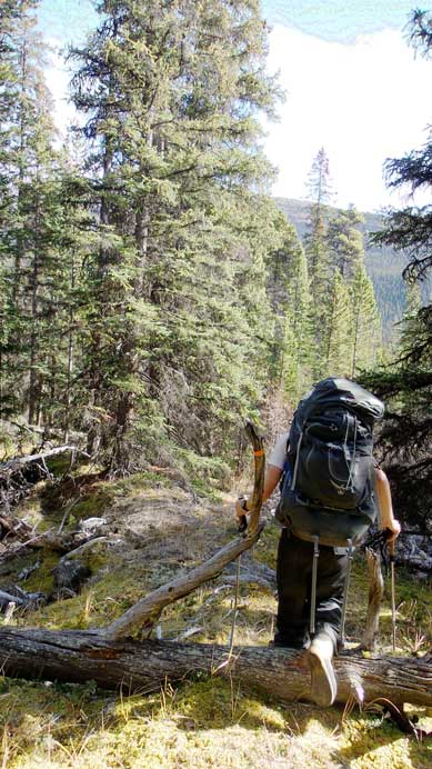
Flat Ridge isn’t an exciting name (official though), but after finishing the ascent I’d say it worth a visit for peak-baggers looking for remote but technically easy objectives. I’d even suggest this area to backpackers having some experience in bushwhacking and off-trail navigation. Ben and I did it as our second objective over 2 days, after successfully ascending Marble Mountain.

Marble Mountain and Flat Ridge scramble route. GPX DL
On the second day of this trip we woke up under good weather. Our original plan was to ascend Flat Ridge in dark, watch sunrise from its top, and then traverse to a higher peak nearby unofficially named “Marble NW4”, but for some reason I didn’t quite feel like waking up early. I noticed a layer of high clouds which would block any alpenglow/sunrise view so we went back to sleep. Eventually we started our day after it’s already bright enough, and yes, there was indeed a layer of high clouds rolling in.
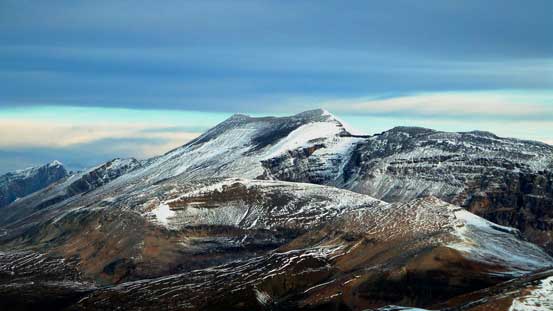
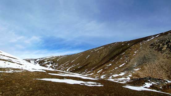
The ascent of Flat Ridge from our bivy was as straightforward as expected. The only terrain easier than that would be on-trail hiking… But on the other hand, it took us longer than expected thank to the foreshortening view. The summit is overall more than 2800 m high and only about 150 m lower than Marble Mountain. And, I have to say Flat Ridge is a very descriptive name of this peak as the summit is indeed very flat… The view from Flat Ridge wasn’t as good as from Marble Mountain, but given the clearer weather we managed to see as far as the giants on Columbia Icefield.
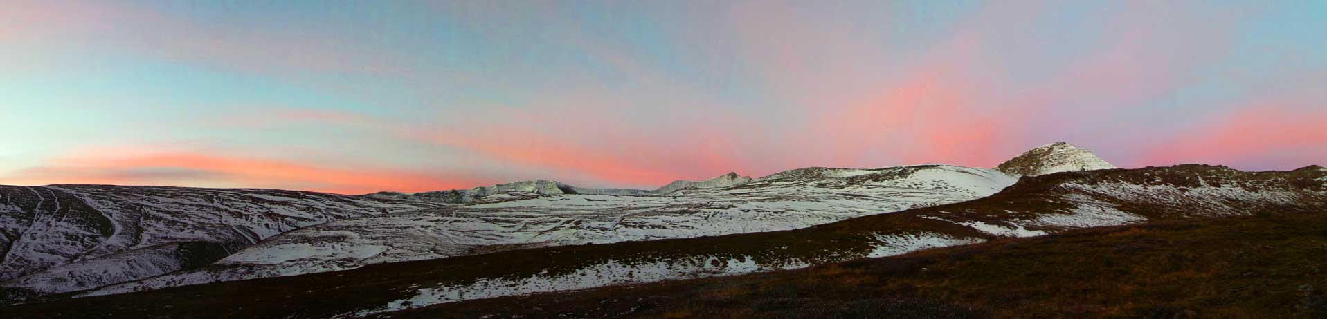
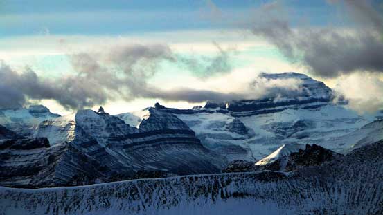
Morning glow on the high clouds
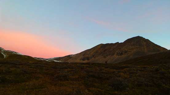
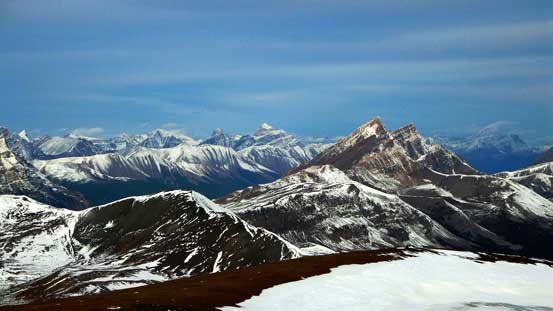
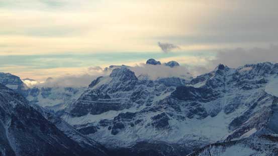
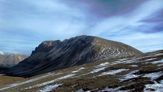
Morning view of out objective, Flat Ridge

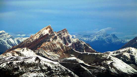
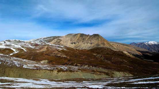
A view of one of the many unnamed peaks in this area
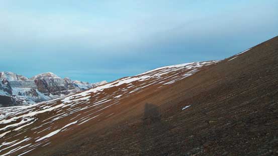
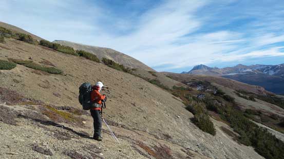
Flat Ridge is as easy as it can get…
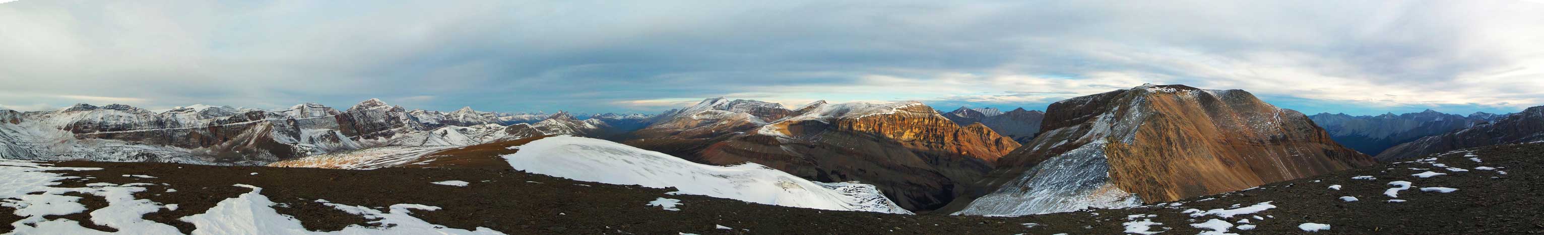
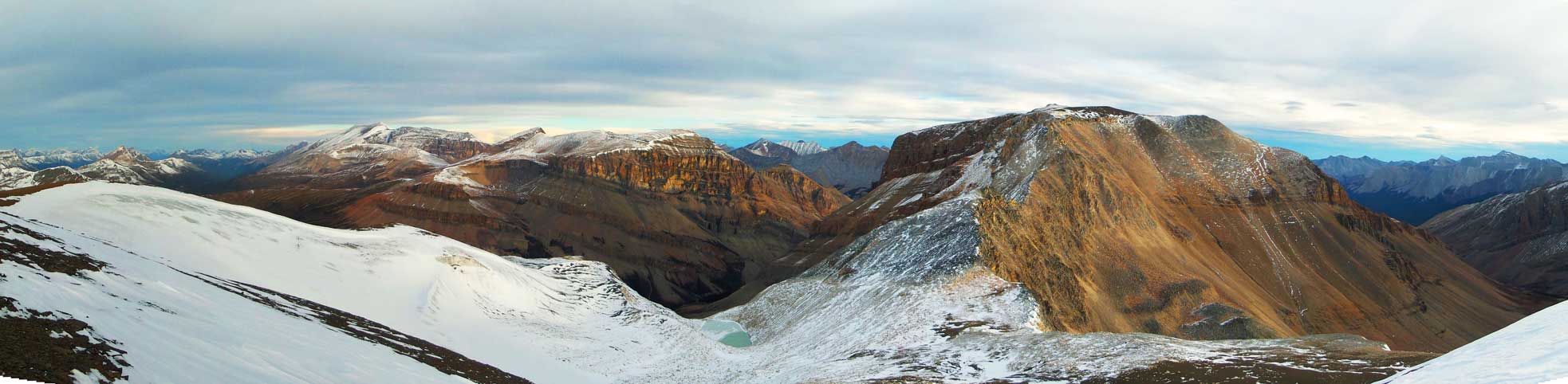
Summit Panorama. Click to view large size.
Great view looking north into the familiar Jasper peaks.
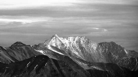
Mt. Saskatchewan decided to show up after being soaked in clouds on Saturday
Surprisingly there wasn’t any clouds on Columbia Icefield – S. Twin, N. Twin and Twins Tower in view.
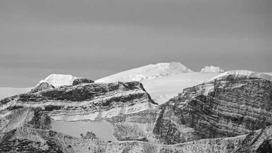
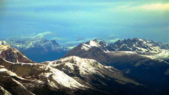
This peak doesn’t have a name. Behind it you can just spot the outline of Catacombs Mountain
Poboktan Mountain is pretty high on my to-do list as a shoulder season objective.

Mt. Fryatt
Waterfall Peaks
Mt. Edith Cavell and the Endless Chain Range

Chocolate Mountain on left. Now I know how it was named – the colour looks pretty similar to chocolate…

Obstruction Mountain

Even Mt. Alberta showed up!
Afternoon Peak and Mt. Willis
This should be Cirrus Mountain, or part of Cirrus Mountain
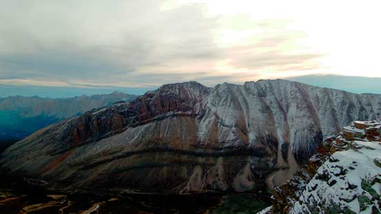
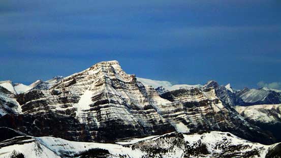
Marble Mountain which was our previous objective. From here it looks like our summit (right) is certainly higher than the official one (left)
Mt. Aztec
Mt. Athabasca and Mt. Andromeda, with Nigel Peak in front. Very unusual view of Nigel though.

Ben soaking in the views

Me on the summit of Flat Ridge
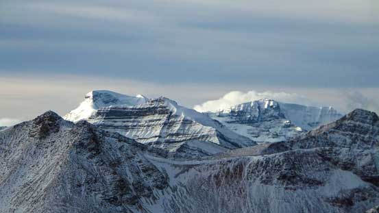
Another panorama from the summit, showing Marble NW4 right of center. Click to view large size.
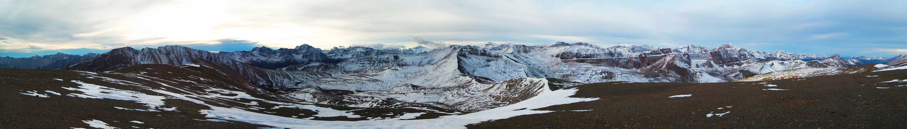
One more panorama. Click to view large size.
It was cold and none of us was motivated enough to bag “Marble NW4” since we didn’t start as early as planned. We had a long way (roughly 30 km) to get back to civilization, so after quickly taking some obligatory shots we immediately focused on the return. But before that Ben noticed there might have a cairn on another highpoint further south. It certainly looked lower than the one we stood on, but just to make sure we went there to check it out – there’s indeed a big cairn.
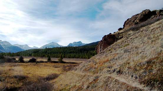
The descent went uneventful and soon we were back to our camp. I really wished we could take our time and enjoy this lovely setting but unfortunately we didn’t have much time to “waste”. It was already near noon and considering I still had a midterm exam on Monday nobody wanted to be back home late… The most experimental part of this return was from our camp down to Brazeau River. In the morning we already noticed some frozen hard scree on Flat Ridge so instead of side-hilling high around Marble Mountain we decided to follow the creek out. This worked out well in the beginning but not so much once entering the bush. What appeared to be open slope wasn’t quite “open”. Some dense brushes forced us to stay left (skier’s left) of the creek, away from any water source. This led us to a much-longer side-hill bashing with some dense bushwhacking. Nothing comparable to Mt. Alexandra, Fortress Mountain or Boule Roche, but certainly worse than our ascending route.
Looking back at our objective from the descent
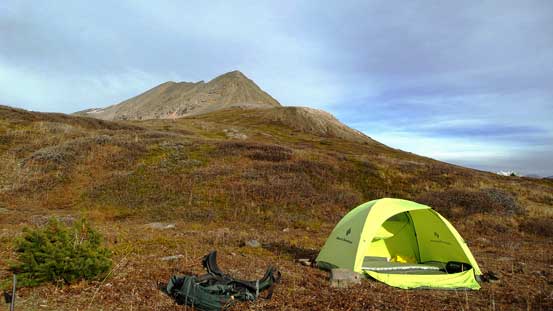
Back to our lovely camp

After packing up, firstly we had to slog up and over Marble’s shoulder

Panorama from Marble Mountain’s shoulder. Click to view large size.
Marble Mountain
Flat Ridge
Ben ready to descend

Into the vegetation.
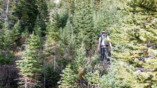
It wasn’t very good…
Eventually we merged to our ascending line and found much-better bush.
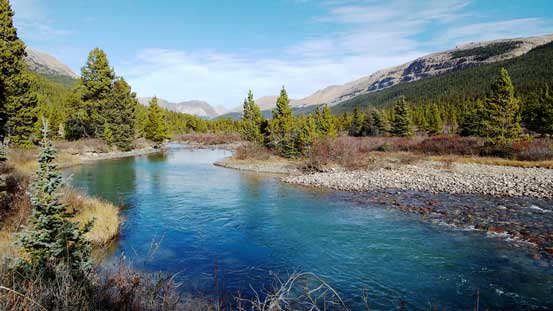
Once back to the South Boundary Trail by Brazeau River the rest of this return would be simply putting one foot in front of another (for hours and hours though). As usual, music on, race began and we soon entered the ‘robot mode’. We managed to maintain our on-trail moving pace at about 6 km/h, so even taking in account the occasional breaks we still moved faster than 5 km/h on average. The only part we kinda slowed down was the steep uphill back towards Nigel Pass but even there my GPS still recorded more than 3.5 km/h average speed. And after that, the last 8 km would be mostly down-hill from Nigel Pass. Well, the return always doesn’t seem ‘enjoyable’ but I have to think positively, so I personally treat this section as part of my weekly exercise.
My favourite view from this length approach
Another view of Brazeau River
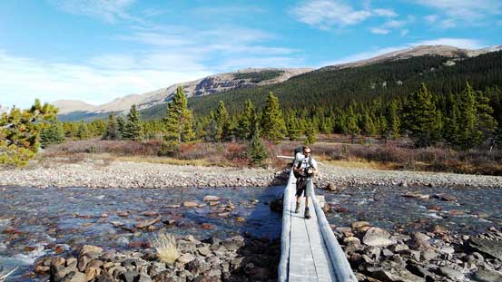
We investigated this bridge a little bit. Parks Canada no longer maintains this bridge now and instead they cut a new trail on the left (northwest) side of Brazeau River
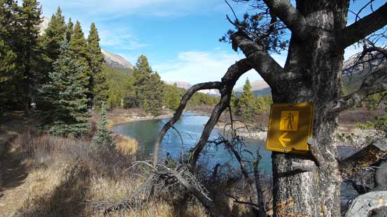
Here’s the sign indicating the new trail.
Oh the long return…

At least we got some nice views. This is Mt. Willis

Ben on the trail.

One of the few creek crossings.

They’re all well bridged!

Another bridge – this one brought us to the other side of Brazeau River

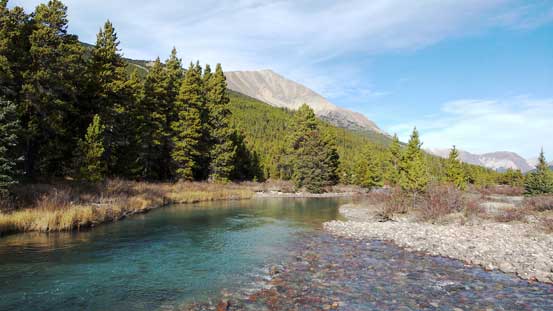
The much-smaller Brazeau River

Can’t ask for a better fall day. It was windy though..

Now, time to slog back up Nigel Pass
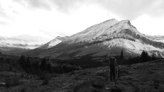
View from Nigel Pass. Clouds were moving in again.

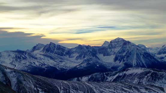
Almost back to the parking lot. We were treated with nice evening view of Cirrus Mountain

The final slog along old Jasper-Banff road
We managed to get back to parking lot 1 hour before darkness and our total time was 9 + 9.5 hours for the two days. This was a productive, successful but also quite tiring 2-day trip. I don’t repeat ascents but imagine if I do it again I’ll give at least 2.5 days. In this past weekend my schedule was constrained by two midterm exams so we ‘had no choice’. Speaking Marble Mountain and Flat Ridge (as well as this general area), I think they deserve more attention to scramblers. I know a lot of people hiking the Le Grand Brazeau Loop but if you have extra time, a lot of the ridges and peaks look fairly straightforward to explore.
