Mount Joffre
June 21-22, 2014
3450m
Kananaskis – Kananaskis Lakes, AB/BC
The beautiful glaciated Mount Joffre is one of the two 11,000ers in Kananaskis Country, also the highest peak south of Mount Assiniboine in the Canadian Rockies. Although not very visible from roadside, it’s often seen from many of the Kananaskis scrambles. Taking a photo of Joffre’s glaciated north face has become obligatory. While the standard route up its north face is considered one of the easiest in the 11,000er family, it does involve several pitches of snow/ice up to 40 degrees. Later in the summer/fall the route will show ice and folks who attempt it at that time often need an ice tool and some protections. The same route has also been ski’d often, but that’s a long way in on skis with significant avalanche risk. Therefore, to take advantage of snow (not ice) and at the same time minimize avalanche danger, the best time is late spring or early summer, and that’s exactly what I would do.
There’s been several weekends in a roll when the few weather forecast models couldn’t agree with each other, even at the last minute. Mountain Forecast was calling for rain showers all over the weekend, while The Weather Network and Environment Canada was predicting a mix of sun and clouds. Based on our previous experience we knew the actual weather tended to be better than expected, especially in the morning. We did propose other options including Aberdeen but none of them seemed to raise much attraction compared to our primary objective. I’d been waiting for more than one year to find an opportunity to climb Joffre and it’s finally the time (last year was ruined by the end-of-the-world flood). So on Friday evening, Ben and I drove out of town, car camped near Petro Canada on Highway 1, and met Vern the following morning. By this time we already knew Mountain Forecast being wrong as it was definitely sunny in the mountains.. Good!
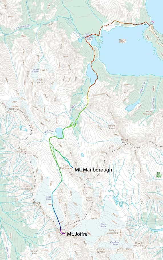
Unfortunately for us, when we arrived at the Upper Kananaskis Lake trail-head, we noticed a sign of area closure due to last year’s flooding damage. We hesitated for a while before making the decision to go around Upper Kananaskis Lake on the other side, which involved more up-and-downs and distance. We figured a few extra kilometers wouldn’t kill us so better play safe than sorry, so we drove to the North Interlakes parking area. It was surprisingly busy on this sunny Saturday morning, and off we went.
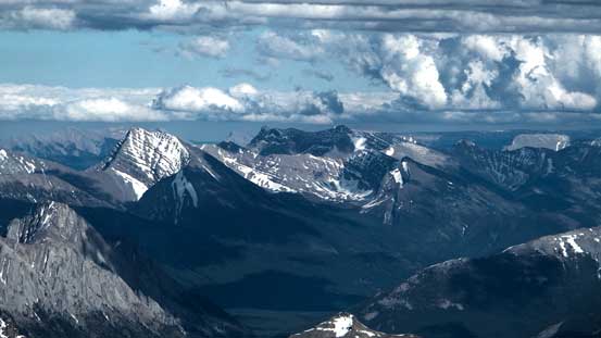
Approach and ascent route for Mt. Joffre and Mt. Marlborough. GPX DL
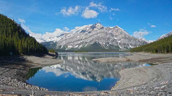
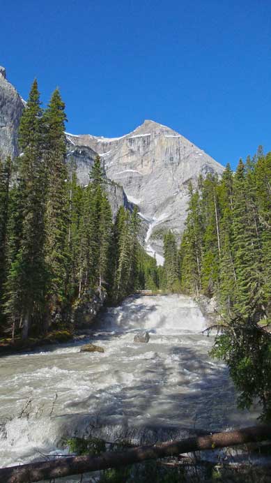
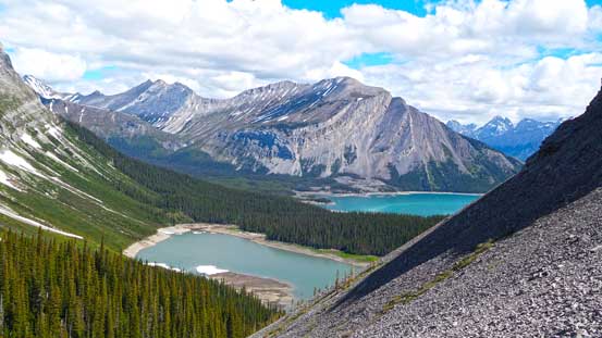
Like I mentioned before, the walk around Upper Kananaskis Lake was long, boring and undulating. Just after the junction that branches off towards Three Isle Lake, the trail descends down towards lakeshore, losing a ton of elevation. We wouldn’t complain at this time, but we knew it would be awful on the return. Another feature worth noticing was the raging Upper Kananaskis River. I believe the old bridge got washed out last year and they built a new one. Otherwise there’s no way to ford this river at this time of the year. There’s also some confusion regarding the Hidden Lake turn-off. On my Mt. Northover trip two years ago, I was pretty sure the cairn being on the west side of the trail. But this time the cairn was on the east side. We also discovered a “HL ->” sign on a tree trunk. This looked official enough to us so we decided to take it. Apparently this was the correct trail and by following it we didn’t encounter too many dead falls. Soon we arrived at Hidden Lake. Seeing the low water level was a great relief as we could just walk around the lakeshore rather than bushwhacking in the woods. To make it even better there’s even a trail around the lakeshore.
A view of Upper Kananaskis Lake from the trail head
We’d cross this raging river on a bridge

Negotiating a field of deadfalls just before Hidden Lake
Ben and Hidden Lake
Hidden Lake

Vern on a grass field
We walked around Hidden Lake on the left shore
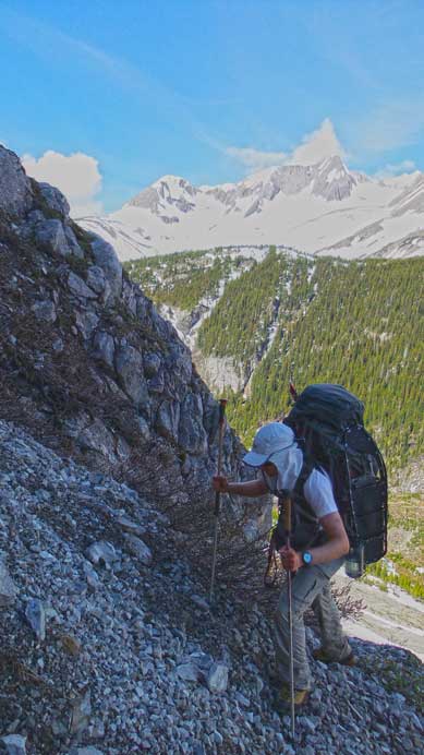
It was also apparent that we could take the summer route to bypass Fossil Falls high on climber’s left side (not enough snow to raise much of an avalanche concern). Otherwise we would have to ford the creek and bushwhack up the trees on climber’s right side which certainly wouldn’t be pleasant. The trail/path was faint but still easy to follow on scree and ledges. There were two snow patches to cross with the second one being very exposed (a slip would probably mean game-over). After this bit we were on the upper flats leading towards Aster Lake. It was still a long way and the terrain was very undulating and confusing even with a GPS track to follow. We managed to follow the trail to a seasonal pond and after that we totally lost it. At this point the snow had become continuous so we strapped snowshoes on which helped a lot. There were essentially a couple ridges to go up and over, or down and round. Either way we had to lose/regain elevation before reaching Aster Lake.

The trail/path led us high on climber’s left to bypass this waterfall and headwall
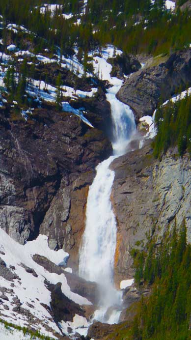
A closer look at Fossil Falls
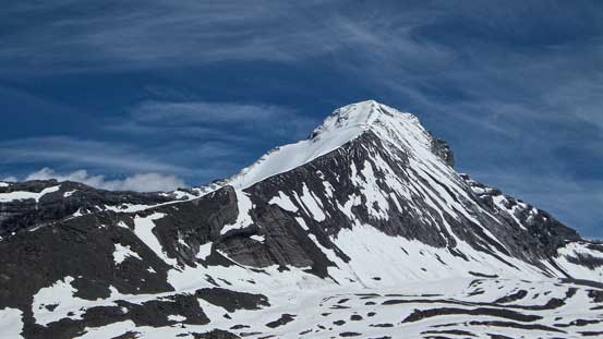
Mt. Lyautey has many sub peaks.
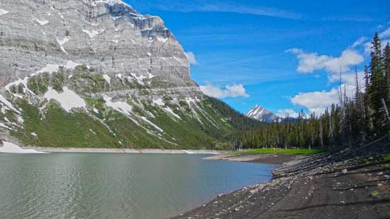
Looking back at Hidden Lake and Upper Kananaskis Lake
The terrain was more-or-less easy scrambling rather than hiking
We had to deal with scree and some exposure

Another look at the two lakes
Me and Ben crossing the exposed snow slope. Photo by Vern.
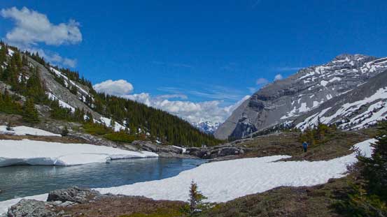
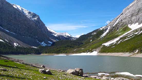
Arriving at Aster Lake
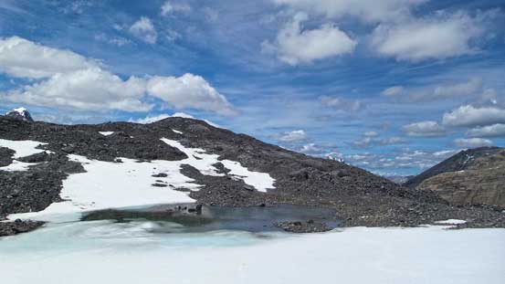
Aster Lake was almost 100% frozen
Warrior Mountain is one of the easy scrambles in this area

Ben filling up his water bottle
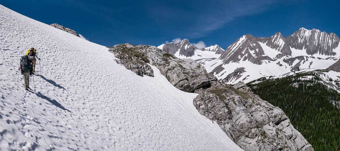
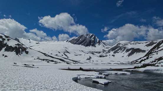
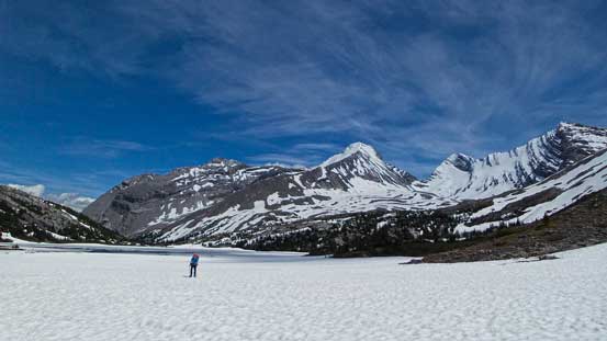
The lake was mostly frozen but obviously the ice wouldn’t be trustful. So after a quick break we started walking round the lake on left side. It wasn’t easy neither as we had to deal with quite a few narrow and awkward spots especially with both overnight gears and snowshoes on our backpacks. Around the other side of Aster Lake, it was a pleasant walk across some flats, and then leftwards up a very long valley on snowshoes. Here snowshoes (or skis) really made travelling easy as the snow eliminated creek crossings, bush and rocks. At this point we also finally got our eyes on the mighty Joffre, which was certainly bigger and farther than it appeared. This long valley would eventually lead us to Petain/Joffre col which is also the route to access Petain Glacier. To climb Joffre we’d leave this valley just beneath the obvious rock fin/wall and up a big slope, climber’s right. Since it was still early in the day and snow condition held nicely, we made the call of setting up camp lower down in this valley and bag Joffre in the afternoon/evening. Originally we planed to haul all gears to a high bivy but figured we didn’t have to. In retrospect it was a long haul to the higher bivy site (unnecessary given the fact we’d bag Joffre on day 1), but that’s also much more scenic especially in evening hours.

Some scrambling terrain to negotiate Aster Lake’s lake shore

Panorama of Aster Lake. Click to view large size.
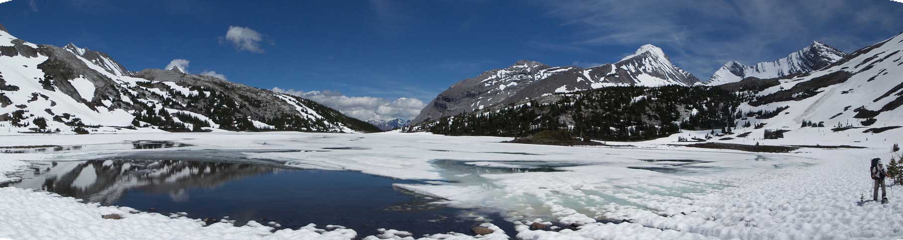
Another panorama of Aster Lake. Click to view large size.
Leaving Aster Lake behind
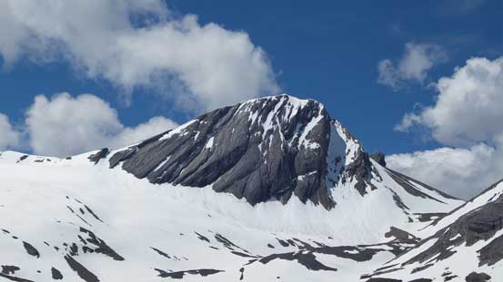
A closer look at Mount Sarrail
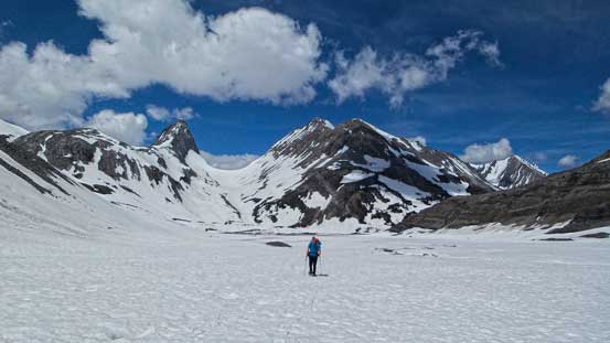
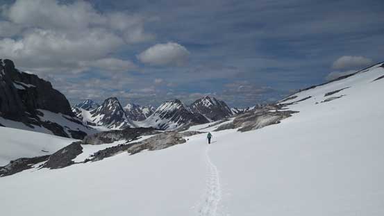
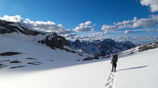
Into the long valley, looking back towards Northover Glacier
Mt. Northover is a very sexy looking mountain

Our camp site.

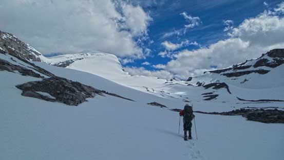
Leaving the camp behind, we were hoping to summit Joffre on day 1
For folks planning to summit the mountain on Day 2, here would be a really nice high camp with some incredible sunset and sunrise views.
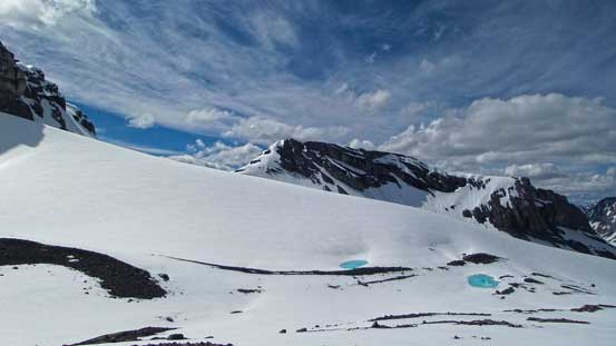
To access Mangin Glacier, there was still some undulating terrain. We picked a nice line and managed to maintain upward travel for most of the time. The glacier was just as tame as one can expect. I knew there’re some holes based on photos from late summer, but on this day, there was barely any sign of a glacier, even the bergschrund was barely visible. It was a very good call to leave rope and glacier gears at home. The glacier and the face itself was very foreshortened though. The summit appeared to be “right there” but based on altimeter reading we knew there’s still 600 vertical meters to go. We had to get 450 m higher than Northover, and higher than everything we could see expect for Assiniboine.
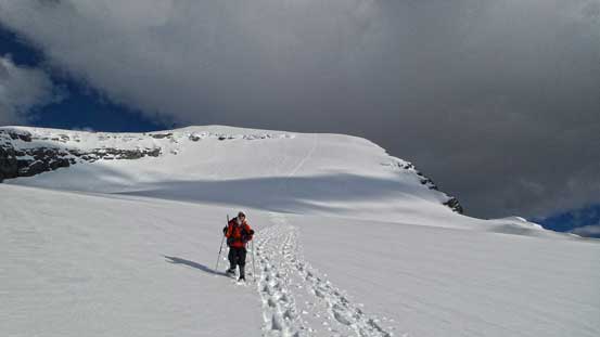
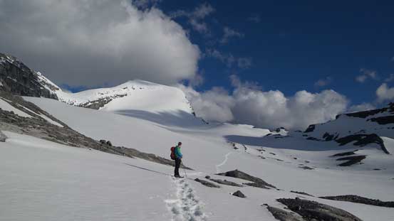
Ben approaching Mt. Joffre
Vern overcoming some undulating terrain to access Mangin Glacier
Mangin Glacier

Vern leading towards our objective
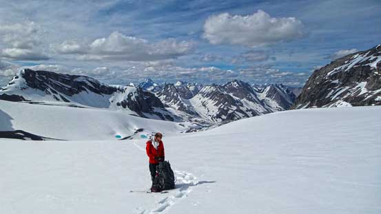
Ben taking a short break.
Mt. Mangin finally started to look small
The slope angle started to increase significantly
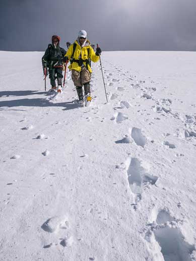
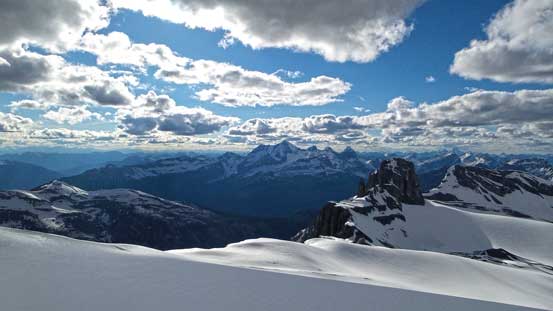
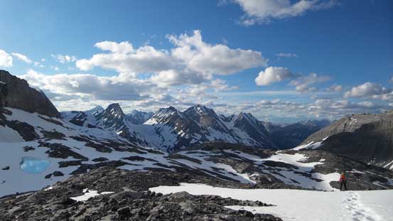
As we approaching the face, the slope angle started to ease off and didn’t appear to be any steeper than Cirrus Mountain’s which we snowshoe’d straight up. It had certainly no comparison with Trapper, Ayesha or Collie that we did earlier in the year. Snow also started to lock up tight unlike lower down where the surface was a bit slushy. This was the best condition we could expect and more importantly, it was the best snow for our MSR Lightning Ascents. With the big teeth and the heal-lifts it felt like walking upstairs (versus kicking steps or post-holing on boots). I was on the lead at this point and I thought I’d snowshoe as high as I could before switching to crampons and ice axe. It turned out that the slope never got too steep and we all managed to snowshoe straight up the face (didn’t bother with ice axe neither). Awesome! Eventually the angle eased off and we were on the broad summit ridge leading to the 3450-meter high point. The view were fantastic towards each direction. One good thing for this time of the year was, there’s almost guaranteed no smoke and we could see as far as we wanted. It felt strange that even peaks like Abruzzi, Sarrail and Foch appeared to be “bumps”.

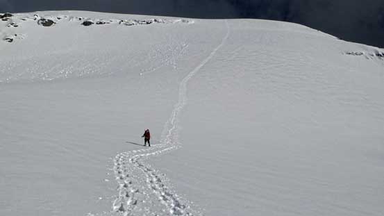
Ben and Vern cresting Joffre’s summit ridge

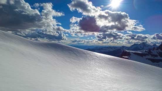
Looking down from the summit ridge. We were done the steepest part now.
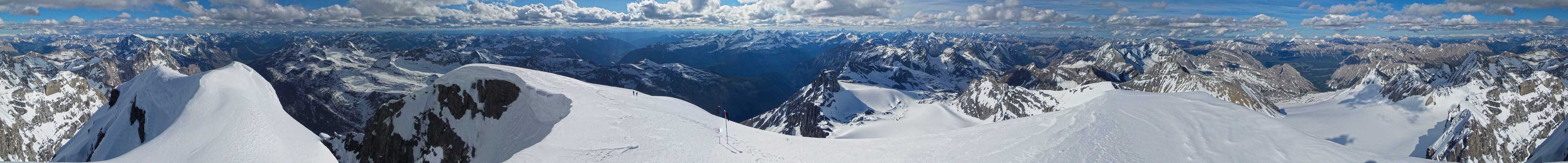
Summit Panorama. Click to view large size.

Looking down at Mt. Neville
Even Mt. Abruzzi looks small from here.

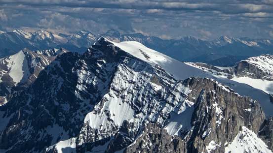
Mt. Harrison is the southernmost 11,000er.

Mt. King George is on my to-do list, another snow ascent

Mt. Assiniboine is the highest I’ve climbed to date
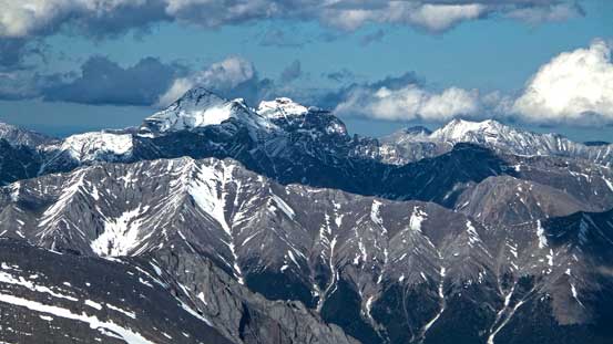
Mt. Sir Douglas is the other 11,000er in Kananaskis Country

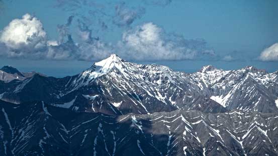
French, Jellicoe and Smith-Dorrien, part of British Military Group
Storm Mountain in Highwood Pass area
Mt. Rae is the 4th highest in K Country.
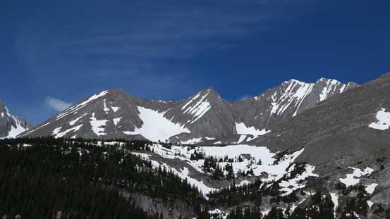
Peaks in High Rock Range. Some are described in Nugara’s scramble guidebook
More peaks in High Rock Range

These are a bunch of very obscured and perhaps unnamed peaks south of the Italian Group

We could also clearly see many peaks in the Purcells, despite the sun direction
Peaks on Opal Range. The Wedge looks like a tiny bump

Cornwall, Outlaw and Banded Peak, part of the Elbow 4-Peak Traverse

Me on the summit of Mt. Joffre, my 11th 11,000er.
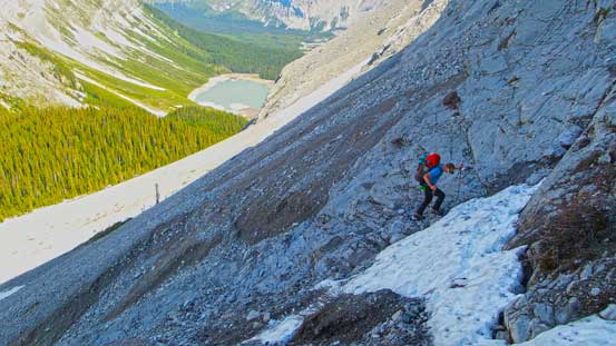
It was pretty chilly on the top so we soon started the descent. We kept snowshoes on until just above the face, then we switched to ice axe and crampons. The snow kinda ball under my crampons for a section but other than that it was simply plunging step down the face, and once we started to post-hole we switched to snowshoes again, and then had a wonderful time plunging down Mangin Glacier. The slushy snow on the lower glacier helped a big time on our knees as we could slide an extra feet or so on each step forward. It was a fast descent back to our warm and windless camp, tired but not exhausted.
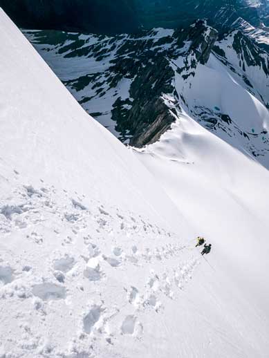
Ben and I descending the face. Photo by Vern
Another photo showing Ben and I plunging down. Photo by Vern
A view from the descent. The Royal Group at center

We’d soon switch back to snowshoes as we started to post-hole
Looking back at our lines
Sun was getting low, but still a few hours before sunset
Ben and Joffre
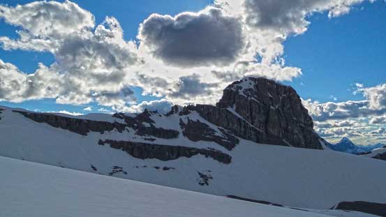
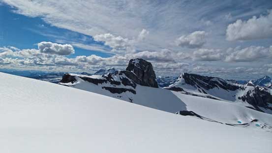
Mt. Mangin is probably the hardest in this area
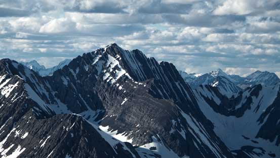
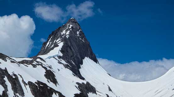
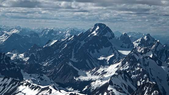
Mt. Lyautey.

Looking back at our tracks on Mt. Joffre
Ben walking back
Vern looking back at our objective
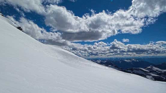
Incredible views all around

Plunging down another slope, with Mt. Marlborough behind

Plunging down the last slope back to camp
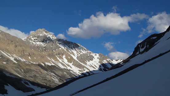
A look at Mt. Petain

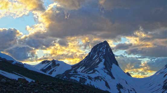
Northover and Lyautey stole the show in this evening
Mt. Northover at sunset

Mt. Petain at sunset
After dinner we went to bed earlier hoping to catch some well deserved sleep. Earlier in the day we had some discussion about our next objective. Among all of us, Mount Marlborough was the only one nobody had done, so it was pretty obvious what we would do the next morning. It turned out to be another wonderful snow climb. Oddly enough, it was harder than Joffre.
