Volcán Tajumulco
March 15, 2024
4220m
San Marcos, Guatemala
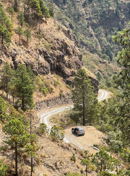
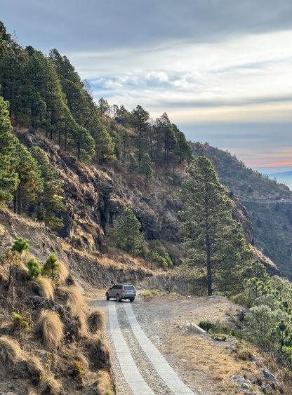
Perhaps the biggest attraction about Volcán Tajumulco is the statistics. It’s the highest peak in Guatemala and subsequently the highest in Central America. It is the 24th most prominent peak in the world with almost 4000 m of prominence, but that’s about it. The peak itself is not that iconic, and the ascent is nothing fancier than a “walk up”. Especially now with the steep but paved access road from San Sebastián one can drive to within 700 m elevation gain from the summit fairly easily, making it a mere half-day outing even by including Cerro Concepción. This is different from the “standard route” but I found more trips done via this route in the recent years. Almost all trip reports stated the access to be much harder than the ascent itself regardless of the route taken. While this is entirely true, I did not find the access of this shorter alternative route to be that bad. Kate and I hired Oswaldo as our driver with a somewhat reliable 4×4 vehicle and I anticipated an adventure with unknowns. At least one trip report indicated the need of “4 Low” to crawl up the steep cobblestone pavement, but we only encountered a short stretch of cobblestone pavement not far up from the bottom. Other than that short stretch the entire way was paved with two tire tracks, that Oswaldo did not even need to switch to 4×4 mode. It’s possible that the two-track pavement was done in recent days.

In any case Kate and I, together with the driver spent the previous night in Hotel Villa Real not far from the base of Volcán Tajumulco at over 3000 m elevation. The hotel was very basic with no wifi nor reliable hot water showers, but the higher elevation did give us additional acclimatization. We left the hotel at 6 am again in the morning and I directed Oswaldo to the start of the steep access road, losing 400 m elevation down to the village of San Sebastián. The direction given by Google Map along with the Gaia GPS app was all we needed to navigate this access road, and for once, the Google’s direction worked out nicely in a foreign country. I was surprised by the “lack of steepness” compared to what we had done on Montañas Peña Blanca a few days prior. The entire drive-up took less than half an hour, including a stop on the upper portion of the road for photos. The road reaches the highest point at 3570 m before making a steep descent to a small village with no other outlet, losing close to 1500 m elevation. I have to admit that the engineering of this road itself was more interesting than the peak we were going to climb, as we could see that entire descent down into the other village was also paved with two tracks. I directed Oswaldo to park at the highest point, and we would locate the trail-head slightly south of the small pull-out. I anticipated the round trip to take no more than 4 hours so Oswaldo should attempt to sleep in the vehicle while waiting for our return.

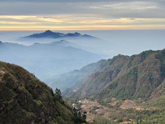
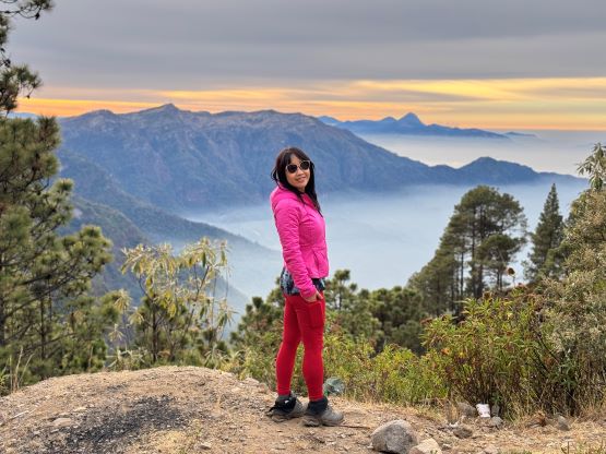
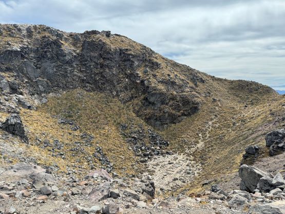
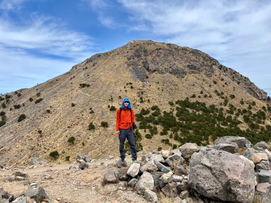
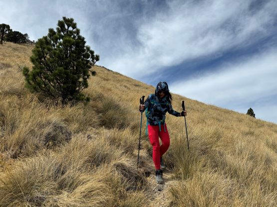
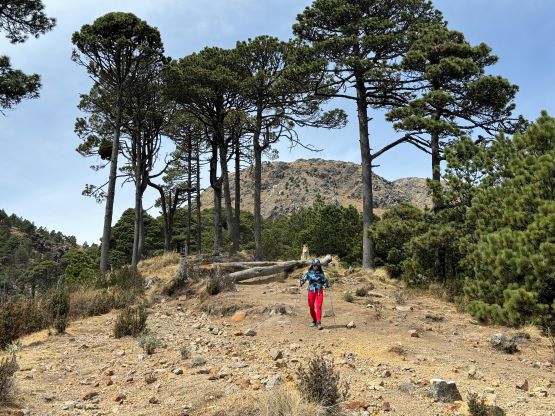
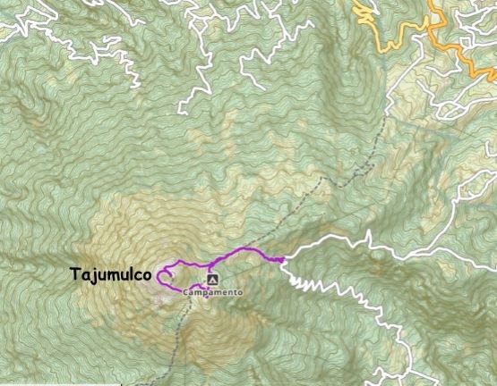
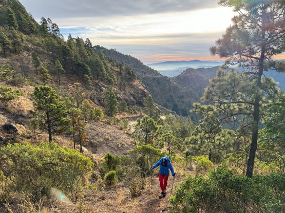
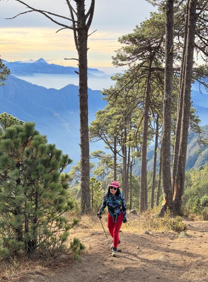
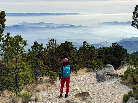
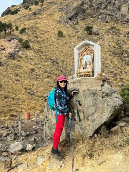
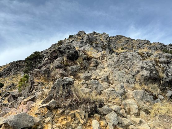
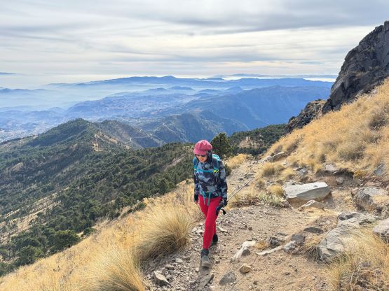
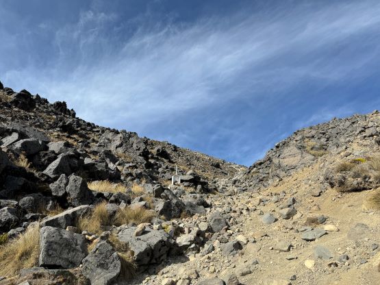
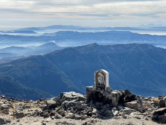
I did not bother to look hard for the trail-head because I spotted an eroded zone that resembled a path. After struggling to gain purchases up a loose chute above the road I quickly realized that this wasn’t the actual trail. We had to deal with some light bushwhacking but eventually joined the trail to the left after gaining 50 m elevation. This trail, though steep, dispatched elevation rather quickly and joined the standard route at above 3800 m elevation on the NE Ridge. Not far beyond that we reached the split where the path to the campground and Cerro Concepción diverged to the left. We took the right side branch which quickly led us to the scrambling section on the east side of Tajumulco where a bunch of religious plaques were erected. The final 200 m ascent to the summit was very scenic, but felt like a drag probably due to the higher altitude. Thankfully the views were rather excellent.


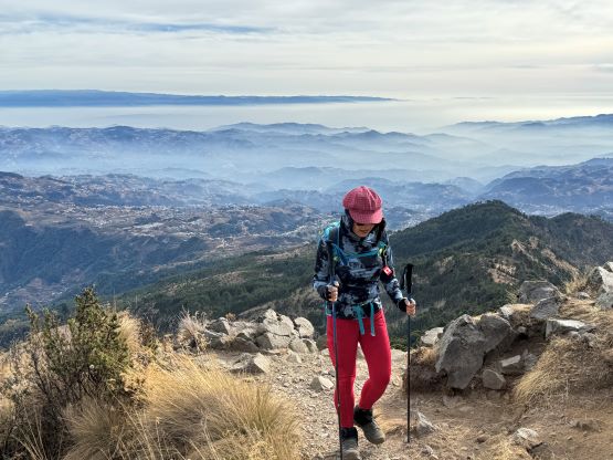


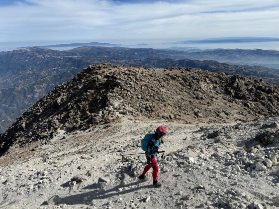
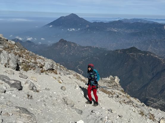
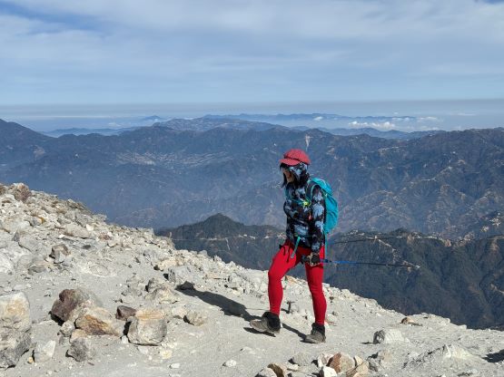
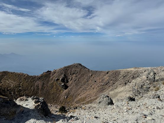
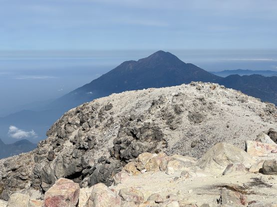


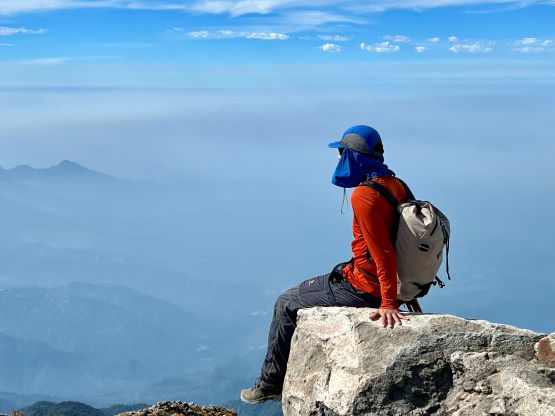
Our first and the only “break” was on the summit so this was definitely going to be a short hike. I then made the spontaneous decision to descend the other side of the crater to make a loop, and the main purpose was to position ourselves better for the bonus objective Cerro Concepción. We could not locate the trail diverging towards this peaklet but the open terrain was easily crossed. This ascent involved about 50 m elevation gain which could also be suggested by the prominence of this sub-peak. Not far below the summit we heard some yelling from behind, and sure enough we found a group on Tajumulco’s standard route staring at us. The yells were loud and repetitive so I’m not sure if our presence was offensive. Kate and I did not hire a guide so it was just the two of us, and I had no clue what was the problem. In any case we quickly made the summit and descended to the camping area which was hidden from their sight. The yells continued, so we made a hasty descent and I could finally relax a little bit after leaving the standard trail onto the alternative route. The rest of the descent was nice and quick and we did manage to locate the correct trail in the end. Our round trip time was just under 4 hours on a very leisure pace, and we spent the next several hours driving to Xela. The traffic was heavy but tolerable and we checked into our next hotel at 2 pm.