Mount Alderson
August 5, 2015
2692m
Waterton Lakes National Park, AB
It’s been more than 3 years since I visited Waterton Lakes National Park so when the weather forecast suggested horrible weather everywhere in the Rockies except for the far south where there’s nothing but sunshine the decision was easily made – a day-trip to Waterton Lakes… While the peaks there are generally less impressive by mountaineering standard, it’s a truly unique place and the landscapes are entirely different than the central Canadian Rockies like Banff, Kananaskis or Jasper. I’ve heard good stories about Alderson-Buchanan-Carthew (the ABC loop) so that’s it. It’s a Wednesday trip so I didn’t even bother to look for partners, instead I figured my mom could accompany me. While she couldn’t do scrambling she should have no problem joining me on the hiking section, as well as sharing a bit of the drive (there’s a LOT of driving for a day-trip to Waterton from Edmonton)…
While these three peaks aren’t technically difficult, it’s not a short day neither. I didn’t do much research beforehand but it’s apparent most parties would take roughly 12 hours to complete. I thought about omitting Buchanan Peak which would easily shave off 3 hours but being a hardcore peak-bagger that’d be shameful for reason of nothing but “being lazy”. Just like my last visit to Waterton the trip always ended up being physically harder than planned, partially because this is such a long drive from Edmonton and I wanted to make full use of it. (For those of you not knowing yet, last time, and the only trip I did in Waterton I squeezed Newman/Spionkop/Avion and Bauerman-to-Anderson the two long traverses into 1 day, 16 hours on full force covering more than 3500 m elevation gain)…
The traverse of Alderson, Buchanan and Carthew. GPX DL
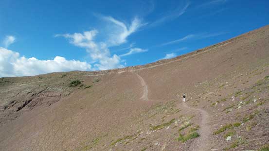
This was also my first time driving the Akamina Highway and by alpenglow-time we were already gearing up at the Cameron Lake parking lot. In short time we were hiking up the mundane trail towards Summit Lake. This section was 4 km long and took roughly 1 hour on a normal pace. There’s some nice morning reflections in the Summit Lake and soon we picked-up the Carthew-Alderson trail towards “Carthew Summit” (as referred by the hiking map). I personally don’t quite like this name as it’s clearly not the summit of Mt. Carthew. They do have a reason to call it a summit though as it’s the highest point on this hiking trail (which will look like a “summit” on an elevation profile), but I’d much rather just call it Carthew’s shoulder. I was also amazed by how well-maintained this trail was especially on the scree traverse, and in another hour or so we arrived at the shoulder.
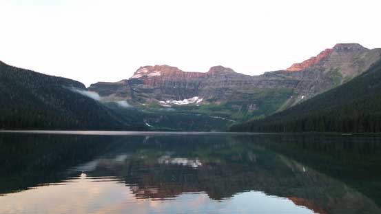
Alpenglow on Mt. Custer and its reflection in Cameron Lake
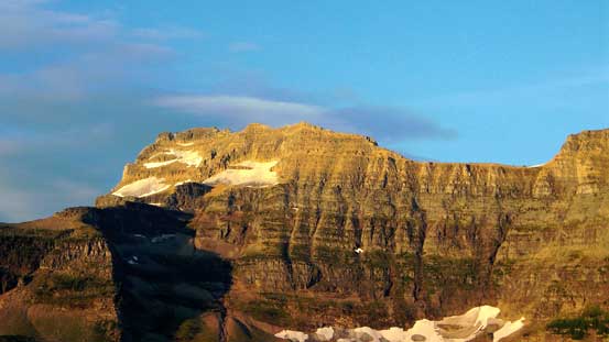
Mt. Custer on golden glow
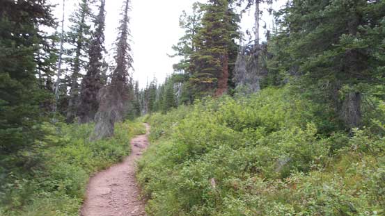
The typical scenery on the initial 4 km trudge
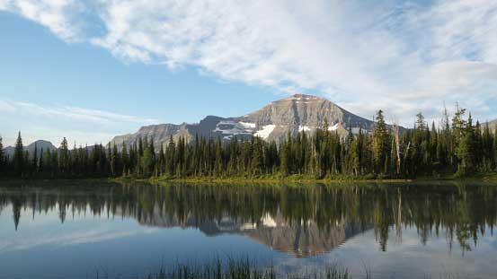
Chapman Peak and its reflection in Summit Lake
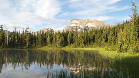
Mt. Custer and its reflection

The scenery started to open up as the forest thinning
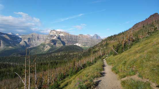
Hiking out of the woods, looking back

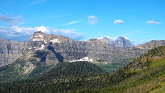
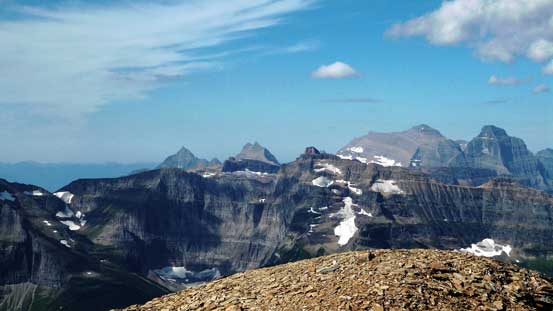
A panorama view of the peaks in GNP, MT, from partway up Carthew’s shoulder
Mt. Custer again
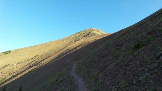
The trail cutting into the scree slope
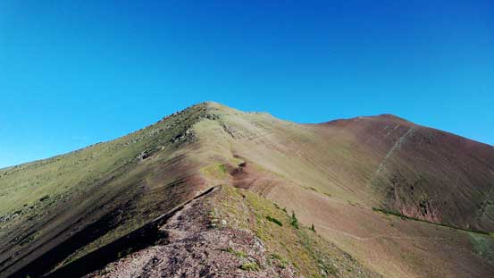
From Carthew’s shoulder, looking towards Mt. Carthew
Here we had to lose about 50 meters of elevation to the broad Carthew/Alderson col. The summit of Mt. Alderson lied roughly 400 m above with nothing but easy terrain in between. While my mom decided to wait for me at the col, I took a short energy break, then ditched my backpack and bolted upwards towards Mt. Alderson on a furious pace. The scrambling was indeed easy but there’s one or two rock bands requiring either a detour or some Class 3 down-climbing. I believe the first detour was on climber’s left while the second was on the right side, but I was too lazy to figure them out so went down the scrambling sections which was kind of fun actually. Higher up I did bypass a section on climber’s right as I could see cairns and paths so might as well use them.
Descending towards Alderson/Carthew col
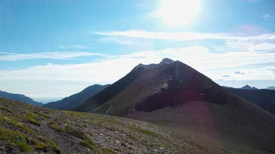
Here’s my first objective – Mt. Alderson
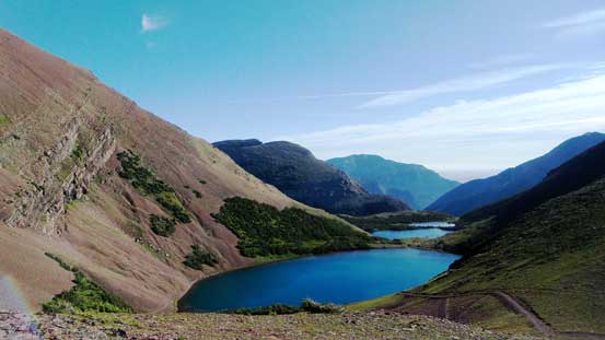
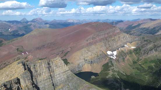
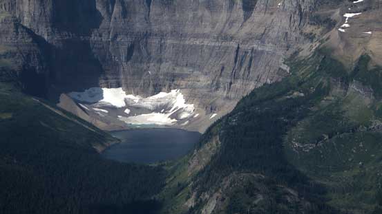
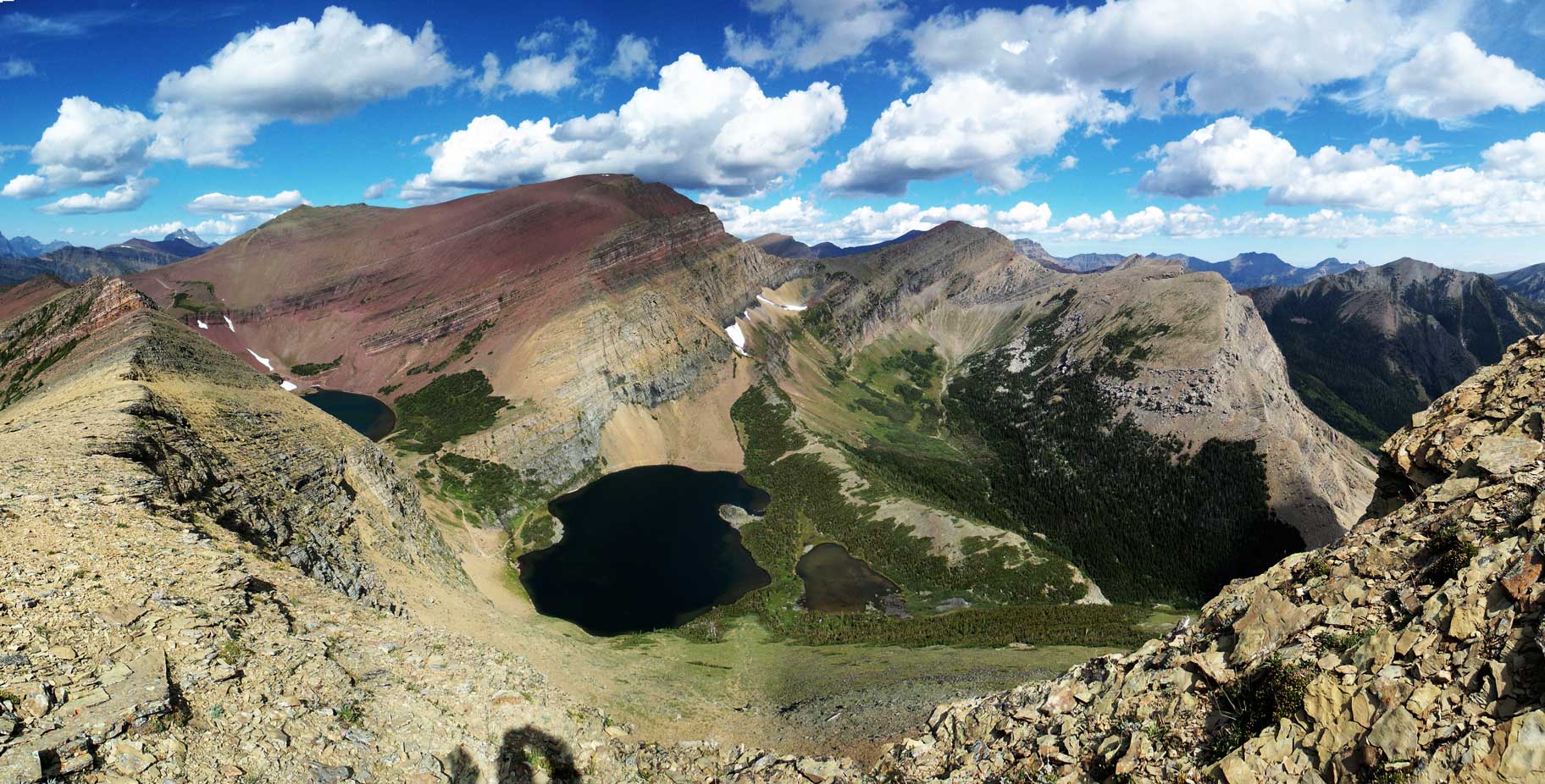
The beautiful Carthew Lakes
Partway up Mt. Alderson, looking towards Mt. Carthew and Carthew Lakes
At one section I topped out on a false summit and immediately to my left I could see the massive drop-off down the N. Face. It’s quite amazing actually. The true summit was still fair a bit of ways to go but there’s no more scrambling involved. The views were quite spectacular as I had pretty much never see the nearby peaks before so it’s quite a unique panorama, with the giants in Glacier National Park, MT, stealing the show.
The steep Mt. Alderson’s N. Face!
Another view at Mt. Carthew
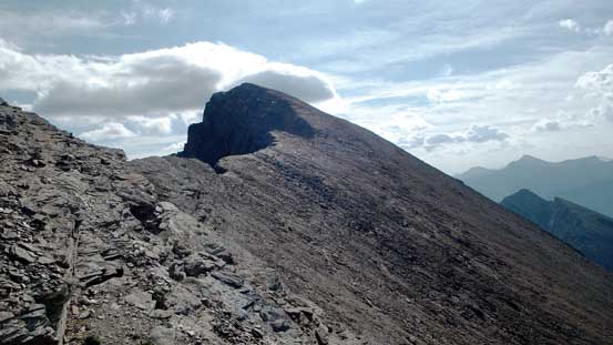
The true summit of Alderson ahead
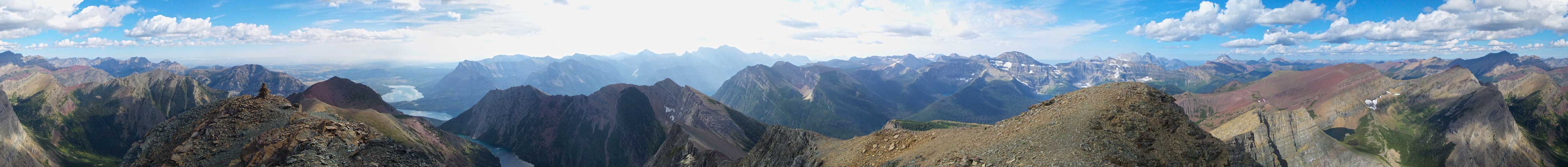
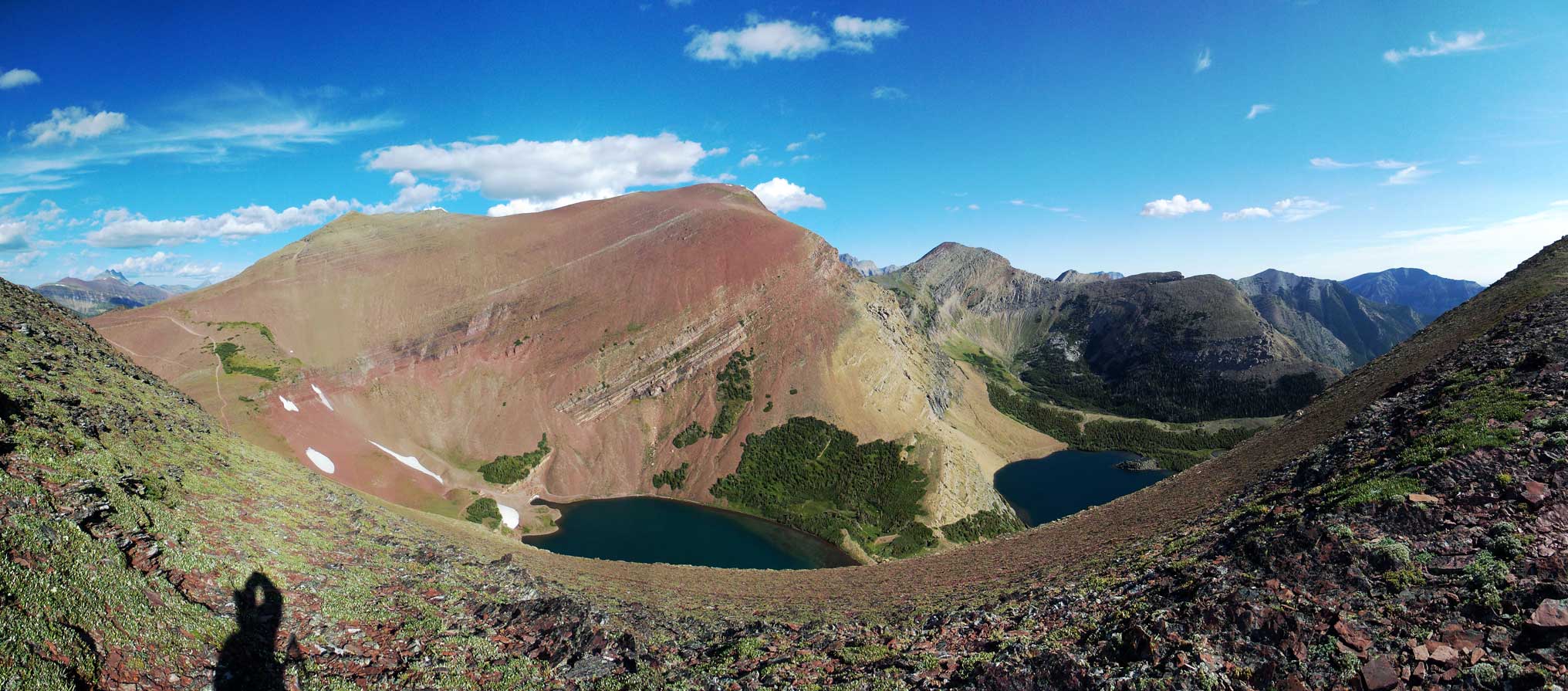
Summit Panorama from Mt. Alderson. Click to view large size.
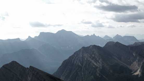
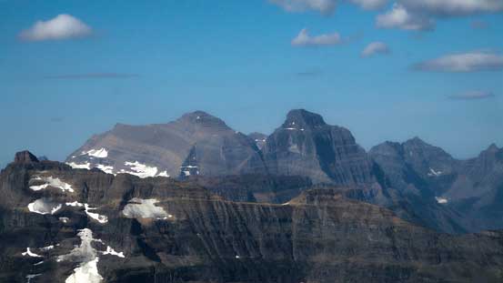
The morning sun doesn’t give the greatest lighting on Mt. Cleveland – highest in GNP, MT
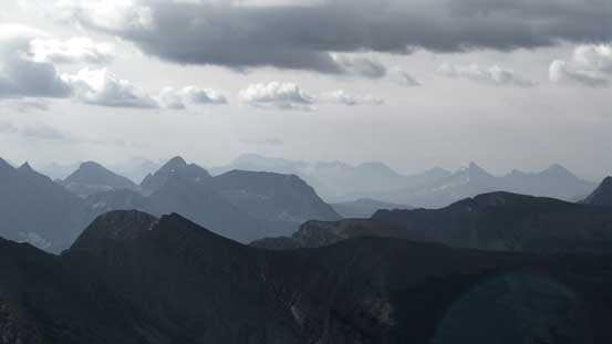
More peaks looking far down south into GNP, MT
Chapman Peak
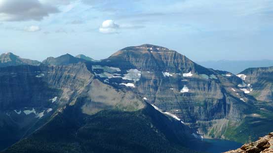
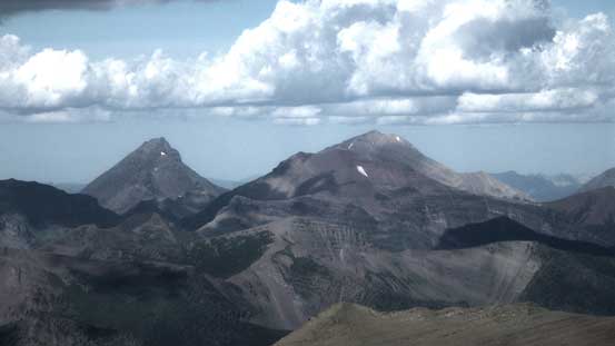
Behind Mt. Custer I could see giants in GNP, MT, including Numa, Peabody, Kintla, Kinnerly
A closer look at Kintla Peak and Kinnerly Peak
Long Knife Peak is another giant in GNP, MT
King Edward Peak and Starvation Peak – these ones are actually Akamina-Kishinena Area, BC
Mt. Lineham is a popular Kane’s scramble in Waterton
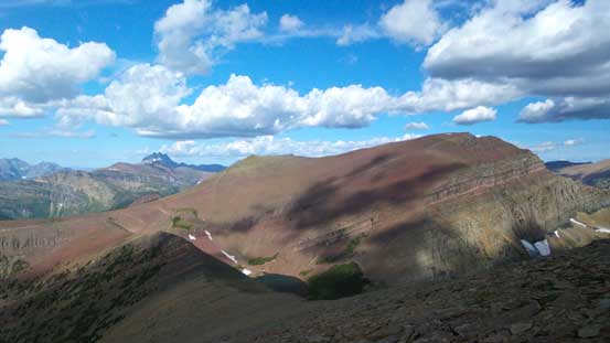
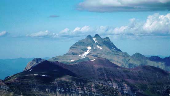
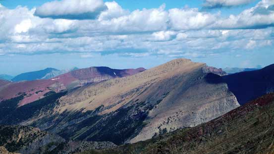
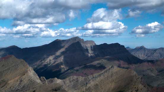
Mt. Carthew is such a colourful peak
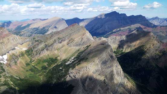
At center foreground is Buchanam Peak/Ridge – my next objective
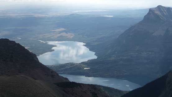
Looking down at Waterton Lakes
Mt. Blakiston is the highest peak in Waterton Park
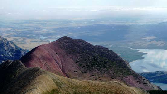
This red-coloured peak is Bertha Peak
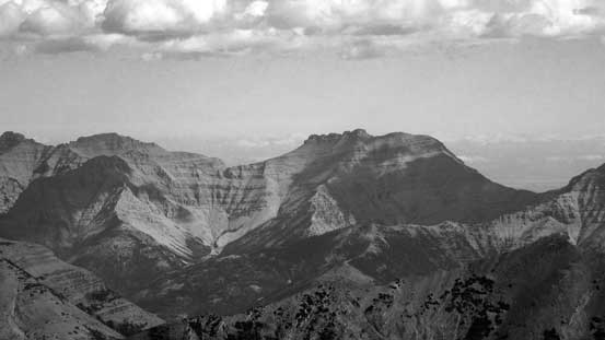
The rugged Mt. Dungarvan
Lake Nooney in Glacier N. Park
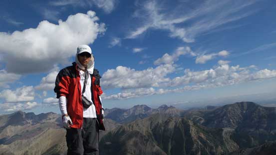
Me on the summit of Mt. Alderson

Another panorama from the summit. Click to view large size.
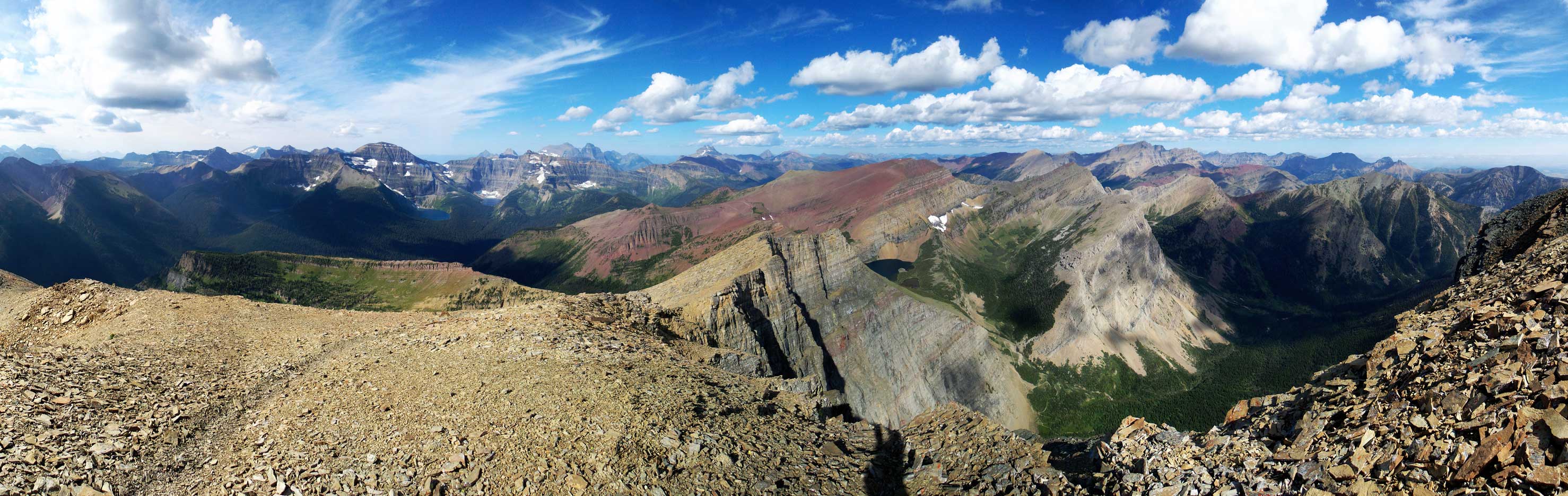
One more panorama from the summit. Click to view large size.
After taking probably 100+ pictures I started the descent. I also opted to climb up the rock step which was again, pretty enjoyable and it didn’t take me long to descend back to Carthew/Alderson col. The wind had picked up considerably and I got pushed around at a couple places, but still manageable.
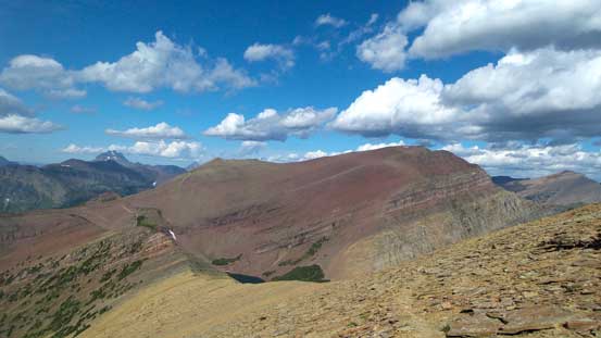
Can’t get rid of Mt. Carthew and its colours!
Another panorama of Mt. Carthew and Carthew Lakes. Click to view large size.
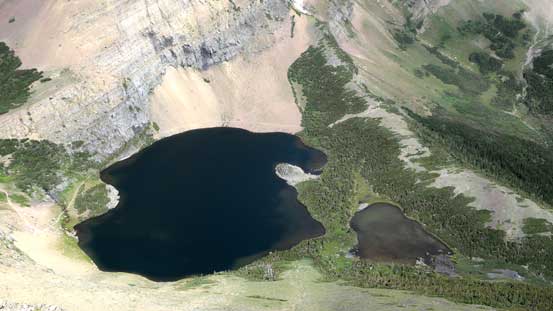
Carthew Lakes where I’d go next to explore up-close
It took me less than 1.5 hours to ascend Mt. Alderson and back down to Carthew/Alderson col. And again, after a short energy break it’s another decision time. For my mom she would re-ascend back to Carthew’s shoulder and attempt Mt. Carthew on her own. It’s all easy scrambling terrain and if she felt uncomfortable then just went back to Carthew’s shoulder and there’s a relatively sheltered place. And at the same time, I’d descend to Carthew Lakes and then followed by a scramble loop along the crest of Buchanan Peak and finally, Mt. Carthew itself.
