Thumb Peak (CA)
December 25, 2021
419m
Blythe, CA
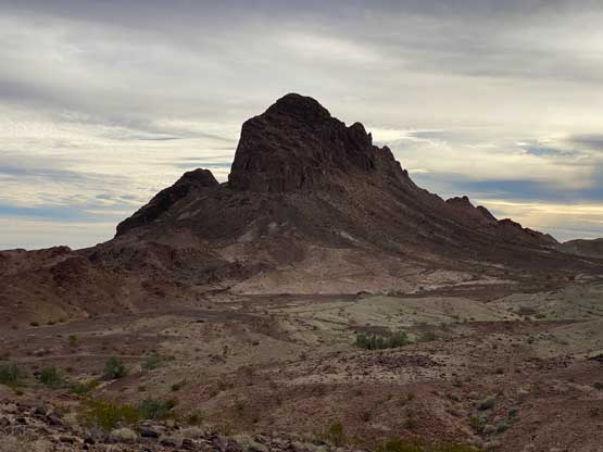
Thumb Peak is a small but pointy summit on the western side of Palo Verde Mountains to the SW of Blythe, CA. The striking profile attracts peak-baggers like myself, but the ascent is nothing fancier than a scramble. Bob Burd had reported a more direct route but a few others had discovered an easier solution by corkscrewing around the north and east sides to access the uppermost south ridge. This new solution is “3rd class” at most, but relatively unknown. Thumb Peak was the first real objective when Adam and I headed for the lower elevation desert south of Las Vegas. This was our 2nd day but my 6th day since leaving Vancouver, B.C.
We drove west out of Blythe after dinner and wifi connections and then drove south along the unpaved Wiley’s Well Road. This dirt road had been dug down well over 1 m and still was very sandy at places. We drove past a prison and camped at Coon Hollow campground about half a dozen kilometers from the starting point. The next morning we drove to where everyone else started their GPS track and parked.

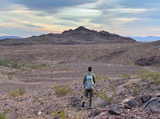
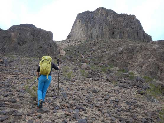
The approach was on the longer side for the desert standard. We got briefly confused at the start while crossing a major wash, but soon located the old road that headed towards the direction we wanted. We followed this road for a bit over 1 km before starting the cross-country travel to the north side of Thumb Peak. This section had lots of micro-terrain but also lots of game trails, so wasn’t too bad. We did not try hard to stick to the existing GPS tracks and just did our own variations here and there, by sticking more or less inside another dry wash.


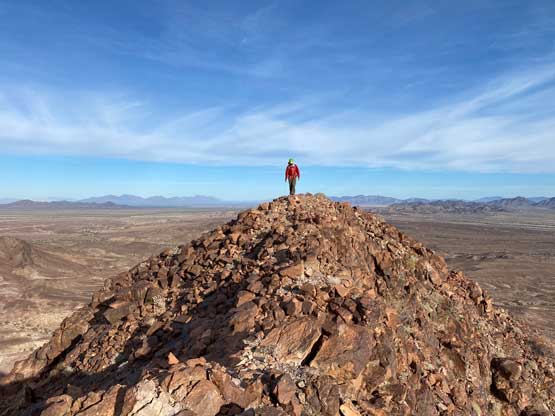
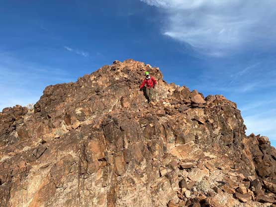
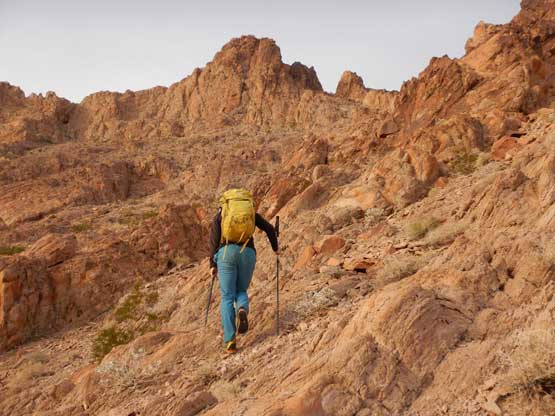
Once the ascent started we again, ignored the beta and went straight up towards the col between the main peak and the eastern sub-summit. I had studied the satellite images and thought this would cut off some distance, and we were correct. The ascent to this col was mostly on solid boulders and from the col we only needed to briefly lose some elevation while traversing to the SE Face. The ascent of the SE Face was mostly class 2 but did require some careful route selection. Higher up we went too far climber’s left and as soon as the scrambling became class 3 I checked the GPS and realized this mistake. We backtracked and found the correct “ramp” that led us to a small notch on the upper south ridge. The ascent into this notch had some brief class 3 but no exposure.


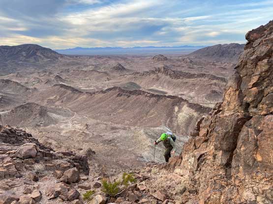
I thought the traverse of the south ridge to the summit would be difficult because by this point we had not encountered anything worthy nothing. The ridge did have some narrow spots, but again, was nothing harder than 3rd class and soon we stood on the summit. We had brought a rope and some trad gears and those seemed to have become training weight. Our ascent via this corkscrew route hopefully has solidified the beta for Thumb Peak’s easiest possible way.


On the descent we really only had one option, that was to trace the exact route we took back to the north side of Thumb Peak. The return back to the vehicle was a different story as we could pick whatever that made sense back across the desert floor. This time we took a line similar to the existing GPS track, which traversed higher than our approach line. I personally enjoyed the route we took in the morning more, as that had less traversing. The last few kilometers’ plod back to the vehicle felt like a drag.