Cerro Ajusco
January 3, 2019
3986m
Ciudad de Mexico, Mexico
The extinct volcano of Ajusco (Malacatepetl) is the highest summit within the boundary of Ciudad de Mexico. It’s nowhere as tall as the other famous volcanoes in the broad vicinity of central Mexico, but at just under 4000 m this is pretty damn significant nonetheless. This peak also boasts over 1000 m of topographic prominence. Due to the close proximity to the crowded Mexico City this is considered as the most often ascended peak in the country (by the locals). Foreign climbers do make ascents of Ajusco, but mostly as an objective of acclimation. The standard route is nothing fancier than a “hike” and for the well-acclimated ones the round trip should take no more than 3 hours. I had this objective in mind when paying a visit to Mexico in the New Year period of 2018-19 but it’s not the priority. After successfully ascending La Malinche on Day 2, Pico de Orizaba on Day 4, Iztaccihuatl on Day 6 and then Nevado de Toluca on Day 8 Lily and I still had a full day before the 2 am flight back to Vancouver. The drive to Mexico City airport would take ~2 hours so I insisted doing Ajusco even for the sake reason of killing time. Lily was not interested in, so I went solo.
After having a luxurious breakfast in the Microtel in eastern edge of Toluca it’s time to move on. The drive from Toluca to Ajusco’s trail-head was supposed to be the easier section and I cruised it without incidence. I let the phone’s GPS technology do its job and remembered very little about this stretch except for we crested a 3500-m mountain pass before descending ~300 m to the trail-head. The entire drive was done on rural or mountainous areas that the traffic was next to non-existent. We did have to drive through a small town before making that steep road ascent onto the pass. The traffic in that town was bad as usual, but by this point I was already used to it. The trail-head was confusing. It seemed like we could have drive a stretch of paved road winding up from the main road but soon enough we came to a gate. There’s a parking lot beside the gate but we saw no car there. I parked there nonetheless and wasted no time to start my hike, while Lily would drive the car back down to the main road where she felt more comfortable with.
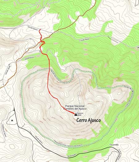
Ajusco standard hiking route. GPX DL
Right off the bat I faced the first interesting feature – a suspension bridge with very questionable wooden planks. A guided group just finished the hike and I got some condition update from them. I had wanted to just ascend the standard route straight for the true summit. The guide warned me that the lower section of that trail was “tricky” but I ignored it for simple reasons. It’s a trail, so how tricky could it be… I soon discovered what he meant by “tricky” as the trail was chocked with a lot of dead-falls, although nothing worth noting by my standard. The trail was relentlessly steep all the way until ~3700 m elevation. It’s also here that the view finally completely opened up.
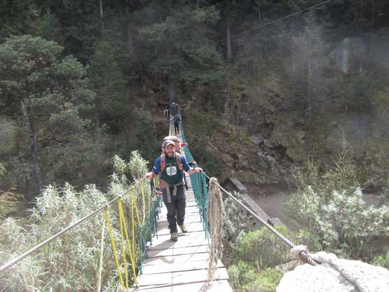
The guided group crossing that suspension bridge
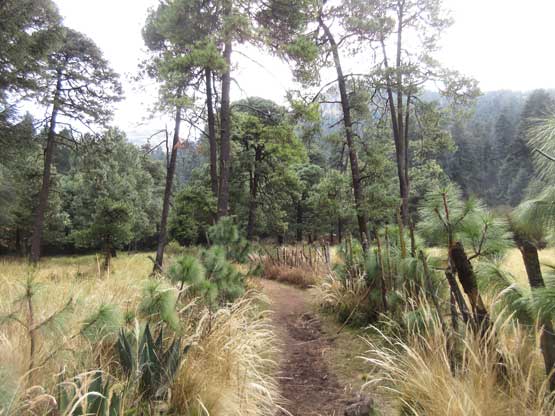
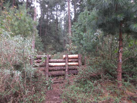
This is the start of the trail
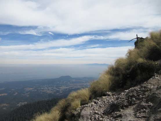
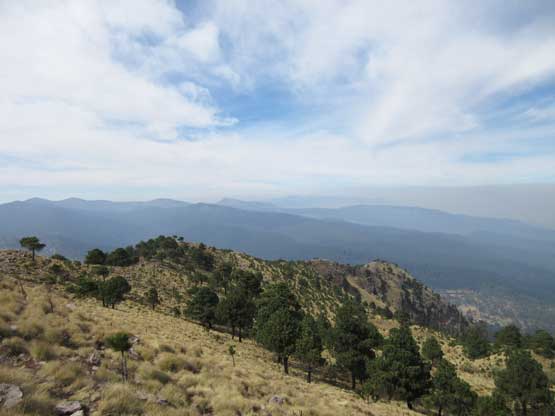
After a while ascending steeply in the forest I broke out of the woods
The trail up beyond treeline was still very rocky and steep

The summit was still fair a bit of ways away
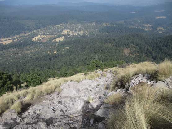
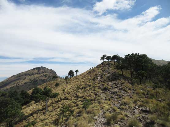
This is the first bump I went over. By now the grade finally tapered off a bit
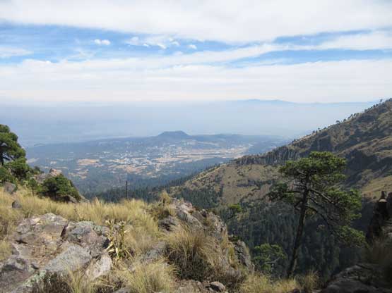
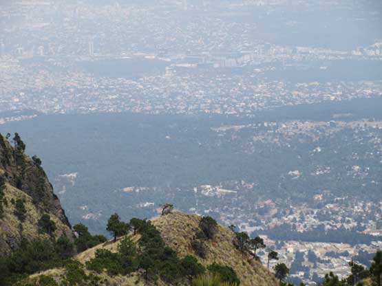
Already expansive views into the Mexico City vicinity
Looking back I could see the smog layer of Mexico City rising and I set my “objective” as beating the smog layer to reach the summit. I picked my pace up and in no time I traversed over or beside two subsidiary bumps and was now looking at the final push. I tried rushing it but had to stop a few times to catch my breathe as well as slow down considerably. I was only ~50 m from the summit so no big deal. I spent around half an hour on the summit taking pictures, but I soon realized there’s no point in lingering. I had met nobody other than the guided party at the bottom and I started wondering how the heck this is the “most often ascended peak” in Mexico…
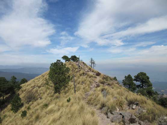
Looking back over the ridge I just ascended from
Upwards and onward
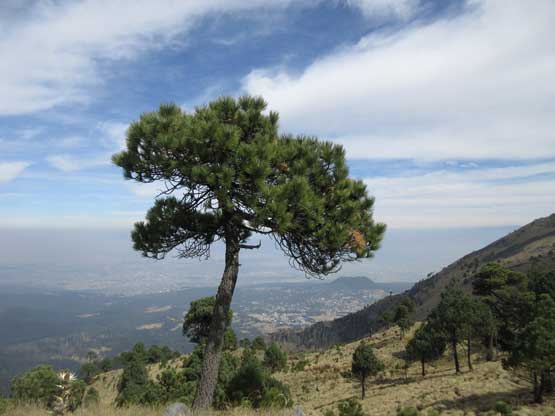
A lone tree on the ridge

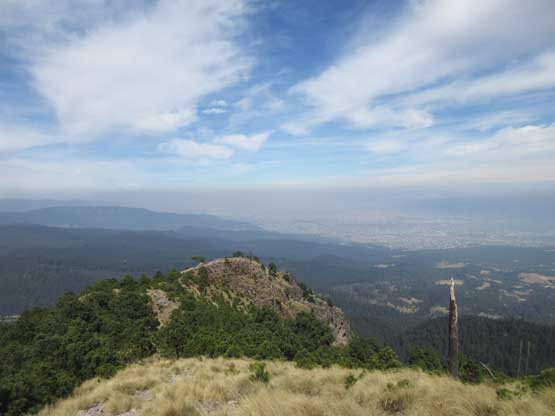
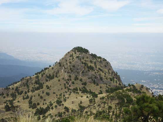
The true summit is the highest (uninspiring) bump
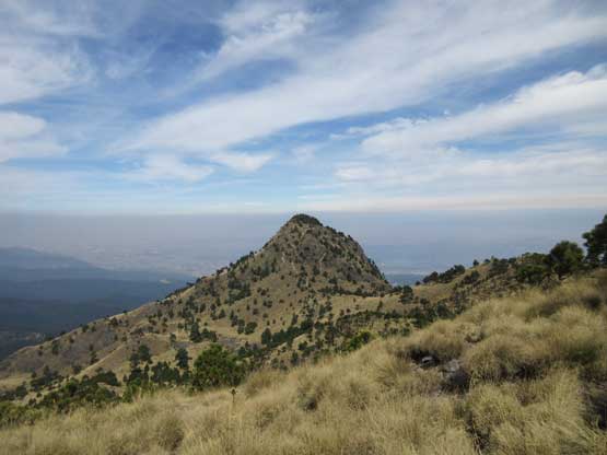
Getting much higher up, looking at Pico de Aguila
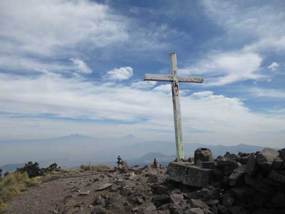
This is the huge cross on the summit of Ajusco

Summit Panorama from Ajusco. Click to view large size.
As you can see, this peak is right on the edge of Mexico City
Another look at Pico de Aguila a sub-summit. I didn’t bother to check it out
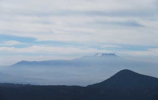
To the east is Nevado de Toluca
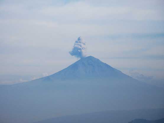
Popocatepetl erupting to the west
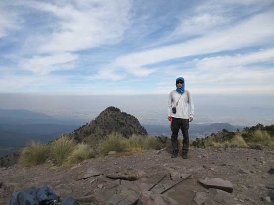
Me on the summit of Ajusco – highest peak in Ciudad de Mexico
The descent was extremely boring that I turned the music on and bolted down in a single shot with no rest break. I did meet two Mexicans struggling their way up but that’s it. I saw nobody else. Back to the parking lot I saw our vehicle was no longer there so continued hiking down the paved road until seeing our vehicle parked at a local restaurant. Lily was enjoying her time with the tacos and I soon joined the party. I had been avoiding eating street taco for pretty much the entire trip to reduce the risk of food poisoning (not good if it can reduce my chance of summitting), but at this point I cared no more. I had got all objectives in the bag and it’s time to play the risky game. I personally like Mexican food and it’s pretty damn cheap here, so I ate until I couldn’t eat anymore…
Time to head down.
This pictures shows the mess at the lower half of the trail.
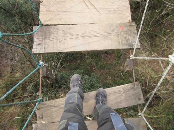
The suspension bridge was freaky to say the least
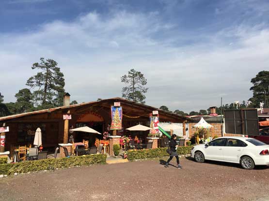
Back to the parking lot. We had a great lunch in this restaurant
After the lunch it’s time to face the final crux of the trip – returning the rental car to Mexico City airport’s Avis. This required driving into and then across the city gong show on a weekday’s afternoon. How fantastic this would be. I had been waiting to take this fun game for at least two days and now it’s finally the time to play it.. I again turned the phone’s data on and let the GPS do its job navigating the gong show, and remembered nothing as where exactly we went. The first portion was quite bad because the road lanes’ weren’t visible (even in daylight time). Once merging onto the main highway the driving improved drastically, but I made a stupid mistake trying to enter the “3rd floor”. The GPS directed me to go up, up and up but apparently only vehicles with special permissions were allowed. After trying to talk to the gate-keepers by Google translation (no ability to speak Spanish) we gave up. After a brutally intense blind merging I got back onto the main highway and stayed on the “second floor” cruising into the show. A few twists and turns later I was no longer driving above the ground, and instead I found we were now eastwards down Viad. Rio de la Piedad. The traffic was horrible as I was warned by other fellow climbers. It’s overall an afternoon of a weekday and I actually wasn’t complaining. The crawling took over half an hour but the worst was just about to come. Thank to the lack of research I incorrectly let the GPS direct us to the Avis official inside the airport. What the mess. I pulled at the “departure” wondering where the heck would we return the car. The traffic was horrendous. We realized the mistake but without Spanish on the phone we could not find where exactly the Avis car return was. In the end I drove around a few circles and parked at the 3rd floor in the airport’s parking lot. We went down to the office and thankfully they managed to find the correct place on the phone’s apps. This time we managed to get there without event and the returning process was done fluently with no surprise. At least there was something good and I think in the future I would stick with Avis for car rental. There services seemed as reliable as it can ever get…
The Avis rental agency even offered us a free shuttle ride back in to the airport. It was around 5 pm and we had at least 8 hours to kill with nothing else to do. We had a few very heavy and immobile luggage (duffel bags) that it seemed like we really had to sit around for 8 hours, but Lily suggested we could pay to store the luggage. We went to the LOCKER to check things out and it turned out that the price was ridiculously expensive, but we did have extra pesos so why not. To store one bag we had to pay 150 pesos so a total of 600 pesos were given to the locker. We also failed to find people willing to purchase our brand new fuel canisters. Instead of throwing the valuables into the garbage bin we just donated them to the locker, and told the owner to sell them to anyone travelling here to climb. Each canister worth 150 pesos… We had 4 brand new ones all wasted… It was almost 5:50 pm now and we had to make a decision. After debating among our options we decided to take a taxi to the city center to explore. Lily had been there in the past so I would just follow. The taxi ride turned out to be the most exciting thing (for me) on this particular day because I got to experience the worst of gong show of Mexican traffic. Thankfully I was not driving as otherwise I doubt I could have escaped without a crash… It was comparable to the worst of China’s traffic.. We killed about 3 hours walking around the crowded streets by the tourism squares and then had another big dinner of tacos. I could not even remember the name of the squares we visited, but the tacos were super good. Needless to say I had another huge meal.

Doing some tourism thing in the center of Mexico City
At around 9 pm we took another taxi and were back to the airport before 10 pm. We had no issue with the border and safety checks. It was not 11 pm yet so we had to kill another 3 hours and this time we really had nothing to do. The airplane was late by around 30 minutes but it seemed like the norm. The rest of the journey back to Vancouver was a fluent flow. I got to catch a few valuable hours of sleep during the flight. And that’s the end…
