Brandywine Mountain
July 8, 2023
2213m
Whistler, BC
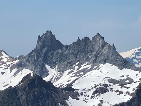
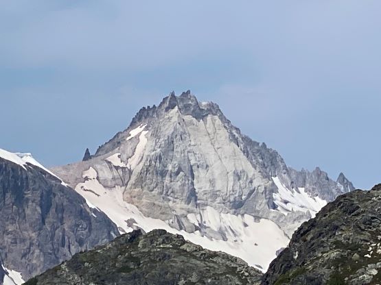
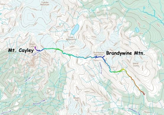
Brandywine Mountain is one of the easiest and more accessible objectives in the vicinity of Squamish and Whistler but one needs a 4×4, high clearance vehicle to drive to the upper trail-head. Without the high clearance one can still park at the lower trail-head. From the upper trail-head the trail leads hikers into Brandywine Meadows and eventually into the alpine. The trail essentially goes all the way to the summit with hardly any “scrambling” required. Over the years I happened to have done all the peaks in the area, mostly in winter or spring with the exception of Brandywine Mtn. I wanted to reserve this one for summer just for the views, but I also wanted to bring new or inexperienced hikers up. The latter eventually fell through as I ended up ascending it as part of the traverse towards Mt. Cayley. I had climbed to under the summit pinnacle of Mt. Cayley over 7 years ago, and this time I returned to finish the true summit with Francis. I knew there’s a shorter way to approach Mt. Cayley from Squamish River side, but I preferred certainty, which was to traverse over Brandywine Mtn. over the alpine ridges and glaciers.
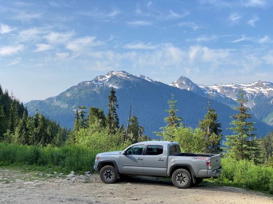
We agreed to climb Mt. Cayley over 2 days so there wasn’t the need to rush. However, there was some chance of thunder showers in the forecast and we didn’t want to get soaked. I drove to downtown and swapped vehicle with Francis at 5:30 am and in about 2 hours we arrived at the upper trail-head. The road definitely required an aggressive 4×4 vehicle such as a Tacoma, 4Runner or a Jeep. Some of the ditches are gigantic and troublesome, but the road’s wide and open without any pin-stripping problem. The mosquitoes were outrageous at the trail-head so we had to limit the trail-head redundancies, and start hiking as quickly as we could.
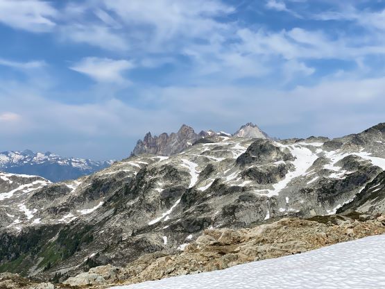
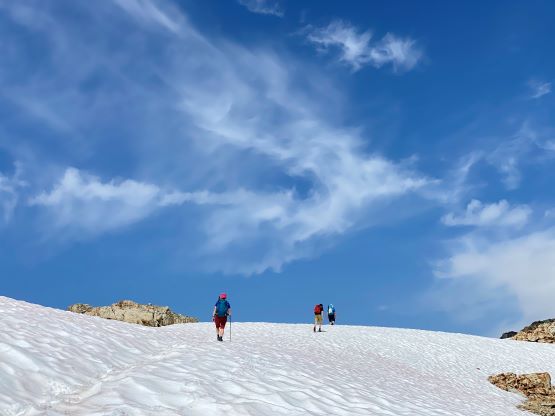
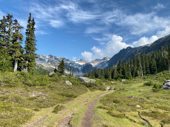
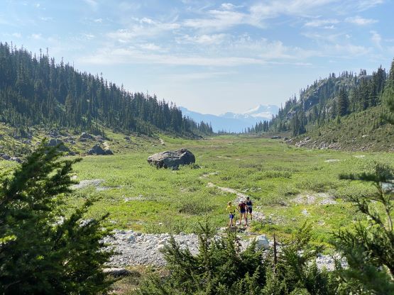
The start of the trail was confusing but Francis had done Brandywine Mtn. several years ago and led us taking the most direct options. There are several trails and all eventually lead into the meadows. Within 15 minutes we arrived at the gorgeous meadows and I could see why the locals, or even some Vancouverites repeatedly visit the area. It’s a beautiful zone. We followed the trail towards the end of this valley, crossed the stream using rocks and ascended the open grass and talus slope to eventually rejoin the trail. Apparently there’s a crossing that we missed. There were still several patches of snow to cross/ascend and the upper slope under the south ridge was quite loose.


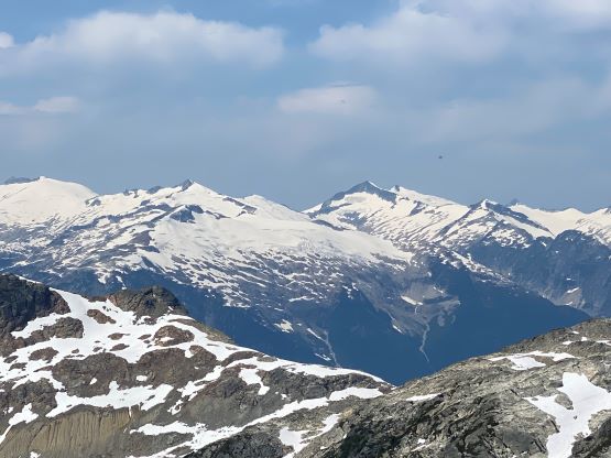
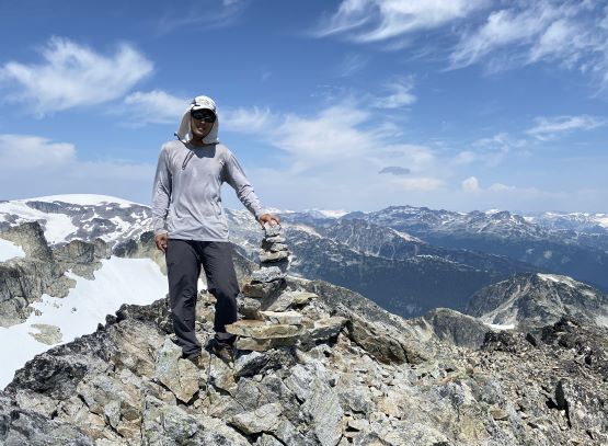
We briefly contemplated about traversing across the entire southwest face of Brandywine Mtn. to intersect the west ridge saddle but decided to just follow the trail on the ridge. This involved and up-and-downs on the ridge, but should be overall faster as plodding on a well-defined path is much simpler. At the base of the summit we traversed across the uppermost SW Face on choss and snow to the uppermost west ridge saddle. Francis opted to wait for me to make a quick dash up the blocky west ridge to the summit. The scramble was longer than I thought and involved some class 2 moves on boulders from this side. I met a group of Squamish locals on the summit, but didn’t linger too long as we had a long day ahead. I quickly made my way back down the west slopes to regroup with Francis.