Mount Grant
June 2, 2021
2180m
Hope / Silver-Skagit Road, BC
“Mt. Grant” is the unofficial name assigned by Fred Beckey in his 1981 Cascades Alpine Guide to a rather iconic and prominent summit immediately to the north of Eaton Lake. This peak is higher than the officially-named Eaton Peak a few kilometers to the south. The name of this peak had seen some confusions as prior to the publication of Beckey’s guidebook it had been referred as either “Crescent Peak” or “Eaton Peak North” in some local club trips. The older names understandably did not survive into this modern era and “Mt. Grant” is pretty much the one-and-only name for this peak on the internet nowadays. This name has also been adopted on the site bivouac.com, Google Earth and Matt Gunn’s Scrambles in SW British Columbia.
The standard route for “Mt. Grant” is a rather simple scramble via the south slopes from Eaton Lake and there’s a decently well-maintained trail to facilitate the approach to Eaton Lake. The same route also offers some winter mountaineering potential although spring is probably the more logical time if one sets to ascend this peak on snow. Either case this is a fairly straightforward and popular objective in spring, summer and fall and there are more than enough “beta” available online through simple search. I did not have a preference about the season that I wanted to ascend this peak but in the end I opted for spring. The forecast for this weekend was not looking very promisingly so I took this Wednesday off to hike. At first I was thinking about a more elusive objective near Pemberton but the conditions suggested that I should pick an objective out east in Fraser Valley or BC Cascades. I then picked this no-brainer objective “Mt. Grant” and Vlad and Elise was also keen to join.
The weather would be sunny but very hot with valley temperature approaching or above 30 degrees in the afternoon so we must aim to summit this peak early. On top of that Vlad did not have a vehicle on this midweek outing, so I set the alarm at 2:50 am. I woke up with less than 2 hours of sleep, drove to Richmond to grab Vlad at 3:30 am then grabbed Elise from Abbotsford an hour later. Buying food from McDonald’s proved to be a little bit problematic due to some mechanical failures but I didn’t buy breakfast beforehand so we must wait. Thankfully the wait wasn’t too long. To make up the time loss I was able to cruise down Silver-Skagit Road at 60+ km/h and we eventually started the hike at 6 am. Parking at the trail-head was a bit concerning due to some homeless camping right next to the parking lot, but I figured that they wouldn’t be stupid enough to break-in the vehicles right from their “front door”.

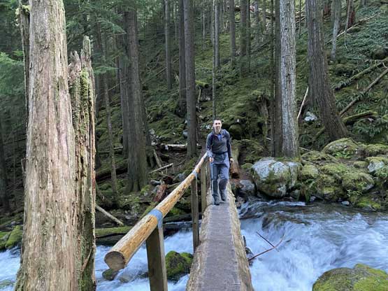
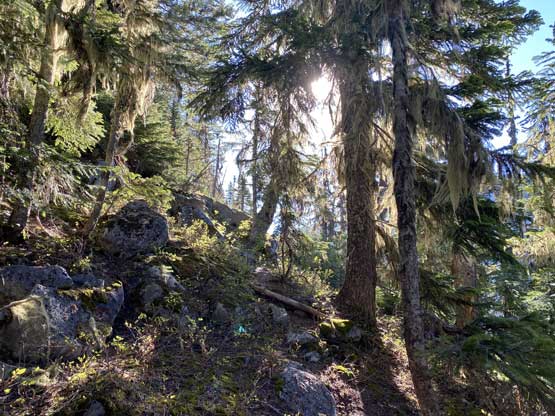
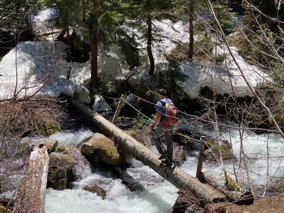
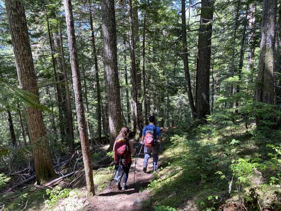
I had done my homework studying the terrain and the weather and my decision was to hike this approach in shorts and trail-runners while carrying mountaineering boots, gaitors and pants for the ascent above Eaton Lake, and this strategy worked out really well. The start of this trail was on some old and deactivated logging roads and the grade picked up once we could hear the roaring sounds of Eaton Creek. The first bridge crossing Eaton Creek with a waterfall above was a cool spot to visit in its own. This was at 550 m elevation and from here to the second Eaton Creek bridge at around 1300 m elevation was a mind-numbing slog on some endless switchbacks. The quality of this trail was surprisingly good, not that because it had met the “national park standard” but rather because of our low expectation. Comparing to most trails I’ve used in Chilliwack and Hope areas this one was in top class.

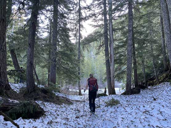
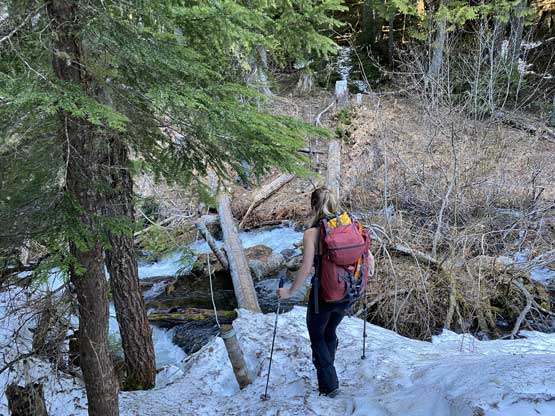
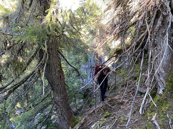
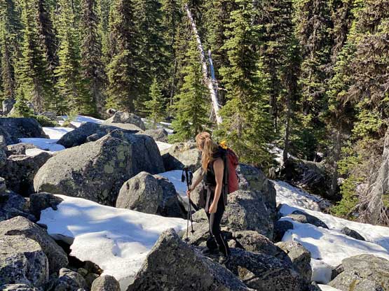
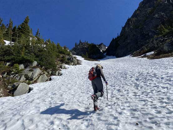
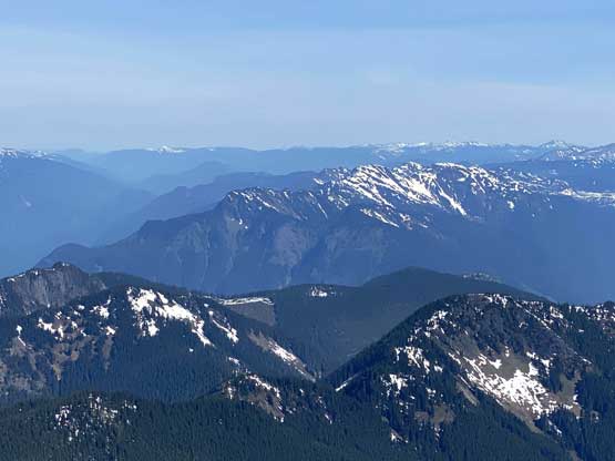
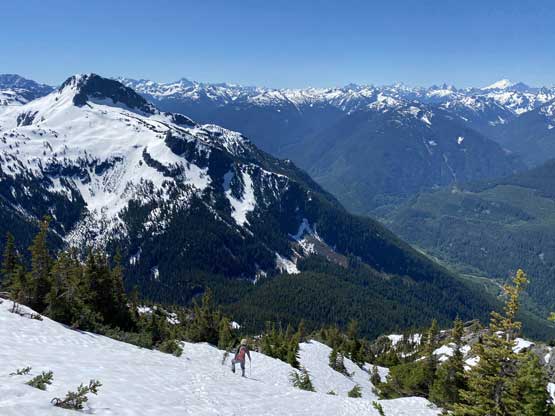
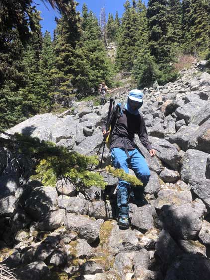
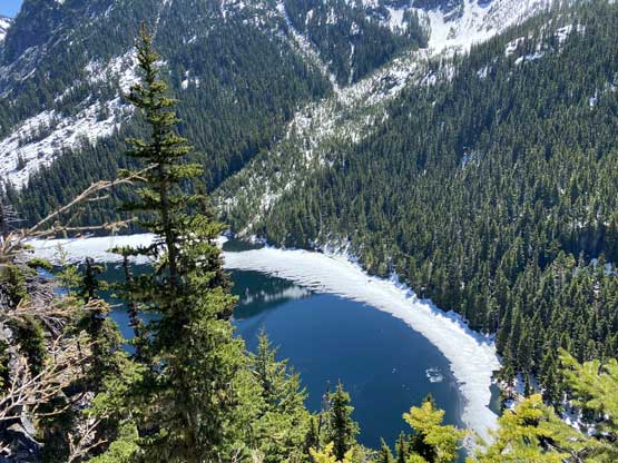
After crossing Eaton Creek back to the north side we took a long break ditching some gears and donning others. The trail continues on the north side for a short while before crossing back to the south side over a “sketchy bridge” according to recent reports on AllTrails. Given that Mt. Grant locates on the north side of Eaton Lake/Creek I would assume one has to cross the outflow on Eaton Lake and given the high water level in “mid spring” I would assume the creek crossing wouldn’t be that straightforward. My plan was to bushwhack directly towards Mt. Grant from the spot where we crossed Eaton Creek to the north side, and skip all the uncertainties associated with the outflow of Eaton Lake and that “sketchy bridge” which apparently required an au-cheval at the moment. The bushwhack involved some minor route-finding through bluffs, boulders and dead-falls but nothing really worth noting. Again, the strategy for us was to have a low expectation so once we actually saw the terrain we thought it was pretty easy. A while later we intersected the flagged path/trail that came up from Eaton Lake and easily followed it over increasingly steep and rough terrain to snowline at around 1500 m elevation. The worst was crossing a boulder field covered in soft snow. We then ascended continuous snow and cut into the major “south face gully” at 1750 m.


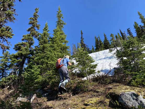

From here onward to the summit was just a 400-m slog on snow so we took our time donning crampons. I did not bother to take the ice axe out because the slope angle looked rather 35-degrees ish and that’s “mellow” to me. Vlad and I took turn breaking trail. For the majority of the grunt we were able to switch-back like skiers skinning up a slope without having to directly kick into the slope. The foot penetration was at most ankle deep even around thin spots. There was one concerning section where we could hear the sounds of a creek running underneath the snow, so we made sure we did not plod directly on top of the creek. Higher up we couldn’t hear the sound anymore. Above 2000 m we ascended a traversing line back climber’s right to the uppermost south face and easily plodded to the summit. There were two “summits” and the left (western) one was higher.

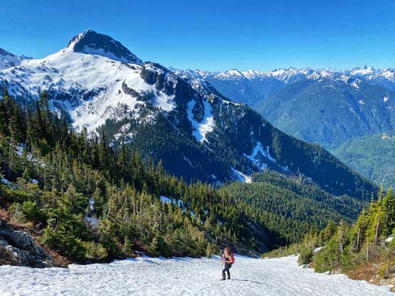

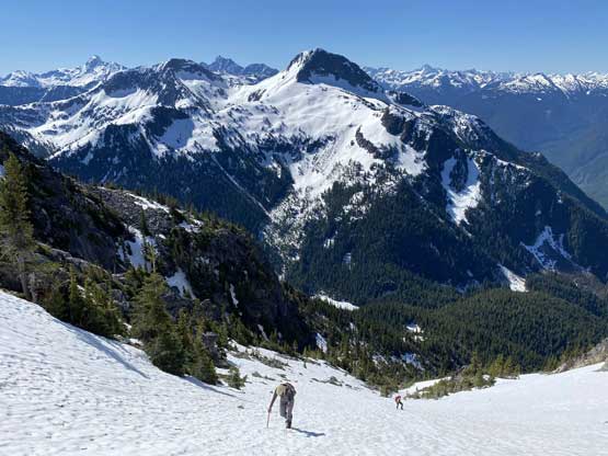
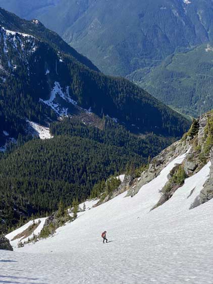
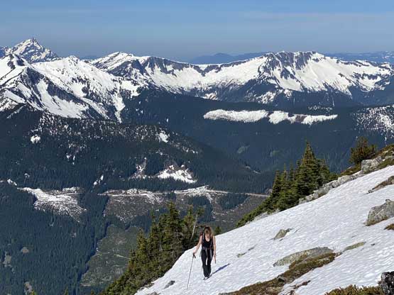
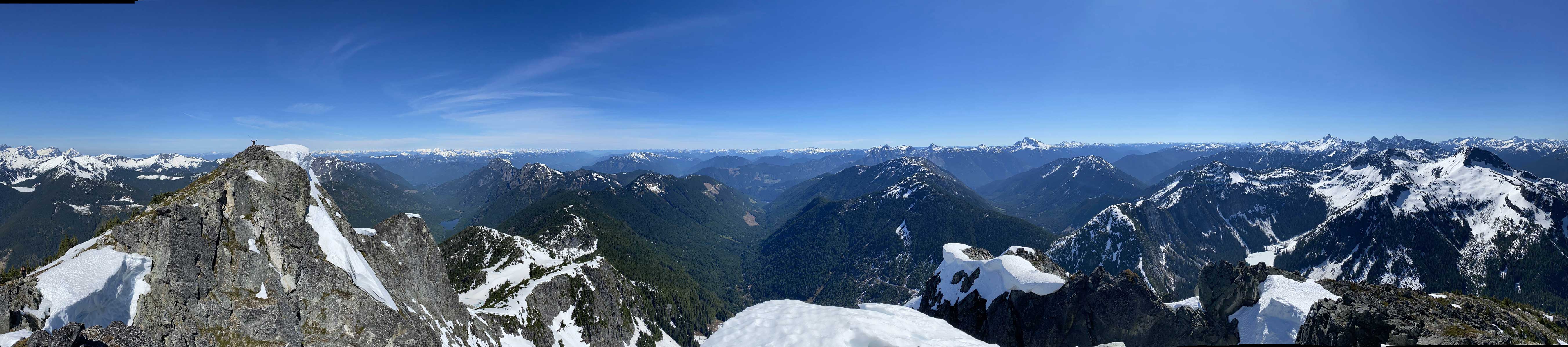
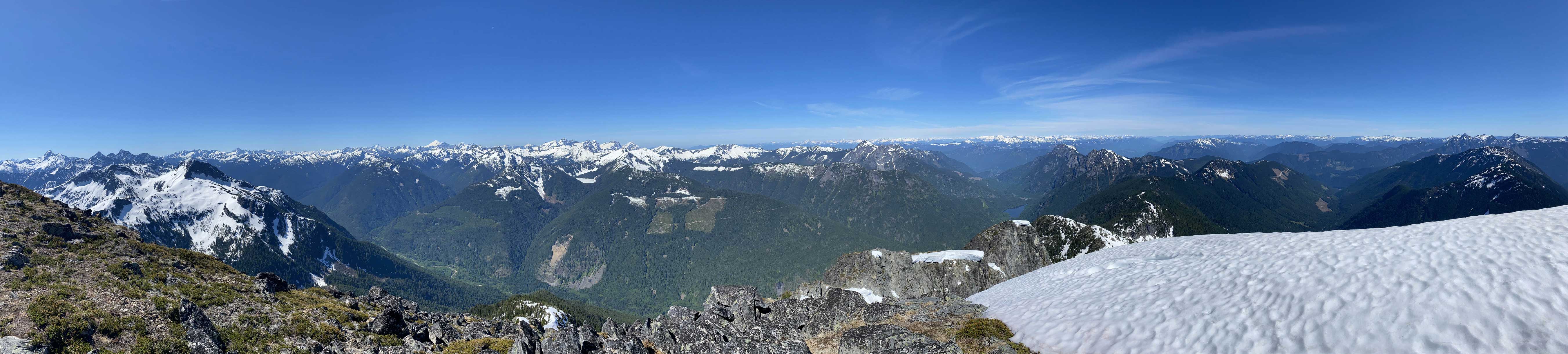

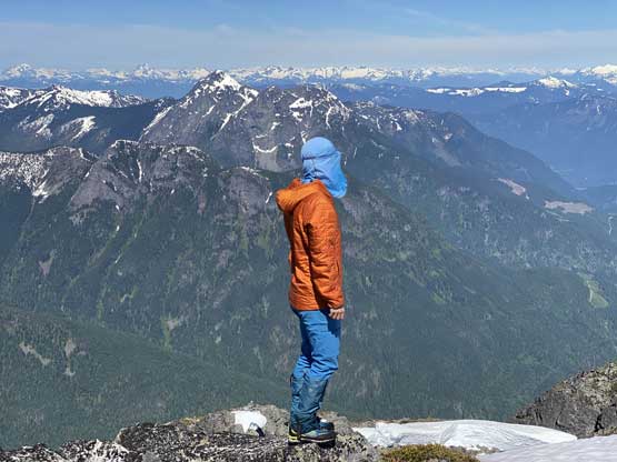
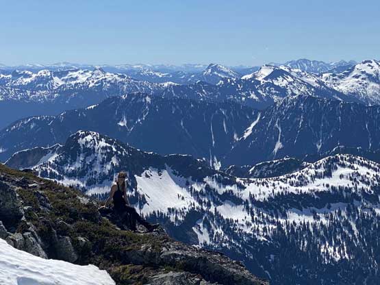

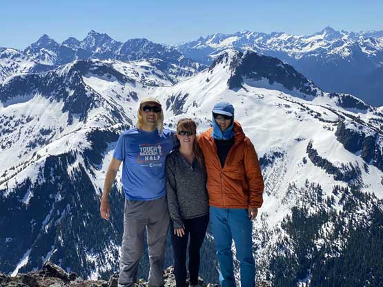
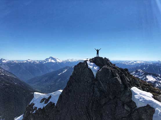

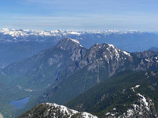

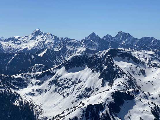


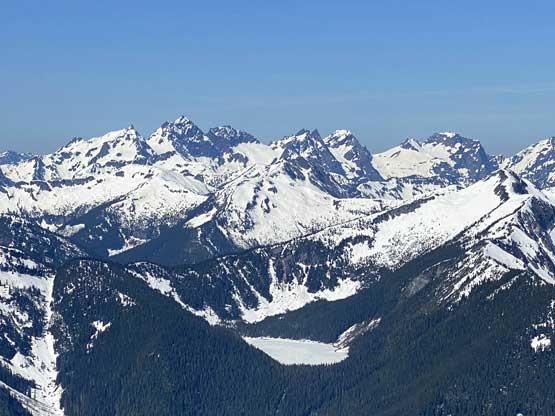
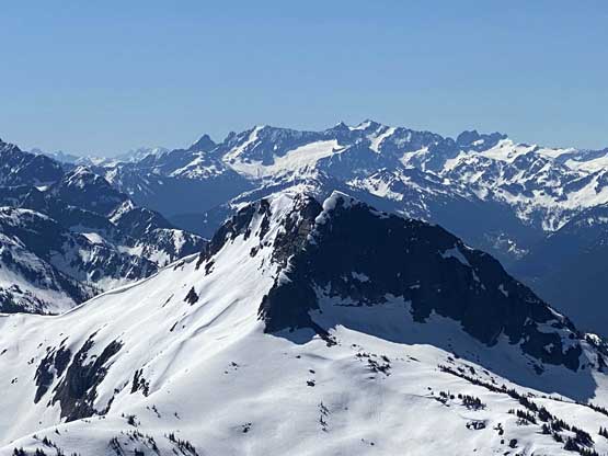
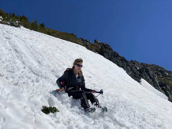
We lingered for almost an hour on the summit because it’s a cool place to stay. I had done the nearby Wells Peak, Hope Mountain and Mt. Coulter but did not get much of a view from any of them, so it’s nice to see what’s actually in this area. On the descent we used a combination of plunging, boot-skiing and glissading to get off the upper snowfield. The glissading was a bit too fast for our likes and to stop the slide I pretty much had to dive into the proper self-arresting mode using an ice axe. While transitioning gears we met Sergio coming up alone and he sure recognized us from following on Instagram. The descent from that spot back down to Eaton Lake trail was not difficult but required some mental work as we did have to pay close attention to the terrain. The trail/path wasn’t the easiest to follow due to snow etc. and the bushwhacking section required GPS navigation to stay on route. Once hitting the trail we took the last long break so that I could switch gears back to trail runners and shorts and the rest of the hike-out was uneventful, albeit boring. The quality of this trail sure made the 1700+ m ascent not as tiring as it was supposed to be.


I was thinking about break-ins when we hiked down the trail but the worrisome was not needed. There were three vehicles parked and no shattered glass on the ground. The initial descent from the parking lot down to Silver-Skagit Road required careful 4-wheel-driving but the main road was an easy cruise. The rest of the drive back to Lower Mainland was uneventful. I had to work in the late evening so desperately needed some sleep, so dropped Vlad off in South Surrey to let him take a bus back home. I got home at 5 pm and that was good enough.
