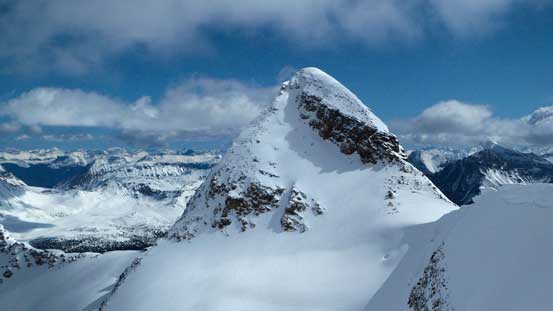
Simon Peak (Mount Fraser)
April 25-28, 2015
3322m
Jasper – Tonquin Valley, AB/BC
The massive bulk of Mt. Fraser has three distinct summits (Simon, McDonell and Bennington), with Simon Peak being the main one. It’s also the highest peak in Tonquin Valley (Mt. Geikie is at 3297 m which is slightly lower than Simon Peak, despite what’s suggested in the ‘book of lies’), as well as the highest summit on the Continental Divide between Fortress Lake and Yellowhead Pass. However, despite its geological significance it has literally no beta except for the few lines of description in the old guidebooks, so when Ben, Liam and I were gaming for a 4-day ski mountaineering trip aiming to bag the highest summit on Mt. Fraser we knew we were in an exploratory mission. The back-up, or bonus objectives would be the more frequently ascended McDonell Peak and a couple other smaller peaks nearby Wates Gibson Hut including Outpost Peak, Thunderbolt Peak and Surprise Point.
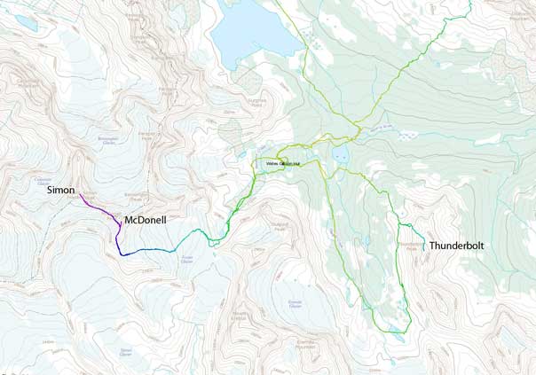
Ascent routes for Simon, McDonell and Thunderbolt. GPX DL
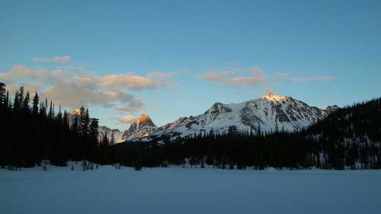
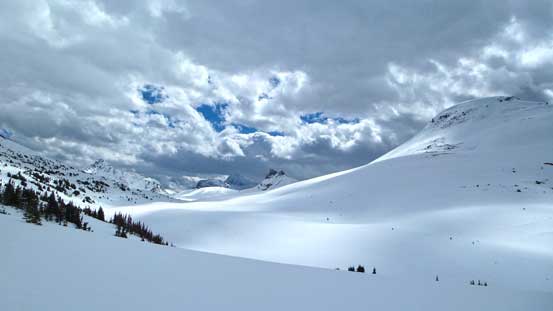
There’re a few approach options to this remote area and on skis, it takes at least 1 very long day no matter what route to take. Our preferred route choice was from Portal Creek and over two short-cut cols by Mt. Maccarib and Oldhorn Mountain, taking a more-or-less direct line from the parking lot to Wates Gibson Hut. This felt a wee bit eerie as at pretty much exactly 1 year ago (the exact timing was only off by 1 day), Ben, Liam, Jake and Meghan started their Great Divide Traverse via the exact same route. That was good though as we’d roughly know what to expect and we’d also have a GPS track to follow. The weather was forecasted to be miserable on the 1st day (Saturday) but as we drove up the Marmot Basin Road we realized it’s going to be a gorgeous day ahead.
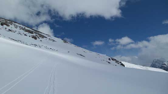
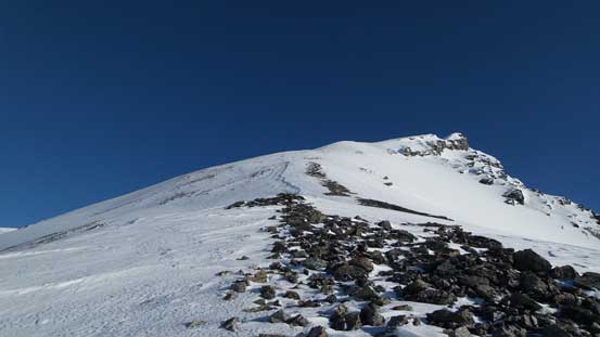
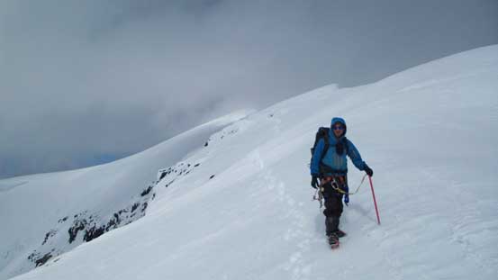
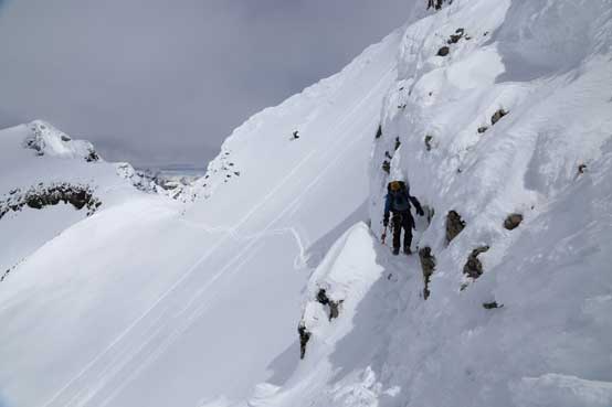
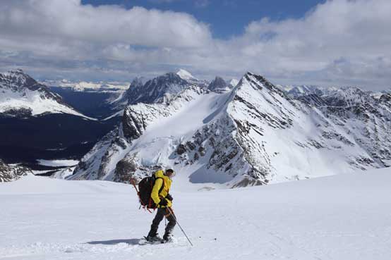
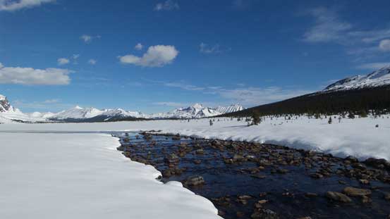
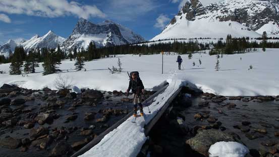
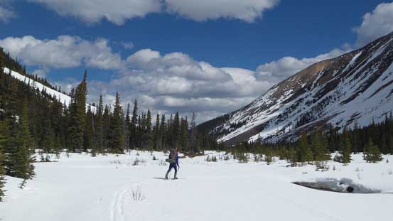
Right at the start we realized there was less snow at lower elevation compared to a year ago. We tried to skin up the creek bed but soon bailed back to the summer trail thank to the maze of open water and suspicious snow bridges. After that we stayed on the summer trail for a long while until it made sense to drop back into the creek. From there on it was a pleasant ski up Portal Creek, passing Peveril Peak on the right and Lectern Peak on left, and into the alpine basin below Maccarib Pass. Here instead of ascending towards the pass, we picked a line aiming straight towards the 1st high col at the pass between Mt. Maccarib and an unnamed peak to its left. The slope got very steep near the crest and we ended up having to take skis off and kick-step (more like post-hole) up the final 50 m.
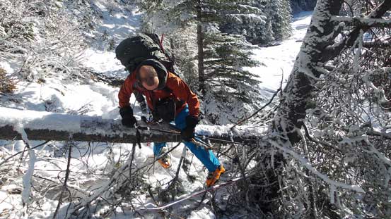
Ben trying to hop over this fallen log without his skis off. It didn’t work out very well though.. Shortly after this we went into the creek.

Here’s Liam skinning up the creek with Peveril Peak in front

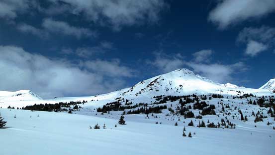
Ascending into the alpine basin below Maccarib
Lots of touring opportunities here
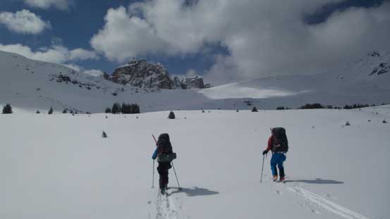
Liam and Ben ascending towards our first high col
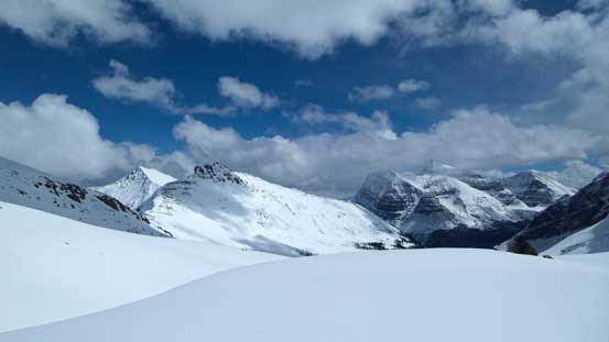
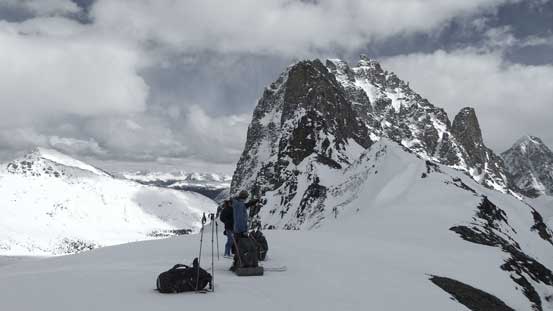
On the 1st high col, looking towards an unnamed summit
Looking back reveals a good sight of Majestic Mountain and Vertex Peak
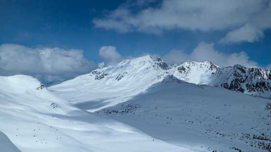
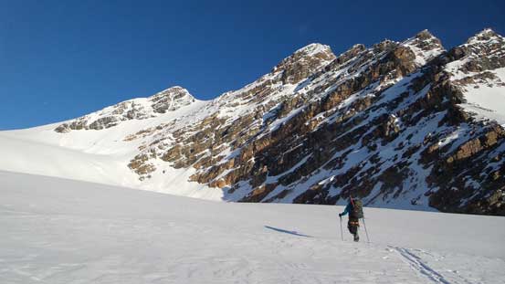
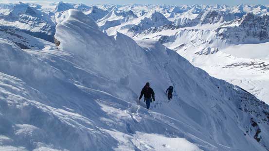
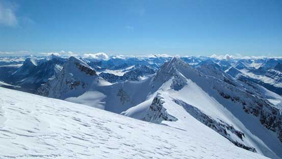
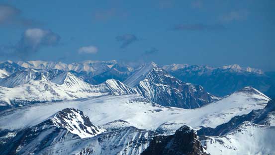
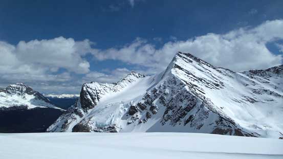
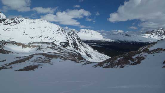
Just as what Liam and Ben remembered from their trip 1 year ago, the terrain between the 1st and 2nd high col was big. We had two options here, of which one was to drop down for 100 m or so immediately but we decided to take the other option, a traversing line cutting high on the slope on climber’s right side. Even that there were more up-and-downs than what I’d expect but with Liam and Ben taking turn breaking trail we were slowly getting closer to the 2nd col (a lot of work to do especially given the hotness in this bowl). Ascending towards the 2nd col was again, very steep but at least we didn’t have to take skis off this time. Upon cresting the 2nd col by Maccarib/Oldhorn col we were treated with a head-on view of the Ramparts. Our objective was the majestic one looming on the left but this view also showed the massive height loss we’d have to cover in the next section.
Neat view looking towards the N. Face of Throne Mountain

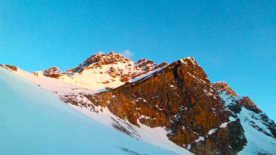
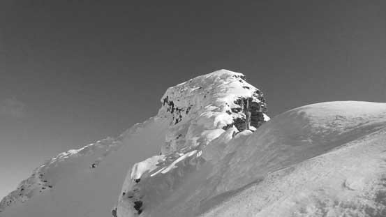
Oh here’s the sexy Oldhorn Mountain

Ben traversing towards our second high col.
Lots of up-and-downs here
But also lots of great views.
A zoomed-in view of the ‘scramble’ side of Mt. Edith Cavell

Ascending towards the 2nd high col
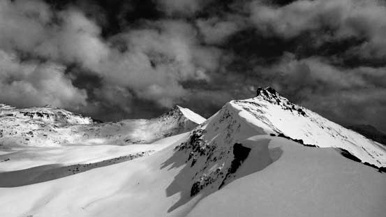
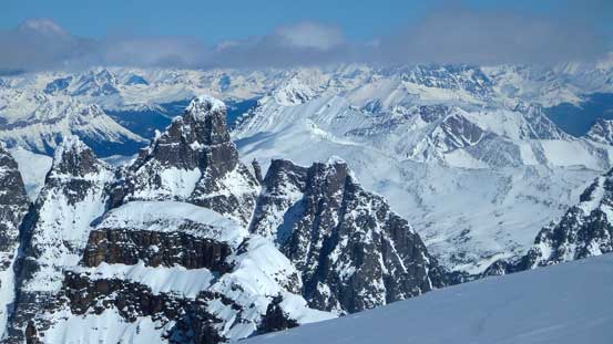
Upon cresting the col, big WOW moment as we could see the Ramparts
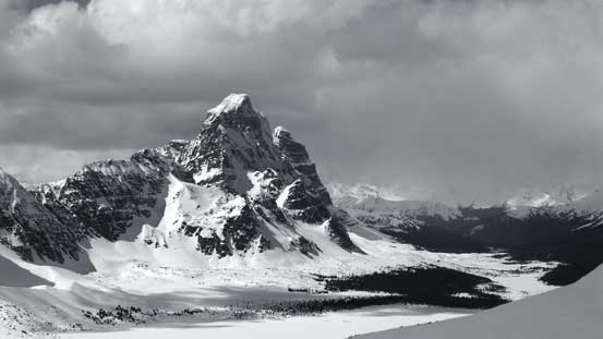
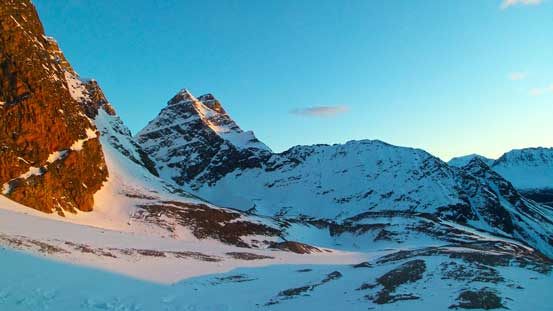
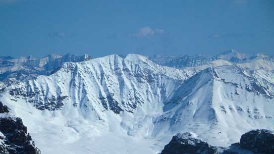
Mt. Geikie

Mt. Fraser and Fraser Glacier

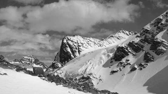
We traversed along this ridge crest for a while
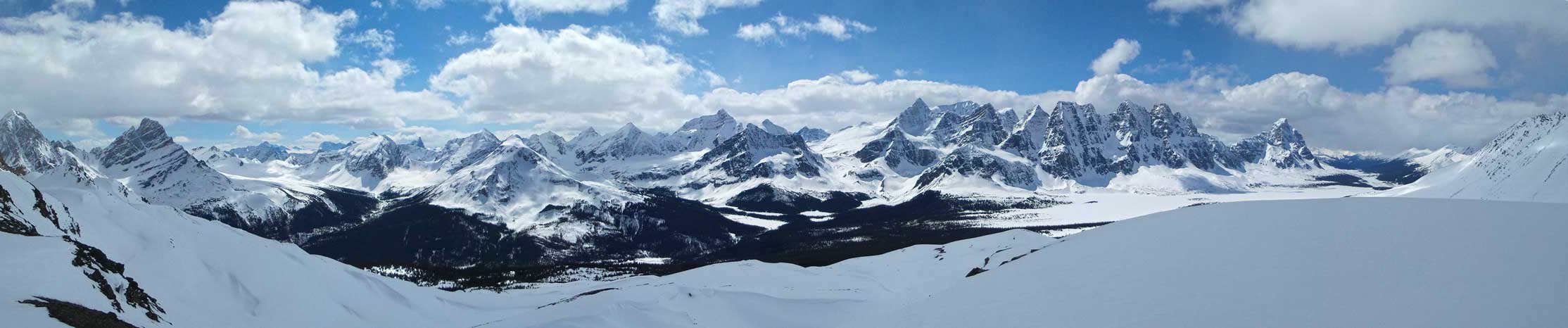
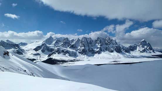
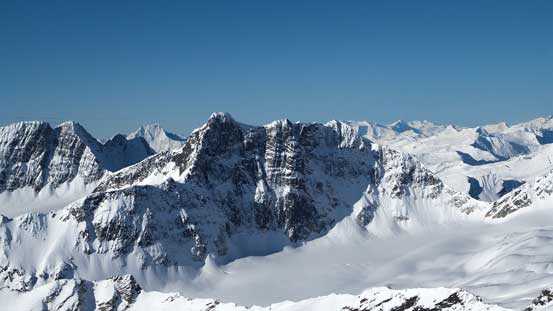
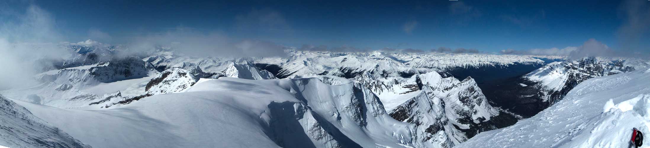
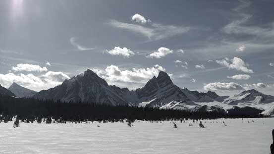
A panorama view of the Ramparts. Click to view large size.
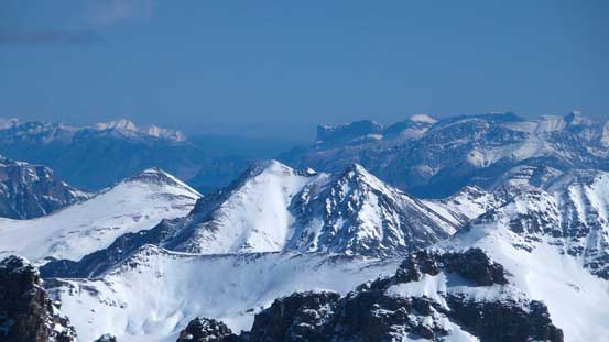
Time to get ready for the descent. Oldhorn Mountain behind
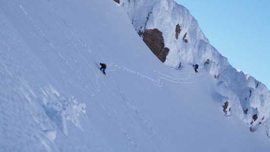
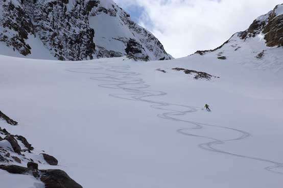
We traversed on the crest towards Oldhorn Mountain for a while before spotting a reasonable line dropping down. The initial 50 m or so was too steep and icy for my like so I boot-packed down while carrying skis. The rest of the skiing down towards treeline was fast and fun, but after that terrain started to get ugly with some increasingly tight bush. One word to describe: miserable, even for the experienced skiers… For me, it was nearly impossible and I ended up walking down with skis strapped in my pack (thankfully the snowpack was still supportive enough in this hot afternoon). After what seemed like eternity I finally rejoined Ben and Liam and at this point we were almost down to Astoria River.
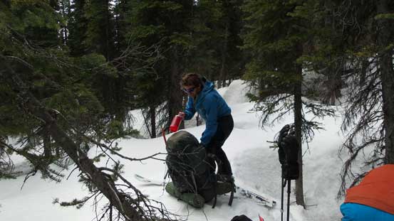
Taking a short break in the miserable bush…
The rest of the trek to Wates Gibson Hut was not as easy as one would think. There was still a fair amount of distance and uphill and for the most important, the hut location was in a weird place and difficult to find. Now after the trip I knew where to go next time (basically if you can get to Outpost Lake then you’re good), but on that day we were getting really confused following a solo skier’s tracks circumventing back and forth (too lazy to pull the GPS out). Eventually after a lot of frustration we made to the Hut. It was an exhausting day out (~11 hours) and by the time I finally could drop that heavy pack I was almost totally beat. The solo skier turned out to be Sean Strang, a guy I’ve talked with before via email and also a fan of my site (nice to hear our sites are helping more people out)! The night was peaceful and we set our alarms up at 4:30 am, hoping for the best for our summit day.

Me pointing at the high col we just descended from. Photo by Ben
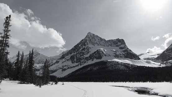
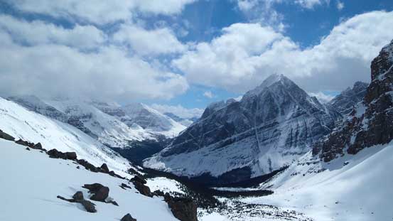
Down to Astoria River now, looking ahead towards Outpost Peak

Looking back towards Oldhorn Mountain and Thorne Mountain
Evening glow on Blackhorn and Thunderbolt
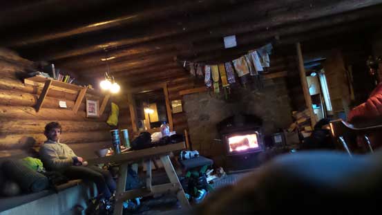
Liam enjoying the Hut.
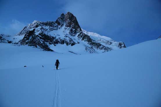
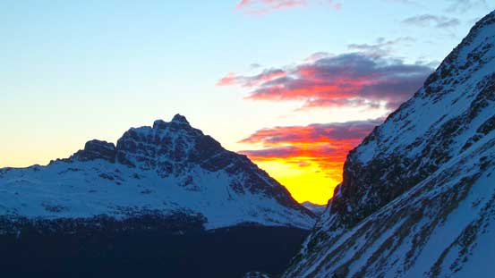
Our mood was high when seeing millions of stars above. After a confusing descent through some tight trees we soon started our foreshortened grind towards the toe of Fraser Glacier. This section was again, following exactly the footsteps of Ben and Liam’s Great Divide Traverse trip. There were a few steeper rolls to go up and over and in short time we were treated with some gorgeous alpenglow view on the Ramparts. The sky was not as perfectly clear as expected looking towards south but at least our objective was free of clouds.
Pre-dawn start. Photo by Ben
Sunrise time looking back
Alpenglow on the East side of Bennington Peak

Liam and Ben ascending one of the few rolls, with Memorial Peak in front
Alpenglow on Paragon Peak, one of the easier summits on the Ramparts

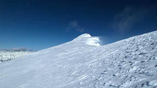
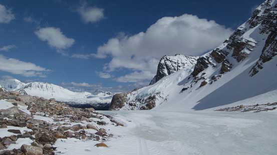
Almost at the high pass, also the toe of Fraser Glacier.
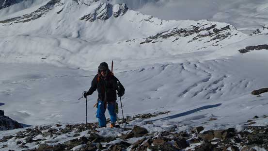
Due to the constant strong winds in this area the snow coverage on Fraser Glacier was a lot less than expected. There was bare glacial ice visible near the start and a lot of holes (some are really big) presenting. Liam led a nice line up climber’s right side first aiming towards the East Ridge of Bennington Peak before cutting sharply left and crossing a big hole on a snow bridge. From here on the route finding became simple as we simply put one foot in front of another, aiming at the high col by the S. Ridge of McDonell Peak. Liam was the machine on skis and broke trail almost entire way up this foreshortened glacier. By the time we crested the S. Ridge we were already higher than Outpost/Memorial Peaks looking back. The ridge was wind blown so we ditched skis shortly after.
Mt. Erebus is always the eye-catching giant
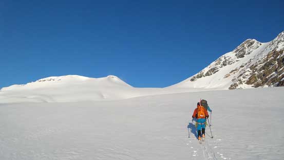
Liam and Ben ascending this foreshortened Fraser Glacier
There are crevasses around…
Liam looks small compared with Bennington Peak…
Ben following behind

We kept marching up.
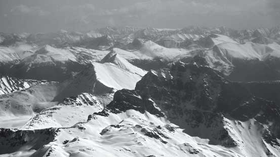
Panorama from the S. Ridge of McDonell Peak. Click to view large size.
On the S. Ridge now, we soon ditched skis.
I took over the lead once the bootpacking started. About another 100 m up the ridge it was time to don crampons as terrain started to get trickier. McDonell Peak was apparently not as simple as we thought as we slowly worked our way up the narrow ridge covered with rime. According to the ‘book of lies’ there were 2 options to get Simon Peak. One was going up and over McDonell and the other involved losing a lot of height to Simon Glacier before ascending some very steep snow back to Simon/McDonell col. Neither looked very feasible to us on this particular day due to the winter condition, but also thank to the snow we discovered a neat traversing line cutting right underneath the summit block of McDonell. I love snow climbs so went for it. The initial part involved negotiating some rime covered rock (aka. the “snow gargoyles”) before dropping onto some 50-degree ish sections. After that the slope angle decreased to averagely 45 degrees for the rest of this traverse, but oh man that was a long one. The view was very foreshortened (just like any other glaciated peak) and it took me quite a while to finish the traverse. For the most part I had to face inwards and kick step into the slope. Looking back I got some crazy pictures of Ben and Liam following.
Mastodon Mountain on the Continental Divide

Bootpacking up scree initially
Behind Needle Peak are peaks on Hooker Icefield – Scott, Evans. Behind them is Mt. Clemenceau
Ben ascending the S. Ridge of McDonell with the broken Simon Glacier behind

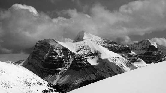
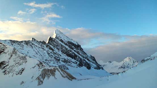
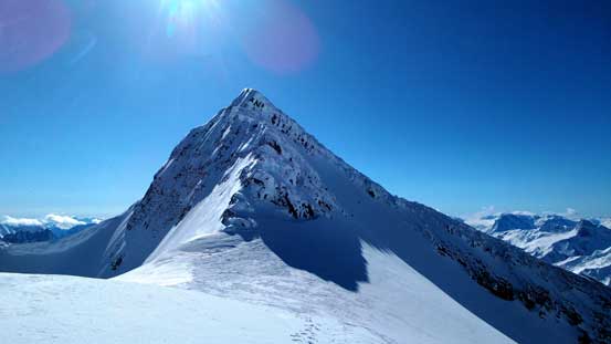
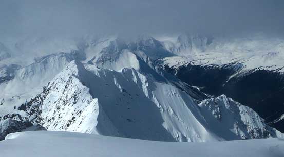
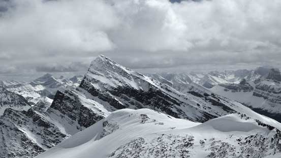
Simon Peak – our objective
McDonell Peak – our 2nd objective
Ben and Liam traversing some rime covered features

Here’s me leading the crux slope traverse. Photo by Ben
Looking back at Ben and Liam following
At Simon/McDonell col now, looking back towards McDonell
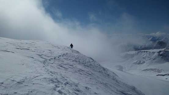
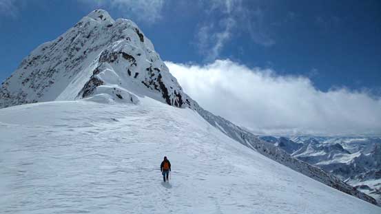
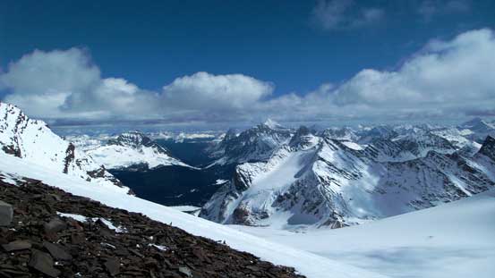
From the col it was a simple, but again, foreshortened hike to the summit of Simon Peak. There were enormous cornices to avoid but other than that there was no technical difficulty. The peak was very high and we pretty much had to work our way up getting higher than all the nearby summits. Too bad some clouds rolled in just before we made to the top, obscuring some of the views. But even that, we were all amazed by the vistas in this rarely visited area. It was very nice to see the backside of the Ramparts and being able to look down at all peaks on it.

Getting higher on Simon Peak now
Bennington and McDonell are getting smaller
The final push to the true summit
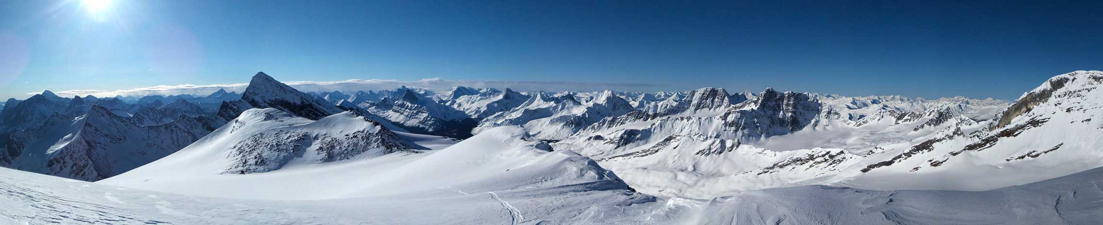
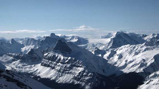
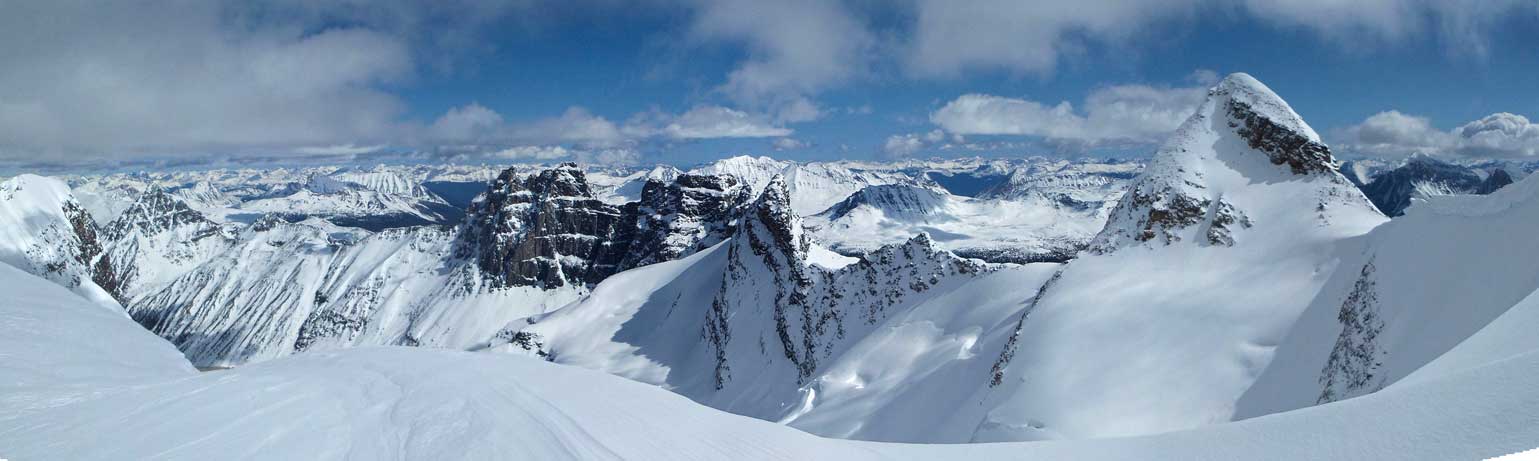
Summit Panorama from Simon Peak. Click to view large size.
These peaks are rarely seen on the backside of the Ramparts – Goodair, Gateway, Portcullis

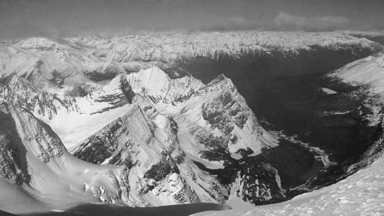
We could see the ascent side of the massive bulk of Mt. Geikie. It’s a beautiful view but also a bit of an emotional sight knowing what happened there in the August of 2012..
Turret Mountain is a sexy peak. Behind it is Mt. Fitzwilliam which looks tiny…
Pyramid Mountain and the Victoria Cross Range is visible
We weren’t expecting to see Bedson Ridge and Roche Miette way to the East
Oldhorn Mountain looks very small in the foreground
Majestic Mountain doesn’t look much higher…
Looking down at Scarp Mountain immediately south on the Divide
Ben arriving at the true summit
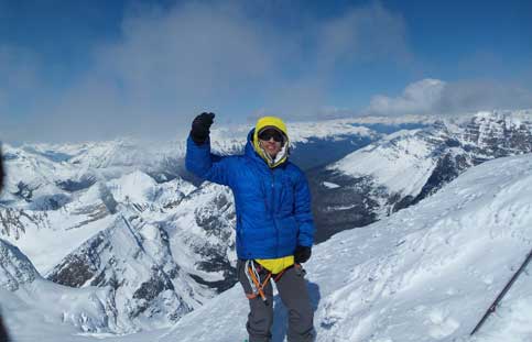
Me on the summit of Simon Peak, highest peak on the Ramparts
With the sun slowly heating up the hills we didn’t linger any longer than necessary before starting the descent. Due to the slight uphill direction the traverse felt a bit easier on the way back. Soon we made back to the S. Ridge of McDonell Peak. This peak didn’t look easy to any of us but since it was “right there” we decided to give it a try. The ascent of McDonell and back down its south ridge is written in a separate trip report. The rest of the descent down to where we ditched skis was uneventful. Everybody was excited about the long run down Fraser Glacier, and we were right. The first part was a bit crusty but for the most of it the skiing quality was very good.
Liam descending the ridge on Simon
Back to Simon/McDonell col now.
A panorama view of the backside of the Ramparts. Click to view large size.
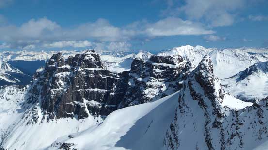
From L to R: Redoubt, Dungeon, Oubliette, Parapet
Bennington Peak doesn’t look hard from this side uhh.
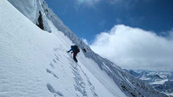
Liam and Ben carefully traversing back the crux slope
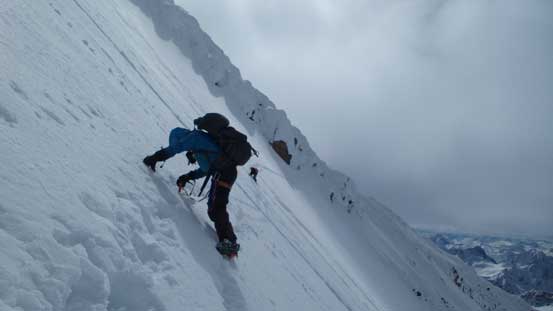
A zoomed-in view of Liam and Ben traversing
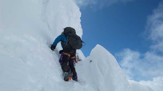
Liam mastering the “snow gargoyles” near the tailing end of this traverse
Liam finishing the traverse. Photo by Ben
Lots of vistas up there!
Mt. Erebus
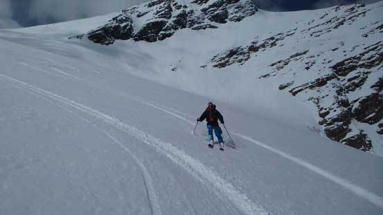
Ben skiing down Fraser Glacier
Me skiing the Fraser Glacier. Photo by Ben
This double-summit peak is Outpost/Memorial
The hanging glacier between Outpost and Memorial is beautiful
Down to the high pass now, note the bare glacial ice…
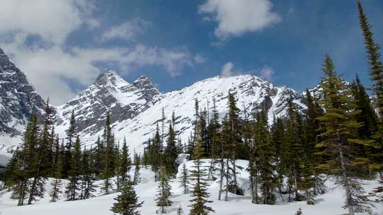
The rest of the skiing down to Wates Gibson Hut reminded me the “7 steps to paradise” on Youngs Peak – fast and fan as we worked our way down 1 roll after another. Near the end we took a different line than in the morning cutting over skier’s right. It avoided us elevation regain but the price we paid was a section of very steep forest. I ended up removing my skis and walking down again. It was only 3 pm when we made back so there’d be plenty of time to rest up. We had a couple options for the 3rd day – Thunderbolt, Surprise Point, Outpost or even a couple longer options. My feet were getting quite a few blisters at this point so by heart I did not want to try anything long, but we’d decide depends on weather. The decision was made to leisurely ascend Thunderbolt Peak. Apparently it was better than expected and the 3rd day is also written in a separate trip report.
Still lots of skiing from this high pass back to Wates Gibson
Me doing turns. Photo by Ben
Down to treeline now.
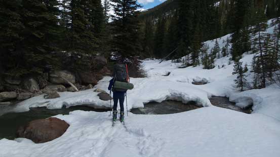
We got a newly updated weather forecast via Ben’s Delorme InReach saying the temperature would shoot up to 21 degrees on Tuesday… Oh well… Guess we’d make an early start and take the long way out then, looping to the backside of Mt. Clitheroe and then up and over Maccarib Pass. It’s about 30 km back to the parking lot and we set our alarms at 6 am. It was another gorgeous day in the mountains. After some unpleasant bush skiing we found the correct snowmobile trail leading uphill from Astoria River to Amethyst Lake. We removed skins and it was a fast ski across this long flat section, especially with the wind blowing from behind aiding our speed.

Me leaving Wates Gibson Hut. Photo by Ben
A morning view of Bennington Peak on the 4th day

Bush skiing wasn’t fun…

Thankfully we eventually found this snowmobile trail

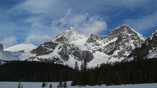
The Ramparts started to show up!!
The outflow of Amethyst Lake provide some extra colours

The Ramparts and Amethyst Lake
Ben carefully skiing across this skinny bridge

Looking back towards Thunderbolt Peak, or 3rd objective

Liam skiing across the flats

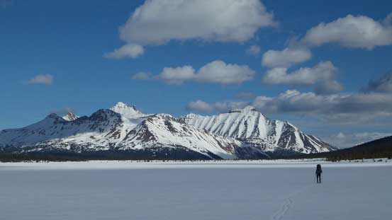
A panorama of the front side of the Ramparts. Click to view large size.
Throne Mountain and Blackhorn Mountain
Curia Mountain and Roche Noire
The rest of the way up to Maccarib Pass was not so fun though. We just kept going up and up and it seemed like the grind would never end. Liam and Ben did the right thing to not use skins (due to the sticky and wet snow the skins were apparently not needed on this gentle uphill). I had my skins on and it was considerably slower. The weather also started to get cloudier at this stage which didn’t help my mood neither, but with some patience I was slowly getting to the pass. Dropping down the other side the terrain was still, very gentle. But it’s overall downhill so we made pretty good in time. We also stayed a bit higher on the left (north) side before dropping down towards Portal Creek. With Liam the machine setting up the tracks the rest of the skiing down Portal Creek was fast and fun for Ben and I. We managed to stay in the creek or slightly on skier’s right in the bush almost all the way back, despite the snow bridge collapsing underneath us..

Liam and Ben ascending back up Maccarib Pass
A view from Maccarib Pass

Skiing down Portal Creek
More about the Portal Creek
Uhh… River crevasses I guess..
Liam trying to decide if this bridge is okay to cross of not..

More careful maneuvering along Portal Creek. Photo by Ben

Done.
Overall I felt a great sense of success to have the highest peak in the Ramparts bagged on my first try. Kudos to Ben suggesting this objective too as I wasn’t really thinking about skiing Mt. Fraser before. It’s definitely another highlight in my peak-bagging ‘career’ and probably my favourate trip in this year so far. Speaking this objective, it’s a big and serious mountain in winter conditions. I bet not many people would be interested in attempting it due to the very long approach and the seriousness of the terrain, but if you do end up making the summit in a clear day, then it’s a real prize. After trip we met Liam’s dad, David at LouLou’s in Jasper and shared some stories. Apparently he’s also going to do some obscured trips this summer so we might end up teaming up for a trip!

That’s a good mileage list for a 4 day trip! That traverse under McDonnell looks like it would have got the heart pounding in the heat on the way home, and the pictures look awesome as always.
Was great to meet you guys.
I feel a bit bad that you guys followed my wandering tracks, I know how frustrated I was at that point and I didn’t put in the mileage you guys did that day. ACC coords for the hut are 52°39′ 48″-118°15′ 24″ which puts it almost on the SE portion of an open area which I mistook for outpost lake. My GPS has the actual cabin 140m to the SE up a dense bush hill from the ACC coords. Actual coords I found are 52°39′ 45″ -118°15′ 19″.
Ice bridges and snowpack was pretty minimal on the Astoria way out too, made for some fun “willow skiing” and a bit of bootpacking. My bike ride out was fast and fun, but I’m definitely jealous of the turns you all got down from Fraser! Well earned turns by the look of it. Thanks for the awesome tr and beta again.