Spoon Needle
February 15, 2014
2165m
Kananaskis – Highway 40, AB
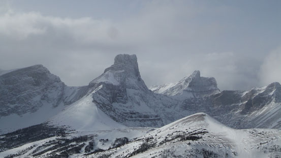
Spoon Needle is a nick name of a small, but impressive looking ridge at the center of Kananaskis Country. Its “needle” or “spire” shaped ridge attracts me every once I drive northwards on Highway 40. Judging by the entries in the register, this rarely visited summit in the past decade just started getting more popular in recent years. A couple trip reports showed up one after another. Apparently people have tried many routes on this small peak and the advantages and disadvantages of each are getting clearer. Due to the presence of raging Kananaskis River, one needs to either approach via Galatea Creek which is bushwhacking from hell, or slog a long way up Fortress ski hill road, bushwhack while losing some elevation to get to its base. For the ascent itself, the south ridge, though with considerable exposure, is much easier than the north ridge and is the only feasible route in winter.
Due to the touchy avalanche condition in this past weekend anything big couldn’t go, but Vern and I were still keen to get out. Spoon Needle seemed like a better idea. I had a panorama photo taken from summit of Opal Ridge showing the entire ascent route (via Fortress Road and south ridge) being pretty much free of avalanche hazard. (There’s still a avalanche gully to cross on the road though). Given the High avi hazard this was pretty much the ‘sexiest’ peak we could do. Not to our surprise nobody else showed interest in ‘bush skiing’ so it would be just two of us, and we met at the parking lot at 8:30 in the morning.
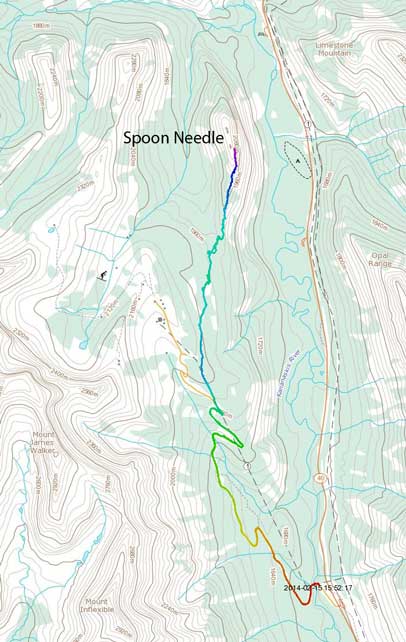
Spoon Needle from Fortress ski area. GPX DL
Apparently there was a movie thing going on in this area. Stuffs told us the only avalanche slope had been bombed so there would be no avalanche hazard at all on this approach road. The road was boring and tedious but fast going. It was kinda confusing where to eventually leave the road and start bushwhacking, but since Vern had armed with Marko’s GPS track, it was pretty clear. At one point the road swung rightwards, made a big switchback and crossed a power line twice. We kept following the road upwards until the next crossing and then we left the road and start skinning up this power line for a while before eventually bailing the ‘man-made’ terrain.

The parking lot was already busy in the morning.
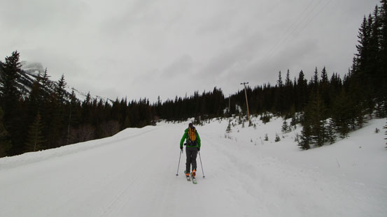
Skinning up the road

Skinning up the power line
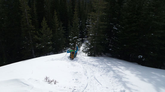
From here on the next 3-4 km was bushwhacking on flat or downhill terrain. Except for the last part, the bush was much better than expected and we were glad to pick skis for this trip instead of snowshoes. It was more like skiing through an open forest. The elevation loss was frustrating though. Everytime we thought we’d lost enough elevation, there’s always another roll showing up and we had to lose more. We certainly felt we’d lost more than 100 m elevation, oh well… Towards the last dip, bush started to get thick and skiing became pretty miserable. Thankfully this section wasn’t too long, and once we finally started going up again the bush also got better. There was more elevation regain before treeline than expected and at one point we made a mistake of ditching skis. It appeared we were pretty close to the scrambling part but actually not. We had to come back to get them due to waist deep post-holing higher up. After this bit of ‘detour’ we managed to skin to the farthest we could before eventually switching to bootpacking.
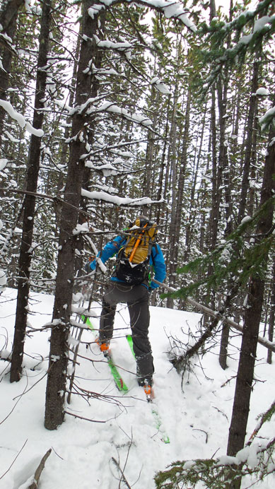
Bush got thick at places
Already great view of The Fortress
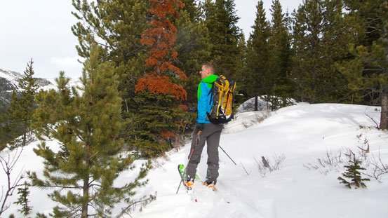
Vern enjoying the views along the lower ridge
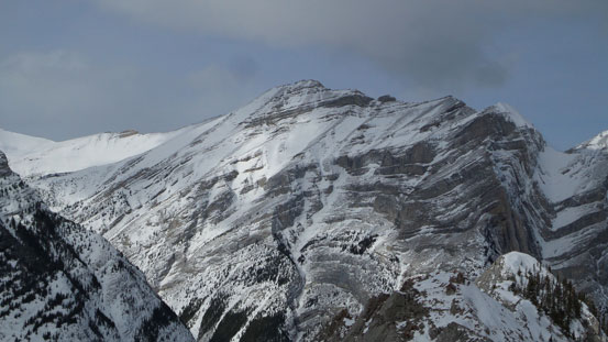
Opal Ridge
Looking south down Kananaskis Highway
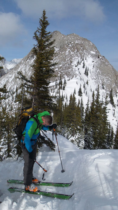
Finally the upper ridge came into view. We ditched skis here
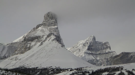
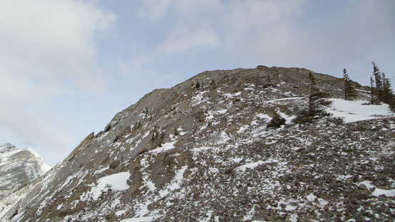
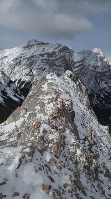
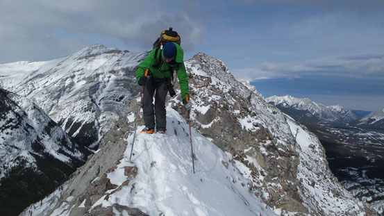
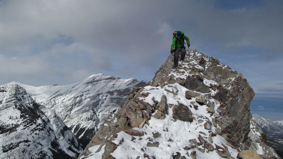
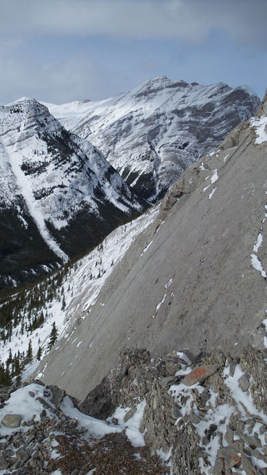
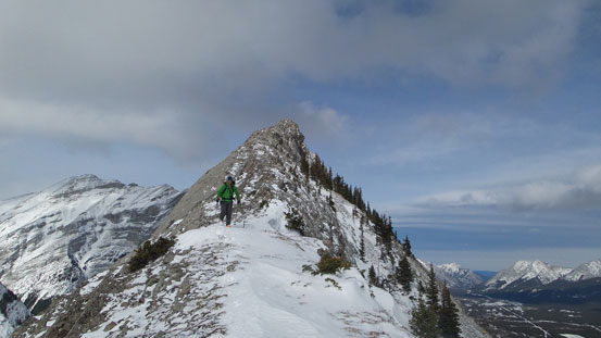
The start of this ridge was scree bashing but it soon got better. It also narrowed down higher up and the steep slabs on each side started to remind me Opoca Peak which we attempted a couple weekends ago. Unlike Opoca which has a big vertical rock face blocking our access to the summit, this one never gets too technical. There were two short sections narrowing down to within 1 feet, with the second one being quite tricky. The climber’s right side was steep thin snow covered slabs and offered no grip on the ski boots, and we had to rely on a couple loose holds on the left side while dealing with significant exposure. I didn’t remember people talking about difficult scrambling on this ridge but I guess it all depends on how much snow on the ridge. The summit arrived shortly after this bit of excitement.
It’s not as steep as looks once getting closer

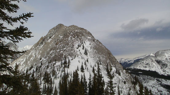
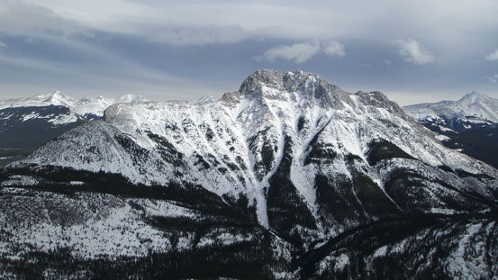
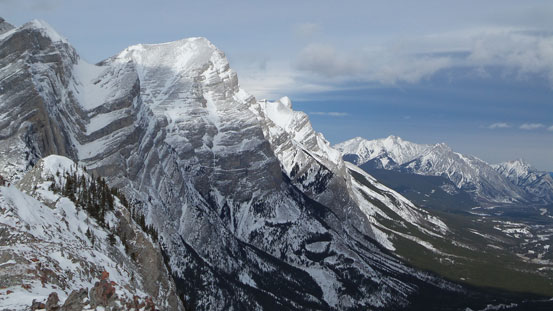
Impressive The Fortress. You can also see the ski hills
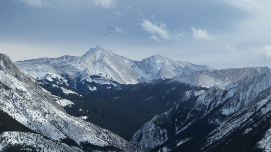
Inflexible and James Walker. I haven’t done either of those

Vern slogging up the initial scree part
Higher up it became more fun
The south ridge

Up a short step
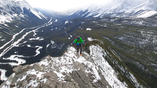
Narrow indeed.

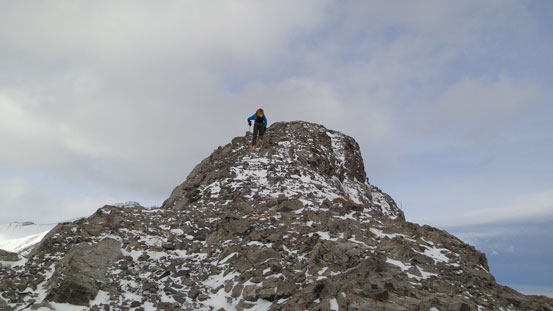
Vern just finishing the crux section
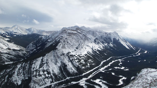
Opal Ridge from the summit
The Wedge from the summit

A closer look at The Wedge

Skogan, Lorette, Mary Barclay’s, Wasootch

Fisher Peak, a climber’s scramble

Kidd South
Mt. Kidd
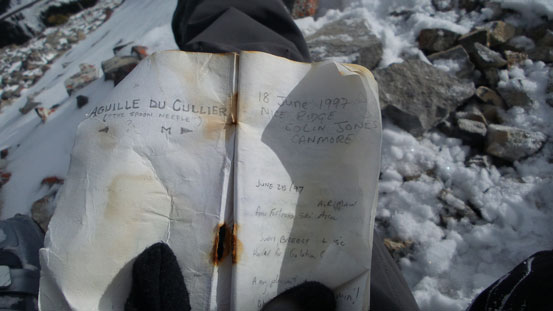
The summit register
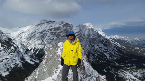
Me on the summit of Spoon Needle
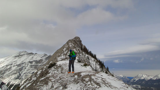
The north summit is only slightly lower, but not a straightforward traverse

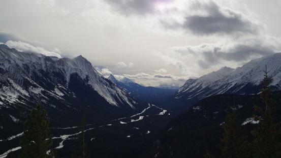
Panorama of Kananaskis Valley. Click to view large size.
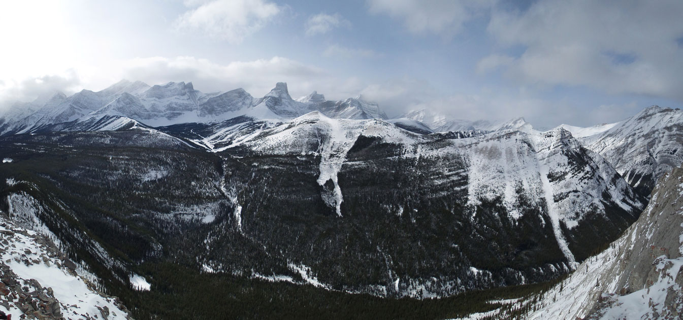
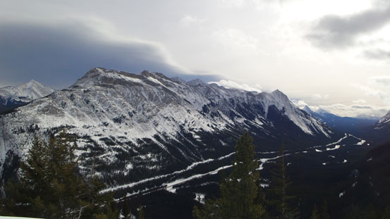
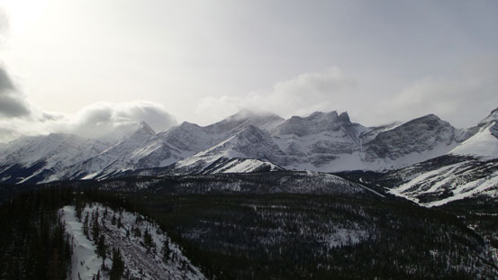
Panorama of Kananaskis Range. Click to view large size.
It took us longer than expected to get here so we didn’t stay long but immediately started the descent. It was a hot day that snow started to ball under the skis but not too bad. Thankfully the sun was out for most of the day or it could be worse. The elevation regain was tedious and frustrating to say the least. There were 3 or 4 hills to go up and over and eventually we cleared them all. Time to take the skins off and enjoy the fast return. Skiing down the cutline was fast and fun. The road wasn’t as fast but still pretty good. Wish I had more cross country experience to deal with a couple flat sections though.

Vern carefully negotiating the crux section
Same as above
No slip on the narrow upper ridge
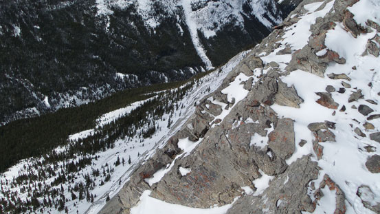
Impressive drop-off…
Steep slabs.
Lower down
Time to put skis on
Not too much of skiing down the ridge
Looking back towards our objective
Overall I can’t say I’d recommend this peak if you simply look for “fun skiing”, but if you do wish to summit this peak, then this is a good winter objective with minimal avalanche hazard. Our round trip time was 7 hours on a steady pace.
