Mount Murchison
August 1, 2015
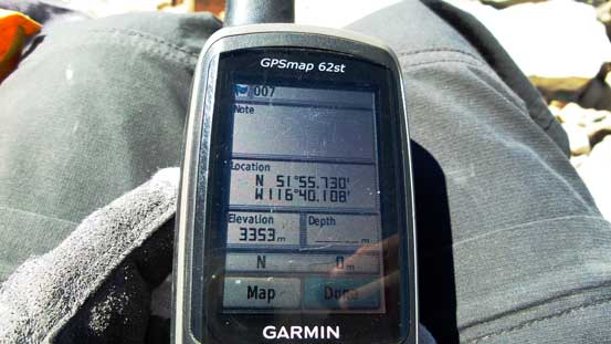
3353m
Icefield Parkway (South), AB
The original plan for this August long weekend was Vern and Ben going for Brazeau/Warren while Eric and I driving far down south to Glacier National Park, MT, for some peak-bagging in a new region, but it didn’t turn out as planned as the title of this trip report suggests. While Ben and Vern left for Brazeau Icefield one day earlier, Eric bailed the trip on the last day (family issue) leaving me figuring something else to do at the last minute, solo. Given the incredible weather forecast I would at least go for something “interesting” – not necessarily an (official) 11,000er but a “climber’s scramble” like Mt. Murchison seemed like just the right idea.
Mt. Murchison is a massive bulk of loose Rockies’ choss guarding Saskatchewan River Crossing on the south side, and just like the nearby Mt. Wilson (which guards the Crossing on its north), this mountain covers a huge amount of ground with two main summits (NW and SE with the SE summit being the true one) as well as about half a dozen “Murchison Towers”. Another interesting fact about Mt. Murchison is its height. The official elevation (3333 m) is likely referring to the lower NW Peak while the true summit, the SE Peak is very likely to be a new 11,000er candidate as confirmed by the GPS readings (3352+ meters) from the previous, and the only 7 or 8 ascent parties including mine based on the summit register. But despite these fascinating facts the lower number of ascents suggest this summit is not easy to reach, and my inspiration (and confidence) mostly came from Vern’s excellent trip report.
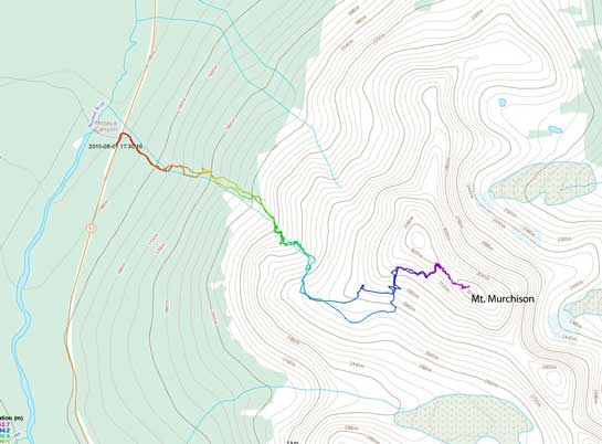
Mt. Murchison scramble route. GPX DL
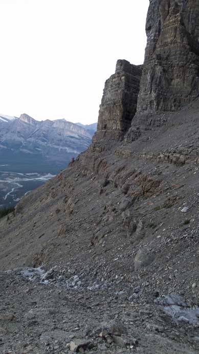
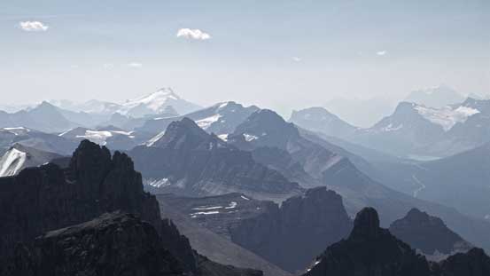
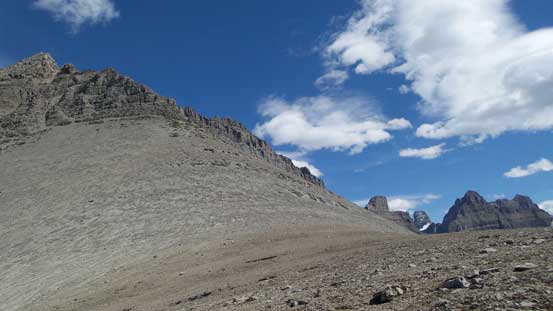
With Vern’s route description I was fairly confident that a (long) day would be more than enough especially for a solo ascent (so faster travel through the loose gullies due to the lack of rockfall concern). I still gave it a full respect though so started at 5 am from Mistaya Canyon parking lot by headlamp. I quickly located the supposed ascending drainage, ascended a fairly long ways up the dry creek bed before bailing into the forest on climber’s left due to a narrow canyon section. The forest had some bushwhacking but nothing terribly ugly and I made progress quickly up the slope. In just over 1 hour I made to treeline and then did a diagonal traverse towards climber’s right on some loose scree covered hard dirt into the “amphitheatre”. Looking back I got treated by some gorgeous alpenglow views.
Traversing into the amphitheatre after the bushwhacking

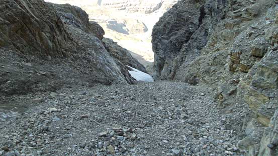
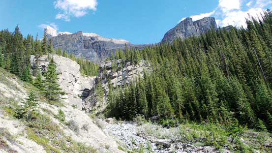
Here’s the start of this amphitheatre -very typical terrain
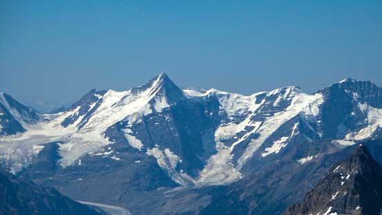
Alpenglow on Division Mountain and Lyell Icefield
Alpenglow on the nearby Mt. Wilson
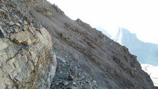
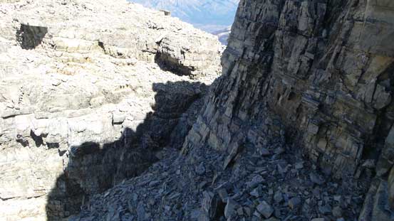
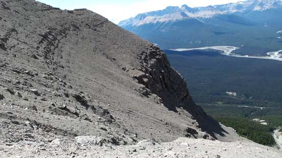
The amphitheatre was just as expected, involving a series of short rock bands that often required moderate/difficult scrambling on loose terrain with route-finding. By wondering back and forth and across the creek bed a few times I generally managed to find easy breaks through each band, and given the experience I had on this type of terrain I didn’t find it to be terribly hard. There’s one place where the route took a hard climber’s left following the drainage through another cliff band and after this bit I was directly underneath the steep rock faces of the NW Peak. Here I worked my way upwards and diagonally back towards climber’s right through a series of “staircases” into the upper draw, and at the last rockband (hardest one in the amphitheatre) I did a few 5th class moves on surprisingly solid rock following a few cairns. I could see an easier line further to the left but that’d involve more side-hill traversing on loose ground (also with cairns). Another short section of scree bash I was on the broad shoulder, also the supposed bivy site. It took me exactly 3 hours to get here and apparently I was doing good on time.
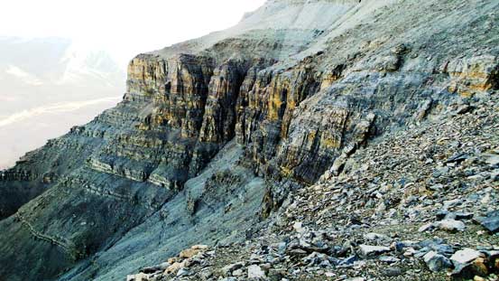
Finishing the amphitheatre now

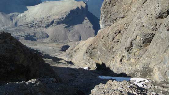
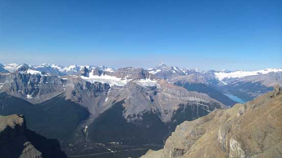
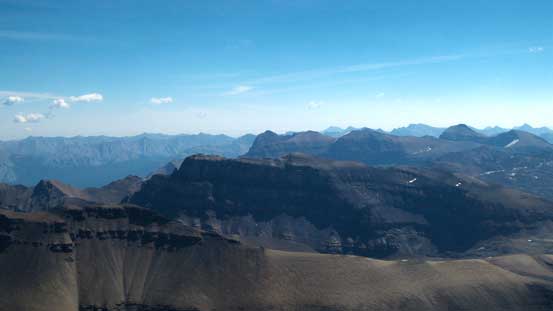
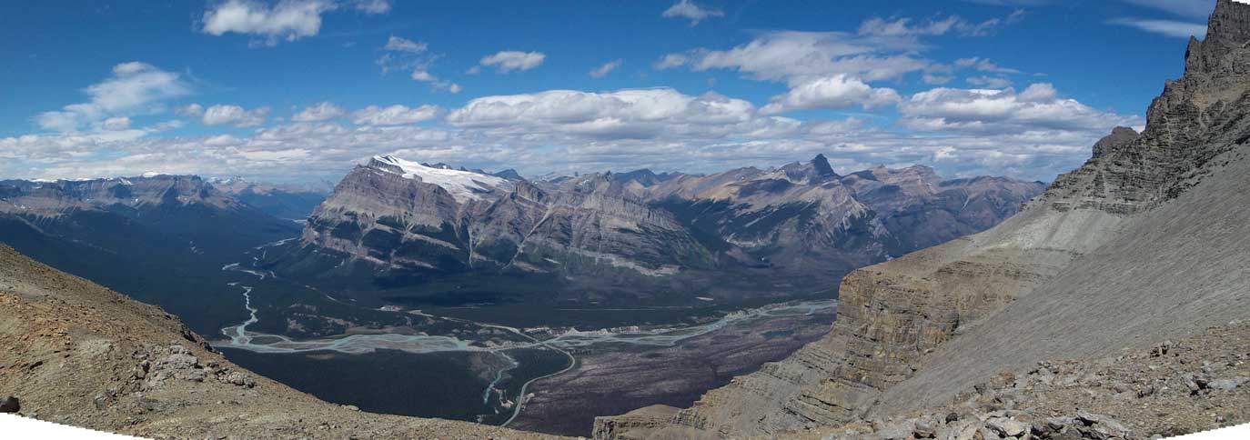
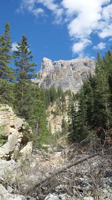
Great panorama of N. Saskatchewan River Valley
Looking ahead to the next stage

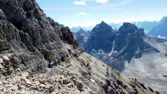
The Murchison Towers from the ‘bivy site’ (that I didn’t use to bivy)

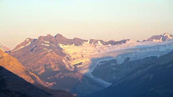
The Lyell Icefield and Glacier Lake
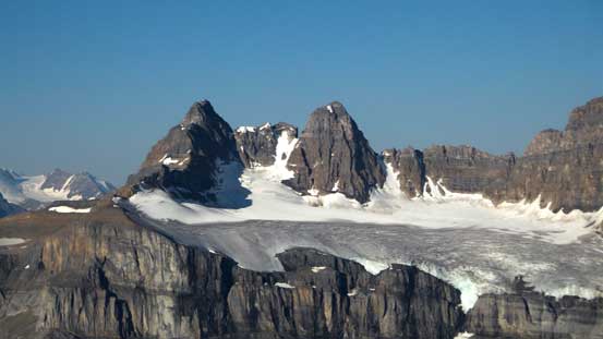
The twin summits of Kaufmann Peaks

Mt. Sarbach is one of my favourite Kane’s scrambles
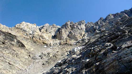
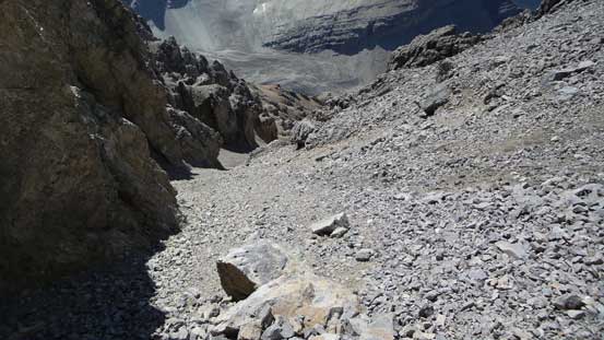
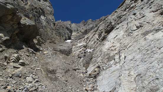
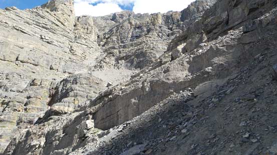
I took a short energy break (~10 minutes) before the chilly wind forced me to get back in the game. Vern’s description for the next section was vague and a bit confusing at places. But that could due to the fact I did not have Rick Collier’s nor Andrew Nugara’s trip reports – the former because I was not a paid bivouac.com member and the latter due to the collapse of Andrew’s website, which was quite a loss to the scrambling/mountaineering community. Here’s I was supposed to traverse/ascend diagonally up the scree ahead to find a “main gully” leading towards the NW peak, but I can tell you right now there’re 2 or 3 gullies that looked like the “main one”… One thing Vern did make clear was the existence of snow and ice in the gully so after gaining a fair bit of height in the wrong one without seeing snow/ice I started to question my route choice. I made the call to retreat and look around and did find the correct one at at least 100 meters to the right (south-east). I ascended this gully on very loose rock all the way to an upper bench that looked like the place where I should start cutting over. The snow/ice was all easily bypassed so no crampon needed.
Finally traversed over to the correct main gully

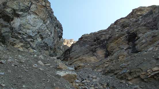
Ahead is a narrow section
Looking down in the first gully
Higher up in the first gully, looking down. It’s a hack of a grind
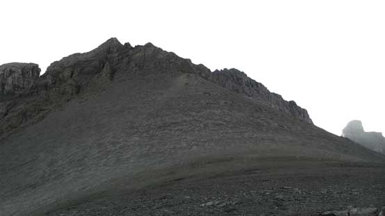
Here’s where I exited the gully and started the traverse. Ahead would be the false (NW) summit
The traverse between the first (main) gully to the second (upper) gully leading to NW/SE col had probably many ways to accomplish. The first thing I wondered about was where exactly to exit the first gully – it looked like I could exit at pretty much anywhere on this “upper bench”. The second question was whether to gain height during the traverse or not. It’s physically harder to traverse this type of terrain (downsloping terrain covered by loose pebbles and with ledges/steps throwing in) without gaining height. I opted to ascend diagonally up and intersect the second gully way up high (within 50 vertical meters from the high col) while Vern and Raf traversed more horizontally without gaining elevation. Both routes worked so any route “in between” would probably also work. So the conclusion is, just work your way over while following your basic route-finding sense.
The traverse from first to second gully
Typical terrain on the ledges
But, awesome views though…

Up and around another rib this’s what I saw into the second gully
Almost in the second gully now, not far from the col
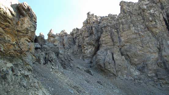
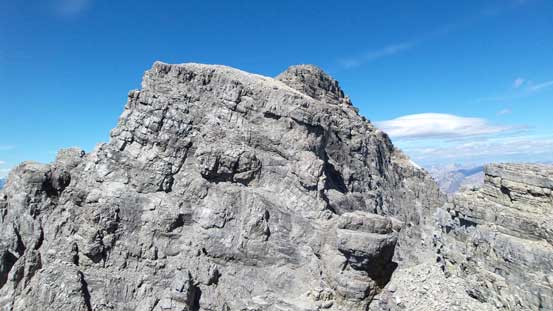
After another loose, albeit shorter slog in the upper gully I was soon near the NW/SE col. I got confused again as whether I should make all the way to the col or not as the terrain immediately after the col did not look scrambler friendly at the first glance from below. The conclusion is both would work as I ascended one option and descended the other. From the col to the true summit the route was not obvious, but by breaking the challenges into smaller steps they’re all fairly easily overcome. The general rule is trying to attack head-on and if the terrain looked more than 4th class then look for ledges on climber’s right side to bypass. There were always easier gullies to ascend back onto the ridge proper from climber’s right side. By sticking with this rule I only had to backtrack a few times (very minor detours) and it didn’t take me long to arrive at the supposed crux – the final rock band.

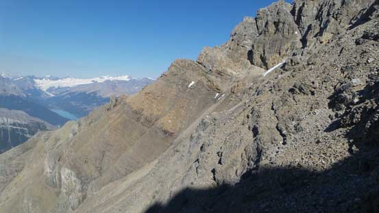
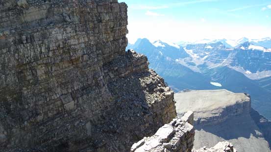
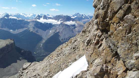
A view along the summit ridge
Some exposed ledges like this are the key to bypass 5th class terrain
Looking back towards the NW Peak

On a flatter bench, looking ahead

An intimidating tower that I bypassed easily on climber’s right
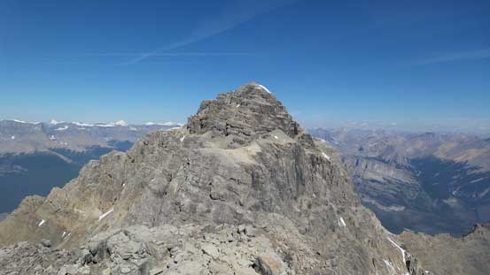
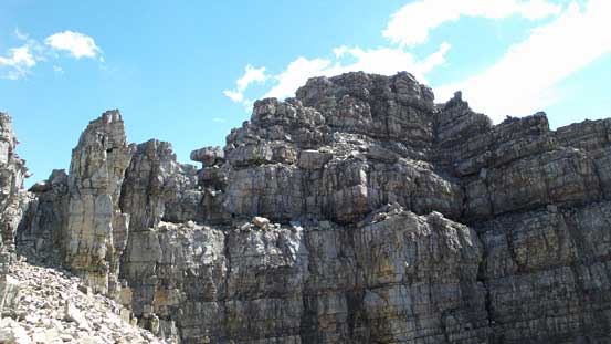
The final summit tower. Another 4th class band leading to the final rock wall – the crux.
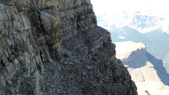
With Vern’s trip report in mind I didn’t even bother to search around. Upon arriving at the crux gully (about 20 m to the climber’s right of the nose) I immediately started the climb. The gully was a bit wet adding to the “fun” but generally I found it pretty straightforward. There were still a few stiff 4th class or low 5th class moves to exit the hard step but due to the gully feature they didn’t feel exposed. It’s also interesting that I didn’t see any sign that Raf and Vern rappelled from here so there’s still the chance that I found an “easier” route up the crux, but the chance is fairly low. After this bit of excitement I soon arrived on the summit, with incredible views towards all directions.
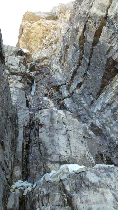
This is the crux gully/chimney
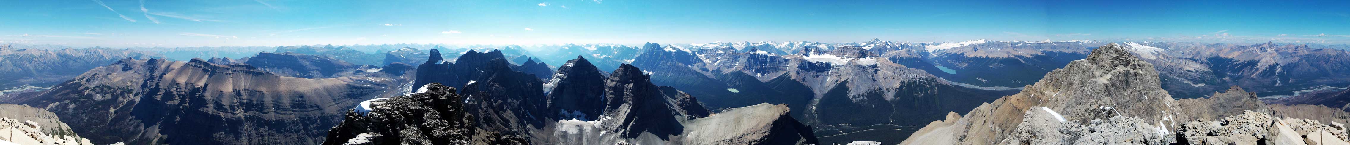
Summit Panorama. Click to view large size.
Smoky view towards Mt. Hector and Bow Pass
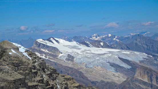
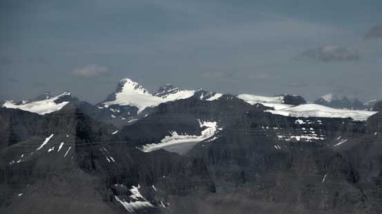
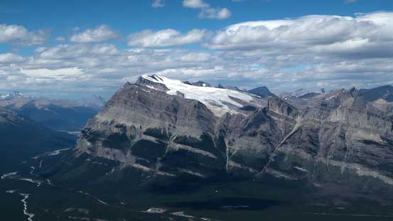
The massive icefield on Mt. Wilson – climbed 2 years ago on snowshoes
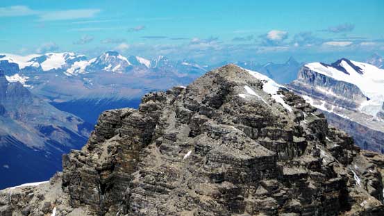
The NW Peak is clearly lower than the SE one
Mt. Cline, Lion Peak and Lioness Peak. Bagged them all 2 years ago
Corona Ridge at center. It looks fairly uninteresting from this vantage point

Behind the impressive Hall Tower is the unofficially named Marmota Peak
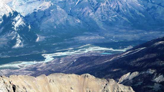
The N. Saskatchewan River
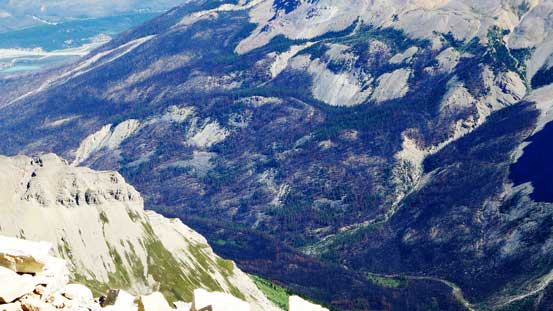
You can see the fire damage to Spreading Creek from last year

The “mighty C” – Mt. Columbia. Ascended in April this year
Mt. Bryce – another one we bagged this year, mid-May
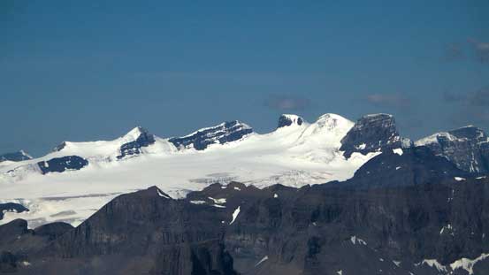
The Lyells that we climbed in late June this year

Kemmel and Lens Mountains rise behind the South-east Lyell Glacier
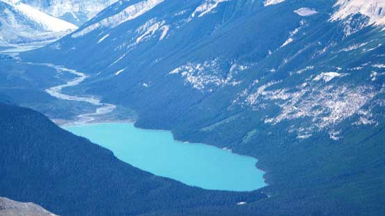
Glacier Lake is where you access Mt. Forbes
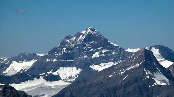
The mighty Mt. Forbes appears huge from everywhere. Bagged it in early June
Another picture of Kaufmann Peaks
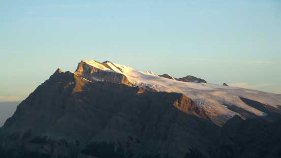
Mt. Freshfield the queen on Freshfield Icefield

The glaciated peak behind is Nanga Parbat Mountain

Mt. Mummery is a giant on the edge of Freshfield Icefield
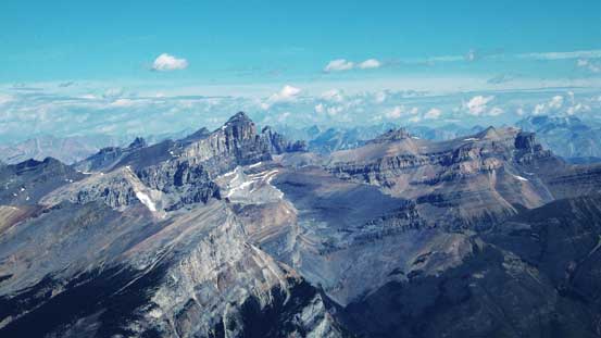
Howse Peak, Mt. Chephren, White Pyramid – bagged them all.
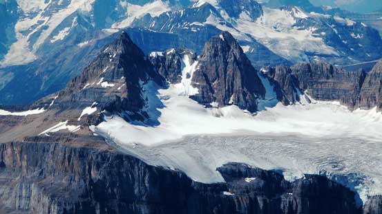
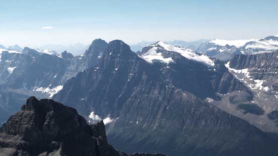
The Murchison Towers
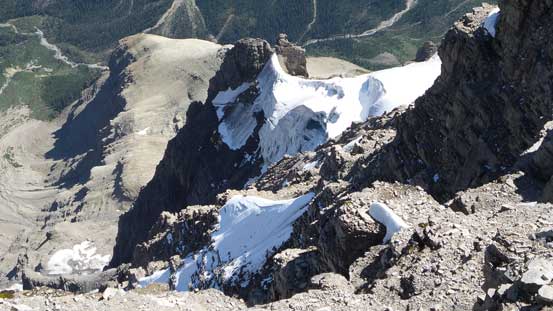
Some small patches of glacier on the steep NE Face
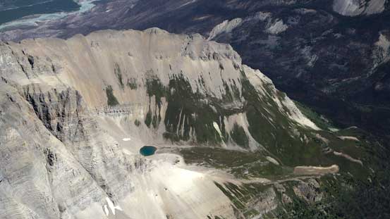
I bet this tarn rarely sees visitors…

Only 1 entry between Vern and Raf’s ascent and mine
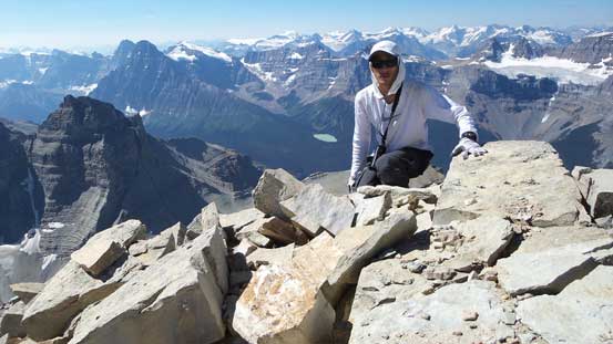
Me on the summit of Mt. Murchison
Mmmm.. Is this a new 11,000er??

Another panorama from the summit. Click to view large size.
Since I did good on time (6.5 hours car to summit) I did a long stay on top, and roughly 50 minutes later I eventually figured it’s the time to get moving again. I did bring a rope and a few pieces of gears but didn’t bother to use. Getting into the down-climb was awkward but once committing to the first 2 moves the rest was fairly straightforward, and with my fresh memories (plus a few cairns) I didn’t encounter too much of a problem route-finding back to the NW/SE col neither. I did have to backtrack 3 or 4 times but those were all short detours. Once back to near the col I picked up my ice tool and crampons (other pieces of gears that I hauled up but didn’t use) and resumed the descent into the upper gully. Scree-skiing was fast and fun but in short time I had to exit the gully following my own route down the traversing bench towards the main one. The terrain here was a bit ugly to descend (slabby and covered by pebbles) but with caution I managed to get through without even one slip.

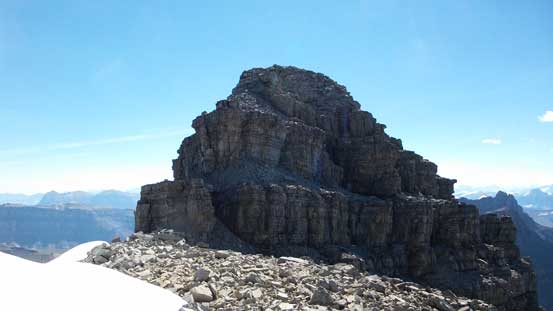
Here’s a review of the summit tower. The lower band I attacked head-on was 4th class. The upper band that I ascended through a chimney on climber’s right is the crux (4th with a few low 5th class moves).
Typical terrain on the SE Peak
A key ledge traverse
If you accidently went up the NW Peak, then you have to either down-climb or rappel this stuffs
This is another key traverse. Would be a better picture with a climber on it…
Descending the loose upper gully
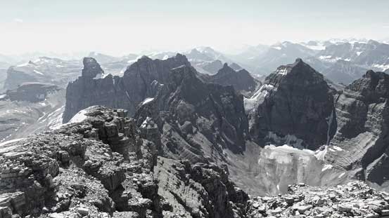
Looking across the typical terrain towards some of the Murchison Towers
Traversing around another corner

And then, descend/traverse this down-sloping terrain.
Descending the lower gully was fast and fun again thank to the loose ground (and also thank to the fact I was soloing). I must have knocked down a ton of rocks including some microwaves and this part would surely be slow and tedious if travelling in a larger group. Near the end I opted not to take the ugly side-hilling traverse back towards the “wrong gully”, but rather taking the main gully further down the slope. This was sort of a good or a bad call. Good because it’s the least technical option but bad because then I had to regain some height. Before I realized I was already too far down the main gully and checking my GPS I had to make a hard turn skier’s right to get back on track. It’s a bit tedious slogging back (up) to the bivy shoulder where I took another long break.
The lower (main) gully
Great view of Mt. Wilson. Click to view large size.
At the bivy shoulder now, time for another break
Another shot of Mt. Wilson
About half an hour later I resumed the descent, and the next section would be that amphitheatre thing. Down-climbing the initial 5th class rock step was interesting and difficult but manageable. I also had the option to descend the easier ground further skier’s right but wanted to try the solid rock first (and did find it being enjoyable). Then it’s the time to wonder back-and-forth down the series of short rock bands through the “staircases” at the base of NW peak’s steep cliffs. Here I couldn’t tell exactly where I went up in the morning but all paths would work eventually. Back into the drainage I managed to pick up cairns (and my fading memories) here and there and managed to stay on track most of the way down. I did make one mistake near the bottom of this amphitheatre and had to backtrack a bit, but by that time I was already very (mentally) tired. Thankfully I found the correct line far to the skier’s right through the last cliff band, and then I retraced my route descending skier’s right into the forest.

Now, time to focus on the amphitheatre
More about this amphitheatre
Typical, typical…

Almost done !!
The forest was much longer than what I remembered in the morning and seemed to drag on forever. Just when I thought it’s time to get back into the drainage there’d be another steep canyon section showing up, and there were at least 2 or 3 or those canyons. I generally managed to stay on the skier’s left edge of the forest so always had my eyes on the drainage immediately to the left. Eventually I did get down the forest, get back into the drainage and leisurely walked the rest back to the highway. My round trip time was 12.5 hours.
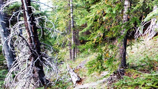
Bushwhacking in the upper forest
Back to the creek, looking back at one of the canyon sections

The creek bed walk
Almost back to the parking lot, looking back…
Overall I actually found Mt. Murchison not terribly bad. In summery I should say it’s the type of peak suitable for the top-end scramblers but not for the rock climbers looking for classic mountaineering. The terrain is loose on every scrambling bit but relatively solid on the 4th/low 5th class sections. There’s sustained and lots of route-finding involved in the micro-terrain but speaking the general (macro) direction the route is fairly obvious. Another interesting thing was my GPS reading from the summit was 3353 m which puts it right on the edge of being an 11,000er… Well, after successfully bagging my 399th summit I was already starting to look forward to the next one!
