Gregory Peak/Big Miracle Mountain
March 5, 2022
1359m
Mission, BC
The unofficial names near Mission seem to be more confusing than anywhere else since almost every single forested bump had been named two times separately, by Robin Tivy on bivouac.com as well as Grant Myers on peakbagger.com. I have no idea who stepped in first but whomever came later decided to name the same mountain differently making additional confusion in the community. I assume these two prolific peakbaggers/explorers do not like each other as I could not come up with another reason why someone would simply ignore an existing name even though it’s unofficial. In any case both “Gregory Peak” and “Big Miracle Mountain” refer to the same mountain not far from Mission. This peak has close proximity to civilization, is fairly visible and boasts over 300 m prominence but is very obscured. Only the die-hard peak-baggers know the existence of such a peak.
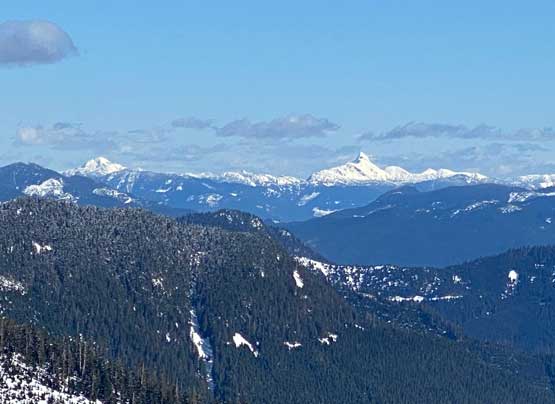
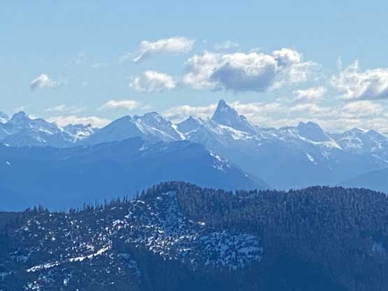
The first time it caught my attention was from Mt. Fletcher a few years ago. I used the Peakfinder app at home to figure out the name “Gregory Peak” (as per bivouac.com). I could not find much information at the time so I was quite keen on this exploratory mission. The only logical access is from Norrish Creek valley. There are logging roads criss-crossing the south and east slopes to within 300 vertical meters from the summit but most, if not all of these “roads” had been re-sloped according to the satellite images. Traversing the messed-up re-sloped roads requires a thick snowpack to cover the dead-falls and the underbrush so “early spring” is the best time. Over the past few years I had already heard two ascents of this peak. Ben Shewan from Mission had made an Instagram post in 2020 and a year later, Simon Chesterton published a GPX track on peakbagger.com. I had no idea how Ben did this peak. Simon’s indirect route only made sense in late-spring when one can drive higher on the spur roads heading up towards “Pattison Peak”. I went back to the maps and proposed an exploratory route starting from Norrish FSR’s gate. The first weekend of this March offered a nice window but finding partner(s) turned out to be extremely frustrating. Thankfully towards the last minute I managed to convince Alex to join and Alex would bring Dane and Marius into the team.
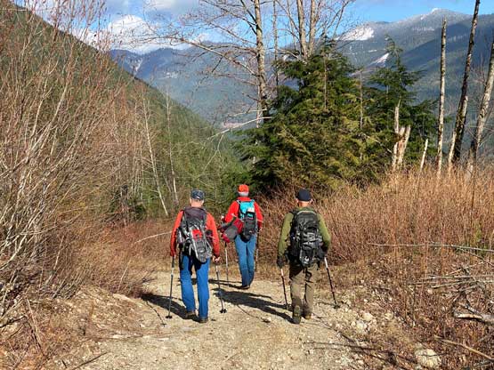
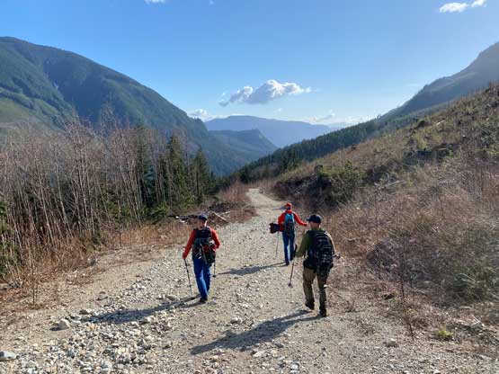
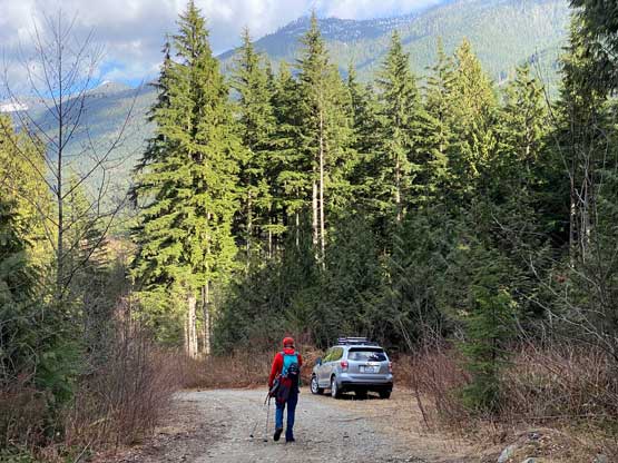
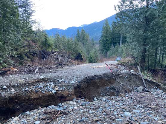
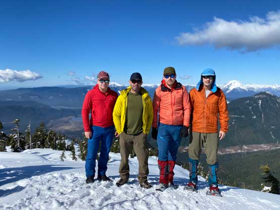
The four of us grouped in Burnaby at 6:15 am and made to Mission an hour later. The drive to km-8 on Norrish Creek FSR was easy. We came here expecting to walk from the start of the spur roads but I secretly hoped that we could drive a few kilometers up. The start of the spur roads looked great so the stoke level was high, but in less than 1 km we came to a wash-out that would stop all forms of motorized access. Alex reluctantly turned around and parked.

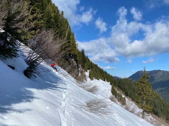
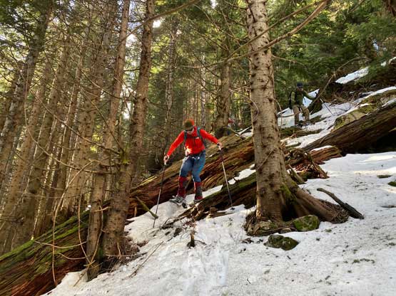
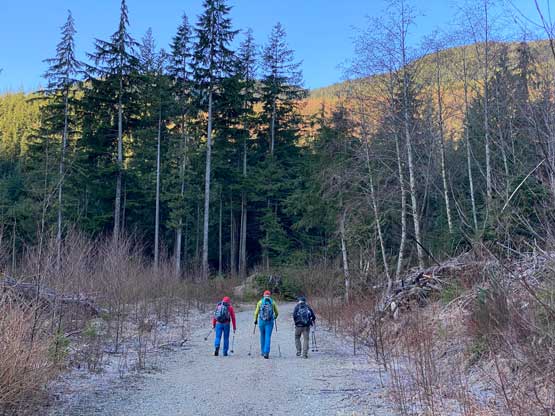
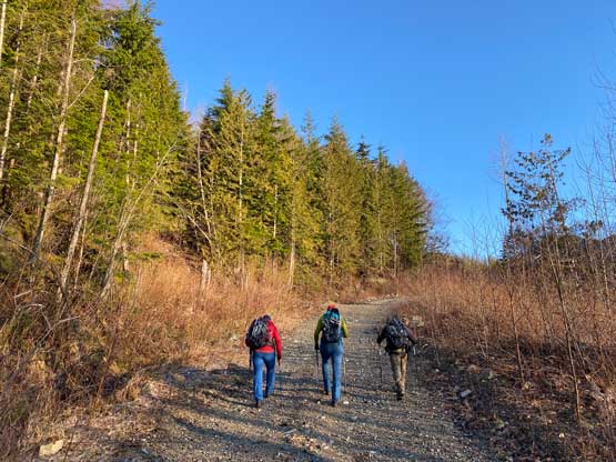
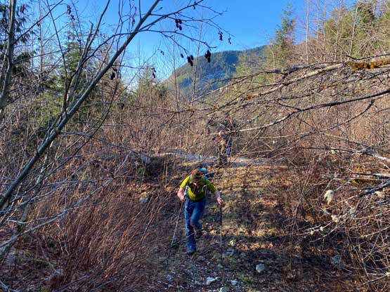
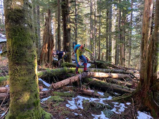
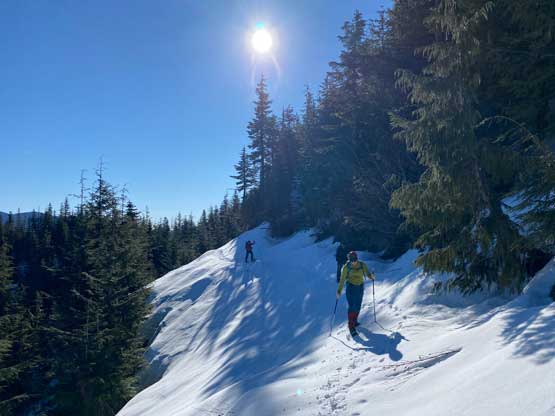
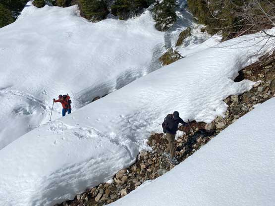
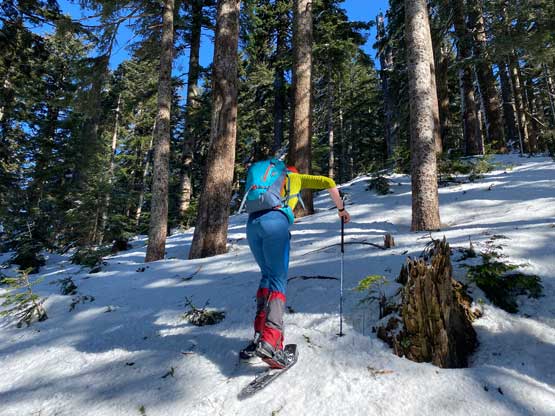
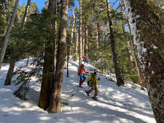
We parked at elevation of 300 m and the end of the good roads was at almost 700 m. The plodding was quite simple and we gained elevation quickly. The roads had progressively become worse and worse after each switchback but the conditions were overall better than expected. There was no notable overgrown portion in these lower switchbacks. At just under 750 m we encountered the first re-sloped stretch but it was also here that we encountered snow. The snow was softer than expected but was supportive enough that the snowshoes stayed strapped to the packs. The re-sloped mess soon gave way to another long stretch of good roads with continuous snow coverage but the goods ended at 850 m elevation. The road ahead became a total mess of re-sloped shits with minimal snow to cover the underbrush. After some discussion we decided to bail into the forest. The bushwhacking in the forest was not the easiest but within the tolerable range. There were some dead-falls to hop across and the patchy snow was never supportive such that we constantly discovered knee+ deep holes. Thankfully the unpleasant terrain did not last long as the snow soon became continuous again. However, minutes after putting the snowshoes on the continuous snowpack gave way to a steeper hill of dirt/roots without much snow, but we stubbornly ascended this roll without taking the ‘shoes off. Eventually this forested section brought us to the upper re-sloped FSR system with (finally) some abundant snow coverage.

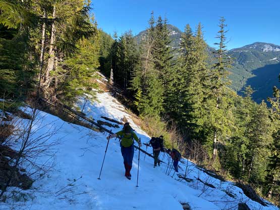

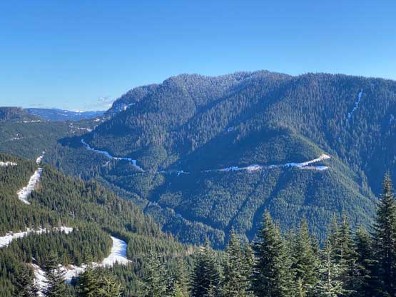
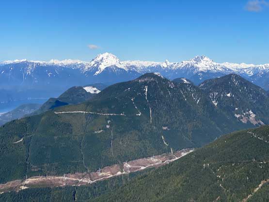
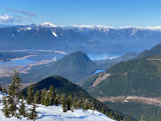
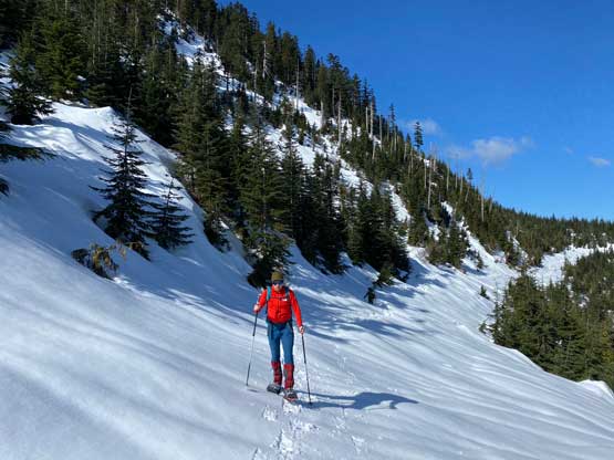
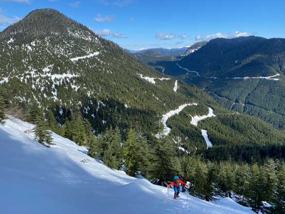
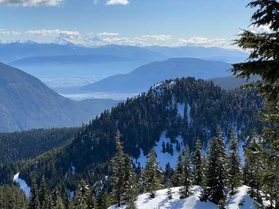
The spot marked the start of a 3-km ish traverse across non-stopping re-sloped FSR to Gregory/MacNab col. The net elevation gain of this stretch was rather minimal but the cumulative gain was not negligible. The slope angle was averaged 25-35 degrees and the snow condition was rather icy. Thankfully it wasn’t too icy, such that with some proper techniques I was able to cut the downhill side snowshoe a little bit into the slope making the side-hilling a little bit more tolerable. There were also one creek crossing with steep snow banks that required briefly detouring into the bush. Though not the most pleasant, the view from this upper re-sloped FSR was quite good and the view from Gregory/MacNab col to the west side was also quite decent.
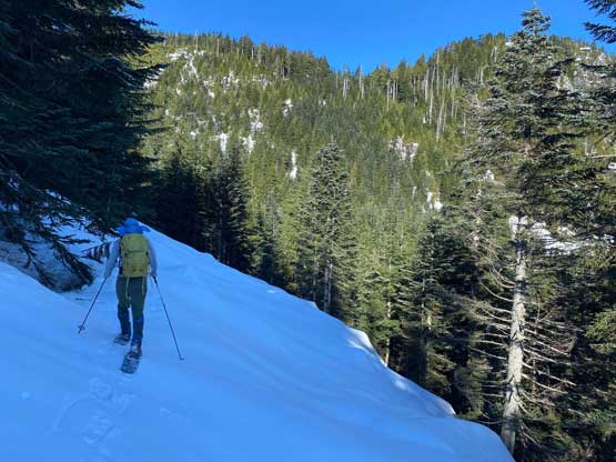


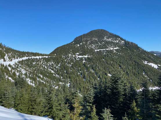


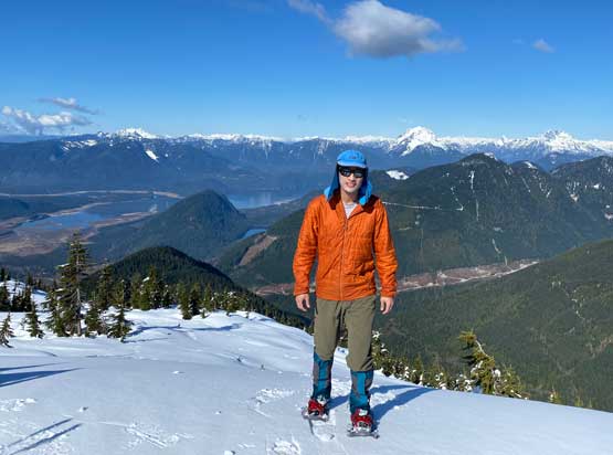
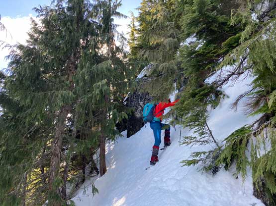
After taking a much-needed break at the col we decided to commit to the final 300-m grunt to the summit. The first half of this final ascent was done in some tight timbers. I could see that this stretch would be a total shit show in summer, fall or even early winter, but with a spring snowpack the going wasn’t too bad. We still had to deal with some light bushwhacking but nobody complained. Higher up we encountered the mature forest with one 40+ degree icy zone that put our snowshoes in test. Of course the MSRs would not let us down, but I could see that some people would prefer to don crampons here. Just when we thought that this would turn into a no-view dumpster summit we popped out of the trees. The summit was only marginally above the trees but offered unobstructed 270-degrees view. There’s no doubt that the nearby “Nursia Peak/Norrish Peak” was a better objective overall, but this one is also worthwhile.


We only stayed on the summit for about half an hour due to some cold winds. To descend that steep forested zone we had to down-climb facing into the slope while wearing snowshoes. We then easily plunged back to Gregory/MacNab col and traversed the the re-sloped FSR for about 500 m southwards. Once making sense we left the road to ascend steeply onto the north ridge of “MacNab Peak” and subsequently plodded to the summit. The ascent onto the north ridge was very steep with sections approaching 40 degrees and the view from the summit was very limited. We then traversed the undulating, forested ridge due south all the way to “Middle Miracle Mountain”, which had absolutely no view. It’s impossible to tell from the maps which of these two bumps is higher. The higher one boasts over 150 m prominence. To descend off “Middle Miracle Mountain” we dropped steeply off the east slopes and got ourselves into some nasty bluffed terrain. The bottom of the 100 m descent to the road was insanely steep and required lots of “technical snowshoeing”, so not recommended. We should have stayed farther on skier’s right but the terrain sucked us to the left.


Nonetheless we all got back down to the re-sloped FSR without incidence. From this spot we no longer had that kilometers-long traversing which we greatly appreciated. The only annoying section was that dead-fall zone but I felt the descent to be much easier, probably because we no longer needed to do route-finding. Once back to the lower snowy FSR I put the snowshoes back on, while the others opted to just post-hole. The rest of the descent was uneventful but tedious and our round trip time was just over 7 hours. I eventually got back to White Rock at 5 pm.