Mount Hooker
December 4, 2022
1263m
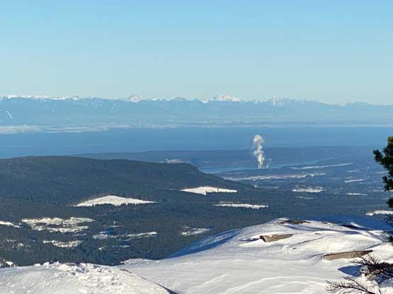
Vancouver Island, BC
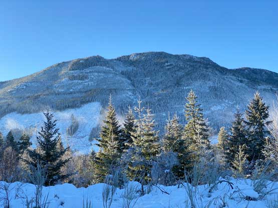
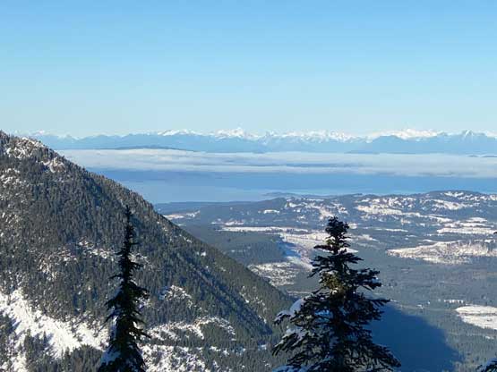
Mt. Hooker is the highest summit in the area immediately to the south of Nanaimo Lakes and subsequently boasts over 600 m prominence. This isn’t a tall peak by the island’s standard as the entire peak sans the very summit is covered in thick forest. The summit does offer some unobstructed views. The entire area around Nanaimo Lakes is riddled with old and new logging roads and most, if not all of them are gated from the bottom. The logging roads on Mt. Hooker is unfortunately both gated and overgrown. This peak might seem innocent on the maps but actually involves fair amount of work and planning. A trail actually ascends to the top of this peak but everyone who hiked this trail mentioned “bushwhacking”. After finishing the ascent I strongly agreed.
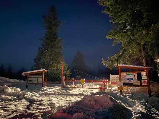
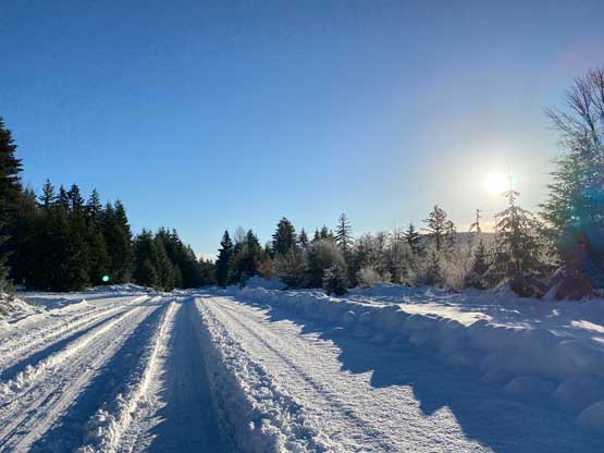
Matt J. had been obsessed about the P600m objectives on the Island recently and Mt. Hooker was one that neither of us had done. A plan was then quickly made as a dominant high pressure system seemed to line up nicely for the upcoming Sunday. The downside was the associated coldness (-10C on the summit) and the fresh dump of snow on the lowlands a few days prior to the trip. The amount of new snow was rather significant as even the city of Nanaimo got at least 20-30 cm. Just a mere week earlier the southern Island was completely dry up to around 1100 m elevation and now we needed snowshoes at sea level. Nikita also messaged me about the weekend so I invited her in. To shorten the drive Nikita and I decided to sleep in Matt’s basement in North Vancouver. The three of us then got up at 4:45 am. The driving distance for this trip was ridiculously short but the logistics associated with the ferry still warranted an early wake-up call. After driving a ways up the Nanaimo River FSR we learnt the gate at the east end of the first Nanaimo Lake was closed despite that they promised to open it on weekends from 8 am to 4 pm. I was honestly not surprised as this wasn’t the first time when the reality was different than the website when it comes to the gate status. I proposed that we should just walk the remaining 5 km to where we originally planned to park, and Matt and Nikita agreed.
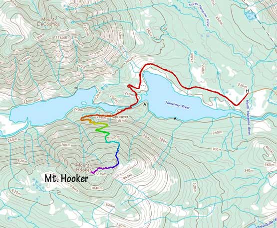
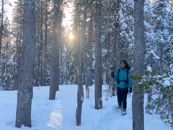
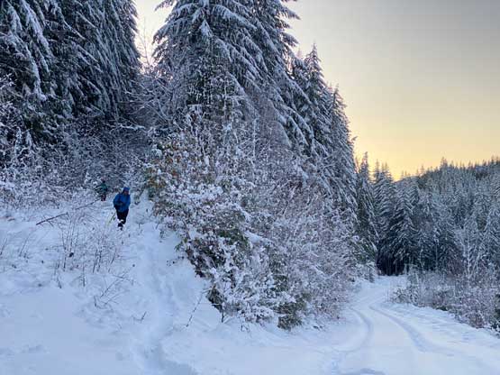
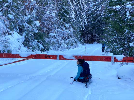
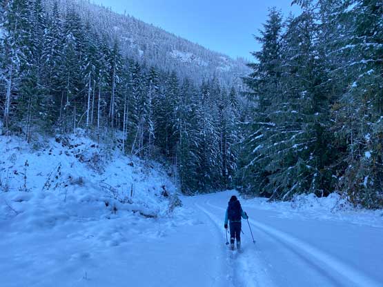
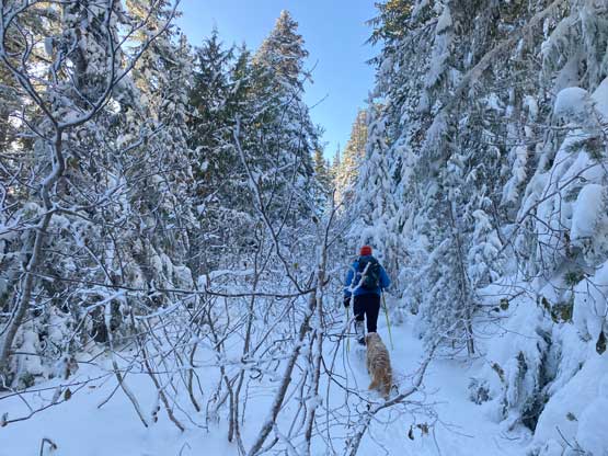
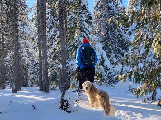
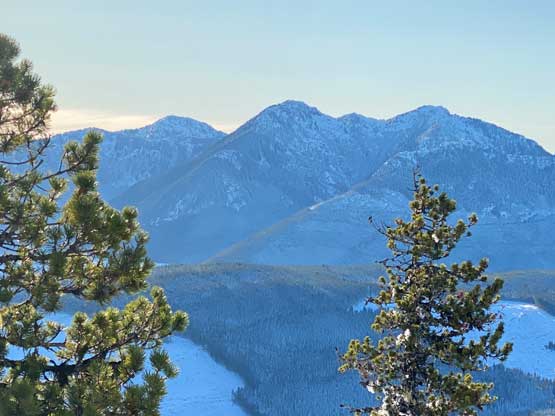
The extra hour of walking was actually not as boring as I thought as the road was open enough to give views towards Mt. Hooker and Mt. DeCosmos. The road had also been packed down by truck traffics so we didn’t really need snowshoes so that also sped things up. Past the first lake we turned south towards “Riverside Campsite” and encountered a permanently closed secondary gate past the campsite. This gate would be the normal “trail-head” for those able to drive through the first gate on the mainline. Beyond the 3rd gate on the south side of the bridge over Nanaimo River the tire tracks stopped and we must stop to put the snowshoes on. We were otherwise post-holing in the foot deep powder and the elevation here is only 200 m. Matt then led the charge westwards down this FSR paralleling Nanaimo River on the south side and a few kilometers later we turned onto the overgrown logging roads on the northern slopes of Mt. Hooker. It was here that we finally started to gain some elevation and the adventure was about to begin.


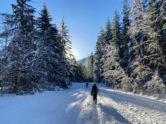

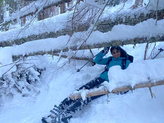
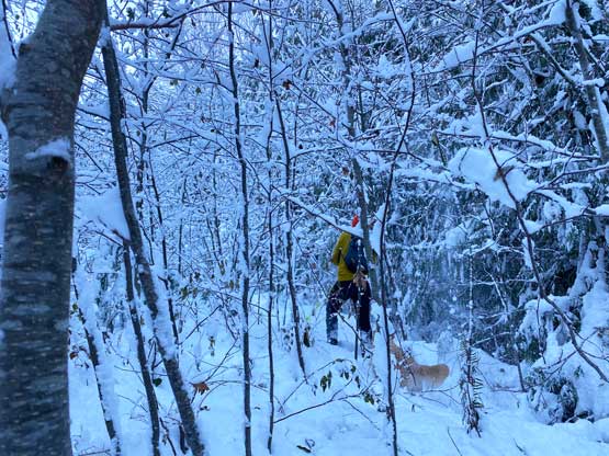
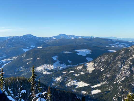
Matt and I knew the road’s going to be overgrown and bushy but it turned out to be even worse than anticipated. We could have made the hike more pleasant had we come here in summer (no snow) or in spring (a lot more snow), but we somehow decided to embrace the early-winter conditions. The foot-deep snow wasn’t thick enough to cover the alders but enough to bring the branches down to our eye level. The fresh dump also made the bushes as wet as they could ever be so a few switchbacks later we were all soaked to the bone. I had a few pieces of dry cloths and gloves in the backpack but I refused to use them as they would be my final reserve for warmth. At one point I became very cold but I made a stop to eat some food and carried on. About 10 minutes later I started to feel better so those clothing reserves stayed in the pack as I’d rather use them for the descent. The bushwhacking had become very sustained for over an hour and Matt and I took turn to lead in front to embrace the misery. We also made a few smaller short-cuts around the switchbacks but the forest wasn’t much better than the alders. A couple larger switchbacks later Matt led us taking a bigger short-cut firstly through pick-up sticks and then through a mess of cut-block. Thankfully the final leg of the logging road was mostly open and actually offered a bit of views northwards towards Mt. DeCosmos.

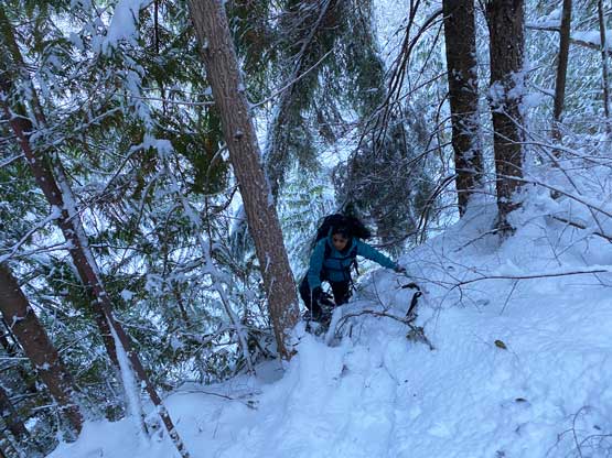
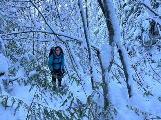


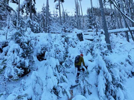


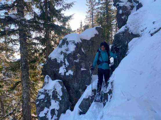
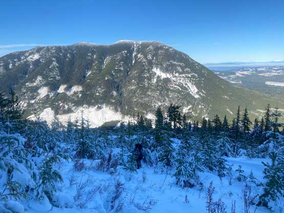
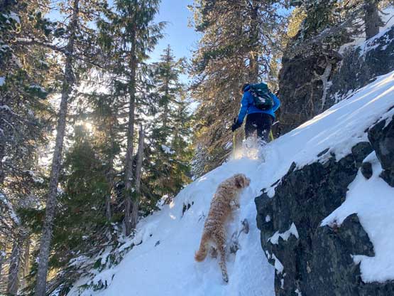
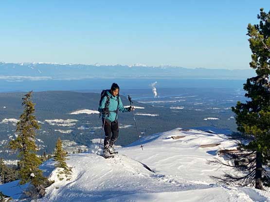
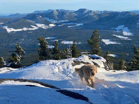
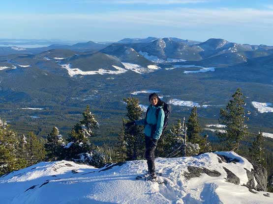
I then took over the lead charging up through another mess of cut-block before finally entering the unlogged forest. The upper cut-block was the worst as we literally post-holed down to the ground (sometimes thigh deep) for every step forward. The forest started off nicely but quickly became steep with bluffs, but then we encountered pieces of flagging that indicated the trail was here. The flagging was frequent enough that we were able to follow the direction to weave around the bluffs. The going had become drastically easier by this point and then next thing we crested the broad east ridge and found a flat spot with glimpses of sunshine to take another break. Matt took over the lead to charge up the final stretch. We started by dropping slightly down the opposite side to find the uppermost logging road but quickly abandoned that road even though the “trail” was actually there. We were all sick of alders by this point so we turned north and ascended back onto the east ridge. The traverse across the east ridge was undulating with fair amount of trail-breaking but was at least free of bushwhacking. The final section under the summit even offered a bit of scrambling experience and the summit was surprisingly scenic given how forested this peak is. This turned out to be a hard-won summit and our stoke level was quite high.


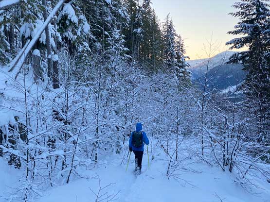
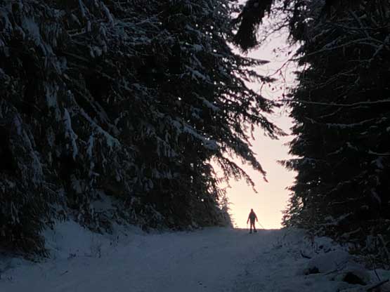
I finally put on the spare dry cloths and the descent was infinitely faster as the track’s broken, the fresh snow had been mostly knocked off the alders and we also knew where exactly to aim at. In no time we were down to that steep section. I anticipated some “technical snowshoeing” needed but it turned out to be rather simple. The bushwhacking on the overgrown FSRs did drag on for a long while and the final few switchbacks seemed to feel like eternity, but we eventually beat the time to get out of the bush at dusk. We dashed back to the 3rd gate, took the snowshoes off and I kept dashing back to the second gate before turning on the head-lamp. The final 5 km back to the truck was a monotonous slog but at least we were able to move rather quickly. Our round trip time was just over 9 hours and the round trip distance was close to 26 km, but the amount of work definitely felt much harder than suggested by the stats. This turned out to be a long and tiring day-trip as I didn’t get back home until after midnight.