Coquitlam Mountain
May 3, 2018
1583m
Coquitlam / Fraser Valley, BC
Behind the city of Coquitlam to the east of North Shore Mountains sits a prominently-looking, but difficult-to-access objective namely Coquitlam Mountain. I’ve been sight-seeing this peak for almost three years from various parts of Metro Vancouver but I never got around to plan an attempt. The “standard route” goes over the entire length of Burke Ridge, drops about 500 m elevation before trudging up the S/SE Ridge and the best time is April when the forest’s still covered in snow. This requires about 30 km distance with over 2200 m elevation gain and a slog fest of 14-16 hours is the norm. Nobody said it’s a “fun” peak to climb, but die-hard peak-baggers are stubborn.
About a month ago I got an email from a local university student looking for a partner to ascend Coquitlam Mtn. sometime around late April or early May and by no doubt it caught my interest. Fast forward, the first week of May saw some guaranteed sunshine and I knew the snowpack had already consolidated enough to allow faster travel. I contacted Sean Z. and sure enough he was still game for the mission. Living in Coquitlam, Sean has done a hell lot of mountain-biking on, and near Burke Ridge and he came up with a creative idea with a potential to shave off that major elevation loss. I checked the maps and I agreed with him. The idea is to connect the lower Burke Ridge (near Coquitlam Lake viewpoint) to Or Creek FSR via a bushy bench. This section had zero beta but we had checked all forms of maps and it looks reasonable enough, and if things go smoothly we’d only lose ~200 m elevation.

Coquitlam Mountain via Or Creek. GPX DL
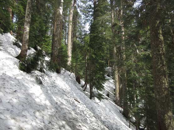
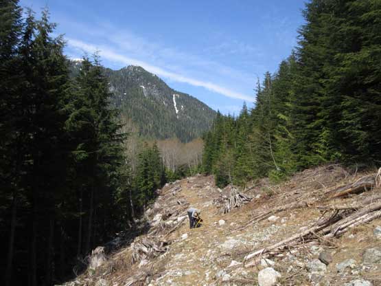
This is one of the shortest drives for me coming from North Delta. About 40 minutes after leaving my home I had arrived at the gun club’s gate on Harper Road. Sean arrived shortly after and we started the plod at around 5:15 am. The first few kilometers was trudging up a boring logging road so there’s no point in wasting the valuable daylight time. About half an hour after starting we turned off the headlamps and then followed Sean’s lead towards “Coquitlam Lake viewpoint”. There are many confusing branches. The secondary logging roads had a few creek crossings and then ends at the Pinecone Burke P. Park boundary. It’s there that I finally switched my Nike runners to the Nepal Evos and then off we went into the bush. The grade steepens up in no time but we did manage to keep a diagonally downhill direction without having to deal with too much of annoying terrain. There’s one huge waterfall that we had to bypass on its bottom but overall the GPS navigation worked out beautifully well. We managed to hit an overgrown road after a bit of re-ascending and then hiked/bushwhacked to join Or Creek FSR without much of a hassle. It had taken us around 3 hours to get here. The route went well but I think adding the micro-terrain we did 300 m elevation loss.

Sean traversing a slippery boulder field that we avoided on the way back.
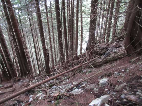
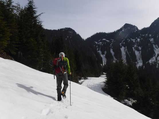
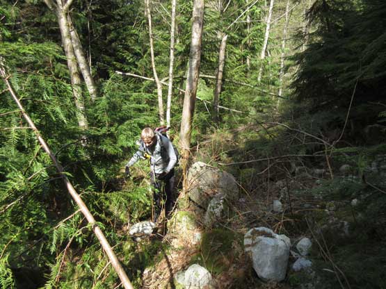
The steep side-hill bushy traverse began.

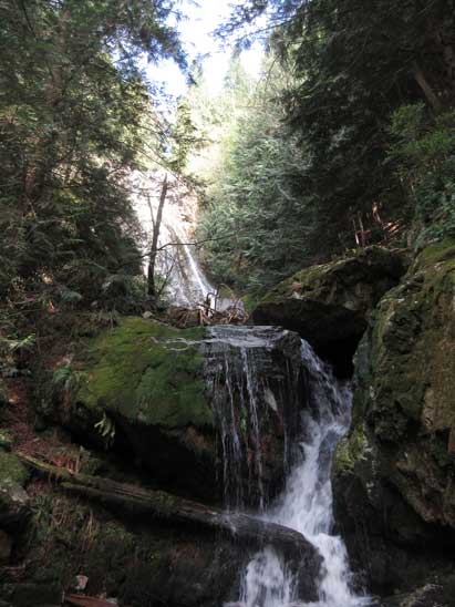
About halfway across we had to cross this waterfall.

Joining an old road and it was quite bushy at places.
It’s a very interesting sudden transition from bushwhacking to hiking on the Or Creek FSR. This road is in a perfect shape for driving but unfortunately it’s off limit for public access. I switched my footwear back to the Nike runners. The drivable section ends after about 2 km of walking and then there came a huge re-sloped section. Beyond that point the road was still in a fine shape for hiking. At around 700 m elevation we started hitting snow so there came the third footwear transition. Another 500 m later we came to the river crossing – knee deep but not too fast flowing. The hikers were ditched after that. Onto the north side of Or Creek we kept walking the road with some degree of post-holing. The snow wasn’t continuous enough for snowshoe travel thank to the 30+ deep ditches that each required some degree of creativity or yoga moves. Negotiating them was fun at the start but soon became tedious.
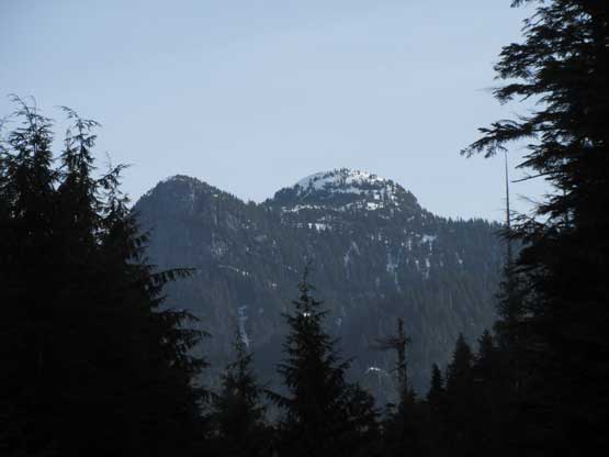
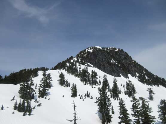
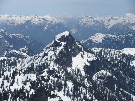
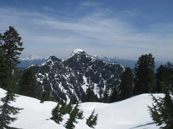
The first sight of Coquitlam Mtn., our objective.
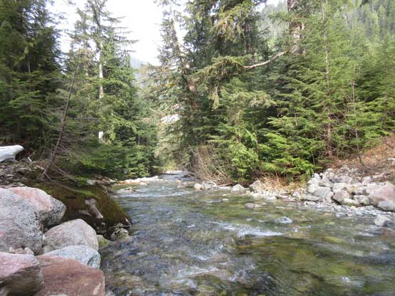
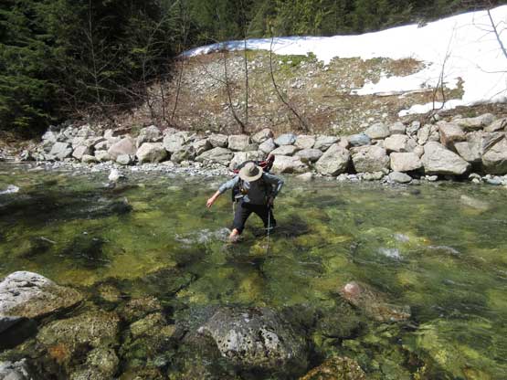
Arriving at the Or Creek crossing.

It was knee deep so not a problem at all.
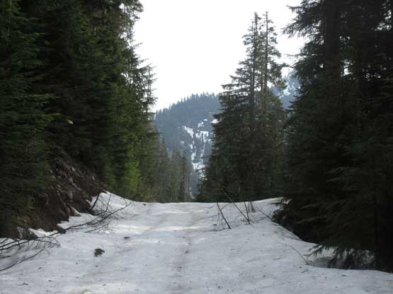
Hitting continuous snow on the north side of Or Creek.

However, we had about 30 ditches to climb down into and across…

Just another ditch…
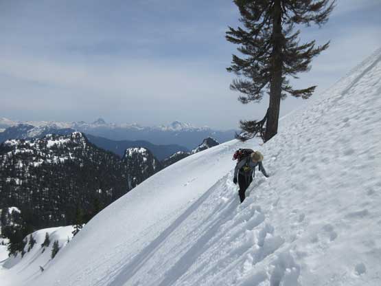
Me charging up the upper Or Creek FSR. More ditches to come…
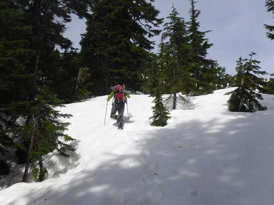
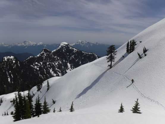
It’s arbitrary as where exactly to leave the road and start climbing. We went all the way to the road’s end and then bailed straight into the bush with a slight diagonal travel to the climber’s right. The snow was again, supportive (and steep) enough that snowshoes weren’t required, yet. The initial part was in secondary growth but we entered the mature forest in short time and then we picked a few large open slopes to speed things up. The slope angle was sustained but did offer easy step-kicking. It’s a long grunt to hit the crest of SE Ridge and then all we needed was to keep the upwards progress. There’s still a long, albeit lesser steep grunt in the forest. The snowshoes were eventually strapped on as post-holing took over, but the snowshoeing was treacherous as the surface layer was slushy and slippery.

It was a steep and long grunt up the lower forested slopes.
A sideways shot to show the slope angle. It was like this for at least 200 m.

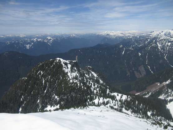
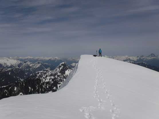
Finally cresting the SE Ridge.
Me post-holing.. Photo by Sean Z.

Sean following up on snowshoes. It wasn’t very easy-going…
Another shot of Sean following up on snowshoes.
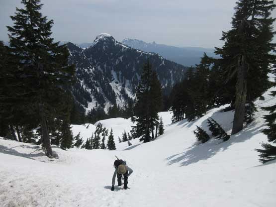
After a while of struggling we slowly but steadily approached the “false summit”. Most parties bypassed it by traversing a steep slope on the north side and that’s exactly what we would do. The slippery surface snow meant it’s no longer safe to do so with snowshoes on, but not sure whether or not the ‘shoes were still required after the traverse we opted to carry them. The traverse was easy. After this short bit of excitement we ditched the ‘shoes as the snow was supportive enough for just boot travel. The final ascent on the uppermost south ridge was uneventful other than the views were foreshortening. And then we lingered on the summit for about an hour soaking in the views.

Nearing the false summit we were looking for that traverse
The actual summit and the upper south ridge (L.H.S. skyline ridge).
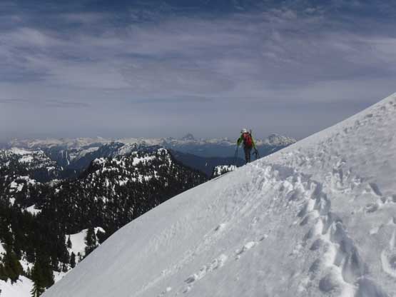
Sean starting that steep traverse.

About halfway up the final push on south ridge.

Summit Panorama from Coquitlam Mountain. Click to view large size.
Cathedral Mountain and other North Shore peaks

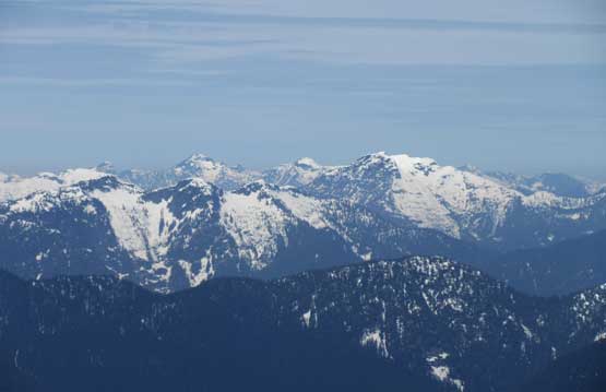
Mt. Robie Reid close-up shot

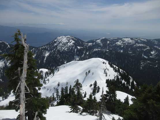
Everything in this frame is super remote and inaccessible
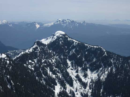
Behind Widgeon Peak is the Golden Ears Group
Gabbro Peak hardly get any ascent as far as I know…
This is a northern view into more remote peaks behind North Shore Mtns.

Mt. Judge Howay close-up shot
Sean exploring the summit area
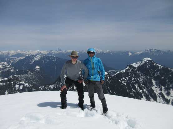
Sean and myself on the summit of Coquitlam Mountain
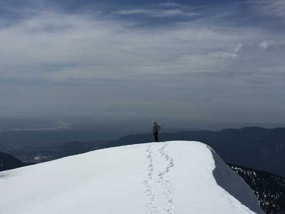
Me on the summit. Photo by Sean Z.

Another panorama from the summit. Click to view large size.
Plunging down from the summit was the most enjoyable part of the trip and then we reversed our tracks across that short traverse. Lower down we decided to just post-hole instead of slipping on the snowshoes. This worked out actually quite well but we did discover some deep holes, especially further down in the secondary growth. Reversing the upper Or Creek FSR with those annoying ditches was also not as bad as we thought. The creek crossing was a little bit higher than in the morning but provides some refreshment.
Time to head down. The false summit in foreground.

Partway down the uppermost south ridge.

Sean having lots of fun plunging down the soft snow

The view’s getting better and better.

The false summit ahead. You can see the traverse as well.

Looking back towards the true summit.
Me starting the traverse. Photo by Sean Z.

Looking back at Sean starting the traverse
Me finishing the traverse. Photo by Sean Z.

Looking back at Sean finishing the traverse…

A close-up shot of Gabbro Peak.
Widgeon Peak starts to look bigger now.

Into the forest. We opted to not use snowshoes on descent

Almost done that steep forested descent

Onto the upper Or Creek logging road

Typical, typical…

Back to the creek crossing..
The water’s higher now but not a big deal crossing Or Creek
Another 500 m later we ran out of snow and then I did the 4th footwear transition of the day back to the (now wet) Nike runners. Despite the wetness they still beat the Nepal Evos for a downhill logging road walk… We correctly located the place to bail into the forest and then the next two hours or so was quite an exercise in GPS navigation. I literally traversed with GPS on one hand for most of the time just to make sure we did actually reverse our approach tracks. In the morning we didn’t feel like having done too much of elevation loss but now we both could feel the regains that after cresting the highpoint I had to call another break. For some reasons I didn’t pack enough food so grabbed a couple Cliff Bars from Sean and that saved my day. The rest of the return was just a foot-numbing slog with nothing worth noting. Our round trip time was 13.5 hours which I have to say, was pretty much as planned.

Running out of snow on Or Creek FSR
A huge re-sloped section means no more vehicle access
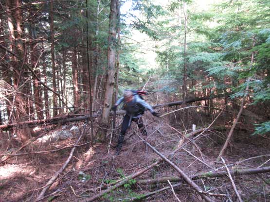
Bailing back into the bush. This is that overgrown old road
Lots of bushwhacking on this short stretch

The typical “road” conditions…

Still somewhere on that short, old FSR.

Traversed back into the old growth now. This is the typical terrain.
Crossing that huge waterfall.

Back to the lower Burke Ridge roads still having some washouts

Almost done. Finally saw someone else. This is the end…
Overall this was an exhausting, but awesome adventure and I have to thank Sean for suggesting this experimental route and doing all of the homework. This route does save some time and elevation regains comparing to the traditional approach over Burke Ridge but no matter what, there’s no easy way to get to Coquitlam Mountain. For die-hard peak-baggers this is a Type II fun kind of trip and for everyone else expect a full day of suffering…
