Mount McLean
November 28-29, 2015
2427m
Lillooet, BC
Note that the summit of Mt. McLean is wrongly labelled on the Canadian Topographic 1:50K map while the “true” Mt. McLean is actually referred to the highest peak in the entire Mission Range at its south-eastern end. A full discussion can be found on Bivouac.com, although to read the article you have to be a paid member. This peak, although not nearly as significant as the nearby Mt. Brew and Mt. Seton (which are the 5th and 7th highest peaks in SW BC, respectively), still features a near-2000 m elevation gain from the valley bottom. The traditional way to tag this summit was by a long traverse over all the subsidiary summits on Mission Range from Seton Portage to the north, but Alex had found a much-faster option thank to his exploration and ascent of the small “Dickey Peak” in the past month.
With a guaranteed high pressure system forming up towards November’s last weekend Alex and I were struggling to find a suitable objective. Due to the previous storm combined with the recent cold temperatures almost all the logging roads were out of question as none of us owns aggressive snow tires/tire chains. We eventually settled on Lillooet again and the plan was to traverse those peaks on Mission Range. In terms of how far we would go we had no idea, but for the least we would bag Mt. McLean which is the highest in that range. The route we planned was by a “secret” unnamed logging road that leads from the town of Lillooet all the way to Mt. McLean’s broad NE flanks that Alex discovered a month ago. In summer time one can drive about 5.5 km up but unfortunately for us, we had to walk from the start. A 2:30 AM wake-up call was in the order and close to 6 hours later we made to the parking lot.
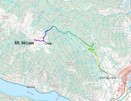
Mt. McLean snowshoe ascent from Lillooet. GPX DL
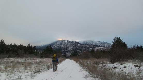
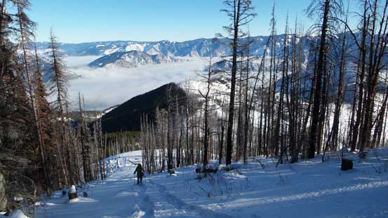
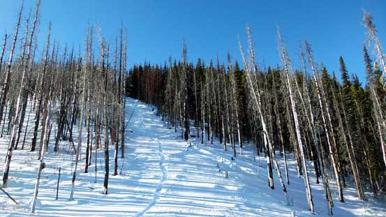
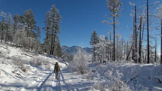
Right from the start we could tell there were ATVs and snowmobiles plodding up that road likely by hunters so it’s actually fairly popular to the locals (just not so much on the Internet). We got lucky as that meant we no longer had to do trail-breaking for the first few kilometers. It was very cold and overcast but we knew there’s suppose to have a strong temperature inversion so at some point we’d break through the clouds and into the sunshine. That came at about 5 km into this trip and it was quite a spectacular moment. At about 1200 m elevation the road finished its last switchback and made a long traverse due NW towards our objective. Here’s where the ATV/snowmobile tracks ended so snowshoes on, and our arduous trail-breaking began… That long traverse ended at a small drop and after that the road became a bit overgrown and hard to follow. The young trees and dead-falls created lots of weak spots and we sank to the bottom of the snowpack for pretty much every step, and we knew it’s only gonna get worse.
Starting the trip under cloud coverage

Looking back towards the Gate that we parked
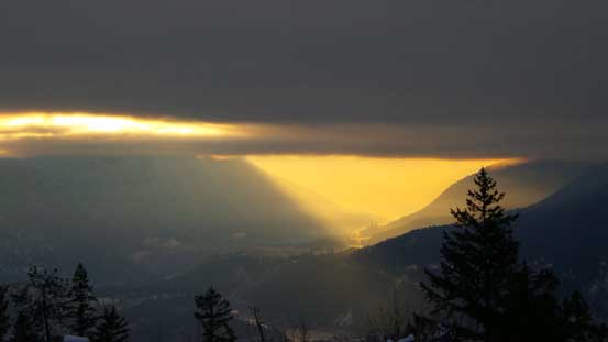
Morning colours through Fraser Canyon.

Entering the mist, but looks like there’s some blue colours appearing from above!
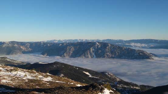
Breaking through the cloud layer
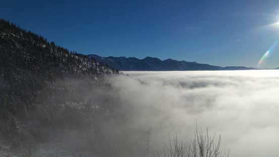
Above the clouds now!!!
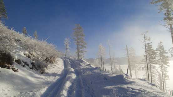
Following the logging road up. Lots of switchbacks
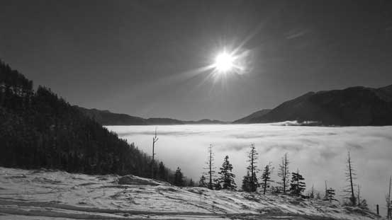
The sun and the valley clouds
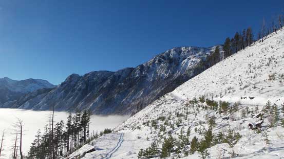
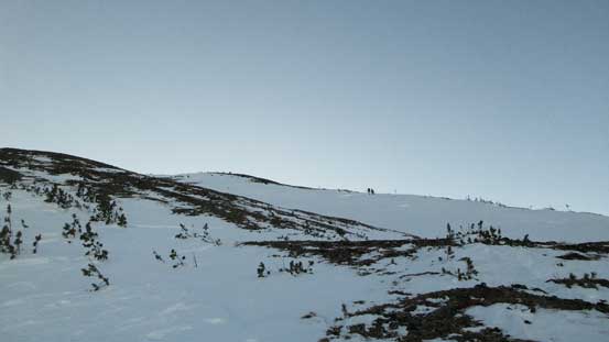
Here’s that long traverse. Starting to break trail now
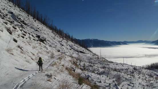
Alex on the road
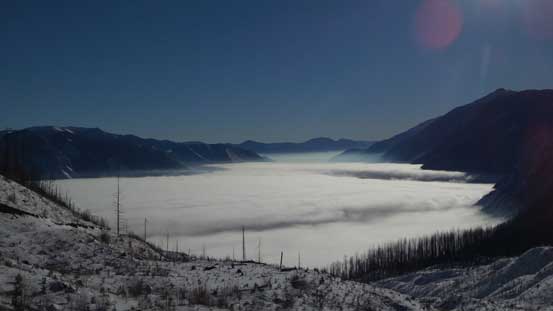
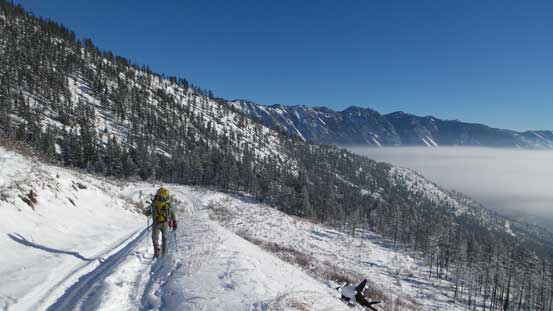
One last look at the valley clouds before entering some forest

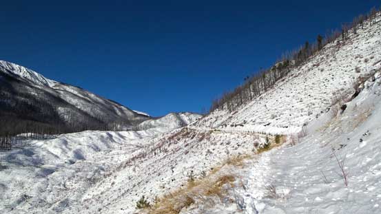
Keep following the road even though it’s getting a bit overgrown

Alex marching up
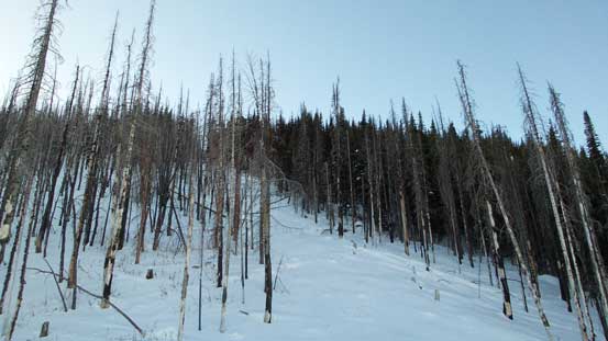
Eventually we made to the broad NE Flanks and here the road gradually became more like a “cut block”. It’s starting to shoot straight up the slope and I wonder what kind of vehicle could handle that steepness… And thank to the steepness the post-holing started to get ridiculous with the uphill side passing my thigh level.. Here we made the call to bail into the forest on climber’s left and thankfully the snow condition actually improved, partly because there wasn’t that much snow in the thick forest… The bushwhacking was actually tolerable so we made some progress. Higher up the terrain levelled out a bit so we went back to the cut block.

Here we briefly lost the road. Those deadfalls constantly gave us good surprises…
Back to the cutblock
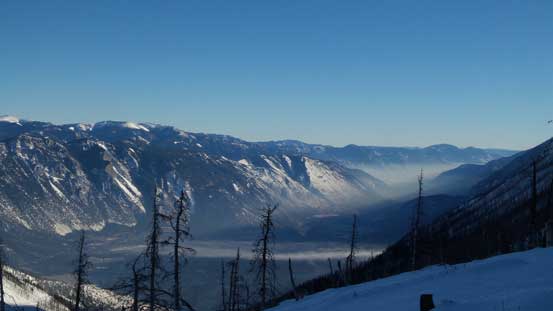
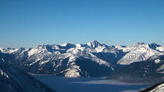
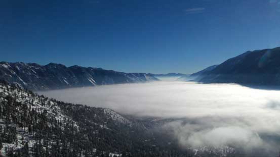
The valley clouds started to lift up revealing views of Fraser Canyon

Lots of post-holing….
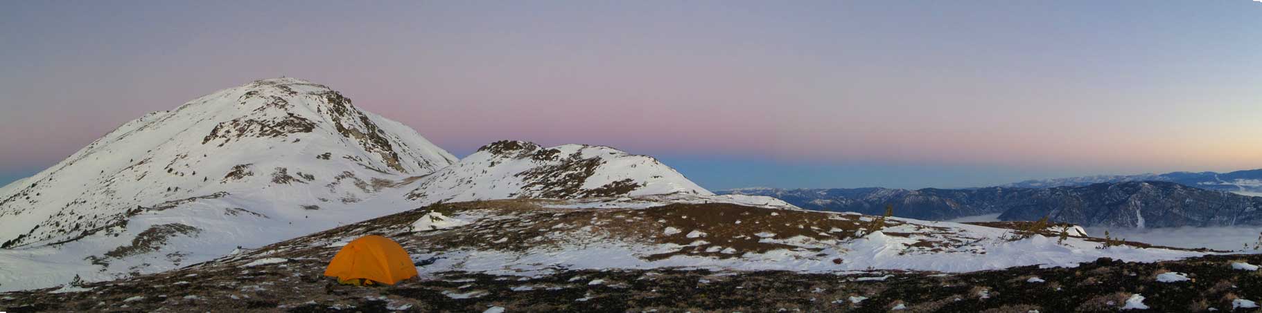
We were a long ways behind schedule at this point and we had to make a critical decision as the route ahead forked. There’re only two interesting summits on Mission Range – Mt. McLean and Mission Peak and the traverse between the two is at least 5-6 km long with at least 3 or 4 major up-and-downs. We figured based on our current progress there’s no way to get that far, plus Mission Peak can be done from Seton Portage side. The decision was fairly easily made – turning left instead of following the road and aiming for Mt. McLean only. The ideal bivy spot for Mt. McLean itself was on its broad east shoulder which thankfully wasn’t very far away. At treeline we were greeted by some Rockies’ styled wind blown dry ground (thus, fast travel). Our perfect camping site was also blown bare saving us at least 1 hour’s of shovelling. And then it’s time to soak in the sunset views…
Above treeline we could just travel on scree.
Looking way down into the Fraser Canyon

Setting up camp at this broad plateau

Our tent and our objective…
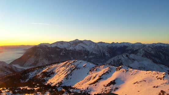
Almost time for sunset

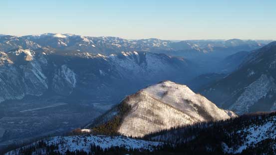
Mt. Brew is only a few meters lower than Wedge and is the 5th highest in SW BC

Fountain Range (foreground) catches the last bit of sunbeam

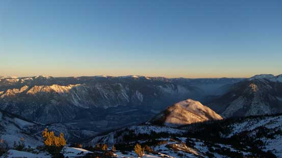
This is the southern end of Mission Range
Sunset over the horizon
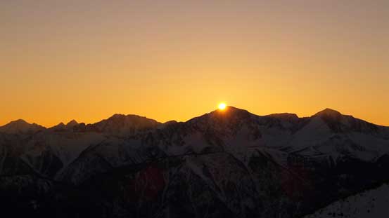
The last bit of sun rays

A zoomed-in view of the town of Lillooet
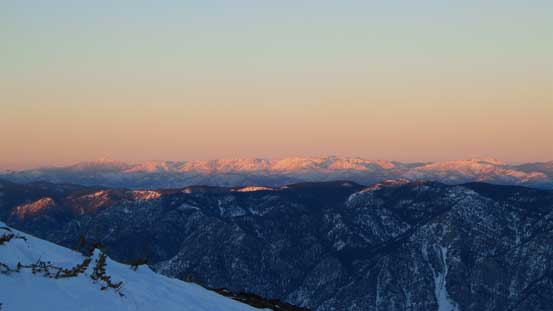
Evening glow on Marble Range by Clinton

Dusk over the Fraser Canyon
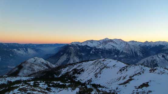
Another picture of the Dusk. Mt. Brew on right
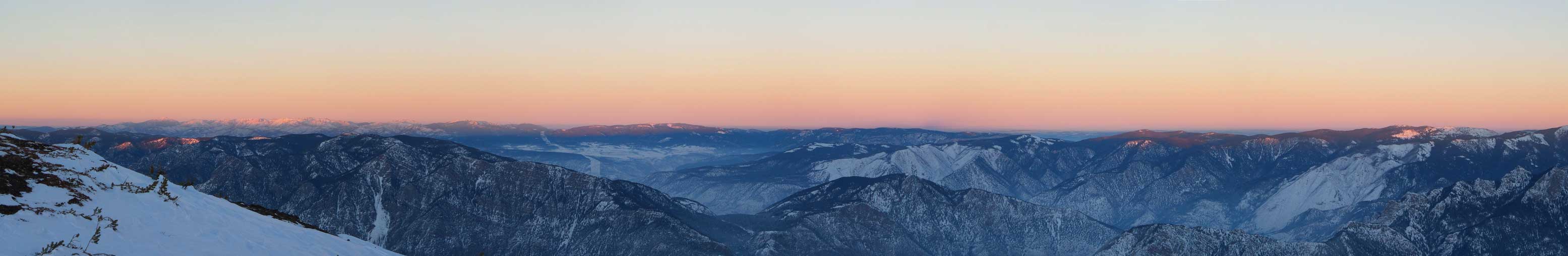
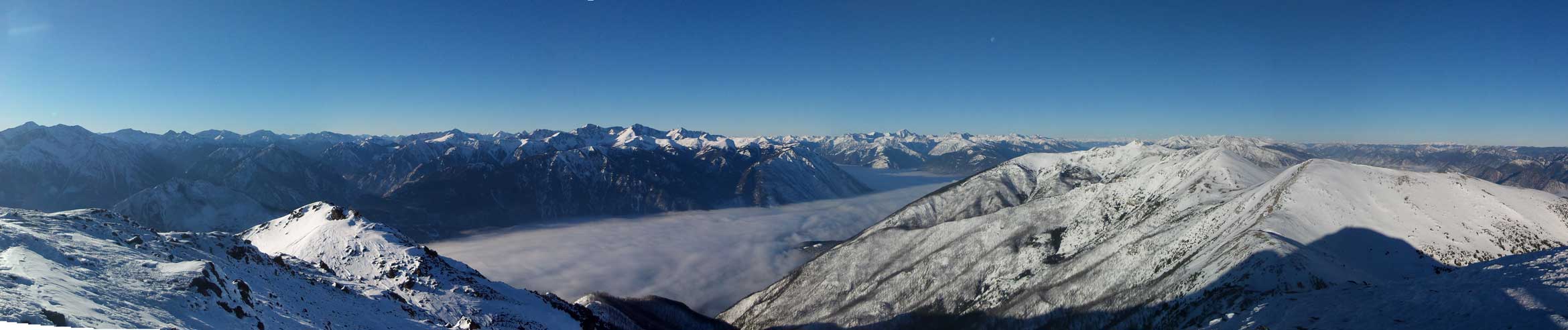
Panorama of the evening colours. Click to view large size.

Another (wider) panorama. Click to view large size.
The overnight temperature was nice and warm thank to the inversion and I really wished I brought my tripod up there as we could see the lights down by Lillooet… And as usual for this time of a year we got at least 13 hours of sleep and woke by just before alpenglow time the next morning. The objective for Day 2 was simply tagging the summit and then plodding down (which would be fast following our tracks) so we weren’t in a hurry at all. We firstly spent at least 1 hour observing the sunrise and then spent another hour or so cooking breakfast.
The sky started to get purple and pink. Click to view large size.
Panorama of dawn. Click to view large size.
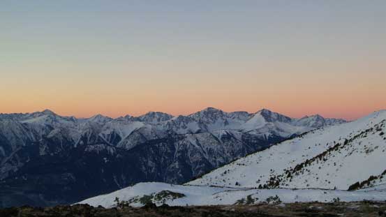
The Mt. Seton area before sunrise by Downton Creek

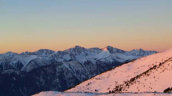
Alpenglow on Mt. McLean – our objective

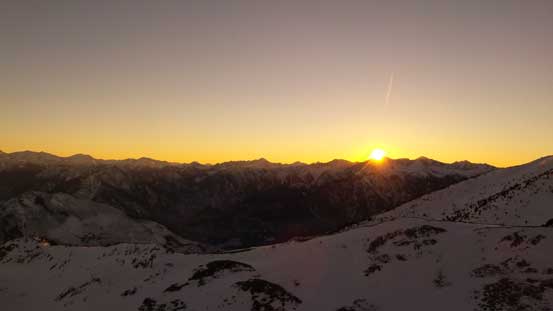
Sunrise time!!
Mt. Seton is the 7th highest in SW BC and the highest in the entire Cayoosh Range
Mt. Brew and the morning glow
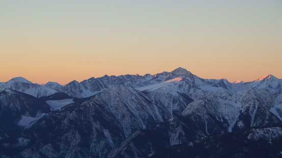
Melvin Peak is another big one by Downton Creek Drainage

Boulder Mountain left of center – day-trip from Duffey Lake Road

Alex soaking in the views

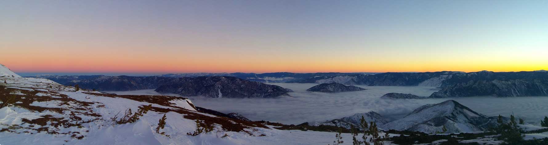
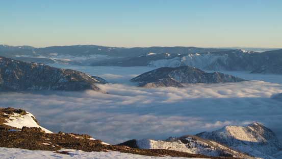
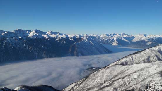
The valley clouds and the morning colours

The first bit of sunbeam shown on the valley clouds
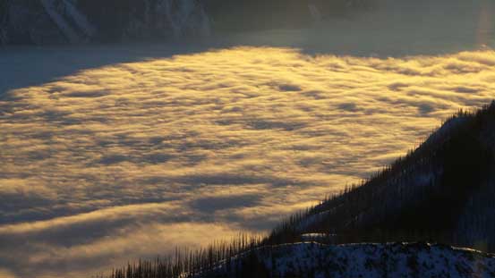
For some reasons we felt those clouds resemble some sort of icefields…
More sunbeam on the clouds now
The lowly Camelsfoot Range poking above the clouds
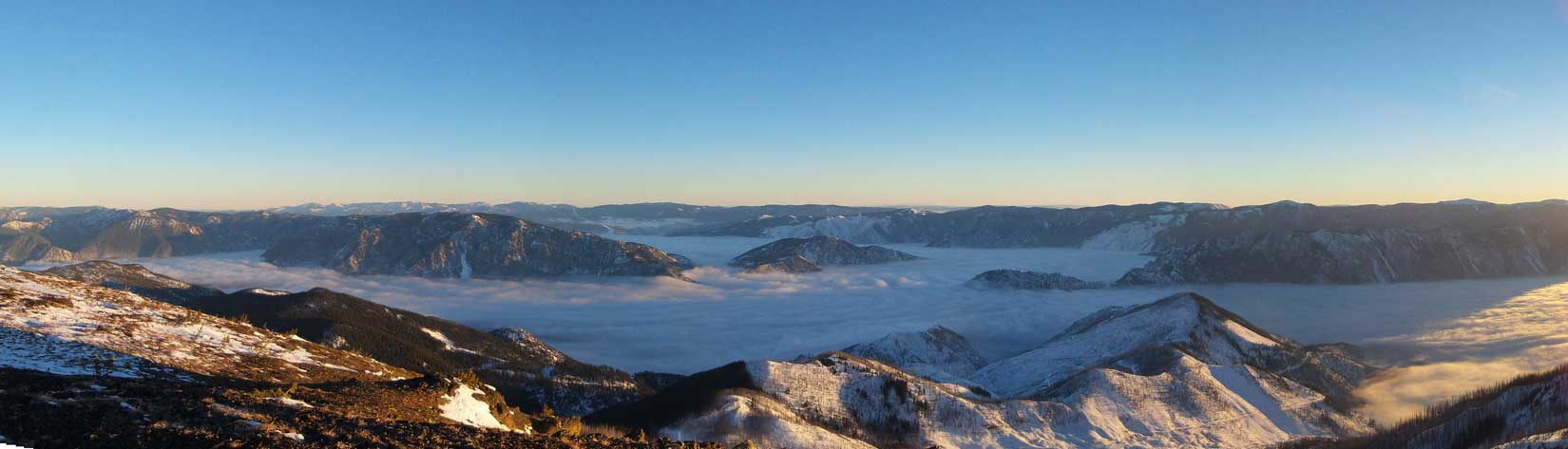
One panorama view at sunrise time. Click to view large size.
But eventually it’s time to get going. The snow on the alpine was hardpacked by the wind so we had some fast travel on the snowshoes. We managed to stay entirely on snow except for a few short stretches of scree, so didn’t even have to take the ‘shoes off. There were 5 mythical “BC green towers” on the summit and we had to wonder around those obstacles for the views. We couldn’t see Seton Lake unfortunately as it’s below the valley clouds.

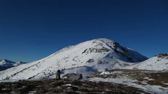
Time to ascend our objective
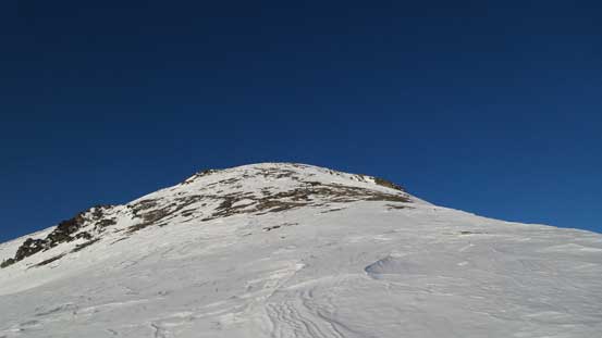
Plodding up…
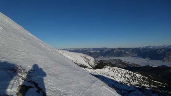
It’s actually fairly steep at places..

Looking back at a sub-summit
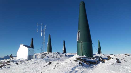
5 towers on the summit?! I think that’s the most I’ve seen so far…..

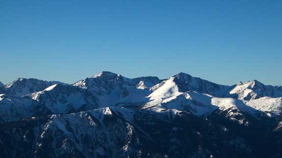
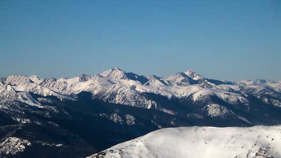
Looking north at the rest of Mission Range traverse with Shulaps Range behind
Whitecap Mountain dominates the skyline looking NW
Mt. Seton – Saddlebag Peak – Modal Peak which I (unfortunately) traversed in a white-out last month
This was supposed to be looking down at Seton Lake, but we couldn’t see it…
Mt. Bobb (L) and Mt. Williams (R) on Bendor Range
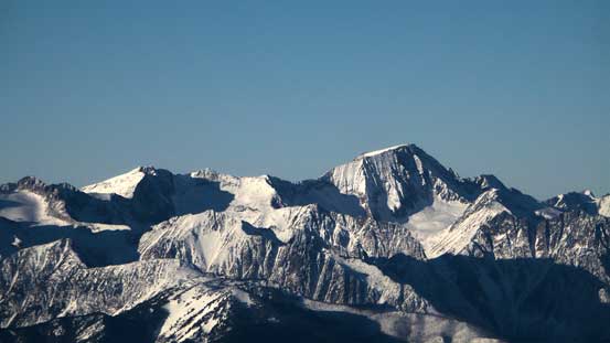
The mighty Whitecap Mountain is the 3rd highest in SW BC…

Melvin Peak
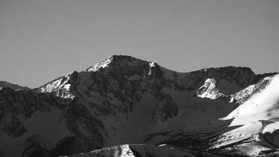
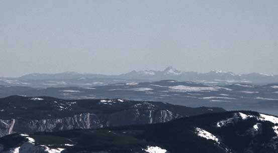
A closer look at Saddlebag Peak (aka. Seton E2). This is Cayoosh Range’s second highest peak

Mission Peak with the Chilcotin Range peaks behind
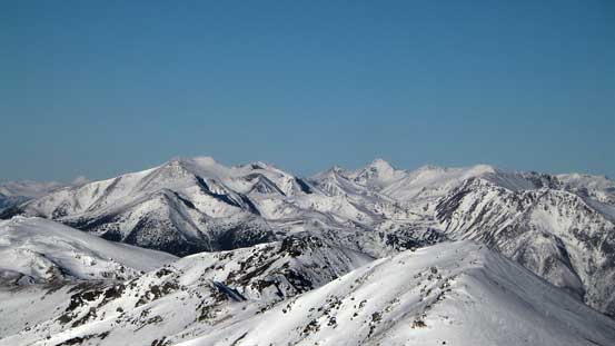
Shulaps Peak right of center
Even peaks in the Monashees are visible. This is Dunn Peak…
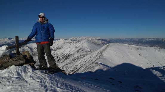
Me on the summit of Mt. McLean

Partial summit panorama. Click to view large size.
Partial summit panorama. Click to view large size.

Partial summit panorama. Click to view large size.
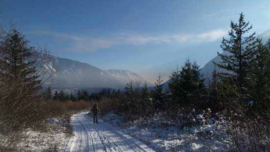
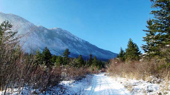
Back to camp it’s time for the descent. The sugary bottomless snowpack was horrible for going up on snowshoes but would allow some fast plunging coming down. In no time we were back to the roads but then the next hour or two’s road slog wasn’t nearly as fun. About 500 m above the valley floor (roughly the same elevation as the previous day) we dropped below the inversion layer and all the sudden it’s getting very cold.
Packing up now.

Another look at the Fraser Canyon where Fraser River travels through
Plunging down the cut block
Looking back at the upper portion of this cut block
The valley clouds were still there
The road slog….
Below the freezing layer now. Note the frost
Almost back
Looking back from near the end
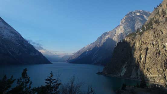
Because we missed the view of Seton Lake from the summit I did one tourist stop on the way back
The only problem now was that we got back to Lillooet before 1 pm… It might look good on paper but knowing where we’d travel through (Highway 99, Whistler, Squamish and eventually Vancouver) it’d be a horrible timing… That traffic was terribly terrible thank to the opening of Whistler’s resort and all the people that went out in this sunny weekend… I really hate getting caught in a line-up for any matter… But oh well, it’s a great trip nonetheless.
