Ochre Mountain
June 25-26, 2021
2543m
Salal Creek / Upper Lillooet FSR, BC
Ochre Mountain is a pile of red/orange choss, beautiful to look at but garbage to ascend. Thankfully the slope angle is pretty mellow on this peak such that one doesn’t quite need to use hands. This peak is often done combined with Salal Peak from Athelney Pass and this area has reputation to be beautiful. The three peaks on the east side of the pass – Ethelweard, Icemaker and Guthrum offer more rewarding mountaineering while the peaks on the west side of the pass offer more dramatic views including some close-up views of a volcanic feature called “The Elephant”. This was the 5th objective for Brayden and I, after completing Ethelweard, Icemaker, Guthrum and Salal earlier in the day. It’s shaping up to become a long ass day and we were looking to possibly finish in the dark.
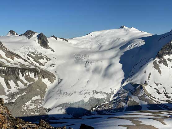
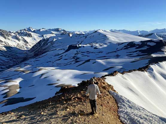
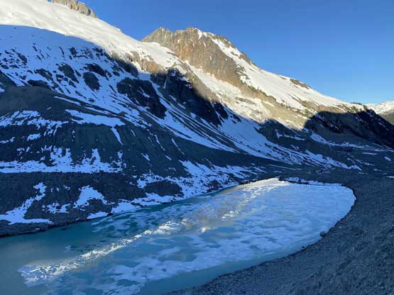
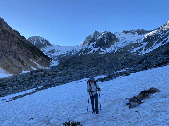
From the gentle ridge connecting with “The Elephant” we had to lose about 50 m elevation into the basin before slogging onto Ochre Mtn.’s W/SW Ridge. This basin was full of boulders in the summer but for us, it was a simple plod on snow. While grunting onto the Ochre’s ridge we started to post-hole seriously in isothermal and thin areas. The original plan was to traverse farther out on snow to bypass the scrambling on the west ridge but given the crappy snow we opted to use rocks. After hitting the west ridge of Ochre Mtn. we ditched the pack.


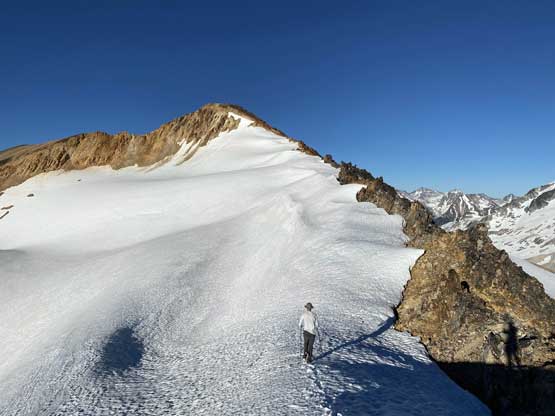
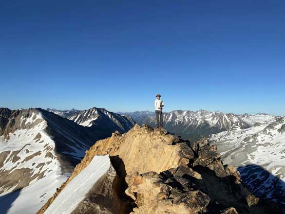
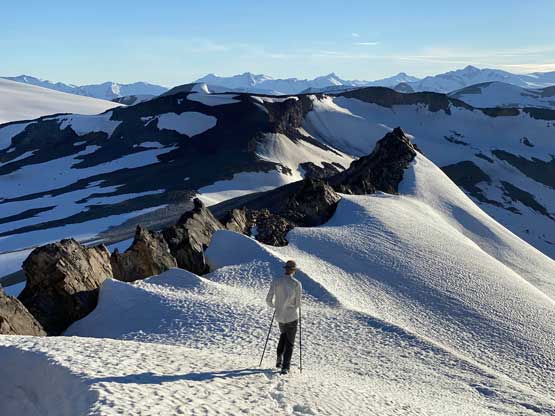
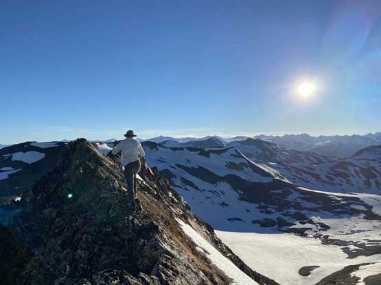
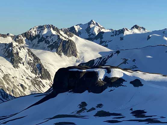
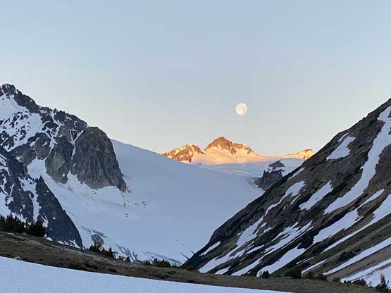
The scrambling on the west ridge was actually quite fun with some moderate exposure in some spots. We bypassed some sections on the sides and stayed tip-toeing on the ridge crest in other spots. The bypass on climber’s left on snow was all smooth going. The ridge did seem to drag on for a long while but at least the views were ass-kicking. This peak had my favourate views among the five we did in this trip.


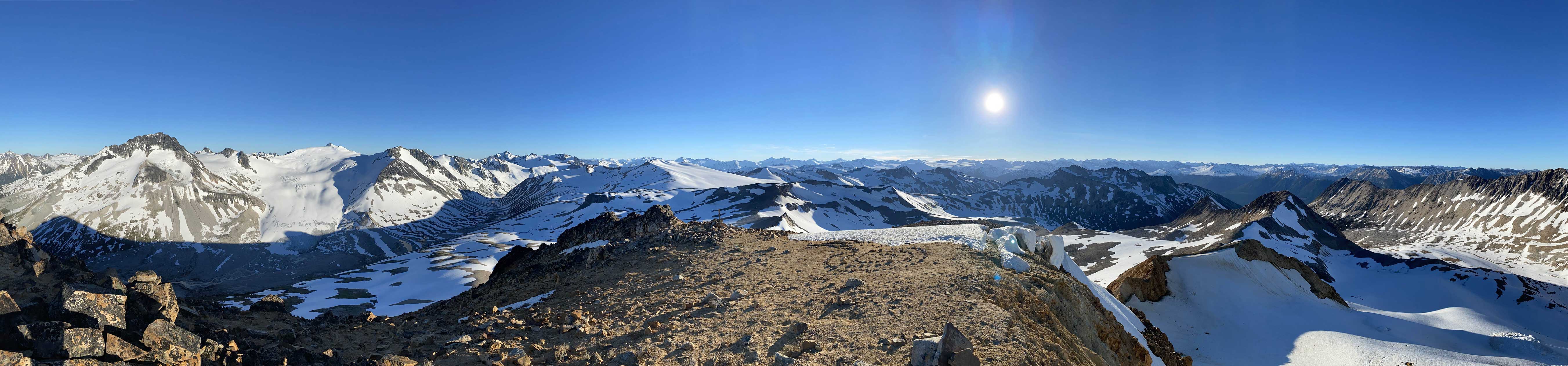

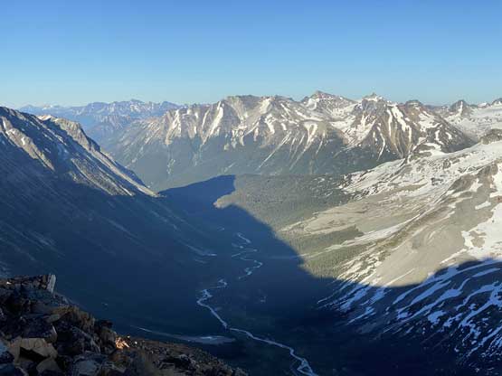


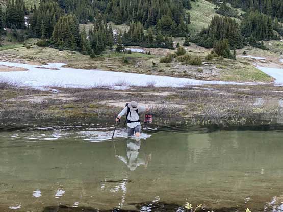
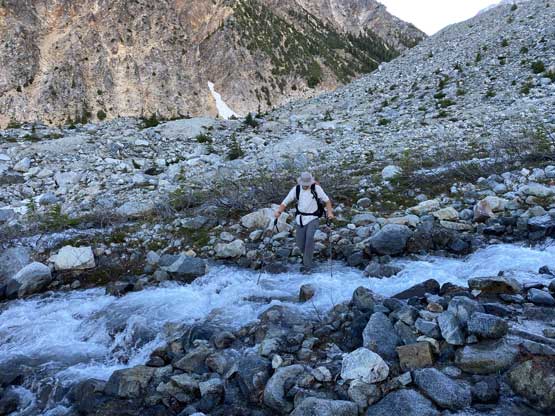
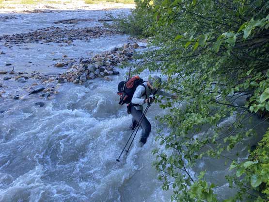
It was 8 pm when we summitted so we had a little over 1.5 hours to get down to camp before head-lamp time. The camp was still 5 km away but we figured it’s very possible to beat the darkness. Because we ditched the pack we must traverse back up and over those pinnacles (which again, was not too bad) and then dropped briefly down onto the tedious talus before merging onto continuous snow. We did have to re-ascend out of that basin to get back onto “The Elephant” ridge. I knew Sean had descended straight from the basin towards Athelney Pass but given the time of the day we decided to not fuck around with “other ideas” and simply retrace our own steps. There’s one long ass traverse followed before we could see our own foot prints. The rest of the descent back to camp was rather uneventful. That stream crossing near the end was just as deep as a few hours earlier and yes, we did get back before dark. We even earned enough time to cook dinner before having to use head-lamps.


It’s very tempted to sleep in on the 3rd day of this trip but given the massive heat wave we both wanted to make the return hike a bit more pleasant, and to achieve so we must dash down a good portion of it before the sun hit us. We set the alarm at 4:30 am and started the descent right after 6 am. The temperature wasn’t too hot and the snow was actually better than the day before. For the first few kilometers we followed the Midnight Crew’s tracks traversing higher than we did on the way in and then managed to find that trail connecting to the crest of that massive moraine. This saved us some time because on the way in, we were boulder-hopping most of the time here. Descending that moraine was painful wearing mountaineering boots but once the slope angle petered out the going became much easier. We kept dashing down the valley until after the first (small) detour into the forest to bypass a bushy section, and then we finally got touched by the sun beams. I called for a break for a number of things but for the most notable I decided to finally swap mountaineering boots for the trail shoes. I had hauled three pairs of footwear and I must justify it by using all three pairs relatively equally. The sandals were obviously useless here but they were crucial for camping comfort and also for wading Salal Creek.


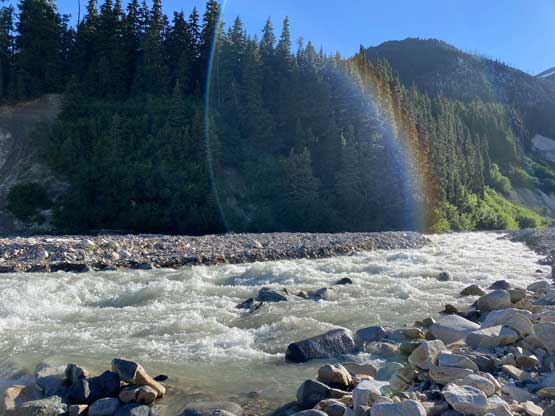
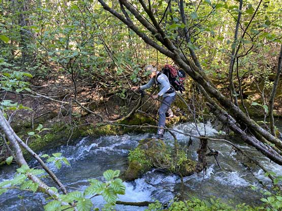
We decided to check GPS every few minutes to make sure we retrace the exact track we took on the way in and also to make sure we did not miss any critical spots. Most of the critical detours were marked by cairns and the trail was not that bad to follow but the worst was yet to come. The worst was the last few kilometers where the river bed was seriously flooded and the last stream crossing was also raging. There was no way to rock-hop that creek anymore and instead of swapping footwear for the sandals we decided to just dip our shoes into the creek and get wet. And because of that we continued dashing down the river bed walking into the streams and not giving a fuck about getting soaked. We actually managed to bypass a good chuck of the bushwhack by dashing down the creek, including one major ford of a rather-major channel at the edge. We then bailed into the forest to find that trail because the fords were becoming sketchy and to find that “trail” we did have to bushwhack. The “trail” was horribly marked on this final stretch with multiple paths going all over the places. We still had to consult with the GPS a hundred times. In the end it wasn’t too bad and the whole return hike took us just over 4 hours with only 1 break in the middle.


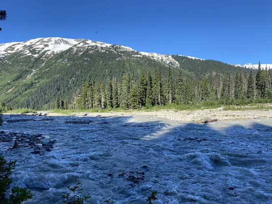


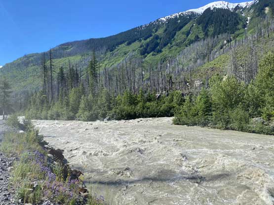
I pushed to make the trail-head transition as efficient as possible because we were still not home-free yet. Driving down Salal FSR was easy peasy but then I started to realize there’s absolutely no traffic on the Upper Lillooet FSR. I stopped a couple times to take photos of the raging river thinking there must have a flooded stretch of a landslide somewhere. There were a few boulders in the middle of the road that I almost drove right into because I was cruising at 60 km/h and wasn’t paying attention. The river did get dangerously close to the road’s level but the road itself wasn’t flooded and in the end we figured out what happened. Right before coming to the junction with the Hurley Road we came to a closed gate. I thought we were seriously fucked but Brayden got out and actually opened the gate. Guess it was just a road closure without enforcement (not locked). The road’s closed because of extreme danger of landslide. I then pushed all the way to Whistler by 1 pm to have a massive lunch in the Splitz Grill before resuming the long drive back home. We eventually got back well before dinner time and I actually managed to punch out a good part of Mt. Ethelwead’s trip report before going to bed. The night was stupidly miserable because there’s no AC in my apartment. The temperature gauge’s approaching 29 degrees right now and I’m thinking to actually go somewhere and get a hotel room. If it’s not the case tonight it’ll definitely be tomorrow night.