Mount Maccarib
June 30, 2013
2749m
Jasper – Tonquin Valley, AB
Mt. Maccarib was high on my list during the past winter/spring, but for some reasons this trip didn’t get realized. Now after completing the ascent, I’m very glad that I didn’t go here in winter. Maccarib Pass is a popular winter destination, but getting up this mountain is definitely not a walk on one’s skis/snowshoes. Our primary objective of this trip was to explore Mt. Clitheroe, but to get there we would go over the summit of Mt. Maccarib. As the July long weekend came closer, the temperature forecast started to get ridiculous. We decided to wake up as early as possible and knock off as much elevation as we could before the sun hit us. The alarm was set at 1:30 am and needless to say I didn’t get any sleep at all, and after a quick “breakfast”, we started our day at 1:55 am from Portal Creek trail-head.
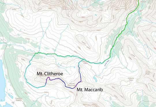
Mt. Maccarib and Mt. Clitheroe scramble route. GPX DL
The next 3 hours or so was simply following the trail with head-lamps on. It was very well-maintained even at a couple rockier sections. After about 300m in we crossed a bridge over the raging Portal Creek. It was definitely more like a river right now. And then it was a steady hike along the side of this creek, for about 1 hour until we crossed another bridge over Circus Creek. With a bright half moon lighting up the sky, we knew we were already at the base of Peveril Peak. The trail then climbs up to its rocky slopes, contours around its slopes, and climbs up and over the broad pass between Peveril Peak and Lectern Peak. At this stage there was already faint brightness showing up behind the skyline. We could see the outlines of all surrounding peaks and it was such a peaceful environment. To our surprise, we still hadn’t encountered any mosquito yet. It also started to get very hot once we left the valley floor. With no sun, no bug, and no bush, I even took off my shirt.
By now we’d already done half of the lengthy approach. The trail soon drops quite a lot of elevation back to the creek side. It was frustrating since we knew that we’d gained all of them back on the de-proach under a hot sun (guess we were absolutely right)… Oh by the way, with a creek accompanying pretty much all the way up, I didn’t bring much water. I only brought 1L up and I would rely on refilling. The trail brought us to an area that looked sort of like a campground, but we didn’t venture into to check things out. But this time, we could see our objective right in front us, on climber’s right side. Behind it on its left is the majestic Oldhorn Mountain. From treeline we had two choices. Based on the time, we figured that if we keep following the trail to Maccarib Pass (north ridge route), we’d missed the awesome alpenglow on Oldhorn; while if we cut left to another ridge (southeast ridge), we’d get extremely close to Oldhorn, but we would miss the alpenglow on the Ramparts… We even thought about splitting up but eventually we decided to go for the Maccarib Pass route. The area around here was foreshortening and it took us quite a while to get to the base of Mount Maccarib’s north ridge.
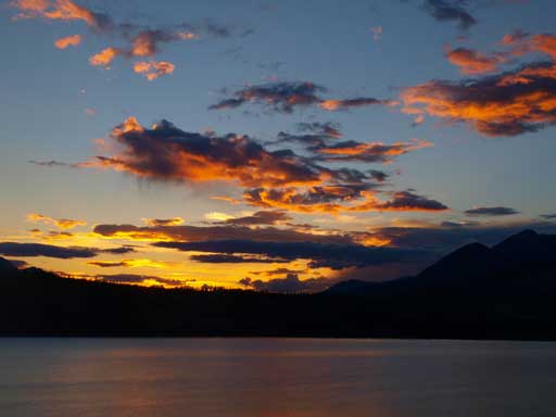
Dusk over Jasper Lake in the previous evening

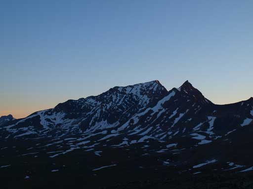
Oldhorn Mountain and its reflection in a tarn near Maccarib Pass
Going up the first big step on the north ridge was proved to be very tedious. The scree was very loose and making progress hard. Near the top there was a short rock band requiring some route-finding, and after getting over this obstacle we were treated with fabulous sunrise view! There IS a reason why we started that early, right?! All the views we got definitely made up for the sleepless night. The rest of the ridge towards false summit is, like most Jasper scrambles, boulder field!! Some boulders provided fun climbs but generally, tedious. And the slope was foreshortened and it took us a long time to get up the false summit.
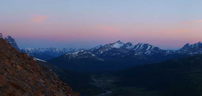
Morning view over Caniche Peak across Tonquin Valley

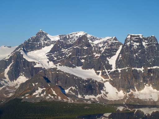
A wider view, showing Mount Clitheroe

Alpenglow on Mount Geikie

The two prominent peaks are Curia and Basilica

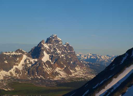
A closer look at Mount Clitheroe
The sun finally fully came out!

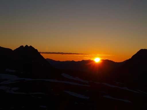
Panorama of sunrise

Panorama looking south

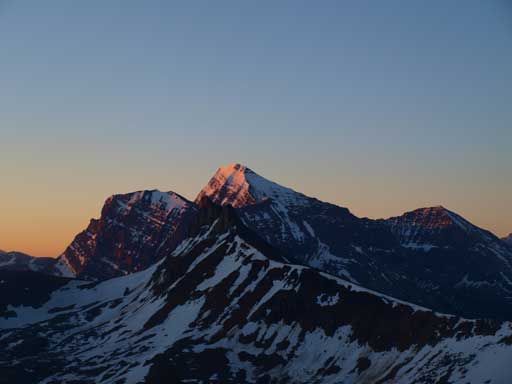
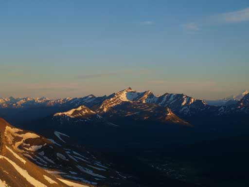
Oldhorn Mountain
Mount Edith Cavell

The Ramparts finally started to show up behind Clitheroe
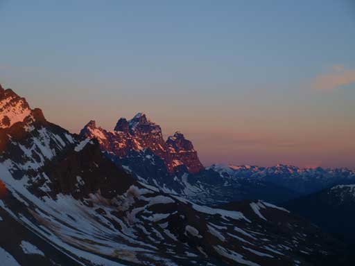
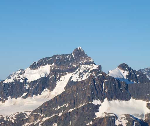
Mount Geikie
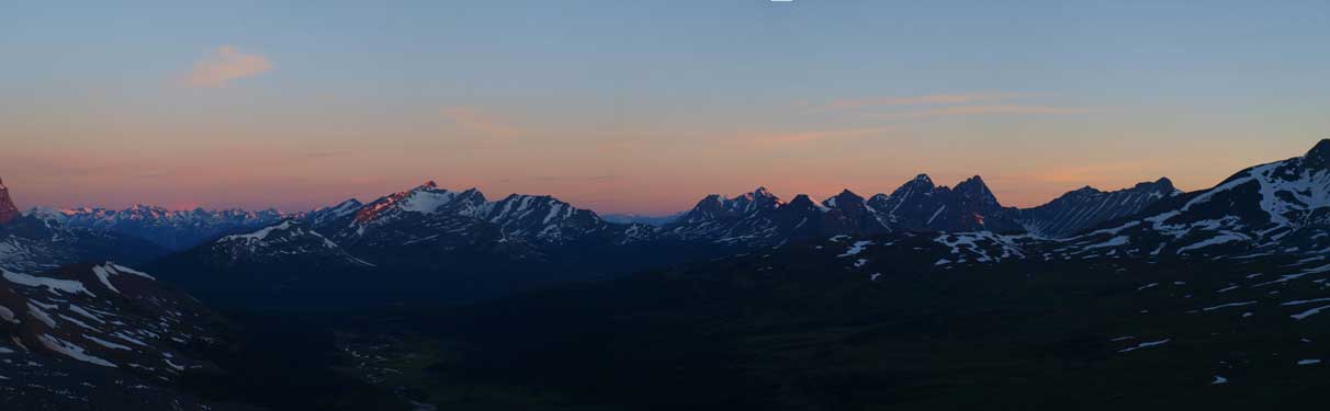
Panorama looking northwest

Franchere Peak and Chak Peak
Majestic Mountain and Vertex Peak

Looking up towards the false and then true summit of Maccarib
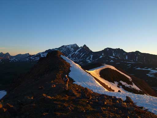
Ben hiking up the boudary ridgeline
Now it’s golden glow on the Ramparts
Golden glow on Caniche Peak

And, on Edith Cavell

Oldhorn Mountain!! Click here to view full size.
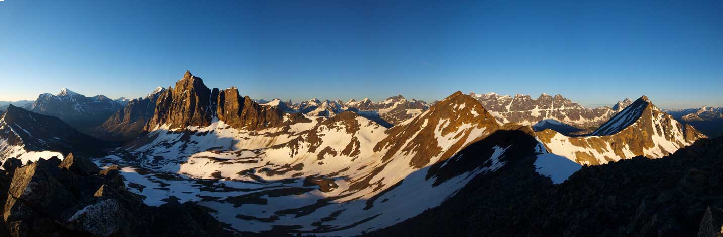
Panorama from false summit. Click to view large size.
The connecting ridge to true summit wasn’t a walk neither. There was one difficult step that could be bypassed on climber’s left side. The bypass would be loose in summer, and very avalanche prone in winter. With snow cover, the direct line would be very sketchy as well, so I probably wouldn’t recommend this as a winter ascent unless you’re very sure about the snow stability. The summit appeared to be definitely lower than Mount Clitheroe, but I don’t know why the official height is actually a few meters higher than Clitheroe’s. We took a lengthy break up there soaking in all the views. This is an amazing viewpoint in the Tonquin Area that I’d recommend to everybody who has some basic scrambling experience.

Traversing towards the true summit

Ben coming up a step

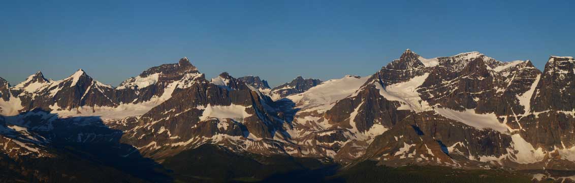
Summit panorama. Click to view large size.

Oldhorn Mountain
The sea of peaks towards south
Mount Erebus on left; Mount Fraser on right
Mount Geikie
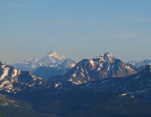
Mount Robson was clearly visible!

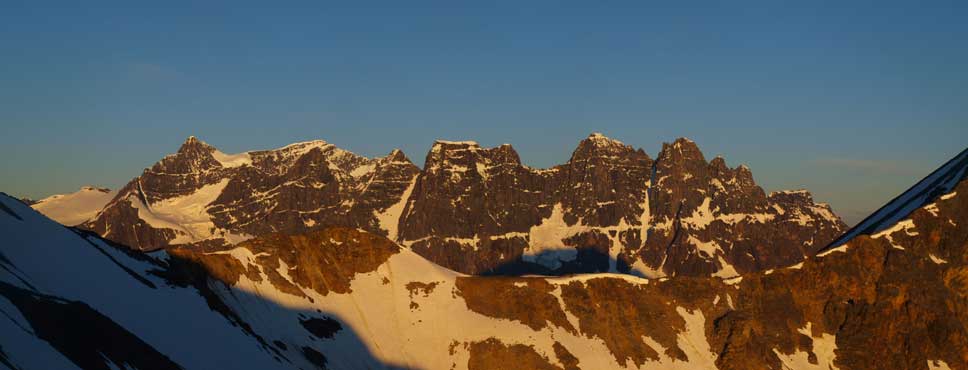
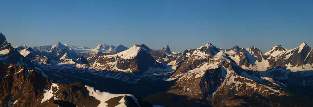
Panorama of The Ramparts

Another summit panorama, using a different setting on my camera.

Looking deeply south into Hooker Icefield
Mount Erebus
Mount Fraser
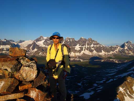
Me on the summit
After having enough of the views, we soon bailed down the west side towards Mount Clitheroe.
