Coffin Mountain
March 9, 2012
2407m
Kananaskis Country (South), AB
Due to the high avalanche risk in most part of the Rockies owing to the snow storm in the previous week, I decided to head south to Livingstone Range. Despite the relatively short driving distance from Calgary, this area rarely sees visitors. The approach road, namely Highway 532, is not paved and is much rougher than Smith-Dorrien Road. And the most important, it’s not maintained in winter. I did manage to drive up with my 2WD without winter tires but luck was on my side as I didn’t encounter a single patch of deep snow otherwise I could get stuck. At the junction of RR 940, I turned left (south) and drove another 7 km to the winter closure gate where I parked and car-camped. The gate is at the southern boundary of Kananaskis Country, so technically Coffin Mountain is located outside K-Country.
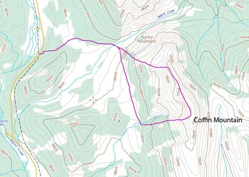
Coffin Mountain scramble route
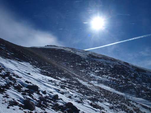
If you come here in summer, the road won’t be closed and you can save 1 hours walking each way by driving further into RR 940. I ascended via NW ridge, which is the proper scramble route. But due to the dead falls, the entire ridge is exposed to the gusting wind… And once breaking the treeline it was beyond crazy. I would say continuing the ascent was risky due to the serious risk of being blown off the mountain. I got knocked off the ground for more than 5 times by the wind.
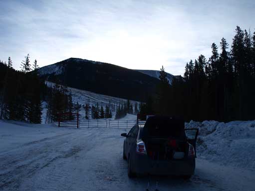
This is where I parked and slept
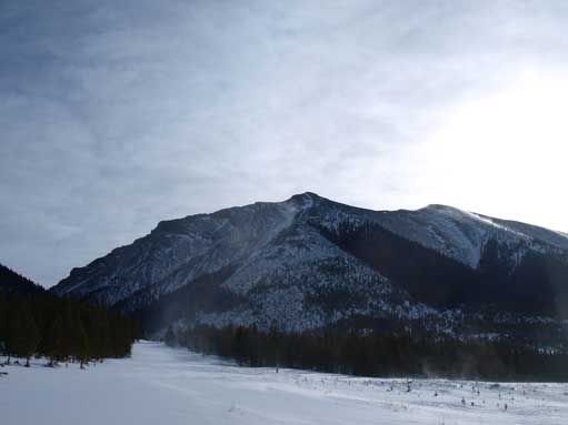
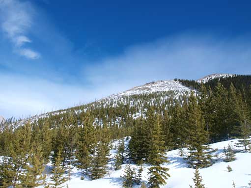
After an hour of walk, this is the view of my objective

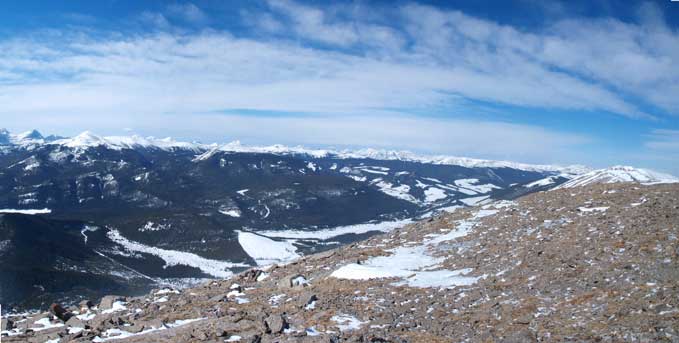
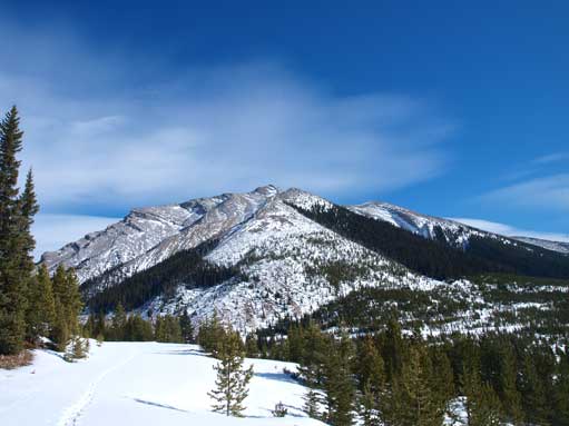
Looking north towards Livingstone. As you can see, it’s quite steep
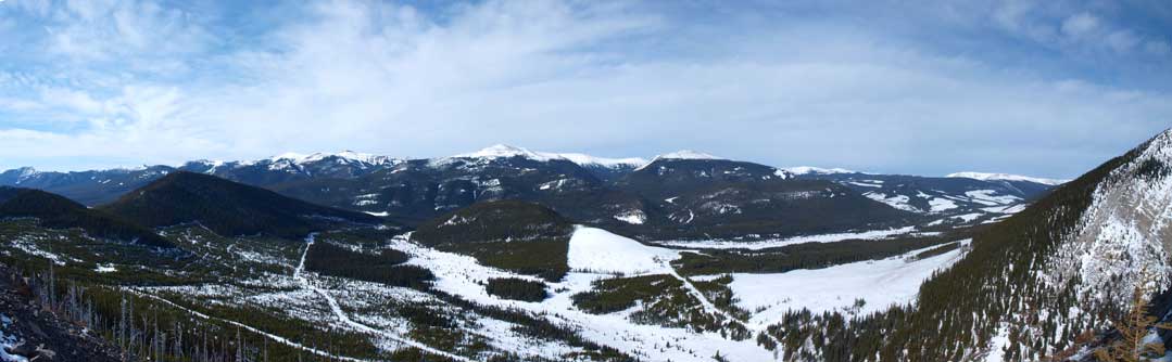
Panorama showing what the clear cuttings do to our mountains
There’s no way I gonna descend the same way (directly facing the wind) as I came, so I had to use an alternate descent route based on my early observations. Near the summit, I got knocked off and blown towards the edge… Thankfully I wasn’t too close to it. By the way, I’m not sure if the other side is cliff or just steep scree slope, because I never got too close to the edge to check it. It might not be a cliff sine you can traverse to Sheep Mountain from here. I stayed at least 5 meters away from the edge, so there’s no good photo of the prairie side… Well, staying alive is more important than taking a nice summit panorama though.

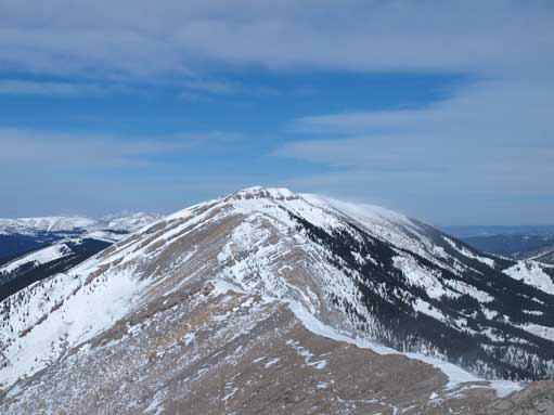
I traversed underneath the false summit. This is looking towards the true summit

This area is a bit wind sheltered
The true summit
Saddle Mountain (not to be confused with the more popular Saddle Mountain in Lake Louise. This one is in South Kananaskis)
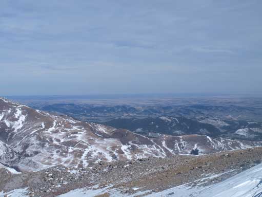
The only good photo I got towards the Prairie
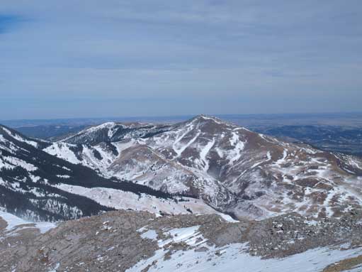
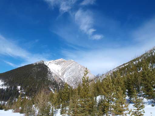
Mount Livingstone

Panorama of RR 940 valley, and High Rock Range behind
Another long photo from the summit
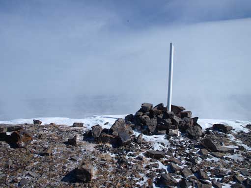
The summit cairn. The other side was a pure white due to the blowing snow…

And this shot from the summit. Oh the chinook!

Zooming-in towards Crowsnest Mountain
Descending from the summit to treeline was the worst part of the trip. Although my descending direction is towards SSW, which is only partly against the W wind, it was still almost practically impossible. The good thing was it’s not too far down to the treeline, and the temperature was all above freezing. Or it would be a survival thing rather than recreation. And once hitting the treeline, the snow got all the sudden to waist deep. Thank god again I brought my snowshoes up with me rather than leaving it at the bottom of the ascending ridge. Or it wood take me infinite time and energy to get down. Plunging step down with the snowshoes was not too bad, but on the other hand, it would be practically impossible to break trail all the way up with this unsupportive snow. That is, I couldn’t reverse my descent and ascent lines.
On the way down. The snow is quite steep

Walking back along another forestry road. Livingstone in the background.
Beautiful afternoon

I had to break-trail on this forestry road, on snowshoes
I took the left skyline up
Mount Livingstone
Looking back towards Coffin

Walking back along RR 940. No other peaks on this day.
A good lesson for this day: do not go to Southern Rockies when chinooks are howling. Under this condition, I decided to leave Mt. Livingstone, Saddle Mountain, and Windy Peak for a summer day when the wind is not that crazy. And the next day, I bagged the smallest “summit” in that area, Indian Graves Ridge.
