South Twin
May 7-10, 2015
3580m
Columbia Icefield, AB
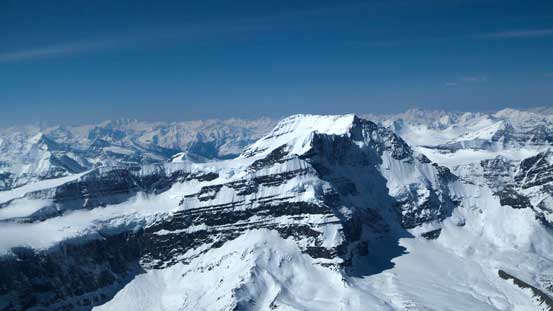
The Twins are a cluster of 4 11,000-foot peaks guarding the northern boundary of Columbia Icefield, towered only by the nearby Mt. Columbia and Mt. Robson to the North. While the highest in this group, North Twin, is a straightforward ski ascent, the other three all require some steep and exposed snow climbing to reach their summits. In the ‘average’ conditions, South Twin is the most technical among the four. After attempting it twice in the past few years, Vern managed to gather a very hardcore peak-bagging group (Vern, Ben, Kevin Barton, Anton Baser and myself) hoping to have a redemption on this lofty summit in the weekend of May 7-11. Thankfully weather aligned perfectly for us (I would say it’s actually a miracle) as a high pressure ridge was building over the interior of BC. But too bad Anton had to bail at the last minute leaving only Vern, Kevin, Ben and myself heading onto the Columbia. The aggressive plan was to bag all peaks on the Northern branch (4 Twins, 2 Stutfields, Cromwell and Kitchener) in a 5-day period. For me myself South Twin was the #1 priority, Twins Tower was the #2 and everything else would be bonuses.
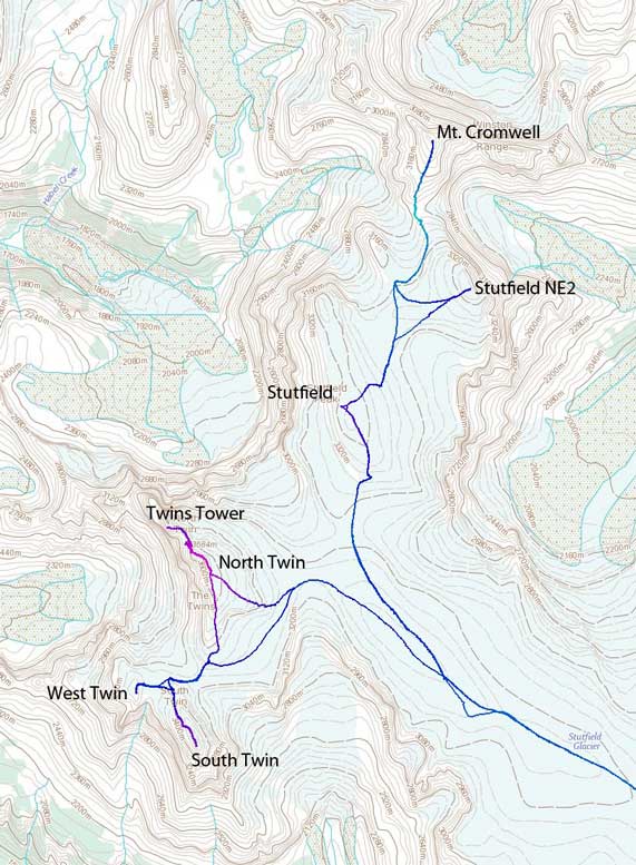
The ascent routes for Twins, Stutfields and Cromwell. GPX DL
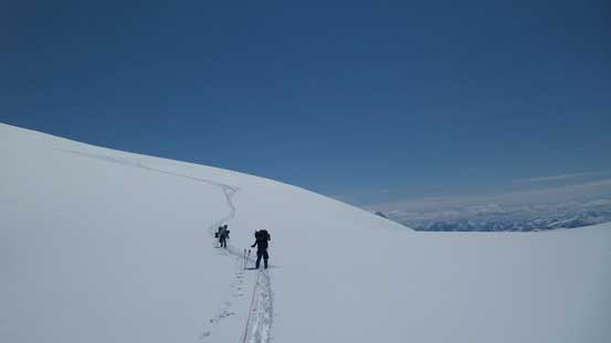
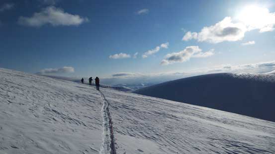
As any other trips to the Northern branch of Columbia Icefield, the task for Day 1 would be simply getting as close to North Twin as possible. The purpose is simple, to shorten the summit day(s). The weather was the most questionable for our first day (Thursday) but when everybody gathered together at the tourist parking lot by Athabasca Glacier, we knew it’s going to be a bluebird day ahead, at least for the morning anyway. Too bad the road leading down to the lower parking lot was still closed so we had to walk an extra kilometer or so with skis strapped on our packs (that was HEAVY)… The ski up to the first icefall went uneventful and we roped up there, then ascended the “slight variation” up the 2nd icefall on climber’s right side which we discovered a couple weeks ago, cruised quickly underneath Snow Dome’s serac zone, and then followed a well-set skin tracks up the Ramp and onto the Neve.

Vern approaching the toe of Athabasca Glacier, with alpenglow on Snow Dome behind

Apparently it’s going to be a sunny day ahead!!
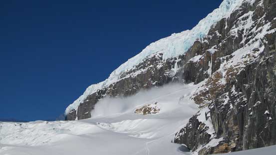
Witnessing serac fall on Snow Dome. Yes, we’re still going underneath it…
Ascending a slight variation up the 2nd icefall

Following a well-set track up the Ramp

Ascending the Ramp
And, onto the Neve
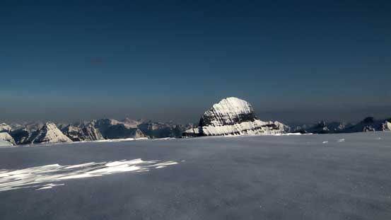
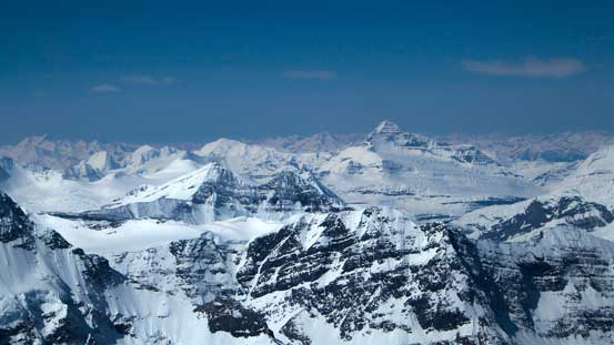
It’s unfortunate that the previous parties were all going towards Columbia so we’d have to break our trails from here on. And thank to the recent heavy snowfall the trail-breaking duty was tough as we slowly worked our way up climber’s right through a slight depression zone. Upon both Bryce and Columbia starting to show up on the horizon we trended right and ascended along a rising traverse line, contouring around Snow Dome following our GPS tracks. This part was the most confusing and without a good track it’s difficult to tell how much height we had to gain. We still ended up getting too far up on Snow Dome and had to drop about 50 vertical meters or so to the base of Kitchener.

Started to see the mighty Mt. Columbia which we bagged 3 weeks ago..

Our objectives finally came in view. Still a long way to go…
Losing some height after contouring around Snow Dome
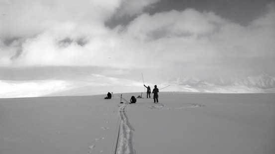
By this point both Kevin and I started have gear issues as those wet and sticky fresh snow started to ball under our skins. As a result our pace was significantly reduced to less than 2 km per hour… This lasted for the next few hours until the CSMC group behind caught us up and shared a bit of trail-breaking. Checking our GPS’s apparently we still had ~4 km to the base of North Twin but we were slowly running out of daylight time and energy, and weather was also moving in. After another half an hour’s slog the other group called a quit and 200 m further, at 13 hours into the trip, we also decided to drop our packs and set up camp. This would leave about 2 km one-way distance to cover on our summit days but oh well, better than setting up camp in a blizzard anyway. As usual for winter trips, the camp set-up was nothing trivial. Too bad weather was really moving in but good news that we managed to set up the shelters quickly enough. Half an hour later it was a full-on blizzard with heavy snowfall and very strong winds. We ended up having to cook dinner in Kevin’s mega mid which was actually quite tight to fit 4 people in…

Ben took over the lead since my skins were balling with snow like crazy…
Just before weather moving in we decided to set up camp
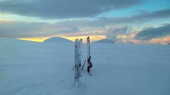
The storm sort of passed by. We got some nice sunset colours

Our camp with our objective behind
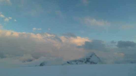
One more picture at sunset time. The clouds were lifting up and our spirit was high.
The snowfall was heavy and wind was howling all night long and by the time we woke up, though crystal clear, we figured it’s probably a better day to grab the Stutfields and Cromwell. This would give 1 day for the snowpack to settle as there’d be some very aggressive terrain on the Twins. We wanted to get all of them in one shot if possible so leaving them for the Day 3 would be a better idea. So off we went for Stutfield Peak, Mount Cromwell and Stutfield NE2. That’s a long day and 13 hours later we made back to the camp with the sun slowly setting over the horizon.
Mt. Bryce in its glory
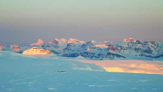
Forbes, Lyells and Alexandra on glow, with Castleguard in front. The CSMC camp is also visible

Panorama at sunset time of Day 2. Click to view large size.
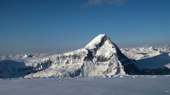
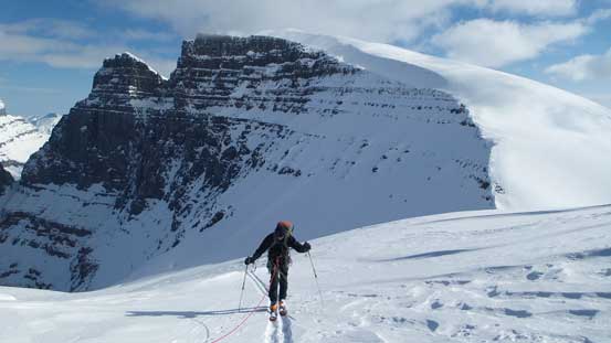
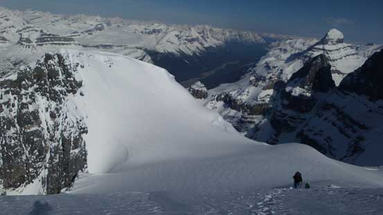
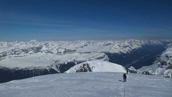
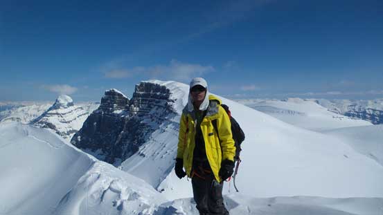
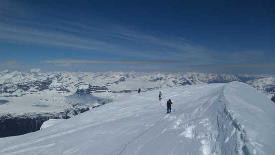
In the morning of Day 3 we woke up under clear sky again and thankfully the wind had died down a bit, so off we went towards the Twins. Our sequence was to ascend South Twin first, and then Kevin and Vern would wait for Ben and I tagging West Twin. Then Vern would ski back to camp solo while Kevin, Ben and I would ascend the south ridge of North Twin, descend to Twins Tower, re-ascend back up North Twin and then ski down the direct face to our up-tracks. For our first objective we’d take a rising traverse line contouring around the south slopes of North Twin, resisting to gain more height than necessary. The traverse was not as steep as it looked and also thank to the fresh snow, ski crampons were not needed on this particular day. By the time we reached the S. Ridge of North Twin we were about 100 m above the col. We removed skis and shortly after we were at South/North col.

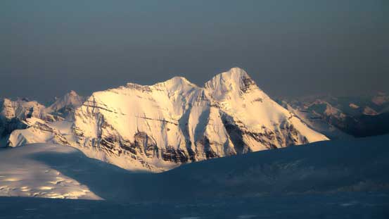
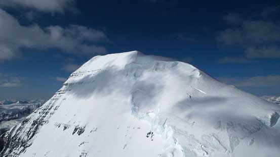
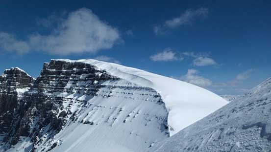
Alpenglow on South Twin, our objective

Alpenglow on Mt. Columbia
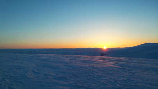
Gorgeous sunrise over the Eastern horizon
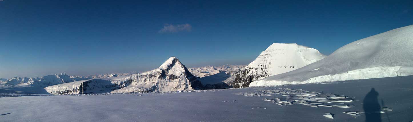
Mt. Columbia, South Twin and the traversing bench on North Twin. Click to view large size.

North Twin will be our 3rd objective in this day
Started to see Mt. Alberta over Stutfield Col

South Twin again – what a beautiful mountain…
Mt. Columbia again
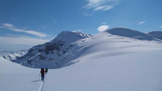
Ben, Vern and Kevin skiing over the 3300-meter rounded bump
And, onto the traversing bench. As you can see, it’s not that steep.
Ben, Vern and Kevin following me on the traversing bench
South Twin started to look bigger!!
West Twin doesn’t look quite big though.
We had to bootpack down this steep slope. Below is ST/NT col
Boot-packing
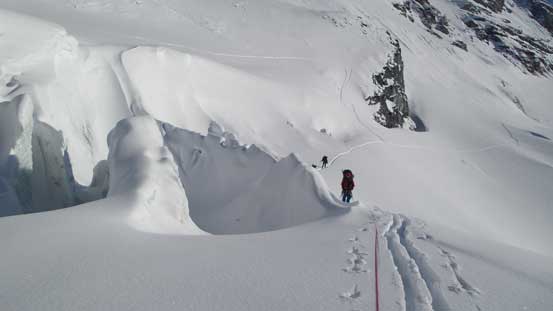
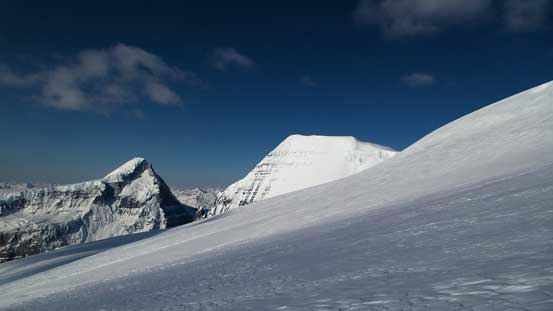
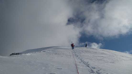
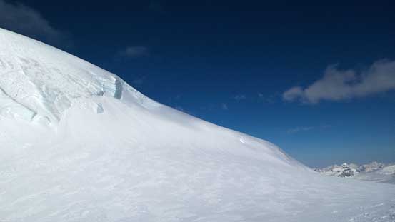
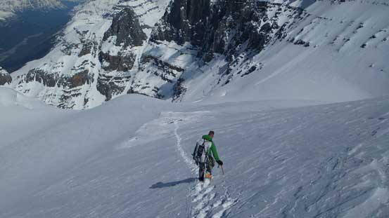
The steepest section on skis was actually the next short while where we had no choice but ascending a very steep roll on a rising traverse line, with a huge crevasse near the crest (well bridged on this day) before cresting the shoulder of the N. Ridge of South Twin. After this bit we then managed to skin up for as far as we could to a rocky island. We all ditched skis here and ahead would be that steep icy section as well as the crevasse that Anton fell in 2 years ago. We took a short break switching gears to crampons and two ice axes. Then I led the way up ascending way towards climber’s right to avoid that crevasse which was supposed to be straight ahead. I had to do about 10 steps of front-pointing on hard glacial ice but for the most part there was enough snow coverage. Vern even managed to “French technique” the entire way up so we got pretty lucky on conditions.
Ahead is another steep roll to traverse/asend
Higher up on the shoulder of N. Ridge of S. Twin. You can see the terrain gets steeper

We were almost as high as West Twin now
Kevin skiing to the rocky platform before ditching skis

Looking over the shoulder of North Twin

Ahead is the harder section. It’s a lot steeper than appears in this picture
Just after ascending the icy section, looking back.
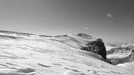
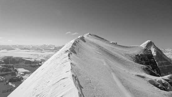
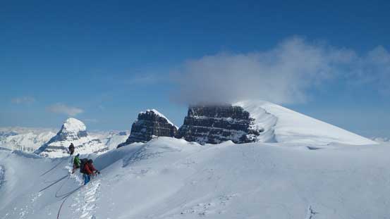
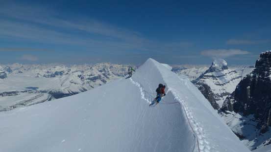
Soon the terrain started to level out and I thought it’d be nothing but a nice walk-up to the summit. I guess I was wrong.. The next short while was indeed nothing but a walk-up but there was lots of crevasses around. I was on lead and didn’t discover one but guys behind me managed put their foot into a deep hole while following my tracks… The ridge was also much longer than I imagined. We were already much higher than West Twin but the ridge just seemed to drag on forever. The final 200 m or so was not easy neither. The traditional route was ascending just to the right of the ridge crest but I found there’s too much post-holing on loose snow (almost waist deep at sections) so climbed to the ridge crest as soon as we could. The ridge was very narrow and exposed towards both sides so after a short while the other guys recommended to bail down to climber’s right again. Thankfully this time the post-holing was tolerable. After negotiating a (sort of) double-cornice by traversing sideways, facing inwards across the slope on climber’s right I had no choice but re-ascending back to the ridge crest. The final 50 m or so we had no choice but balancing on the ridge, and soon after we made to the summit, my 23rd 11,000er!
Terrain suddenly gets mellower, but we discovered crevasses in this section
Ahead would be the summit ridge
Onto the summit ridge now. Narrow and exposed..
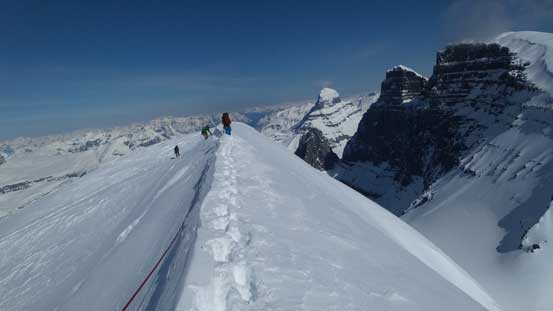
Looking back at Ben, Vern and Kevin ascending onto the crest
Soon we dropped down to the right side as it’s too exposed on the crest
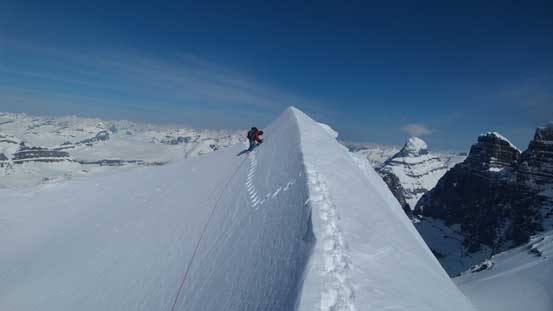
Here’s a massive cornice to negotiate. Ben following my tracks, kicking in while facing inwards

Me, Ben and Vern ascending the final ridge. Photo by Kevin Barton
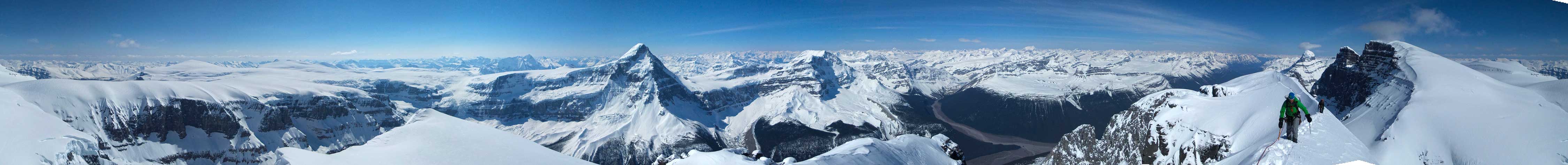
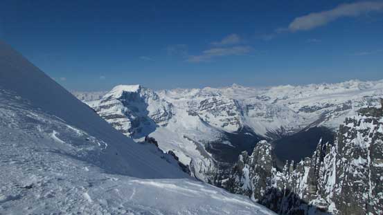
Summit Panorama from South Twin. Click to view large size.

Vern and Kevin approaching the summit of South Twin. This is Vern’s last “Twin”
Mt. King Edward is another giant
Tsar Mountain in the far distance

Mt. Shakleton, Tusk Peak and Mt. Clemenceau dominating the skyline

Mt. Alberta

Looking North towards Blackfrairs Peak and Catacombs Mountain

What a view of the N. Ridge of Mount Columbia!!
Me on the summit of South Twin
The celebration was short-lived as we all knew it’s going to be a long day ahead if we wanted to climb all 4 Twins. On the way back Kevin recommended us to stay roped up which was safer (as one guy fell to one side the others could jump to the opposite side to arrest the fall), but also much slower. After passing that crevasse we discovered on the way up we unroped. We all managed to “French technique” that icy section on the way down.
Traversing back across that cornice

Looking back on the summit ridge
Easier terrain for a while

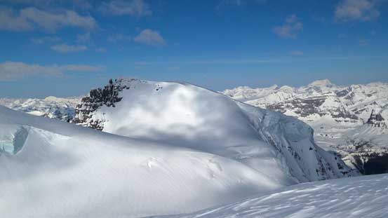
A zoomed-in view of Twins Tower – our last objective
The S. Ridge of North Twin looks like a pure slog…
Vern descending the icy and steep bit just above where we ditched skis

Kevin descending the icy bit
At this point we were slightly behind schedule. I could see Kevin was tired and Ben was not super keen on bagging all 4 in one day neither. But I was high on motivation and energy so I knew if I wanted all 4, I’d have to kill West Twin for as fast as possible. So I quickly switched gears and ski’d down to the bowl between South Twin and West Twin, without taking any necessary break. And the day continued with ascents of West Twin, North Twin and Twins Tower.
While Mt. Columbia and North Twin are higher in elevation, I would say South Twin and Twins Tower are the actual crown jewels of ski mountaineering on the Icefield. Their exhilarating summit ridges, the challenging snow/ice climb as well as the complicated approach make them much more rewarding than simply tagging the geological apex. This is a highly recommended objective for experienced ski mountaineering party. You’ll need a solid weather window, good snow condition, your time off work and the most important, strong and tough partners lined up perfectly at the same time. On top of that, you’ll also wish luck is on your side (no crevasse fall, etc..).
