Mount Martin
November 23, 2022
1746m
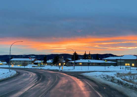
Kamloops / Monte Creek, BC
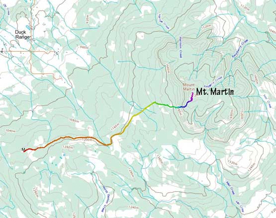
Mt. Martin is one of the many prominent peaks that locate between Kamloops and Salmon Arm but this one might actually be the most obscured among those. Logging roads do not extend onto the summit plateau and the area is highly subjected to private property issues and on top of that, we couldn’t find “beta” on the internet. Matt J. had been studying this peak for a while and proposed a few route options. I thought the western access from Duck Range made the most sense but those roads were very likely to be private. We eventually made an agreement on the road system a few kilometers further south and we learnt later that this is “Martin Mountain FSR” with a sign near the entrance. [Later at home we learnt that GoldenScrambles.ca had ascended this peak in Feb. 2021 but via a different route.]
I happened to have this week’s Wednesday available for a full day and the weather suggested us to drive far to the east. Matt had 4 “P600m” objectives pointed out and we prioritized on Mt. Martin as this seemed like one that it’s better to tackle in a team. The secondary purpose of this trip for me was to reunite with the fatbike that had been sent out to Matt’s bike shop for maintenance. The trip itself wouldn’t require a bike but I needed the bike for some other trips planned in the near future. I swapped vehicle with my parents and drove north on Tuesday night to sleep in Matt’s house. I needed the Tacoma to be parked in Matt’s home as I could not transport the bike in the small ass Corolla. I didn’t manage to arrive at Matt’s house until midnight but I did manage to get a couple hours of sleep. Matt woke me up at 2:45 am and we subsequently left North Vancouver about half an hour later.
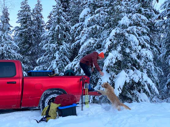
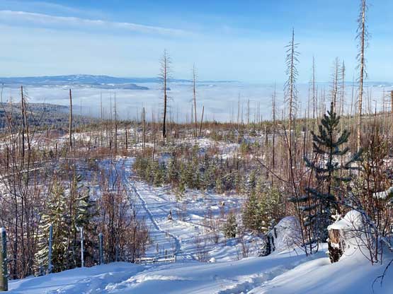
The drive northwards up the Coquihalla Corridor was as horrible as it could get. We somehow picked a day immediately after some major snowfall event and the condition was a combination of black ice, compact snow and fog. Even Matt couldn’t drive much faster than the speed limit so we only got to Kamloops a few minutes quicker than Google’s suggestion. There was a lot of fresh snow even in the city of Kamloops. We chose to have a luxurious breakfast in one of Matt’s favourate restaurants before proceeding eastwards towards Falkland past Monte Creek. The logging road started from “Hanna Road” that quickly led to someone’s house and thankfully there wasn’t a gate nor any aggressive signs of “private property” so we proceeded on. This Hanna Road soon turned into “Martin Mountain FSR” and luckily we had fresh set of tire tracks to follow. Without these tire tracks we would have to park soon and that would turn this hike into a mission. Whoever came prior to us had done an excellent job. The combination of the existing tracks, Matt’s excellent winter driving skills and his monstrous truck with aggressive tires we managed to dispatch 5 km distance and 500 m elevation gain up the mainline and parked at a convenient spot to turn around. The fresh tire tracks had stopped and we didn’t want to risk getting stuck in the deep snow.
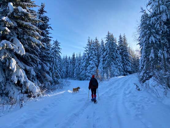
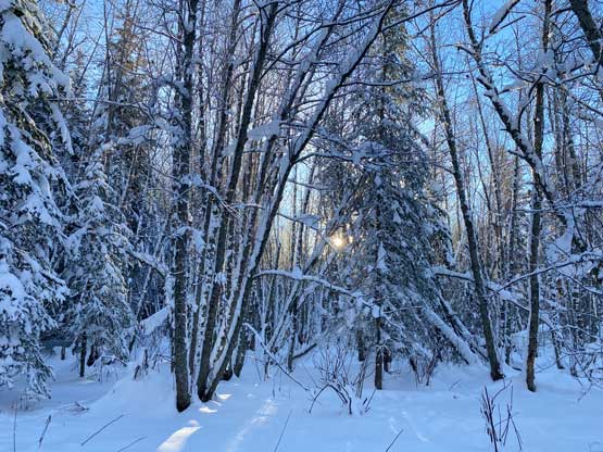
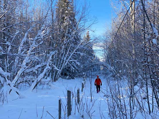
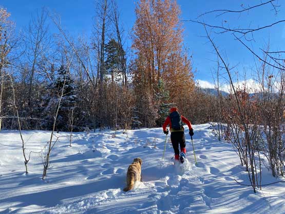
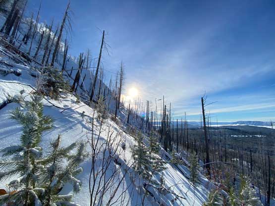
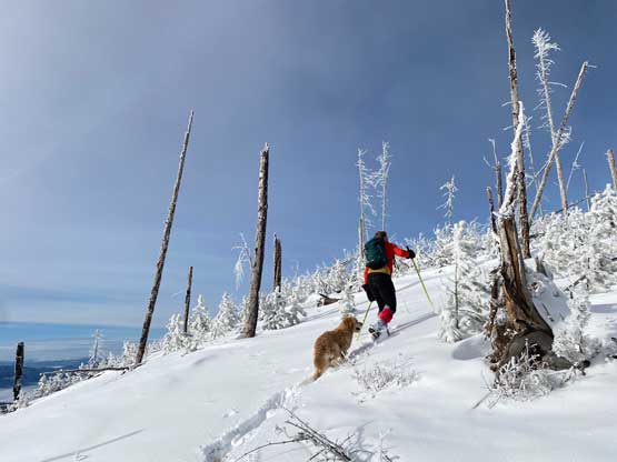
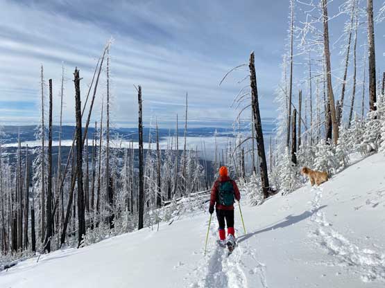
The snowshoes were strapped on immediately from the parked truck. I had brought a shit ton load of gears including two pairs of snowshoes and at the last minute I decided on the 30′ version. The old tire tracks continued further along the road but we were about 7 km from the base of the objective and had those tire tracks stopped we would be in for a mission of trail breaking. It turned out that the old tire tracks continued all the way to the base of Mt. Martin so in retrospect the women’s 25′ version might actually be the better choice, but we didn’t have these information on the first hand so I must pick the most robust option. Snowshoeing inside the tire tracks proved to be awkward for the large snowshoes as the tire tracks weren’t very wide. The solution was to make big forward steps but doing so for kilometers was tiring. It’s also worth noting that we didn’t actually need to do much additional elevation gain on the road (100 m gain in 6-7 km distance) and the plod was very monotonous. Right before crossing another cattle guard with a fence Matt made the decision to short-cut a major switchback using the fence line. I wasn’t keen as the satellite images were very “green” suggesting bushwhacking but I reluctantly agreed, thinking it couldn’t be that bad anyway. It turned out that the bush was either not dense at all, or was partially covered in the snowpack. We joined a smaller road at 1300 m elevation and followed it eastwards to the base of our objective.


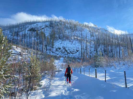
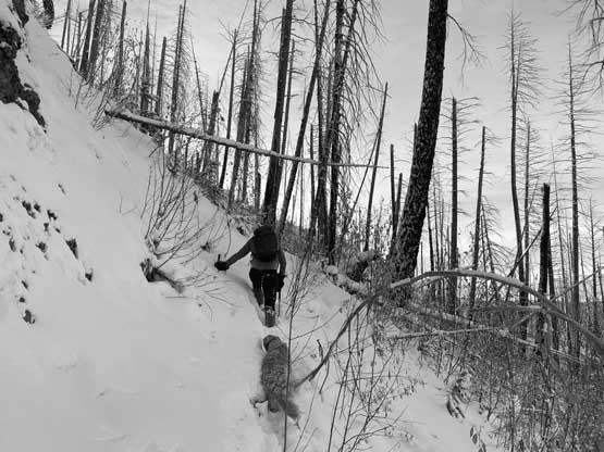
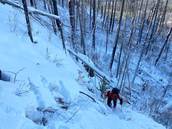
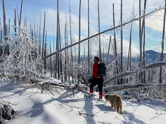
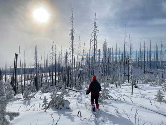
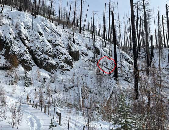
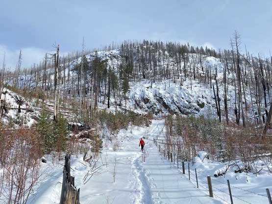
The western slopes of Mt. Martin seemed to be steep and cliffy from satellite images and they sure are. I anticipated that we might have to ascend some bushy gullies to break through the cliffs but Matt wanted to take the ribs instead. The crux was actually to gain the rib at the beginning where we must tackle a zone of 45+ degrees covered in thin snow. This section had put our snowshoes and our skills in test. I’m sure there are easier ways around but we were too lazy to figure that out. We actually tried to traverse out to the right but the terrain was chocked with pick-up sticks so it wasn’t that easy to traverse around. So we climbed straight up instead and it worked. After a while the terrain eased off but remained insanely steep for at least another 100 m elevation but eventually petered out. We took a long break to gather some strength. Matt then took the lead charging through some mangled mess of dead-falls. At times we were balancing from log to log 2 meters above the ground, with snowshoes on. Thankfully that kind of craziness didn’t last long. After ascending onto the “plateau” SW of the summit we still had substantial amount of pick-up sticks to content with and the final kilometer seemed to drag on for a long time.

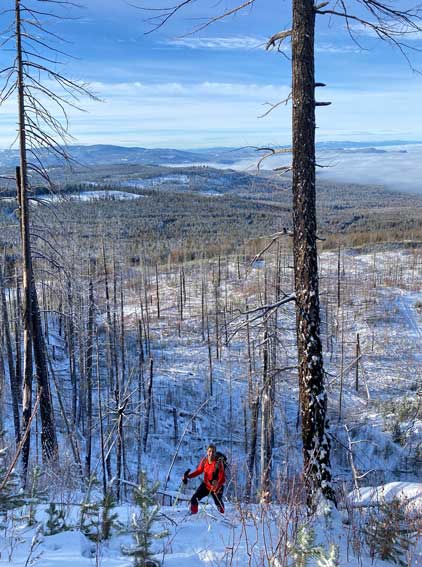


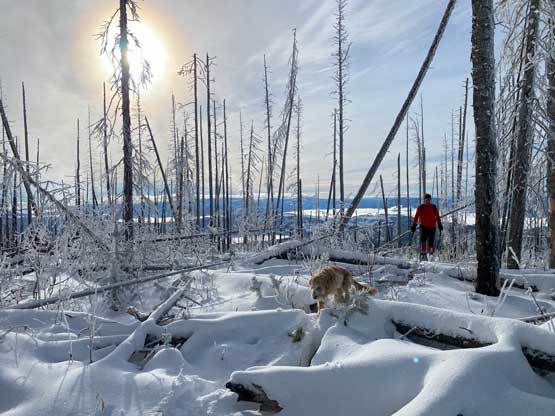


Even the summit itself was a plateau-ish area covered in dead-falls so we didn’t linger too long. It’s also apparent that we might not have enough time/energy to tackle a secondary objective so I didn’t rush too much on the descent. Wearing that 30′ snowshoes made the descent particularly awkward as the snowshoes kept catching anything that stuck out of the ground. Above the steep zone we both took the snowshoes off and I even put the crampons on. Matt opted for his slip-and-slide method while I gingerly down-climbed the zone facing into the slope. I didn’t bring an ice axe so I took my time there to make sure I wouldn’t slide into some poky sticks. Once putting the snowshoes back on the rest of the job was as simple as to put one foot in front of another but man the descent dragged on for a long time. It was only 6-7 km of plodding but the view was very monotonous.


We finished the hike at 2:30 pm and drove out of the snowy FSR half an hour later. We decided against bagging a secondary objective and went straight for Kamloops for more food. I’m glad we forced in an early dinner as minutes later we learnt the Coquihalla Highway was closed due to a “politics incident”. Instead of waiting or to detour through Princeton we opted to turn around and drive to Logan Lake. Matt’s a big fan of the Lillooet area and the Duffey Lake Road so that’s the new plan. Matt managed to drive us down to Ashcroft and then I took over the drive to Lillooet. Matt then pushed the rest of the drive all the way back to North Vancouver by 9 pm. I then loaded my truck up and made one more stop in Elise’s place for more pieces of gears before driving the final hour back to White Rock. I eventually turned in at 11 pm, completely exhausted.