Cerro Moreno
February 6, 2020
1138m
Antofagasta, Chile
Cerro Moreno is a sizeable peak that boasts almost 1000 m of prominence along the coastal line of Antofagasta in northern Chile. It is very visible from the city of Antofagasta and almost appears like an island in its own. Connor and I noticed this peak immediately after entering the city on a bus ride. My Gaia map shows this peak actually locates inside its namesake national park, so even though the map doesn’t show a trail we were confident to reach the summit wouldn’t be a difficult fair. We made a tentative plan to bag this peak on our last day of this trip while relaxing in Antofagasta, and then off to climb Volcán Llullaillaco and Volcán Pili. We got back half a day ahead of schedule, booked a room in Hotel Antofagasta and went for a dinner while briefly exploring the downtown.

Our home for two days – Hotel Antofagasta

A view from our hotel. It’s right on the beach and in the downdown
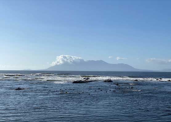
Cerro Moreno from our hotel
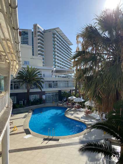
This hotel is quite luxurious
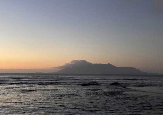
Cerro Moreno at dusk

Night scenery in Antofagasta
Connor did some research in the evening and found multiple sets of GPS tracks. The route was not shown on my Gaia map so we needed more information. In the morning we had a luxurious breakfast in the hotel and then drove to the start of trail using Google Map app. The drive to the trail-head was scenic in its own. The last couple kilometers on the dirt road were technically inside the national park and were gated for motorized access. We however, simply followed a set of tire tracks and drove around the gate. We parked before entering the main canyon system but on hindsight we should have kept driving, as the road actually continued into the canyon for a long stretch before deteriorating into a “trail”. The elevation at the “trail-head” was around 300 m.

Cerro Moreno hiking route. GPX DL

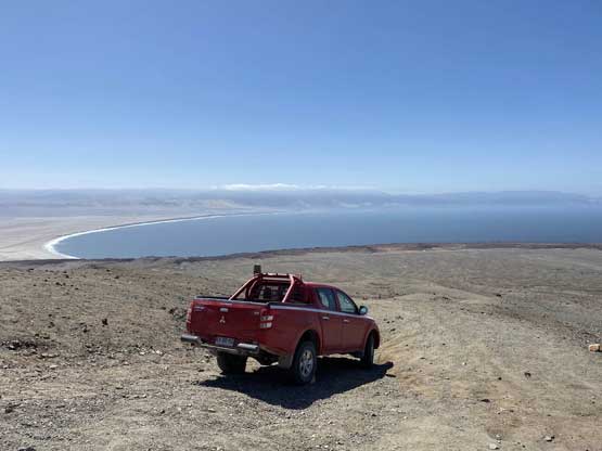
Our rental truck parked at the “trail-head”
We opted to carry only one backpack to save weight as all we needed was some food and water. Given the fact we just spent one month climbing at high altitude we wanted to do some experiment to see the improvement of our cardio capability. Connor led a blistering pace as usual and I would try as hard as I humanly could to keep up the pace. Half an hour later we entered a narrow and steep section in the canyon and the route transitioned into a series of fun, class 2 scrambling steps. The fun stretch lasted for a while but tapered off as we transitioned onto the upper mountain. We got onto a plateau feature and the summit was still over 400 m taller.
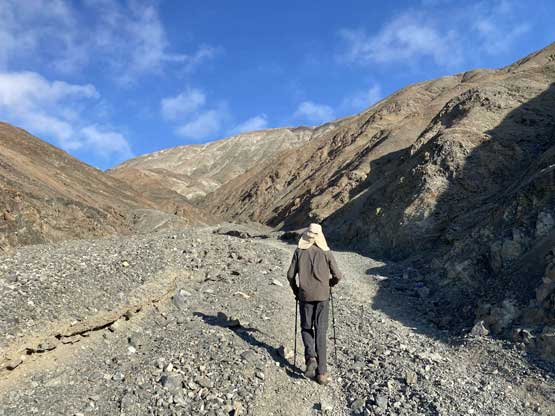
Connor starting the plod up the canyon
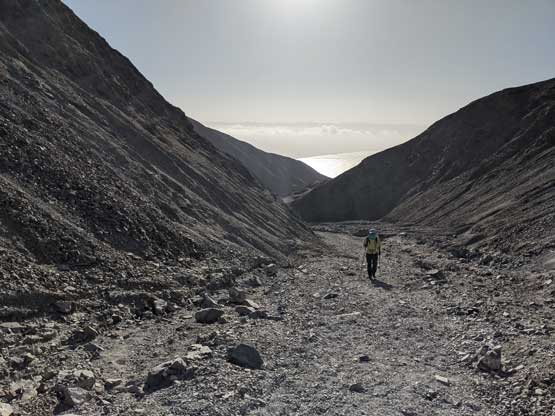
Me plodding up. Photo by Connor M.

Connor higher up in the canyon. Almost at the scrambling section
Past the scrambles we came to the upper mountain.
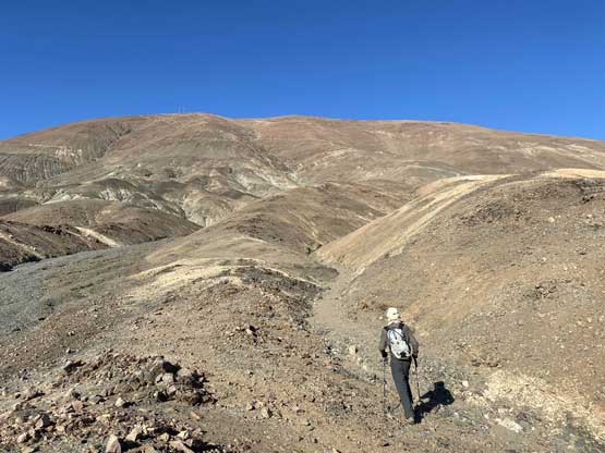
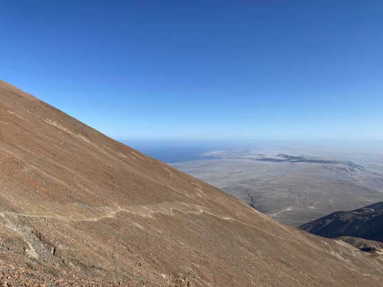
What appeared to be a half-an-hour stroll turned out to be longer than expected. I couldn’t keep up with Connor’s pace anymore so just went at my own pace (still faster than my normal hiking pace at sea level), breathing as hard as I could. Eventually after a few long switchbacks I reached the summit where some facility towers were located. I went down the other side for a short distance for unobstructed views of the Pacific Ocean.

Connor leading the upper mountain on one of the few traverses

Looking back from partway up the slog. Cool desert views
The last long traverse before the summit ridge
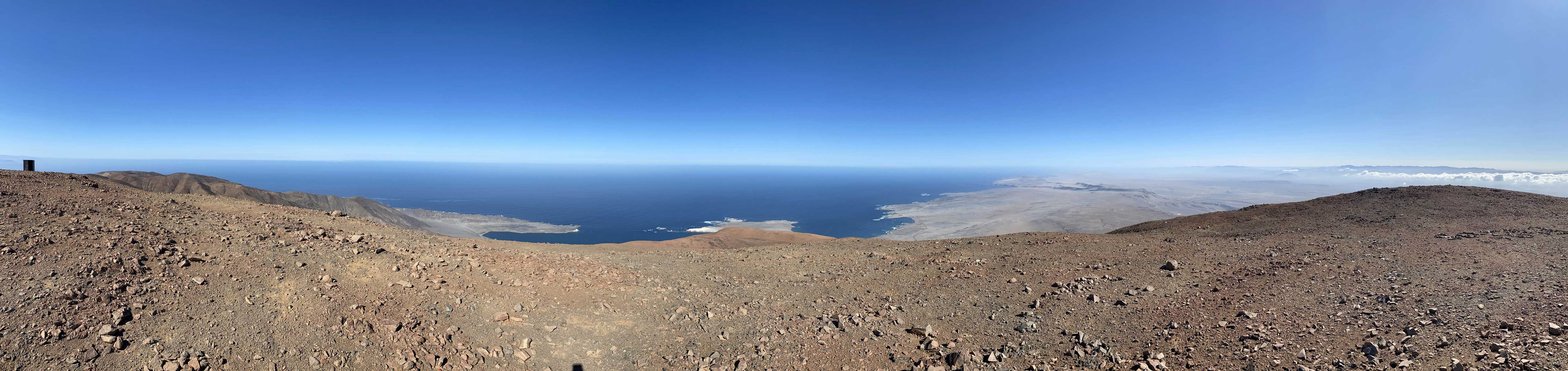
Summit Panorama from Cerro Moreno. Click to view large size.

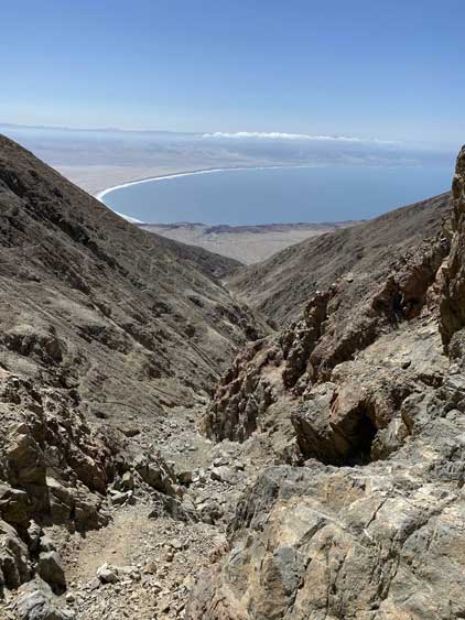
Looking back towards Antofagasta. It was a bit hazy

This is the typical scenery of the desert around here
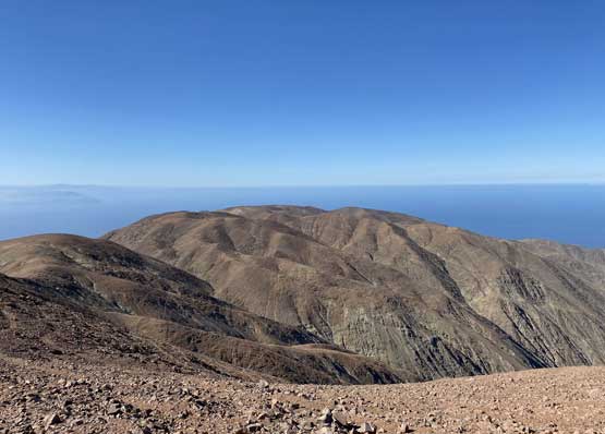
The southern reach of the Moreno massif
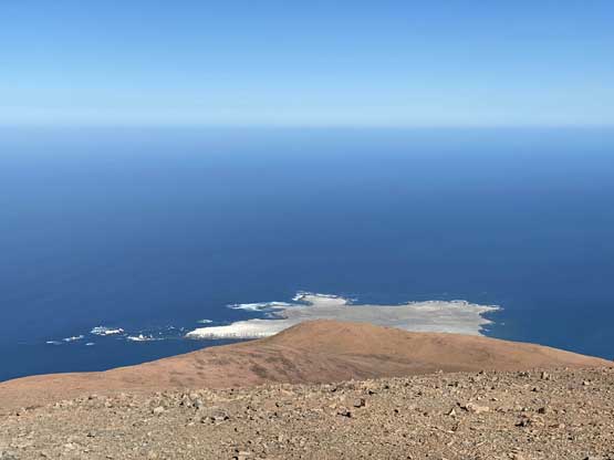
The unobstructed view of the Pacific Ocean

Me on the summit of Cerro Moreno
We lingered on the summit for almost an hour as there’s no point to rush, but eventually it’s time to get down. It turned out that we got down in one single push. The ground was loose and soft for the most parts and we jogged for at least half of the route. I briefly thought about bagging more peaks but nothing seemed “worthwhile” so we decided to drive back into the city of Antofagasta to catch up with work and stuffs.
Entering the canyon

Fun scrambling
Back to the “trail-head”.
The next day would be our travel day to Santiago. The flight was in the PM so we spent the whole morning packing up. Returning the truck proved to be frustrating as we failed to find where exactly to park it. Our Spanish wasn’t good enough to communicate effectively neither so it took a while, but we did figure it out eventually. On the flight to Santiago we once again, had some clear views of the high Andes but those peaks weren’t unfamiliar to us at this point. A couple hours later we learnt that our LATAM flight to Los Angeles was delayed for over two hours and this meant my connecting flight to Vancouver would be screwed up. Thankfully it’s the airline’s job to deal with the mess. We eventually departed Santiago at 1 am and arrived at Los Angeles in the mid morning. I had to go through the customs to retrieve the bags and then bring them to the Westjet and re-enter the airport. It took a while. At 12 pm I boarded the Westjet flight. To my surprise, the right side window seat offered some really good views as we flew over the high Sierras and the Cascade Volcanoes. To sum this trip up, we climbed 5 peaks over 6000 m and all are “ultras”, one “P3K” along the coastline and one bonus dumpster summit, over the course of 30 days. Not a bad introductory trip to 6000m climbing.
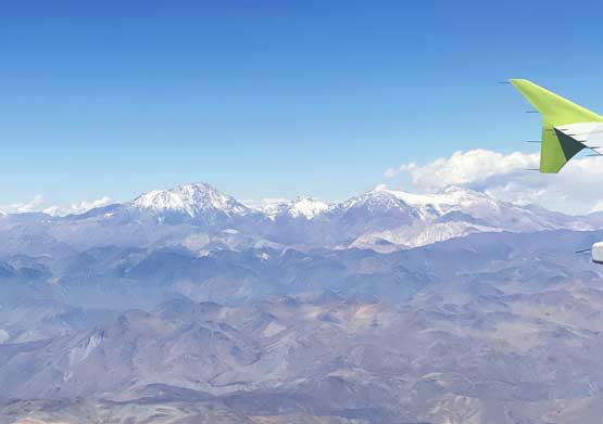
Cerro Mercedario and La Ramada
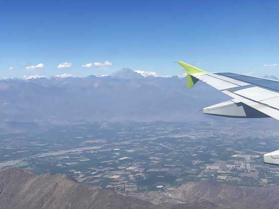
The west face of Aconcagua dominates the skyline

Leaving Los Angeles we got to see the mountains in SoCal

Flying over the crest of the High Sierras. The Palisades at center

Lake Tahoe from air

Flying over the top of Mt. Adams entering Washington state

Flying beside the massif of Mt. Rainier
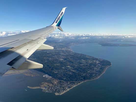
Flying over South Surrey / White Rock where I live in

The beautiful Vancouver.
