Frozen Boot
August 21, 2017
2579m
Harrison Hut / Lillooet South FSR, BC
“Frozen Boot” seems like a funny name of a mountain. Together with the whole bunch of nearby peaks the names were assigned by one or two parties of VOC (Varsity Outdoor Club) when Harrison Hut was built. I’m always curious about what exact scenario led to the creation of this “Frozen Boot” name but I cannot find reliable reference online. In any case “Frozen Boot” is just an insignificant summit on the northern edge of Pemberton Icefield. The access is by some major forestry service roads extending tens of miles up into the remote Lillooet River Valley, still-maintained 4×4 roads up Meager Creek drainage and then a well-constructed Harrison Hut trail. From the Hut a bunch of peaks including the main prize – Overseer Mountain can be accessed in a single day.
The popularity of this area is contrary to the otherwise, extremely remote and inaccessible nature of the upper Lillooet River headwaters. Two factors make the difference – the existence of this well-advertised Harrison Hut, and the fact three of the peaks are included in Matt Gunn’s Scrambles in Southwest British Columbia. For me myself neither of the two is the main driven force. For Adam (Gimplator) the main prize is Overseer Mountain, one of the only few “ultras” in SW BC. By definition an “ultra” is a peak with at least 1500 m of clean prominence. Interestingly to me this is also not the driven force and in fact, I’m just one of the few who bag peaks almost everywhere anywhere. All peaks are on my to-do list and that surely includes Overseer Mountain, along with “Frozen Boot” and a whole bunch of others. Our plan was to approach via Harrison Hut trail and aim to ascend as much as we humanly could over the course of two days.
Driving to the far northern edge of Pemberton Icefield is not an easy fair and to make full use of the 2-day weather window we had to get there in the previous evening and car-camp at the trail-head. This time I volunteered to put some tears on my Tacoma and the truck did not disappoint us at all. This was also my first time ever going “left” after Pemberton, and is, into Pemberton Valley.. The main Lillooet South FSR was bumpy but easy going. The spur road is steep and rough but any 4×4 HC should not have a problem reaching to the trail-head. Recent logging activities had pushed the trail-head even further shaving off about a kilometer of walking. The new parking area seemed like a mess. In the pitch dark I went to scout out the start while Adam spent some time erecting the tent. About 15 minutes later I came back with firsthand beta of the initial “connector” and then it’s time to catch some hours of sleep.
Overseer et al. around Harrison Hut. GPX DL
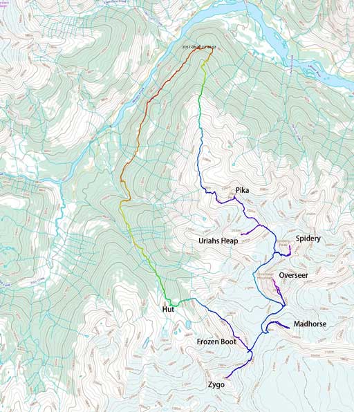
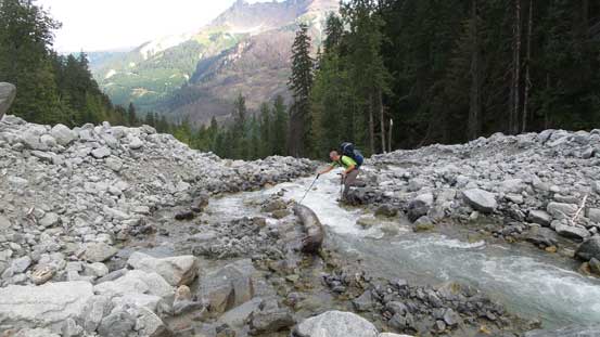
The next morning in a pitch dark we started the approach by head-lamp. After merging onto the main trail proper we had no trouble following the path (as it’s well marked) but the problem came from the massive amount of up-and-downs. It’s not easy to believe but from the parking lot to where the trail rejoins the old logging road there’s about 450 m of gain and 450 m of loss. The topographic map made me believe it’s just a casual morning walk but man was I wrong.. Eventually after descending (yes, descending) a good stretch along that old logging road the trail finally starts to really gain height. The two creek crossings require additional elevation losses. The first one (Pika Creek) was done by boulder hoping and a sketchy log bridge while the second one (Barr Creek) had a partially damaged steel bridge.
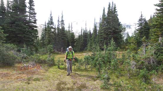
After a long while of undulating terrain this trail rejoins the old road.
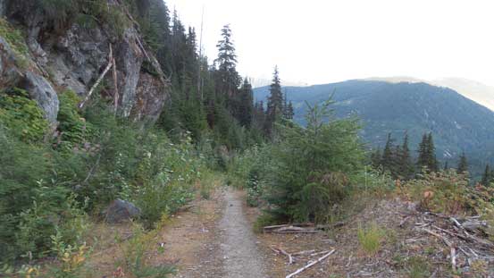
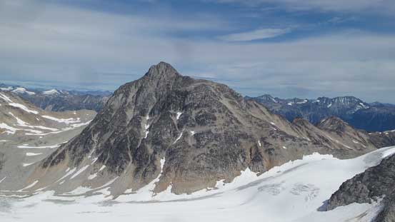
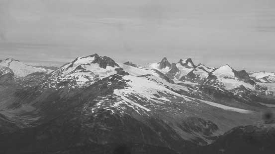
Pylon Peak on Mt. Meager massif
Adam hopping across Pika Creek
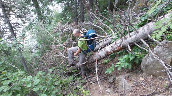
This trail desperately needs more maintenance…
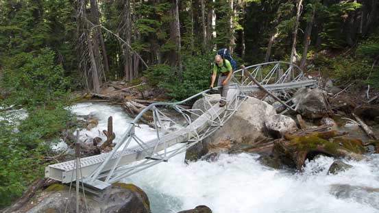
The mangled bridge over Barr Creek. No way to cross had the bridge collapsed.
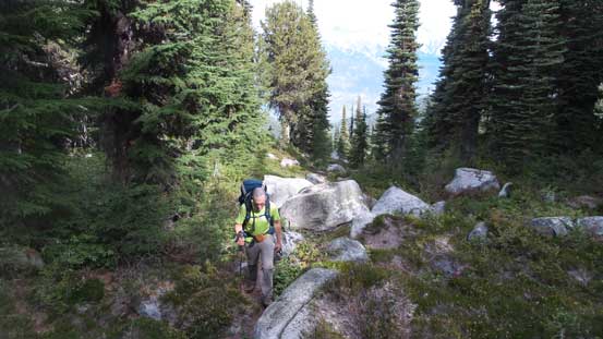
As much as the plod goes after the two creek crossings.
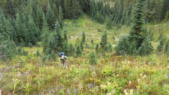
Harrison Hut came quicker than expected. I think some parties reported over 11 hours. It took us under 5 hours but of course that was done on a peak-bagger’s racing pace. We were really motivated to check this new area out so in the forest the only thing I wanted was to plod as fast as possible. We also did not bother to linger much in the hut as it’s simply too low to be used as a base-camp. Our plan was to carry camp up and over “Frozen Boot” and camp high up on Madhorse Glacier. Getting onto the broad NW flanks of “Frozen Boot” required some degree of bushwhacking on increasingly steep terrain. Thankfully we managed to link up grassy openings here and there hence, avoided thrashing the brushes. There’s more elevation gain than expected to crest the broad NW Ridge.
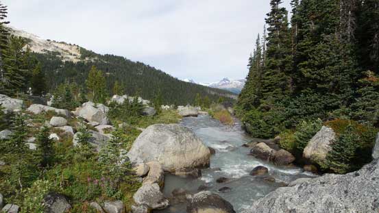
Madhorse Creek near the hut
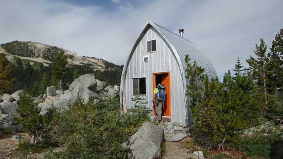
Checking out Harrison Hut
We had no interest in the hut as it’s too lame to stay there as a launching point
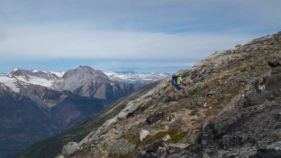
Steep grunt on grass to gain the NW Ridge of Frozen Boot
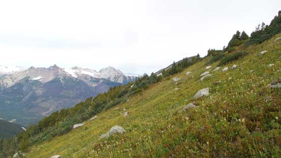
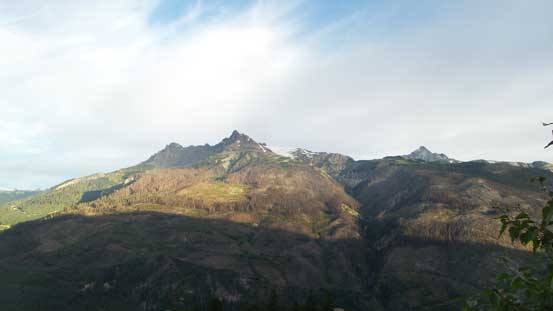
The meadows were neat but the weather was cloudier than we had hoped for
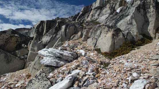
The views were opening up but with the peak in sight we had little time to linger. I was hoping to take a break at some point but we just simply couldn’t find that perfect spot so just kept plodding. The slog involved going up and over or around a couple minor bump and the true summit is always the farthest one, much much farther than you might think. Eventually I think at roughly 100 m below the peak I gave up and took a short energy break.
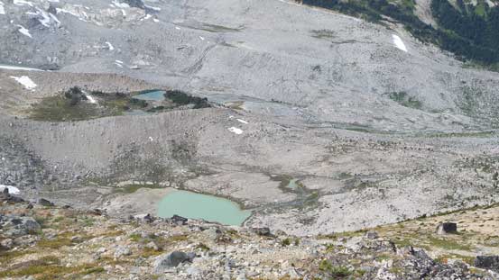
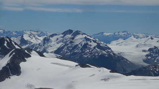
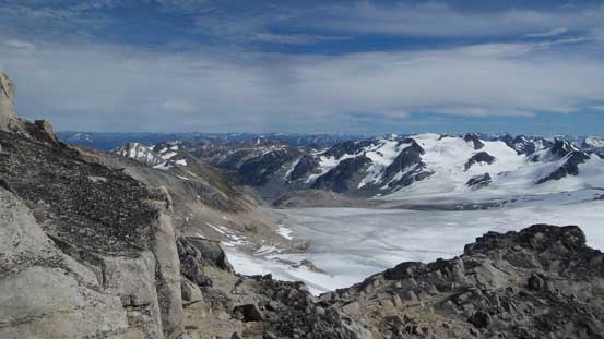
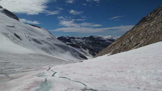
It’s obvious that this valley was once fed up with massive glaciers
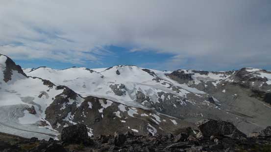
The typical plod along the NW Ridge. Mt. Meager behind
The Three Stooges at center
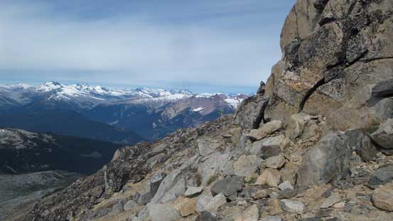
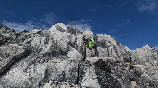
For once in a while we had a band of rock to deal with.
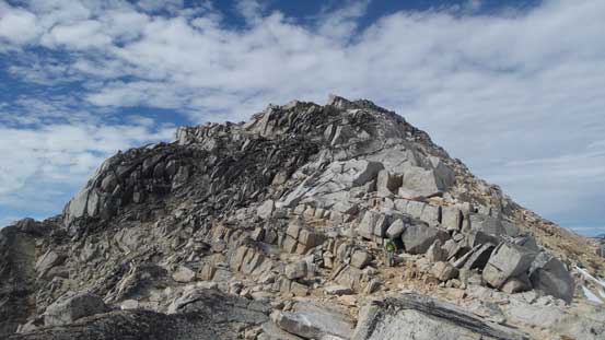
Resuming the ascent the final summit block was getting steeper and more broken. There were a couple big steps and ledges all requiring some 3rd class scrambling but we were also too tired to check out other route possibilities. Attacking from slightly climber’s right (south) side worked out and we soon reached the summit where we took the first (much needed) real break since we stopped in Harrison Hut.
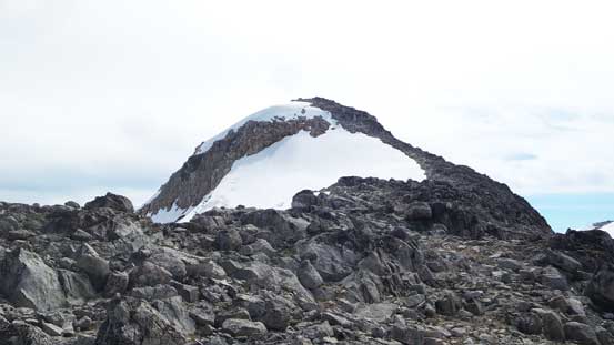
The summit block was finally in sight.
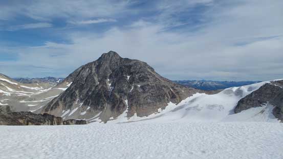
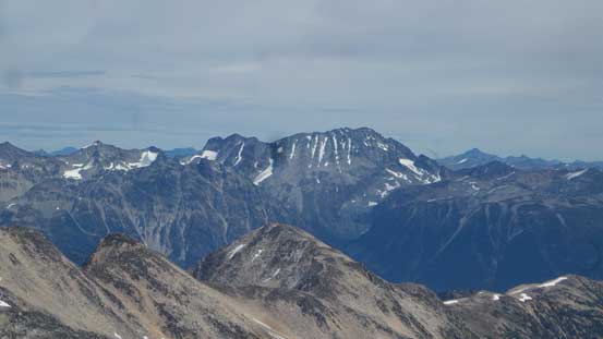
Great view of Overseer Mountain – our main objective
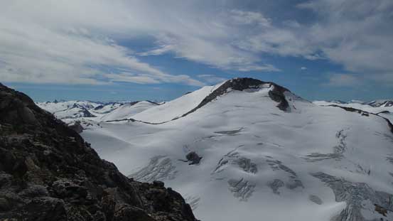
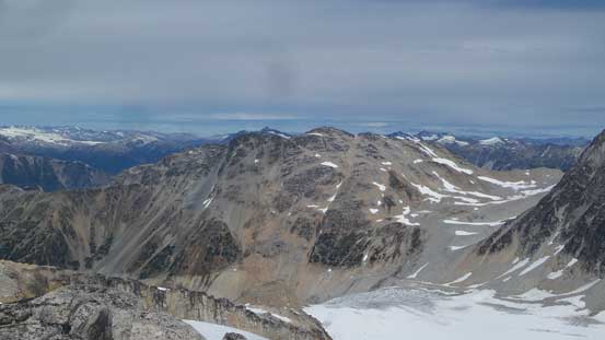
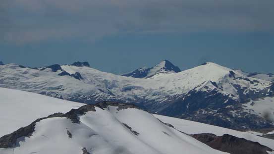
Zygo Peak would be our next objective
A bit of scrambling to gain the flat summit
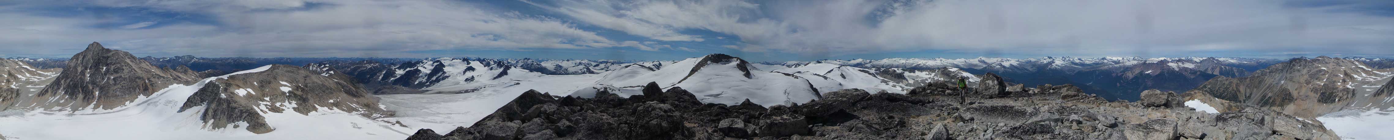
Summit Panorama from Frozen Boot. Click to view large size.
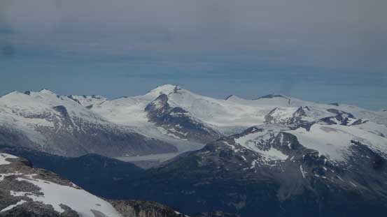
Overseer Mountain
In the foreground is Uriah’s Heap – also bagged in this trip…
Mt. Sampson across Lillooet River Valley.
Longspur Peak looks much more inviting from this side…
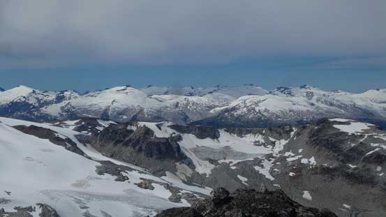
A sea of glaciated summits looking deeply into Clendinning Provincial Park
Mt. Tinniswood poking out. It would be a hell of an access…
Elaho Mountain with the massive glaciers flowing around…
Manatee Peak and Wahoo Tower
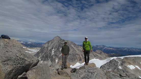
Adam and me on the summit of Frozen Boot
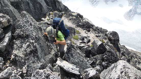
It’s also not easy to believe that by now we had gained close to 2000 vertical meters with a heavy backpack. However, the day was still young and looking around we increased our ambition to tag the nearby Zygo Peak and Madhorse Mountain all on Day 1. The first business was descending the SE Ridge to the top of Madhorse Glacier. This section had me worried a little bit due to the lack of beta but actually wasn’t too bad. Good route-finding skill was required and with a bit of patient backtracking we managed to keep things within “class 2” terrain.
Heading down the SE Ridge now
The typical country on SE Ridge. Much steeper than NW Ridge
Fun scrambling down blocky steps.
Almost down now.
At Zygo/Frozen Boot col now also the top of Madhorse and Roller Coaster Glaciers
Once down to the glacier we ditched much of the heavy stuffs and then there goes the ascent of Zygo Peak.
