Natapoc Mountain
December 7, 2021
1283m
Lake Wenatchee / US-2 Corridor, WA
Natapoc Mtn. is rather just a low-status forested hill with the only significance being its prominence. With over 2000 feet or 600 m prominence this peak does catch peak-baggers’ attention. This peak locates on the rainshadow side of the Cascade Range not far from Leavenworth. The decision to bag this peak on this Tuesday was a late-minute one. The forecast for Leavenworth area was “mostly cloudy” while anywhere closer to home was “rain”. To drive to Leavenworth required over 270 km distance each way and the border crossing. These days the border has become easier but the Canadian side still hands out random take-home Covid test kits to travellers coming back to Canada. I’ve heard rumours that the percentage of getting chosen is about 20% and if being chosen, at least a couple more hours would be wasted on the following day. I thought about to get lazy but there’s nothing else I wanted to do on my day off work, so I picked an objective, filled in the ArriveCan form and set the alarm at 6 am. I debated about Natapoc versus Tumwater and decided on this more dumpster-ish objective to save the other one for a sunnier day.
The border crossing into U.S. was as expected, very easy in the morning hour but the traffic down I-5 corridor near Everett was a bit heavy. After turning onto US-2 the traffic had become easier. The road condition at Stevens Pass was actually okay despite the snow accumulation. The areas to the east of the pass felt snowier than I thought. I chose to access this peak from the west/north and parked my truck at a pull-out on Highway 207. I had studied a few trip reports and GPS tracks on peakbagger.com. People seemed to have started the ascent from various spots. Given the fresh snow I could not drive any portion of the logging roads. I opted for the most direct option from the highway.

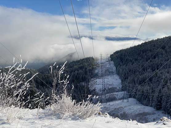
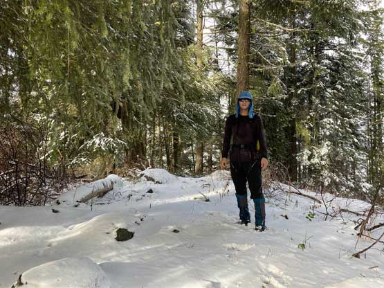
I parked the truck right at the bottom of the power line cut-block. There’s actually a smaller road on the climber’s right side of the cut-block and I used this road to start my short-cut approach. After crossing the main FSR I decided to bushwhack straight up under the power line for a couple hundred meters of elevation. The other option would be to follow the road, but that involved an seemingly inefficient switch-back further to the north. The fresh snow made the bushwhacking more annoying than what I would have liked, but this was still the faster option. The bushwhacking was the worst at the bottom and became quite tame after gaining 50 m elevation. The going was so fluent such that after crossing path with the higher road I decided to short-cut the next switch-back again. This did not turn out very pleasantly with more snow-covered bush. I made a mental note to not follow my tracks on this section a few hours later. I had enough of short-cutting at this point so decided to just stick to the road for the rest of the ascent onto the north ridge. The snow depth did not seem to increase and the snowshoes stayed strapped to the pack.


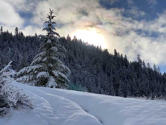


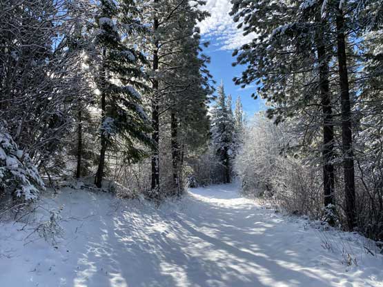
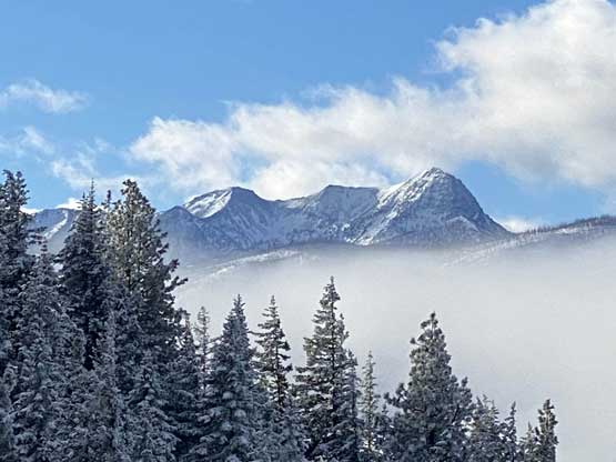
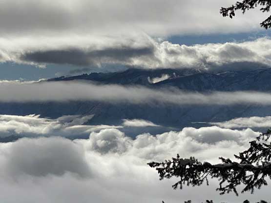
The road continued along the north ridge for quite a while and a well-maintained trail showed up from the road’s end. I did not do much homework about this mountain other than briefly looking at the peakbagger.com trip reports, so having this trail was a pleasant surprise. I thought there definitely would have bushwhacking on this ridge. Despite the snow coverage this trail was easy to follow. I hiked passed several viewpoints along the way. The weather was better than expected with blue skies above and cloud inversion lower down. There are two summits on this mountain and both are forested. After summitting the higher south summit I toggled the map later to the satellite images and noticed some open slopes to the south. I descended steeply down south for about 5 minutes with light bushwhacking, found some nice views and took a break there to have lunch.


The view was overall not panoramic so after having some food I decided to head back. I took a slightly different route to get back up to the summit and then followed my own footprints back down the north ridge. The fresh snow made the trail extremely slippery such that I took one big spill somewhere on the ridge. I also entered the cloud layer while descending so there’s very minimal view from the way home. Lower down I mostly retraced my own steps under the power line and lost elevation in no time. My round trip time was 3.5 hours.


I finished the trip at 1 pm so technically I had enough time to make another ascent, but it started to drizzle and the sky was completely soaked in, so it’s time to go home. The traffic back through US-2 and then I-5 corridor was actually quite tolerable except for the merge from US-2 onto I-5 at Everett. At the border I fully expected to get a mandatory Covid test kit but got lucky again. This time there was also no line-up such that I crossed back into Canada in just one minute.
