Mount Fletcher
April 8, 2020
1412m
Chehalis Lake / Chehalis FSR, BC
Mt. Fletcher is a small summit right next to Chehalis Lake and south of the Ratney/Stonerabbit group. The taller peaks in the Chehalis region are known to have good rock quality but also subject to access difficulties, as tens of kilometers on logging roads with tricky link-ups are required just to reach the base of these peaks. Mt. Fletcher is further to the south with a different access road. The Chehalis FSR from south leads right to the base of this peak, but one needs to drive 28 km each way on this rough road.. I had previously driven the Chehalis FSR to access Fleetwood FSR and hence Mt. Downing from the west, in December 2019 and the road condition was a smooth sailing, but I knew logging roads like this are highly variable. Assuming one gets to the base of Mt. Fletcher, the hike is fairly straightforward via the NE Ridge but one needs a thick snowpack to cover the brushes, hence the best time to do Mt. Fletcher is spring.
The inspiration of this trip came from Chris Hood’s ascent last weekend. I received a text from him while driving back from Lillooet saying “a set of snowshoe tracks were broken to the summit of Mt. Fletcher”, and “I should take advantage of that as a half-day exercise”. I was instantly sold on this objective as I too had been considering it for a while. Further discussion with Chris about the conditions and route had me realized that he took a southern approach that’s different than the one I had in mind – NE Ridge following Simon’s footsteps. I convinced Alex to join on this past Wednesday, and we both agreed that the NE Ridge would be more direct and much more open with likely no bushwhacking whatsoever. We figured that a 600 vertical meters of trail-breaking wouldn’t be problematic anyway. In the morning we left White Rock at around 4 am and made to the start of the hike 2.5 hours later. The drive up Chehalis FSR was a slow show with millions of pot-holes that required careful driving.

Mt. Fletcher via NE Ridge. GPX DL
The first portion of this hike was walking up the deactivated spur road. I actually tried to drive up this spur road but gave up after encountering the first ditch. It appeared like ATV terrain to me so backed down and parked. While walking up the road I did think we made the correct decision to park on the main road as this spur road was definitely not in a good shape.. The road also climbs steeply and after the first switchback we encountered patchy and supportive snow and after the second switchback we took the only stop on the ascent – to don snowshoes and apply sunscreen. This was at around 650 m elevation. We then easily snowshoed to the end of this spur road at around 800 m and were already treated with gorgeous views down to Chehalis Lake. The next stage was a steep, 300+ meters of grunt to reach the NE Ridge and the terrain was sustained 35-40 degrees in the forest. The snow condition was great for uphill snowshoeing though so we made some furious pace, crushing the gain in just over half an hour and then we gradually topped out on the first stage of the NE Ridge.
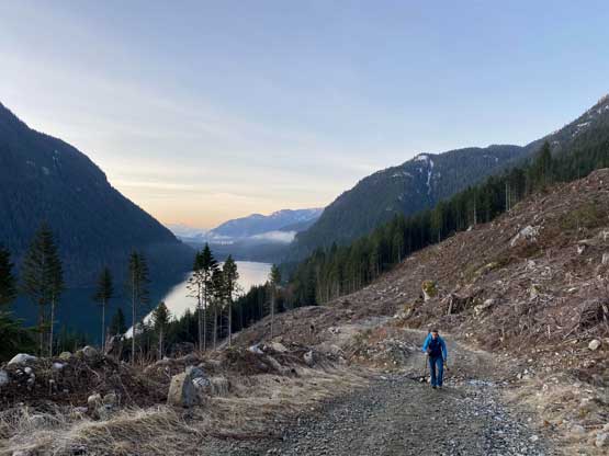
Alex walking up the road at the start
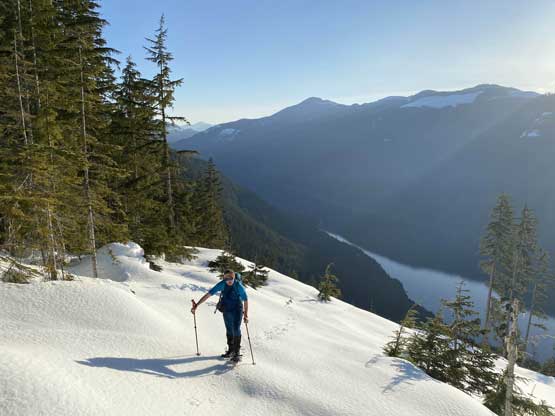
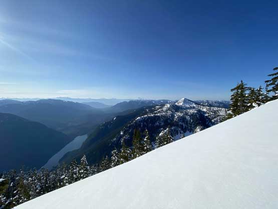
Morning colours looking south down Chehalis Lake

Alex trying to tumble this boulder. Or not…
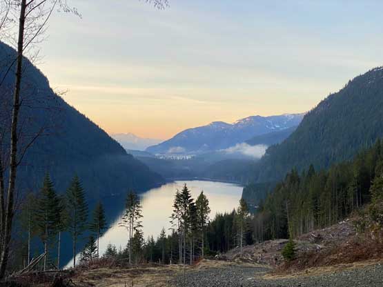
Chehalis Lake in full glory
We were still walking up the dry sections of this road

The sun finally reached us…

The snowshoes were strapped on now

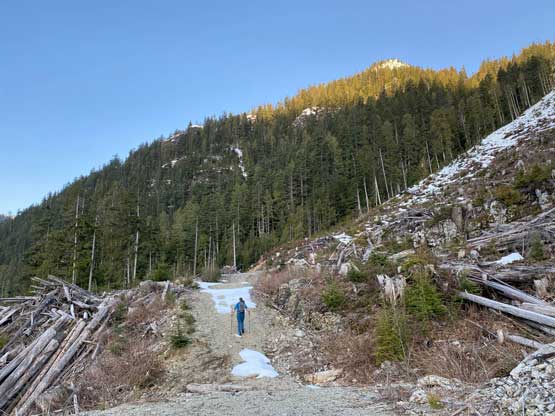
This was the end of this logging road.
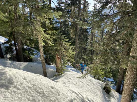
Alex ascending a steep cutblock to enter the woods
The typical steep grunt in the forest. For 300 vertical meters
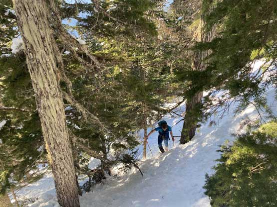
Alex negotiating a steep spot

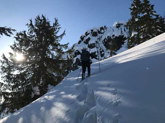
Topping out on the lower NE Ridge, looking ahead
After a bit of undulating up-and-downs we soon started the next stage of grunt to gain the upper NE Ridge. This stretch was steeper and more involved than I thought and definitely had avalanche concerns in some circumstances, but not in today’s conditions. The grade was again, 35+ degrees for a while on sparsely treed slope. I led a line by firstly traversing leftwards and then by some tight zig-zags to crest the upper ridge. Alex then took over the trail-breaking and we finally joined Chris’ snowshoe tracks at less than 100 meters below the summit. The last stretch was nice and open and we reached the summit in under 2.5 hours since leaving the vehicle.
Me breaking trail. Photo by Alex R.

Alex following up this steep roll.
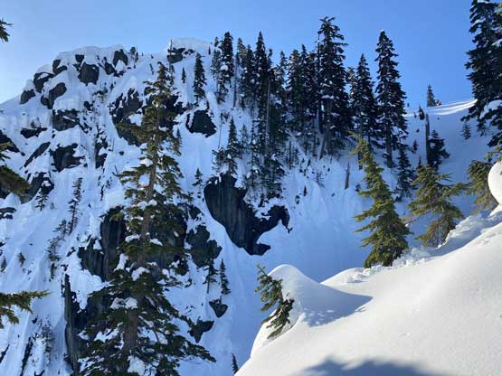
I wasn’t expect big terrain on this small peak..
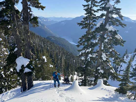
Alex grunting up with the north end of Chehalis Lake behind
Alex breaking trail now.

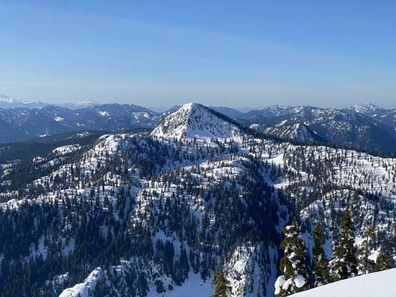
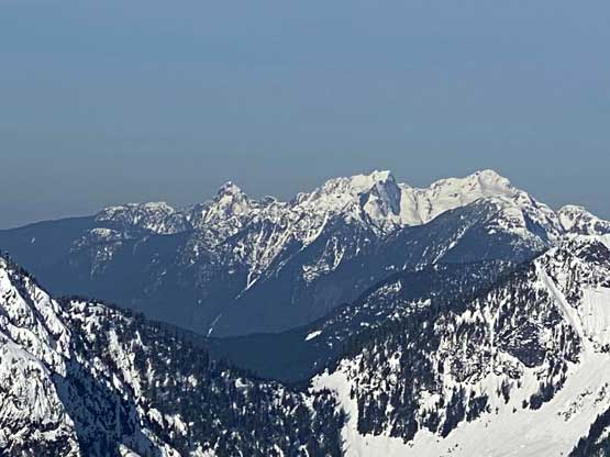
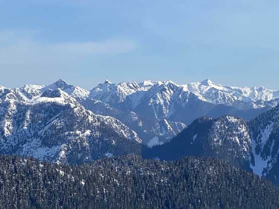
Mt. Ratney and Mt. Bardean with Mt. Clarke behind

What a pristine country!
Looking back at our tracks and Mt. Orrock

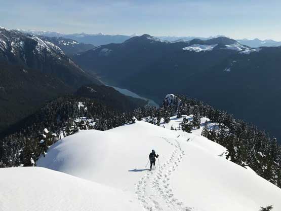
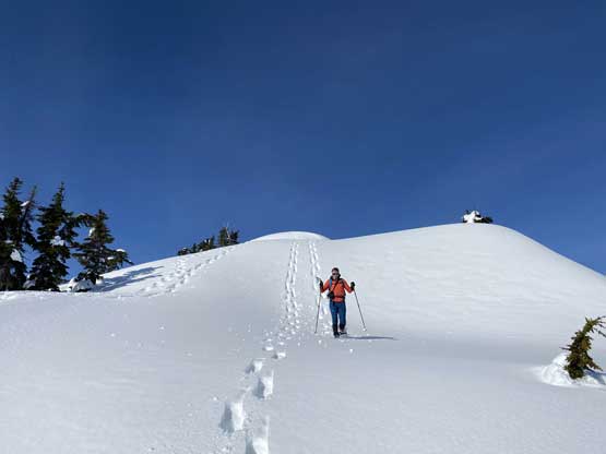
Alex heading for the summit, which was still a ways away…
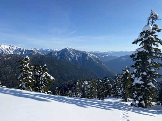
A wider shot looking south from just below the summit
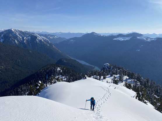
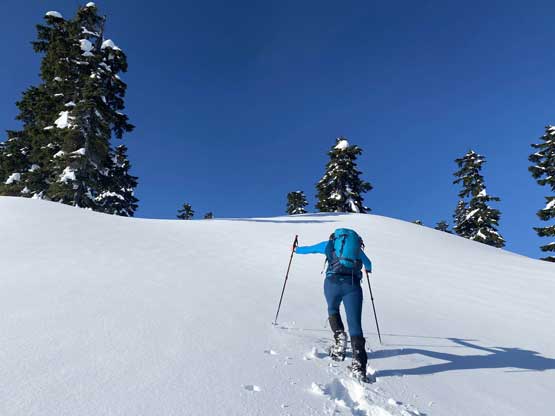
Alex snowshoeing up the last roll below the summit of Mt. Fletcher
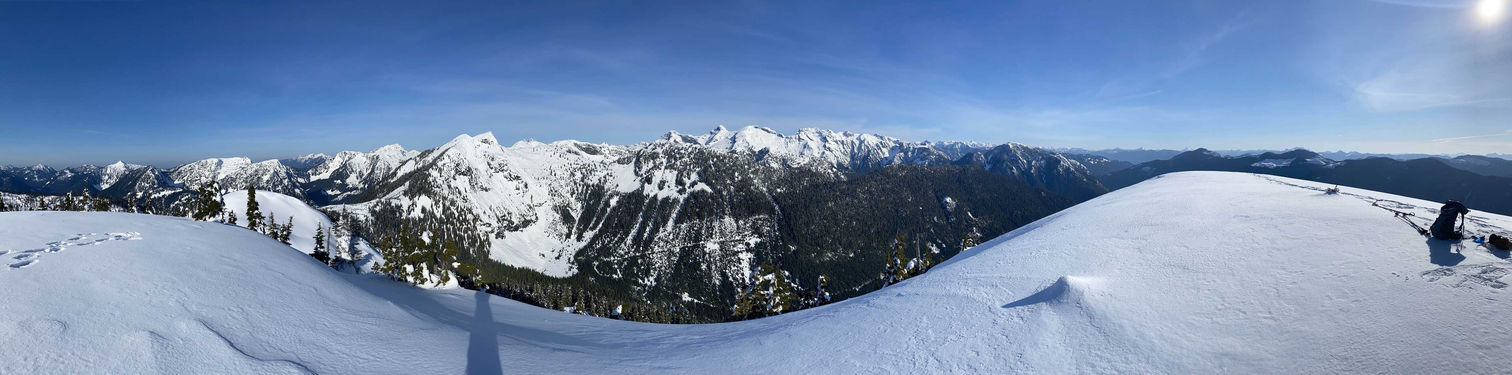
Partial Summit Panorama from Mt. Fletcher. Click to view large size.
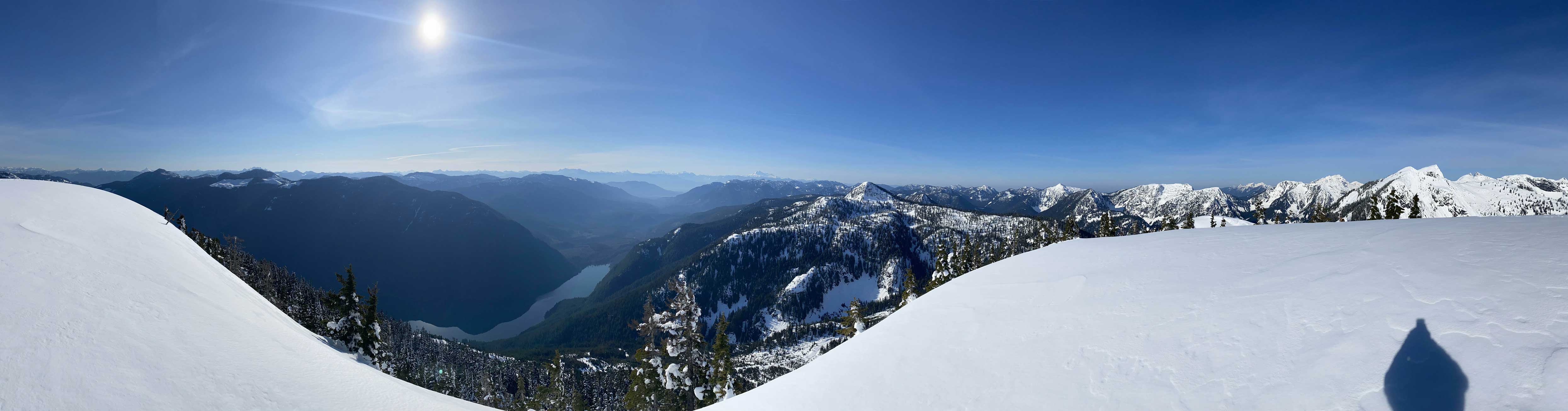
Partial Summit Panorama from Mt. Fletcher. Click to view large size.

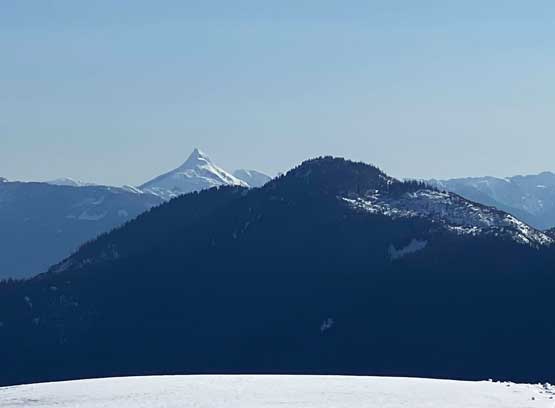
Mt. Jasper by Statlu Creek Valley
This peak south of Mt. Fletcher has no name

Looking deeply down Chehalis River valley towards the Chilliwack horizon
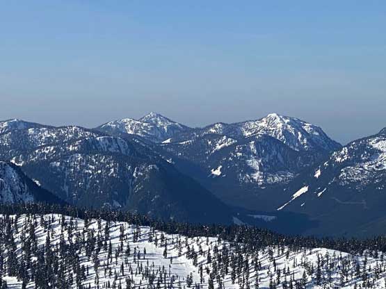
“Nursia Peak” and “Gregory Peak”
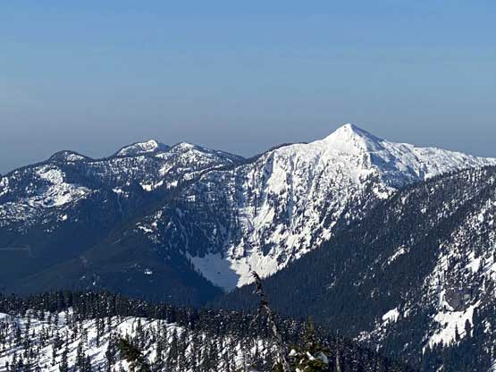
“Statlu Peak” is the tall peak; behind to the left is Mt. St. Benedict
Mt. Robie Reid pokes behind the massif of “Blinch Peak”
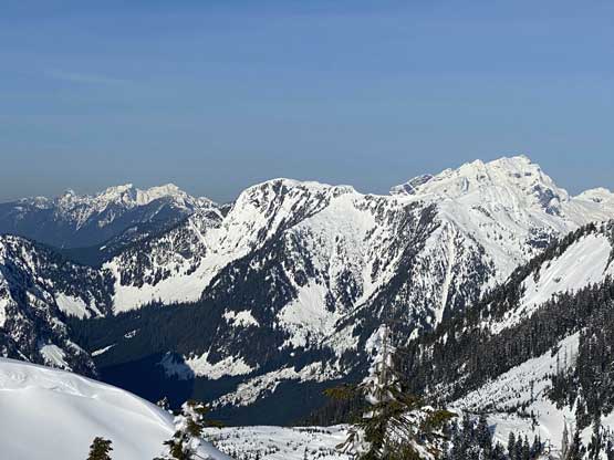
Blanshard Needle, Edge Peak and Golden Ears from L to R

As you can see, the terrain in the Chehalis area is big…
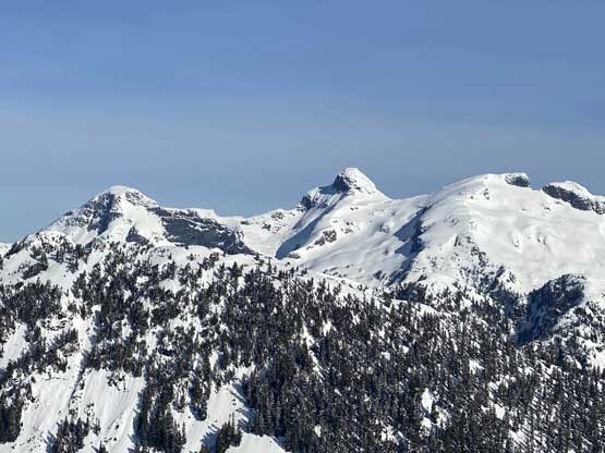
Stonerabbit Peak, Mt. Ratney and Mt. Bardean from L to R
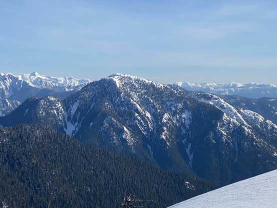
Mt. Orrock in the foreground
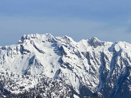
Mt. Clarke, Recourse Peak and Viennese Peak from L to R
Looking north towards the remote Trio Peaks, and Mt. Breakenridge
Mt. Urquhart pokes behind Mt. McRae
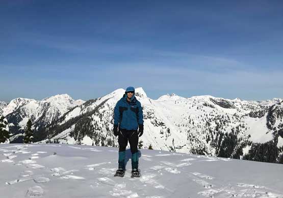
Me on the summit of Mt. Fletcher

Another photo of me on the summit of Mt. Fletcher
Because of the slow show on the drive we actually were not doing too good on time, so we didn’t linger too long up there despite the 360-degree views. The wind was also brutally cold that I had to don all the layers anyway. The descent off the upper ridge was fast and furious but the descent down that steep treed zone wasn’t as fun. The snow was turning slushy and required some degree of concentration, but still we managed to descend in a timely manner. The hike-out on the logging road was uneventful and the only stop we took on the descent was to take our snowshoes off, which costed about 1 minute. We both tried hard to be efficient on all transitions.
Me heading down from the summit. Photo by Alex R.
Alex plunging down the summit ridge

A while later we were back to that broad, undulating section

The steep forested descent wasn’t so fun

Alex negotiating the slushy and steep forest..

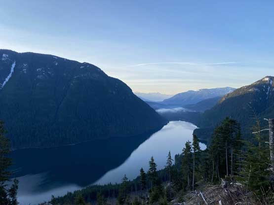
Back to the logging road now, looking at Chehalis Lake
Our round trip time was 3 hours 45 minutes which was not bad considering we had to break trail pretty much the whole way. At this point I was no longer in a rush because I knew I definitely would be back home in time for the work. I actually took a short nap while driving back down Chehalis FSR as tiredness kicked in and I couldn’t stay focused. The rest of the drive back home was uneventful and I made back by 1 pm. This meant I had enough time to take a shower, cook a (big) lunch and then sleep for an hour before my exhausting afternoon/evening work.
